Flash flooding threatens areas from the Tennessee Valley to the Carolinas as storms repeat along a stalled front. Monsoonal storms may trigger flooding in the Southwest. Dangerous heat expands across the Desert Southwest, Plains, mid-Mississippi Valley and Southern Tier. Critical fire weather for interior Pacific Northwest. Cooler, drier air brings brief relief to the Great Lakes and Northeast. Read More >
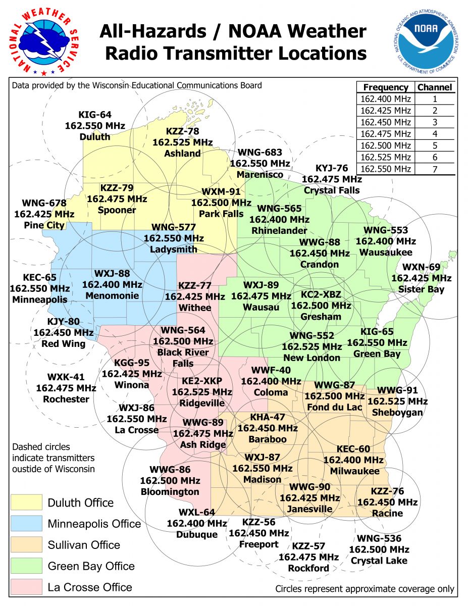
NOAA Weather Radio All-Hazards
| Channel | Station | Frequency (MHz) | Watts | Coverage and S.A.M.E. Codes |
| 1 | KEC-60 | 162.400 | 1000 | Milwaukee/Waukesha Area and Surrounding Counties |
| 2 | WWG-90 | 162.425 | 300 | Janesville Area |
| 3 | KZZ-76 | 162.450 | 300 | Racine and Kenosha Areas |
| 4 | KHA-47 | 162.450 | 300 | Baraboo/Wisconsin Dells Area |
| 5 | WWG-87 | 162.500 | 1000 | Fond du Lac Area and Surrounding Counties |
| 6 | WWG-91 | 162.525 | 300 | Sheboygan Area |
| 7 | WXJ-87 | 162.550 | 1000 | Madison Area and Surrounding Counties |
Use this information to program your S.A.M.E. Weather Radio:
|
|