Tropical Depression Two is expected to gradually strengthen and could bring tropical storm conditions to the Florida Panhandle beginning late Monday. Areas of flash flooding will be possible through Thursday along the eastern and central Gulf Coast. Severe thunderstorms will develop and move along a cold front crossing the Upper Midwest Monday, and through the Ohio Valley/Mid-Atlantic on Tuesday. Read More >
Overview
|
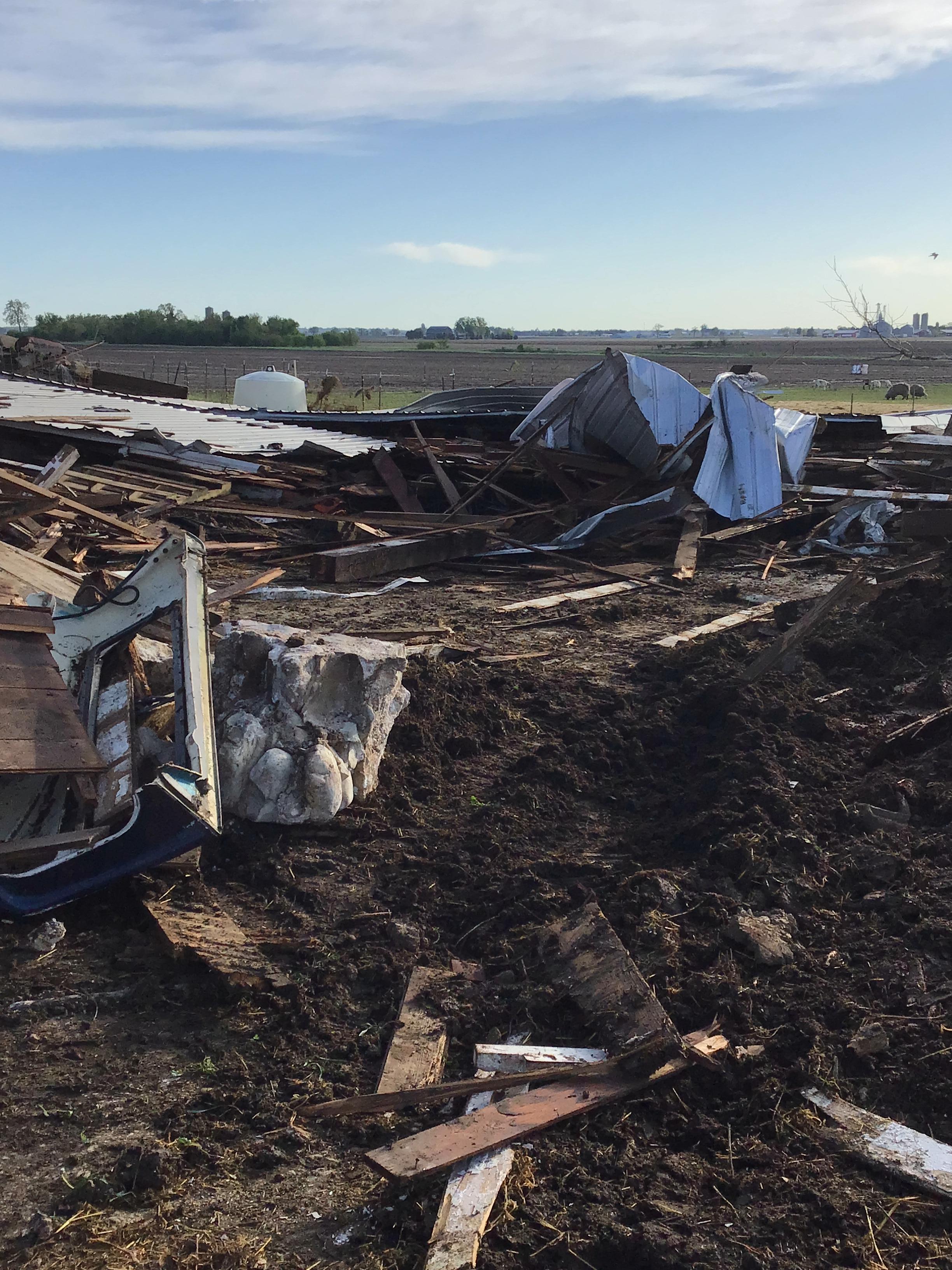
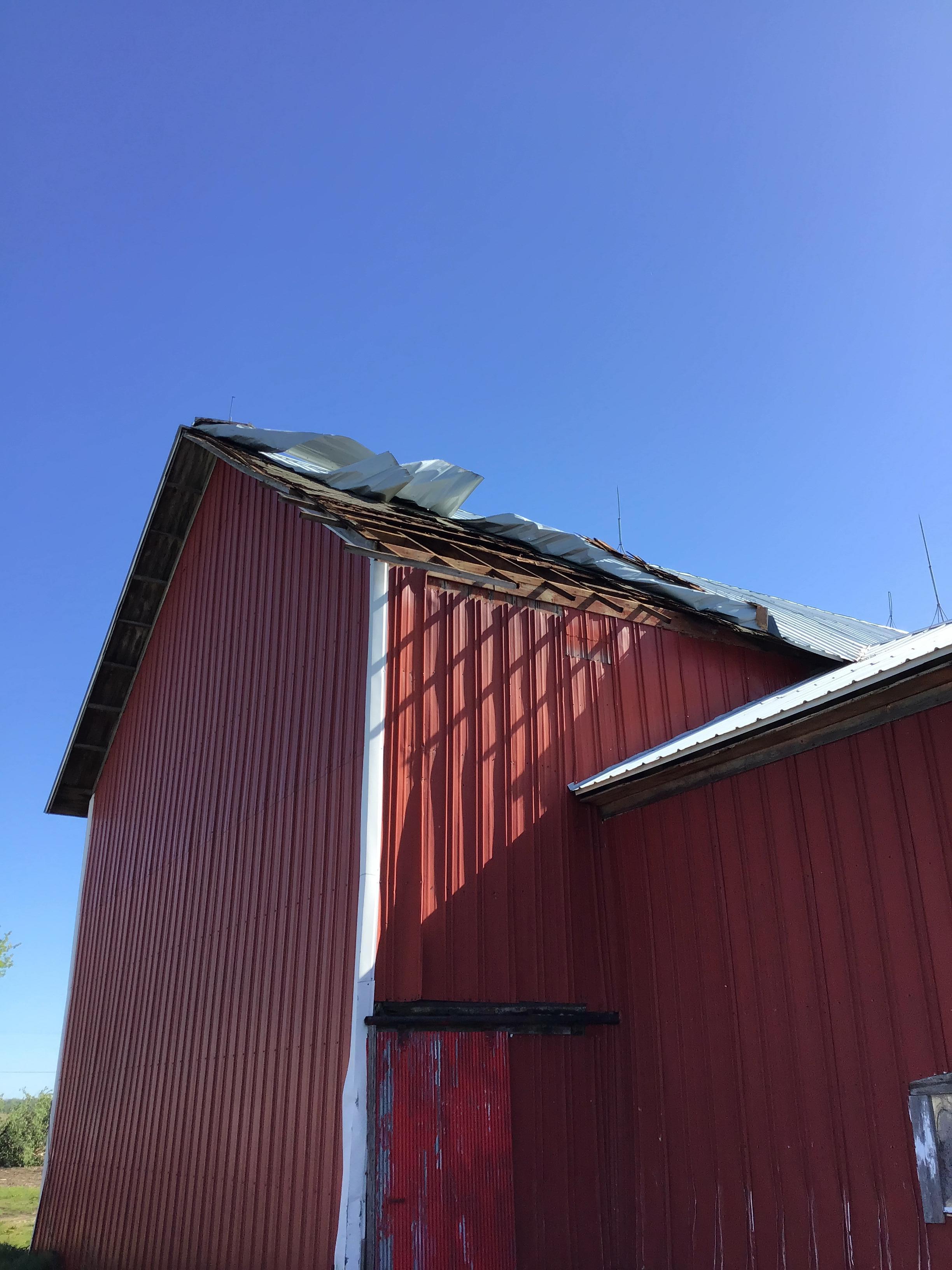
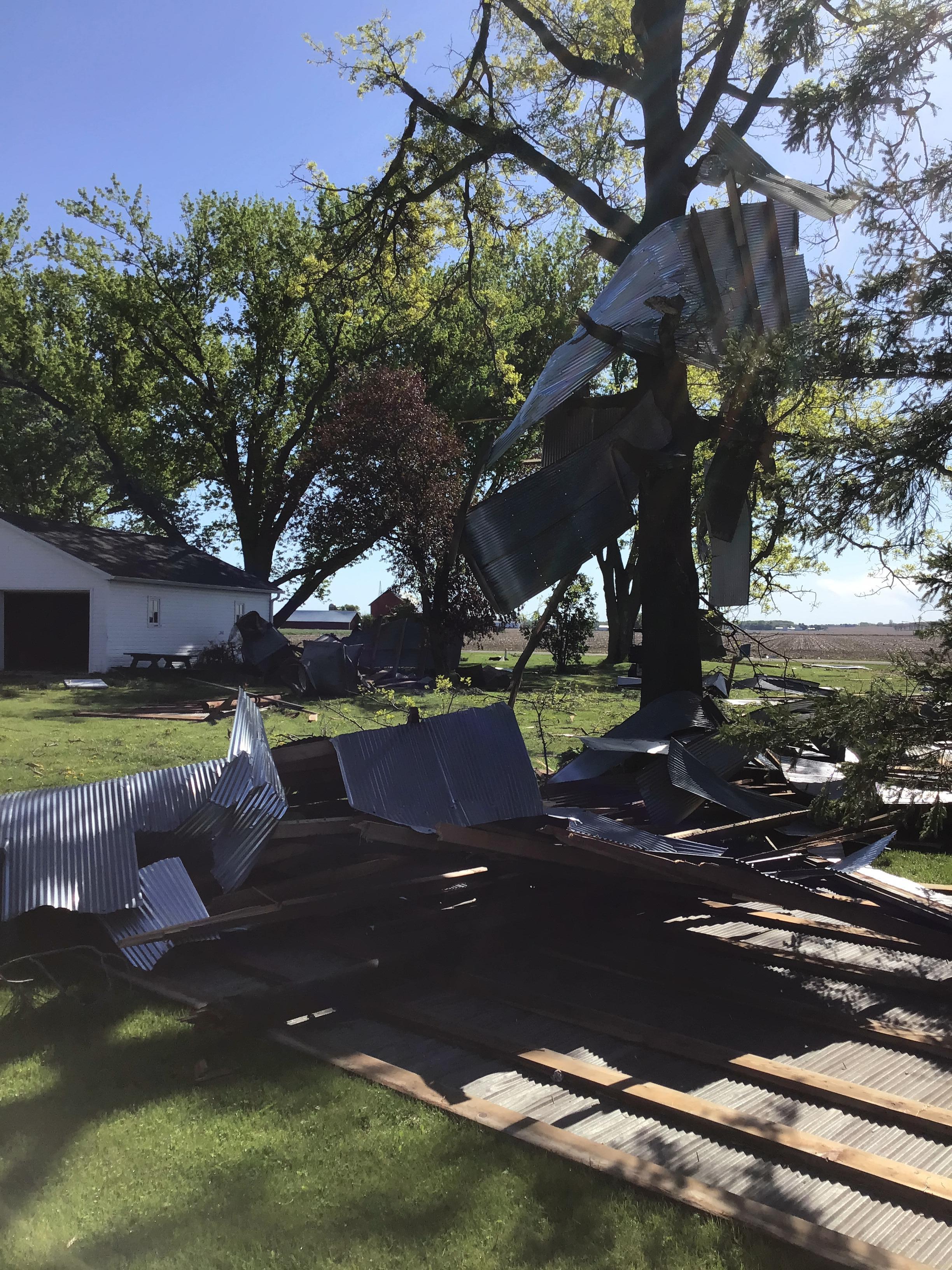
Two rounds of thunderstorms rolled across portions of southern Wisconsin during the afternoon and evening hours of Tuesday, May 7th, 2024. The first round produced two tornadoes in Walworth County. There was also severe thunderstorm wind damage and 1-inch hail across eastern Wisconsin between 2 and 4 PM. The second round of thunderstorms developed along a warm front and lifted into southwest Wisconsin around 7 PM. Storms exited southeast Wisconsin around 10 PM. Most of the storms were of the pop-up variety that produced nickel to quarter size hail. Once several storms congealed into a line over eastern Dane County, winds increased with these storms and posed a threat for brief, small tornadoes along the leading edge of the line. The line of storms tracked eastward to Lake Michigan and produced sporadic wind damage and some hail along the way. While a few tornado warnings were issued, no tornadoes actually developed with the second round of storms. |
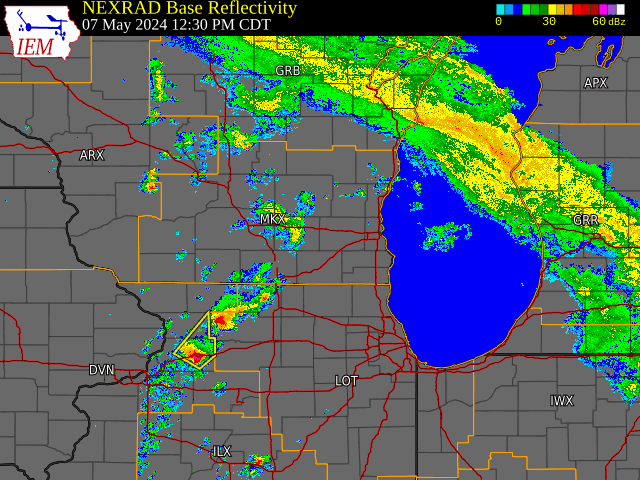 Radar loop from 12:30 PM to 10 PM CDT |
Tornadoes:
|
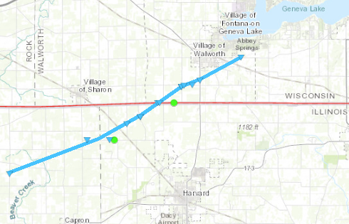
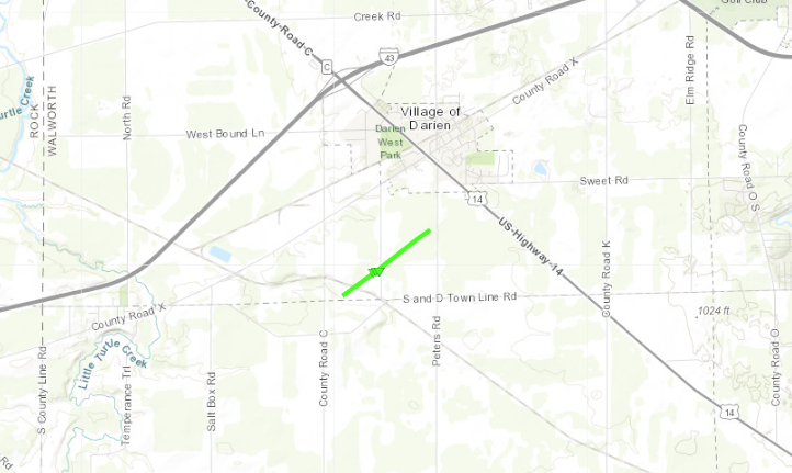
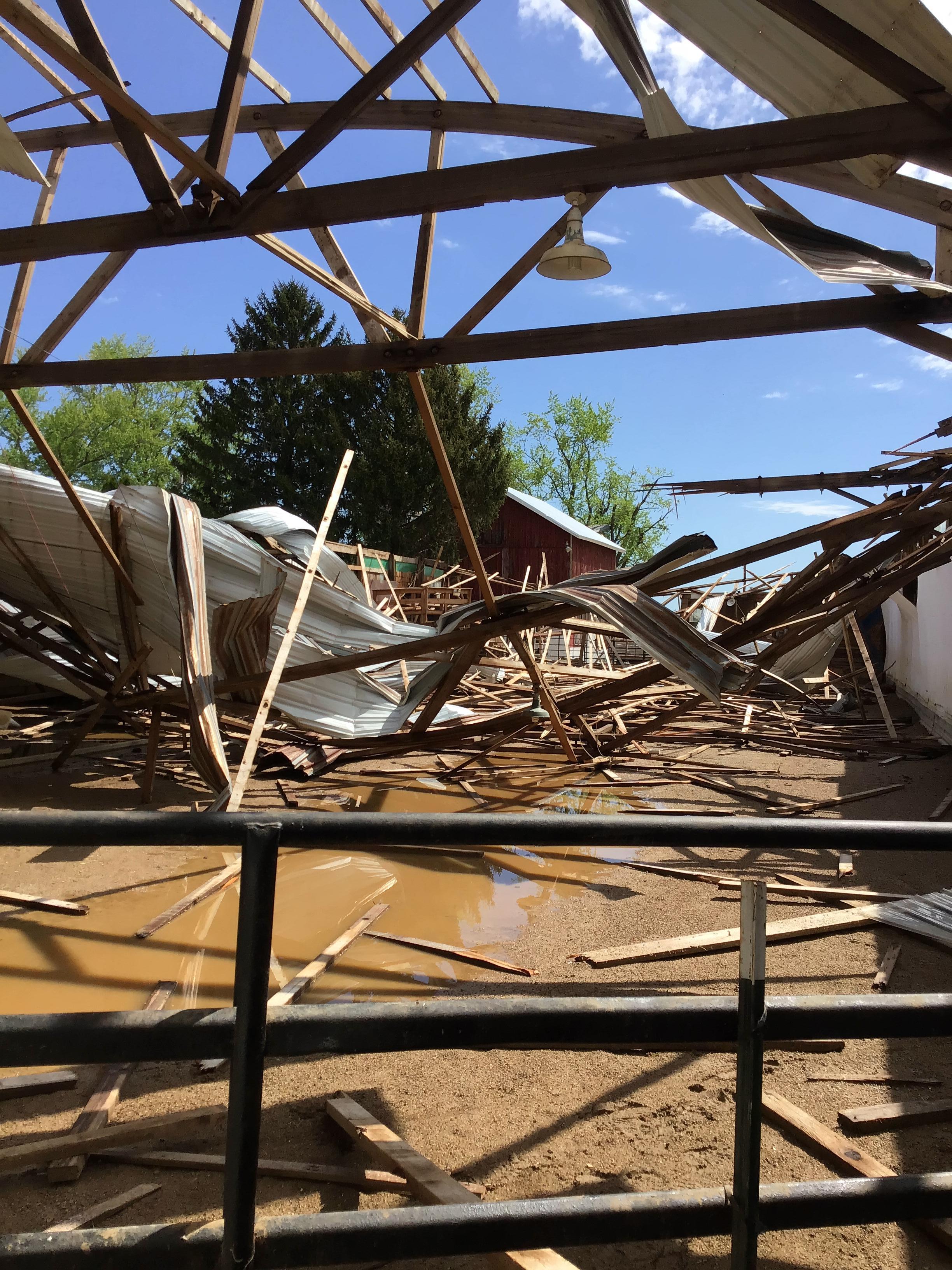
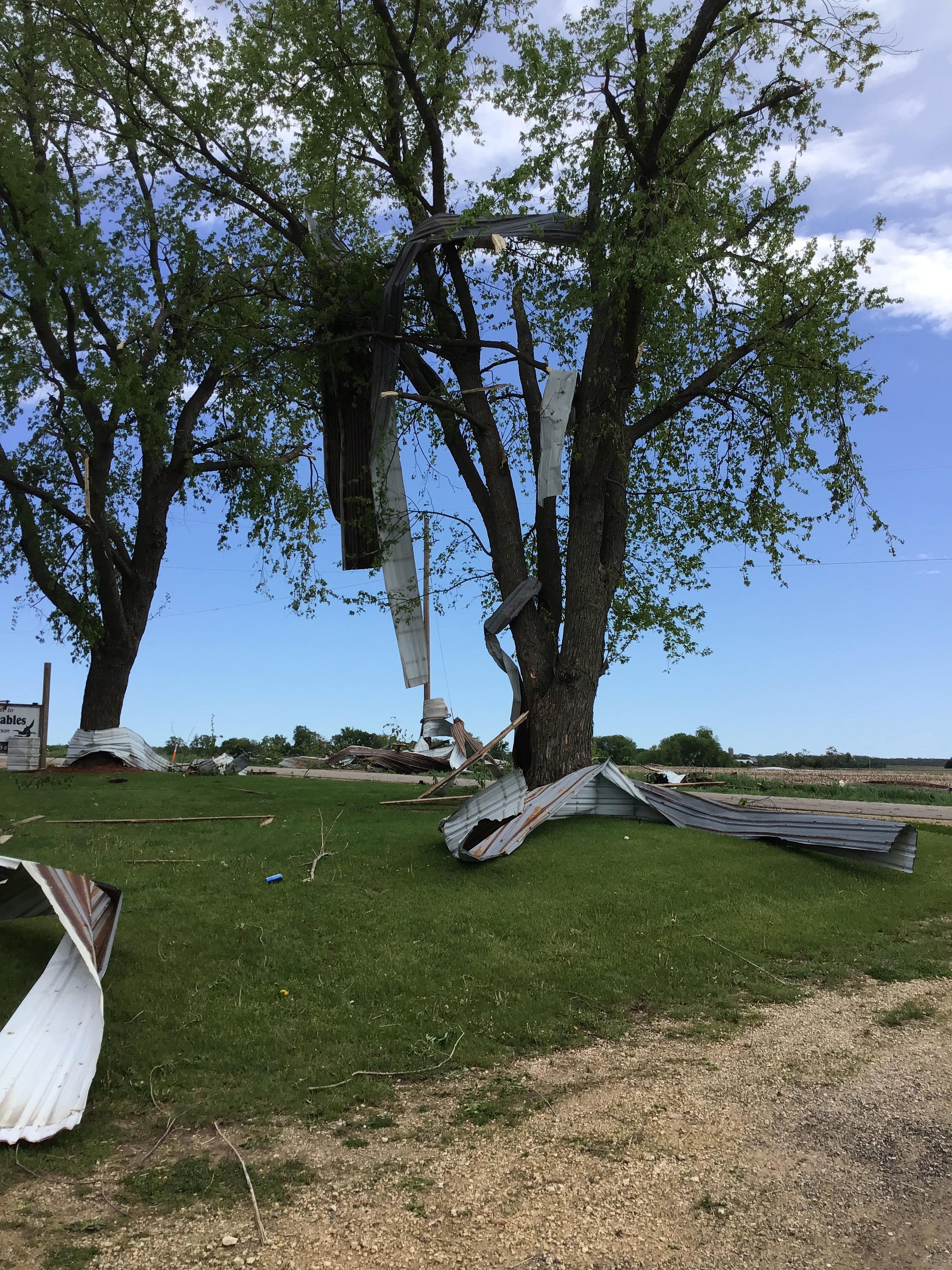
Tornado - Boone County, IL to Walworth County, WI
|
||||||||||||||||
|
||||||||||||||||
|
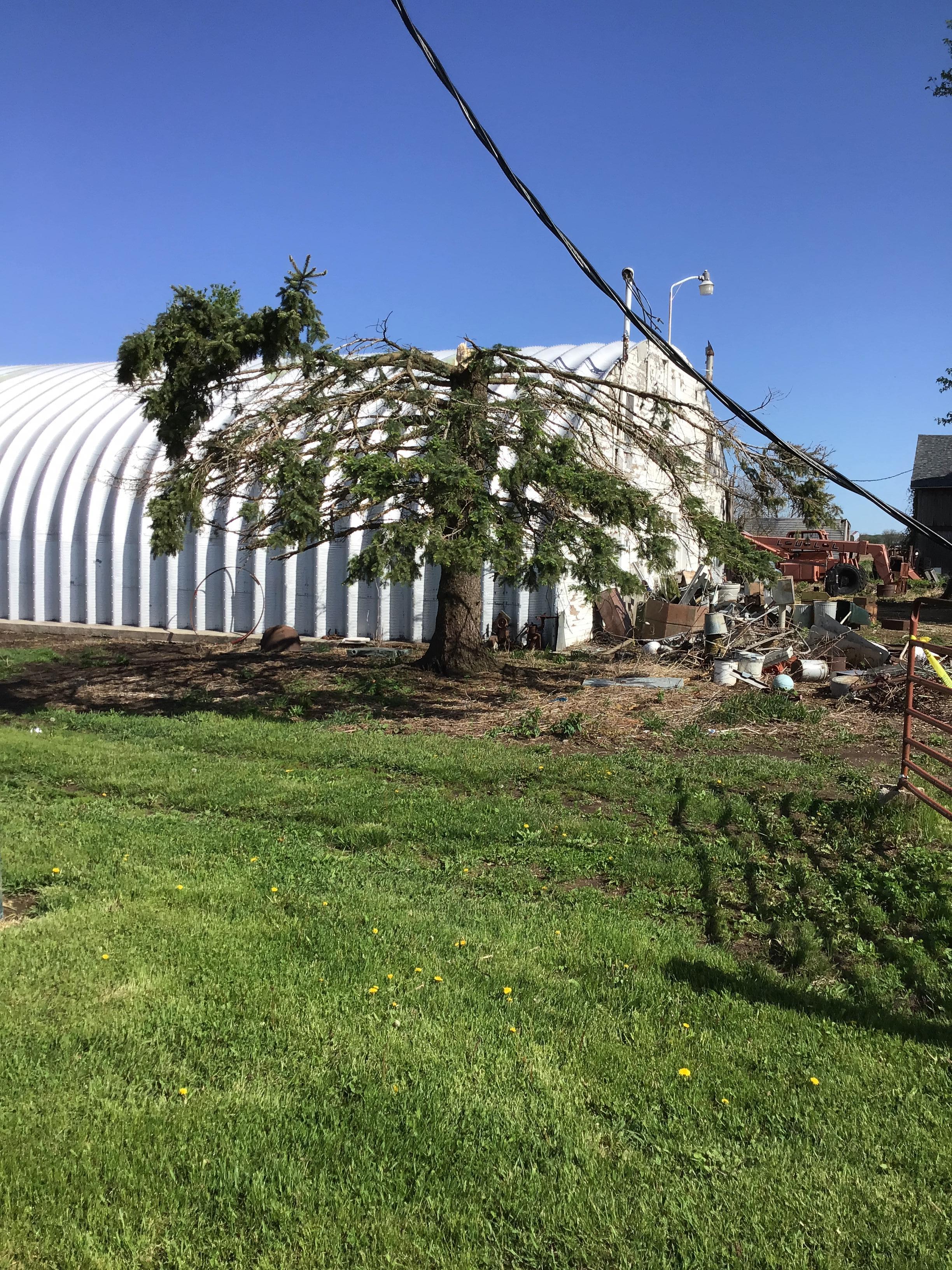
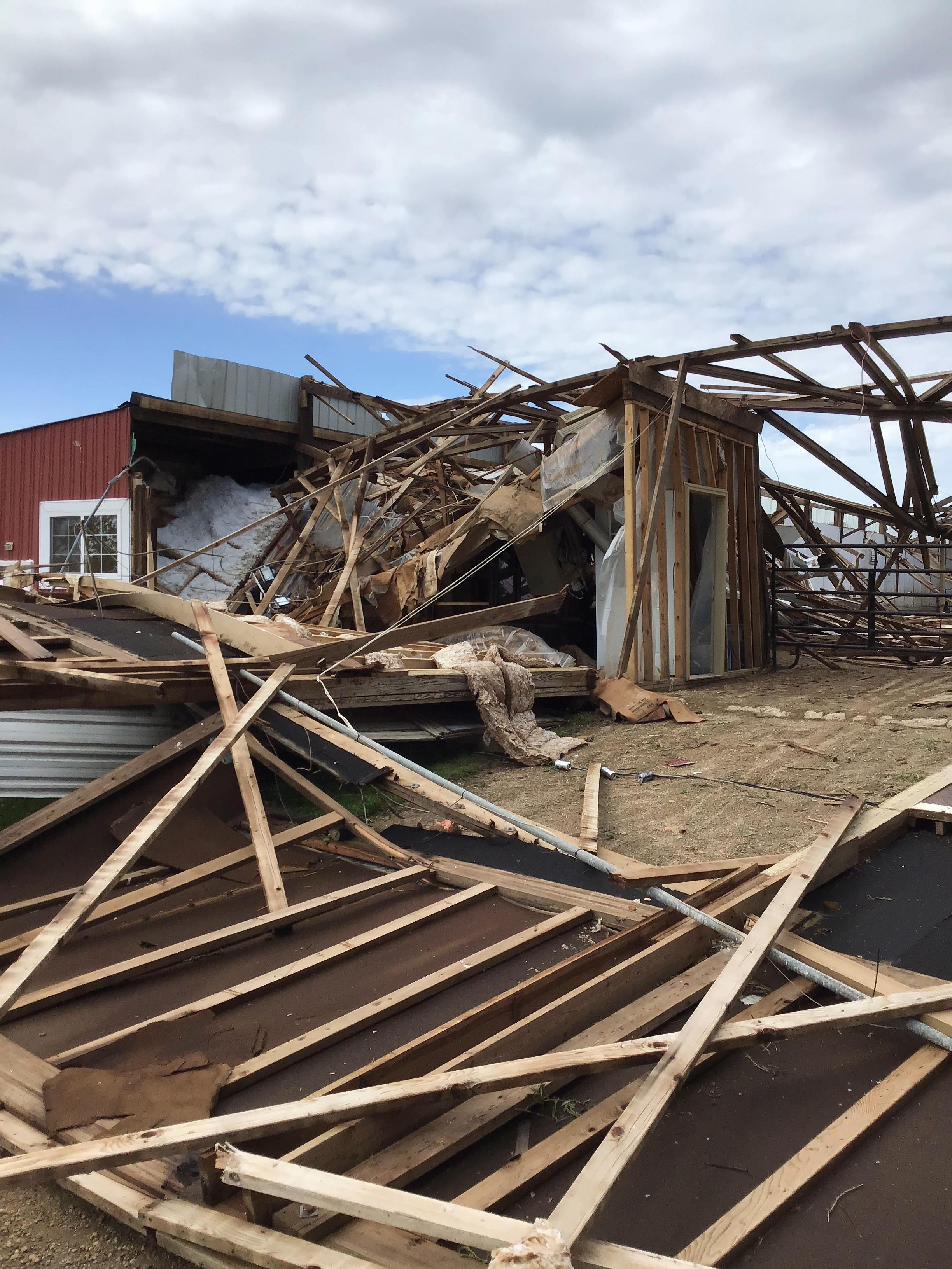
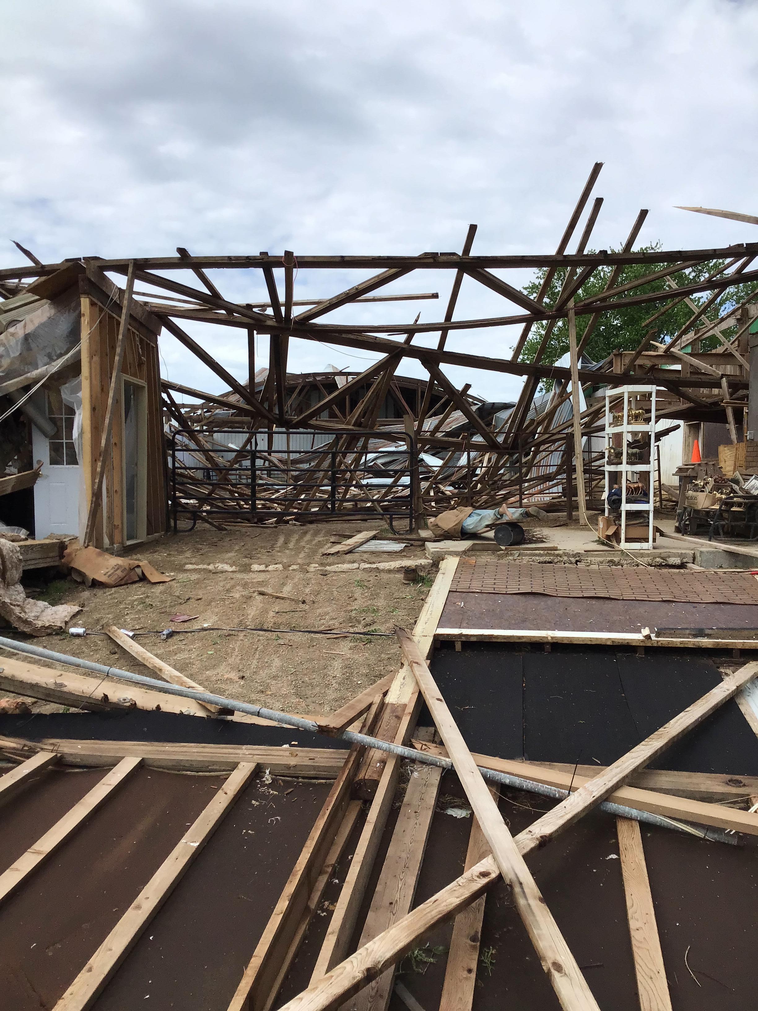
Tornado - Darien, WI
|
||||||||||||||||
|
||||||||||||||||
The Enhanced Fujita (EF) Scale classifies tornadoes into the following categories:
| EF0 Weak 65-85 mph |
EF1 Moderate 86-110 mph |
EF2 Significant 111-135 mph |
EF3 Severe 136-165 mph |
EF4 Extreme 166-200 mph |
EF5 Catastrophic 200+ mph |
 |
|||||
Hail / Rainfall:
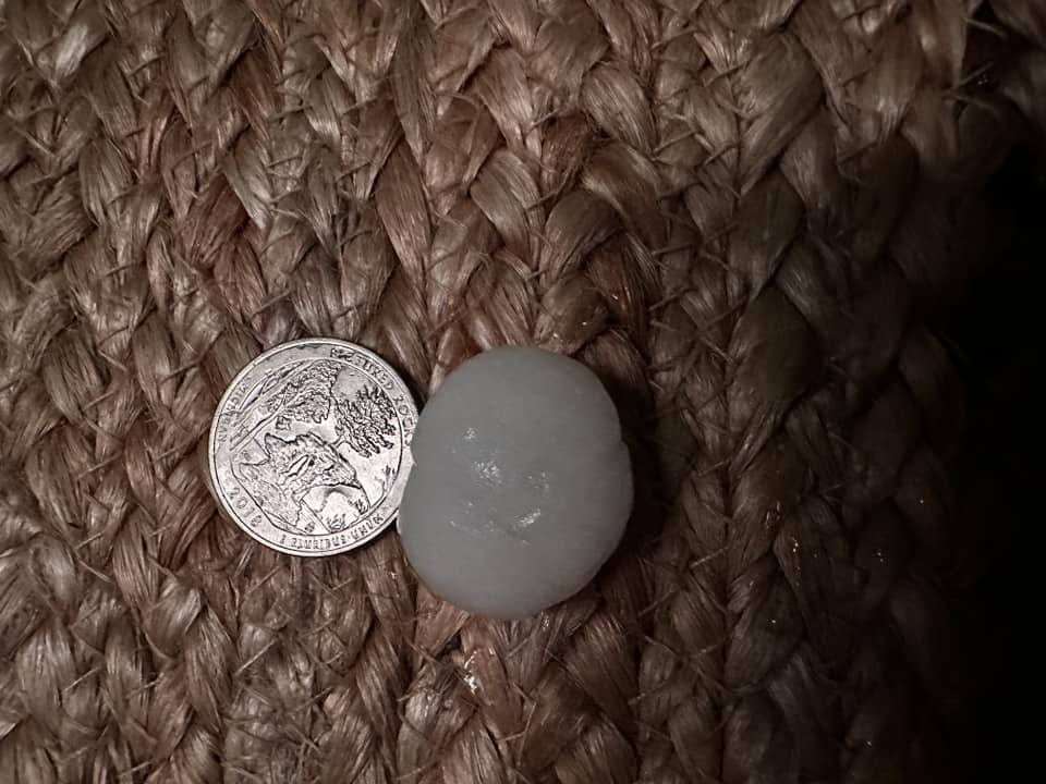
During the second round of thunderstorms, numerous storms produced nickel to quarter size hail. Quarter size is 1" in diameter and is considered Severe level.
 |
 |
| Hail stone next to a quarter for reference (about 1" diameter) Photo Credit: Chris O in Sussex |
Hail stones approx. the size of a nickel or quarter (0.8 to 1.0" diameter) Photo Credit: Joe K in Mukwonago |
This is the 24-hour precipitation from 7 AM Tuesday, May 7th through 7 AM May 8th. Some of the rainfall in this graphic includes the steady showers and thunderstorms that were rolling through eastern Wisconsin at the beginning of this time period. The amounts were generally between a half inch and 2 inches. The highest amounts occurred over south central and southeast Wisconsin where multiple rounds of storms occurred.
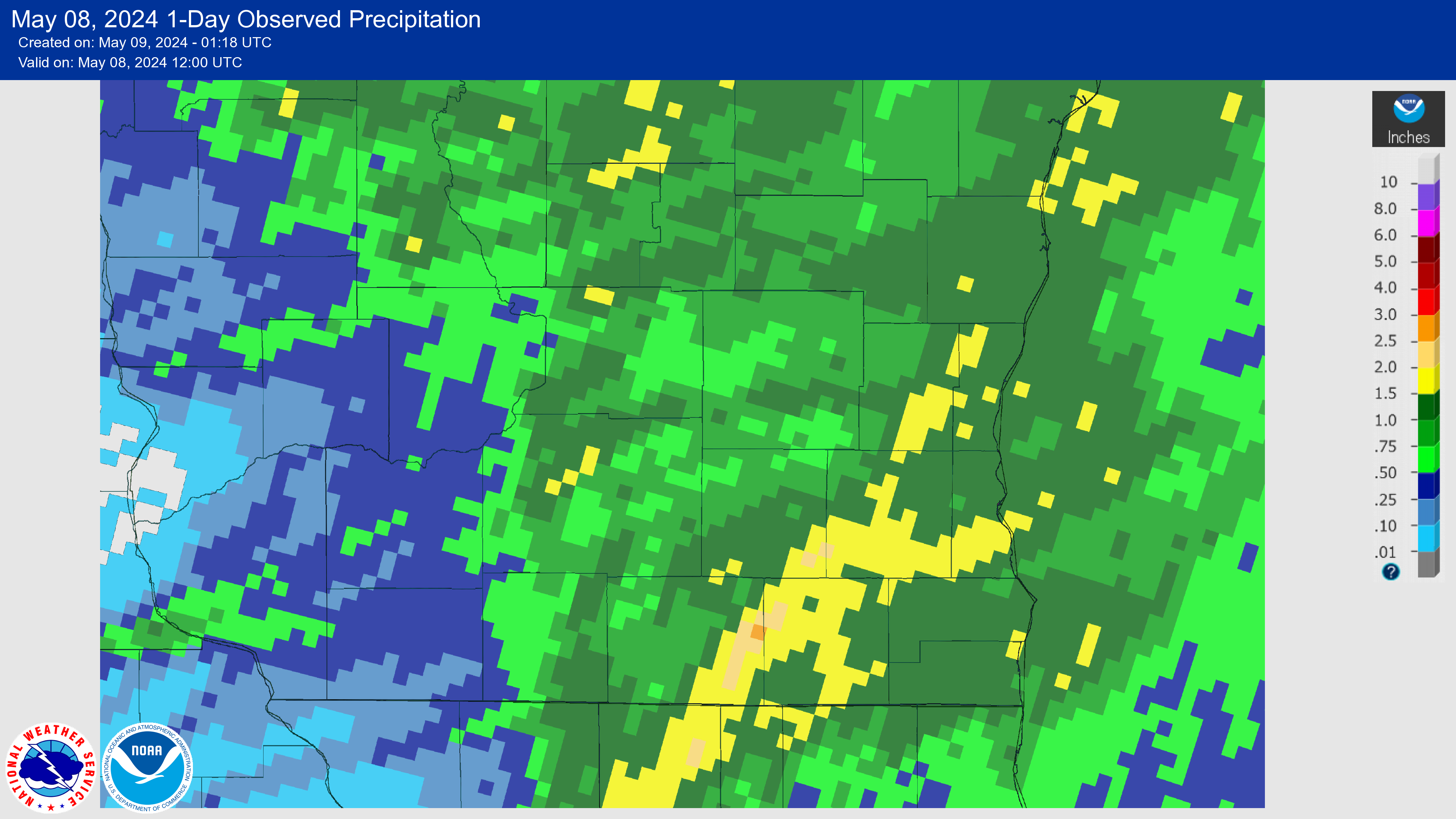 |
| Tuesday, May 7th Estimated Rainfall Amounts |
Storm Reports
Storm Reports
Preliminary Local Storm Report...Summary
National Weather Service Milwaukee/Sullivan WI
915 PM CDT Wed May 8 2024

..TIME...   ...EVENT...      ...CITY LOCATION...     ...LAT.LON...
..DATE...   ....MAG....      ..COUNTY LOCATION..ST.. ...SOURCE....
            ..REMARKS..

0940 PM     Flood            2 E Greenfield          42.96N 87.97W
05/07/2024                   Milwaukee          WI   911 Call Center

            One lane blocked on I-43 at Loomis Rd due to
            high water.

0913 PM     Tstm Wnd Gst     1 NE Cudahy             42.95N 87.85W
05/07/2024  E55 MPH          Milwaukee          WI   Trained Spotter

            Trained spotter estimated wind speeds of
            50-55 MPH in Cudahy. Time confirmed via
            radar data.

0910 PM     Hail             1 NW Saint Francis      42.98N 87.89W
05/07/2024  M0.75 Inch       Milwaukee          WI   Public

            Report from mPING: Dime (0.75 in.).

0909 PM     Hail             1 NW Cedarburg          43.31N 88.00W
05/07/2024  M1.00 Inch       Ozaukee            WI   Public

            Report from mPING: Quarter (1.00 in.).

0908 PM     Hail             Grafton                 43.32N 87.96W
05/07/2024  E0.75 Inch       Ozaukee            WI   Public

            Report from mPING: Dime (0.75 in.).

0908 PM     Hail             Grafton                 43.32N 87.96W
05/07/2024  E0.75 Inch       Ozaukee            WI   Public

            Report from mPING: Dime (0.75 in.).

0906 PM     Tstm Wnd Gst     2 W Cudahy              42.95N 87.90W
05/07/2024  M56 MPH          Milwaukee          WI   ASOS

            General Mitchell International Airport KMKE.
            Peak wind gust measured. Pea to dime size
            hail also reported.

0905 PM     Hail             1 E Greendale           42.93N 87.99W
05/07/2024  E0.75 Inch       Milwaukee          WI   Public

            Report from mPING: Dime (0.75 in.).

0904 PM     Hail             1 E Greendale           42.93N 87.99W
05/07/2024  E0.75 Inch       Milwaukee          WI   Public

            Report from mPING: Dime (0.75 in.).

0904 PM     Hail             1 E Greendale           42.93N 87.99W
05/07/2024  E0.75 Inch       Milwaukee          WI   Public

            Report from mPING: Dime (0.75 in.).

0903 PM     Hail             1 NW Cedarburg          43.31N 88.00W
05/07/2024  E0.75 Inch       Ozaukee            WI   Public

            Report from mPING: Dime (0.75 in.).

0858 PM     Tstm Wnd Dmg     Menomonee Falls         43.17N 88.10W
05/07/2024                   Waukesha           WI   Emergency Mngr

            Several reports around town of trees, limbs
            and power lines down. Time est by radar.

0858 PM     Hail             1 W Hales Corners       42.93N 88.07W
05/07/2024  M0.75 Inch       Waukesha           WI   Public

            Report from mPING: Dime (0.75 in.).

0855 PM     Tstm Wnd Dmg     Brookfield              43.06N 88.13W
05/07/2024                   Waukesha           WI   Emergency Mngr

            Multiple reports around town of trees, limbs
            and power lines down. Time est by radar.

0852 PM     Hail             2 SE Waukesha           42.99N 88.21W
05/07/2024  E0.75 Inch       Waukesha           WI   Public

            Report from mPING: Dime (0.75 in.).

0852 PM     Hail             2 SE Waukesha           42.99N 88.21W
05/07/2024  E0.75 Inch       Waukesha           WI   Public

            Report from mPING: Dime (0.75 in.).

0847 PM     Funnel Cloud     2 NE Twin Lakes         42.55N 88.24W
05/07/2024                   Kenosha            WI   Public

            Public report of a funnel cloud 2 miles
            northeast of Twin Lakes. Report time
            confirmed via radar data.

0845 PM     Tstm Wnd Dmg     2 W Bohners Lake        42.62N 88.33W
05/07/2024                   Walworth           WI   911 Call Center

            Tree down at the Knob Road and Warren Road
            intersection. Time estimated by radar.

0845 PM     Hail             1 S Mukwonago           42.85N 88.34W
05/07/2024  E1.00 Inch       Waukesha           WI   Public

            Report from mPING: Quarter (1.00 in.).

0841 PM     Tstm Wnd Gst     3 ENE Waukesha          43.04N 88.19W
05/07/2024  E55 MPH          Waukesha           WI   NWS Employee

            Off-duty NWS meteorologist reports estimated
            50-55 mph winds. Time estimated by radar.

0839 PM     Tstm Wnd Dmg     2 ESE Lac La Belle      43.13N 88.49W
05/07/2024                   Waukesha           WI   Public

            Tree downed, damaging a vehicle.

0838 PM     Hail             Mukwonago               42.87N 88.34W
05/07/2024  M1.00 Inch       Waukesha           WI   Public

            Public report of nickel to quarter size hail
            in Mukwonago. Time estimated via radar.

0835 PM     Tstm Wnd Dmg     3 NE Lake Geneva        42.62N 88.39W
05/07/2024                   Walworth           WI   911 Call Center

            Time estimated by radar. Report of tree down
            along Sheridan Springs Road.

0829 PM     Tstm Wnd Dmg     1 SE Delavan Lake       42.59N 88.60W
05/07/2024                   Walworth           WI   911 Call Center

            Multiple reports of trees and power lines
            down between southern Delavan area and
            Geneva area. No specific address at this
            time. Time estimated from radar.

0825 PM     Tstm Wnd Dmg     4 E Avalon              42.62N 88.79W
05/07/2024                   Rock               WI   Public

            Public report of broken tree limbs near the
            community of Avalon.

0825 PM     Tstm Wnd Dmg     Delavan                 42.63N 88.63W
05/07/2024                   Walworth           WI   Public

            Time estimated by radar. Trees damage
            reported across Delavan.

0755 PM     Funnel Cloud     1 NE Cambridge          43.02N 89.00W
05/07/2024                   Jefferson          WI   Public

            Jefferson County Emergency Manager reports
            funnel cloud.

0749 PM     Hail             Windsor                 43.22N 89.34W
05/07/2024  M0.75 Inch       Dane               WI   Public

            Report from mPING: Dime (0.75 in.).

0741 PM     Tstm Wnd Dmg     4 WSW Marshall          43.15N 89.15W
05/07/2024                   Dane               WI   911 Call Center

            Report of wires down. Time estimated by
            radar.

0741 PM     Tstm Wnd Dmg     4 ENE Sun Prairie       43.20N 89.17W
05/07/2024                   Dane               WI   911 Call Center

            Report of wires down at Meadow Lane/County
            Rd VV. Time estimated by radar.

0700 PM     Hail             1 W Mount Horeb         43.01N 89.74W
05/07/2024  E1.00 Inch       Dane               WI   Public

            Report from mPING: Quarter (1.00 in.).

0648 PM     Hail             1 SW Oxford             43.77N 89.57W
05/07/2024  M1.00 Inch       Marquette          WI   Fire Dept/Rescue

            Dime to Quarter size hail.

0647 PM     Tstm Wnd Dmg     1 NE Oxford             43.79N 89.56W
05/07/2024                   Marquette          WI   911 Call Center

            Report of 2 trees down in Town of Oxford and
            1 tree down in Village of Westfield. Time
            estimated from radar.

0639 PM     Hail             2 SW Janesville         42.65N 89.04W
05/07/2024  E0.75 Inch       Rock               WI   Public

            Report from mPING: Dime (0.75 in.).

0633 PM     Hail             1 SW Dodgeville         42.95N 90.14W
05/07/2024  M1.00 Inch       Iowa               WI   Public

            Some Quarter size, most nickel size. Also
            reported by Emergency Manager.

0613 PM     Hail             2 S Cobb                42.94N 90.33W
05/07/2024  M0.88 Inch       Iowa               WI   Public


0344 PM     Hail             2 SW Racine             42.71N 87.80W
05/07/2024  E0.75 Inch       Racine             WI   Public

            Report from mPING: Dime (0.75 in.).

0342 PM     Hail             1 W South Milwaukee     42.91N 87.87W
05/07/2024  E1.00 Inch       Milwaukee          WI   Public

            Report from mPING: Quarter (1.00 in.).

0339 PM     Hail             1 E Pleasant Prairie    42.55N 87.92W
05/07/2024  E0.75 Inch       Kenosha            WI   Public

            Report of dime sized hail relayed via mPING.
            Time confirmed using radar data.

0338 PM     Hail             2 SW Pleasant Prairie   42.52N 87.95W
05/07/2024  M1.00 Inch       Kenosha            WI   Public

            Report from mPING: Quarter (1.00 in.).

0336 PM     Hail             2 S Oak Creek           42.85N 87.90W
05/07/2024  E1.00 Inch       Milwaukee          WI   Public

            Report from mPING: Quarter (1.00 in.).

0332 PM     Hail             1 E Oak Creek           42.87N 87.87W
05/07/2024  E1.25 Inch       Milwaukee          WI   Public

            Report from mPING: Half Dollar (1.25 in.).

0331 PM     Hail             Oak Creek               42.89N 87.91W
05/07/2024  M1.50 Inch       Milwaukee          WI   Public

            Picture with measurement shown on WISN 12.

0331 PM     Hail             2 W Oak Creek           42.88N 87.93W
05/07/2024  E0.75 Inch       Milwaukee          WI   Public

            Report from mPING: Dime (0.75 in.).

0330 PM     Hail             1 S South Milwaukee     42.90N 87.86W
05/07/2024  M0.75 Inch       Milwaukee          WI   Public

            Report of dime sized hail relayed via mPING.
            Time estimated from radar.

0330 PM     Hail             1 S South Milwaukee     42.89N 87.86W
05/07/2024  E1.00 Inch       Milwaukee          WI   Public


0330 PM     Hail             South Milwaukee         42.91N 87.86W
05/07/2024  E1.25 Inch       Milwaukee          WI   Public

            Photos of hail provided via email.

0330 PM     Hail             South Milwaukee         42.91N 87.86W
05/07/2024  M1.00 Inch       Milwaukee          WI   Trained Spotter

            Photos of measured 1in hail from spotter on
            Facebook.

0330 PM     Hail             1 S Oak Creek           42.87N 87.90W
05/07/2024  E1.00 Inch       Milwaukee          WI   Public

            Report from mPING: Quarter (1.00 in.).

0315 PM     Hail             Waterford               42.76N 88.22W
05/07/2024  M0.75 Inch       Racine             WI   Public

            Report from mPING: Dime (0.75 in.).

0307 PM     Hail             1 SW Waterford          42.75N 88.23W
05/07/2024  E0.75 Inch       Racine             WI   Public

            Report from mPING: Dime (0.75 in.).

0307 PM     Hail             Waterford               42.76N 88.22W
05/07/2024  E0.75 Inch       Racine             WI   Public

            Report from mPING: Dime (0.75 in.).

0253 PM     Tstm Wnd Gst     2 NW Burlington         42.69N 88.30W
05/07/2024  M53 MPH          Racine             WI   AWOS


0238 PM     Tstm Wnd Dmg     1 W Como                42.61N 88.52W
05/07/2024                   Walworth           WI   Amateur Radio

            Photos and video relayed by amateur radio
            showing snapped trees and tree limbs near
            Prestwick Drive in the Geneva National Golf
            Community. Time estimated via radar.

0227 PM     Hail             3 SE Hubertus           43.19N 88.20W
05/07/2024  E0.75 Inch       Washington         WI   Public

            Report from mPING: Dime (0.75 in.).

0224 PM     Tstm Wnd Dmg     Walworth                42.53N 88.60W
05/07/2024                   Walworth           WI   Emergency Mngr

            Semi rolled over near intersection of Hwy 67
            and US 14. Power lines down in area of
            Walworth and Fontana. Time estimated from
            radar.

0224 PM     Hail             Sussex                  43.14N 88.22W
05/07/2024  M1.00 Inch       Waukesha           WI   Public


0223 PM     Tstm Wnd Dmg     Walworth                42.53N 88.60W
05/07/2024                   Walworth           WI   Trained Spotter

            Large tree branch down and leaning power
            pole near intersection of Hwy 67 and County
            Rd B.

0221 PM     Tornado          2 SSW Walworth          42.51N 88.61W
05/07/2024                   Walworth           WI   NWS Storm Survey

            NWS survey team confirmed an EF-0 with 80
            mph winds across southern Walworth County
            from east of Sharon to west of Walworth.

0219 PM     Tornado          1 SSW Darien            42.58N 88.72W
05/07/2024                   Walworth           WI   NWS Storm Survey

            NWS storm survey confirmed a short lived
            EF-1 with 90 mph winds south of Darien.

0218 PM     Hail             1 W Pewaukee            43.09N 88.26W
05/07/2024  E1.00 Inch       Waukesha           WI   Public

            Report from mPING: Quarter (1.00 in.)
Rainfall Reports
Public Information Statement
National Weather Service Milwaukee/Sullivan WI
249 PM CDT Wed May 8 2024

...PRECIPITATION REPORTS...

Location                     Amount    Time/Date       Provider

...Wisconsin...

...Columbia County...
Lodi                         1.37 in   0233 AM 05/08   AWS
Pardeeville                  0.75 in   0214 AM 05/08   RAWS
Portage                      0.64 in   0223 AM 05/08   CWOP

...Dane County...
Windsor                      1.71 in   0225 AM 05/08   CWOP
Waunakee                     1.55 in   0229 AM 05/08   CWOP
DeForest                     1.36 in   0230 AM 05/08   CWOP
CAMBRIDGE                    1.20 in   0215 AM 05/08   CWOP
MIDDLETON                    1.17 in   0225 AM 05/08   CWOP
Monona                       0.98 in   0228 AM 05/08   CWOP
Cottage Grove                0.88 in   0225 AM 05/08   CWOP
OREGON                       0.88 in   0225 AM 05/08   CWOP
Brooklyn                     0.85 in   0141 AM 05/08   RAWS
Deerfield                    0.80 in   0224 AM 05/08   CWOP
Belleville                   0.74 in   0228 AM 05/08   CWOP
Sun Prairie                  0.73 in   0225 AM 05/08   CWOP
Oregon                       0.71 in   0230 AM 05/08   CWOP
Madison-Dane County Airport  0.67 in   0214 AM 05/08   ASOS
4 SE Cross Plains            0.65 in   0222 AM 05/08   CWOP
MAZOMANIE                    0.58 in   0226 AM 05/08   CWOP

...Dodge County...
Horicon                      0.81 in   0130 AM 05/08   RAWS
Beaver Dam                   0.78 in   0225 AM 05/08   CWOP
Watertown 4.3 ENE            0.73 in   0500 PM 05/07   COCORAHS
Juneau                       0.72 in   0215 AM 05/08   AWOS

...Fond du Lac County...
Fond Du Lac Airport          0.94 in   0153 AM 05/08   ASOS
Campbellsport                0.91 in   0215 AM 05/08   CWOP
1.8 E South Byron            0.91 in   1200 AM 05/08   COOP
1 ESE Fond Du Lac            0.62 in   0235 AM 05/08   AWS

...Green County...
Monroe                       0.67 in   0215 AM 05/08   AWOS

...Green Lake County...
3 N Friesland                0.84 in   0230 AM 05/08   AWS
Berlin                       0.81 in   0235 AM 05/08   AWS

...Iowa County...
Mineral Point                0.62 in   0215 AM 05/08   AWOS
Dodgeville                   0.55 in   0211 AM 05/08   RAWS

...Kenosha County...
Burlington 6.2 SSW           2.02 in   0917 PM 05/07   COCORAHS
2 NNW Kenosha                1.39 in   0235 AM 05/08   AWS
Kenosha-Water Pollution Cont 1.34 in   1200 AM 05/08   COOP
Pleasant Prairie             1.33 in   0215 AM 05/08   CWOP
Kenosha Airport              1.23 in   0153 AM 05/08   ASOS
Kenosha 1.5 S                1.05 in   0508 PM 05/07   COCORAHS

...Lafayette County...
Benton                       0.82 in   0230 AM 05/08   CWOP

...Milwaukee County...
Greendale                    2.40 in   0227 AM 05/08   CWOP
Oak Creek                    1.90 in   0215 AM 05/08   CWOP
3 NNE Butler                 1.70 in   0230 AM 05/08   AWS
1 S Milwaukee                1.67 in   0230 AM 05/08   AWS
West Allis                   1.57 in   0230 AM 05/08   CWOP
Shorewood 0.6 NW             1.35 in   0800 PM 05/07   COCORAHS
Milwaukee-Gen Mitchell Arpt  1.22 in   0152 AM 05/08   ASOS
1.9 SE South Milwaukee       1.17 in   1200 AM 05/08   UCOOP
Brown Deer                   1.16 in   0235 AM 05/08   AWS
GLENDALE                     1.08 in   0228 AM 05/08   CWOP

...Ozaukee County...
Port Washington              1.73 in   0234 AM 05/08   AWS
Cedarburg                    1.61 in   0217 AM 05/08   CWOP
Mequon                       1.43 in   0225 AM 05/08   CWOP
Grafton                      1.21 in   0235 AM 05/08   AWS

...Racine County...
Waterford                    1.35 in   0145 AM 05/08   HADS
Burlington 1.4 NE            1.28 in   0355 PM 05/07   COCORAHS
Racine-Batten Airport        1.08 in   0153 AM 05/08   ASOS
Burlington                   1.02 in   0220 AM 05/08   CWOP
Yorkville                    0.85 in   0215 AM 05/08   CWOP
Franksville 7.0 WNW          0.76 in   0430 PM 05/07   COCORAHS
Wind Lake                    0.52 in   0215 AM 05/08   CWOP

...Rock County...
2 NNW Beloit                 1.32 in   0230 AM 05/08   AWS
Edgerton                     0.92 in   0215 AM 05/08   CWOP

...Sauk County...
Dells Baraboo                0.53 in   0215 AM 05/08   AWOS
Rock Springs                 0.53 in   0200 AM 05/08   HADS
Lone Rock-Airport            0.50 in   0156 AM 05/08   ASOS

...Sheboygan County...
Sheboygan                    1.85 in   0229 AM 05/08   CWOP
Howards Grove                1.66 in   0215 AM 05/08   CWOP
Sheboygan-Airport            1.49 in   0153 AM 05/08   ASOS
1 NNW Sheboygan              1.34 in   0235 AM 05/08   AWS
Random Lake                  1.25 in   0230 AM 05/08   CWOP
Plymouth                     1.13 in   0230 AM 05/08   CWOP

...Walworth County...
Pell Lake                    1.91 in   0225 AM 05/08   CWOP
East Troy                    1.66 in   0225 AM 05/08   CWOP
1 SSE Lake Geneva            1.50 in   0235 AM 05/08   AWS
Mukwonago                    1.14 in   0225 AM 05/08   CWOP
8 SW Richfield               1.04 in   0230 AM 05/08   AWS
Genoa City                   1.00 in   0230 AM 05/08   AWS

...Washington County...
JACKSON                      2.01 in   0226 AM 05/08   CWOP
Colgate                      1.97 in   0215 AM 05/08   CWOP
Newburg                      1.71 in   0235 AM 05/08   AWS
GERMANTOWN                   1.52 in   0230 AM 05/08   CWOP
Allenton                     0.98 in   0230 AM 05/08   CWOP

...Waukesha County...
Muskego                      1.99 in   0228 AM 05/08   CWOP
Waukesha                     1.83 in   0225 AM 05/08   CWOP
2.7 S Muskego                1.79 in   0145 AM 05/08   HADS
Delafield                    1.75 in   0230 AM 05/08   CWOP
Brookfield                   1.55 in   0229 AM 05/08   CWOP
Mukwonago                    1.45 in   1224 AM 05/08   CWOP
Eagle                        1.37 in   0207 AM 05/08   RAWS
1 SSE Lannon                 1.23 in   0230 AM 05/08   AWS
Eagle                        1.14 in   0225 AM 05/08   CWOP
New Berlin                   1.09 in   0227 AM 05/08   CWOP
OKAUCHEE                     0.94 in   0230 AM 05/08   CWOP
2 NNE Chenequa               0.93 in   0234 AM 05/08   AWS
Oconomowoc 2.3 WSW           0.65 in   0500 PM 05/07   COCORAHS

Observations are collected from a variety of sources with varying
equipment and exposures. We thank all volunteer weather observers
for their dedication. Not all data listed are considered official.
 |
Media use of NWS Web News Stories is encouraged! Please acknowledge the NWS as the source of any news information accessed from this site. |
|