
Hurricane Isaias is expected to make landfall along the U.S. northern Gulf Coast late Friday or early Saturday. A life-threatening storm surge is expected along the coast with damaging wind gusts extending well inland. Areas of heavy rainfall are forecast throughout much of the Southeast U.S. The remnants of Rachel will bring gusty winds and heavy rainfall to the Southwest U.S. this weekend. Read More >
Overview:
|
Several rounds of severe thunderstorms moved across southern Wisconsin during the late afternoon and evening hours on Tuesday, May 21, 2024 and lingered into the overnight hours of Wednesday, May 22, 2024. These storms brought widespread wind damage across south central and parts of southeast Wisconsin during this period. Large hail also occurred in some areas. |
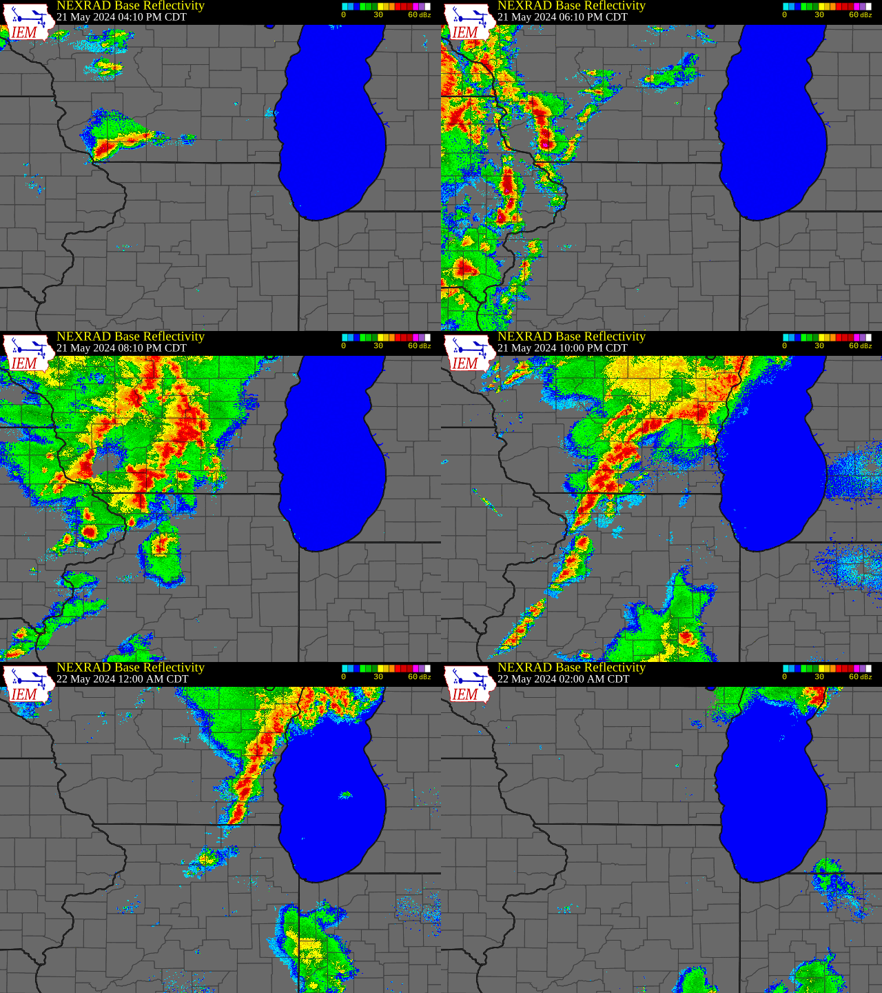 Radar Loop Of Storms |
Wind & Hail:
Widespread wind damage occurred across south central and parts of southeast Wisconsin during the late afternoon and evening hours of May 21, 2024. These storms lingered into the overnight hours of May 22, 2024, before gradually weakening after midnight.
Reports:
Widespread wind damage occurred with these storms, especially over south central and parts of southeast Wisconsin.
Hail up to 1.50 inches in diameter was reported across parts of the area with these storms.
 |
 |
 |
 |
|
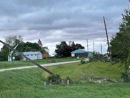
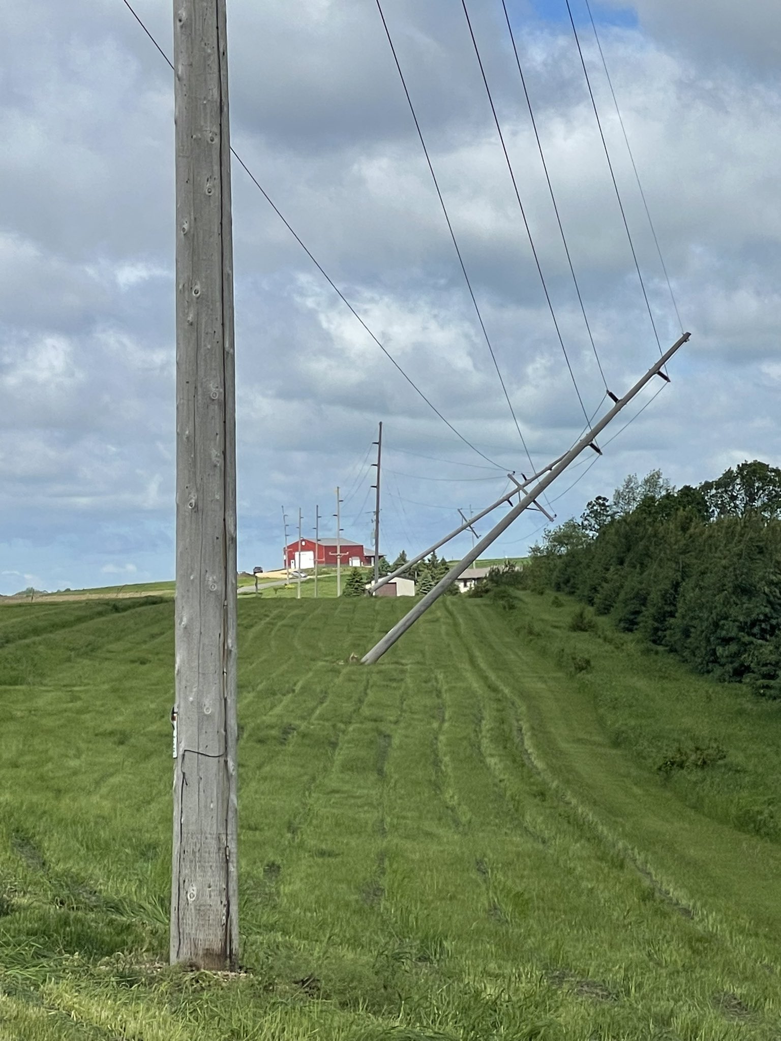
Downed Power Poles Near Ripon Photo Credit: Brian Waite |
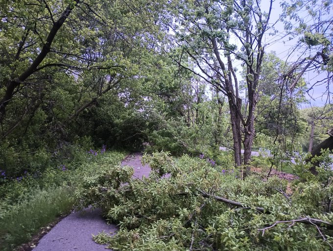
Multiple Tree Limbs and a Few Trees near Wales Photo Credit: @bikewxmt |
Tree snapped in town of Waldwick Photo Credit: @JohnKivikoski |
Snapped Power Poles near Hollandale Photo Credit: @JohnKivikoski |
 |
|||
|
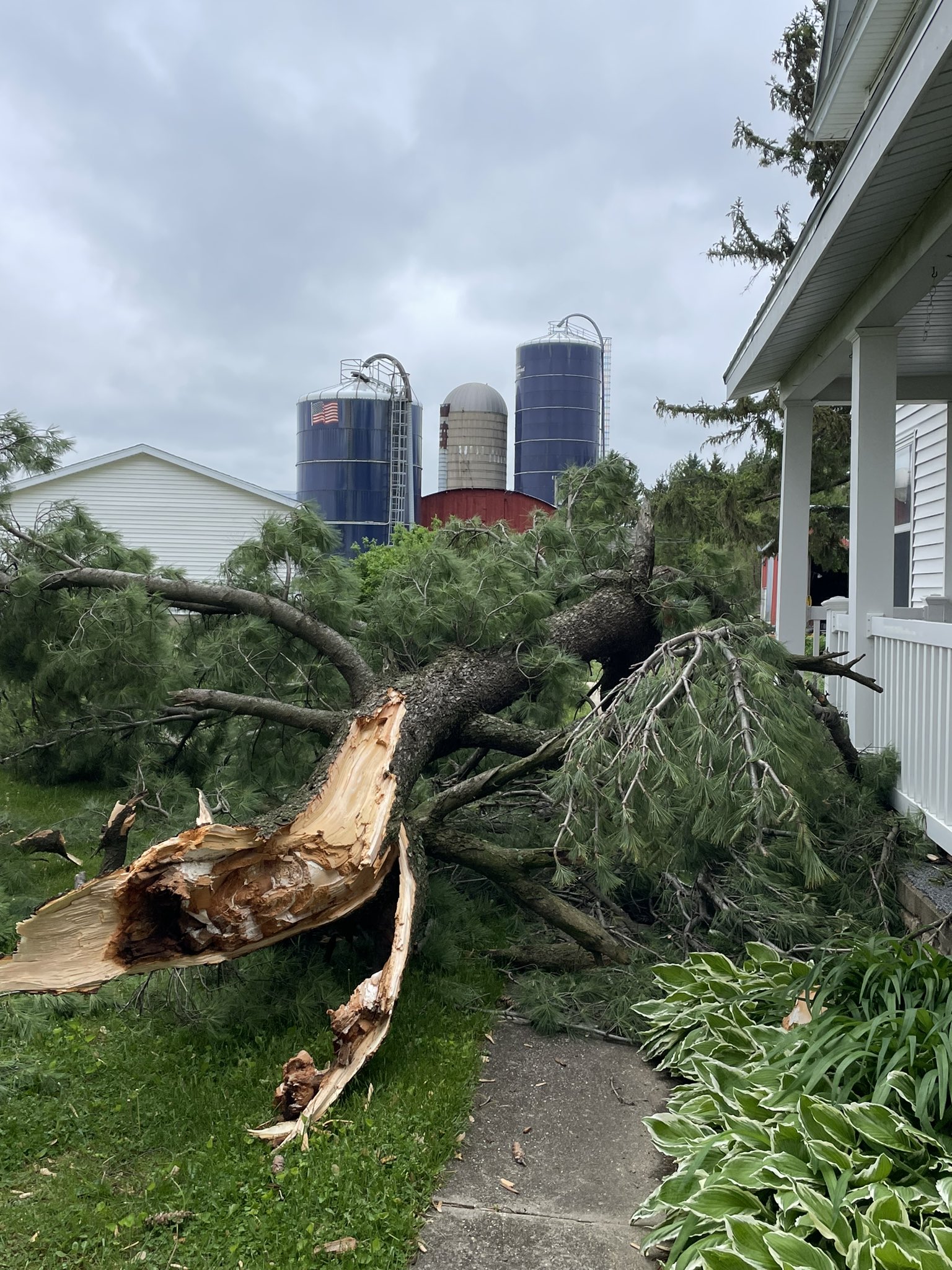
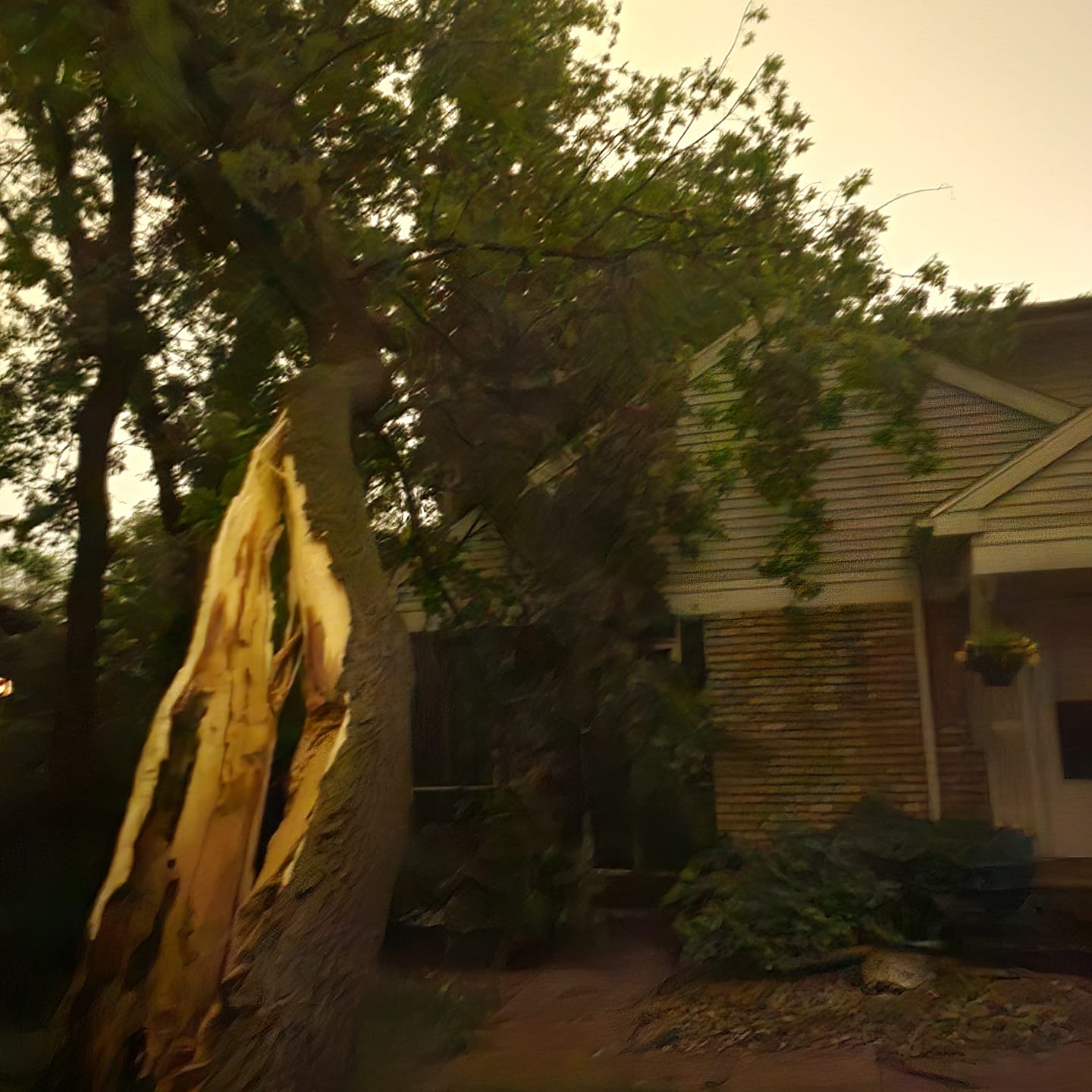
Split Tree on house in west Madison Photo Credit: Jeanette Krause |
|
|
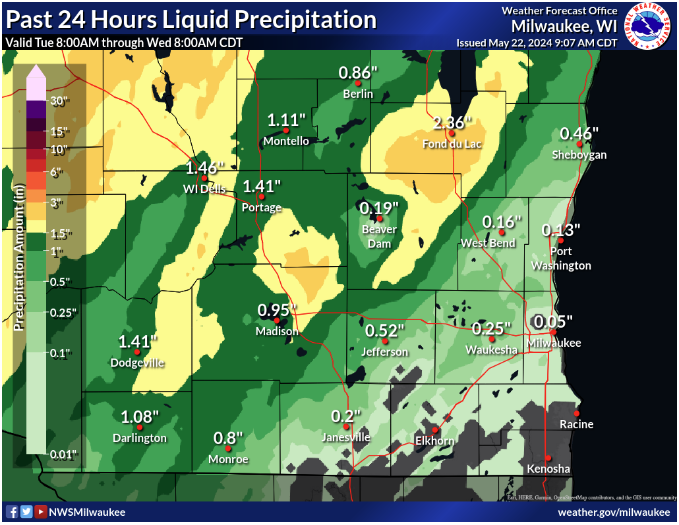
Radar / Rainfall:
 |
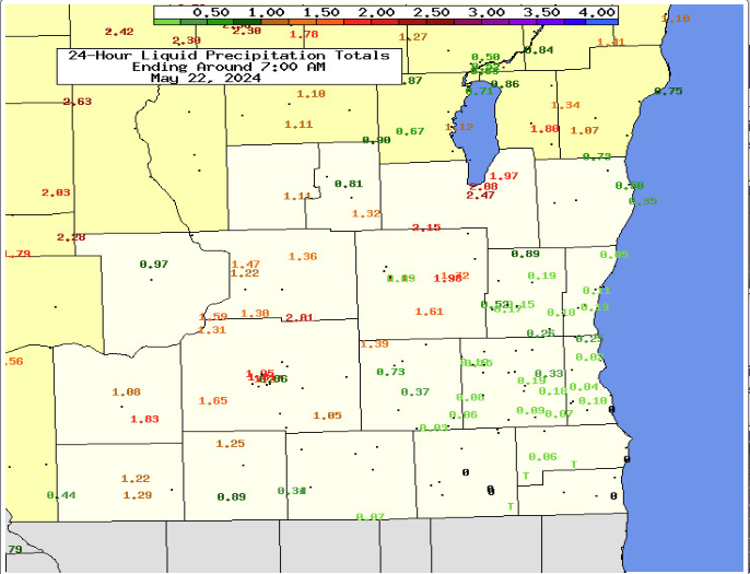 |
| Observed Rainfall Amounts - Contoured Map | Observer Rainfall Amounts - Individual Report Map |
 |
Media use of NWS Web News Stories is encouraged! Please acknowledge the NWS as the source of any news information accessed from this site. |
|



 Follow us on X
 Follow us on Facebook
 Follow us on YouTube
 MKX RSS Feed