Severe thunderstorms will continue to be possible over parts of the northern Plains and upper Midwest through Saturday which could bring large hail, damaging winds, and possible tornadoes. Heavy to excessive rainfall may produce flooding over a part of the Midwest today. Elevated to critical fire weather are expected today into this weekend over parts of the central Rockies and Great Basin. Read More >
Milwaukee/Sullivan, WI
Weather Forecast Office
|
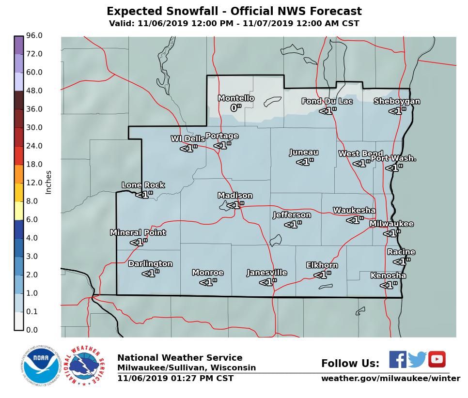
Additional Light Snow Through Late Evening Additional light snow will spread into southern Wisconsin late this afternoon and exit from west to east through late evening. An additional inch or less of snow is expected. Widespread hazardous travel conditions are not anticipated, so the Winter Weather Advisory has been cancelled. However, brief conditions are possible for the late afternoon and evening commute.
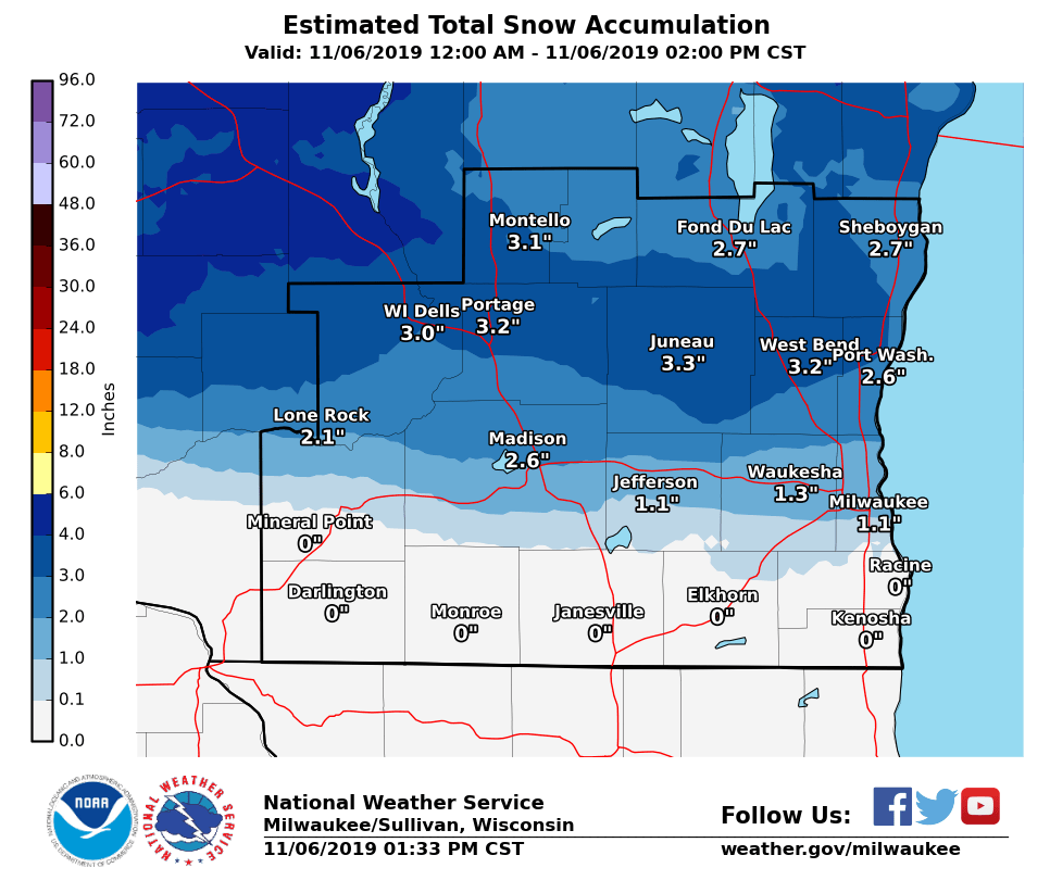
Estimated Snowfall Graphic from Midnight through 2 PM Wednesday for southern WI:
Click here to submit your snow or ice report. Here are the latest Wisconsin road conditions from the Wisconsin DOT.
Additional Snowfall Forecast Here's a graphic showing the additional snowfall expected for southern Wisconsin through late evening:
|
NWS Milwaukee/Sullivan
Aidan Kuroski and Cameron Miller
Hazards
National Briefing
Hazardous Weather Outlook
Skywarn
View Local Storm Reports
Submit A Storm Report
Winter Weather
Summer Weather
Beach Hazards
Local Forecasts
Marine
Aviation
Fire
Local Text Products
Local Precip Forecast
Hourly Forecast Graphics
Forecast Discussion
Climate
Local Climate Products
Normals/Records MKE/MSN
CoCoRaHS
Historic Events For Srn WI
Lightning Plot Archive
Daily Climate Graphics
US Dept of Commerce
National Oceanic and Atmospheric Administration
National Weather Service
Milwaukee/Sullivan, WI
N3533 Hardscrabble Road
Dousman, WI 53118
262-965-2074
Comments? Questions? Please Contact Us.