
Heavy rain and widely scattered severe storms capable of large hail, damaging winds, and possibly a tornado are expected over portions of the central and southern Plains into the Lower Missouri Valley. Unseasonable warmth will continue for a few more days across the Midwest and Southeast where several daily record highs could fall. Read More >
Overview
|
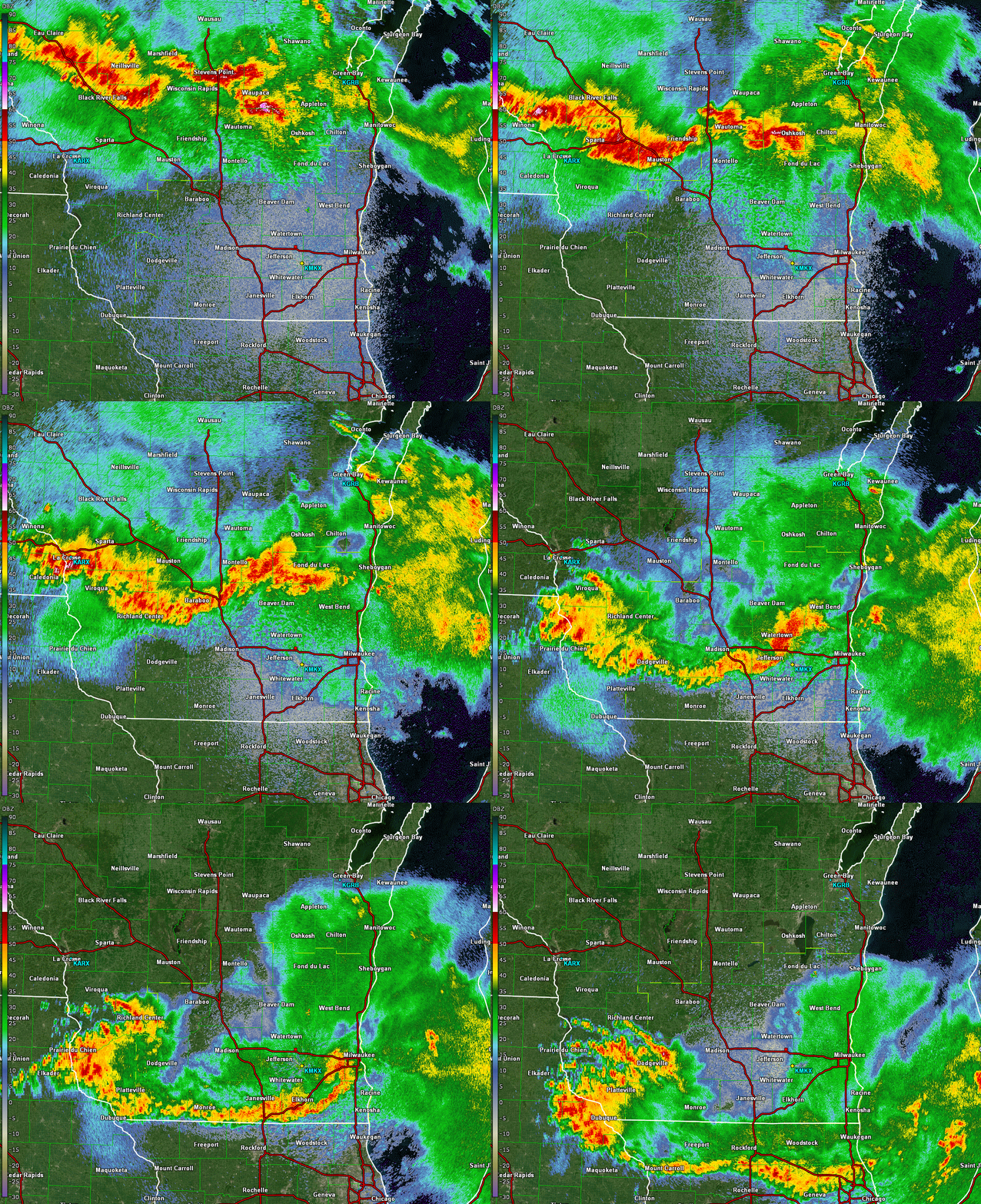
Thunderstorms developed over northern Wisconsin and congealed into a line as they tracked through southern Wisconsin. In southern Wisconsin, this line of thunderstorms produced damaging winds and 12 tornadoes. Check out the specifics below on the tornadoes and the severe weather event. |
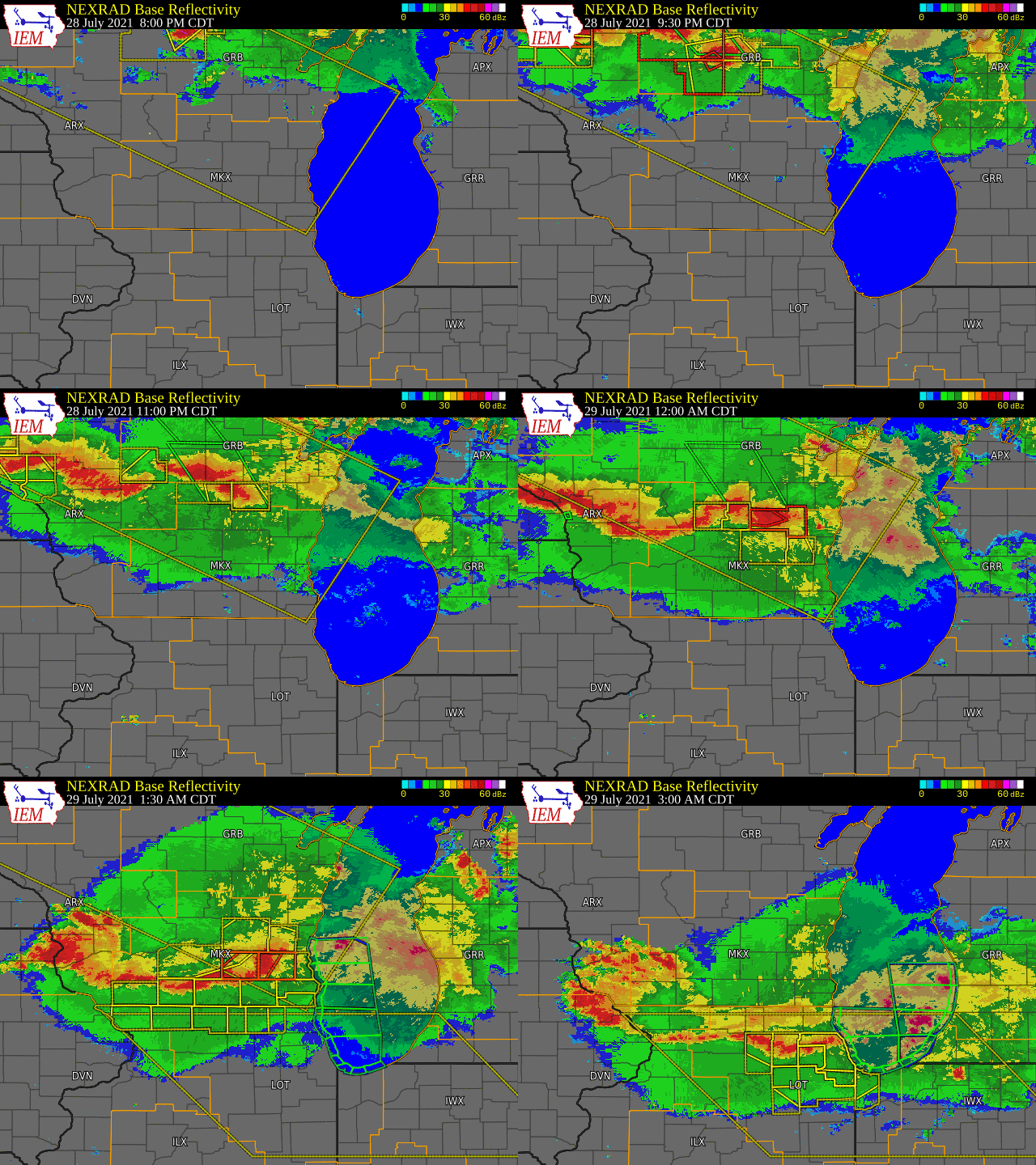 Caption |
Tornadoes:
|
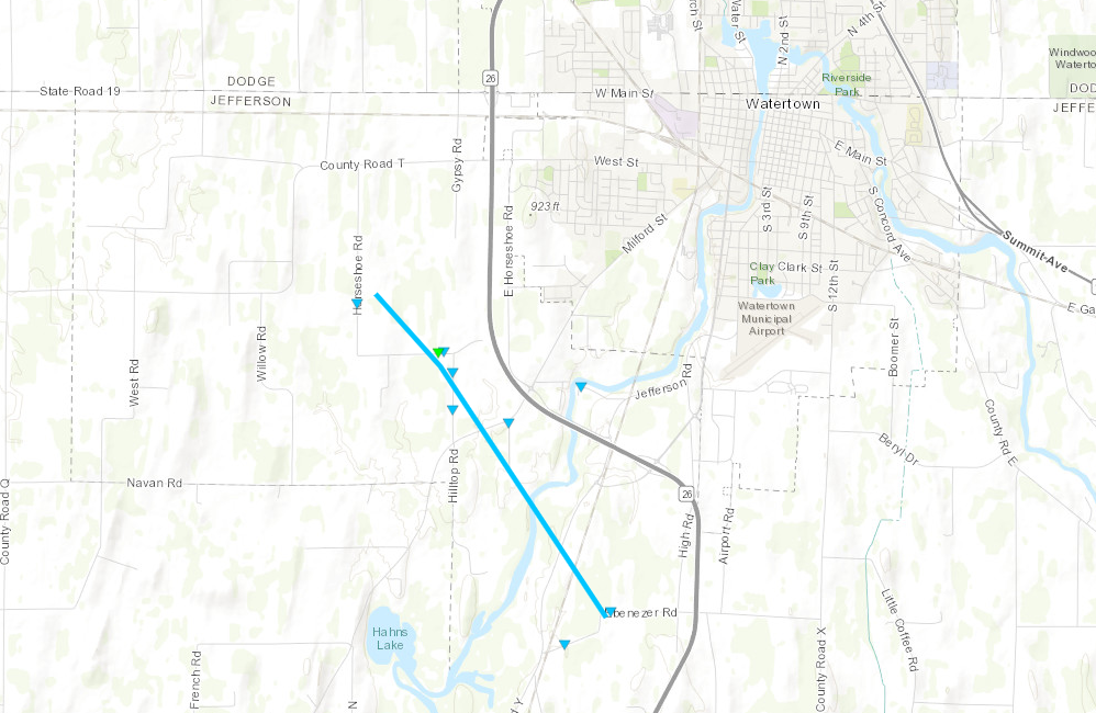
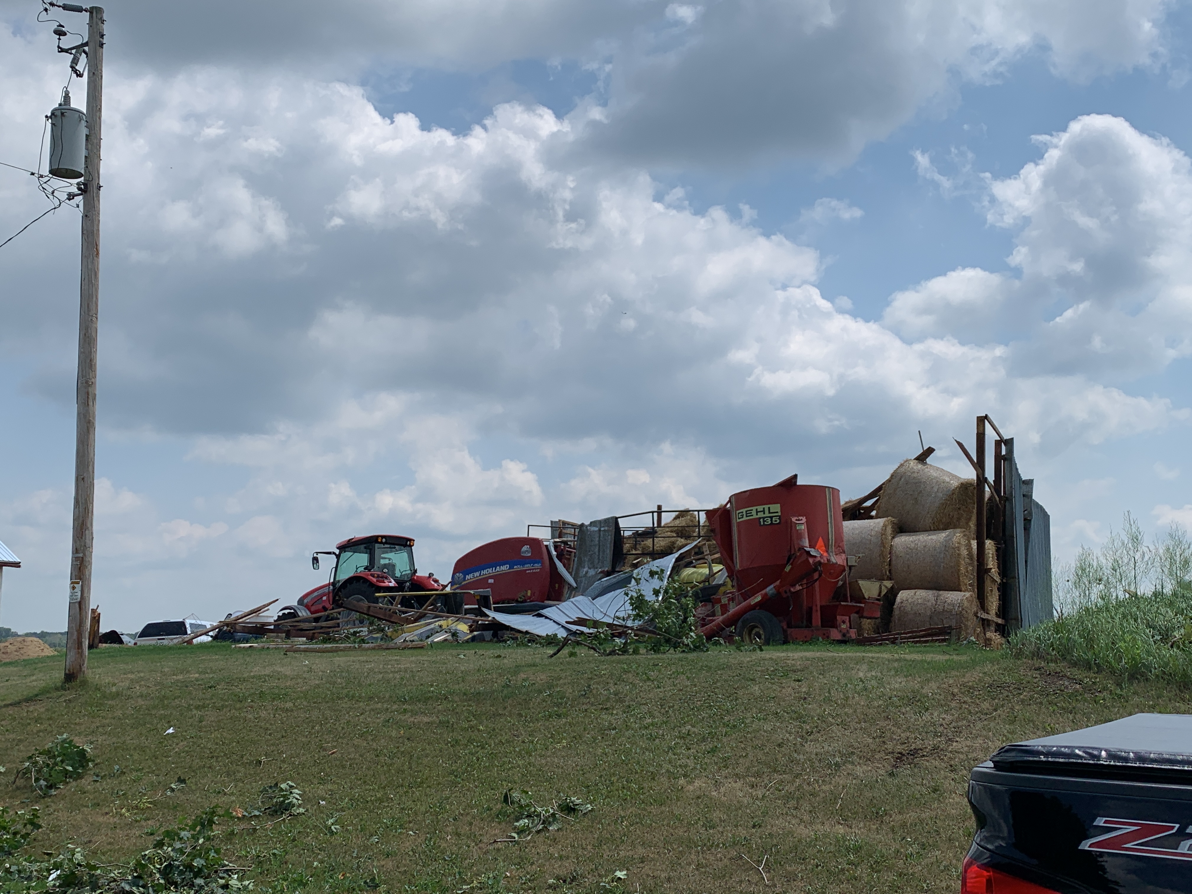
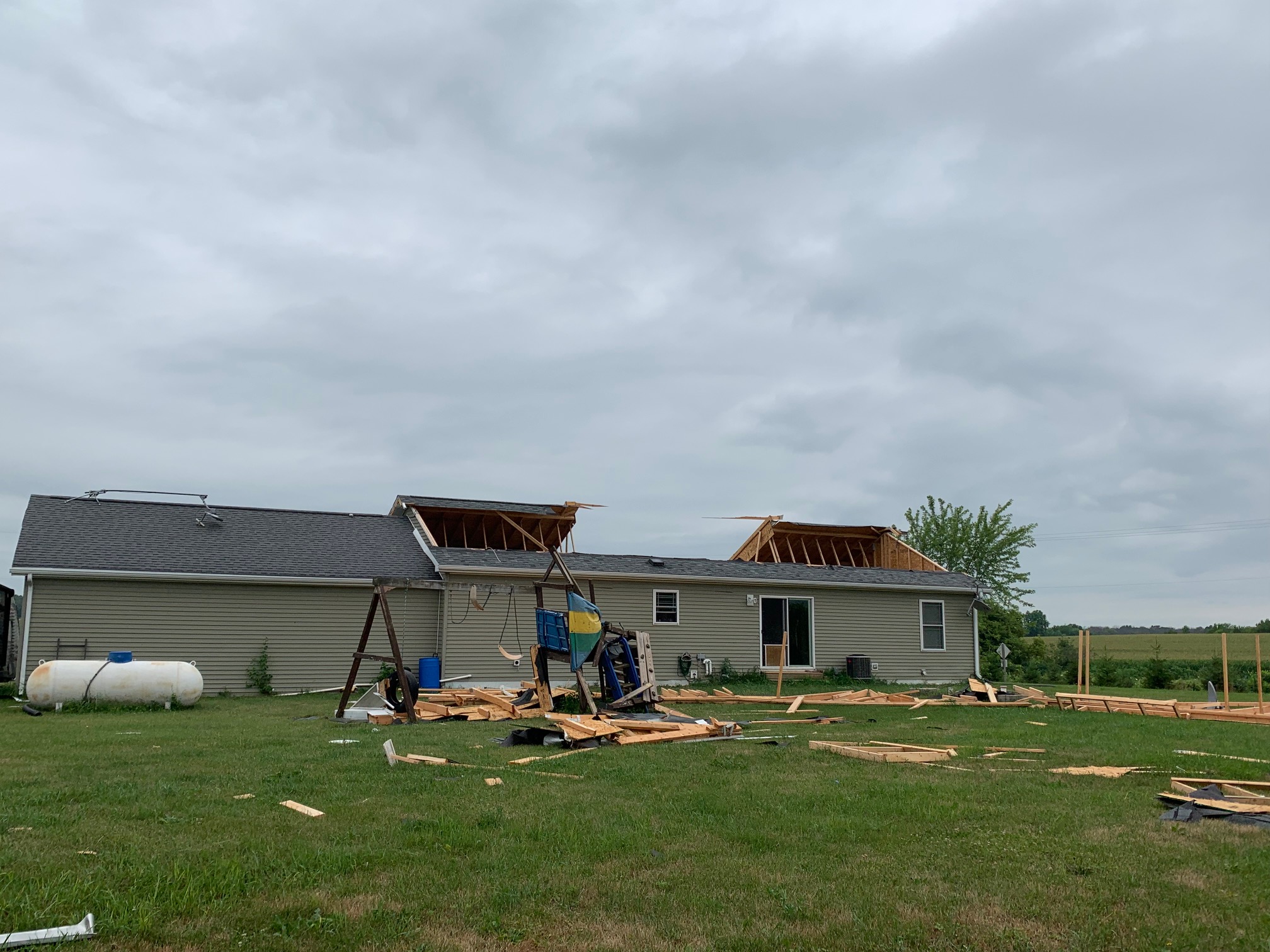
Tornado 1 - Southwest Watertown
|
||||||||||||||||
|
||||||||||||||||
|
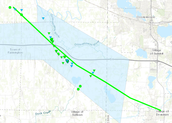
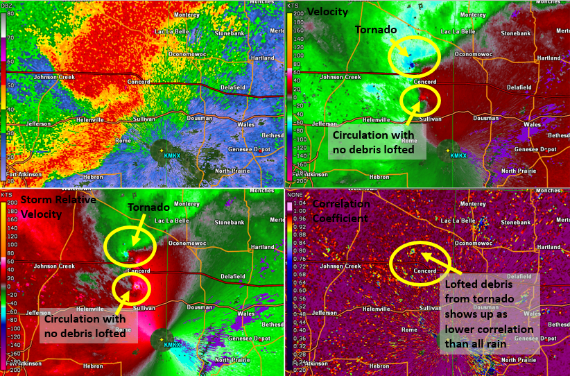
Tornado 2 - Concord to Dousman
|
||||||||||||||||
|
||||||||||||||||
|
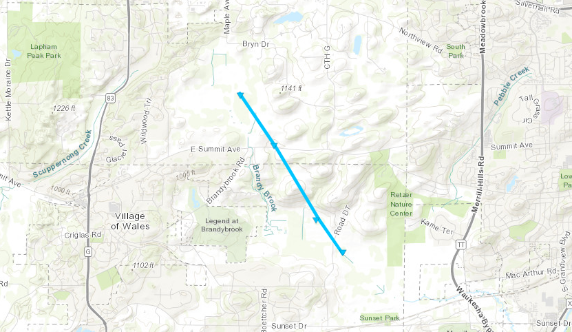
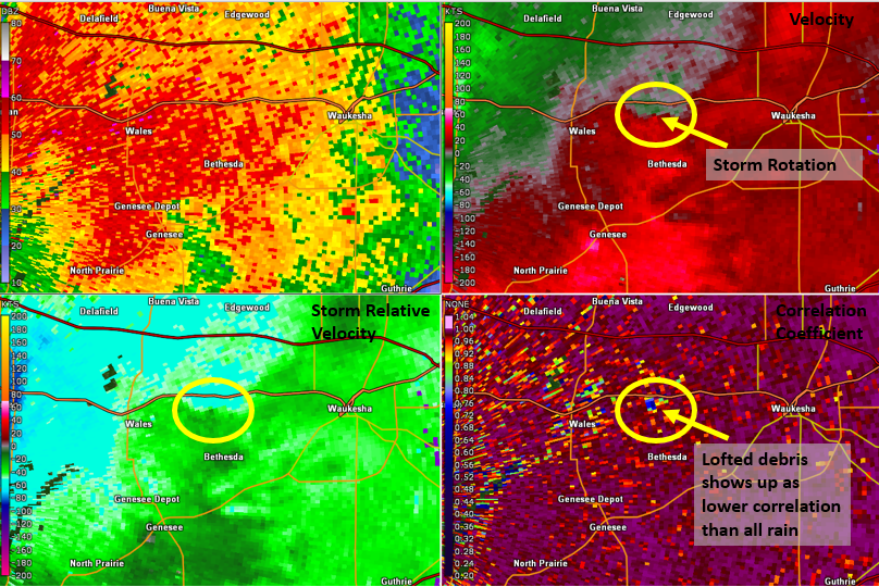
Tornado 3 - Eastern Wales/Town of Genesee
|
||||||||||||||||
|
||||||||||||||||
|
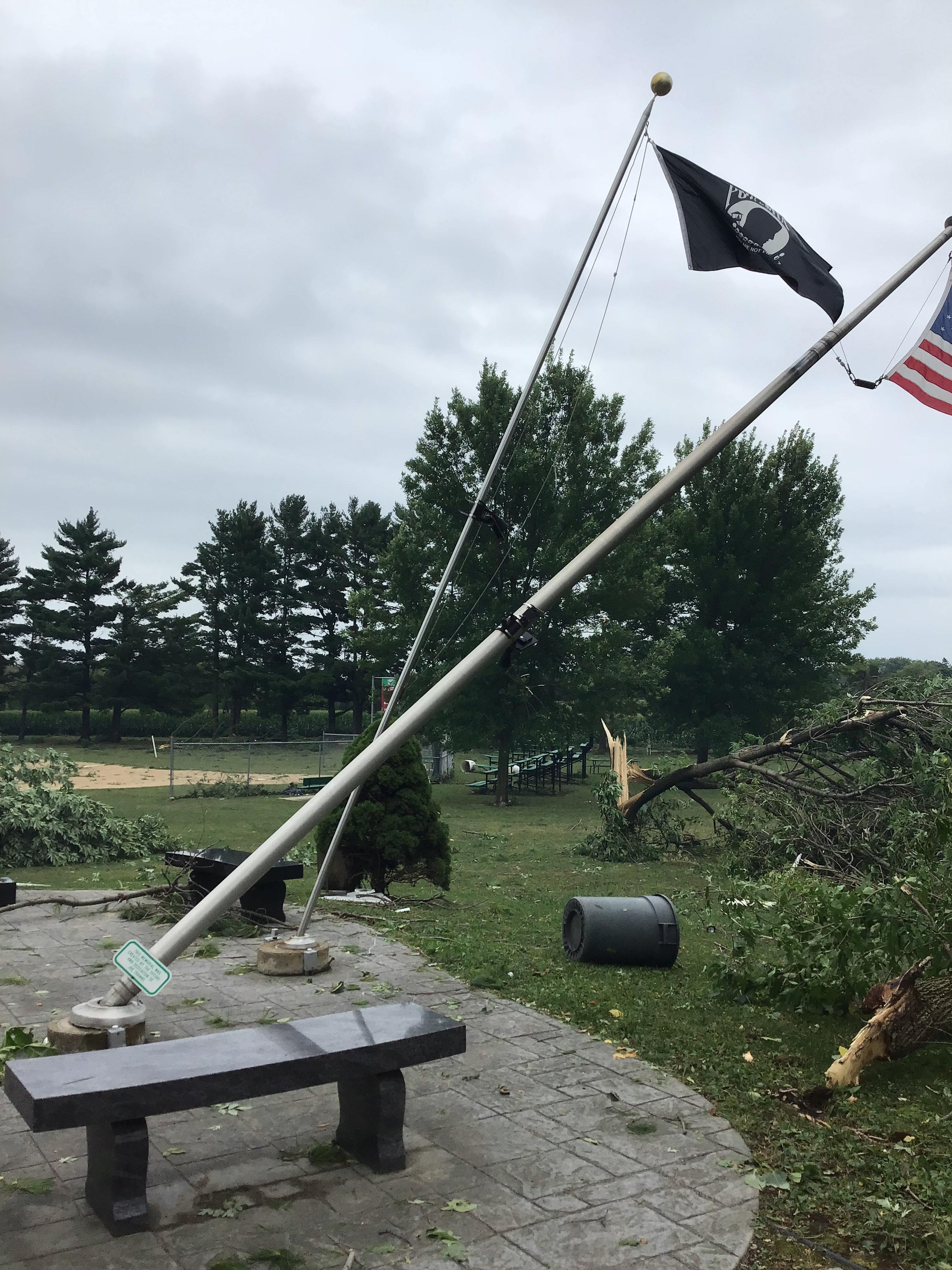
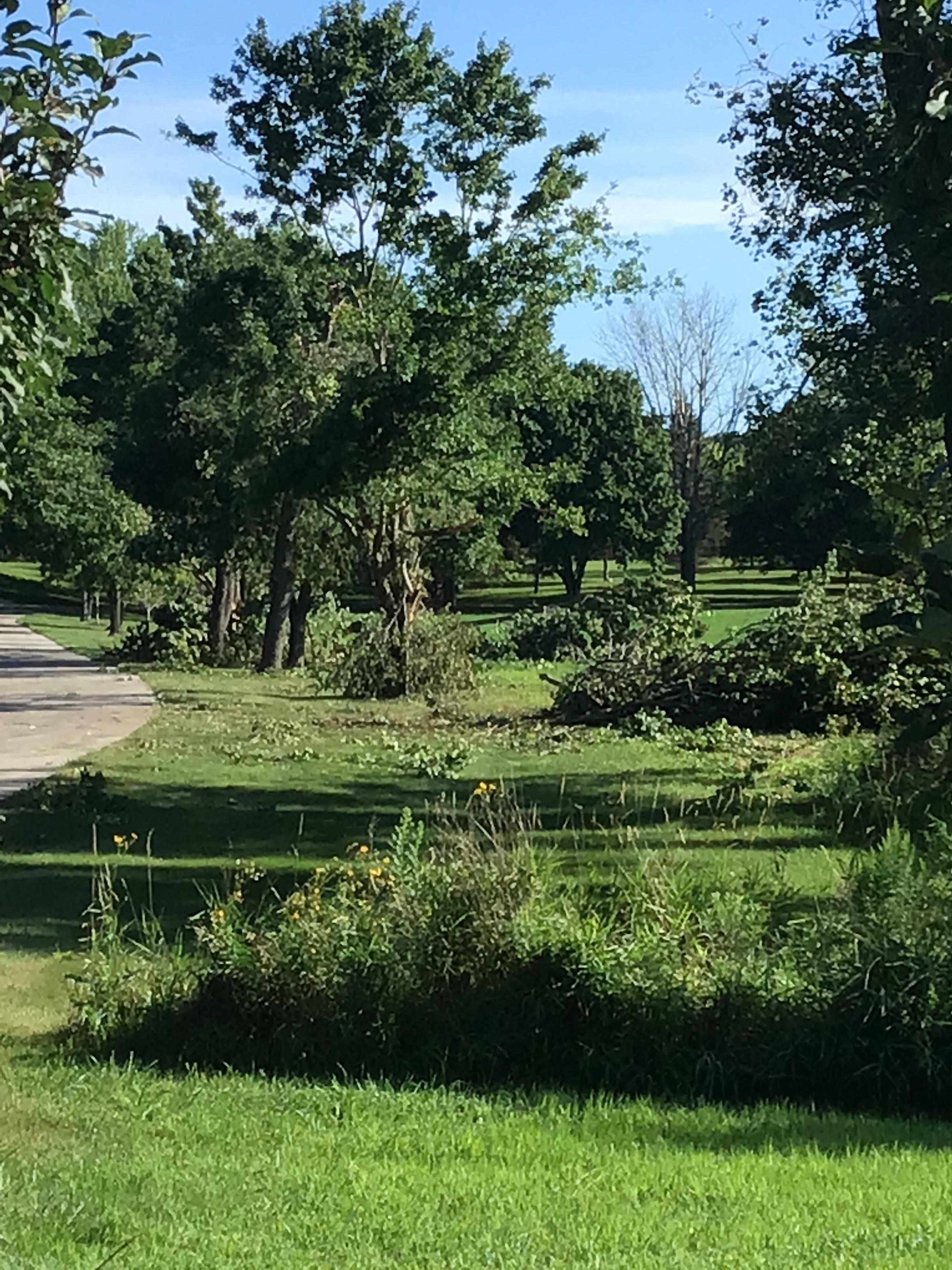
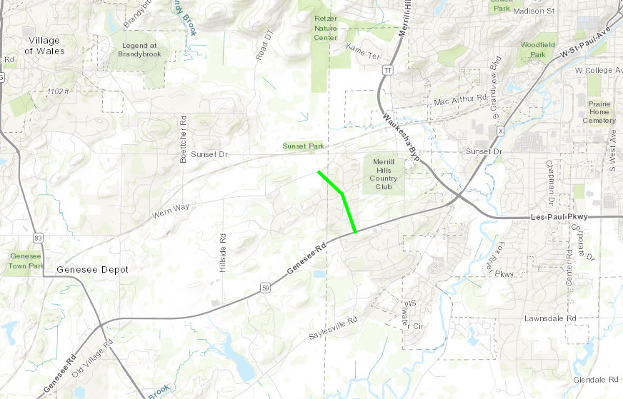
Tornado 4 - Western Waukesha (Town of Genesee)
|
||||||||||||||||
|
||||||||||||||||
|
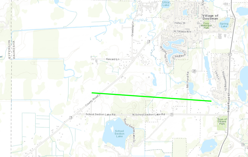
Tornado 5 - School Section Lake Road
|
||||||||||||||||
|
|
||||||||||||||||
|
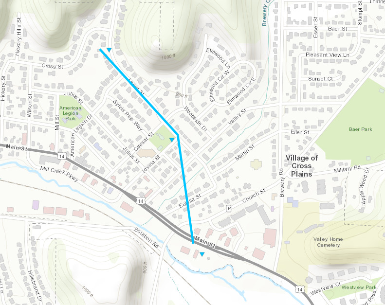
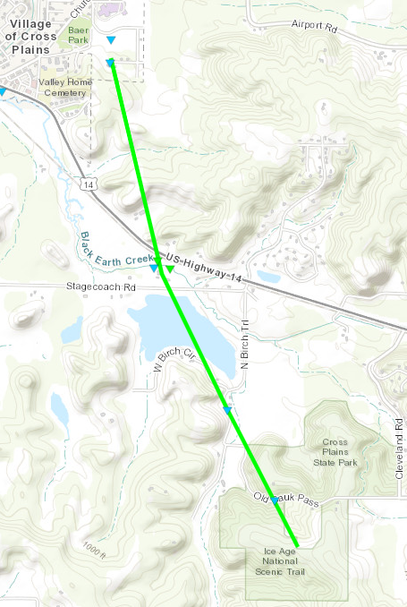
Tornado 6 - Cross Plains
|
||||||||||||||||
|
|
||||||||||||||||
|
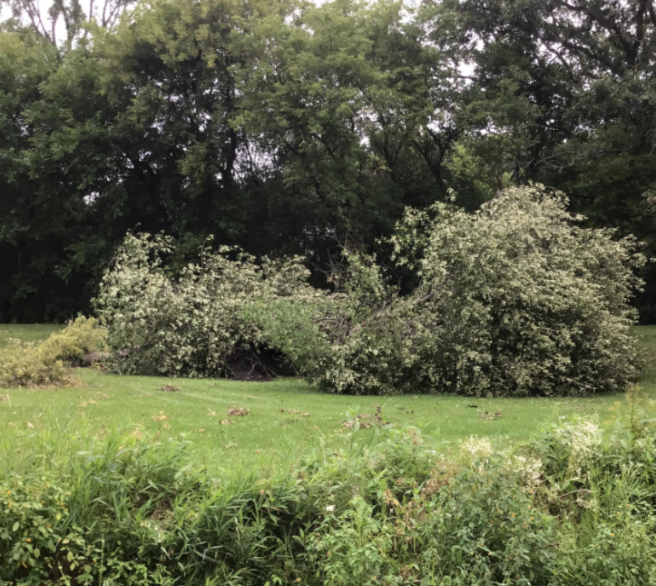
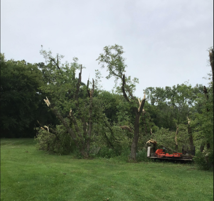
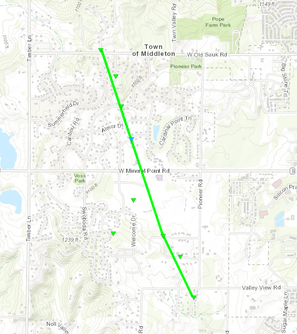
Tornado 7 - Southeast of Cross Plains
|
||||||||||||||||
 |
 |
 |
|
| NWS Storm Survey | NWS Storm Survey | NWS Storm Survey |
|
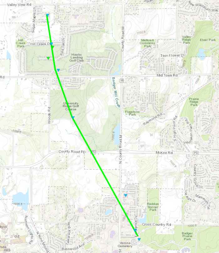
Tornado 8 - South of Middleton
|
||||||||||||||||
|
|
||||||||||||||||
|
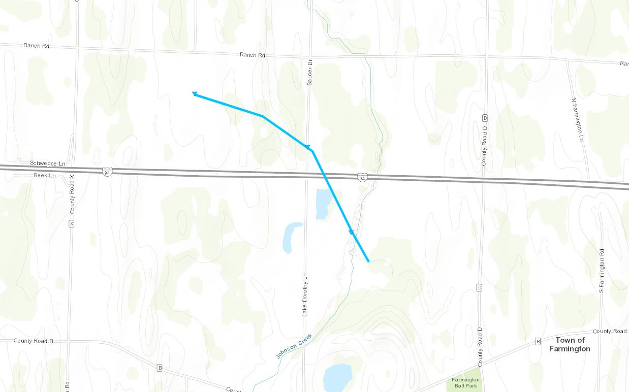
Tornado 9 - North of Verona
|
||||||||||||||||
|
|
||||||||||||||||
|
Tornado 10 - Farmington
|
||||||||||||||||
|
||||||||||||||||
|
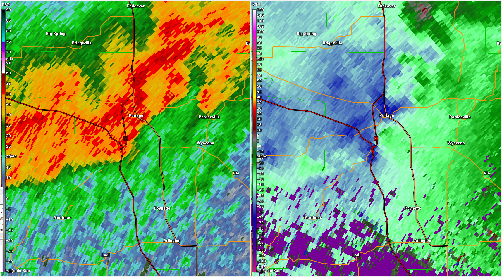
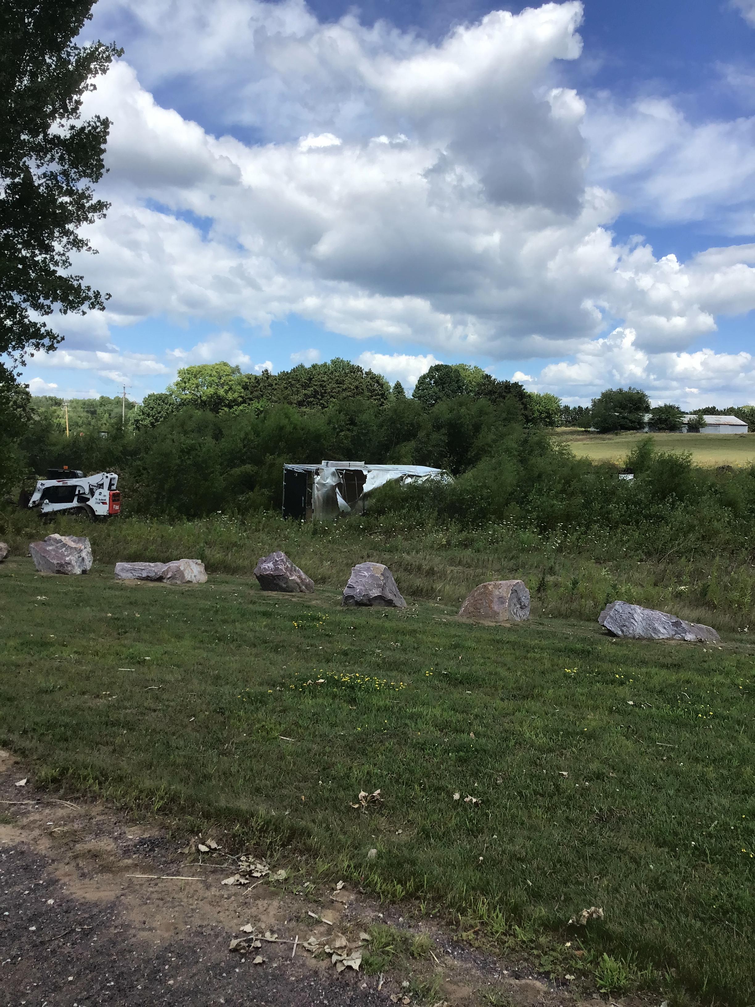
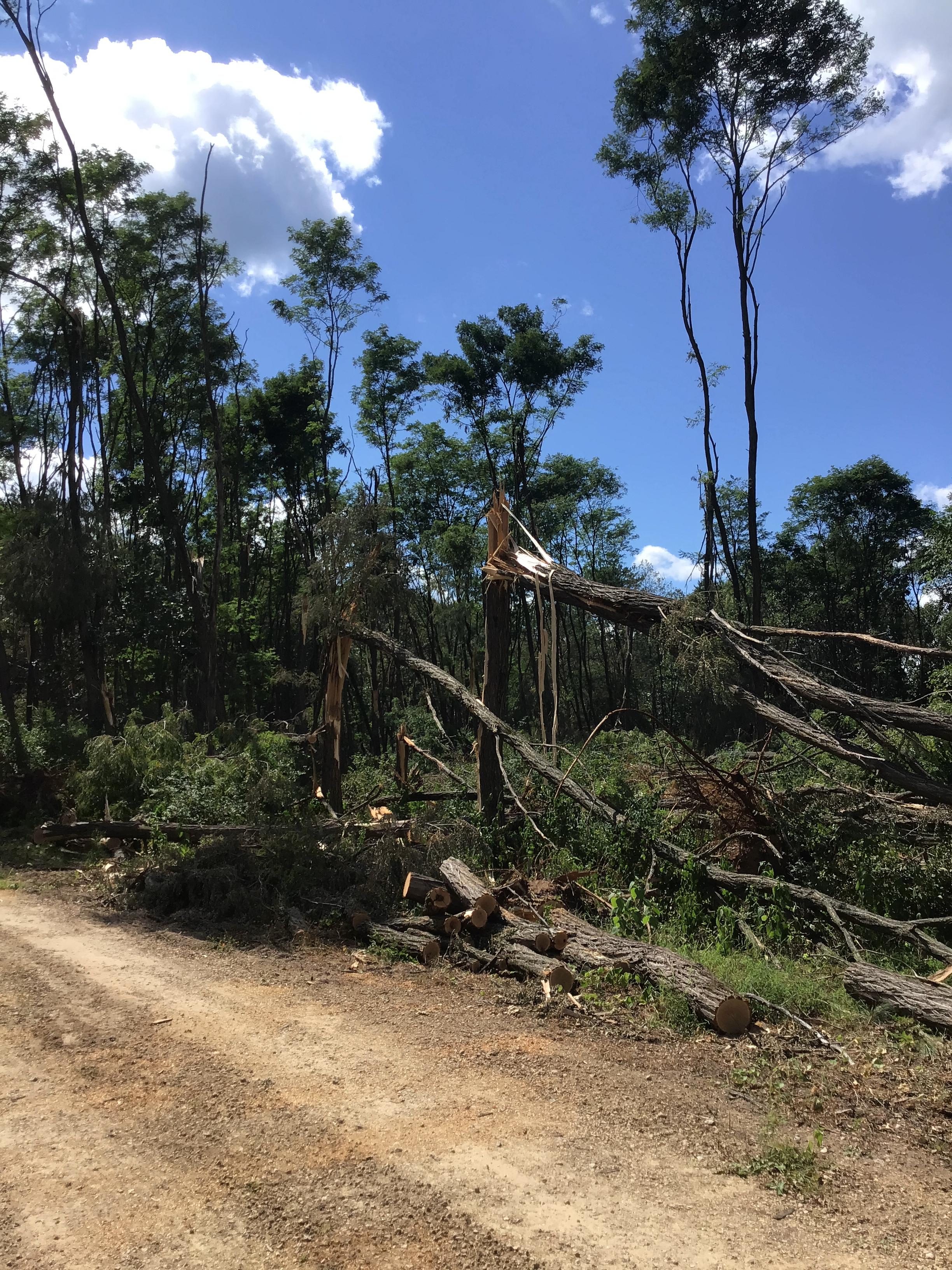
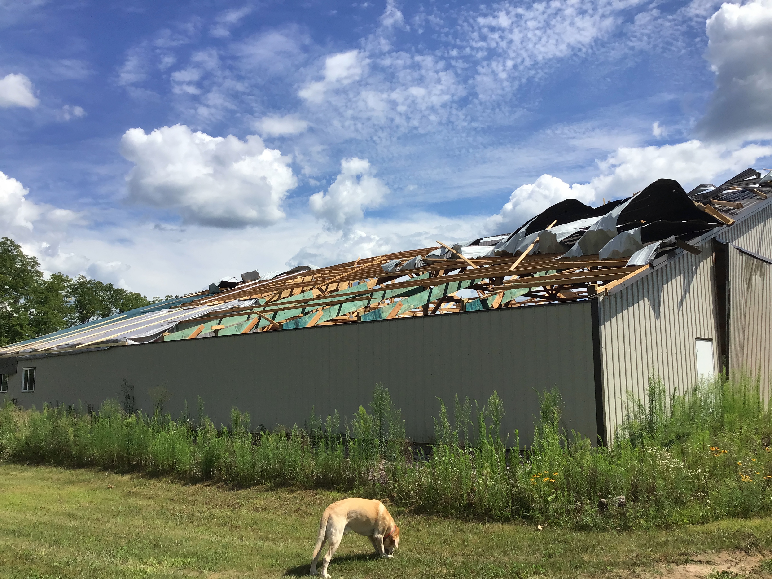
Tornado 11 - South of Portage
|
||||||||||||||||
|
||||||||||||||||
|
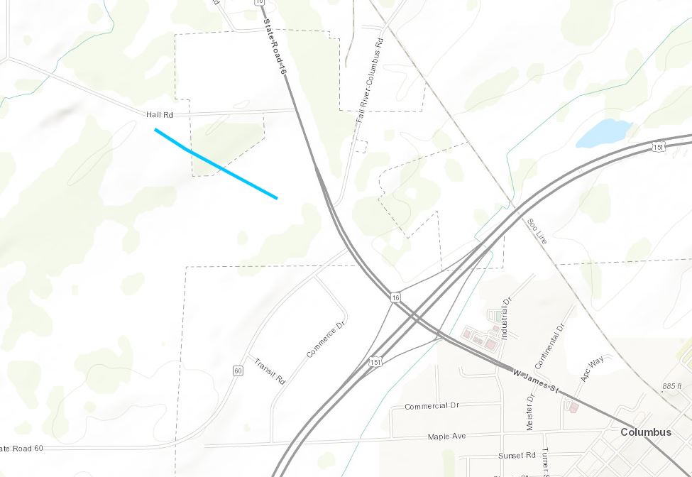
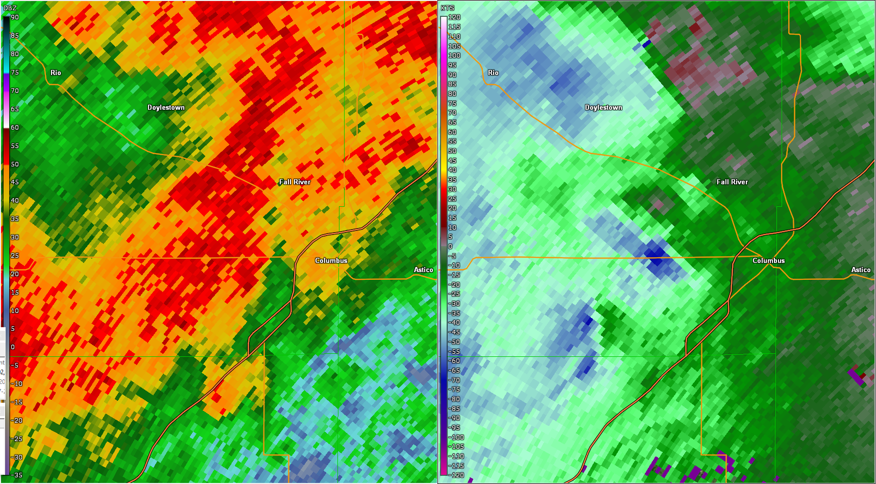
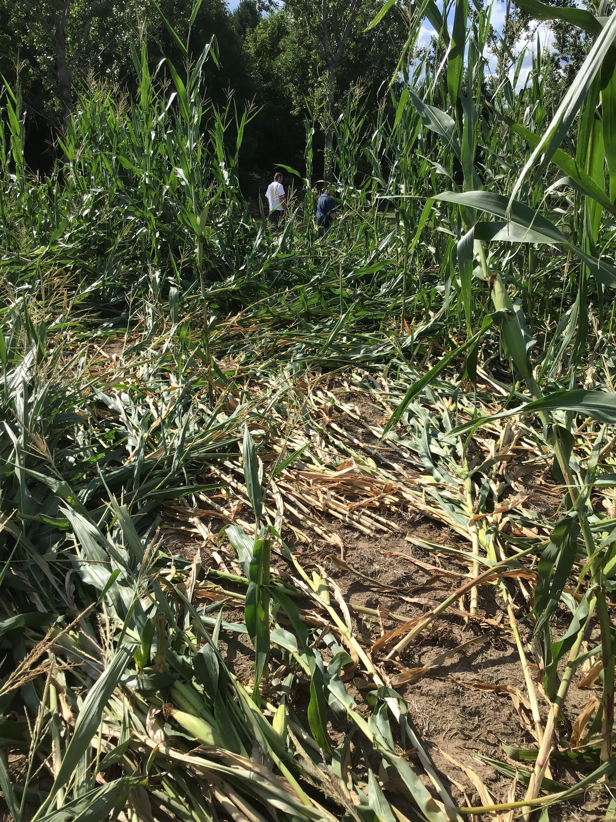
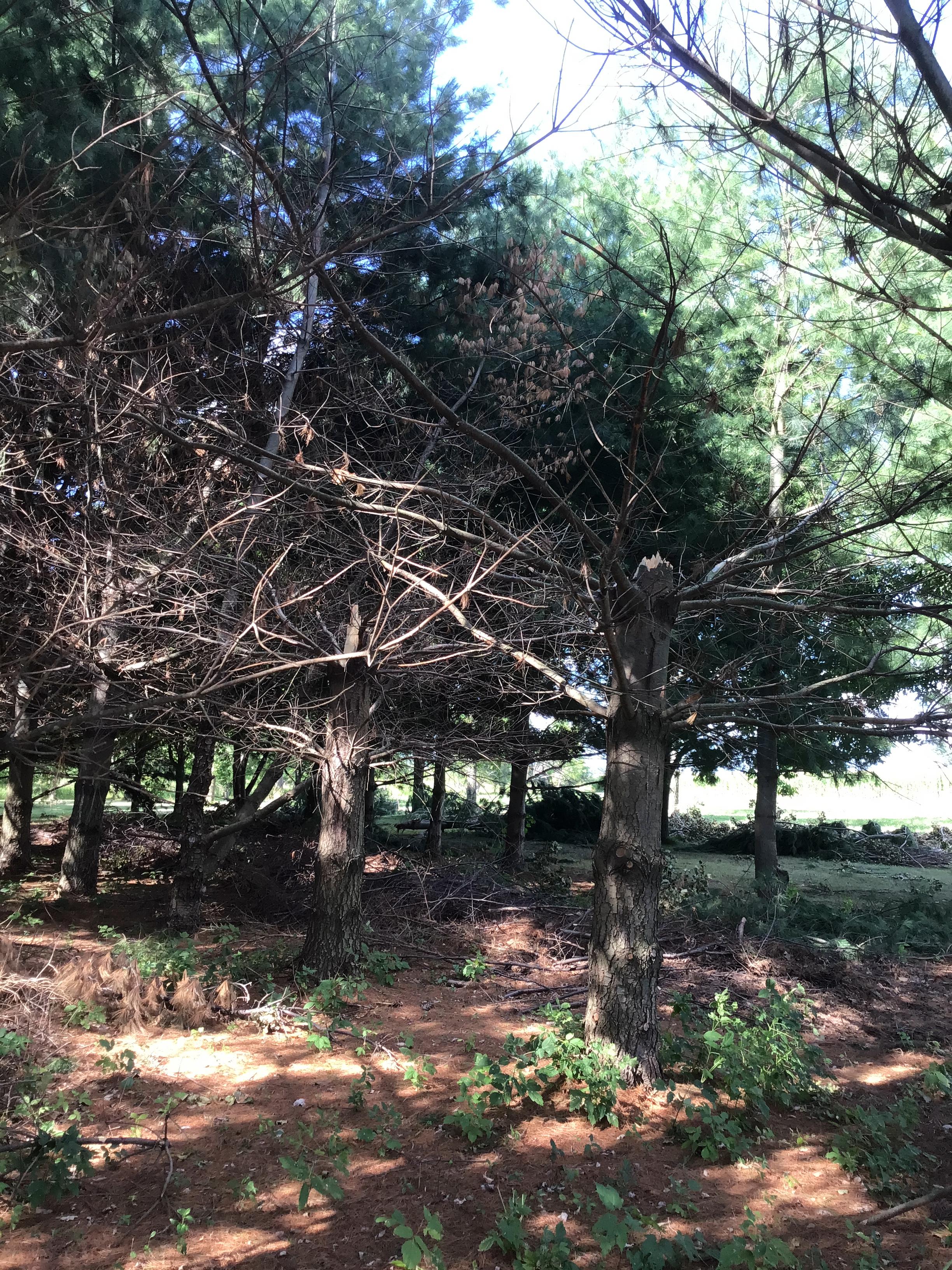
Tornado 12 - Northwest of Columbus
|
||||||||||||||||
|
||||||||||||||||
The Enhanced Fujita (EF) Scale classifies tornadoes into the following categories:
| EF0 Weak 65-85 mph |
EF1 Moderate 86-110 mph |
EF2 Significant 111-135 mph |
EF3 Severe 136-165 mph |
EF4 Extreme 166-200 mph |
EF5 Catastrophic 200+ mph |
 |
|||||
Wind:
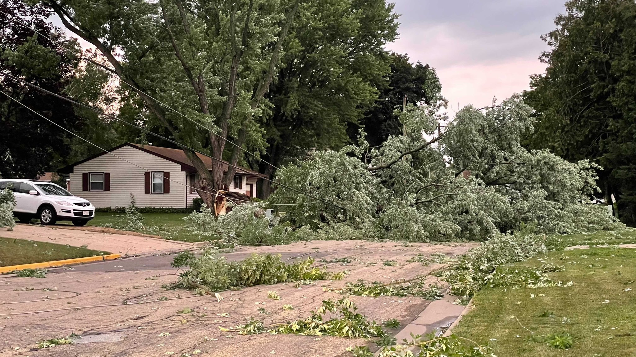
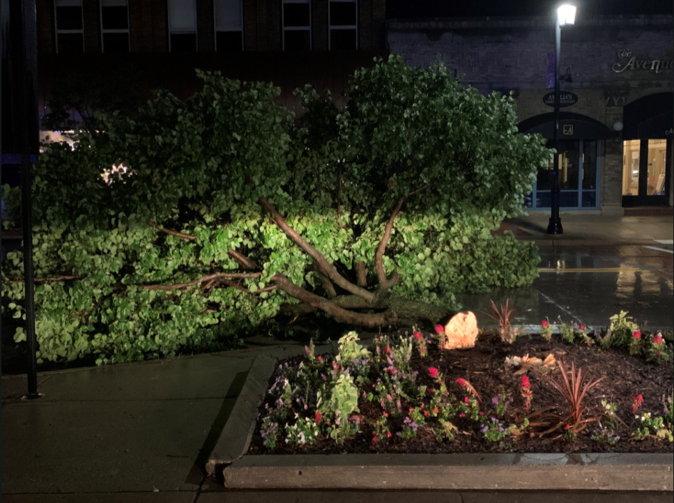
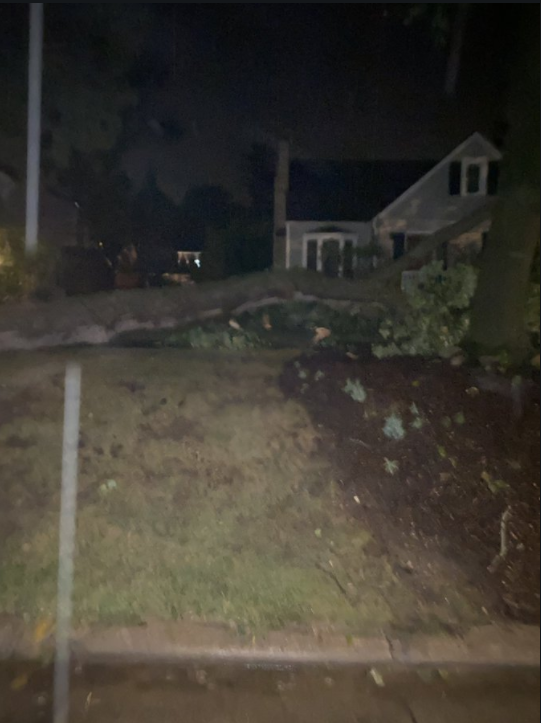
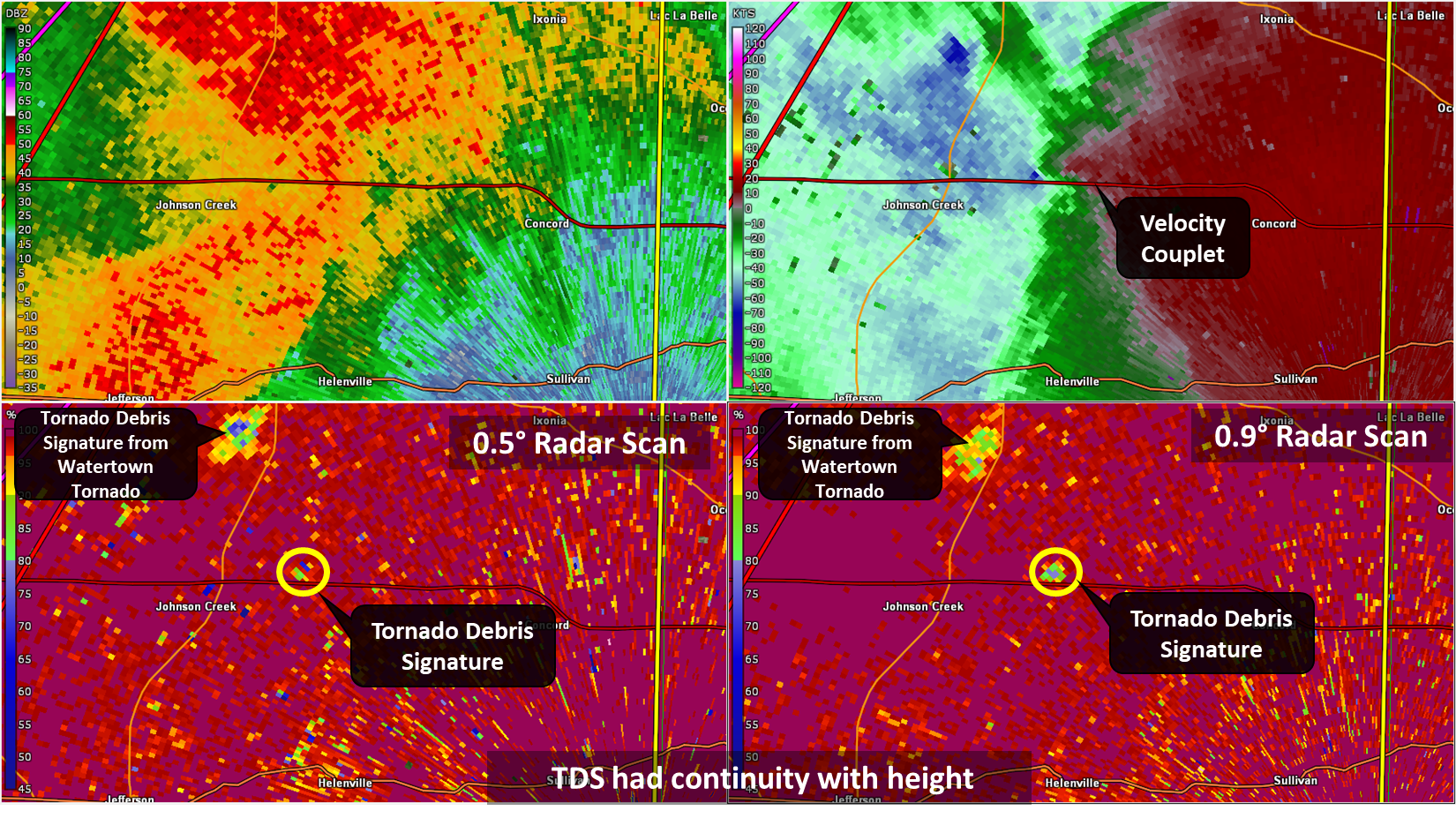
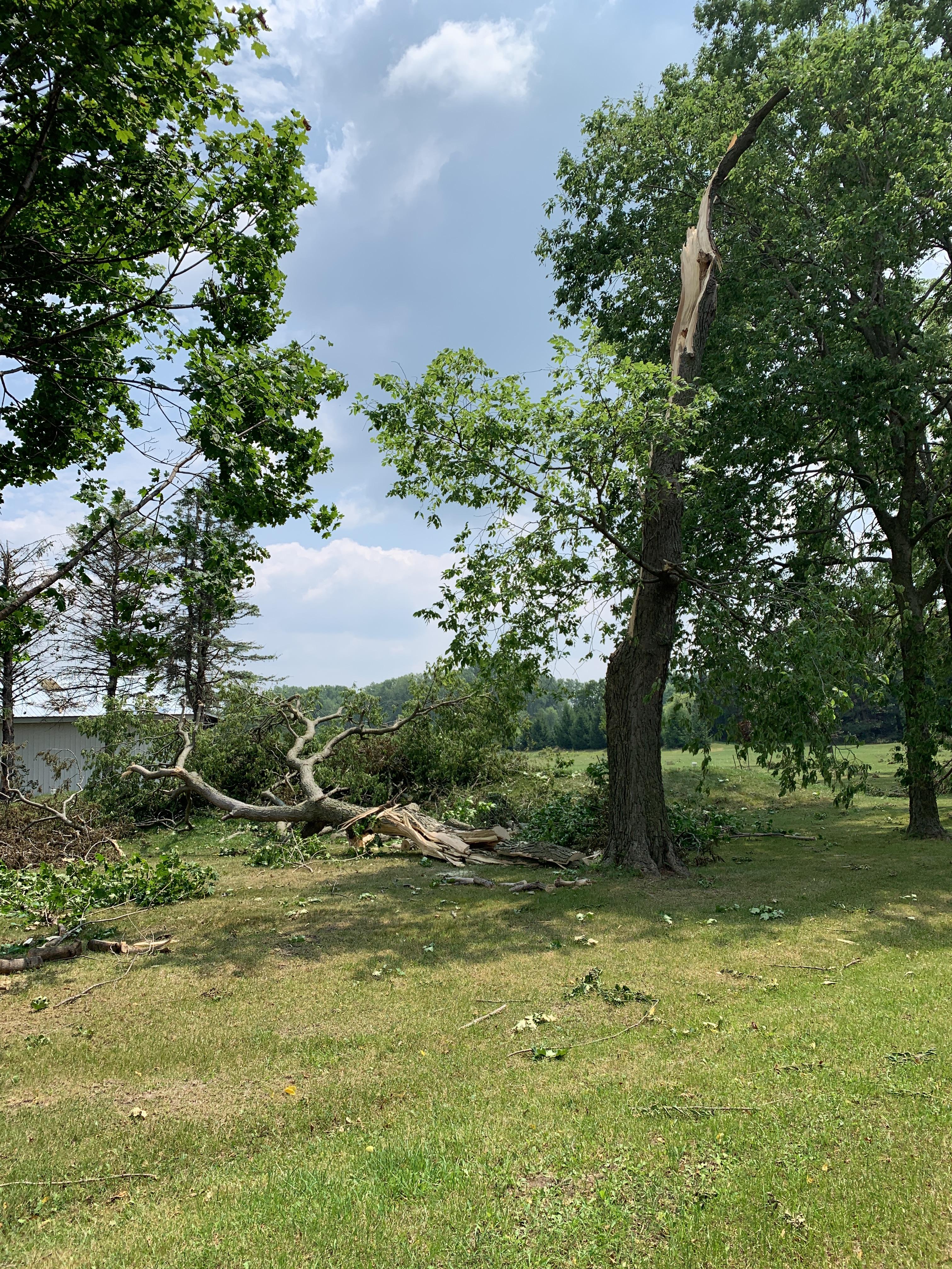
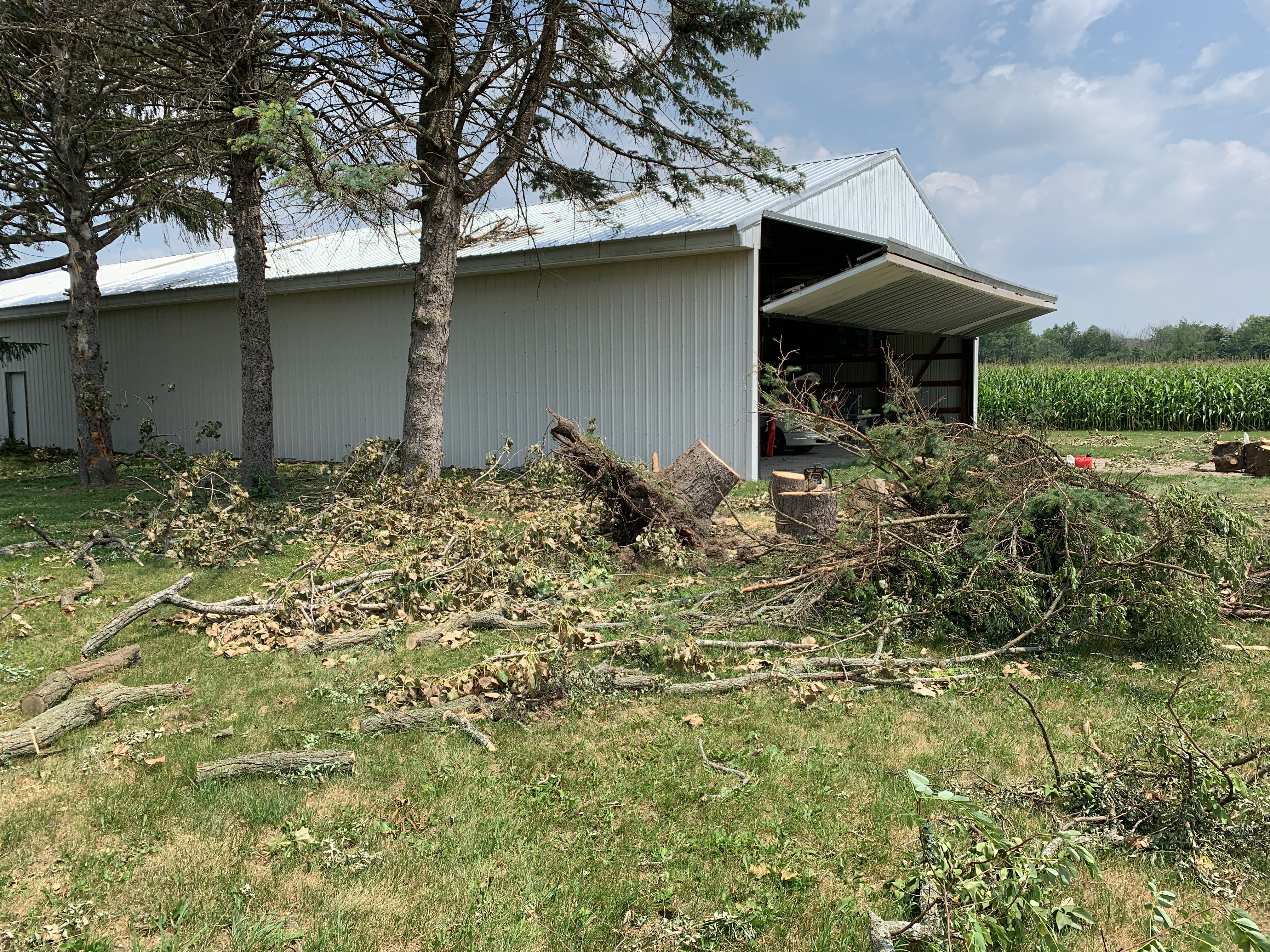
Very strong winds tracked from Ripon to Brandon in western Fond du Lac County just before midnight. There were numerous reports of large trees down and power lines down with estimated winds in excess of 70 mph. Straight line wind damage to trees occurred in the Cross Plains and Middleton areas in southern Dane County. There was a persistent rotation signature on radar that prompted a tornado warning for portions of Jefferson and Waukesha counties around 1 am, especially between southern Watertown and western Waukesha. The radar showed evidence of short-lived tornadoes with a "Tornadic Debris Signature" where we could detect debris using the Correlation Coefficient Dual-Pol radar product. Scattered straight line wind damage also occurred in Wisconsin Dells/Portage, Lone Rock, Clyman, near Holy Hill, Dousman, Mukwonago, and Kenosha.
 |
 |
 |
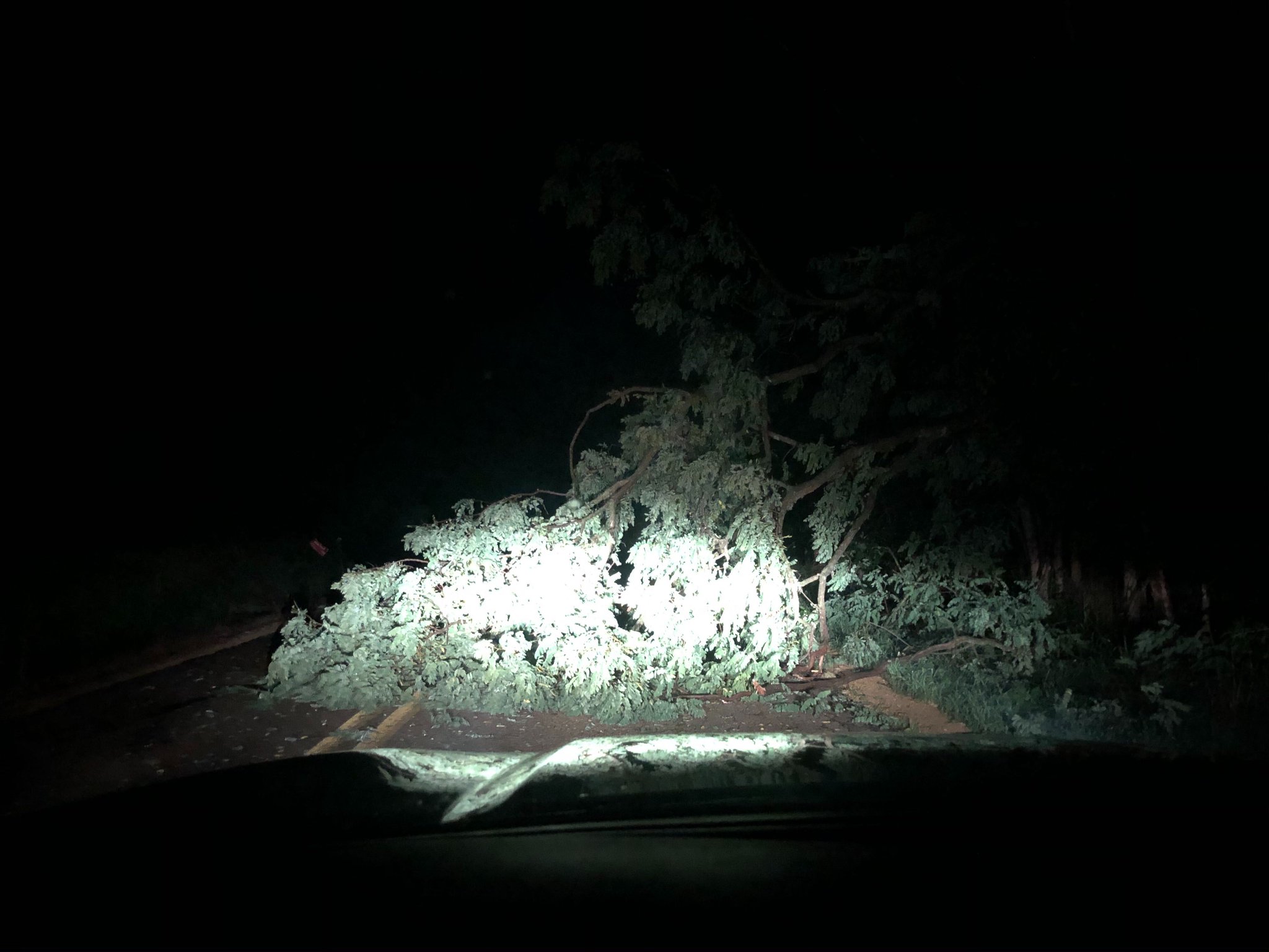 |
| Wind Damage in Cross Plains Photo Credit: @SaraMDNews |
Downtown Oconomowoc | Watertown | Middleton near Twin Valley Rd Photo Credit: @27StormTrack |
Radar and Rainfall:
Rainfall amounts ranged from a few tenths to 1.5 inches. This is beneficial rain, but will have little impact on overall drought conditions. Specific rainfall reports from CoCoRaHS observers here.
 |
 |
||
| 24 hr Rainfall Amounts ending at 7 am 7/29 | Radar Reflectivity |
Storm Reports:
PRELIMINARY LOCAL STORM REPORT...SUMMARY
NATIONAL WEATHER SERVICE MILWAUKEE/SULLIVAN WI
820 PM CDT THU JUL 29 2021

..TIME...   ...EVENT...      ...CITY LOCATION...     ...LAT.LON...
..DATE...   ....MAG....      ..COUNTY LOCATION..ST.. ...SOURCE....
            ..REMARKS..

1127 PM     TSTM WND GST     BERLIN                  43.97N 88.95W
07/28/2021  E45 MPH          GREEN LAKE         WI   TRAINED SPOTTER

            SPOTTERS ESTIMATED WIND GUSTS OF 40 TO 50
            MPH WITH STORM MOVING THROUGH BERLIN.

1137 PM     TSTM WND DMG     3 SE RIPON              43.81N 88.80W
07/28/2021                   FOND DU LAC        WI   BROADCAST MEDIA

            HWY KK BETWEEN CALLAN RD AND BRANDON RD WAS
            CLOSED DUE TO SNAPPED POWER POLES. ALSO,
            THERE WAS SHEET METAL ROOFING OR SIDING
            STREWN IN THE FIELDS ON EITHER SIDE OF
            BRANDON RD JUST NORTH OF INTERSECTION WITH
            KK.

1143 PM     TSTM WND DMG     RIPON                   43.85N 88.83W
07/28/2021                   FOND DU LAC        WI   EMERGENCY MNGR

            REPORT OF MULTIPLE TREES DOWN IN RIPON. TIME
            ESTIMATED FROM RADAR.

1143 PM     TSTM WND DMG     RIPON                   43.84N 88.84W
07/28/2021                   FOND DU LAC        WI   EMERGENCY MNGR

            REPORTS OF MULTIPLE TREES DOWN IN RIPON.
            TIME ESTIMATED FROM RADAR.

1145 PM     TSTM WND DMG     RIPON                   43.84N 88.84W
07/28/2021                   FOND DU LAC        WI   PUBLIC

            CITY OF RIPON POLICE DEPARTMENT REPORTS
            NUMEROUS DOWNED TREES AND ROAD CLOSURES CITY
            WIDE. POWER OUT CITY WIDE.

1145 PM     TSTM WND DMG     RIPON                   43.85N 88.84W
07/28/2021                   FOND DU LAC        WI   BROADCAST MEDIA

            RELAYED FROM TMJ4 MULTIPLE POWER LINES AND
            POLES DOWN ACROSS RIPON. TIME ESTIMATED FROM
            RADAR.

1155 PM     TSTM WND DMG     2 ENE WISCONSIN DELLS   43.63N 89.73W
07/28/2021                   COLUMBIA           WI   PUBLIC

            MULTIPLE TREES DOWN IN MOBILE HOME PARK,
            WITH DAMAGE TO HOMES AND VEHICLES.

1202 AM     TSTM WND GST     WISCONSIN DELLS         43.63N 89.77W
07/29/2021  M65 MPH          COLUMBIA           WI   PUBLIC


1232 AM     TSTM WND DMG     2 NNW FOX LAKE          43.59N 88.92W
07/29/2021                   DODGE              WI   PUBLIC

            LARGE TREE DOWN ALONG WITH DISPLACED BOAT
            HOIST ON THE EAST SIDE OF ELMWOOD ISLAND.
            TIME ESTIMATED WITH RADAR.

1245 AM     TSTM WND GST     7 WNW SPRING GREEN      43.21N 90.19W
07/29/2021  M68 MPH          SAUK               WI   ASOS

            THE LONE ROCK ASOS REPORTED A 59 KT GUST.

1247 AM     TSTM WND DMG     CROSS PLAINS            43.11N 89.65W
07/29/2021                   DANE               WI   PUBLIC

            MULTIPLE TREES DOWN ON POWER LINES. RELAYED
            FROM SOCIAL MEDIA.

1250 AM     TSTM WND DMG     MIDDLETON               43.10N 89.51W
07/29/2021                   DANE               WI   LAW ENFORCEMENT

            REPORTS OF MULTIPLE TREES SNAPPED AND
            UPROOTED ACROSS MIDDLETON. TREES ON
            POWERLINES AND TREES ON HOUSES AND OTHER
            STRUCTURES. TIME ESTIMATED FROM RADAR.

1255 AM     TSTM WND DMG     1 N VERONA              43.01N 89.53W
07/29/2021                   DANE               WI   PUBLIC

            SEVERAL REPORTS OF TREE AND MINOR STRUCTURAL
            DAMAGE BETWEEN VERONA AND MIDDLETON.

0100 AM     TSTM WND DMG     CLYMAN                  43.31N 88.72W
07/29/2021                   DODGE              WI   EMERGENCY MNGR

            MULTIPLE TREES DOWN IN CLYMAN. TIME
            ESTIMATED FROM RADAR.

0103 AM     TSTM WND DMG     WATERTOWN               43.19N 88.73W
07/29/2021                   JEFFERSON          WI   BROADCAST MEDIA

            RELAYED FROM WISN LARGE TREE DOWN IN
            WATERTOWN. TIME ESTIMATED FROM RADAR.

0105 AM     TORNADO          3 SW WATERTOWN          43.16N 88.77W
07/29/2021                   JEFFERSON          WI   NWS STORM SURVEY

            NWS STORM SURVEY FOUND PRELIMINARY EF0
            TORNADO DAMAGE JUST SOUTHWEST OF WATERTOWN.
            DAMAGE IS CONCENTRATED ALONG HILLTOP RD JUST
            NORTH OF HIGHWAY A. TORNADO OCCURRED AT
            APPROXIMATELY 1:05 AM CDT ON JULY 29, 2021.
            PATH LENGTH AND OTHER DETAILS TBD.

0107 AM     TSTM WND DMG     4 W WATERTOWN           43.19N 88.80W
07/29/2021                   JEFFERSON          WI   EMERGENCY MNGR

            BARN DAMAGE NEAR INTERSECTION OF WEST RD AND
            T.

0110 AM     TSTM WND DMG     2 N SULLIVAN            43.04N 88.58W
07/29/2021                   JEFFERSON          WI   NWS EMPLOYEE

            TREES DAMAGE AND TREES DOWN ON HIGHWAY F AND
            E FROM SULLIVAN TO CONCORD. TIME ESTIMATED
            FROM RADAR.

0112 AM     TSTM WND GST     JOHNSON CREEK           43.08N 88.77W
07/29/2021  E70 MPH          JEFFERSON          WI   NWS EMPLOYEE

            NWS EMPLOYEE ESTIMATED WIND GUST OF 70 MPH.

0113 AM     TSTM WND DMG     4 N SULLIVAN            43.07N 88.60W
07/29/2021                   JEFFERSON          WI   PUBLIC

            POWER POLES DOWN ACROSS HIGHWAY F. DEBRIS
            FROM HOUSES AND OTHER STRUCTURES COVERING
            ROADWAY. TIME ESTIMATED FROM RADAR.

0113 AM     TSTM WND DMG     2 E ERIN                43.25N 88.34W
07/29/2021                   WASHINGTON         WI   PUBLIC

            LARGE TREES DOWN ALONG HIGHWAY 167 NEAR HOLY
            HILL. TIME ESTIMATED FROM RADAR.

0115 AM     TORNADO          4 SSE PIPERSVILLE       43.09N 88.61W
07/29/2021                   JEFFERSON          WI   NWS STORM SURVEY

            ...EDITED TO INCLUDE PATH LENGTH EXTENDED
            INTO WAUKESHA COUNTY...NWS STORM SURVEY HAS
            CONFIRMED A TORNADO STARTING BETWEEN
            WATERTOWN AND CONCORD, WITH WIDESPREAD
            DAMAGE IN THE CONCORD AREA. THE PATH EXTENDS
            SOUTHEAST INTO WAUKESHA COUNTY, ENDING NORTH
            OF DOUSMAN. PATH LENGTH IS ESTIMATED TO BE
            12.6 MILES LONG, WITH A WIDTH OF 200 YDS.
            PEAK WIND ESTIMATED TO BE 105 MPH.

0115 AM     TSTM WND DMG     4 SSE PIPERSVILLE       43.09N 88.61W
07/29/2021                   JEFFERSON          WI   EMERGENCY MNGR

            REPORT OF MULTIPLE HOMES AND BUILDINGS
            DAMAGED ALONG COUNTY RD E JUST NORTH OF I-94
            IN CONCORD.

0116 AM     TSTM WND DMG     1 N OCONOMOWOC          43.12N 88.50W
07/29/2021                   WAUKESHA           WI   PUBLIC

            TREES SNAPPED NEAR THEIR BASE IN DOWNTOWN
            OCONOMOWOC. TIME ESTIMATED FROM RADAR.

0118 AM     TSTM WND DMG     4 N SULLIVAN            43.07N 88.60W
07/29/2021                   JEFFERSON          WI   EMERGENCY MNGR

            BUSINESS BUILDING DAMAGE.

0120 AM     TORNADO          3 SW DOUSMAN            42.99N 88.51W
07/29/2021                   WAUKESHA           WI   NWS STORM SURVEY

            NWS STORM SURVEY FOUND EF1 RATED TORNADO
            DAMAGE SOUTH OF DOUSMAN, STARTING NEAR A
            CEMETERY ON HIGHWAY Z. THE TORNADO PATH WAS
            2.19 MILES LONG WITH A WITH OF 100 YDS. PEAK
            WIND 100 MPH.

0122 AM     TSTM WND DMG     1 WSW DOUSMAN           43.01N 88.50W
07/29/2021                   WAUKESHA           WI   NWS EMPLOYEE

            NUMEROUS BRANCHES AND A FEW TREES BLOCKING
            PORTIONS OF HARDSCRABBLE RD AND HWY Z NEAR
            DOUSMAN. TIME ESTIMATED BY RADAR.

0124 AM     TSTM WND DMG     2 E SULLIVAN            43.01N 88.55W
07/29/2021                   JEFFERSON          WI   PUBLIC

            MULTIPLE VERY LARGE TREES BROKEN AND DOWNED.

0130 AM     TSTM WND GST     2 N OCONOMOWOC          43.13N 88.49W
07/29/2021  E60 MPH          WAUKESHA           WI   NWS EMPLOYEE

            NWS EMPLOYEE ESTIMATED WINDS TO 60 MPH.

0132 AM     TSTM WND DMG     3 E WALES               43.01N 88.32W
07/29/2021                   WAUKESHA           WI   LAW ENFORCEMENT

            REPORTS OF MULTIPLE TREES SNAPPED AND LAYING
            IN THE ROADWAY OFF ROAD DT AND HIGHWAY 18.
            TIME ESTIMATED FROM RADAR.

0140 AM     TORNADO          4 ESE WALES             42.99N 88.31W
07/29/2021                   WAUKESHA           WI   NWS STORM SURVEY

            ...UPDATED TO EF1 RATING AND TO INCLUDE PATH
            LENGTH INFO...NWS STORM SURVEY HAS CONFIRMED
            A TORNADO WITH A PRELIMINARY DAMAGE RATING
            OF EF1 WSW OF WAUKESHA, OR ESE OF WALES IN
            WAUKESHA COUNTY. DAMAGE STRETCHES FROM HWY D
            AND TOWNLINE RD SOUTH OF HWY 18. PATH LENGTH
            OF 0.91 MI AND WIDTH OF 100 YDS.

0140 AM     TSTM WND DMG     1 S MUKWONAGO           42.86N 88.33W
07/29/2021                   WAUKESHA           WI   PUBLIC

            TREE LIMBS DOWN, TRANSFORMER EXPLODED BEHIND
            VILLAGE OF MUKWONAGO POLICE DEPARTMENT.

0141 AM     TSTM WND GST     5 ESE FOOTVILLE         42.66N 89.12W
07/29/2021  M68 MPH          ROCK               WI   AMATEUR RADIO


0214 AM     TSTM WND DMG     1 SSW KENOSHA           42.57N 87.82W
07/29/2021                   KENOSHA            WI   TRAINED SPOTTER

            CORRECTS PREVIOUS TSTM WND DMG REPORT FROM 1
            SSW KENOSHA. LARGE BRANCHES DOWN IN SOUTHERN
            KENOSHA. TIME ESTIMATED FROM RADAR.
Click this link to access an interactive map of storm reports:
https://www.weather.gov/source/crh/lsrmap.html?sid=mkx
 |
Media use of NWS Web News Stories is encouraged! Please acknowledge the NWS as the source of any news information accessed from this site. |
|







 Follow us on X
 Follow us on Facebook
 Follow us on YouTube
 MKX RSS Feed