
Flash flooding threatens areas from the Tennessee Valley to the Carolinas as storms repeat along a stalled front. Monsoonal storms may trigger flooding in the Southwest. Dangerous heat expands across the Desert Southwest, Plains, mid-Mississippi Valley and Southern Tier. Critical fire weather for interior Pacific Northwest. Cooler, drier air brings brief relief to the Great Lakes and Northeast. Read More >
Overview
|
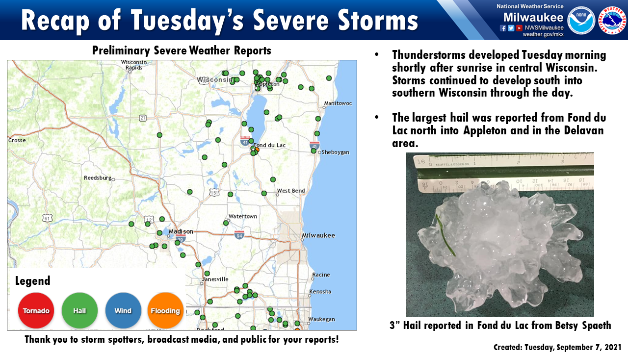
A cold front moved it's way south across Wisconsin on Tuesday with storms developing quickly over north-central Wisconsin shortly after sunrise. These storms quickly became severe in the NWS Green Bay forecast area. Large hail was reported in the Appleton area with hail approaching 4 inches in diameter. Storms continued south to southeast along the front and hail of 2 to 3 inches was reported in Fond du Lac. Additional storms developed along the southern flank of the front near Madison and produced hail around 1 inch. These southern storms continued to strengthen and hail closer to 2 inches was reported in Rock and Walworth counties. While the storms were very strong there was enough of a stable layer near the surface to prevent strong wind gusts from these storms from reaching the surface. These storms did produce very frequent and intense lightning and a couple of houses were struck and caught fire from the lightning strikes. |
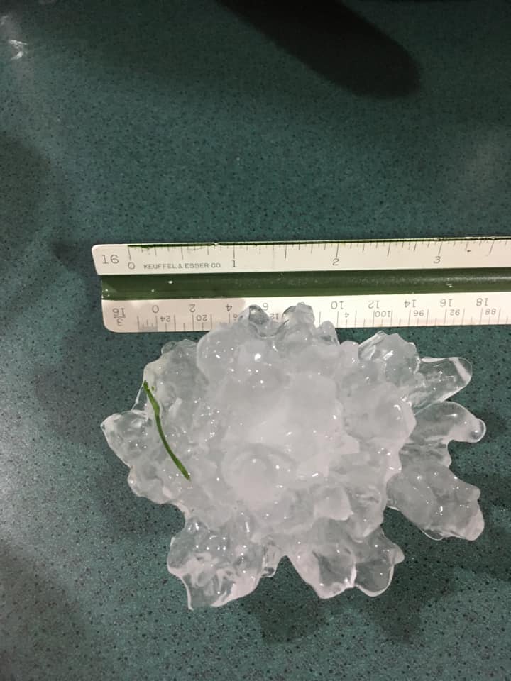 Large Hail up to 3" in Fond du Lac from Betsy Spaeth |
Radar
 |
| Radar loop of storms as they moved across central and southern Wisconsin Tuesday morning into the early afternoon hours. |
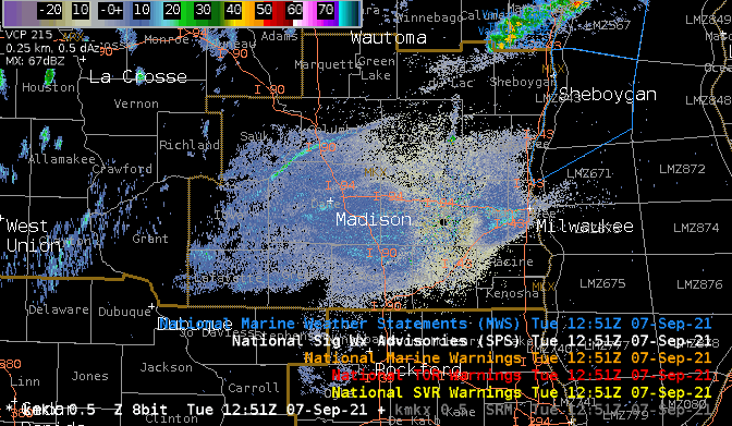
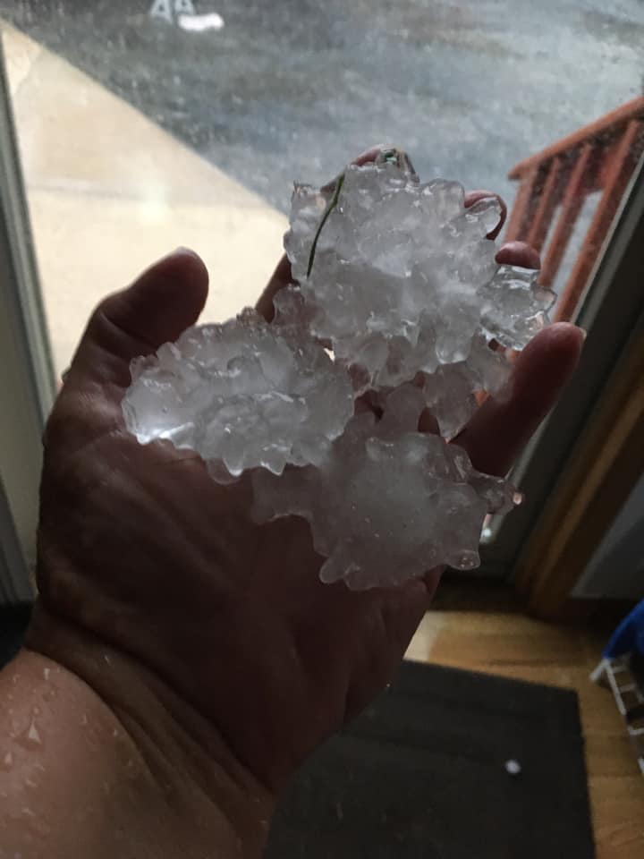
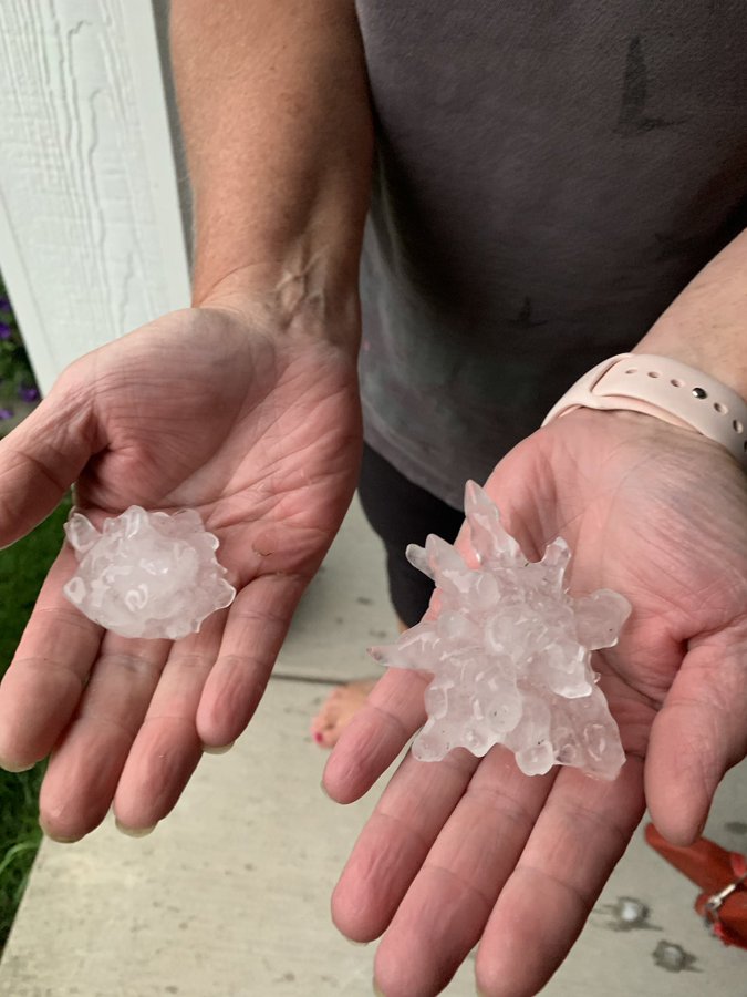
Hail Photos
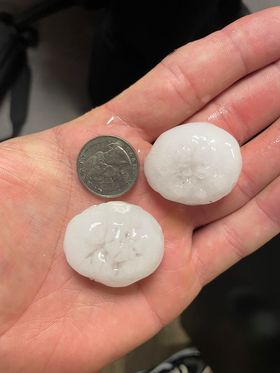
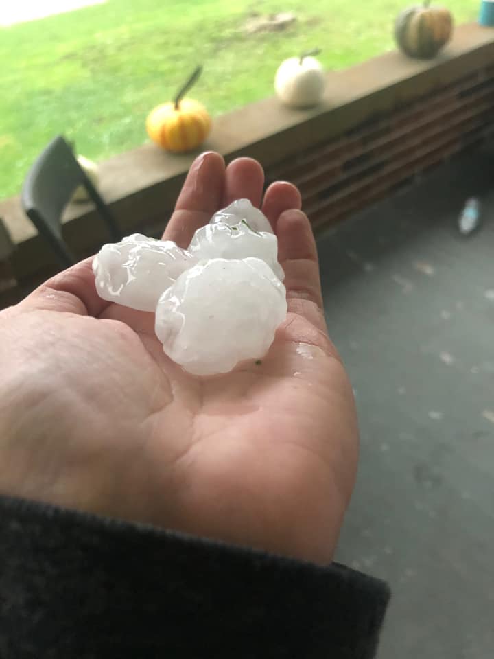
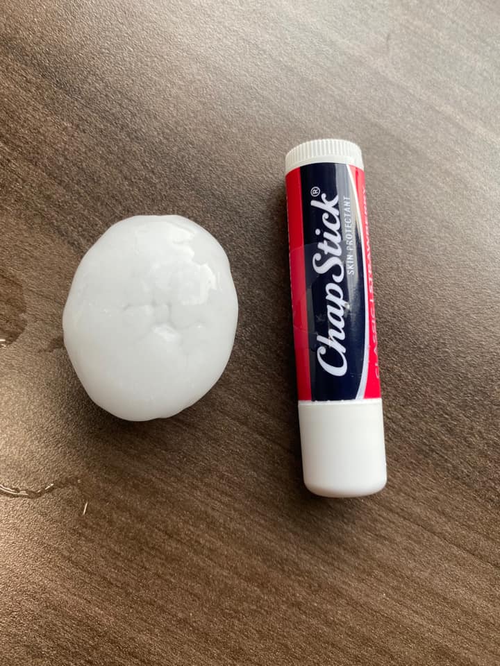
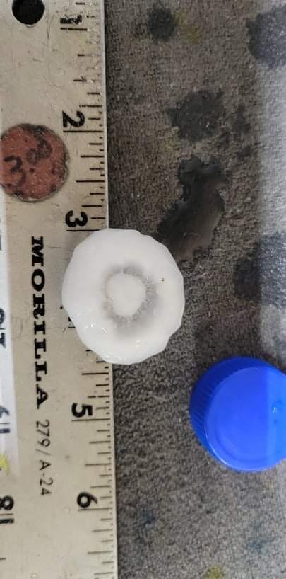
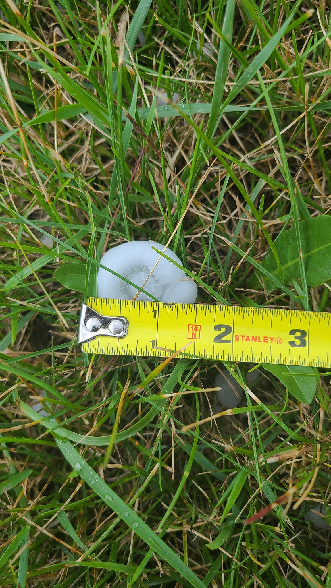
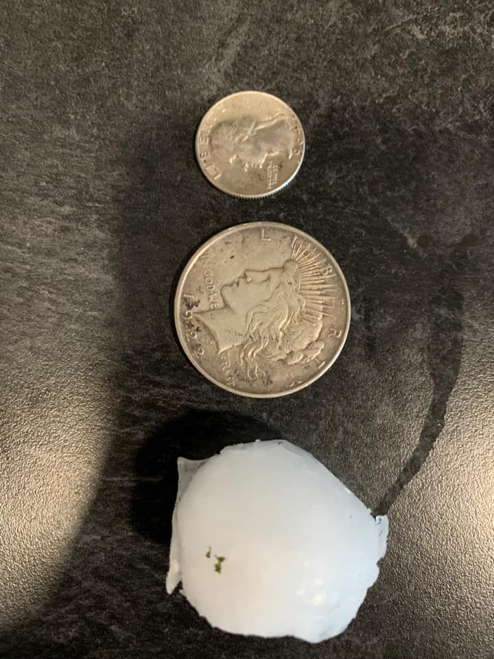
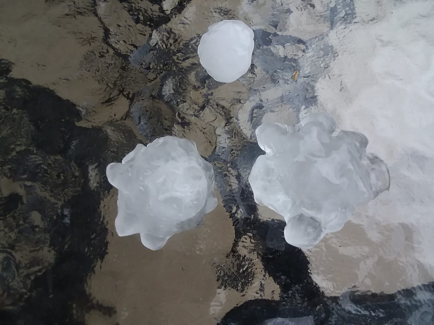
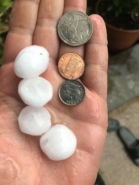
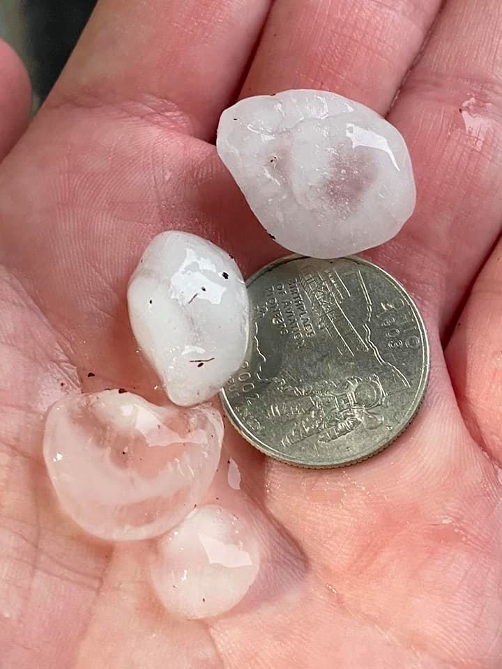
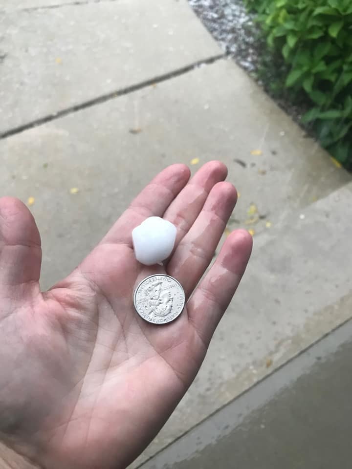
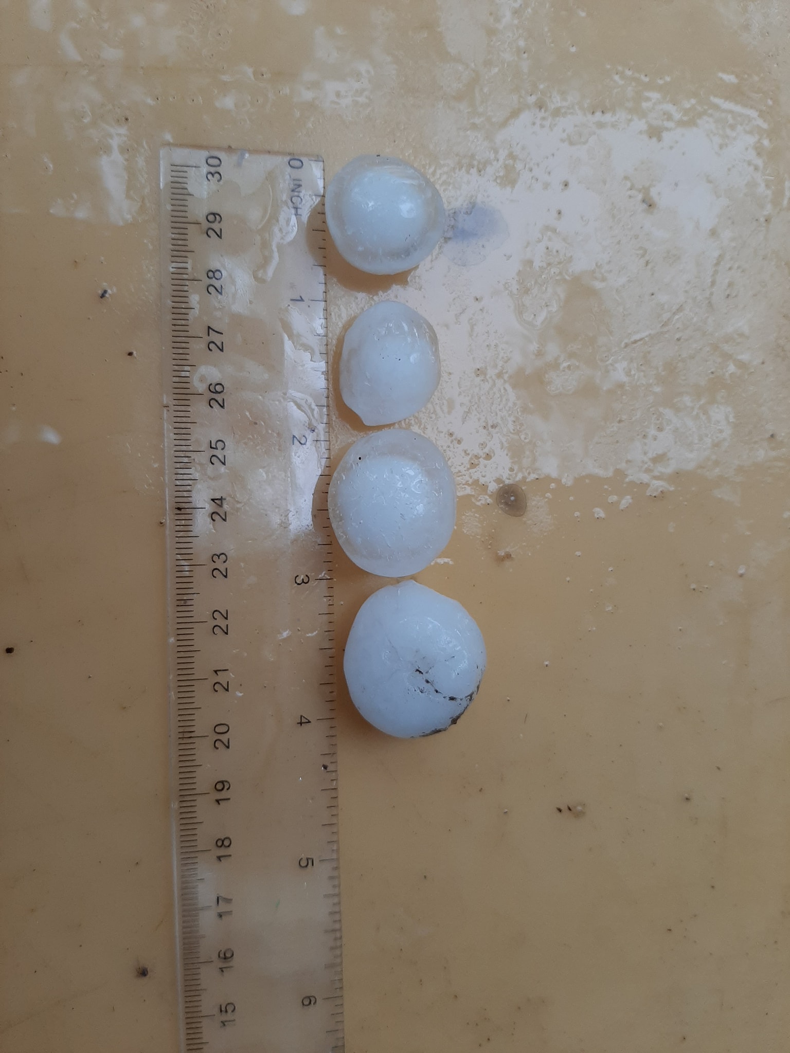
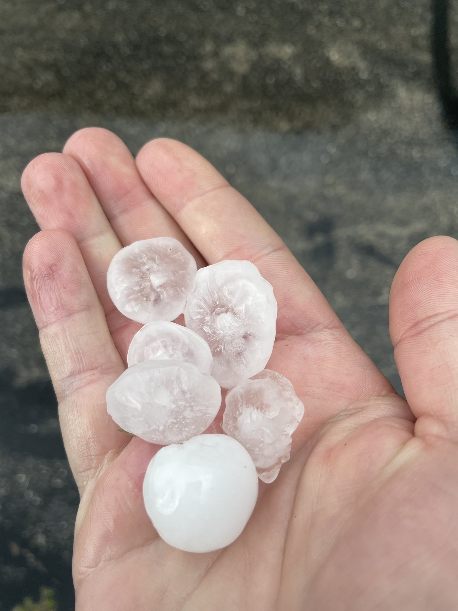
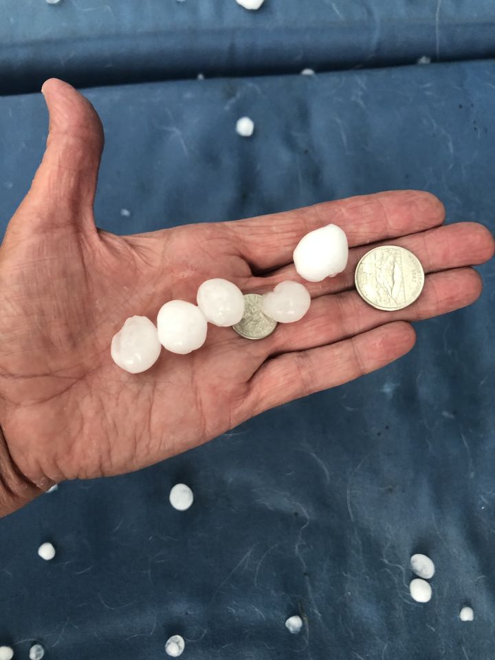
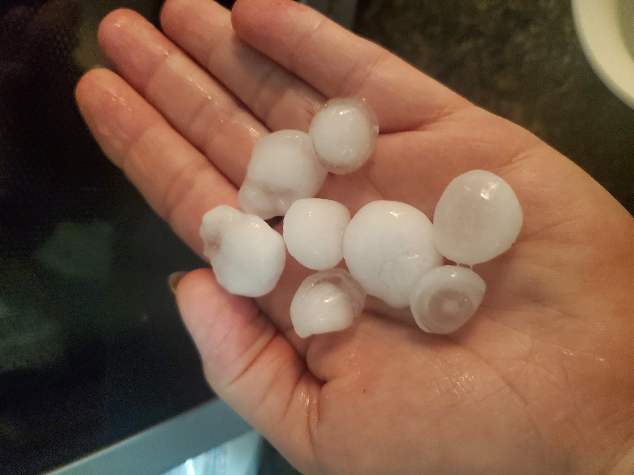
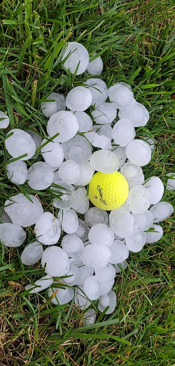
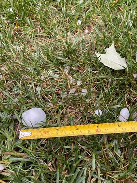
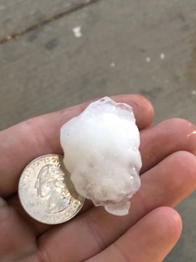
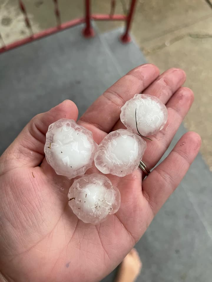
Hail ranged from pea size for most locations all the way up to Teacup size hail which is around 3 inches. The largest hail stones were reported in Fond du Lac.
|
 |
 |
 |
| 3" hail in Fond du Lac from Betsy Spaeth | 2" to 2.75" hail in Fond du Lac from Betsy Spaeth | Golfball Hail Fond du Lac from DDeumer via Twitter | Golfball Hail Ripon from SarahS relayed from WKOW27 |
 |
 |
 |
 |
| Half Dollar hail in Fond du Lac from Jason Michael | Ping Pong Ball hail in Cleveland from Sara Tremblay | Ping Pong Ball hail in Delavan from Bridgett Zerbach | Ping Pong Ball hail in Delavan from Jeff Coblentz |
 |
 |
 |
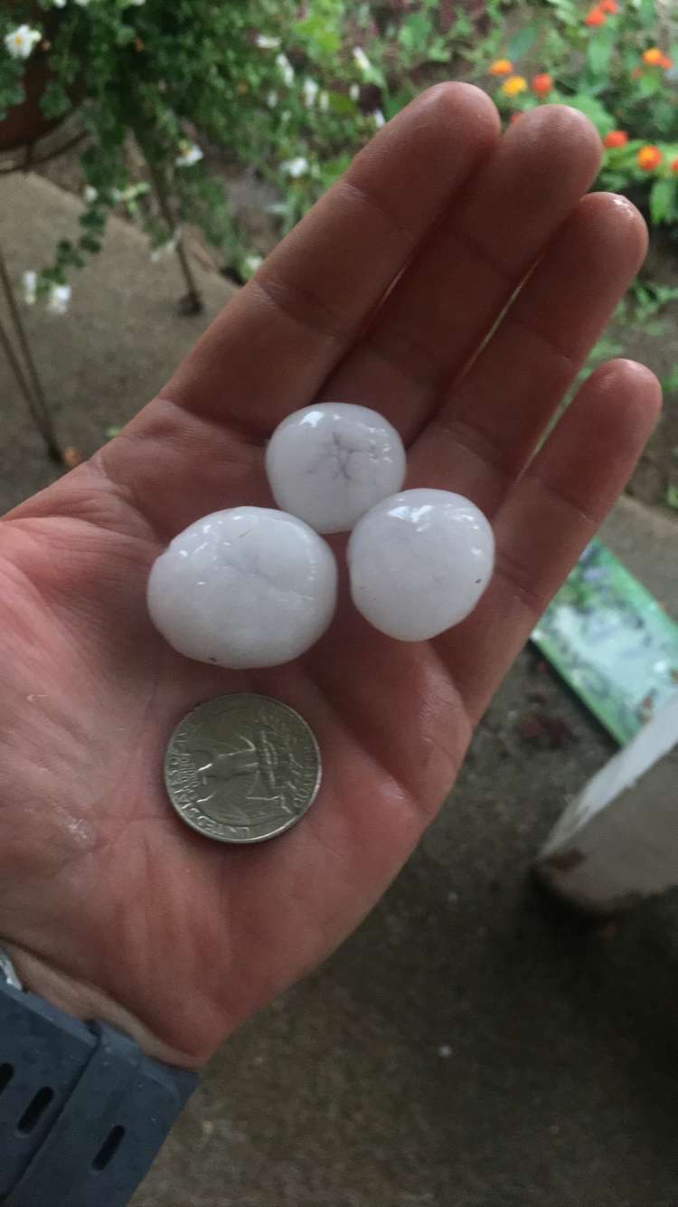 |
| Ping Pong Ball hail in Delavan from Tom Russ | Ping Pong Ball hail in Doylestown from Bonnie Langsdorf | Ping Pong Ball hail in Fond du Lac from Sharky Berenz | Quarter size hail in Juneau from Ashley Rabehl |
 |
 |
 |
 |
| Quarter size hail in Lake Geneva from Melissa McKay | Quarter size hail in Mazomanie from Anita Robinson | Quarter size hail in Town of Geneva from Kelly Herwald | Quarter size hail in Edgerton from Abby Mazuk relayed from WKOW27 |
 |
 |
 |
 |
| Penny size hail in Lake Geneva from Sara Wahlstedt | Quarter size hail in Milton from Michael Gouvin | Quarter size hail in Kristin Behring relayed from NBC15 | Quarter size hail in Westfield from Dana Rae Neufeld relayed from WKOW |
 |
 |
 |
 |
| Golfball hail in Delavan from David Eucker relayed from TMJ4 | 1.5" hail in Delavan from Meg Syves | 1.25" hail in Delavan from Josh Schmirler | Ping Pong ball size hail in Ripon from Kimberly Young |
Storm Reports
 |
| Link to Map of storm reports |
				000
				NWUS53 KMKX 072035
				LSRMKX

				PRELIMINARY LOCAL STORM REPORT...SUMMARY
				NATIONAL WEATHER SERVICE MILWAUKEE/SULLIVAN WI
				335 PM CDT TUE SEP 7 2021

				..TIME...   ...EVENT...      ...CITY LOCATION...     ...LAT.LON...
				..DATE...   ....MAG....      ..COUNTY LOCATION..ST.. ...SOURCE....
				            ..REMARKS..

				1045 AM     HAIL             1 N KEWASKUM            43.53N 88.23W
				09/07/2021  E1.00 INCH       WASHINGTON         WI   PUBLIC


				1122 AM     HAIL             ALLENTON                43.42N 88.33W
				09/07/2021  M1.00 INCH       WASHINGTON         WI   LAW ENFORCEMENT

				            SHERIFFS OFFICE REPORTED QUARTER SIZE HAIL
				            IN ALLENTON.

				1232 PM     HAIL             DELAVAN                 42.63N 88.63W
				09/07/2021  E1.25 INCH       WALWORTH           WI   TRAINED SPOTTER

				            CORRECTS PREVIOUS HAIL REPORT FROM DELAVAN.
				            1.0 TO 1.25 INCH HAIL REPORTED BY TRAINED
				            SPOTTER.

				1233 PM     HAIL             1 N DELAVAN             42.64N 88.63W
				09/07/2021  M1.50 INCH       WALWORTH           WI   PUBLIC

				            MULTIPLE REPORTS OF 1.0 TO 1.5 INCH HAIL
				            REPORTED AROUND DELAVAN WI.

				1242 PM     HAIL             ELKHORN                 42.67N 88.54W
				09/07/2021  E1.00 INCH       WALWORTH           WI   PUBLIC


				1244 PM     HAIL             WILLIAMS BAY            42.58N 88.54W
				09/07/2021  M1.50 INCH       WALWORTH           WI   PUBLIC

				            PENNY SIZE TO PING PONG BALL SIZE. TIME
				            ESTIMATED FROM RADAR.

				1244 PM     HAIL             1 NNE COMO              42.62N 88.49W
				09/07/2021  E1.00 INCH       WALWORTH           WI   PUBLIC


				1246 PM     HAIL             1 S COMO                42.59N 88.49W
				09/07/2021  E1.00 INCH       WALWORTH           WI   PUBLIC


				1248 PM     HAIL             1 NNW WALWORTH          42.54N 88.60W
				09/07/2021  E1.00 INCH       WALWORTH           WI   PUBLIC


				1112 AM     HAIL             2 N KOHLER              43.76N 87.78W
				09/07/2021  E1.00 INCH       SHEBOYGAN          WI   PUBLIC


				1135 AM     HAIL             EDGERTON                42.84N 89.06W
				09/07/2021  M1.00 INCH       ROCK               WI   PUBLIC


				1152 AM     HAIL             MILTON                  42.77N 88.96W
				09/07/2021  U1.00 INCH       ROCK               WI   PUBLIC

				            REPORT FROM MPING: QUARTER (1.00 IN.).

				1235 PM     HAIL             4 WSW CLINTON           42.54N 88.93W
				09/07/2021  M1.00 INCH       ROCK               WI   PUBLIC


				0847 AM     HAIL             WESTFIELD               43.89N 89.49W
				09/07/2021  E1.00 INCH       MARQUETTE          WI   PUBLIC

				            TIME ESTIMATED FROM RADAR.

				1124 AM     HAIL             2 WSW WATERTOWN         43.18N 88.75W
				09/07/2021  E1.00 INCH       JEFFERSON          WI   PUBLIC


				0918 AM     HAIL             BERLIN                  43.97N 88.95W
				09/07/2021  M1.00 INCH       GREEN LAKE         WI   LAW ENFORCEMENT


				1024 AM     HAIL             MARKESAN                43.71N 88.99W
				09/07/2021  E1.00 INCH       GREEN LAKE         WI   PUBLIC

				            PENNY TO QUARTER SIZE HAIL.

				0943 AM     HAIL             RIPON                   43.85N 88.84W
				09/07/2021  E2.00 INCH       FOND DU LAC        WI   PUBLIC

				            REPORTS OF 3/4 INCH UP TO 2 INCH HAIL.

				1010 AM     HAIL             2 NNE NORTH FOND DU LAC 43.84N 88.47W
				09/07/2021  M3.00 INCH       FOND DU LAC        WI   PUBLIC

				            IMAGE SHARED WITH US ON SOCIAL MEDIA.

				1024 AM     HAIL             2 SSE ALTO              43.65N 88.77W
				09/07/2021  M0.88 INCH       FOND DU LAC        WI   PUBLIC


				1037 AM     HAIL             FOND DU LAC             43.78N 88.45W
				09/07/2021  M0.88 INCH       FOND DU LAC        WI   PUBLIC


				1039 AM     HAIL             3 S FOND DU LAC         43.74N 88.45W
				09/07/2021  E1.50 INCH       FOND DU LAC        WI   TRAINED SPOTTER

				            SPOTTER REPORTED PING PONG BALL SIZE HAIL
				            NEAR THE INTERSECTION OF.

				1042 AM     HAIL             2 SSE FOND DU LAC       43.75N 88.43W
				09/07/2021  M1.00 INCH       FOND DU LAC        WI   PUBLIC


				1045 AM     HAIL             FOND DU LAC             43.78N 88.45W
				09/07/2021  E1.75 INCH       FOND DU LAC        WI   PUBLIC


				1056 AM     HEAVY RAIN       2 ESE FOND DU LAC       43.77N 88.41W
				09/07/2021  M0.80 INCH       FOND DU LAC        WI   PUBLIC

				            0.8 INCHES OF RAIN REPORTED OVER HALF HOUR
				            DURATION IN EASTERN FOND DU LAC.

				1107 AM     HAIL             JUNEAU                  43.41N 88.70W
				09/07/2021  M1.00 INCH       DODGE              WI   LAW ENFORCEMENT

				            NICKEL TO QUARTER SIZE HAIL.

				1030 AM     HAIL             MAZOMANIE               43.17N 89.80W
				09/07/2021  M1.00 INCH       DANE               WI   PUBLIC

				            REPORT OF QUARTER SIZE HAIL FROM MAZOMANIE.
				            TIME ESTIMATED FROM RADAR.

				1051 AM     HAIL             4 NNE CROSS PLAINS      43.17N 89.62W
				09/07/2021  E1.00 INCH       DANE               WI   PUBLIC


				1055 AM     HAIL             1 ESE MIDDLETON         43.10N 89.49W
				09/07/2021  E1.00 INCH       DANE               WI   PUBLIC


				1055 AM     HAIL             1 NNW WAUNAKEE          43.21N 89.46W
				09/07/2021  M0.88 INCH       DANE               WI   PUBLIC


				1057 AM     HAIL             1 NNE VERONA            43.00N 89.53W
				09/07/2021  M1.00 INCH       DANE               WI   PUBLIC


				1058 AM     HAIL             2 W VERONA              42.99N 89.57W
				09/07/2021  E1.50 INCH       DANE               WI   PUBLIC


				1108 AM     HAIL             MCFARLAND               43.02N 89.29W
				09/07/2021  M1.00 INCH       DANE               WI   BROADCAST MEDIA

				            TIME ESTIMATED FROM RADAR.

				1110 AM     HAIL             FITCHBURG               42.99N 89.43W
				09/07/2021  M1.00 INCH       DANE               WI   PUBLIC


				1122 AM     HAIL             STOUGHTON               42.92N 89.23W
				09/07/2021  M1.00 INCH       DANE               WI   TRAINED SPOTTER

				            SPOTTER REPORTED QUARTER SIZE HAIL IN
				            STOUGHTON.

				1038 AM     HAIL             DOYLESTOWN              43.43N 89.15W
				09/07/2021  M1.50 INCH       COLUMBIA           WI   PUBLIC

				            TIME ESTIMATED FROM RADAR.


				&&

				$$
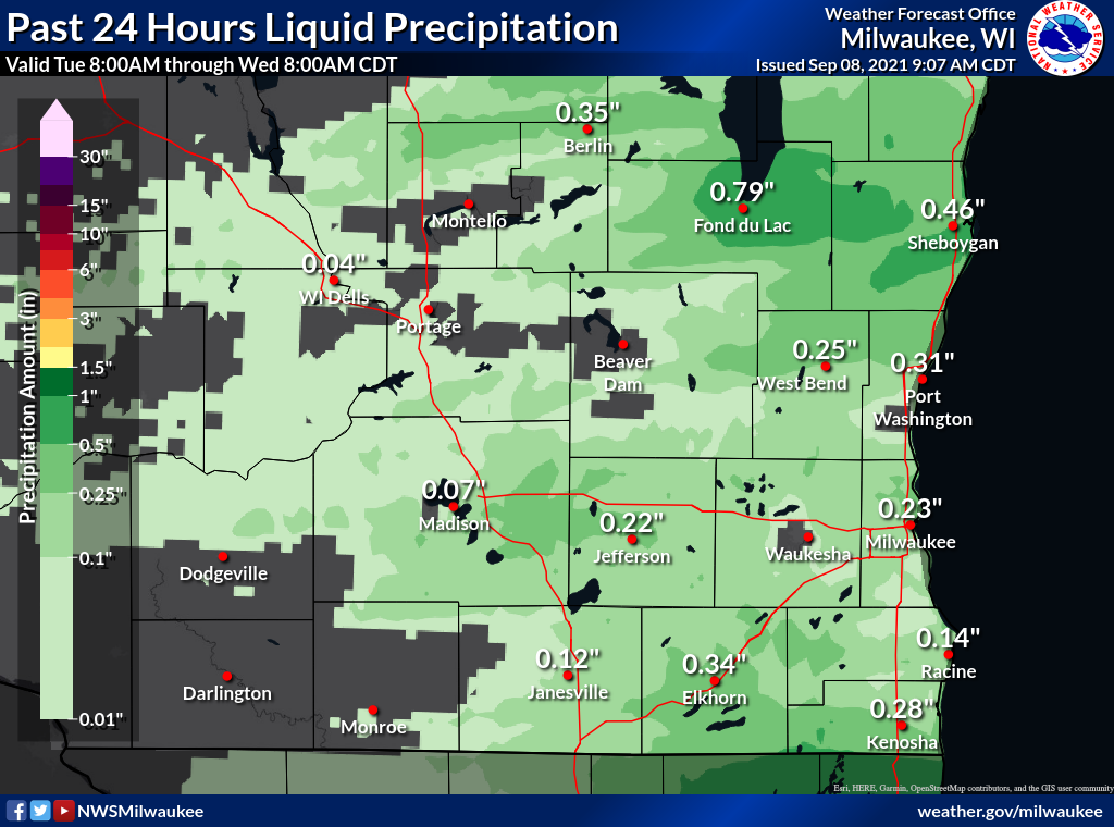
Rain Reports
Map of rainfall reports from Co-op, CoCoRaHS, and airport observations.
 |
| Event total rainfall |

