
Third Tornado Outbreak of April 2020
April 23, 2020
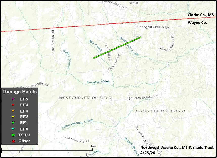
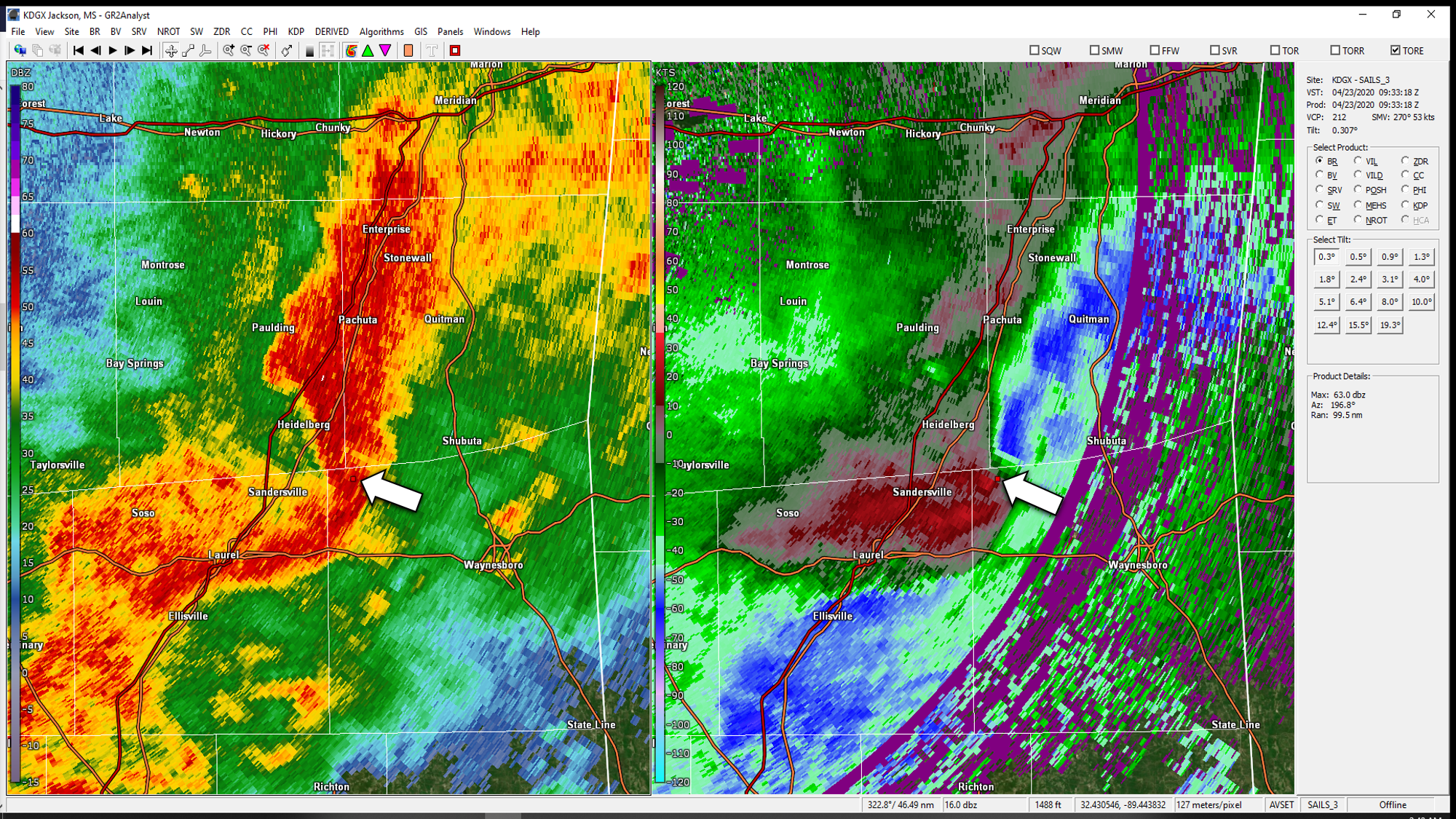
Summary of all Local Storm Reports (LSRs) on March 17-18, as well as all the LSRs across the region for this event
(regional map may take a minute to load).

Public Information Statement
National Weather Service Mobile AL
654 PM CDT Fri Apr 24 2020

...NWS Damage Survey For 4/23/2020 Tornado Event...

.OVERVIEW...The following is survey information for Wayne County MS,
George County MS, and Mobile County AL. Another statement will be
issued for findings in Covington County AL and Okaloosa County FL.

.Northwest Wayne County MS Tornado...

Rating:                 EF-1
Estimated Peak Wind:    105 mph
Path Length /statute/:  1.8 miles
Path Width /maximum/:   350 yards
Fatalities:             0
Injuries:               0

Start Date:             Apr 23 2020
Start Time:             433 AM CDT
Start Location:         16 mi NW Waynesboro MS
Start Lat/Lon:          31.8116/-88.8782

End Date:               Apr 23 2020
End Time:               435 AM CDT
End Location:           15 mi NW Waynesboro MS
End Lat/Lon:            31.8226/-88.8505

Survey summary: The tornado formed near Eucutta Road and traveled
northeast, lifting just east of Sugar Hill Road. The damage was
confined to softwood and hardwood trees, some of which were
uprooted and some that were snapped. Thanks to NWS Jackson for
their assistance with this survey.
|
|
__________________________________________________________________________________
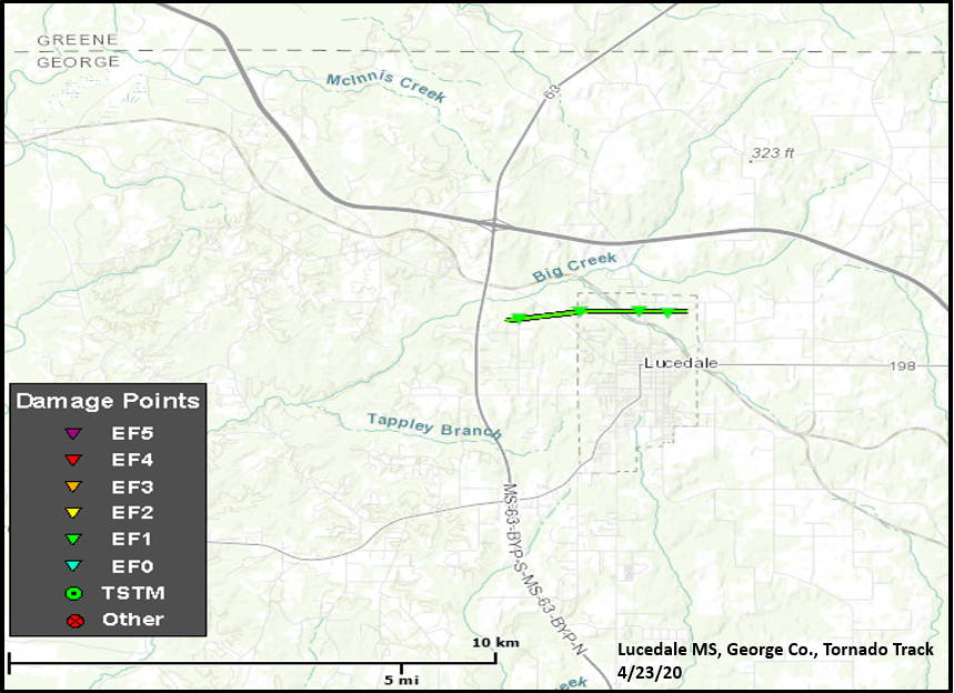
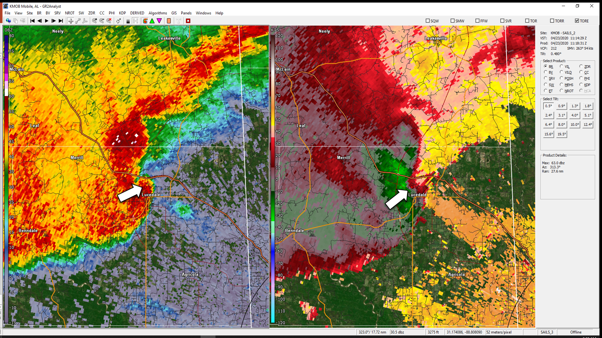
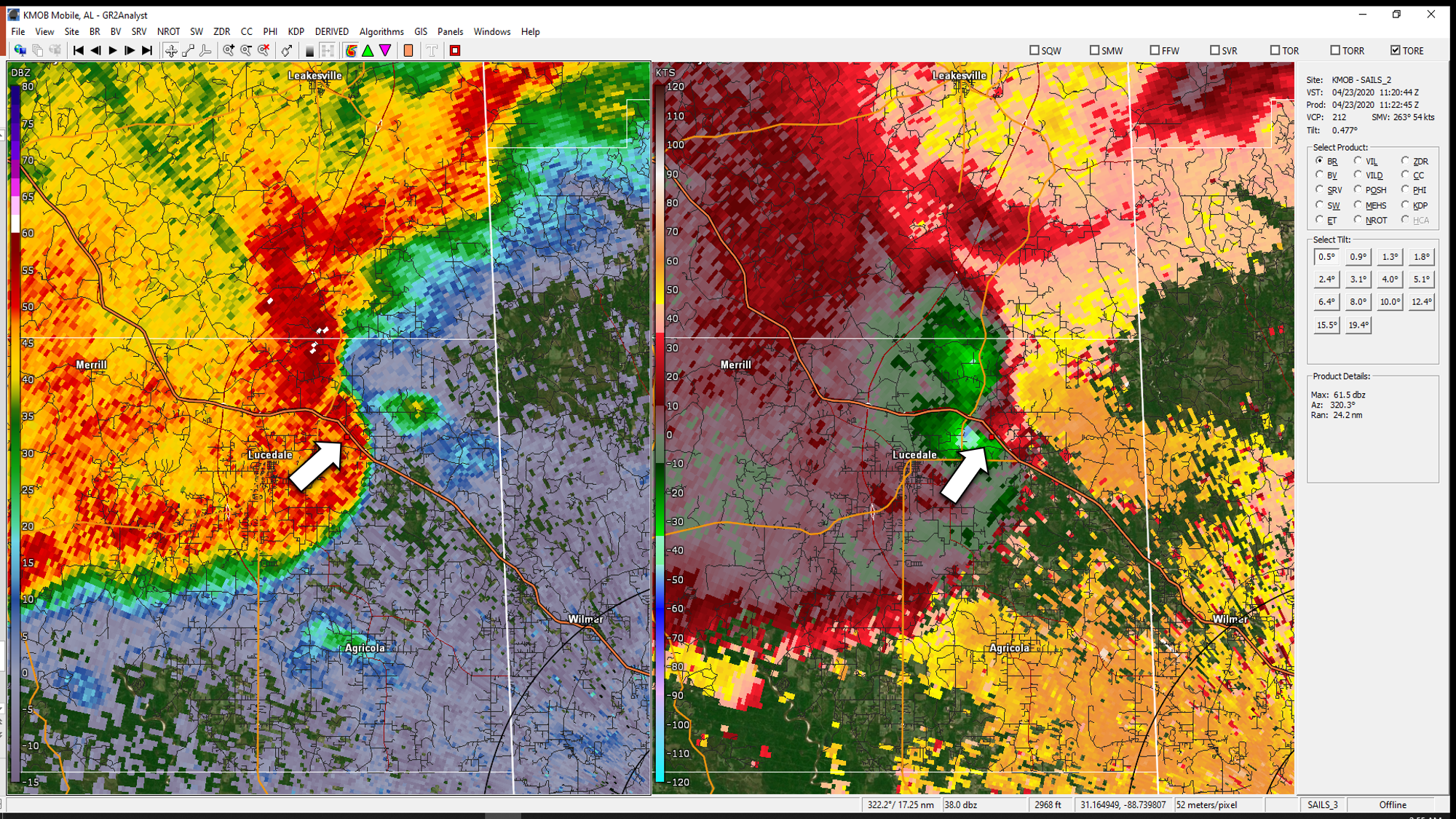
.Lucedale MS Tornado (George County)...

Rating:                 EF-1
Estimated Peak Wind:    95 mph
Path Length /statute/:  2.3 miles
Path Width /maximum/:   200 yards
Fatalities:             0
Injuries:               0

Start Date:             Apr 23 2020
Start Time:             617 AM CDT
Start Location:         2 mi NW Lucedale MS
Start Lat/Lon:          30.9349/-88.6208

End Date:               Apr 23 2020
End Time:               619 AM CDT
End Location:           1 mi NNE Lucedale MS
End Lat/Lon:            30.9371/-88.5828

Survey summary: The tornado first touched down just east of
Highway 63 on Inland Beach Road. The tornado continued mainly
east and crossed Beaver Dam Road and lifted just east of Jones
Road and south of Northside Church Road. The tornado resulted in
primarily damage to trees, snapping some softwood trees and
uprooting hardwood trees along the path. A few homes were damaged
by the downed trees and a few homes experienced some minor roof
damage.
|
|
__________________________________________________________________________________
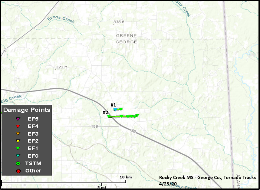
.Rocky Creek Area Tornado #1 (George County MS)...

Rating:                 EF-1
Estimated Peak Wind:    95 mph
Path Length /statute/:  0.4 miles
Path Width /maximum/:   50 yards
Fatalities:             0
Injuries:               0

Start Date:             Apr 23 2020
Start Time:             623 AM CDT
Start Location:         4.4 mi ENE Lucedale MS
Start Lat/Lon:          30.9381/-88.5195

End Date:               Apr 23 2020
End Time:               624 AM CDT
End Location:           4.7 mi ENE Lucedale MS
End Lat/Lon:            30.9387/-88.5131

Survey summary: A brief and narrow EF-1 tornado touched down just west
of Passeau Road and moved east across Rocky Creek Road. The tornado
produced heavy damage to a mobile home at the intersection of Rocky
Creek Road and David Wade Road, removing the roof which then resulted in
the collapse of the walls on the back side of the structure. Several pine
trees were uprooted or snapped as well. The tornado then quickly lifted
east of this point.


.Rocky Creek Area Tornado #2 (George County MS)...

Rating:                 EF-1
Estimated Peak Wind:    105 mph
Path Length /statute/:  1.5 miles
Path Width /maximum/:   250 yards
Fatalities:             0
Injuries:               1

Start Date:             Apr 23 2020
Start Time:             624 AM CDT
Start Location:         3.9 mi ENE Lucedale MS
Start Lat/Lon:          30.9322/-88.5243

End Date:               Apr 23 2020
End Time:               625 AM CDT
End Location:           5.4 mi ENE Lucedale MS
End Lat/Lon:            30.9332/-88.4999

Survey summary: Just as the first tornado on David Wade Road lifted,
another tornado touched down just west of Highway 98 and traveled east,
paralleling just north of Old Mobile Highway and Gordon Road. The tornado
lifted near Odom Road. This tornado resulted in significant tree damage,
snapping a large amount of pine trees. Numerous large oak trees were also
uprooted. The downed trees produced damage to a few homes. A few other homes
suffered shingle and roof damage. There was also roof damage to a church
at the split between Old Mobile Highway and Gordon Road. A travel trailer
on Old Mobile Highway was flipped, resulting in a minor injury to one
person.
|
|
__________________________________________________________________________________
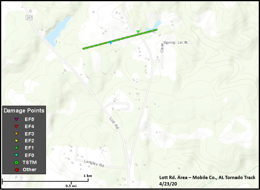
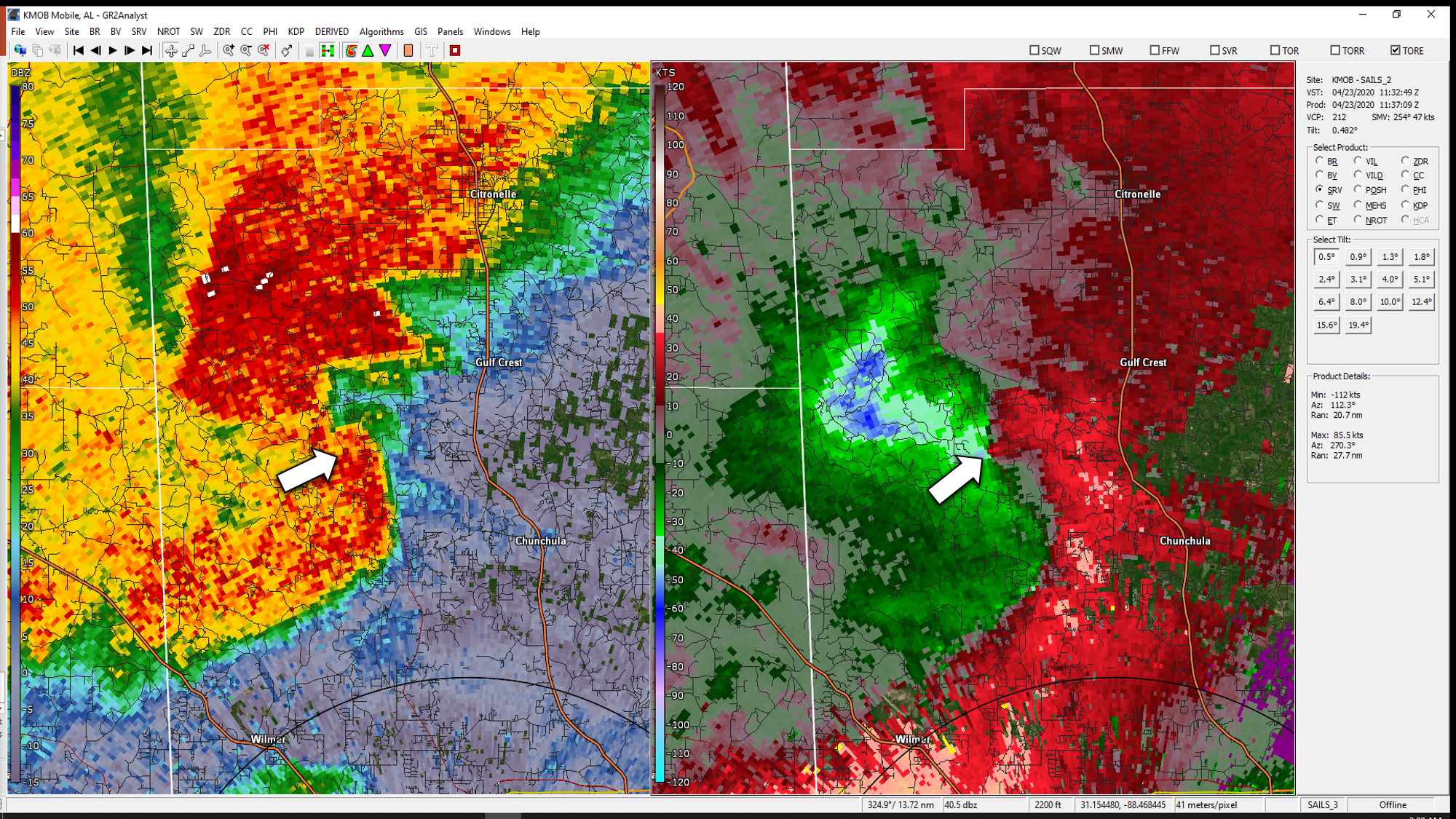
.Lott Road Tornado (Mobile County AL)...

Rating:                 EF-1
Estimated Peak Wind:    90 mph
Path Length /statute/:  0.6 miles
Path Width /maximum/:   75 yards
Fatalities:             0
Injuries:               0

Start Date:             Apr 23 2020
Start Time:             637 AM CDT
Start Location:         7.3 mi NW Chunchula AL
Start Lat/Lon:          30.9642/-88.3089

End Date:               Apr 23 2020
End Time:               638 AM CDT
End Location:           6.9 mi NW Chunchula AL
End Lat/Lon:            30.9662/-88.2999

Survey summary: The tornado touched down just between Lott Road and
Malone Road and moved east across Malone Road. Due to no access further
east, the end point is an estimate. The tornado resulted in primarily
tree damage. However, one large tree resulted in significant damage to a
home. One residence also had its garage door blown in and a shed was
heavily damaged.
|
|
__________________________________________________________________________________
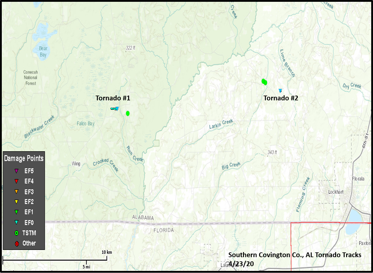
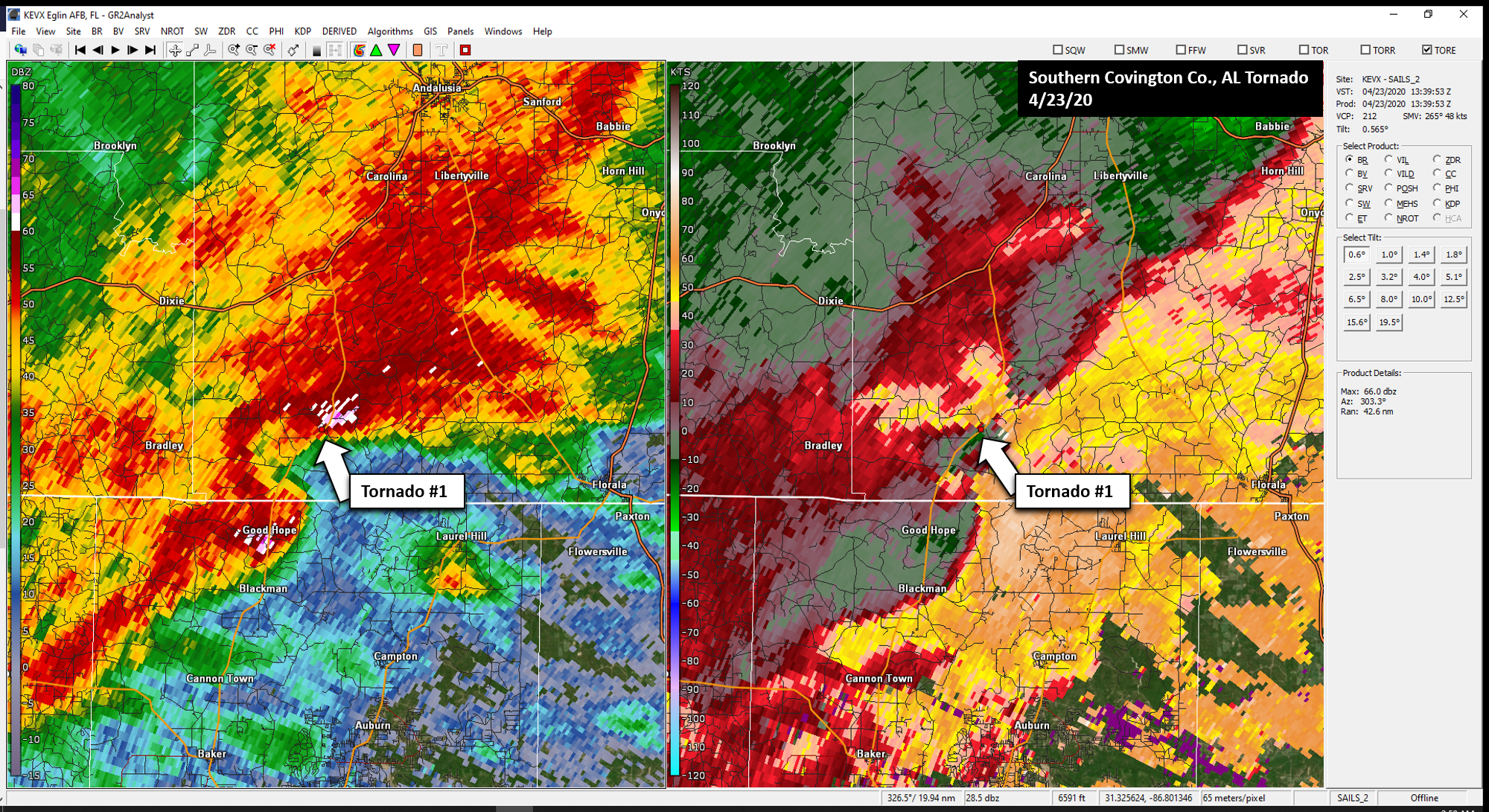
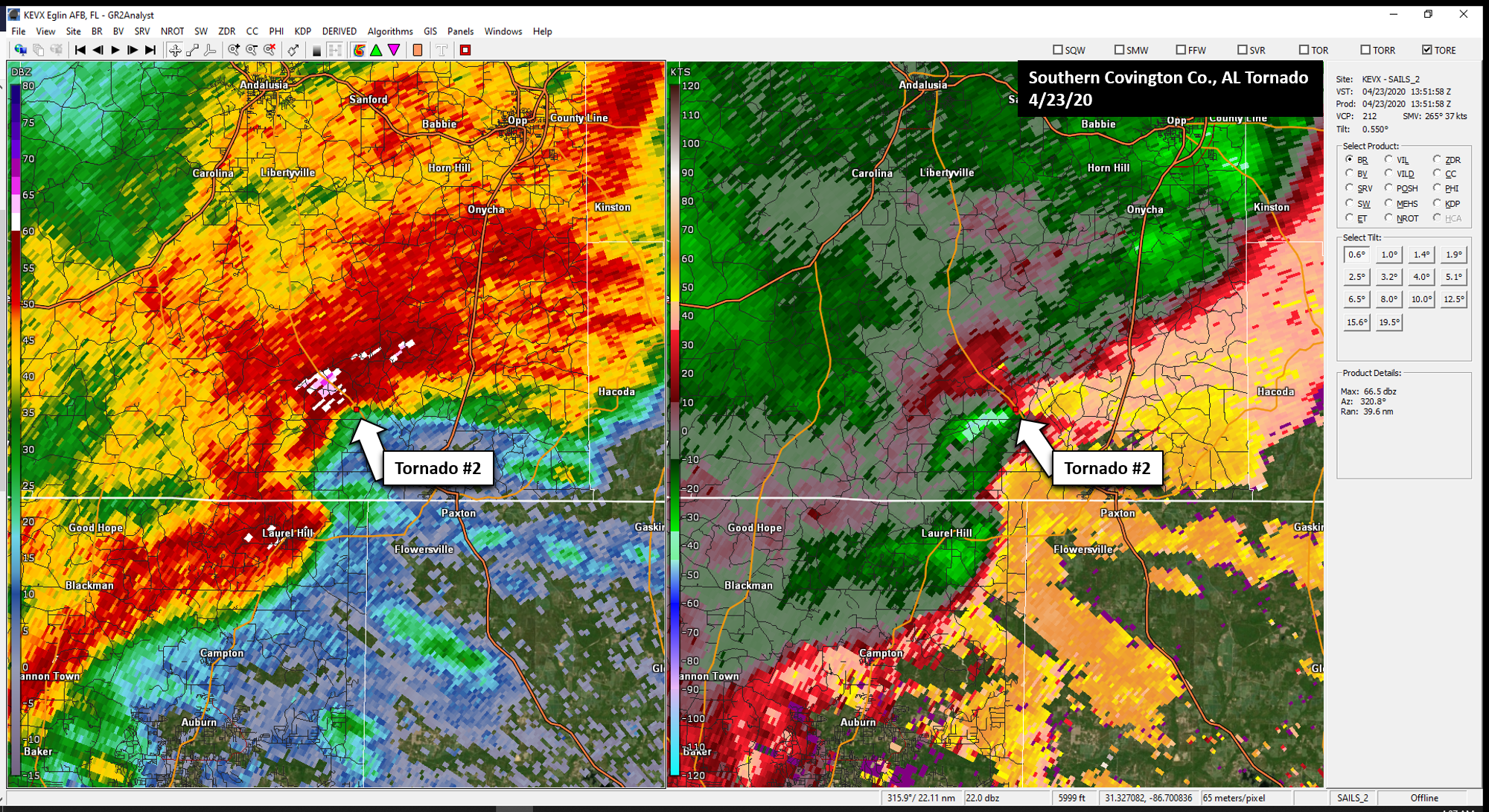
Public Information Statement
National Weather Service Mobile AL
1129 AM CDT Sat Apr 25 2020

...NWS Damage Survey for April 23, 2020 Tornado Event...

.OVERVIEW...The following survey information is for Covington County, AL,
and Okaloosa County, FL.

.Southern Covington County AL Tornado 1...

Rating:                 EF-0
Estimated Peak Wind:    85 mph
Path Length /statute/:  0.5 miles
Path Width /maximum/:   50 yards
Fatalities:             0
Injuries:               0
Start Date:             April 23, 2020
Start Time:             8:42 AM CDT
Start Location:         3.5 mi NE of Falco, AL
Start Lat/Lon:          31.063/-86.5700

End Date:               April 23, 2020
End Time:               8:43 AM CDT
End Location:           4 mi NE of Falco, AL
End Lat/Lon:            31.0627/-86.5638

Survey summary: A brief tornado touchdown occurred along an approximately
one half of a mile track.  There were several trees snapped and uprooted with
a weak convergence damage pattern noted.  This short track was just west of
Boggan Level road and ended at the roadway.


.Southern Covington County AL Tornado 2...

Rating:                 EF-0
Estimated Peak Wind:    85 mph
Path Length /statute/:  0.1 miles
Path Width /maximum/:   25 yards
Fatalities:             0
Injuries:               0

Start Date:             April 23, 2020
Start Time:             8:53 AM CDT
Start Location:         6.5 mi NW of Florala, AL
Start Lat/Lon:          31.0735/-86.3995

End Date:               April 23, 2020
End Time:               8:53 AM CDT
End Location:           6.5 mi NW of Florala, AL
End Lat/Lon:            31.0735/-86.3989

Survey summary: A grain bin was damaged by a brief EF-0 tornado.
|
|
|
__________________________________________________________________________________
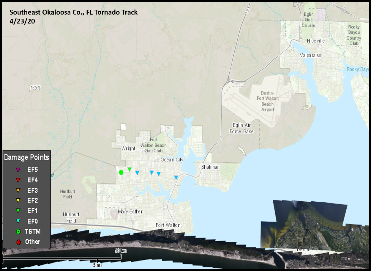
.Southeast Okaloosa County, FL...

Rating:                 EF-1
Estimated Peak Wind:    90 mph
Path Length /statute/:  2.7 miles
Path Width /maximum/:   50 yards
Fatalities:             0
Injuries:               0

Start Date:             April 23, 2020
Start Time:             2:51 PM CDT
Start Location:         0.75 miles SW of Wright, FL
Start Lat/Lon:          30.4441/-86.6463

End Date:               April 23, 2020
End Time:               2:54 PM CDT
End Location:           Ocean City Neighborhood of North Ft. Walton Beach, FL
End Lat/Lon:            30.4386/-86.6014

Survey summary: A tornado touched down along Vickie Leigh road and quickly
intensified to EF-1 intensity.  There was a path of numerous trees uprooted
and snapped.  Winds were estimated around 90 mph in this location.

The tornado weakened and produced intermittent damage over the next
approximately 2.7 miles as it moved through the Ocean City section of north
Ft. Walton Beach.  Damage in these locations were of the EF-0 intensity
with trees snapped and uprooted along with damage to home siding and roof
shingles.  The intermittent track ended at Eglin Parkway just to the west
of the Highway 85 bridge into Shalimar.
|

|
__________________________________________________________________________________
EF Scale: The Enhanced Fujita Scale classifies tornadoes into the
following categories.

EF0...Weak......65 to 85 mph
EF1...Weak......86 to 110 mph
EF2...Strong....111 to 135 mph
EF3...Strong....136 to 165 mph
EF4...Violent...166 to 200 mph
EF5...Violent...>200 mph

Note:
The information in this statement is preliminary and subject to
change pending final review of the events and publication in
NWS Storm Data.
Acknowledgements: Page created by Joe Maniscalco (Forecaster). Updated by Michael Mugrage (Forecaster).
LAST UPDATED: March 2024

