and Annual Recap for 2017
Mobile and Pensacola Areas
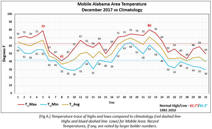
Mobile Area - December started off unseasonably warm for the first few days of the month then the 1st of 2 anomalously cold
snaps occurred when the earliest measurable snow on record occurred on the 8th of 1 inch. Temperatures rebounded into
the middle of the month, then dived to well below seasonal values heading into the holiday following the 2nd in a series of
cold surges into the deep south. The average monthly high was 62.0° or -0.7° below normal. The average monthly low was
43.8° or 1.6° above normal. The average temperature was 52.9° or 0.5° above normal. Three record highs were broken at
Mobile on the 5th , warming to 79°, soon to be followed by a new record low high temperature of 41° set a few days later
on the 8th. 80° set a new record on the 22nd. (Fig. A) shows how the numbers compared to the seasonal normal monthly
highs and lows, which are shown by the dashed lines.
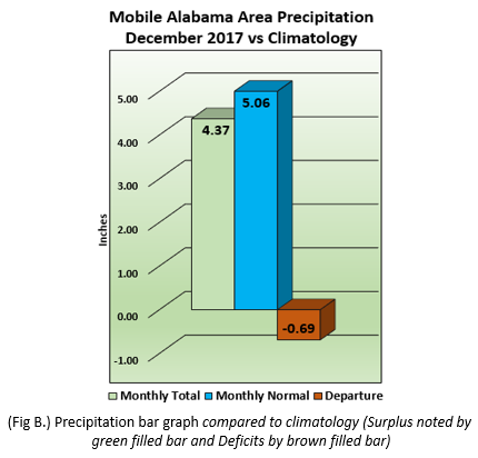
After a very dry November, December’s rainfall recovered to 4.37”. This value was slightly below the normal of 5.06” shown in (Fig. B).
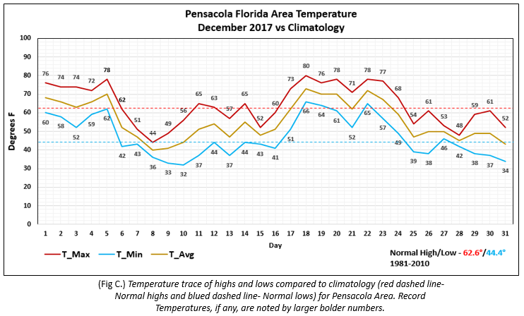
Pensacola Area - December started off unseasonably warm for the first few days of the month then the 1st of 2 anomalously
cold snaps occurred. Temperatures rebounded into the middle of the month, then dived to well below seasonal values heading
into the holiday following the 2nd in a series of cold surges into the deep south. The average monthly high was 64.1° or 1.5°
above normal. The average monthly low was 47.2° or 2.8° above normal. The average temperature was 55.6° or 2.1°
above normal. No record temperatures occurred this month. (Fig. C.) shows how the numbers compared to the seasonal
normal monthly highs and lows, which are shown by the dashed lines.
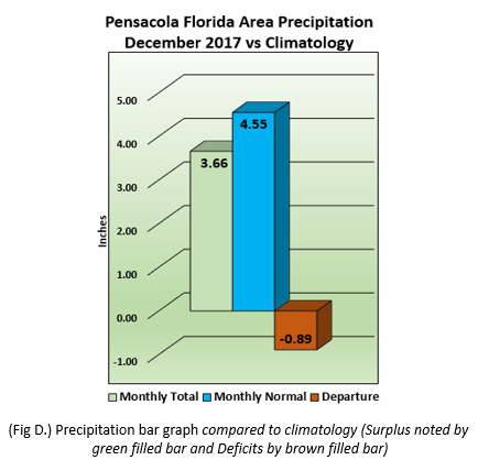
After a very dry November, December’s rainfall recovered to 3.66”. This value is shy of an inch below the normal of 4.55” shown in (Fig. D).
2017 Annual Recap:
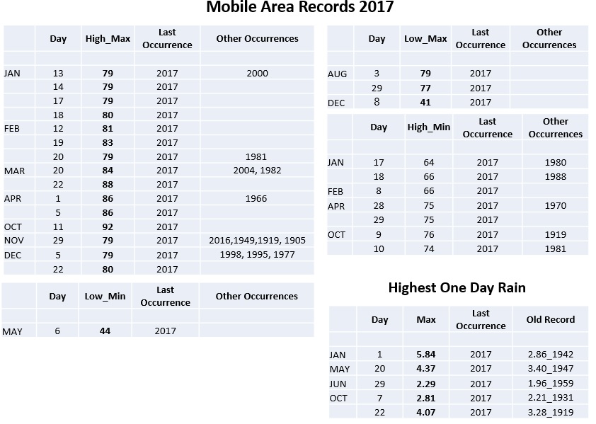
Mobile Area - 2017 now stands as the 7th warmest year with an average temperature of 69.4° in the period of record
(04/1872 to 12/2017). Yearly rainfall totaled 83.78", stands at 8th wettest year on record (01/1871 to 12/2017).
The table below summarizes the daily records for both temperatures and precipitation for the Mobile area.
15 record highs were broken or tied, 1 record low was broken, 3 record daily low highs broken and 7 daily high lows
broken or tied. 5 days saw record one day total rainfall. Not shown, the earliest measurable snowfall on record occurred on
the 8th of December.
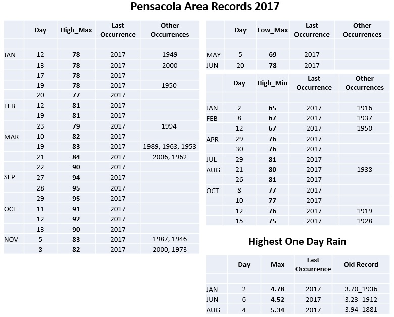
Pensacola Area - 2017 set a new all time record warm year with an average temperature of 71.7° in the period of record
(11/1879 to 12/2017). Yearly rainfall totaled 91.91", which now stands as the 2nd wettest year on record (11/1879 to 12/2017).
The table below summarizes the daily records for both temperatures and precipitation for the Pensacola area. 20
record highs were broken or tied, 2 record daily low highs broken and 12 daily high lows broken or tied. 3 days saw record
one day total rainfall.
Long Range Climatic Outlook:
Additional Climate Links:
Climate Prediction Center (CPC)
WFO Mobile AL Climate and Past Weather
National Weather Service Mobile

 NWSMobile

