Twin Cities, MN
Weather Forecast Office
Severe Cold Weather Safety Resources
Local Warming Centers/Emergency Shelters
Hennepin County, including Minneapolis: https://www.hennepin.us/residents/health-medical/heating-options
Ramsey County, including St. Paul: https://www.ramseycounty.us/residents/assistance-support/assistance/housing-services-support/winter-warming-spaces-0
Anoka County: https://www.anokacounty.us/3661/35569/Severe-Cold-Warming-Stations-in-Anoka-Co
Dakota County: https://www.co.dakota.mn.us/HealthFamily/PublicAssistance/Housing/Pages/emergency-shelter.aspx
Washington County: St. Andrew's Lutheran Church, 900 Stillwater Road in Mahtomedi
North Mankato: North Mankato Police Annex Community Room, 1001 Belgrade Avenue
Extreme Cold Weather Safety Tips
National Weather Service Winter Safety Information and Graphics: https://www.weather.gov/safety/winter
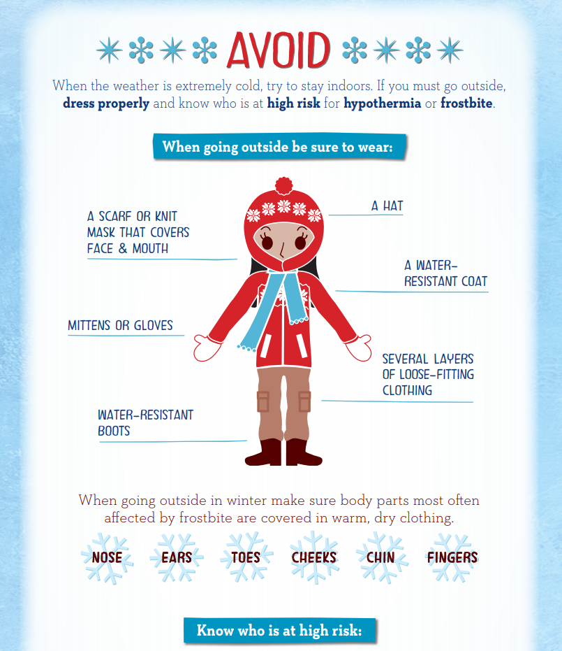
Know the warning signs of hypothermia and frostbite to keep safe from the severe cold. Here's a great resource with tips to avoid, spot and treat frostbite and hypothermia: https://www.ramseycounty.us/sites/default/files/Emergency%20Response/avoid_spot_treat_hypothermia_frostbite.pdf
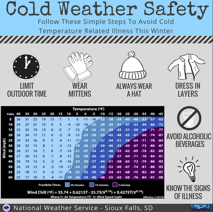
Wind Chill Chart
US Dept of Commerce
National Oceanic and Atmospheric Administration
National Weather Service
Twin Cities, MN
1733 Lake Drive West
Chanhassen, MN 55317-8581
952-361-6670
Comments? Questions? Please Contact Us.

