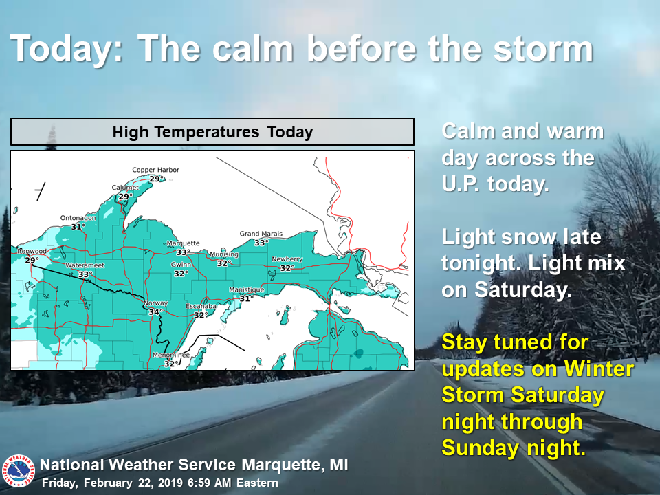
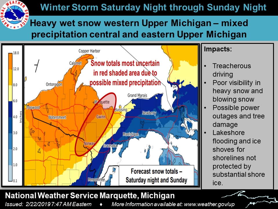
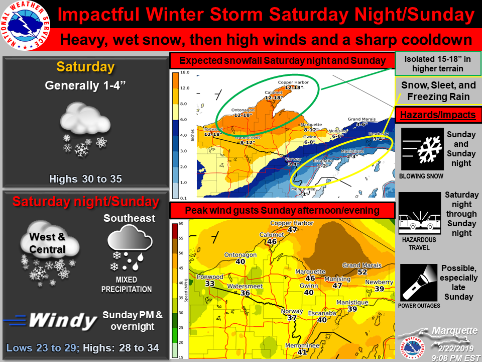
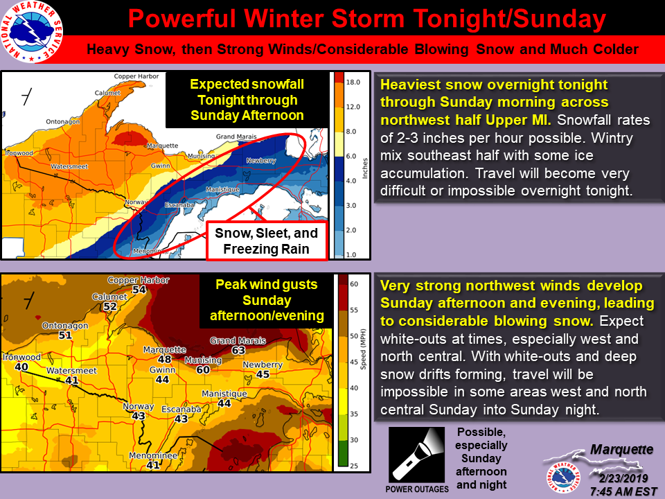
Overview
|
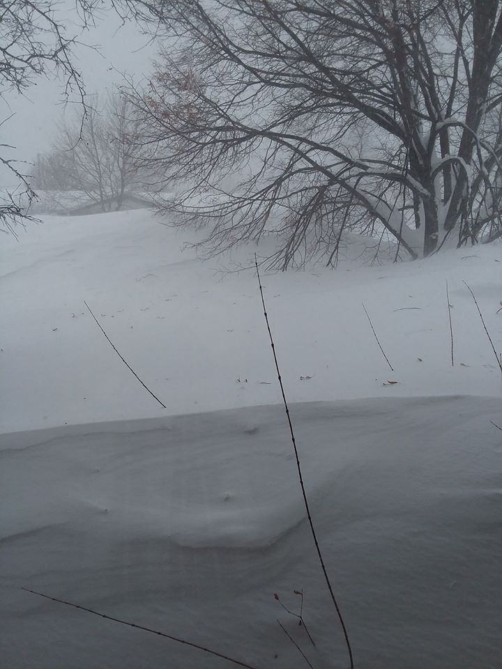
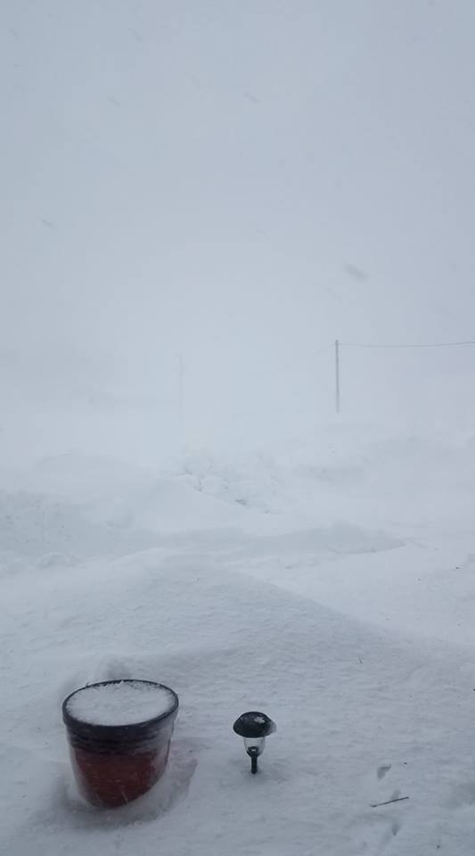
Significant winter storm impacted all of Upper Michigan late Saturday night through Sunday, bringing with it heavy snow, sleet, and freezing rain. Several roof collapses were reported across the area due to the weight of the snow on top of what has already been a very snowy last 5 weeks. On top of the wintry precipitation, strong northwest winds on the backside of the system, with gusts upwards of 50 to 65 mph, resulted in blizzard conditions at times. Numerous roads were closed, including M-117, M-28 between Harvey and Munising, M-26 between Eagle River and Copper Harbor, and US-2 in Mackinaw County east of Worth Rd. |
Photos & Video
 |
 |
 |
 |
| A shed collapsed near Norway, MI due to the weight of the snow (Photo courtesy Art Belding) |
Snow drifted over Turner Rd in Channing (Photo courtesy Elizabeth Story) |
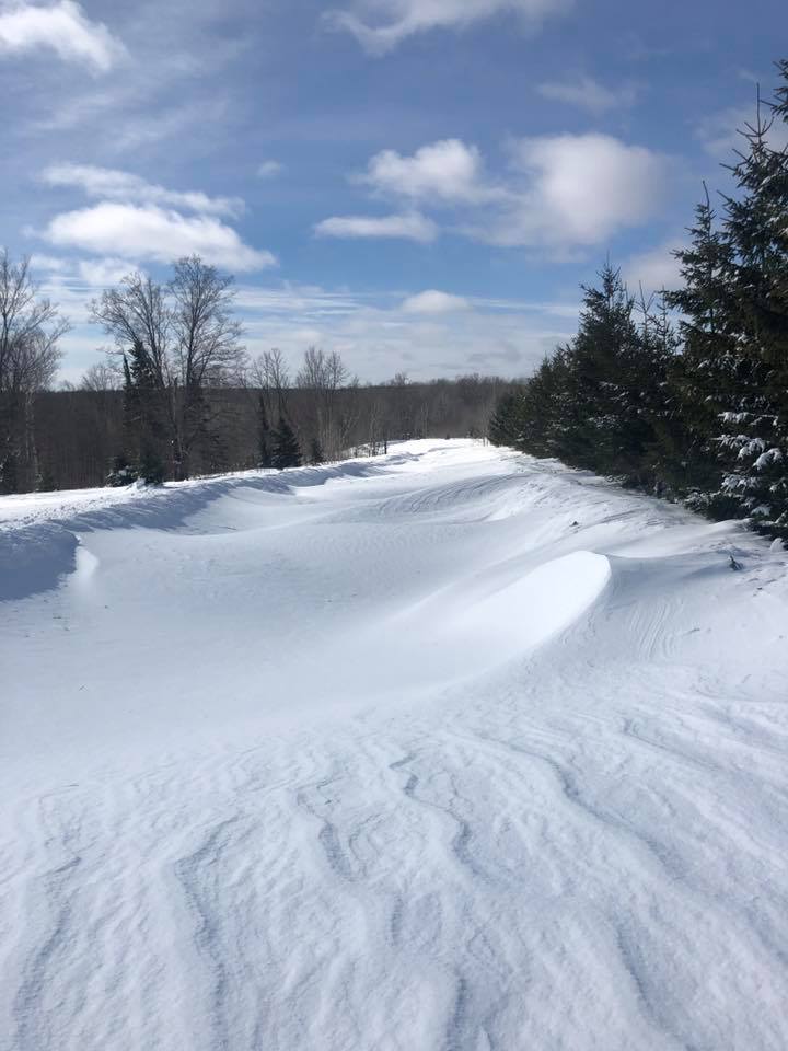
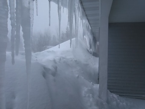
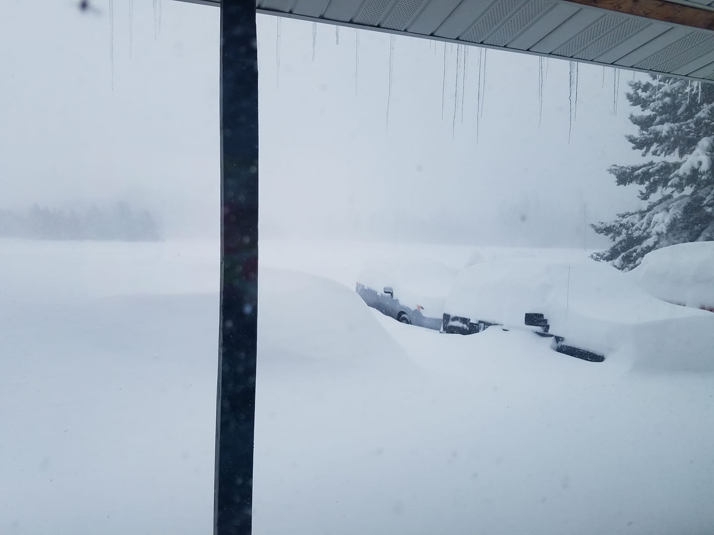
Deep snow drifts and large icicles in Ewen (Photo courtesy Jeff Tormala) | Very deep snow in Pelkie nearly swallowing cars (Photo courtesy Clare Loveless) |
 |
 |
 |
 |
| Over a month's worth of snow piled on a roof in Negaunee Township (photo courtesy Denise Brown) |
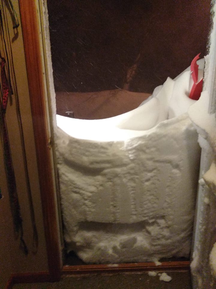
Snow drift blocking nearly half a doorway in Lake Linden (Photo courtesy Chantel Miller) |
Deep snow drifts in West Ishpeming (Photo courtesy Monika McLaughlin) |
Very low visibility in blizzard conditions. Photo taken 7 miles north of Engadine (Photo courtesy Merle Randolph Edwards) |
 |
 |
 |
 |
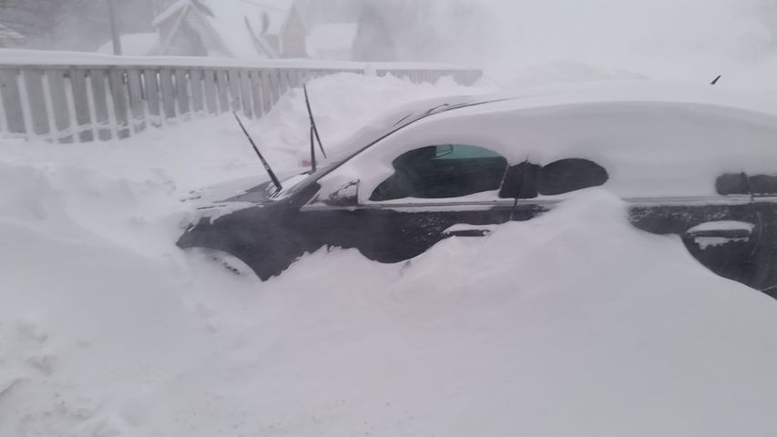
| A car almost completely buried in a snow drift in Hancock (Photo courtesy Brenda Antitila) |
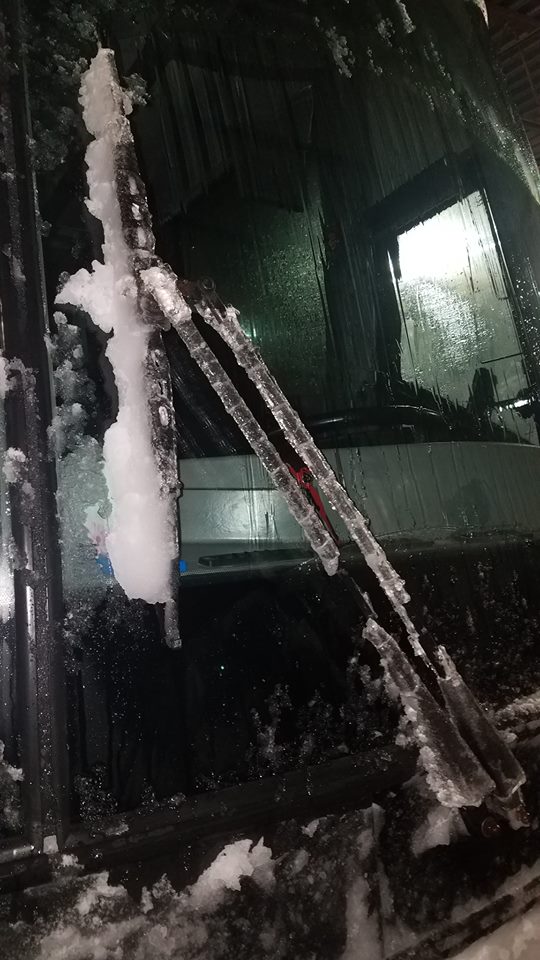
Ice accumulated on windshield wipers while driving from Sault Ste. Marie to Marquette (Photo courtesy James Roberts) |
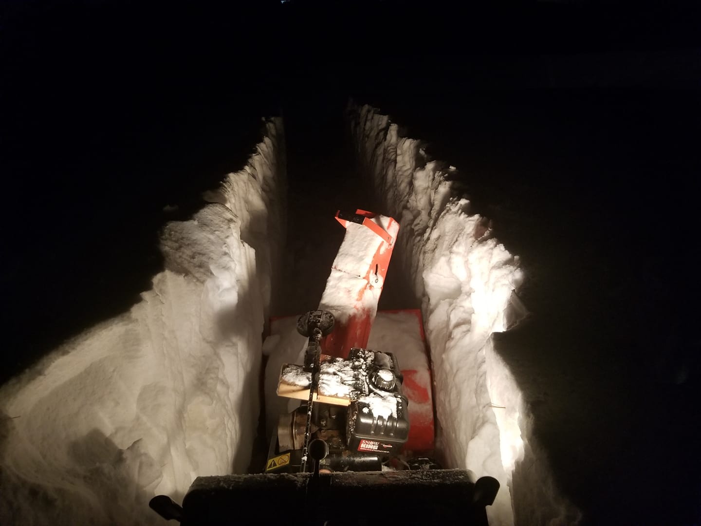
A snowblower cuts a path through deep snow in Harvey (Photo courtesy Travis East) |
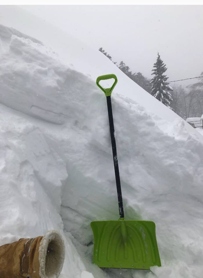
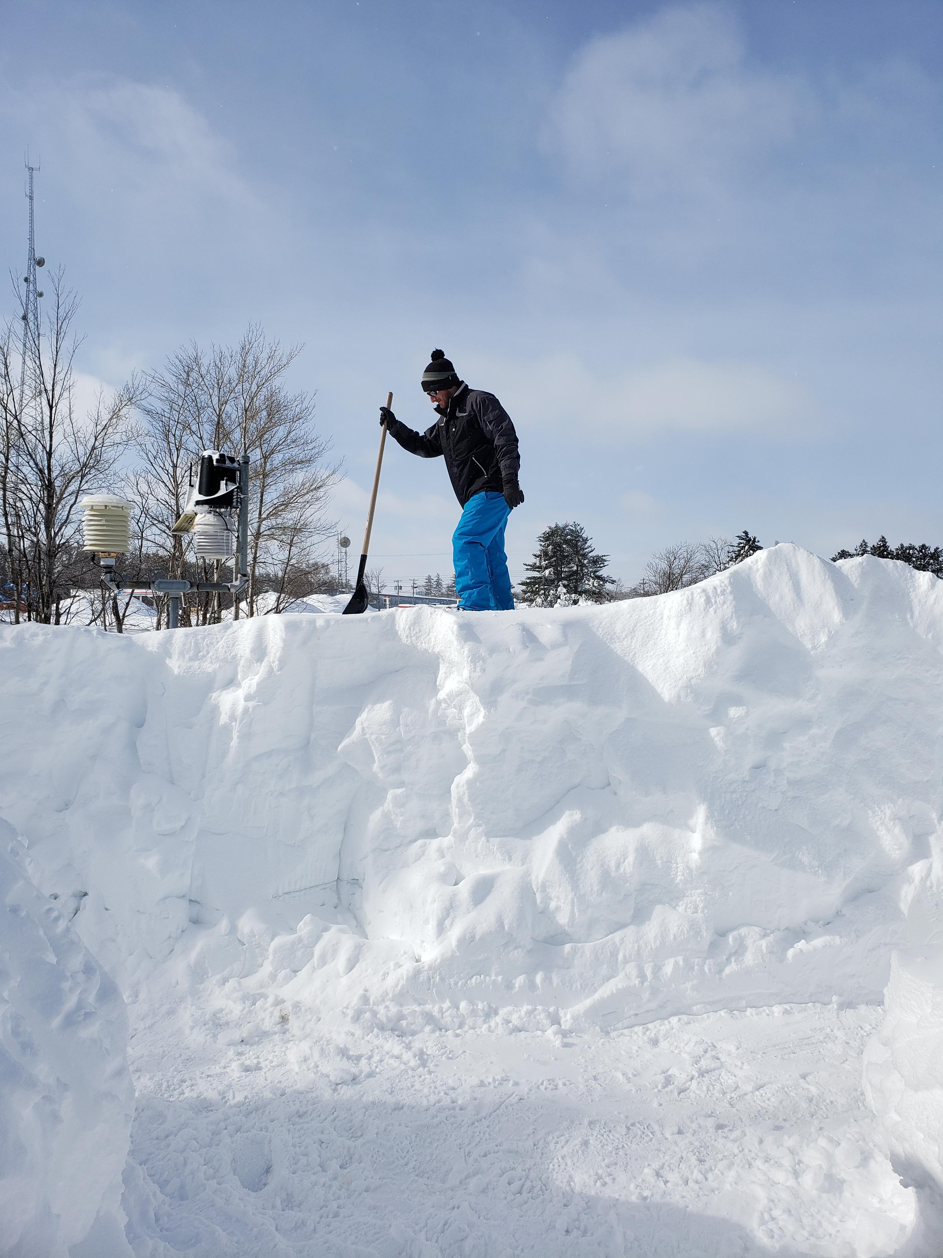
One of our meteorologists digs through more than 50 inches of snow to measure the frost depth at NWS Marquette |
Storm Reports
Snowfall Reports as of Sunday Morning Feb 24th:
.PNG)
Full Listing:
000
NOUS43 KMQT 260035
PNSMQT
MIZ001>007-009>014-084-085-261235-

Public Information Statement
National Weather Service Marquette MI
735 PM EST Mon Feb 25 2019

...STORM TOTAL SNOWFALL REPORTS FROM FEBRUARY 23-24 2019...

Location                     Amount     Lat/Lon

...Michigan...

...Alger County...
Grand Marais 10S             15.0 in    46.51N/85.96W
Munising                     13.5 in    46.41N/86.66W
Chatham Experiment Farm 2    10.8 in    46.34N/86.92W

...Baraga County...
1 NNW Covington              25.0 in
2 S Baraga                   22.0 in    46.75N/88.50W
3 WSW LAnse                  15.0 in    46.74N/88.50W
2 WSW Watton                 14.8 in    46.53N/88.64W
Michigamme 3WNW              14.7 in    46.55N/88.18W
Three Lakes                  14.5 in    46.56N/88.21W
Herman                       10.0 in    46.65N/88.33W
1 NE Pelkie                  10.0 in    46.82N/88.62W

...Delta County...
9 S Rapid River              7.0 in     45.79N/86.94W
Escanaba                     4.5 in
Garden Corners               4.2 in     45.90N/86.55W
3 S Trenary                  4.0 in     46.16N/86.96W
2 SSW Escanaba               4.0 in     45.72N/87.10W
1 SW Gladstone               3.9 in     45.84N/87.04W
3 ESE Garden                 2.0 in     45.76N/86.49W

...Dickinson County...
4 NNE Iron Mountain          6.0 in     45.88N/88.04W
1 SSE Norway                 3.1 in     45.78N/87.90W

...Gogebic County...
1 W Ironwood                 15.7 in    46.46N/90.16W
Ironwood WWTP                13.3 in    46.47N/90.18W
1 NNW Wakefield              12.0 in    46.49N/89.94W
Watersmeet 12WSW             11.0 in    46.22N/89.41W
Wakefield                    7.0 in     46.48N/89.93W

...Houghton County...
Quincy Hill                  25.3 in
Kearsarge                    20.0 in    47.28N/88.42W
Chassell                     19.5 in    47.03N/88.53W
Painesdale                   18.4 in    47.03N/88.67W
Dollar Bay                   15.0 in
Jacobsville                  12.1 in    47.01N/88.43W

...Iron County...
1 W Amasa                    11.5 in
Caspian                      7.5 in     46.06N/88.63W
2 SSE Stambaugh              7.5 in     46.06N/88.63W

...Luce County...
Newberry City                12.6 in    46.36N/85.52W

...Marquette County...
1 NW Big Bay                 26.4 in    46.83N/87.74W
Clarksburg                   24.0 in    46.50N/87.84W
6 N Negaunee                 18.0 in    46.58N/87.62W
1 S Big Bay                  16.9 in    46.81N/87.73W
1 NW Big Bay                 16.3 in    46.83N/87.75W
5 SW National Mine           16.2 in    46.41N/87.76W
Ishpeming                    16.0 in    46.49N/87.67W
2 NW National Mine           16.0 in    46.48N/87.72W
NWS Marquette                16.0 in    46.53N/87.55W
Green Garden                 13.8 in    46.45N/87.30W
9 SE Big Bay                 13.0 in    46.72N/87.62W
Marquette                    12.7 in    46.55N/87.38W
1 SSW Marquette              12.5 in    46.54N/87.40W
3 WSW National Mine          12.0 in    46.44N/87.74W
3 NNW Sands                  12.0 in    46.46N/87.42W
5 NNW Ishpeming              11.9 in    46.57N/87.69W
Trowbridge Park              11.0 in    46.56N/87.44W
2 S Harvey                   10.1 in    46.47N/87.34W
4 SE Big Bay                 9.3 in     46.78N/87.67W
2 WSW Skandia                9.0 in     46.36N/87.27W
2 NW Skandia                 9.0 in     46.40N/87.28W

...Ontonagon County...
Ewen                         25.9 in    46.53N/89.29W
6 N Greenland                23.0 in    46.87N/89.10W
Ontonagon 1S                 13.3 in    46.86N/89.31W

...Schoolcraft County...
Gemini Lakes                 19.0 in    46.49N/86.31W
Manistique WWTP              5.0 in     45.95N/86.25W
7 ENE Garden                 3.6 in     45.81N/86.42W

Observations are collected from a variety of sources with varying
equipment and exposures. We thank all volunteer weather observers
for their dedication. Not all data listed are considered official.

$$
RJC
Peak Wind Gusts
000
NOUS43 KMQT 251144
PNSMQT
MIZ001>007-009>014-084-085-252344-

Public Information Statement
National Weather Service Marquette MI
644 AM EST Mon Feb 25 2019

...PEAK WIND GUST REPORTS OF 40 MPH OR MORE OVER THE PAST 24 HOURS...

Location                     Speed     Time/Date       Lat/Lon
Stannard Rock                79 MPH    0830 PM 02/24   47.19N/87.22W
Granite Island               76 MPH    0910 PM 02/24   46.78N/87.41W
Houghton Co. Airport         69 MPH    0622 PM 02/24   47.17N/88.49W
Copper Harbor                67 MPH    0632 PM 02/24   47.47N/87.88W
Ojibway - Isle Royale        63 MPH    0724 PM 02/24   48.11N/88.61W
Munising                     60 MPH    0335 PM 02/24   46.41N/86.65W
Ford Airport                 58 MPH    0742 PM 02/24   45.81N/88.11W
Ontonagon                    58 MPH    0653 PM 02/24   46.87N/89.31W
1 SW Freda                   56 MPH    0225 PM 02/24   47.13N/88.83W
Passage Island - Isle Royale 56 MPH    0700 PM 02/24   48.22N/88.37W
NWS Marquette                54 MPH    0600 PM 02/24   46.53N/87.55W
Sawyer Airport               52 MPH    0747 PM 02/24   46.35N/87.40W
Wakefield                    51 MPH    0337 PM 02/24   46.48N/89.95W
Marquette                    51 MPH    0913 PM 02/24   46.54N/87.40W
Silver City                  50 MPH    0133 PM 02/24   46.83N/89.57W
Port Inland                  48 MPH    0912 PM 02/24   45.97N/85.87W
3 SSW Pelkie                 47 MPH    0513 PM 02/24   46.78N/88.66W
Ironwood Airport             46 MPH    0128 PM 02/24   46.53N/90.13W
Delta Co. Airport            45 MPH    0219 PM 02/24   45.72N/87.09W
Shot Point                   45 MPH    1120 PM 02/24   46.51N/87.17W
Schoolcraft Co. Airport      41 MPH    1156 PM 02/24   45.97N/86.17W
Menominee Airport            40 MPH    0759 PM 02/24   45.13N/87.64W

Observations are collected from a variety of sources with varying
equipment and exposures. We thank all volunteer weather observers
for their dedication. Not all data listed are considered official.

$$
JLA
Environment
Insert synoptic summary.
 |
 |
 |
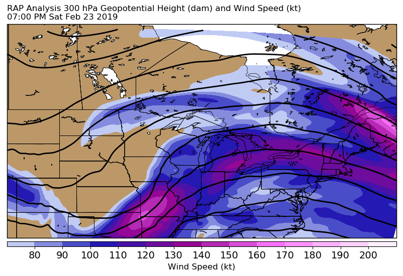
| 300 mb Heights and Winds | 500 mb Heights and Relative Vorticity | 700 mb Heights, RH, Fgen, and EPV EPV < 0 is in purple; EPV > 0 but < 0.25 is in blue. |
 |
 |
 |
| 850 mb Heights and Temperatures | 925 mb Heights and Wind Speeds | Mean Sea Level Pressure and Pressure Falls |
Services:
Social Media
 |
 |
 |
 |
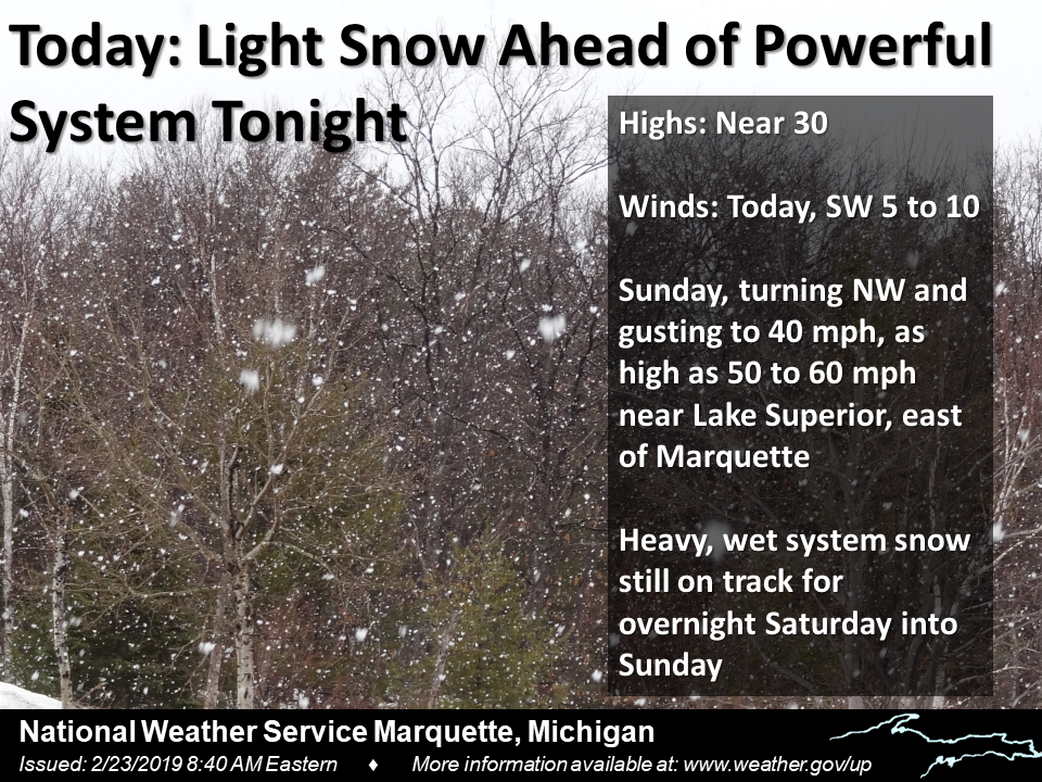
| AM Weather Story Friday 02/22 | Messaging ramp-up began with this outlook Friday morning | Began messaging specifics on snowfall amounts and high wind gusts Friday night. | Saturday morning update with increased wind gusts |
 |
 |
 |
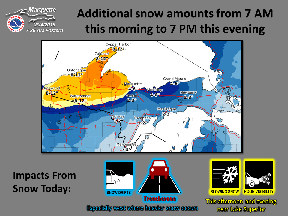 |
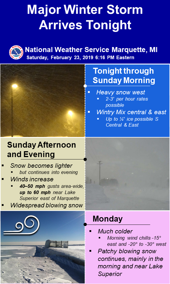
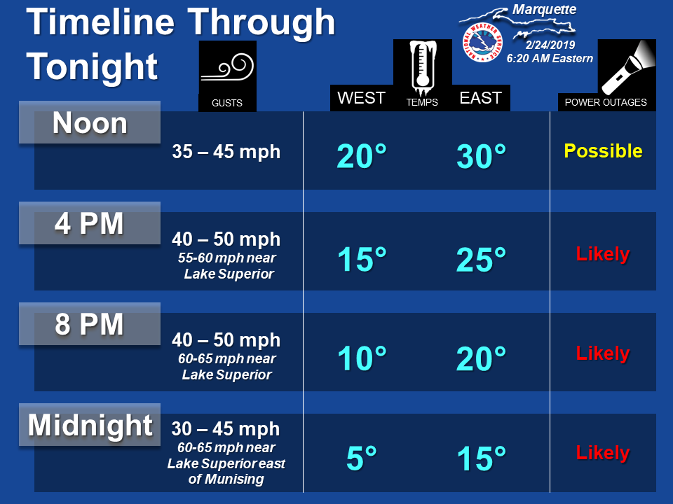
| AM Weather Story Saturday 02/23 | Saturday night impacts timeline highlighting the three main hazards over the next 36 hours | Sunday morning impacts timeline | Sunday morning additional snow/impacts |
 |
 |
 |
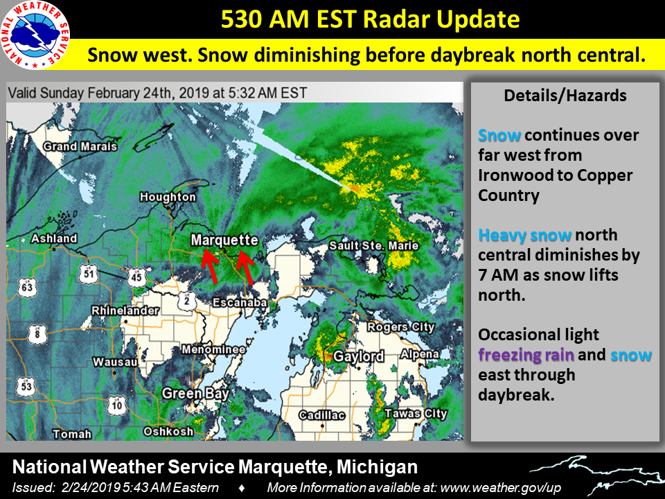 |
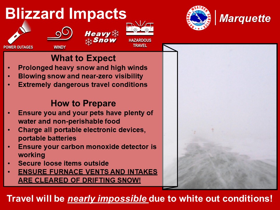
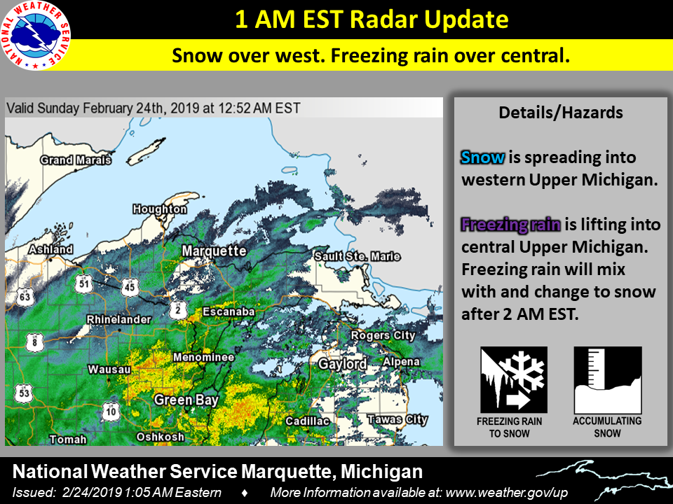
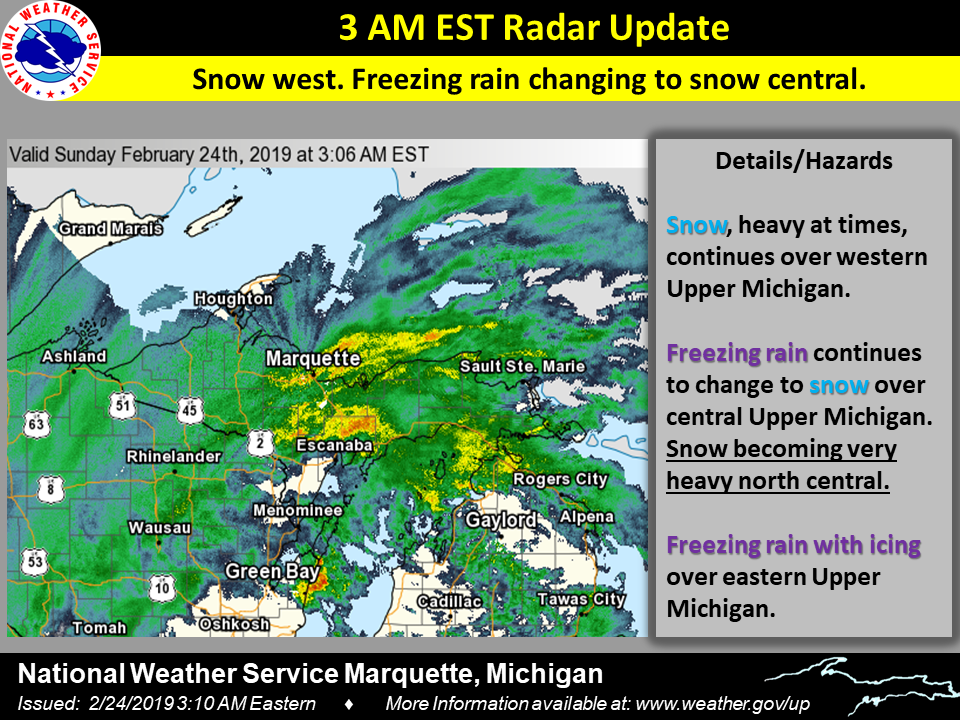
| Blizzard impacts/preparation posted midday Sunday | 1AM Sunday radar update | 3AM Sunday radar update | 530 AM Sunday radar update |
Headlines Before & During the Event:
| Headline | Issuance Time |
| Special Weather Statement | Thursday afternoon |
| Winter Storm Watch | Friday morning |
| Winter Storm Warnings | Saturday morning |
| Blizzard Warnings | Sunday morning |
Summaries from other NWS Offices
 |
Media use of NWS Web News Stories is encouraged! Please acknowledge the NWS as the source of any news information accessed from this site. |
|

