Overview
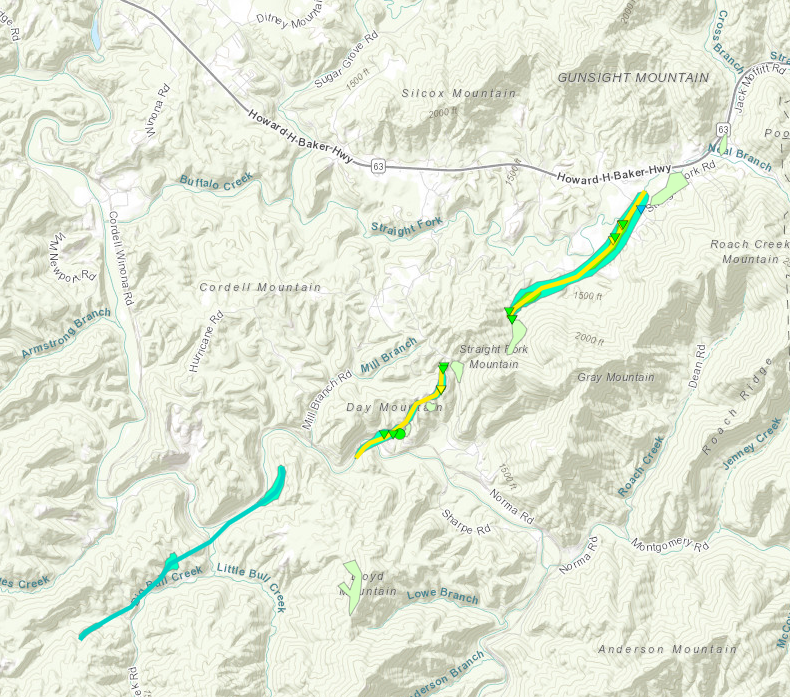
A supercell progressed onto northern portions of the Cumberland Plateau with tornadic characteristics observed and multiple reports of damage in Scott County, TN and many other nearby locations. An NWS survey found the damage to be consistent with a tornado up to EF-2 strength with other intermittent EF-0 damage observed as well. All images can be magnified by clicking them and then restored back to normal size by clicking on them again. The data is still preliminary and could be subject to change in the future.
|
Tornadoes - Near Norma, TN SCOTT COUNTY, TN |
||||||||||||||||||||||||||||||||||||||||||||||||
Downloadable KMZ File |
||||||||||||||||||||||||||||||||||||||||||||||||
The Enhanced Fujita (EF) Scale classifies tornadoes into the following categories:
| EF0 Weak 65-85 mph |
EF1 Moderate 86-110 mph |
EF2 Significant 111-135 mph |
EF3 Severe 136-165 mph |
EF4 Extreme 166-200 mph |
EF5 Catastrophic 200+ mph |
 |
|||||
Photos
Near Norma, TN Area
 |
 |
 |
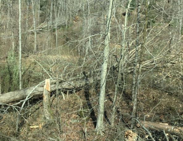 |
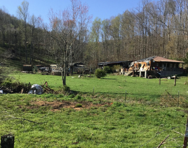
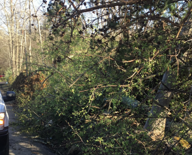
| EF-2 Damage on Straight Fork Rd. (NWS) |
EF-2 Damage on Howard Day Rd. (NWS) |
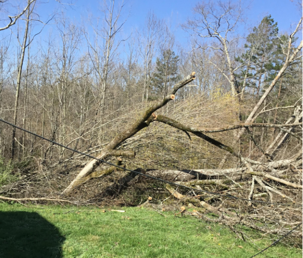
EF-1 Damage on Straight Fork Rd. (NWS) |
EF-1 Damage on Howard Day Rd. (NWS) |
Environment
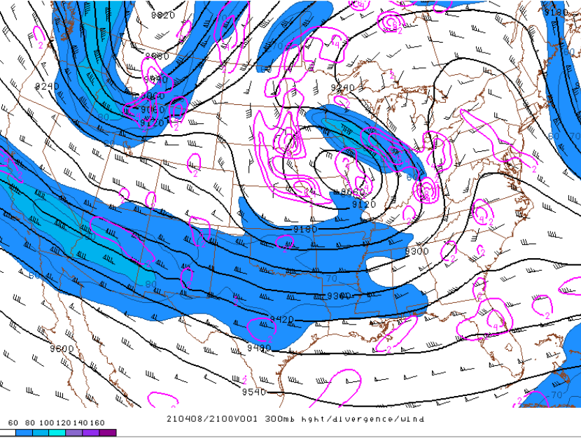
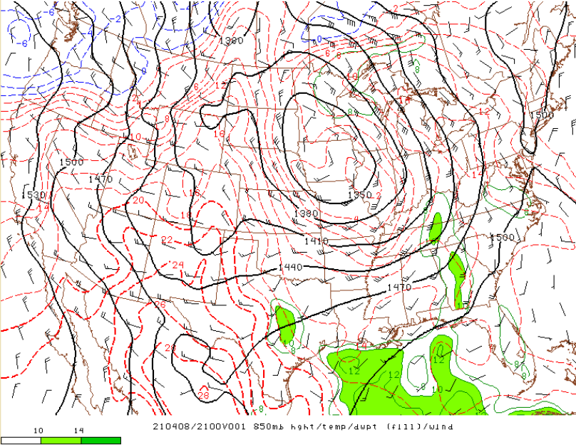
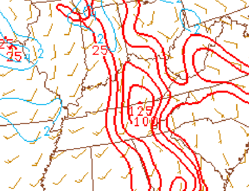
In the upper-levels, a negatively tilted shortwave trough moved into the area with a 60 to 80+ kt jet across the southern Plains/Mississippi Valley. This setup put East Tennessee in the exit region of the jet, which helped to increase upper divergence. Height falls also helped to steepen lapse rates and increase instability. This is all seen with quasi-geostrophic ascent in mid/upper-level differential vorticity advection. At the 700mb level, a mid-level dry slot is seen, which also helped to enhance lapse rates. Near the boundary layer, increasing moisture resulted with strong convergence along the Plateau.
 |
 |
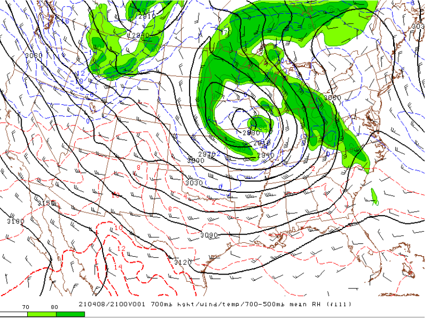 |
| Figure 1: 300mb Heights, Winds and Divergence | Figure 2: 700-400mb Differential Vorticity Advection | Figure 3: 700mb Heights, Winds, RH, and Temps |
 |
|
|
| Figure 4: 300mb Heights, Winds and Divergence | Figure 5: 850mb Convergence |
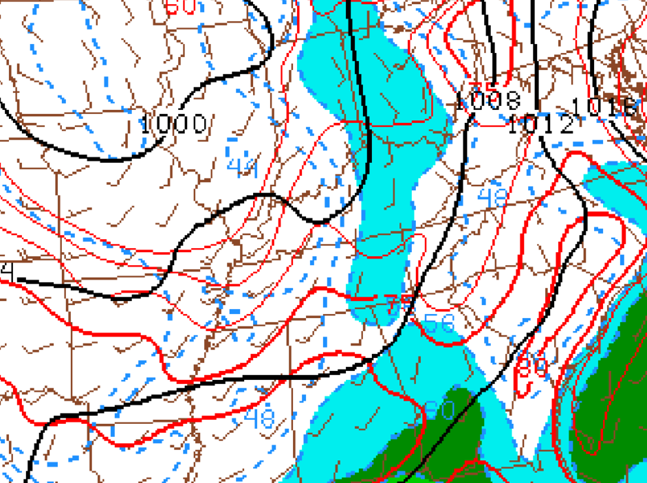
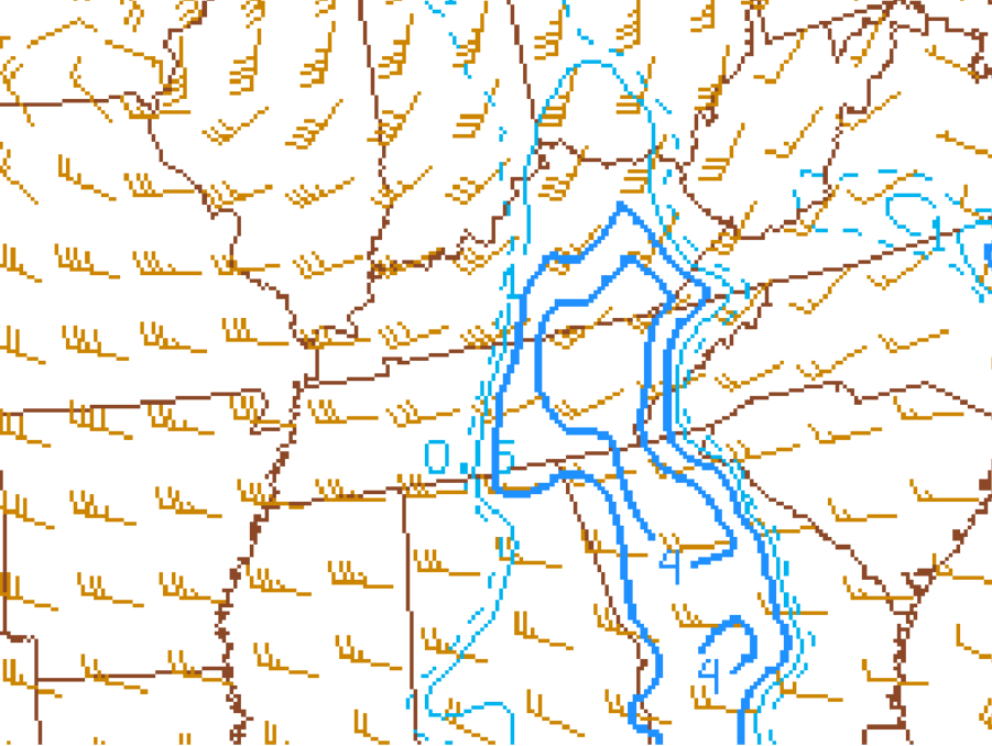
At the surface, a convergent boundary is clearly seen along the Cumberland Plateau within the surface wind pattern. This is also noted with increasing low-level moisture. These factors helped increase surface-based destabilization/forcing and added to an environment conducive for organized convection/supercells. It is also noted that boundary can help increase low-level vorticity, a key metric in tornadogenesis.
 |
 |
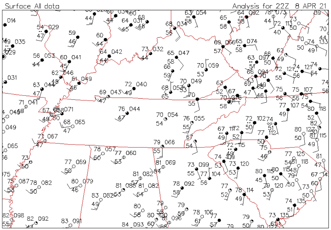 |
| Figure 6: Surface Winds, MSLP, Td's, and Temps | Figure 7: Surface Winds and Mixing Ratios | Figure 8: Surface METAR Plot |
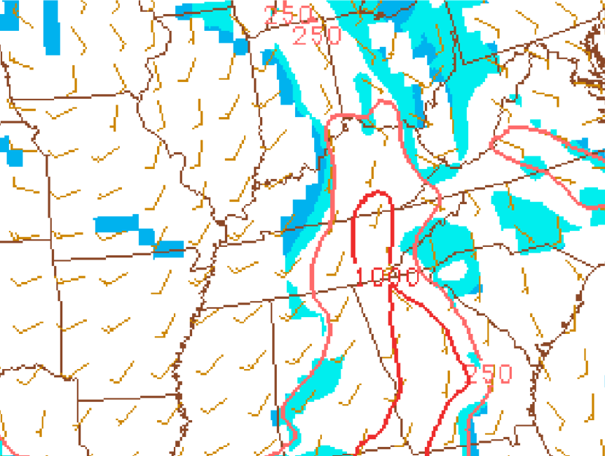
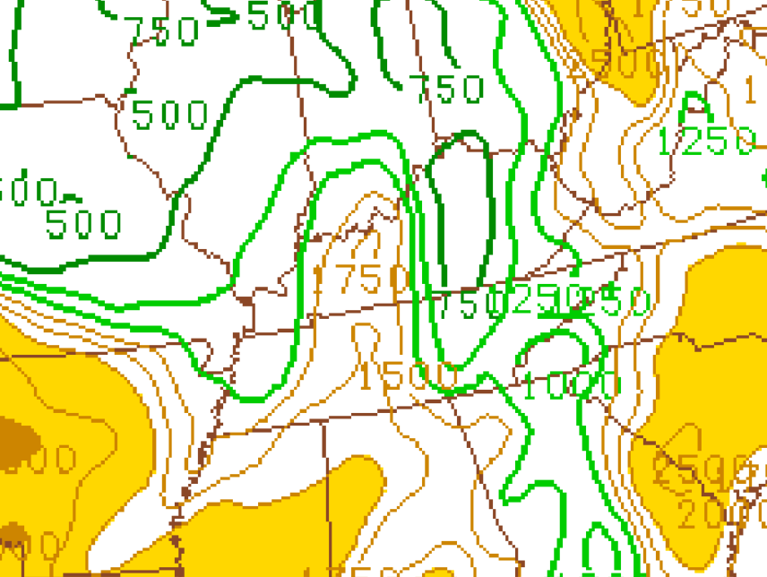
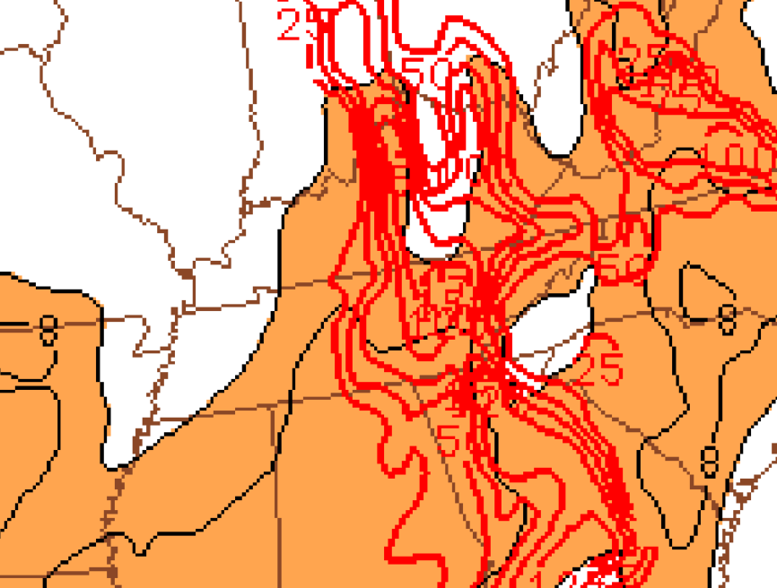
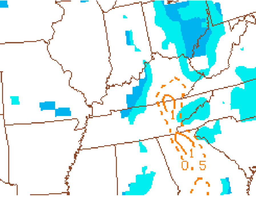
The aforementioned increasing instability is clearly seen below in MLCAPE with multiple other environmental parameters delineating the environment conducive to tornadogenesis. LCL heights were near 1,000m or less with research showing that anything less than 1,000m for this parameter being conducive to tornadoes. Also, the destabilization at the surface helped to increase low-level lapse rates, which provided favorable 0-3km (inflow) CAPE. Only about 50 J/kg is typically desired for tornadogenesis with 100+ J/kg being in place over the northern Plateau. Also, supercell composite parameter (SCP) values were 4 or higher across much of the area with a value of only 1 or greater being desired for supercellular convection. When looking at the significant tornado parameter (STP), values were barely reaching to 1 in the area of interest. This is still supportive of tornadogenesis but was not suggesting widespread and/or long-track tornadoes.
 |
 |
 |
| Figure 9: MLCAPE | Figure 10: LCL Heights | Figure 11: 0-3km CAPE |
 |
 |
 |
| Figure 12: 0-3km Lapse Rates | Figure 13: Supercell Composite Parameter | Figure 14: Significant Tornado Parameter |
Radar Imagery
Below is a 4-panel of radar data depicting the supercellular storm of interest for this event. A clear hook echo can be seen in the reflectivity imagery, which is also the location of the mesocyclone in the storm-relative velocity image. With normalized rotation (NROT), a value of 1.00 or greater indicates strong rotation, which is clearly seen in the image. Correlation coefficient, a detection of the consistency of particle sizes, is commonly used as an indicator of debris lofted into the air, usually seen as lower values surrounded by higher values. As this image was from fairly early in the event, it is difficult to see debris. Plus, at this distance from the radar, the sampling is several thousand feet above the surface.
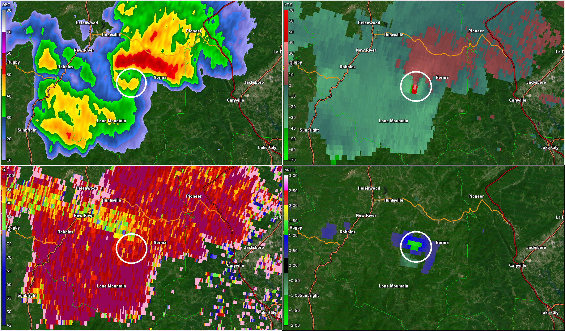 |
| Figure 15 (from top-left going clockwise): Base Reflectivity, Storm-Relative Velocity, Normalized Rotation, and Correlation Coefficient |
 |
Media use of NWS Web News Stories is encouraged! Please acknowledge the NWS as the source of any news information accessed from this site. |
|


 Local Radar
 Huntsville Radar
 Regional Satellite
 Graphical Forecast
 Weather Map