
Heat expands across the Desert Southwest, Plains, Mississippi Valley and Midwest into Monday. Fire weather concerns continue for portions of the Intermountain West. Active monsoonal moisture fuels thunderstorms over the Southwest with possible flash flooding. Tropical cyclone Fausto in the Pacific, should weaken as it approaches Hawaii; Dangerous surf, swells and rip currents are expected. Read More >
Overview
Following the devastating tornado outbreak across Kentucky and neighboring areas, a line of strong to severe storms moved through the region Saturday morning into the early afternoon, associated with the same system. The main impact across the region was damaging winds with a confirmed gust of 62 mph at the Knoxville McGhee Tyson Airport. As a result, some areas had numerous downed trees and a few snapped powerlines with scattered downed trees in other areas. Thousands lost power in the region with a few injuries reported as well.
Photos & Video
 |
 |
 |
 |
| Fence Blown Down in Lenoir City (Courtesy Ben Cathey WVLT from Resident Bill) |
Damage from Fallen Tree on a Home in Jefferson County (Courtesy JCSO from WVLT Weather) |
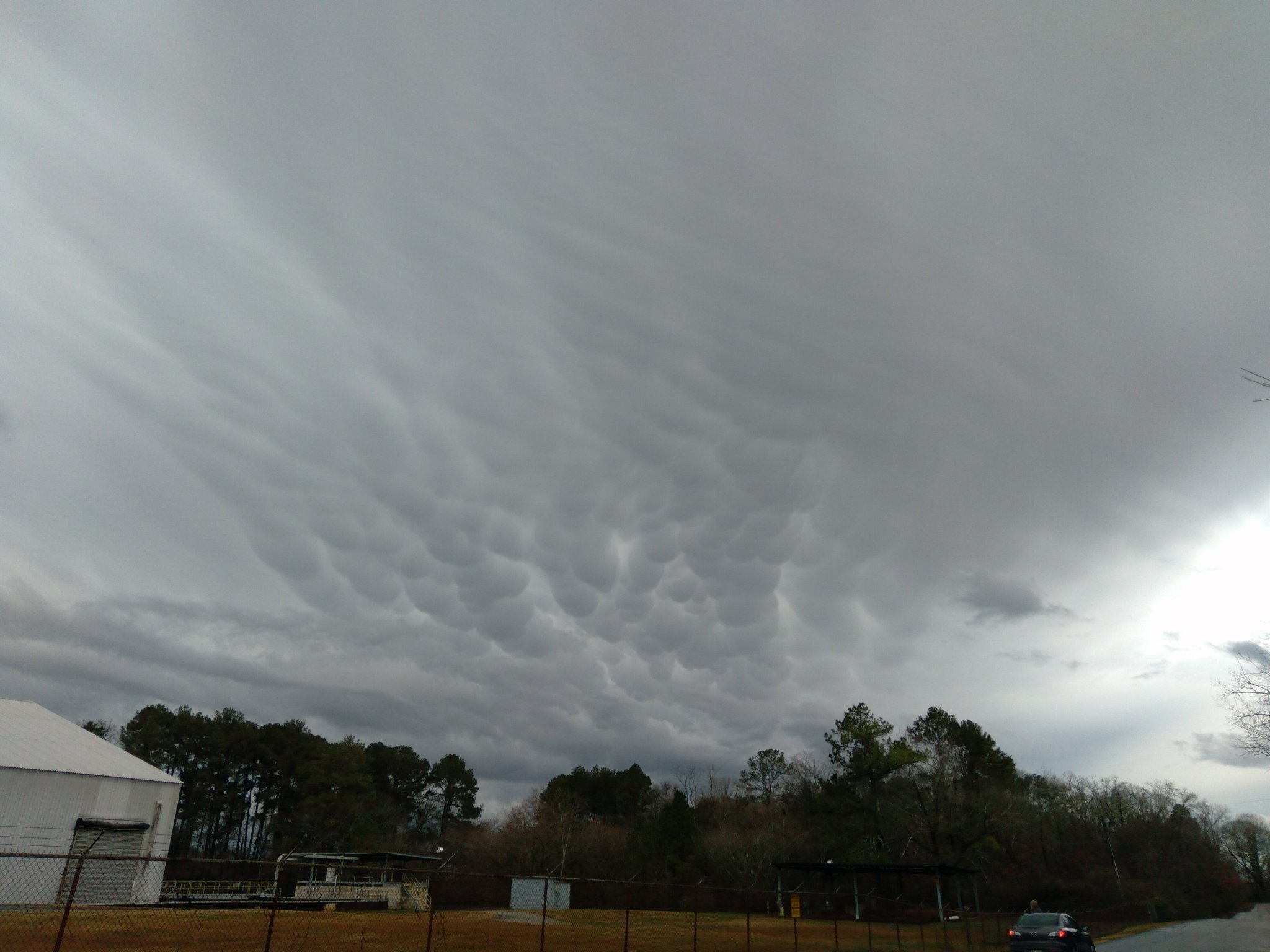
Mammatus Clouds in Hixson (Courtesy Kimberly Turner via Alison Pryor WRCB) |
Power Pole Snapped in Knoxville (Courtesy KUB) |
 |
 |
 |
| Tree Down in Knoxville (Courtesy Will Puckett WVLT) |
Tree Down in Sevierville (Courtesy Andrew Carroll) |
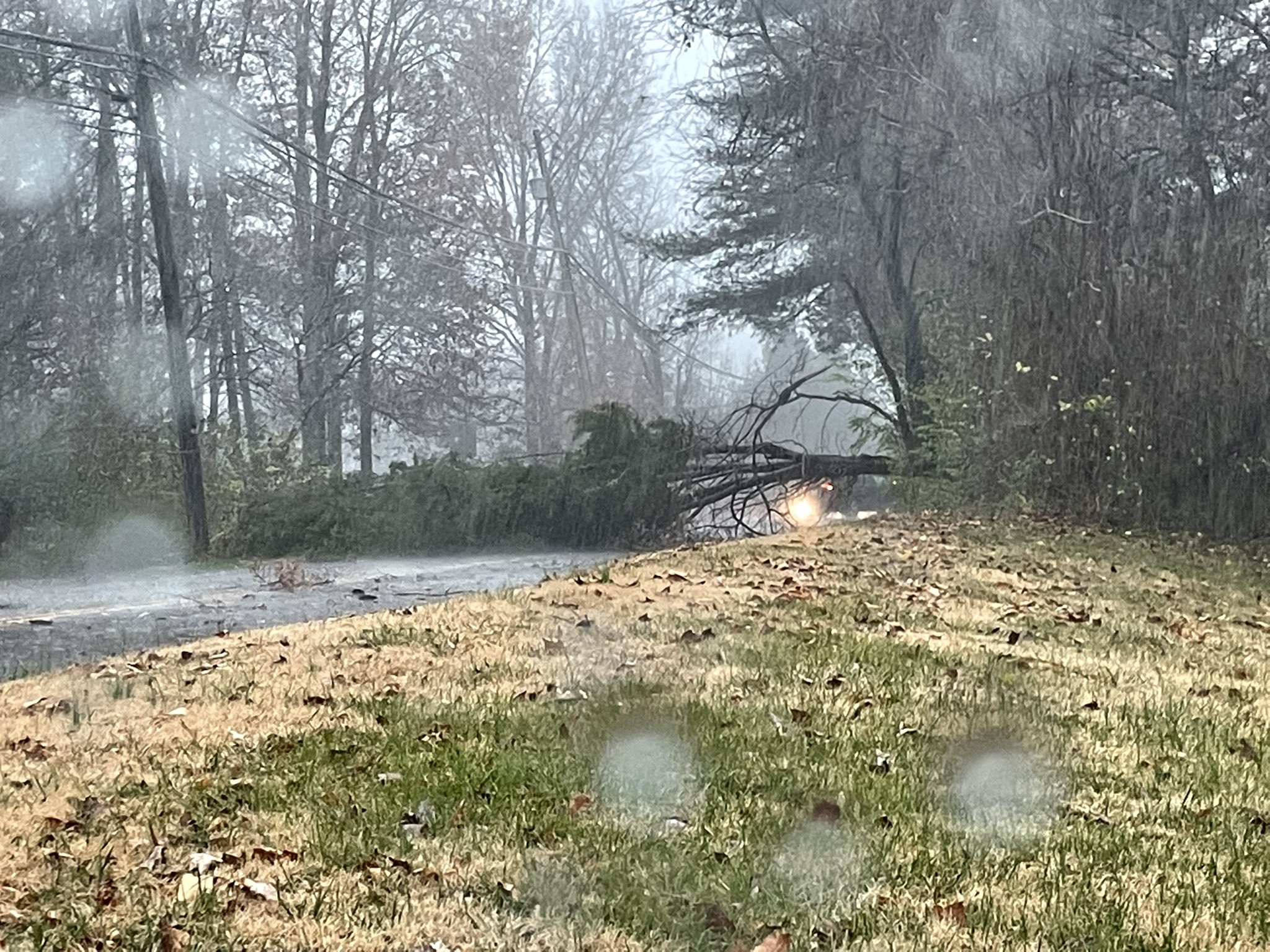
Trees Down in Sequatchie County (Courtesy of RealJasonWx) |
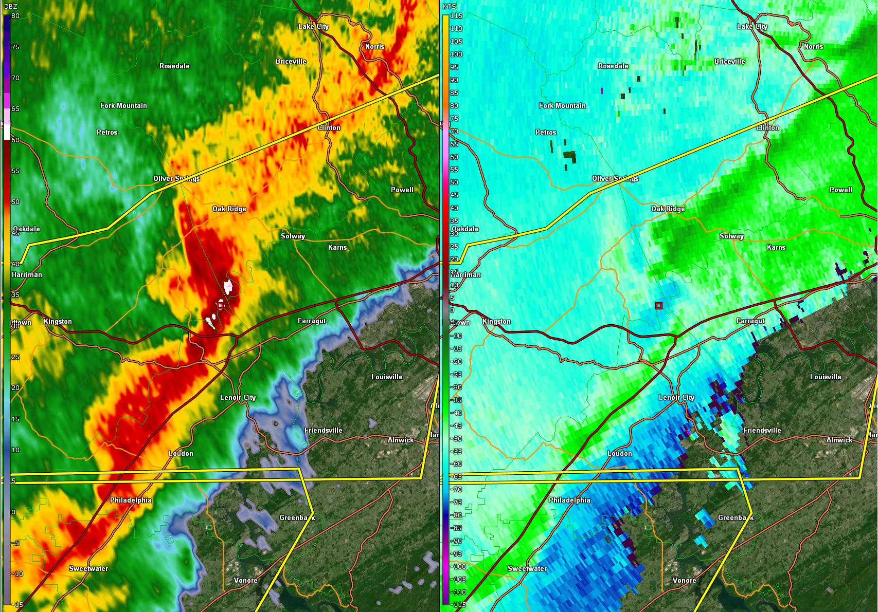
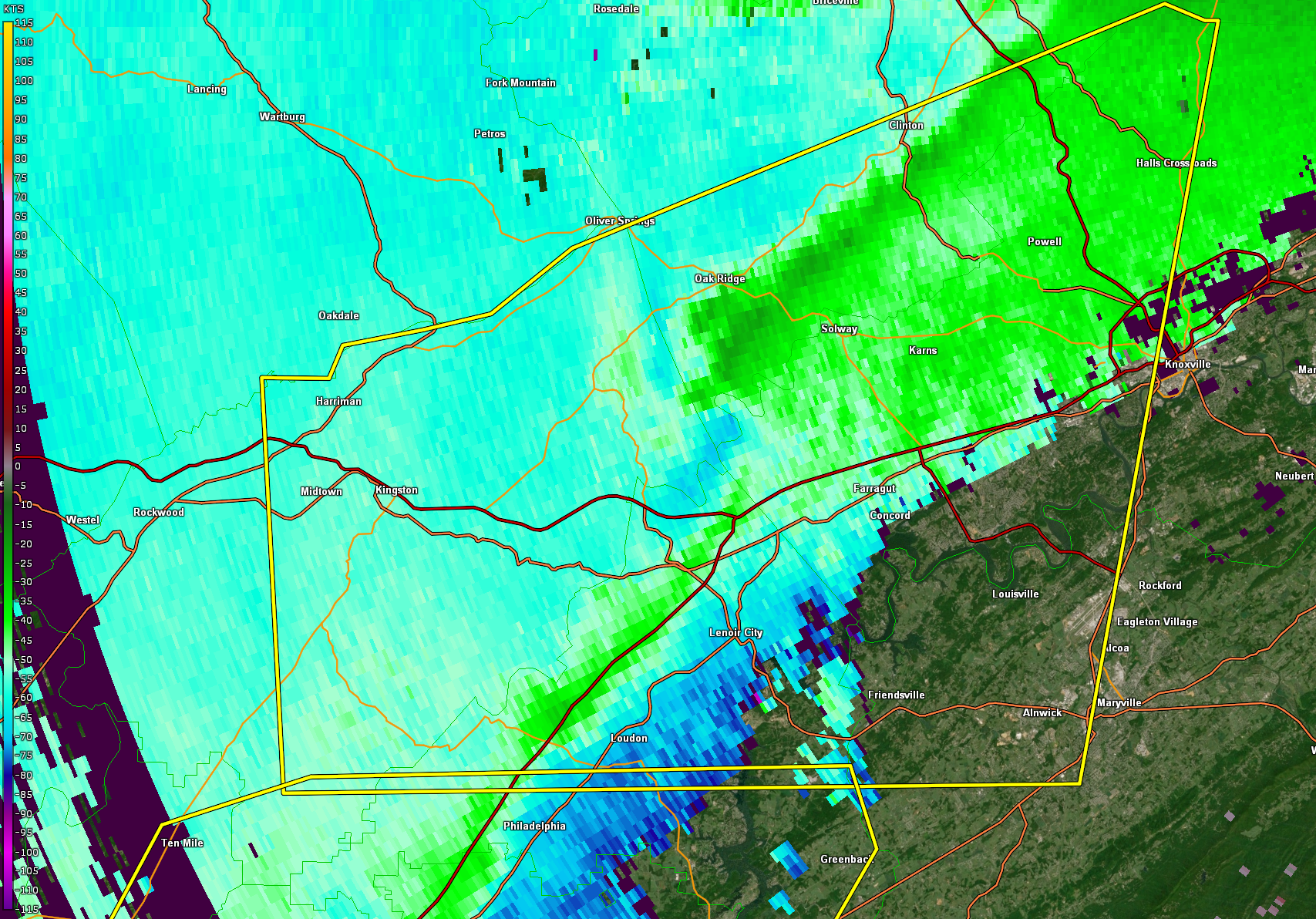
Radar
 |
 |
 |
 |
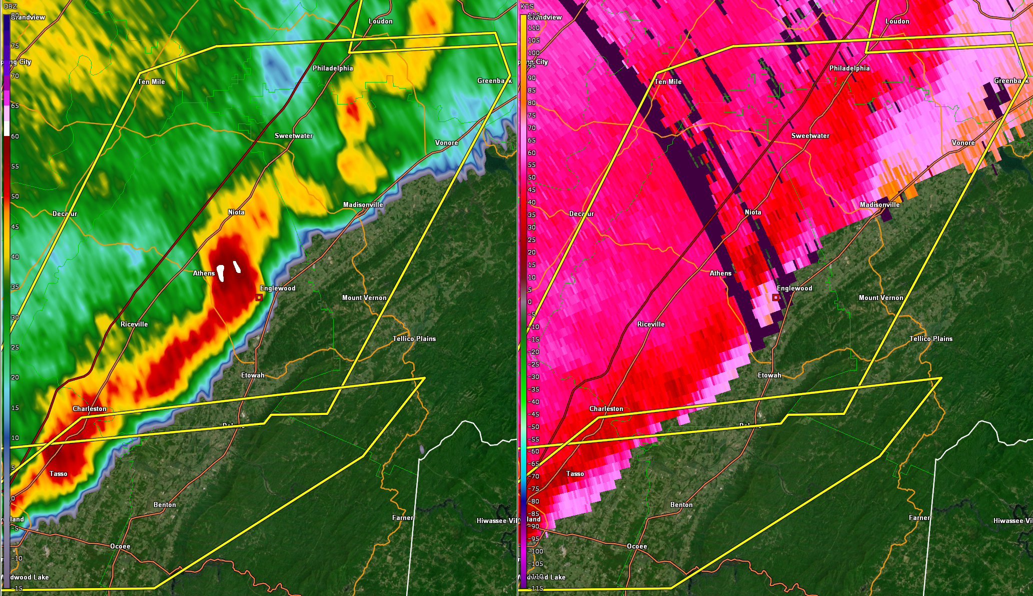
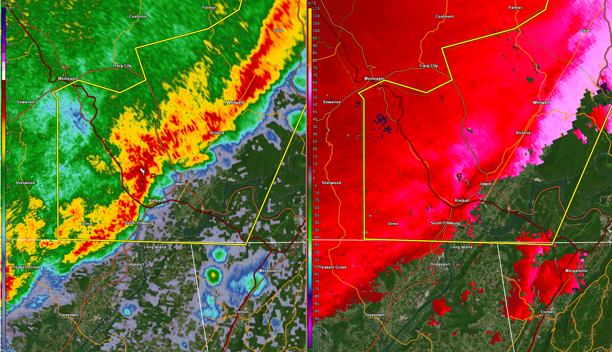
| Base Reflectivity/Velocity (75 kts) in McMinn and Monroe Counties | Base Reflectivity and Base Velocity in Marion County | Base Reflectivity/Velocity of a Bow Echo in Knox and Anderson Counties | Base Reflectivity of a Bow Echo in Roane County |
 |
|
Base Velocity Max > 70 kts in Anderson/Knox/Roane County Areas |
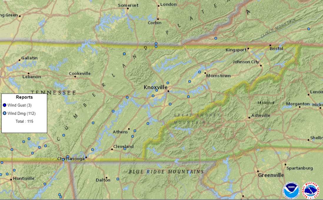
Storm Reports
Below is a map display of Local Storm Reports (LSRs), followed by a text of that information from the day.
 |
|
Map of Local Storm Reports |
..TIME...   ...EVENT...      ...CITY LOCATION...     ...LAT.LON...
..DATE...   ....MAG....      ..COUNTY LOCATION..ST.. ...SOURCE....
            ..REMARKS..

1030 AM     Tstm Wnd Dmg     Jonesville              36.69N 83.12W
12/11/2021                   Lee                VA   911 Call Center

            A tree fell on a house.

0635 AM     Tstm Wnd Dmg     Big South Fork National 36.52N 84.67W
12/11/2021                   Scott              TN   911 Call Center

            Few trees down just east of the park.

0825 AM     Tstm Wnd Dmg     3 S Big South Fork Nati 36.48N 84.67W
12/11/2021                   Scott              TN   Law Enforcement

            Corrects previous tstm wnd dmg report from 3
            S Big South Fork National. A few trees down.

0940 AM     Tstm Wnd Dmg     3 ENE Rockwood          35.88N 84.62W
12/11/2021                   Roane              TN   NWS Employee

            Multiple trees down south of Interstate 40,
            exit 347, along HWY 27.

0910 AM     Tstm Wnd Dmg     Spring City             35.69N 84.86W
12/11/2021                   Rhea               TN   911 Call Center

            Few trees down.

1050 AM     Tstm Wnd Dmg     1 SW Benton             35.17N 84.66W
12/11/2021                   Polk               TN   Law Enforcement

            Multiple trees down.

1040 AM     Tstm Wnd Dmg     5 E Madisonville        35.52N 84.27W
12/11/2021                   Monroe             TN   911 Call Center

            Numerous trees down across the county.

1015 AM     Tstm Wnd Dmg     Englewood               35.42N 84.49W
12/11/2021                   McMinn             TN   911 Call Center

            Multiple trees and power lines down.

1020 AM     Tstm Wnd Dmg     Etowah                  35.34N 84.53W
12/11/2021                   McMinn             TN   911 Call Center

            Multiple trees and power lines down.

0900 AM     Tstm Wnd Dmg     South Pittsburg         35.02N 85.71W
12/11/2021                   Marion             TN   911 Call Center

            Several trees down.

0900 AM     Tstm Wnd Dmg     Jasper                  35.06N 85.63W
12/11/2021                   Marion             TN   911 Call Center

            Several trees down.

1005 AM     Tstm Wnd Dmg     2 NNE Farragut          35.90N 84.18W
12/11/2021                   Knox               TN   911 Call Center

            *** 1 INJ ***
            Tree down off Campbell Station road.

1020 AM     Tstm Wnd Dmg     Karns                   35.98N 84.12W
12/11/2021                   Knox               TN   911 Call Center

            Over 20 trees down in the Karns community. 1
            of the downed trees fell on a home.

1025 AM     Tstm Wnd Dmg     Halls                   36.08N 83.93W
12/11/2021                   Knox               TN   Public

            Several trees down.

1050 AM     Tstm Wnd Dmg     1 WNW New Market        36.10N 83.56W
12/11/2021                   Jefferson          TN   Broadcast Media

            *** 2 INJ ***
            Damage to a mobile home. A couple had to be
            helped from their home.

0945 AM     Tstm Wnd Dmg     7 NNE Chattanooga       35.16N 85.21W
12/11/2021                   Hamilton           TN   NWS Employee

            Few trees down.

1100 AM     Tstm Wnd Dmg     3 N Alpha               36.23N 83.39W
12/11/2021                   Hamblen            TN   Public

            Power lines down on Kidwell Ridge rd.

0840 AM     Tstm Wnd Dmg     Jellico                 36.58N 84.13W
12/11/2021                   Campbell           TN   911 Call Center

            Few trees down.

1035 AM     Tstm Wnd Gst 2 N Alcoa               35.82N 83.98W
12/11/2021  M62 MPH          Blount             TN   ASOS

            ASOS station KTYS Knoxville McGhee Tyson.

1040 AM     Tstm Wnd Dmg     1 SW Wildwood           35.79N 83.89W
12/11/2021                   Blount             TN   Trained Spotter

            Multiple trees down on hwy 411.

0910 AM     Tstm Wnd Dmg     5 S Pikeville           35.53N 85.20W
12/11/2021                   Bledsoe            TN   911 Call Center

            Trees down in multiple locations south of
            Pikeville.
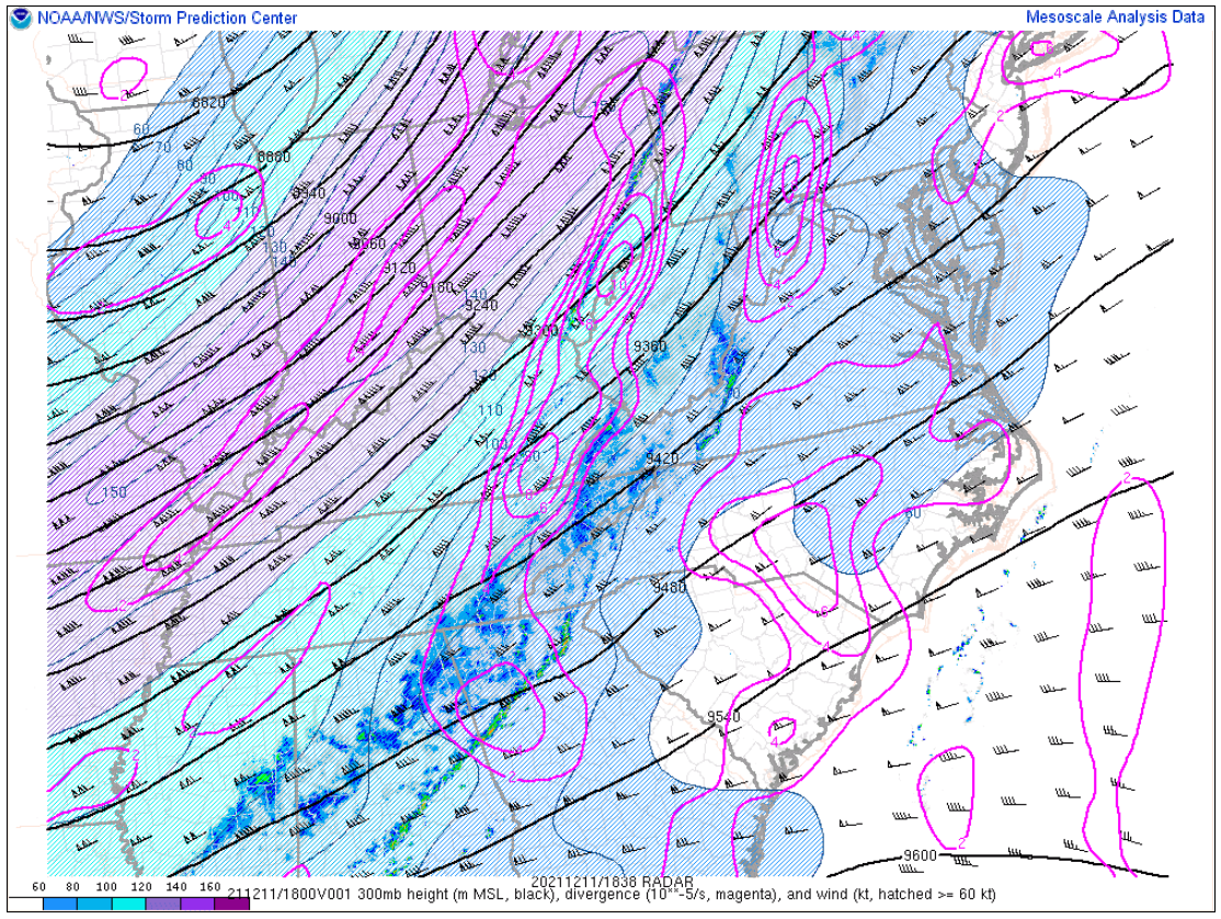
Environment
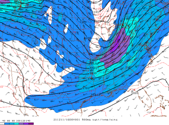
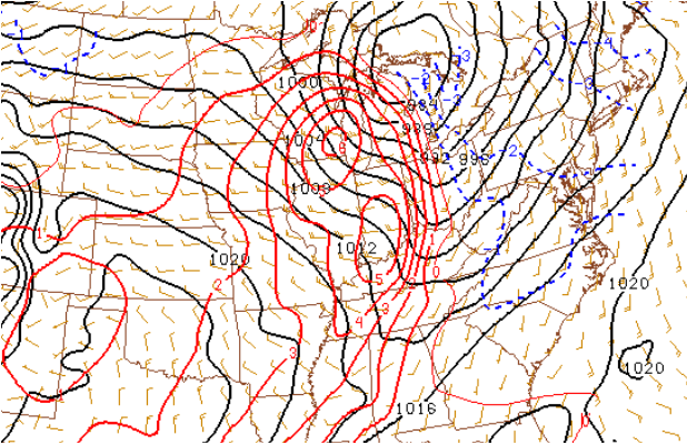
A strong upper trough moved across the midsection of the nation into the Great Lakes from Friday night into Saturday morning. The strongest part of the jet was over the Ohio valley where 300mb winds exceeded 150 knots. This placed the Tennessee and Ohio valleys under strong upper forcing during the morning hours of Saturday, December 11th 2021. The strong upper jet structure produced a deep area of low pressure system over the Great Lakes and Ohio valley. This deep low pressure system and continued ridging over the deep southeast United States increased the pressure gradient over the region with the 850mb low-level jet increasing to 60 to 70 knots.
 |
 |
 |
| Figure 1: 300mb Heights, Divergence, and Winds at 1600 UTC | Figure 2: 500mb Heights, Temperatures, and Winds at 1600 UTC | Figure 3: 850mb Heights, Temperatures, Dewpoints, and Winds at 1600 UTC |
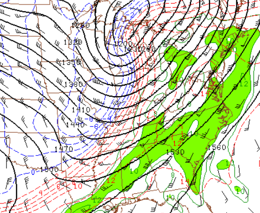
The strong low-level jet pulled abundant moisture into the Tennessee valley and eventually the southern Appalachian region Unseasonably warm air was also pulled north into east Tennessee, southwest Virginia, and southwest North Carolina with mid-morning temperatures already in the 60s to lower 70s over much of the area. This was 15 to 20 degrees above normal. The increased moisture and unseasonably warm temperatures produced an unstable air-mass over the Tennessee valley and southern Appalachians.
 |
 |
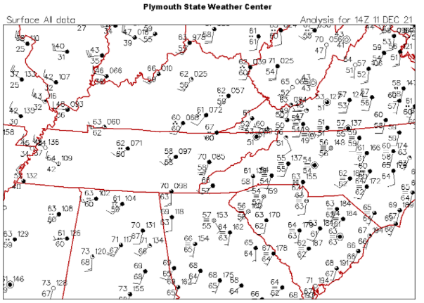 |
| Figure 4: 850mb Moisture Transport at 1500 UTC, 11 December 2021 | Figure 5: Surface Temperature, Dewpoint, Winds, and Isobars at 1500 UTC, 11 December 2021 | Figure 6: Surface Station Plot at 1400 UTC, 11 December 2021 |
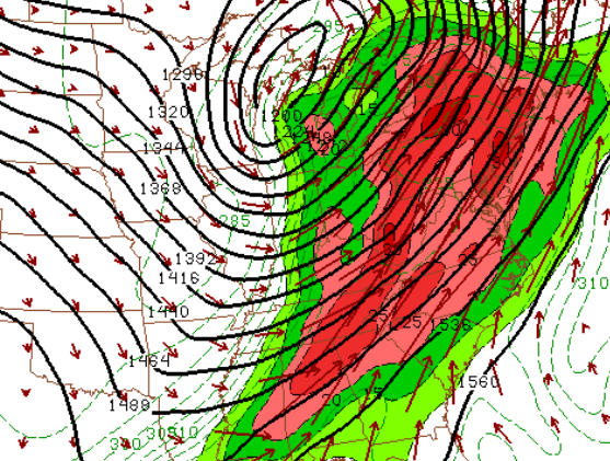
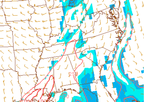
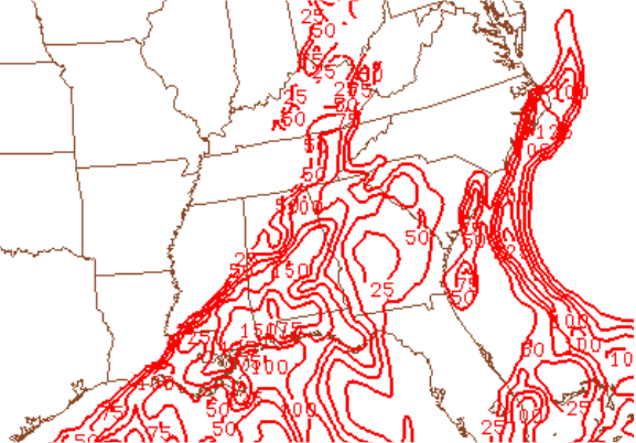
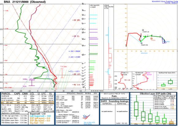
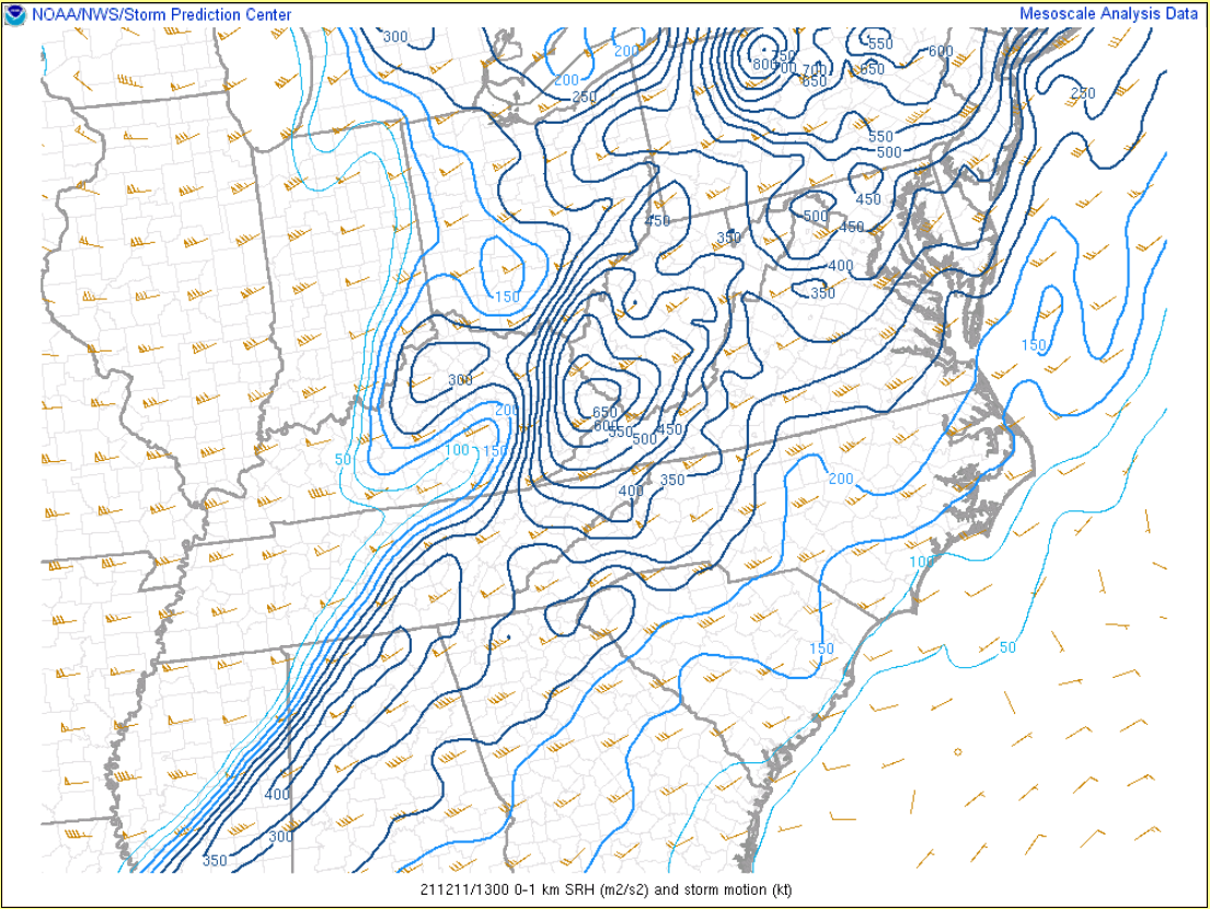
A strong cold front eventually pulled east across the area during the day. The strength of the front was enhanced by the strong upper forcing producing a band of strong to severe showers and thunderstorms that quickly moved across the area. Due to the time of the day, instability was limited with CAPE values of 250-500 J/Kg and low-level CAPE of 50-75 J/Kg. Due to the strength of the low-level jet, shear along the incoming frontal boundary was high with 0-1km shear of 40-50kts and effective shear near 60kts. The highly sheared environment kept the threat of a tornado across east Tennessee. Even though a tornado did not develop, several of the storms exhibited rotation.
 |
 |
 |
| Figure 7: 2-Hour Surface Pressure Change at 1500 UTC, 11 December 2021 | Figure 8: MLCAPE and CIN at 1500 UTC, 11 December 2021 | Figure 9: 0-3km Lapse Rate and CAPE at 1500 UTC, 11 December 2021 |
 |
 |
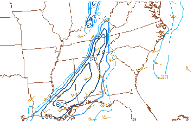 |
| Figure 10: Nashville Observed Sounding at 0000 UTC, 11 December 2021 | Figure 11: 0-1km Shear at 1300 UTC, 11 December 2021 | Figure 12: Effective Shear at 1500 UTC, 11 December 2021 |
 |
Media use of NWS Web News Stories is encouraged! Please acknowledge the NWS as the source of any news information accessed from this site. |
|


 Local Radar
 Huntsville Radar
 Regional Satellite
 Graphical Forecast
 Weather Map