
Record setting heat is expected over the next several days from the Intermountain West through the northern Plains. Furthermore, fire weather concerns increase with dry and breezy conditions. Meanwhile, heavy rainfall and severe thunderstorm threats for the Ohio/Tennessee Valleys, central Appalachians and Southeast today. The threat shifts to central Gulf Coast and across central Texas this week. Read More >
Overview
On January 12, a line of strong to severe thunderstorms moved across the area during the late morning and early afternoon hours. Several bowing segments within the line produced severe thunderstorm wind damage. Three quasi-linear convective system (QLCS) tornadoes were surveyed. Wind damage due to the straight-light winds alone was widespread, especially as the line intensified east of Knoxville. This was a rare event locally as only 5 January tornadoes had previously been confirmed in the modern MRX County Warning Area (CWA) since 1950. The two counties affected by the tornadoes, Meigs and Jefferson, both has less than 10 total recorded tornadoes for 1950 to the present.
Tornado
|
Tornado - 1SW of Decatur, TN
Track Map 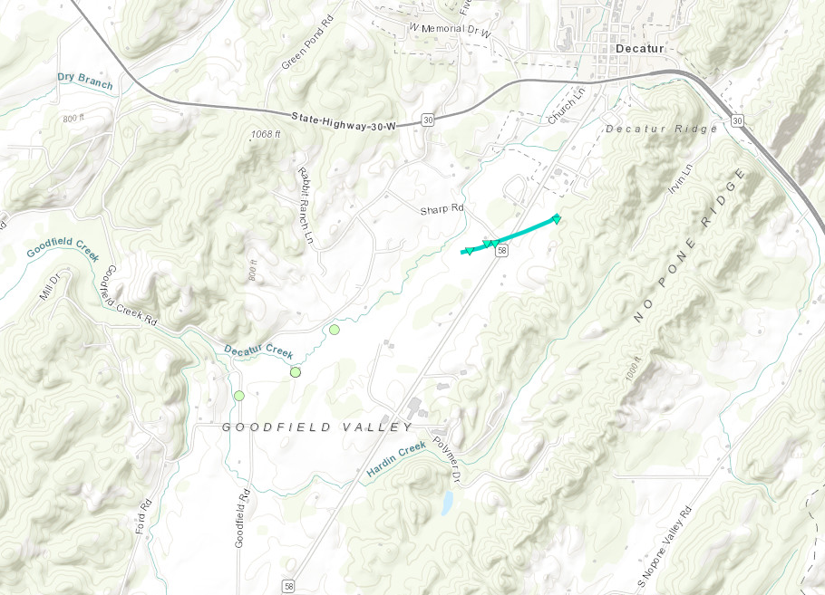 
|
||||||||||||||||
|
Tornado - 5 WSW Dandridge, TN
Track Map 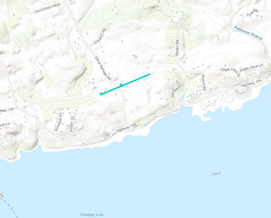
|
||||||||||||||||
|
Tornado - 1 SE Baneberry, TN
Track Map 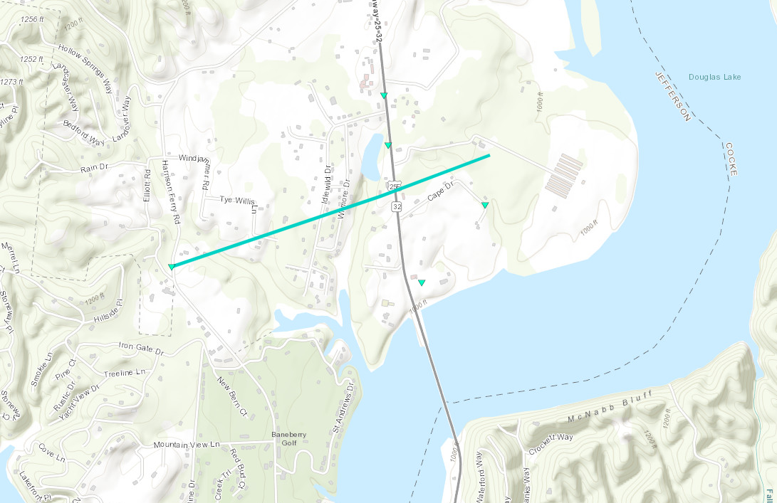
|
||||||||||||||||
The Enhanced Fujita (EF) Scale classifies tornadoes into the following categories:
| EF0 Weak 65-85 mph |
EF1 Moderate 86-110 mph |
EF2 Significant 111-135 mph |
EF3 Severe 136-165 mph |
EF4 Extreme 166-200 mph |
EF5 Catastrophic 200+ mph |
 |
|||||
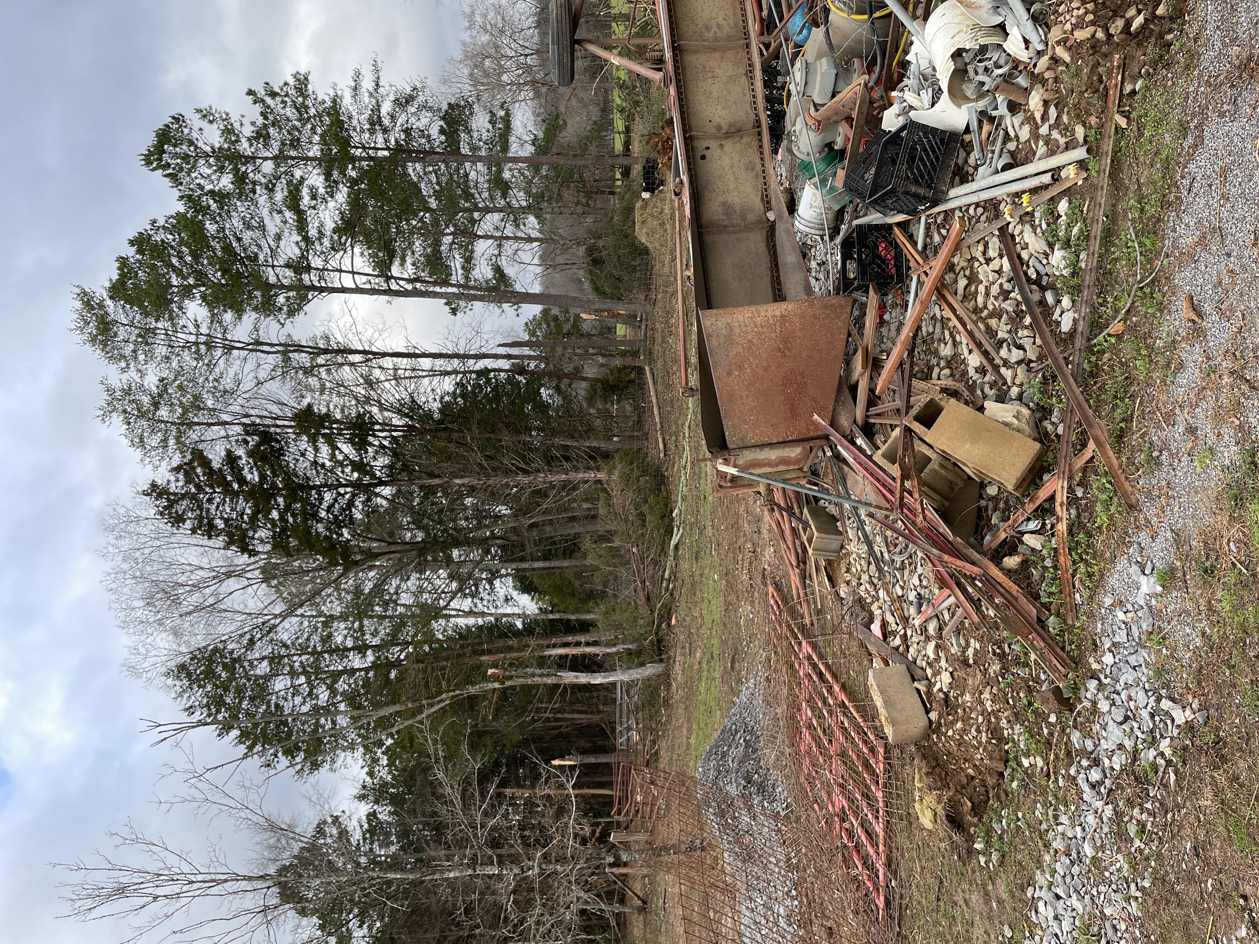
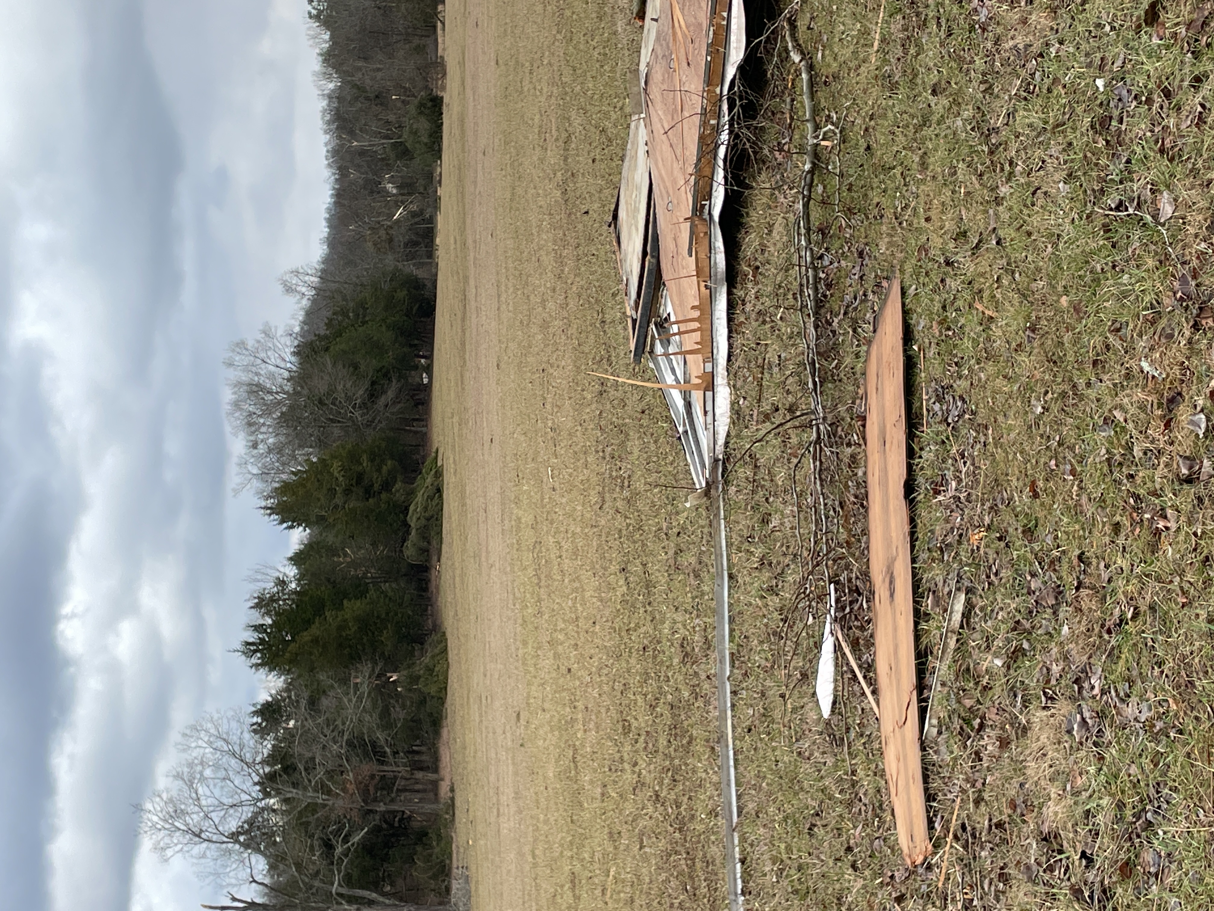
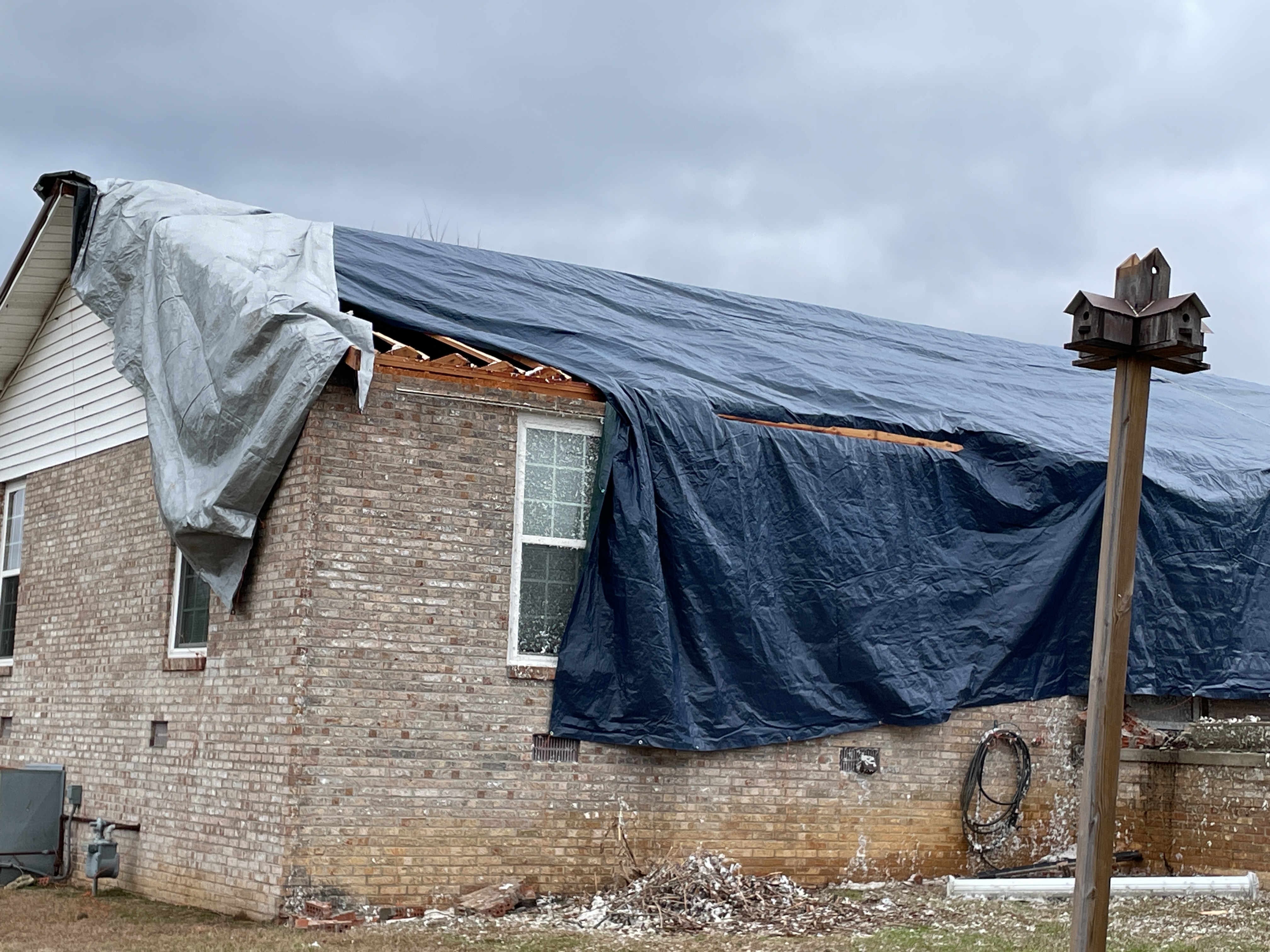
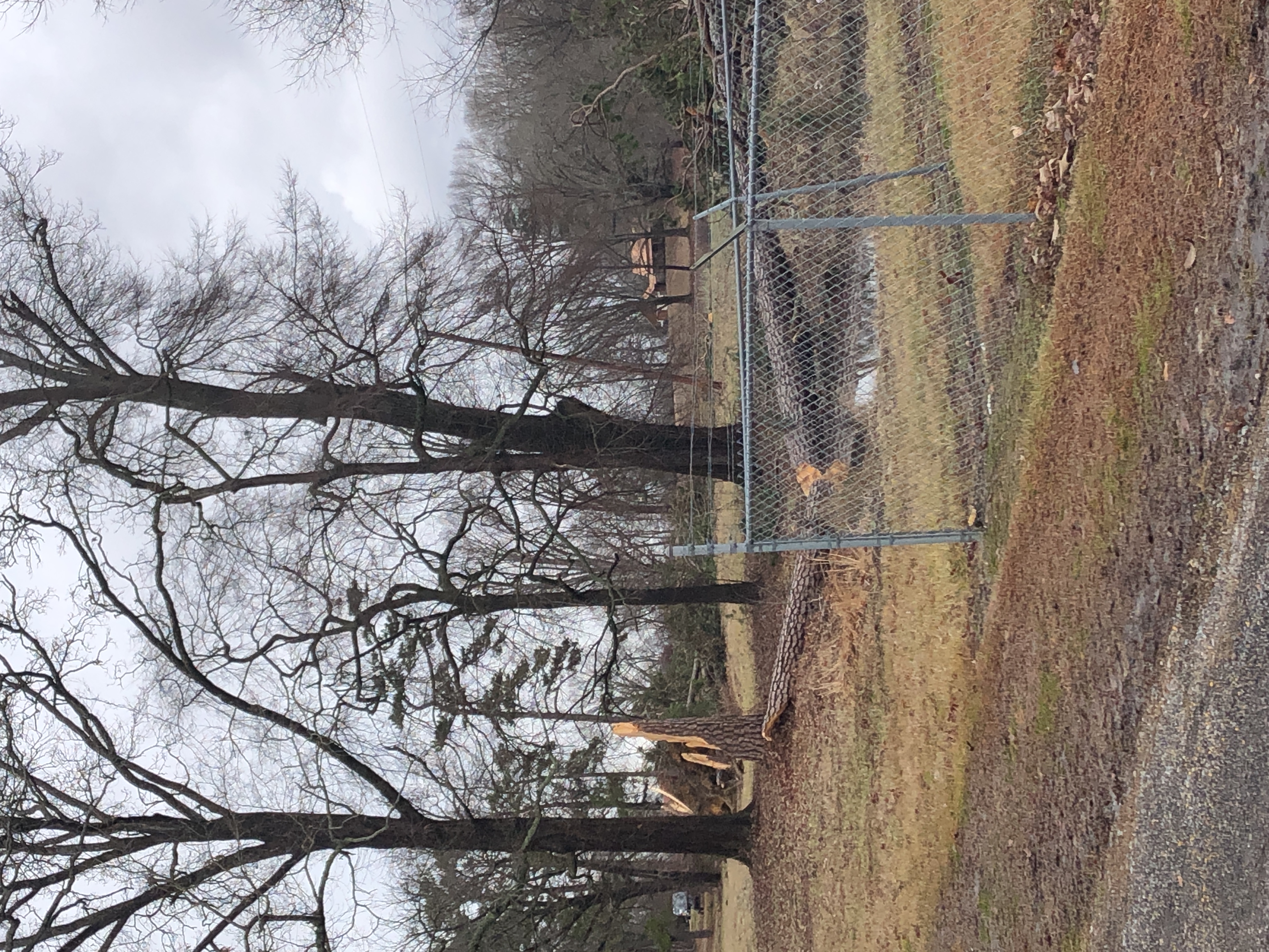
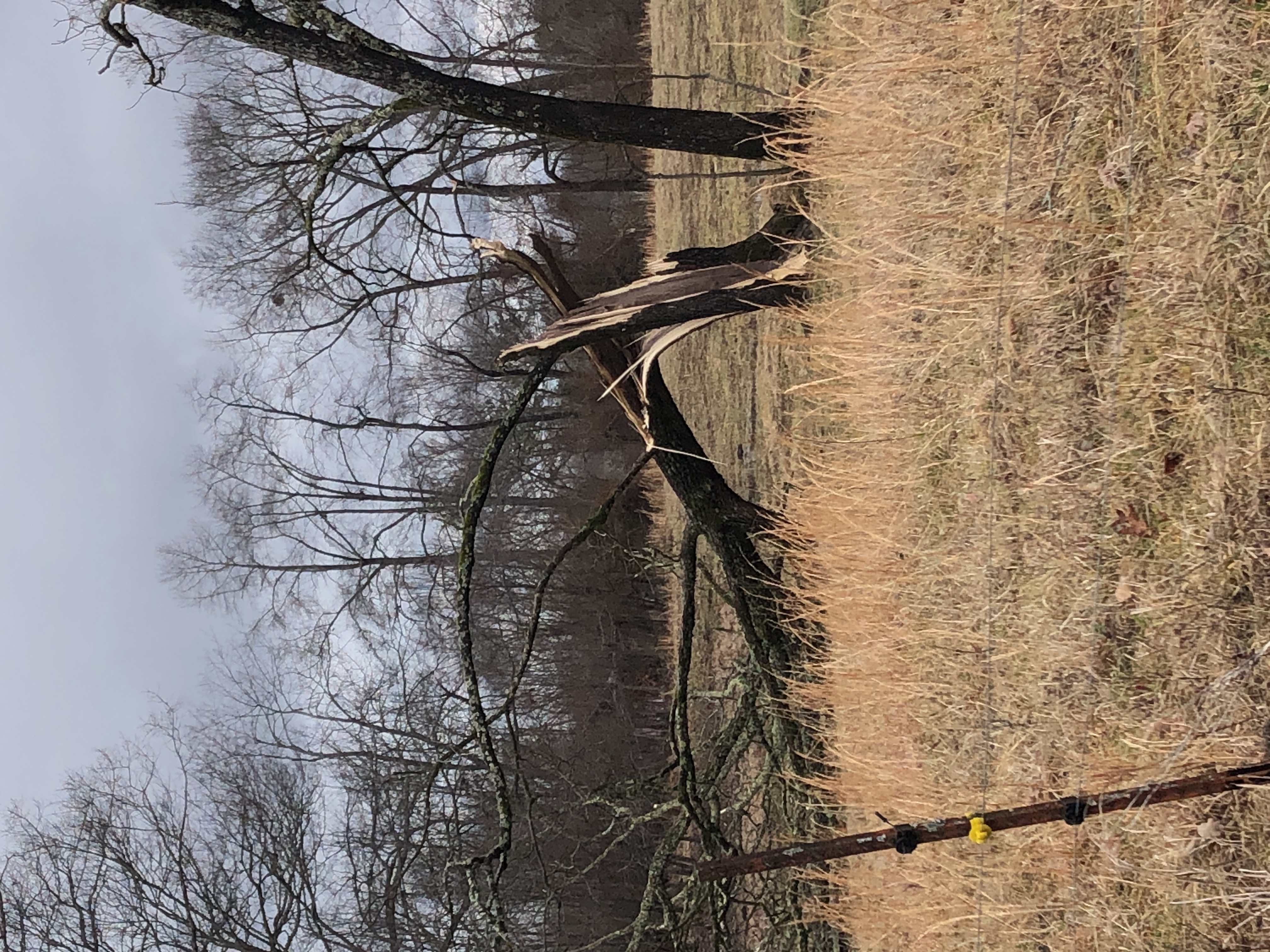
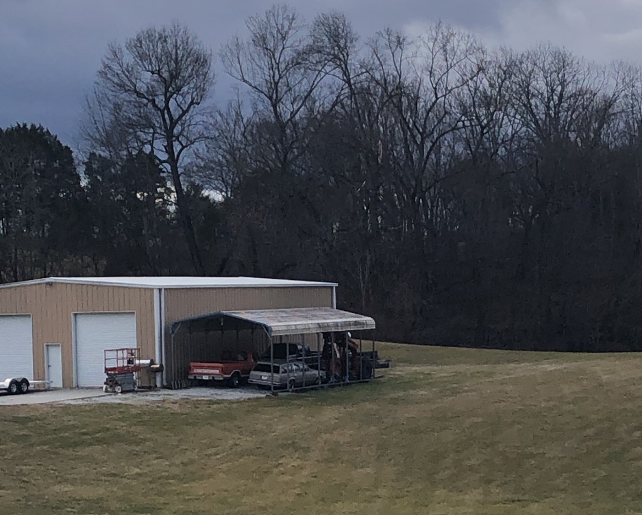
Damage Photos
The following photos were taken by NWS Morristown during the damage surveys in Meigs and Jefferson Counties.
 |
 |
 |
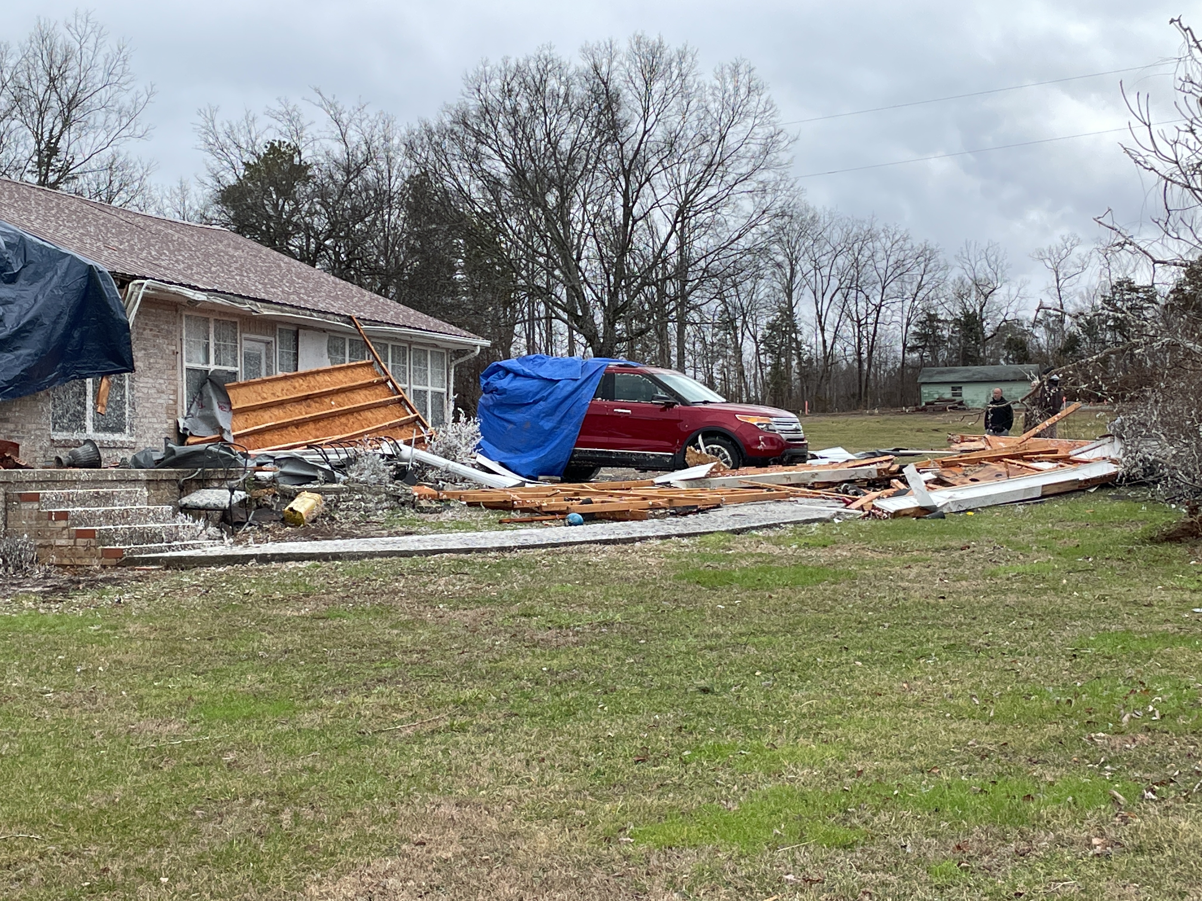 |
| Damage from the Meigs County NWS Survey | Damage from the Meigs County NWS Survey | Damage from the Meigs County NWS Survey | Damage from the Meigs County NWS Survey |
 |
 |
 |
| Damage from the Jefferson County/Baneberry NWS Survey | Damage from the Jefferson County/Baneberry NWS Survey | Damage from the Jefferson County/Dandridge NWS Survey (large tree limbs broken) |
Radar
 |
 |
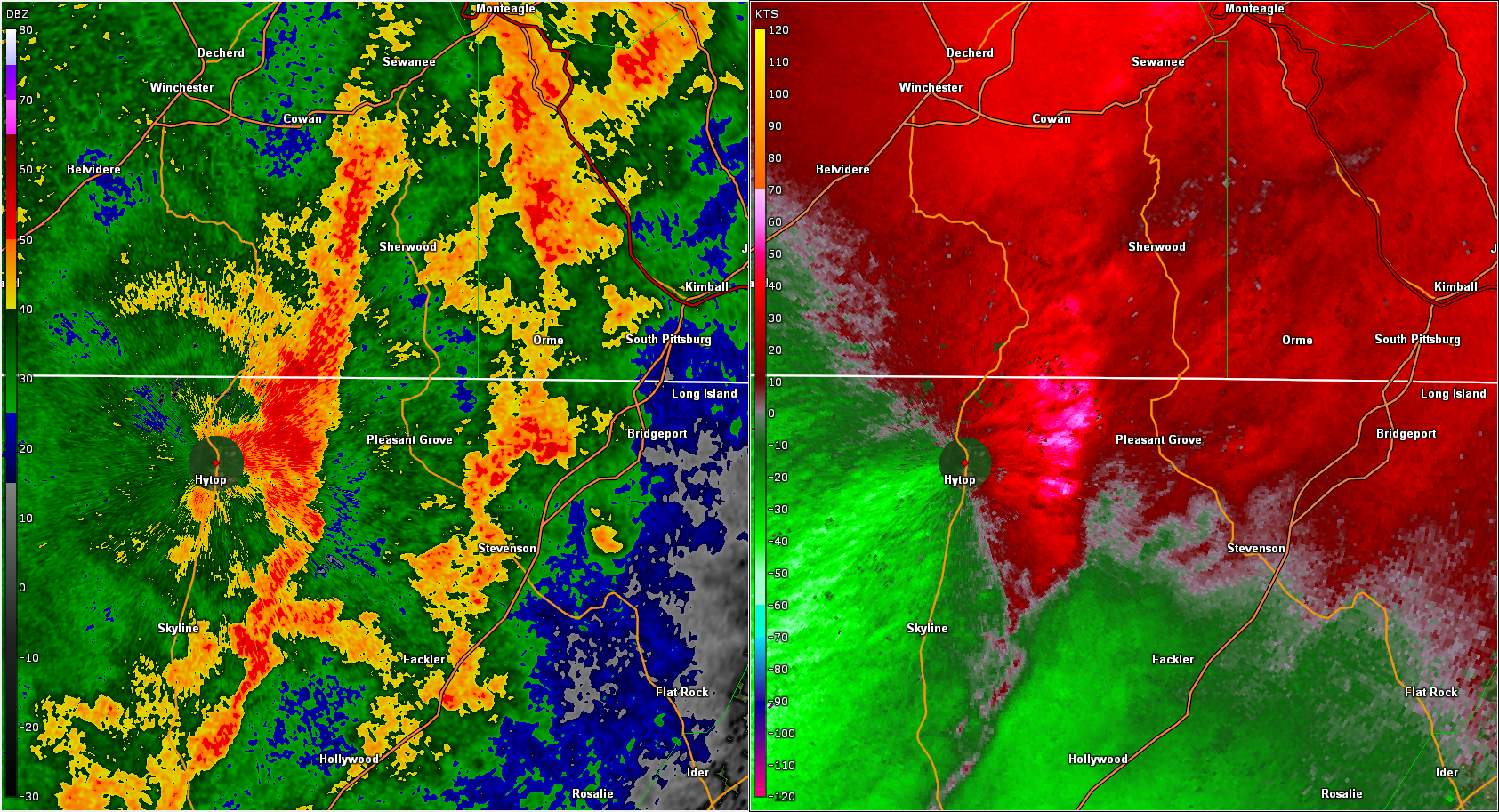
| Figure 1: Base Reflectivity and Base Velocity from HTX Radar at 9:46 CST / 10:46 EST | Figure 2: Base Reflectivity and Storm-Relative Velocity from HTX Radar at 10:49 CST / 11:49 EST |
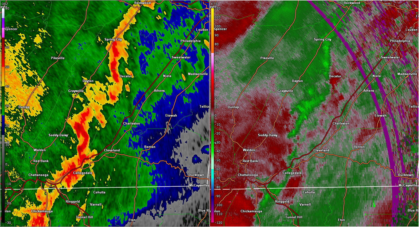
As the line of storms moved over the KHTX radar, located in Hytop, AL (Figure 1), outbound velocities of 60-65 kt were detected in the base velocity product (bright pink colors between Hytop and Pleasant Grove in the right half of the image). These wind speeds prompted a Severe Thunderstorm Warning to be issued for Marion and Sequatchie counties. Straight-line winds from the storm blew down several trees as it moved across Marion and Sequatchie counties.
A segment along the line of storms developed a bow structure as it moved across Hamilton County (Figure 2). In the reflectivity image on the right, this bow is located just north of Collegedale. This bow structure prompted a Severe Thunderstorm Warning, and numerous trees were blown down in Bradley County. At the same time, a less obvious bow structure was located near Decatur. The storm-relative velocity image on the right shows weak and broad rotation in this area. However, the radar beam from the KTX radar is located over 7,300 feet above the ground at this location, so it is likely not detecting the weak and shallow tornado that developed near Decatur. An NWS survey team determined that an EF-0 tornado briefly touched down and damaged some homes near Decatur.
 |
 |
 |
| Figure 3: Base Reflectivity and Storm-Relative Velocity from MRX Radar at 1:14 PM EST | Figure 4: Base Reflectivity and Storm-Relative Velocity from MRX Radar at 1:26 PM EST | Figure 5: Animated GIF of MRX Radar |
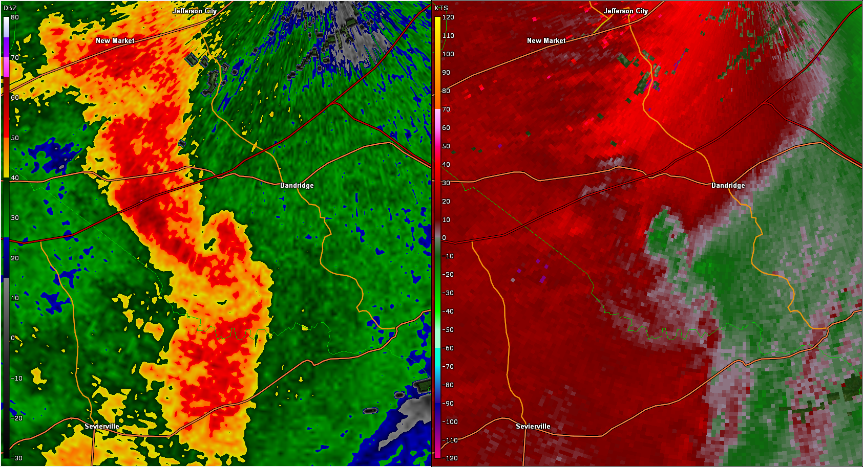
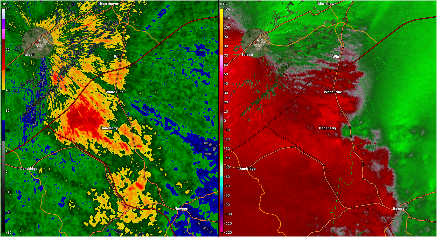
The radar image in Figure 3 shows the storm that produced the EF-0 tornadoes in Jefferson County. A segment of the line of storms began to develop a bow structure as it moved across Sevier County, where straight-line winds blew down trees. As it moved into Jefferson County, the southern end of the bow began to develop rotation. Due to the close proximity of this storm to the KMRX radar, we are able to view this storm at very low levels, just a few hundred feet above the ground, and the rotation pattern stands out in the reflectivity and velocity images. The storm-relative velocity product on the right shows weak but tight rotation, with winds moving toward the radar (green) directly beside winds moving away from the radar (red). In the reflectivity image on the left, the rotation is evident in the pronounced hook just southwest of Dandridge. An NWS survey team determined that an EF-0 tornado touched down near Douglas Lake just after this radar image.
The storm continued to show rotation on radar as it tracked northeast and crossed Interstate 40. An NWS survey team determined that an EF-0 tornado touched down and produced some tree damage as the storm crossed Highway 25E, just north of the Baneberry Golf Course.
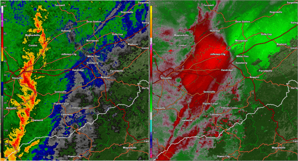
An animated gif showing the evolution of the line of storms, and the development of a bow structure and rotation on the southern end of the bow as it moved through Sevier and Jefferson counties is shown in Figure 5.
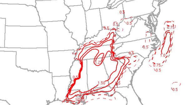
Storm Reports Map
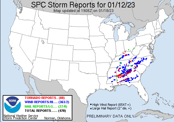
Local Storm Reports
*This summary does not include the tornadoes that were confirmed the next day.

..TIME...   ...EVENT...      ...CITY LOCATION...     ...LAT.LON...
..DATE...   ....MAG....      ..COUNTY LOCATION..ST.. ...SOURCE....
            ..REMARKS..

1101 AM     TSTM WND DMG     5 NE GRIFFITH CREEK     35.34N 85.49W
01/12/2023                   SEQUATCHIE         TN   911 CALL CENTER

            CORRECTS PREVIOUS TSTM WND DMG REPORT FROM 5
            NE GRIFFITH CREEK. SEVERAL REPORTS OF TREES
            DOWN COUNTY WIDE.

1209 PM     TSTM WND DMG     4 W CLEVELAND           35.18N 84.93W
01/12/2023                   BRADLEY            TN   PUBLIC

            TREES DOWN.

1245 PM     TSTM WND GST     2 N ALCOA               35.82N 83.98W
01/12/2023  M69 MPH          BLOUNT             TN   ASOS

            CORRECTS PREVIOUS NON-TSTM WND GST REPORT
            FROM 2 N ALCOA. ASOS STATION KTYS KNOXVILLE
            MCGHEE TYSON.

1254 PM     TSTM WND DMG     1 E LAKE FOREST         35.93N 83.86W
01/12/2023                   KNOX               TN   AMATEUR RADIO

            TREE WAS BLOWN DOWN ONTO POWER LINES AND IS
            BLOCKING THE ROAD.

1255 PM     TSTM WND DMG     MAYNARDVILLE            36.24N 83.80W
01/12/2023                   UNION              TN   911 CALL CENTER

            WIDESPREAD TREES DOWN ACROSS THE COUNTY.

0103 PM     TSTM WND DMG     1 ENE TOWNSEND          35.68N 83.74W
01/12/2023                   BLOUNT             TN   911 CALL CENTER

            REPORT OF TREES DOWN ACROSS BLOUNT COUNTY.

0110 PM     TSTM WND DMG     4 E KODAK               35.96N 83.56W
01/12/2023                   SEVIER             TN   AMATEUR RADIO

            TREE DOWN BLOCKING ROBERTS ROAD AT SUNRISE
            BLVD.

0117 PM     TSTM WND GST     3 SW DANDRIDGE          36.01N 83.43W
01/12/2023  M60 MPH          JEFFERSON          TN   TRAINED SPOTTER

            SHINGLES MISSING FROM ROOF AND ONE LARGE
            TREE BLOWN DOWN.

0120 PM     TSTM WND GST     DANDRIDGE               36.02N 83.43W
01/12/2023  E70 MPH          JEFFERSON          TN   TRAINED SPOTTER

            NEAR HIGHWAY 92.

0154 PM     TSTM WND DMG     TUSCULUM                36.17N 82.76W
01/12/2023                   GREENE             TN   BROADCAST MEDIA

            SHINGLES WERE BLOWN OFF HOUSES AND TREES
            KNOCKED DOWN IN THE TUSCULUM AREA.

0219 PM     TSTM WND GST     TRI-CITY AIRPORT        36.48N 82.40W
01/12/2023  M62 MPH          SULLIVAN           TN   ASOS

            CORRECTS PREVIOUS NON-TSTM WND GST REPORT
            FROM TRI-CITY AIRPORT. ASOS STATION KTRI
            TRI-CITIES AIRPORT.

0235 PM     TSTM WND DMG     1 W ABINGDON            36.71N 81.99W
01/12/2023                   WASHINGTON         VA   911 CALL CENTER

            WIDESPREAD TREES DOWN ACROSS THE COUNTY VIA
            MULTIPLE DIFFERENT REPORTS.
Environment
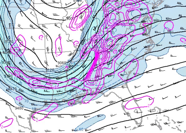
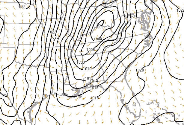
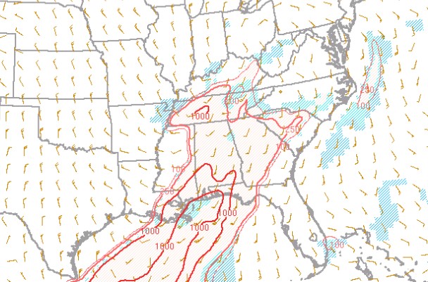
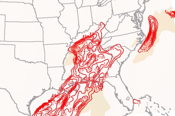
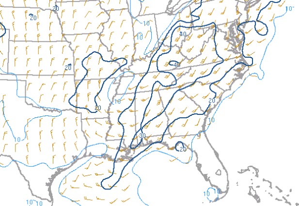
A strong long-wave upper trough was across the midsection of the nation with several jet streaks rotating around the base of the trough. The most important features were a 130 knot jet over Mississippi into the western Tennessee valley and another 110 knot jet across the western Ohio valley. These features produced strong large-scale ascent over the Tennessee valley into the southern Appalachians.
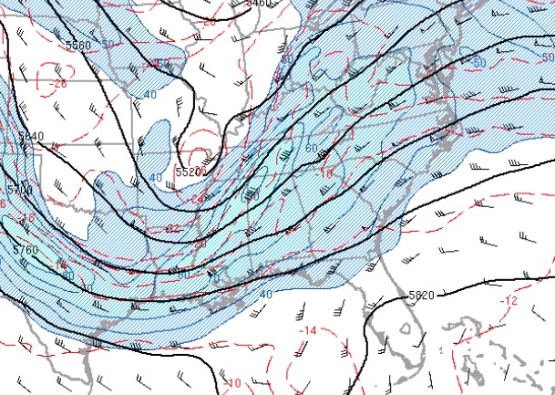
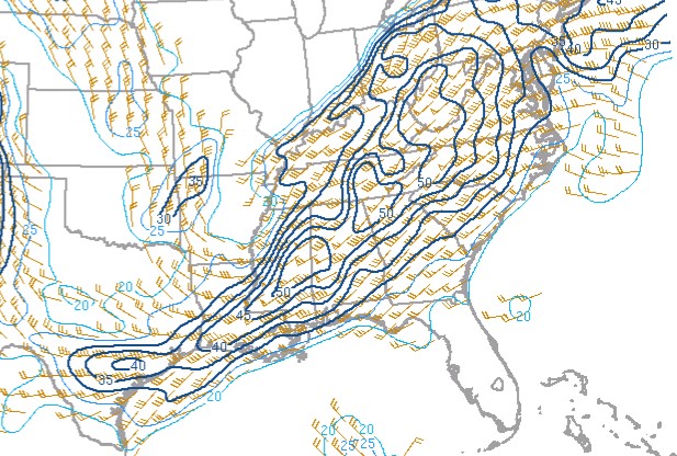
The 500mb analysis of heights, temperature and wind showed cold air advection aloft increasing the instability over the Tennessee valley. The 850mb analysis showed a south to southwest low-level jet of 45-50 knots. This low-level jet pulled abundant moisture and instability into the Tennessee valley and southern Appalachians.
 |
 |
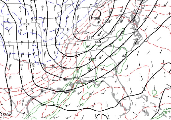 |
| Figure 1: 300mb Heights, Divergence, and Winds at 1700 UTC, 12 Jan 2023 | Figure 2: 500mb Heights, Temperature, and Winds at 1700 UTC, 12 Jan 2023 | Figure 3: 850mb Heights, Temperature, and Winds at 1700 UTC, 12 Jan 2023 |
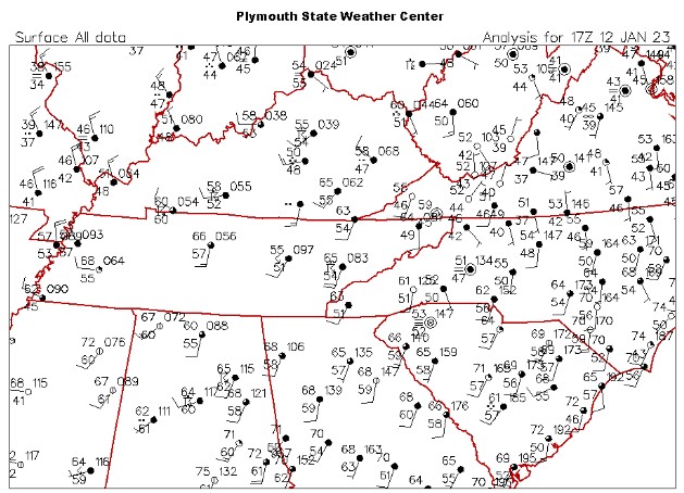
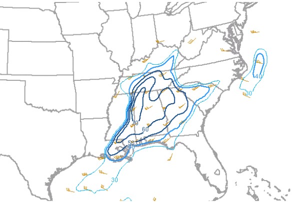
The strong low-level jet pulled a warm frontal boundary northeast across the Great Tennessee valley. Surface analysis showed increasing southerly winds along with higher temperatures and dewpoints behind this boundary. At 1600 UTC, southerly winds were quite strong at TYS with dewpoints climbing into the middle 50s while generally calm winds were noted at TRI with dewpoints in the middle and upper 40s.
This boundary was located between Newport and Greeneville Tennessee from Noon and 2 pm which is near the time of the Jefferson county tornadoes. This boundary likely contributed to the potential of tornadoes in this region.
 |
 |
 |
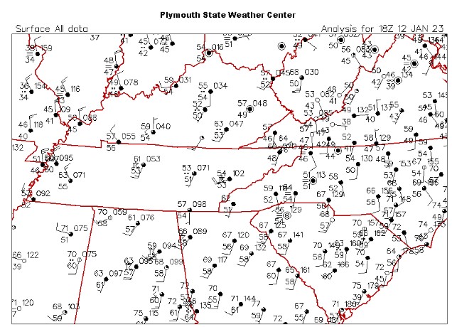 |
| Figure 4: MSL Pressure and Surface Wind at 1700 UTC, 12 Jan 2023 | Figure 5: Surface Station Plot at 1600 UTC, 12 Jan 2023 | Figure 6: Surface Station Plot at 1700 UTC, 12 Jan 2023 | Figure 7: Surface Station Plot at 1800 UTC, 12 Jan 2023 |
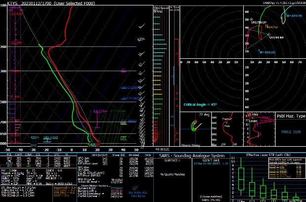
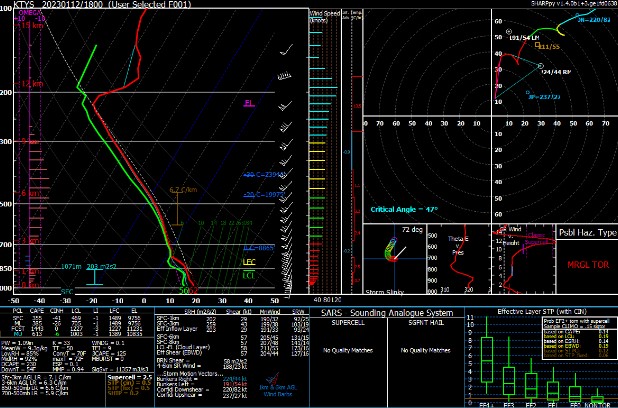
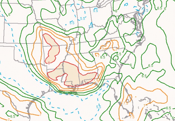
The RAP model soundings from near Knoxville, Tennessee between 1700 and 1900 UTC, 12 January 2023 showed a low CAPE and high shear environment over the central valley. MLCAPE values were only around 300-400 J/Kg. Steep mid-level lapse rates were noted with values near 7 degrees. The 0-3 km CAPE increased to 125-150 J/Kg which is quite favorable for the inflow instability into the convection. The Lifting Condensation Level (LCL) is favorable with values near 700 meters.
 |
 |
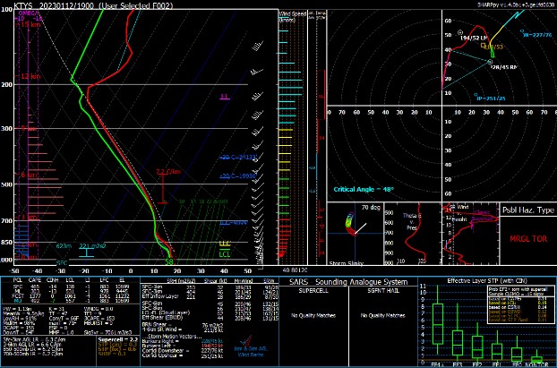 |
| Figure 7: RAP Model Sounding Initialization at 1700 UTC, 12 Jan 2023 | Figure 8: RAP Model Sounding Initialization at 1800 UTC, 12 Jan 2023 | Figure 9: RAP Model Sounding Initialization at 1900 UTC, 12 Jan 2023 |
The Supercell Composite Parameter (SCP) was between 2 and 4 and the Significant Tornado Parameter (STP) was around 0.5. Overall, the composite parameters depicted an environment conducive to supercell development with low-end potential of tornadoes. However, given the low CAPE and high SHEAR environment the low CAPE values will often limit the STP and SCP. The Severe Hazards in Environments with Reduced Buoyancy (SHERB) parameter is a good to use to determine the potential of tornadoes in low CAPE and high SHEAR environments.
The SHERBE is a normalized composite parameter intended to identify the potential for significant damaging winds and tornadoes in low CAPE, high shear environments typical of the southeast U.S. cool season.
SHERBE = (LR0-3/5.2) * (LR75/5.6) * (EBWD/27)
where the lapse rate (LR) terms apply to the 0-3 km and 700-500 mb layers (C km-1), respectively, and the EBWD is the effective bulk wind difference (m s-1).
This formulation of SHERBE inherently accounts for at least weak buoyancy by utilizing the EBWD (which requires an effective inflow layer), which tends to reduce false alarms compared to the original version of SHERB using the fixed-layer 0-3 km shear. Still, the parameter can suggest an over-estimate of the severe weather threat in areas of relatively steep 0-3 km lapse rates which overlap with the 700-500 mb layer in the vertical.
 |
 |
 |
| Figure 10: MLCAPE and CIN at 1700 UTC, 12 Jan 2023 | Figure 11: 0-3km CAPE at 1700 UTC, 12 Jan 2023 | Figure 12: Mid-Level Lapse Rates (700-500mb) at 1700 UTC, 12 Jan 2023 |
 |
 |
 |
| Figure 13: 0-1km Shear at 1700 UTC, 12 Jan 2023 | Figure 14: 0-3km Shear at 1700 UTC, 12 Jan 2023 | Figure 15: Effective Shear at 1700 UTC, 12 Jan 2023 |
 |
 |
 |
| Figure 16: Effective Storm Relative Helicity at 1700 UTC, 12 Jan 2023 | Figure 17: Supercell Composite Parameter (SCP) at 1700 UTC, 12 Jan 2023 | Figure 18: Significant Tornado Parameter (STP) at 1700 UTC, 12 Jan 2023 |
 |
 |
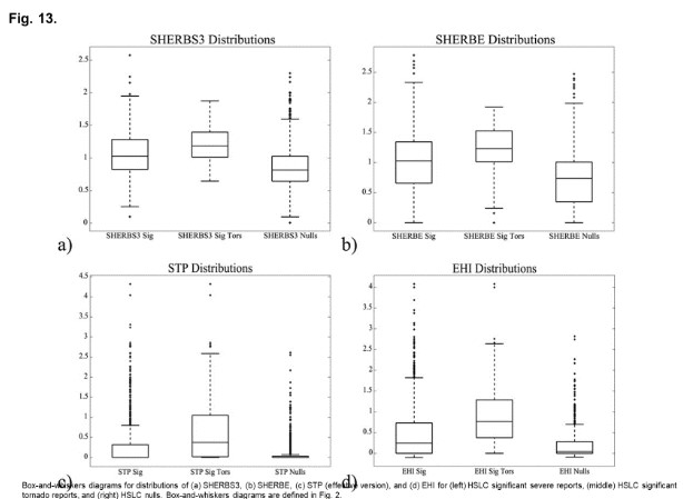 |
| Figure 19: SHERB3 (using the 0–3-km shear magnitude) at 1700 UTC, 12 Jan 2023 | Figure 20: SHERBE (using the effective shear magnitude) at 1700 UTC, 12 Jan 2023 | Figure 21: Box and Whisker Plots of SHERBE, STP, and EHI |
 |
Media use of NWS Web News Stories is encouraged! Please acknowledge the NWS as the source of any news information accessed from this site. |
|


 Local Radar
 Huntsville Radar
 Regional Satellite
 Graphical Forecast
 Weather Map