Overview
Multiple rounds of showers and thunderstorms occurred from the morning hours of July 28th until the evening. During the morning, the threat of strong to severe storms was in southwest Virginia and northeast Tennessee, with a gradual southward shift of the severe threat through the day. The storms affected areas east of I-75. Initial storms in the morning spread in from eastern Kentucky along a boundary left by a dying overnight storm complex. A cold front stretching west to east moving south proved to be the main focus for storm development in the central and southern Tennessee Valley during the mid-afternoon and evening. Many of the strongest storms showed supercell characteristics. Straight-line wind damage was the primary threat from the storms, with a few reports of golfball-sized and quarter-sized hail. Photos and videos were received of funnel clouds in Greene County, Blount County, and Cherokee County. So far, one tornado was confirmed, an EF-1 in southeast Greene County to the south of Camp Creek. This marks the first confirmed July tornado in our area since 2015. Flash flooding occurred in areas where multiple storms tracked over the same locations.
Photos & Video
.png) |
.png) |
.png) |
| Satellite Data in Southeast Greene County before the Event (May 20, 2026) |
Satellite Data in Southeast Greene County After the Event (August 25, 2026) | Satellite Data in Southeast Greene County After the Event Notated with Damage (August 25, 2026) |
Radar and Satellite
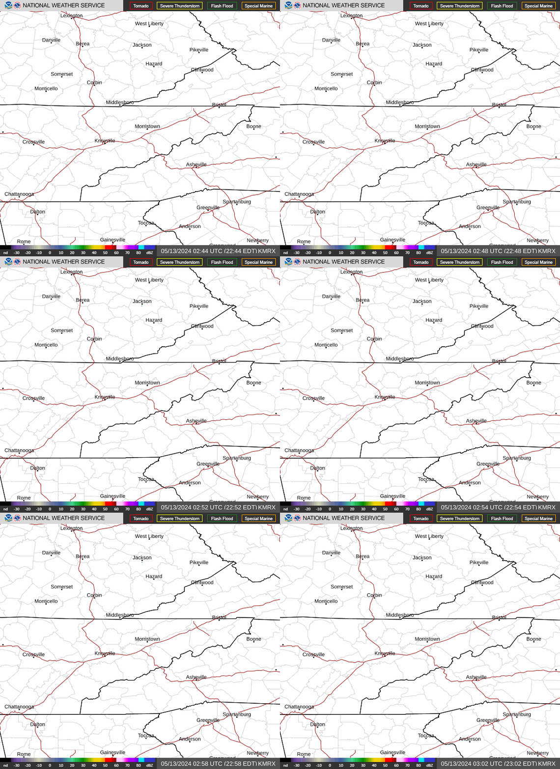
For the following images, classic radar reflectivity is on the left. Doppler velocity is on the right. For velocity, red is air moving away from the radar, green is air moving towards radar, and gray is interpreted as air moving perpendicular to the radar beam.
Figure 1: Church Hill TN Storm: Radar depicting reflectivity on the left and doppler velocity on the right. Our primary focus was on a strong apparent circulation depicted to the northwest of Church Hill, TN associated with a severe supercell thunderstorm. Two white rings depict where the velocity coincides with the reflectivity. Inbound (green) and outbound (red, pink, or orange) indicate which way the winds are going from the radar’s perspective. One difference between archival radar and live radar is the data frames loaded in real time, complicating analysis as each piece of radar data is scanned at slightly different times and locations.
There is a secondary supercell thunderstorm with its main rotation (indicated by cyan rings) south of Kingsport, TN. Pay attention to where in both storms the velocity couplet is located versus the reflectivity. Ideally the velocity signature is co-located, that is in the same location and time, as high reflectivity. This ensures the signature is more likely to be legitimate versus a radar artifact. Neither storm should be thought of as the ideal presentation, but at what point should a warning be sent or should it be withheld?
The initial signature in the Church Hill storm prompted a tornado warning. As time went on, the signature weakened and broadened and we eventually allowed the warning to expire. No tornado was confirmed with this thunderstorm, although a few trees were damaged or felled near Mount Carmel. This damage was caused by the thunderstorm’s own non-tornadic winds.
 |
 |
| Figure 1: Church Hill, TN at 4:03 PM EDT | Figure 2: Washington County, VA at 4:17 PM EDT |
Figure 2: Washington County, VA Storm: The tornado warned storm in Washington County, VA near Abingdon and Meadowview that moved towards Damascus. White rings again overlay over the reflectivity on the left, and doppler velocity on the right. This was an impressive thunderstorm, despite the distance from our radar in Morristown. Inbound winds were very light, as indicated by the grays, whereas outbound winds were quite strong (red, pink, orange). The signature persisted and we issued a tornado warning for it. An observer in Abingdon reported a funnel cloud with this storm. This storm’s rotation weakened notably after it crossed I-81 heading southeast. No tornado was confirmed. Eventually we received a report of non-tornadic damage from felled trees in Laurel Bloomery, TN as the storm crossed from VA into Johnson County TN and then into NC.
Figure 3: Greene County Storm: A severe warned rotating thunderstorm passed through Greeneville around 5:15 PM EDT. The warning on this storm had a “tornado possible” tag, to indicate the warning meteorologist was concerned a tornado could be possible, but was not convinced one was imminent. In the white circle on the left, a faint hook signature can be seen. But the velocity data on the right is very weak. The height of the radar beam here is 1800 feet. At 7,000 feet (not shown) the thunderstorm was rotating very strongly. Two separate observers in the Mosheim area looking towards Greeneville reported a rotating funnel cloud, and indeed a video of a funnel cloud was sent to us on Facebook. Those videos, with later evolution of the storm, would prompt a tornado warning later.
 |
 |
| Figure 3: Greene County at 5:19 PM EDT | Figure 4: Camp Creek in Greene County at 5:29 PM EDT |
Figure 4: Camp Creek in Greene County: Now the storm is rapidly becoming tornadic. This image has 3 arrows. The big green arrow is with inbound winds towards the Morristown radar, the red arrows are winds away from the Morristown radar. The big arrows are with winds that are likely associated with the storm’s overall mesocyclone, the big rotating core of the storm from which tornadoes spawn from. The smaller red arrow is displaced to the west of the larger velocity cores. From a storm’s perspective, the overall structure is likely indicative of what’s known as cyclonic convergence. The storm is making an earnest attempt to produce a tornado. At this point, the decision was made to elevate the severe thunderstorm warning to a tornado warning.
Figure 5: Camp Creek in Greene County: Now the tornado warned supercell thunderstorm is fully into the Camp Creek community in southeastern Greene County. The circulation has tightened up, with a very strong outbounds (red arrow) showing, aligned within the broader red/green of the low level mesocyclone. At this time stamp the hook echo is about to pass over Valk Industries and The Oaks Retreat Center. Speaking to a worker at the Retreat revealed no known wind damage here. Further to the north in the white circle is where notable wind damage occurred. However, the storm’s rotation did not pass through this portion of Camp Creek, this damage was caused by the severe thunderstorm’s main downdraft winds, which can be powerful enough to mimic tornado damage. In this case, a few trees were felled, a couple barns sustained major damage, and minor building damage was elsewhere observed.
 |
 |
| Figure 5: Camp Creek in Greene County at 5:33 PM EDT | Figure 6: Mountains of Greene County Tornado at 5:39 PM EDT |
Figure 6: Mountains of Greene County Tornado: Now we have arrived. Top Left is reflectivity, top right is doppler velocity, bottom right is “correlation coefficient”, and bottom left is called “probability of tornado debris (PTDS)”. We have arrived. We have strong reflectivity in the hook, the velocity couplet is bright green and bright red in close proximity indicating strong rotation, the correlation coefficient or CC has blues and light greens, indicating irregular shapes that are airborne, and the bottom left PTDS product depicts high confidence that the radar signature is tornadic debris. This signature was seen on multiple angles from the radar, which gave the warning team high confidence that a tornado was in progress in the mountains of Greene County. At 5:42 PM EDT we upgraded the warning to observed radar confirmed tornado. Shortly thereafter the storm exited into western North Carolina. Satellite and drone imagery depict a tornado occurred in the mountainous forests of EF-1 intensity, snapping trees as it progressed. We communicated our thoughts to the NWS office in Greenville-Spartanburg, who upgraded their matching tornado warning to observed as well. The storm produced an additional EF-0 tornado in Madison County, NC.
Figure 7: Southern Blount/Far Eastern Monroe County Storm: Now that we have our feet wet, we advance forward in time to very potent thunderstorms in southern Blount, far eastern Monroe Counties. These storms were quite tall and impressive on both satellite and from observers in Maryville observing from a distance! From our radar’s perspective, the storm top on this thunderstorm was 58,000 feet! Commercial airplanes typically cruise from 35,000 to 45,000 feet for comparison. Once again we see both a broader velocity signature and a tighter couplet indicating rotation. We issued a tornado warning based on this radar scan. This tornado would produce a highly photogenic wall cloud (rotating lowering underneath the base of the thunderstorm) and a funnel cloud. While no radar confirmed evidence of a tornado was noted, we are still analyzing data as of this writing as to our final opinion on the funnel cloud observed with this storm.
 |
 |
 |
| Figure 7: Southern Blount/Far Eastern Monroe County Storm at 7:01 PM EDT | Figure 8: Cherokee County, Andrews Storm at 7:55 PM EDT | Figure 9: Polk County at 8:24 PM EDT |
Figure 8: Cherokee County, Andrews Storm: Advance in time more and the earlier Blount/Monroe storm is crossing through western North Carolina. At this distance from the Morristown radar, the lowest radar beam height is 5,600 feet, which is not ideal for monitoring for tornadoes. Nevertheless, the radar signature at this time stamp was concerning enough with a tight velocity couplet to trigger a tornado warning for Cherokee County. We eventually issued another downstream tornado warning for Clay County as this storm progressed to the south. As of this writing, we are still analyzing a funnel video and storm damage to determine what happened with this storm.
Figure 9: Polk County: Finally, the Polk County storm. The lowest beam height on Morristown radar is just over 8,000 feet, and the lowest off of Hytop Alabama radar is just over 9,000 feet. Despite Morristown having a better beam height, the better velocity signature appeared on the slightly higher Hytop radar scan. Unfortunately it is very challenging to infer anything regarding the low levels of the storm at these heights without ground truth from observers. With both radars as data, we issued a tornado warning for this storm shortly after this image.
These satellite images are from the GOES-East geostationary satellite. They are from the ABI imager onboard the satellite, specifically Band-13 or longwave infrared. This band is useful for monitoring thunderstorms and how tall, and by inference, severe, they are. Each image is labeled for time of the satellite’s picture and location of the storms underneath. Compare and contrast!
 |
 |
 |
| Figure 10: GOES-East Band 13 at 5:40 PM EDT | Figure 11: GOES-East Band 13 at 7:20 PM EDT | Figure 12: GOES-East Band 13 at 8:10 PM EDT |
Figure 10: GOES-East Band 13: Tornado is observed on radar in the Greene County mountains as the parent storm enters western North Carolina.
Figure 11: GOES-East Band 13: Storms are in far southern Blount County and far eastern Monroe County along the Little Tennessee River about to enter Graham and far western Swain Counties in western North Carolina.
Figure 12: GOES-East Band 13: Storm complex is making its way through Clay, Cherokee, and far southern Graham Counties in western North Carolina. The front of the storm is at Hayesville when this satellite image is recorded.
Tornado
On the afternoon of July 28th, a southeast moving supercell thunderstorm spawned a short-lived tornado in the Camp Creek area. The tornado was first identified via the Tornado Debris Signature algorithm on radar. Due to the very rural nature of the area where the tornado occurred, detailed analysis was impossible. However, with the use of drone imagery and satellite date the office was able to determine that a defined path of tree damage occurred from just south of Camp Joshua Lane across Norton Spring and into the higher terrain of Green Mountain. Based on satellite imagery, the path width was estimated to be a maximum of around 300 yards with a maximum intensity around 95 mph.
..TIME...   ...EVENT...      ...CITY LOCATION...     ...LAT.LON...
..DATE...   ....MAG....      ..COUNTY LOCATION..ST.. ...SOURCE....
            ..REMARKS..

0535 PM     Tornado          3 S Camp Creek          36.05N 82.76W
07/28/2026                   Greene             TN   NWS Storm Survey

            An EF1 tornado occurred in a forested area
            of southeast Greene County. Satellite
            imagery indicated a path width of
            approximately 300 yards and length of 1.5
            miles. No structures were impacted.
            Estimated winds were 95 mph.
Storm Reports
W - Damaging winds
H - Hail
T - Tornado and/or funnel cloud

..TIME...   ...EVENT...      ...CITY LOCATION...     ...LAT.LON...
..DATE...   ....MAG....      ..COUNTY LOCATION..ST.. ...SOURCE....
            ..REMARKS..

0523 PM     Tstm Wnd Dmg     2 E Camp Creek          36.08N 82.73W
07/28/2026                   Greene             TN   Public

            Numerous trees down.
0520 PM     Tstm Wnd Dmg     1 NNE Erwin             36.16N 82.40W
07/28/2026                   Unicoi             TN   Public

            Several trees down.
0505 PM     Tstm Wnd Dmg     1 WNW Greeneville       36.17N 82.84W
07/28/2026                   Greene             TN   Public

            Several trees down.
0500 PM     Tstm Wnd Dmg     1 SW Laurel Bloomery    36.55N 81.77W
07/28/2026                   Johnson            TN   Public

            Trees down.
0450 PM     Tstm Wnd Dmg     3 S Watauga             36.32N 82.30W
07/28/2026                   Carter             TN   Law Enforcement

            Several trees down across the county.
0442 PM     Hail             1 NE Murphy             35.10N 84.02W
07/28/2026  E1.25 Inch       Cherokee           NC   Public

            Quarter sized hail to slightly larger hail
            in Murphy.

0440 PM     Tstm Wnd Dmg     3 NNW Johnson City      36.37N 82.38W
07/28/2026                   Washington         TN   Amateur Radio

            Power lines down State of Franklin Road and
            Bristol Highway.
0425 PM     Funnel Cloud     1 ESE Abingdon          36.70N 81.96W
07/28/2026                   Washington         VA   Trained Spotter

            Funnel Cloud reported.
0425 PM     Lightning        3 N Bluff City          36.50N 82.27W
07/28/2026                   Sullivan           TN   Amateur Radio

            Trained spotter report of: Power pole struck
            by lightning and exploded near the
            intersection of 394 and 11E in Bristol
            Impacting traffic.
0420 PM     Tstm Wnd Dmg     2 SSW Mount Carmel      36.54N 82.67W
07/28/2026                   Hawkins            TN   Public

            Several trees down.
0420 PM     Tstm Wnd Dmg     Blountville             36.54N 82.32W
07/28/2026                   Sullivan           TN   Amateur Radio

            Minor roof damage at Blountville Sheriff
            Office.
0535 PM     Tornado          3 S Camp Creek          36.05N 82.76W
07/28/2026                   Greene             TN   NWS Storm Survey

            An EF1 tornado occurred in a forested area
            of southeast Greene County. Satellite
            imagery indicated a path width of
            approximately 300 yards and length of 1.5
            miles. No structures were impacted.
            Estimated winds were 95 mph.
0415 PM     Tstm Wnd Dmg     2 S Pound               37.10N 82.60W
07/28/2026                   Wise               VA   Public

            Several trees down.
0410 PM     Tstm Wnd Dmg     2 SE Lebanon            36.88N 82.05W
07/28/2026                   Russell            VA   Public

            Several trees down.
0315 PM     Tstm Wnd Dmg     Howard Quarter          36.47N 83.41W
07/28/2026                   Claiborne          TN   Public

            Trees Down.
0251 PM     Tstm Wnd Dmg     3 E Bybee               36.05N 83.13W
07/28/2026                   Cocke              TN   Law Enforcement

            A few trees down.
1011 AM     Tstm Wnd Dmg     4 ENE Rutledge          36.29N 83.46W
07/28/2026                   Grainger           TN   Law Enforcement

            Several trees down.
0947 AM     Hail             4 ESE Thorn Hill        36.34N 83.36W
07/28/2026  E1.00 Inch       Grainger           TN   Public

            Quarter sized hail reported near Thorn Hill
            with secondhand reports of wind damage from
            neighbors. Time estimated radar.
Environment
The presence of multiple boundaries across East Tennessee led to a very complicated setup for strong to severe storms throughout the day. A remnant boundary from a decaying storm system brought some showers and storms from eastern Kentucky into southwest Virginia in the morning. These storms gradually dissipated as they entered northeast Tennessee. These storms can be seen in the first few frames of the radar loop in Figure 1.
 |
 |
 |
| Figure 1: Radar Obs Warning Loop | Figure 2: Visible Satellite Loop | Figure 3: Visible Satellite with Boundaries |
Rain and cloud cover from the morning storms led to a boundary forming across northeast Tennessee, aligned north to south, approximately from Jonesville, VA to Morristown, TN to Newport, TN. Parts of the Tennessee Valley to the west of the boundary warmed into the lower to mid 90s in the afternoon, while temperatures east of the boundary were slower to rise due to the morning rain and clouds, peaking in the lower to mid 80s. The satellite image loop in Figure 2 shows SW Virginia and NE Tennessee covered by clouds in the morning, followed by decreasing clouds by the afternoon. In addition, there are multiple boundaries seen in the satellite imagery, oriented from east to west, moving from north to south from Kentucky into Tennessee. These boundaries are identified by lines of clouds building along the boundaries. As these boundaries move south across East Tennessee through the afternoon, they initiate new storms. Figure 3 shows the location of these boundaries (red dashed line) and the cold front (blue line with blue triangles).
The north-to-south boundary was reinforced by the next round of storms that developed in the afternoon. Figure 4 shows an analysis of temperatures (red contours) around 6 pm, and there was a tight gradient of temperatures across northeast Tennessee. The afternoon storms brought cooler temperatures to the east side of the boundary, which made the boundary stronger and pushed it toward the southwest. The strongest storms of the day, the storms that produced rotation and possible tornadoes in Greene and Blount counties, rode along this boundary. The presence of boundaries is very important to the formation of tornadoes.
 |
 |
 |
| Figure 4: Surface MSLP, Temperatures, Dew Points, and Winds | Figure 5: 300mb Jet Circulation | Figure 6: Surface-Based CAPE |
An upper jet contributed to the formation and intensity of storms during the afternoon and evening. Figure 5 shows a jet from northwest to southeast across northern Illinois, Indiana, and eastern Kentucky (blue shaded area). Often the exit region of a jet is a place where there is enhanced lifting of air through the atmosphere. This forcing is shown in Figure 5 by the purple contours. The lifting motion from this jet is strongest over East Tennessee and southwest Virginia.
There was plenty of instability to fuel these storms during the afternoon. Instability can be measured by Convective Available Potential Energy (CAPE), which is shown at 5 PM in Figure 6. Values of CAPE were in the 4000-5000 J/kg range in central and southern portions of the Tennessee Valley, which is very high. There is a sharp difference in instability from the central Valley to the Tri-Cities area, which indicates the presence of a boundary (created by the morning rain and clouds). In addition, a southwest wind up the Valley was feeding this very unstable air into northeast Tennessee near the boundary, where the storms were located.
On a normal summer day, wind shear through the atmosphere is very weak. Most summertime thunderstorms that develop will dissipate as quickly as they form. However, shear was quite strong on this day. Shear allows for storms to maintain their longevity and intensity, as well as posing a higher potential for supercell thunderstorms that can produce tornadoes (if other conditions are favorable). Figure 7 shows shear values of 40-50 kt of shear through a deep layer of the atmosphere, which is unusually high for late July. Many storms on this day showed characteristics of supercells.
 |
 |
 |
| Figure 7: Effective Bulk Shear | Figure 8: Effective 0-1km SR Helicity | Figure 9: Effective Significant Tornado Parameter |
Having adequate wind shear in the lower levels of the atmosphere is an important ingredient in tornado formation. Storm-relative helicity is a measurement of how much shear is available for a storm to form a tornado. On this day, 0-1 km storm relative helicity values were high enough over eastern portions of East Tennessee to support tornadoes.
The Significant Tornado Parameter combines several ingredients that are necessary for tornado formation into one parameter. Values above 1 are favorable for tornado formation. On this day, values reached around 3 in eastern East Tennessee.
 |
Media use of NWS Web News Stories is encouraged! Please acknowledge the NWS as the source of any news information accessed from this site. |
|



 Local Radar
 Huntsville Radar
 Regional Satellite
 Graphical Forecast
 Weather Map
 Follow us on X
 Follow us on Facebook
 Follow us on YouTube
 MRX RSS Feed