
A prolonged, dangerous heat wave will continue today in the Midwest and Mississippi Valley, and persist through the Independence Day weekend across the Ohio Valley, Mid-South, and East Coast. Severe thunderstorm are expected from the northern/central Plains to the Mid-Atlantic. Isolated slash flooding is possible from the central Plains to the Upper Midwest. Read More >
Historic Flooding Across The Tennessee Valley
February 22-23, 2019
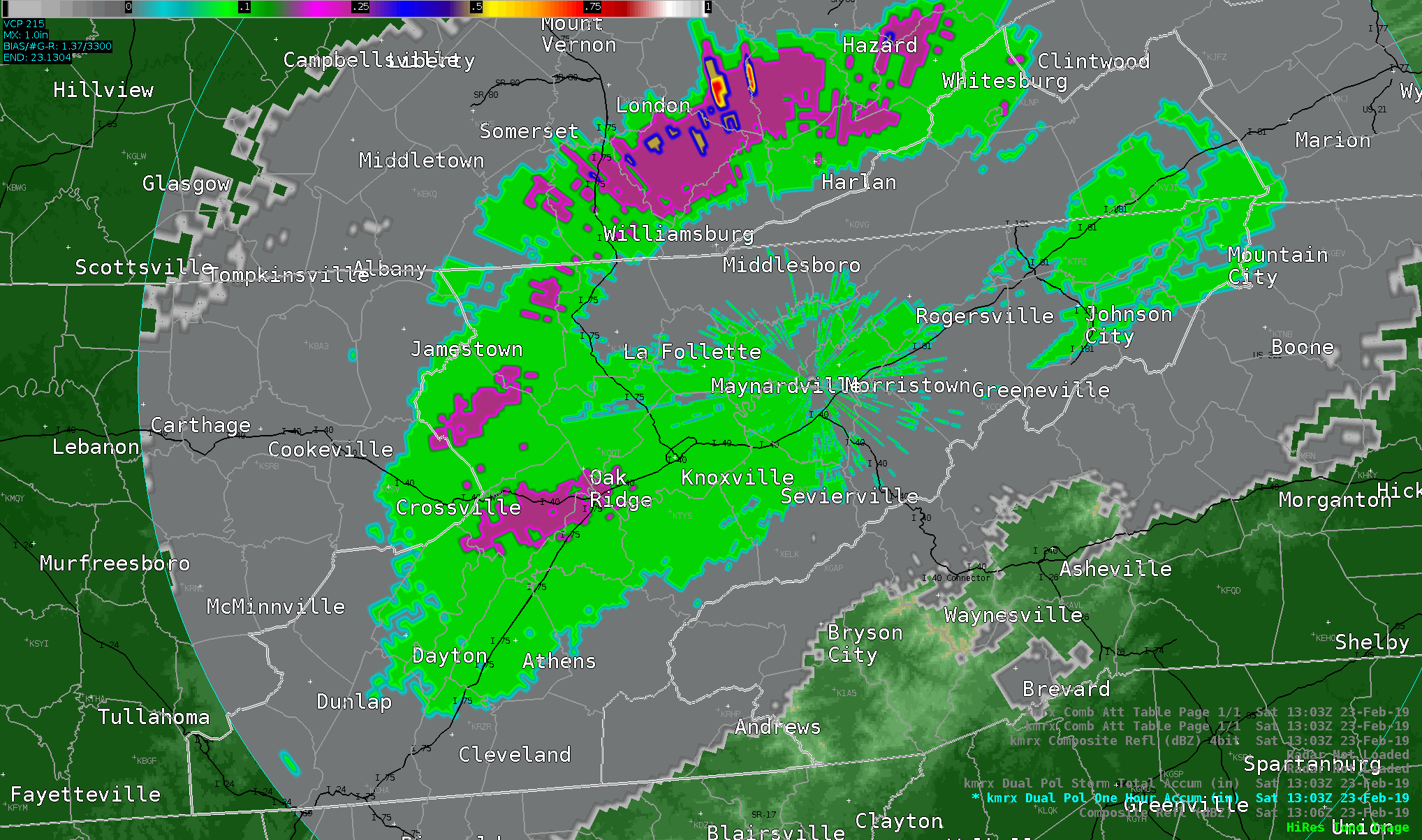
Radar loop of composite reflectivity
from early morning through mid afternoon (click to enlarge)

A persistent wet pattern in early/mid February setup poor antecedent conditions later in the month.
Subtropical ridging over the western Atlantic combined with troughing out west to set the
stage for epic flooding across the Tennessee Valley as moisture continued to stream into the
region. Already wet ground wasn't able to absorb much (if any) additional rainfall, thus vast
amounts of runoff occurred. This led to increasing River and Areal flooding conditions, which
culminated on Saturday February 23rd, 2019. Daily rainfall records were shattered at McGhee
Tyson Airport. Below are some interesting graphics.
Radar loop of one hour estimated rainfall
from early morning through mid afternoon (click to enlarge)
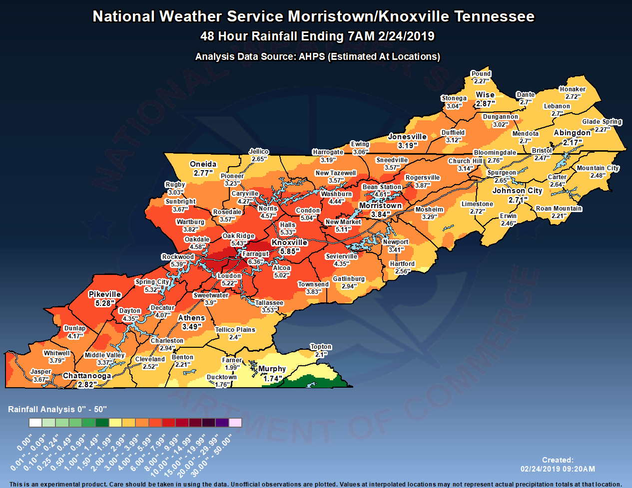
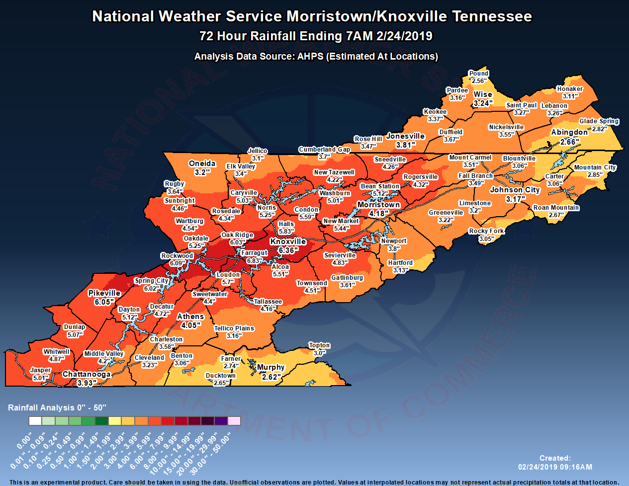
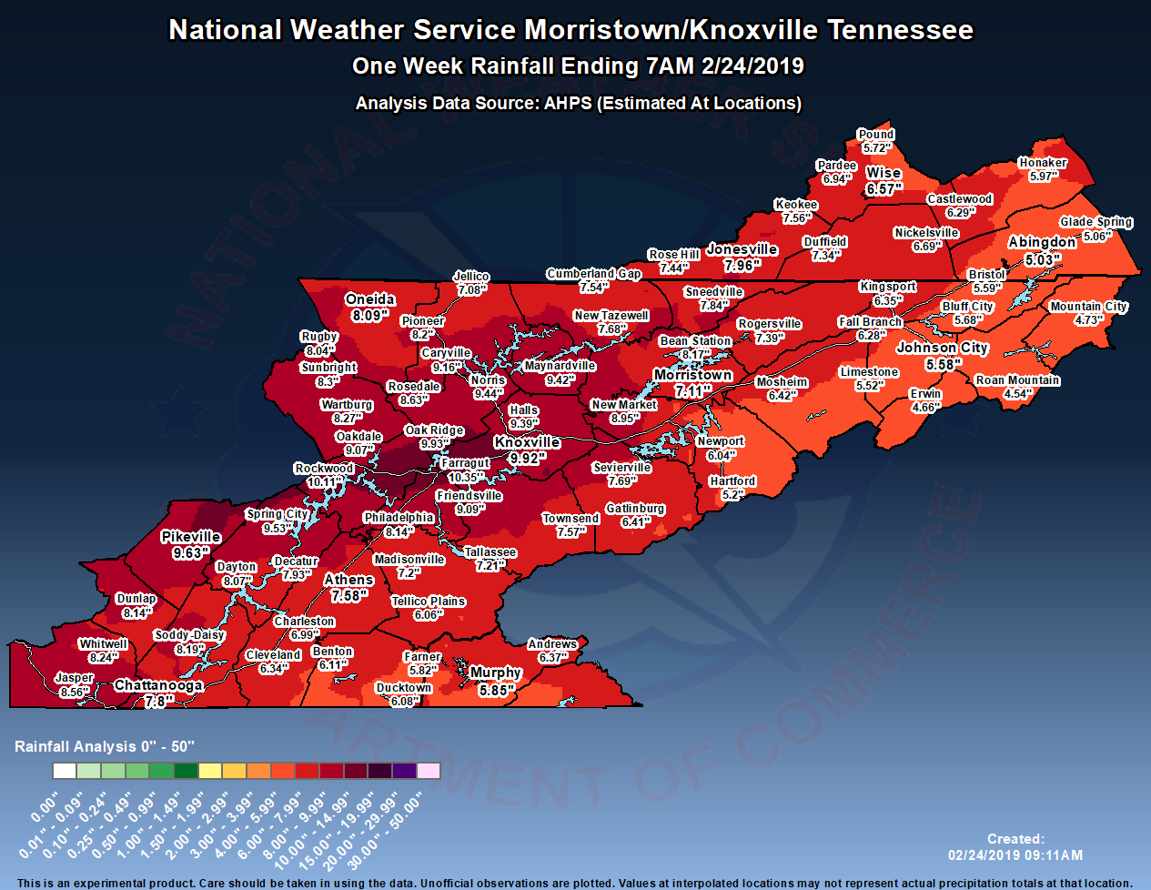
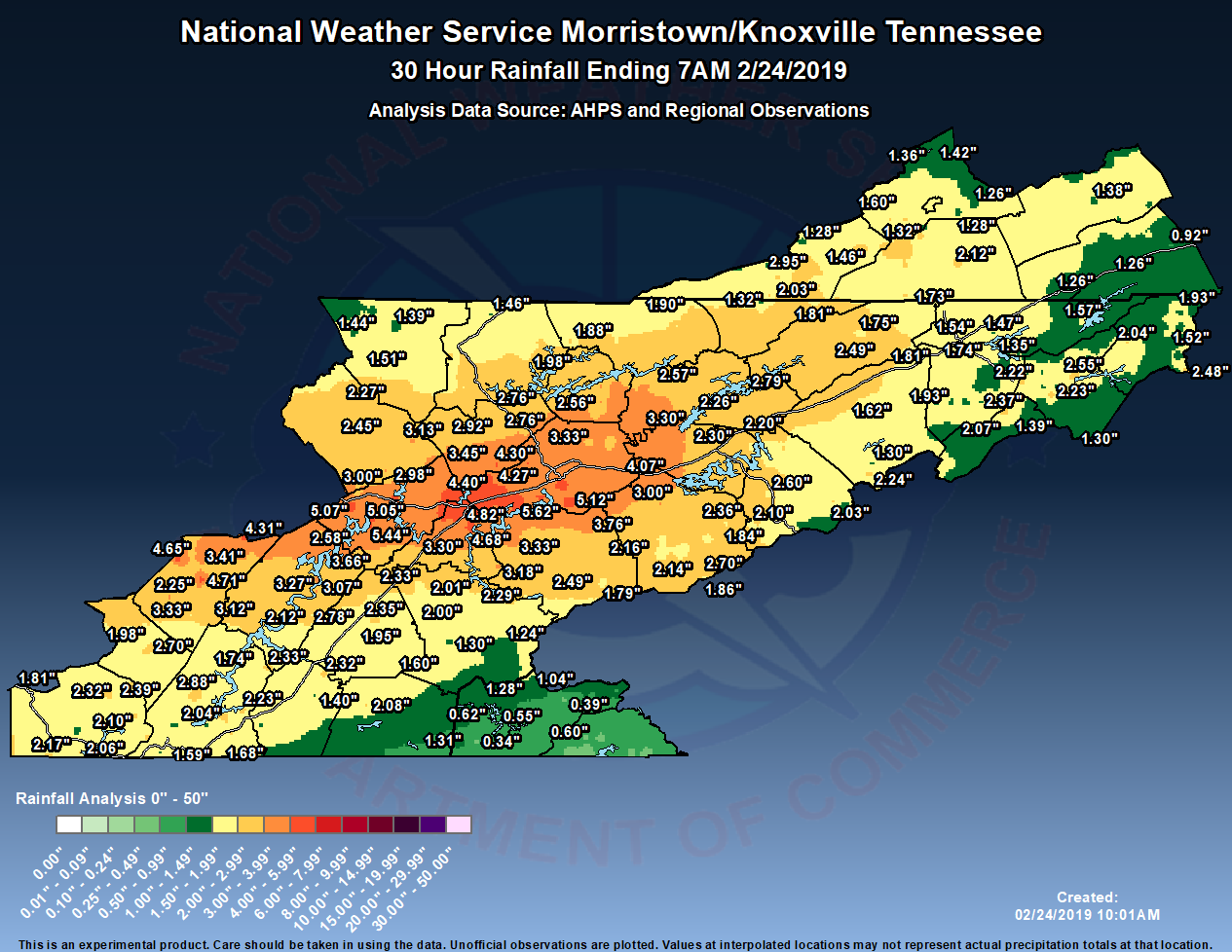
Observed and Estimated Rainfall Totals (30 Hour, 48 Hour, 72 Hour, 1 Week) (click to enlarge)
|
|
||
|---|---|---|
 |
 |
 |
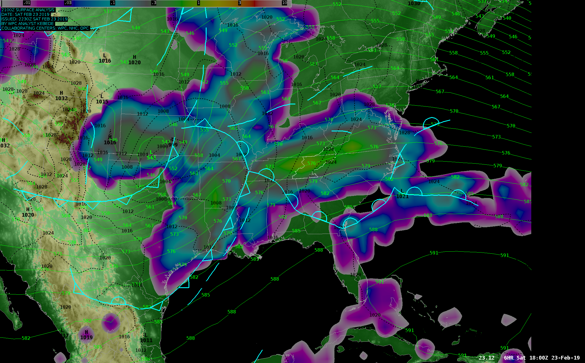
500 MB Heights (green contours), MSLP (dashed black contours),
and Surface front analysis, QPF (click to enlarge)
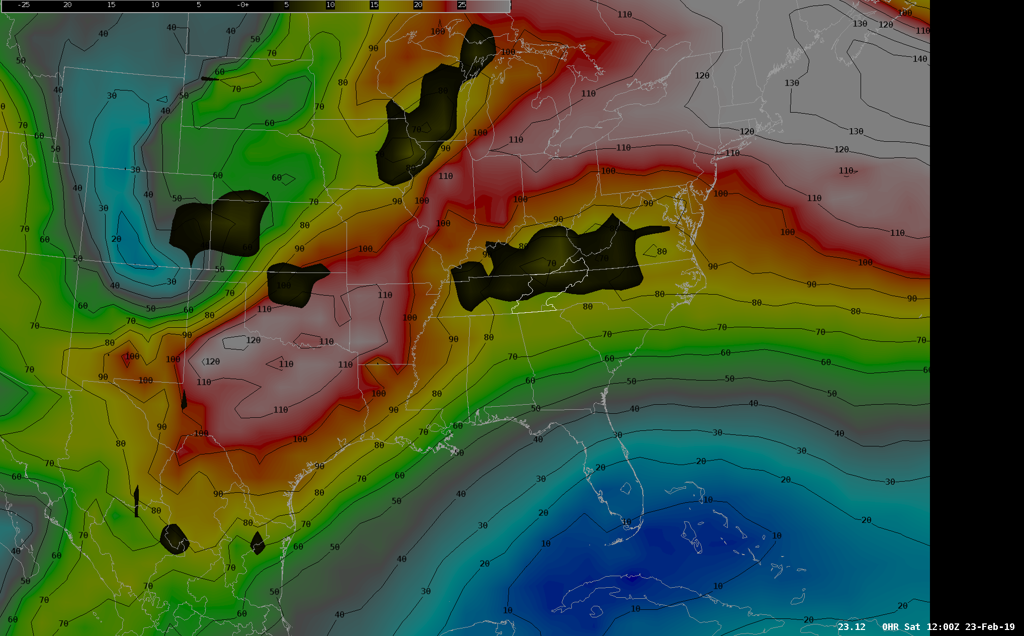
300 MB Winds (image and black contours) and
200MB - 400MB Upper Divergence (black shading) (click to enlarge)
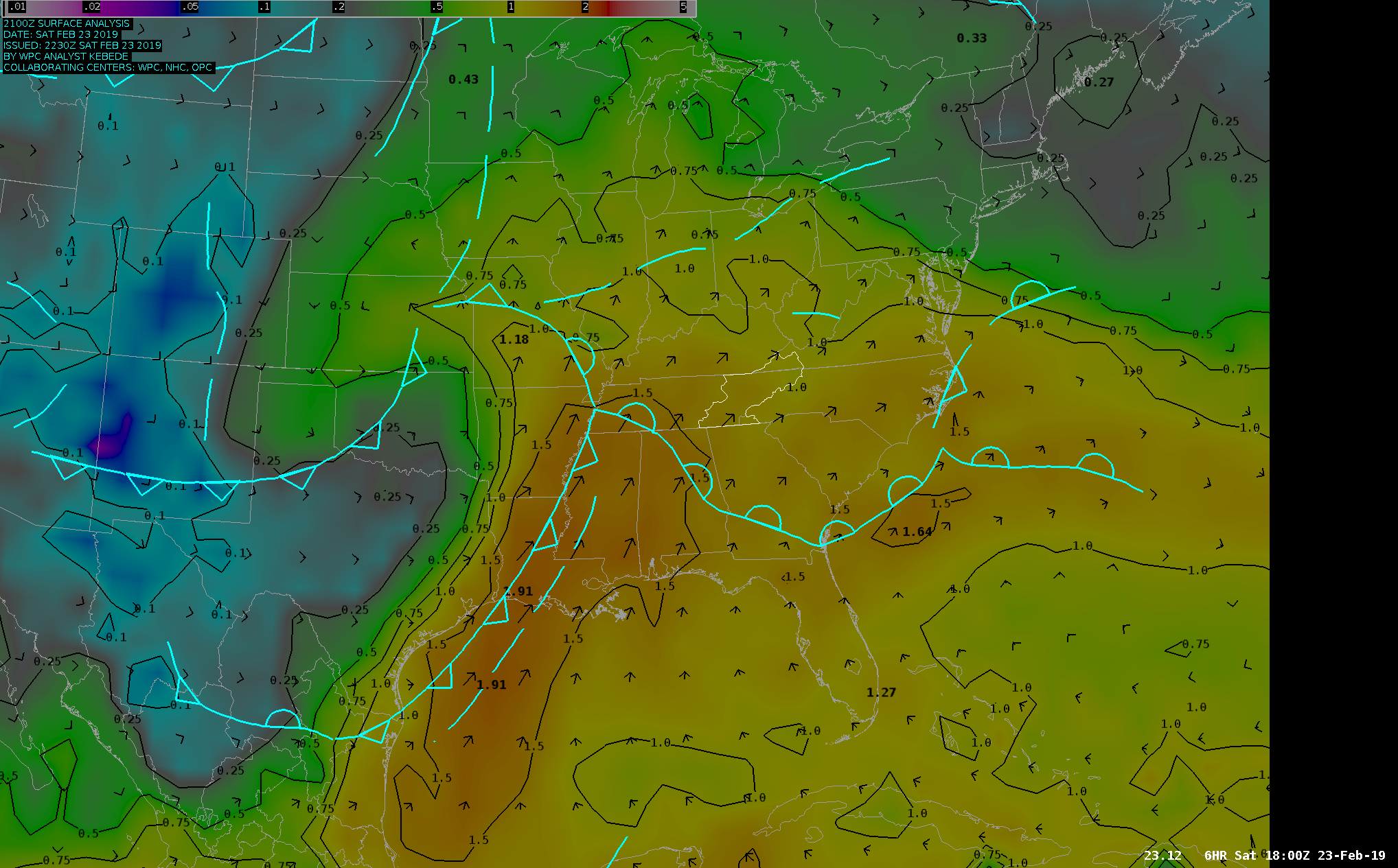
Surface front analysis, Precipitable Water (image and black contours),
and Moisture Transport Vectors (click to enlarge)


 Local Radar
 Huntsville Radar
 Regional Satellite
 Graphical Forecast
 Weather Map