Training To Forecast
Preparing and training to be a qualified forecaster is not a quick, or easy process. There are hundreds of online modules with tests that a meteorologist has to pass, as well as hundreds of hours of hands on experience before a college educated meteorologist can finally forecast and warn on their own.
When someone first gets hired into the National Weather Service, they must go through a radar course. This course consists of over 110 hours of training built into over 40 online modules. At the conclusion of each module, the meteorologist is required to take and pass a quiz before they can move onto the next module. Each person has between 4-6 months to complete all of these modules. Upon completion of the on-line portion, each student travels to the National Weather Center on the campus of the University Of Oklahoma in Norman. Here, they work with other forecasters in training to issue warnings. Students work in a simulated warning environment using past weather event data where they practice issuing products in real-time for these events. The focus of this course is to give users practical experience in issuing warnings, collaborating with others, and assimilating numerous data points simultaneously during the warning process. This gives each person the experience of issuing warnings in a hectic, fast-paced, and quickly changing environment that may be experienced during severe weather operations in a forecast office. Only once this course is completed can a meteorologist be allowed to start issuing severe and flood warnings under supervision within the office.
Additional courses to be completed include a Warning Operations Course (WOC) which includes four different areas of emphasis. The focus areas for the WOC course include Severe Weather, Flash Flood, Winter Weather, and Core Decision Making. This course focuses on teaching the science, technology, and human factors necessary to providing effective warning operations in an office. This course includes over 60 hours of training along with numerous hours of forecast and warning simulations in the local office. Throughout all of this time, students continue to get numerous hours of on the job training which further helps to build their forecasting and warning proficiency.
Additional course work is required in fire weather, aviation, emergency management principals, as well as areas directly related to meteorology such as training with skew-t data, understanding jet dynamics, and a plethora of other important subject areas. All of these courses can further add well over 100 more hours of book training that must be accomplished before finally working the forecast desk on your own.
As new meteorologist begins to work on the forecast desk, they first shadow the qualified forecasters in the performance of the duties. After several shifts of shadowing the student will begin to grow more comfortable with the tools, software, and products available to make and issue forecasts and warnings. Once they become comfortable with different methods to look at data and create a forecast, the trainee then sits in at a forecast desk and proceeds to making the forecasts under the close supervision of the qualified forecaster. It is here where the qualified forecaster answers any questions the meteorologist may have, along with offering advice, tips, and other pertinent information that can be used in effectively performing their job.
Several more months can pass before the meteorologist is cleared to work a shift without direct supervision. As an entry level forecaster, the new meteorologists will still always have a lead forecaster or someone with much more experience working along side them to help, if the need arises. Additionally, it is not uncommon to see shift forecasters having long discussions with the new forecasters about the weather, tools, and nuance of forecasting.
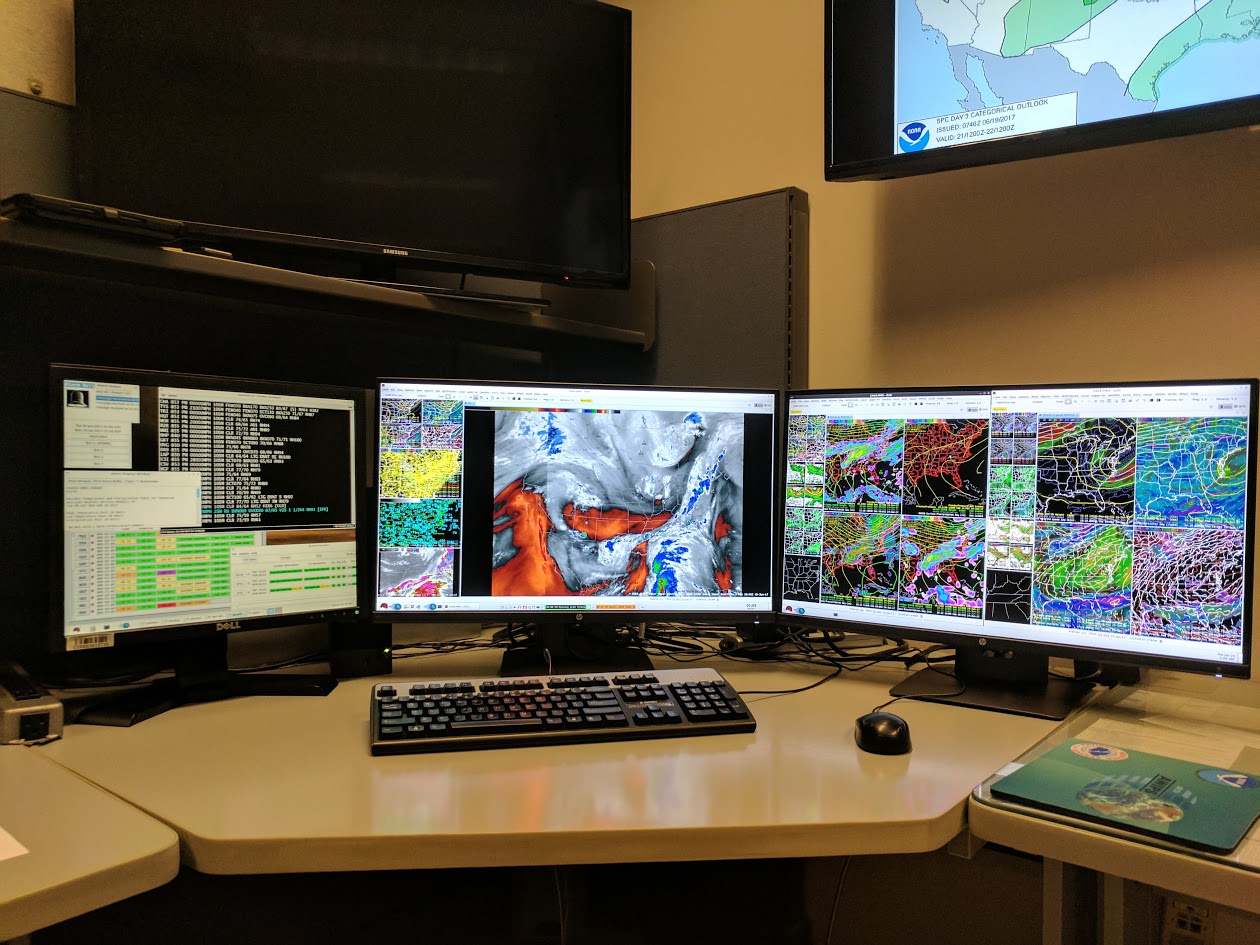
In a science profession with research being done all the time, the training of an operational forecaster never really ends. There are always new tools, new data sources, new study's and new ideas that need to be vetted, taught and implemented into operational forecasting. Below is a picture of a typical forecaster workstation. Each workstation contains two 27 inch monitors and a 19 inch monitor used to display literally thousands of different data sources. The root of all of the training is to be able to effectively and efficiently maximize a forecasters understanding of the current and future state of the atmosphere and allow them to issue the best possible warning and forecast in order to meet the mission of our organization, Saving Lives and Property.


 Local Radar
 Huntsville Radar
 Regional Satellite
 Graphical Forecast
 Weather Map