National Weather Service United States Department of Commerce

Active Pattern for the Center of the Nation

Critical fire weather conditions, severe thunderstorms capable of producing severe wind gusts, large hail, strong tornadoes and heavy rainfall remain on tap for the central U.S. this evening. Flash flooding is also possible for portions of the Plains and Mississippi Valley. Very large hail up to 3 inches in diameter will be possible this evening across western Kansas. Read More >

NERFC Short Term County Averaged Precipitation Totals

3 Day Precipitation | 5 Day Precipitation | Days Since Precipitation Exceeded One Quarter Inch


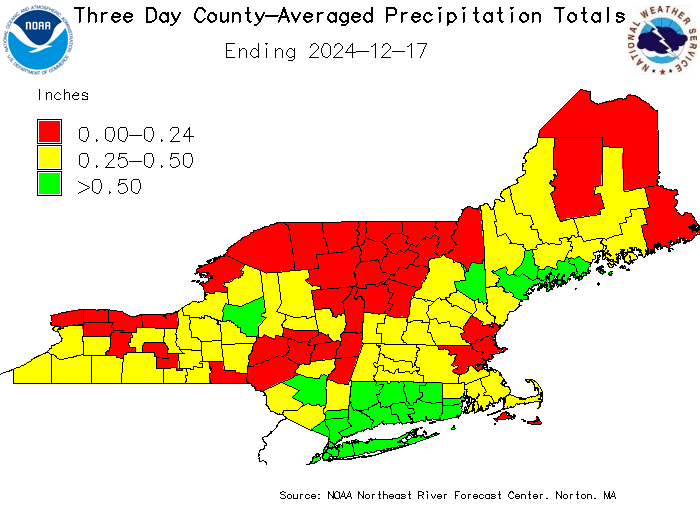
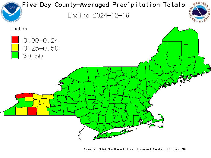
The precipitation totals used in these graphics are 6-hourly county-averaged precipitation calculated by the Northeast River Forecast Center's River Forecast Model (NWSRFS).

Acknowledgment: The Precipitation Totals for the counties of Broome, Chemung, Chenango, Cortland, Delaware, Otsego, Steuben, Sullivan and Tioga in New York State are provided by the Middle Atlantic River Forecast Center.


3 Day Precipitation Totals

Graphic of county averaged precipitation over the past 3 days.
Top of This Page | NERFC Precipitation and Departures from Normal Page


5 Day Precipitation Totals

Graphic of county averaged precipitation over the past 5 days.
Top of This Page | NERFC Precipitation Totals and Departures from Normal Page


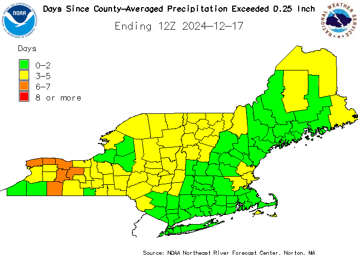
Days Since County-Averaged Precipitation Exceeded One Quarter of an Inch

Days Since County-Averaged Precipitation Exceeded One Quarter of an Inch
Top of This Page | NERFC Precipitation and Departures from Normal Page