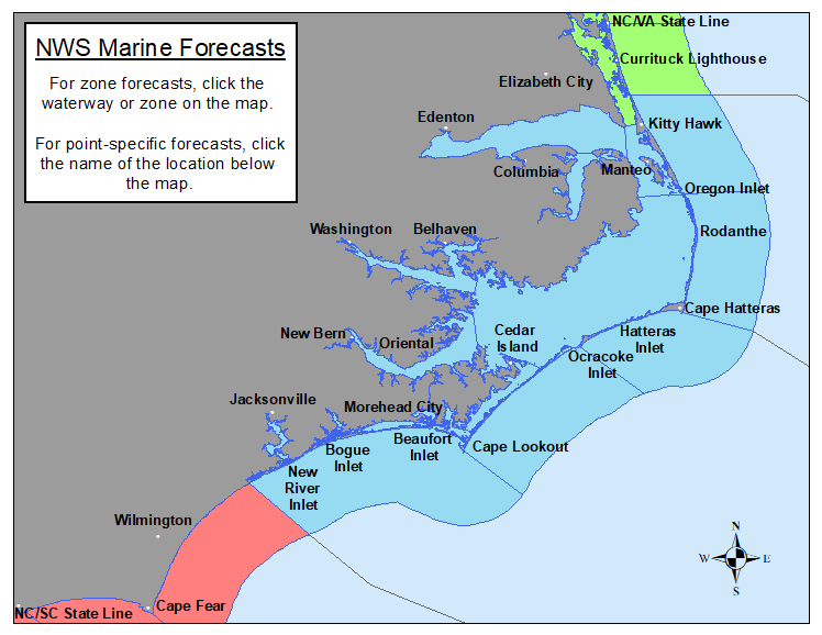
040
WHUS72 KMHX 221933
MWWMHX
URGENT - MARINE WEATHER MESSAGE
National Weather Service Newport/Morehead City NC
333 PM EDT Wed Jul 22 2026
AMZ156-158-230800-
/O.CON.KMHX.SC.Y.0076.000000T0000Z-260723T1500Z/
S of Ocracoke Inlet to Cape Lookout NC out 20 nm-
S of Cape Lookout to N of Surf City NC out 20 nm-
333 PM EDT Wed Jul 22 2026
...SMALL CRAFT ADVISORY REMAINS IN EFFECT UNTIL 11 AM EDT
THURSDAY...
* WHAT...Southwest winds 20 to 25 kt with gusts up to 30 kt and
seas 4 to 6 ft.
* WHERE...The coastal waters from Ocracoke Inlet to Surf City.
* WHEN...Until 11 AM EDT Thursday.
* IMPACTS...Conditions will be hazardous to small craft.
PRECAUTIONARY/PREPAREDNESS ACTIONS...
Inexperienced mariners, especially those operating smaller
vessels, should avoid navigating in hazardous conditions.
&&
$$
AMZ152-154-230800-
/O.CON.KMHX.SC.Y.0076.000000T0000Z-260723T1500Z/
S of Oregon Inlet to Cape Hatteras NC out 20 nm-
S of Cape Hatteras to Ocracoke Inlet NC out 20 nm
including the Monitor National Marine Sanctuary-
333 PM EDT Wed Jul 22 2026
...SMALL CRAFT ADVISORY REMAINS IN EFFECT UNTIL 11 AM EDT
THURSDAY...
* WHAT...Southwest winds 20 to 25 kt with gusts up to 30 kt and
seas 4 to 6 ft.
* WHERE...The coastal waters from Oregon Inlet to Ocracoke Inlet.
* WHEN...Until 11 AM EDT Thursday.
* IMPACTS...Conditions will be hazardous to small craft.
PRECAUTIONARY/PREPAREDNESS ACTIONS...
Inexperienced mariners, especially those operating smaller
vessels, should avoid navigating in hazardous conditions.
&&
$$
AMZ150-230800-
/O.CON.KMHX.SC.Y.0076.000000T0000Z-260723T1200Z/
S of Currituck Beach Light to Oregon Inlet NC out 20 nm-
333 PM EDT Wed Jul 22 2026
...SMALL CRAFT ADVISORY REMAINS IN EFFECT UNTIL 8 AM EDT
THURSDAY...
* WHAT...Southwest winds 15 to 25 kt with gusts up to 30 kt.
* WHERE...The coastal waters from Duck to Oregon Inlet.
* WHEN...Until 8 AM EDT Thursday.
* IMPACTS...Conditions will be hazardous to small craft.
PRECAUTIONARY/PREPAREDNESS ACTIONS...
Inexperienced mariners, especially those operating smaller
vessels, should avoid navigating in hazardous conditions.
&&
$$
AMZ135-230800-
/O.CON.KMHX.SC.Y.0076.000000T0000Z-260723T1500Z/
Pamlico Sound-
333 PM EDT Wed Jul 22 2026
...SMALL CRAFT ADVISORY REMAINS IN EFFECT UNTIL 11 AM EDT
THURSDAY...
* WHAT...Southwest winds 15 to 25 kt with gusts up to 30 kt and
rough waters.
* WHERE...Pamlico Sound.
* WHEN...Until 11 AM EDT Thursday.
* IMPACTS...Conditions will be hazardous to small craft.
PRECAUTIONARY/PREPAREDNESS ACTIONS...
Inexperienced mariners, especially those operating smaller
vessels, should avoid navigating in hazardous conditions.
&&
$$
AMZ131-230-231-230600-
/O.CON.KMHX.SC.Y.0076.000000T0000Z-260723T0600Z/
Alligator River-Albemarle Sound-Croatan and Roanoke Sounds-
333 PM EDT Wed Jul 22 2026
...SMALL CRAFT ADVISORY REMAINS IN EFFECT UNTIL 2 AM EDT
THURSDAY...
* WHAT...Southwest winds 15 to 25 kt and choppy waters.
* WHERE...Albemarle, Croatan, and Roanoke Sounds and the
Alligator River.
* WHEN...Until 2 AM EDT Thursday.
* IMPACTS...Conditions will be hazardous to small craft.
PRECAUTIONARY/PREPAREDNESS ACTIONS...
Inexperienced mariners, especially those operating smaller
vessels, should avoid navigating in hazardous conditions.
&&
$$
AMZ136-137-230800-
/O.CON.KMHX.SC.Y.0076.000000T0000Z-260723T0900Z/
Pamlico and Pungo Rivers-Neuse and Bay Rivers-
333 PM EDT Wed Jul 22 2026
...SMALL CRAFT ADVISORY REMAINS IN EFFECT UNTIL 5 AM EDT
THURSDAY...
* WHAT...Southwest winds 15 to 25 kt and choppy waters.
* WHERE...Pamlico, Pungo, Neuse, and Bay Rivers.
* WHEN...Until 5 AM EDT Thursday.
* IMPACTS...Conditions will be hazardous to small craft.
PRECAUTIONARY/PREPAREDNESS ACTIONS...
Inexperienced mariners, especially those operating smaller
vessels, should avoid navigating in hazardous conditions.
&&
$$
Martin
741
FZUS52 KMHX 222300
CWFMHX
Coastal Waters Forecast for North Carolina
National Weather Service Newport/Morehead City NC
700 PM EDT Wed Jul 22 2026
From S of Currituck Beach Light to N of Surf City NC out 60 NM,
including the Albemarle and Pamlico Sounds and the Monitor
National Marine Sanctuary
AMZ100-231200-
700 PM EDT Wed Jul 22 2026
.Synopsis for Eastern North Carolina coastal waters...
A slow moving cold front will drift south into the ENC waters on
Thursday, then stall. The front is then forecast to move offshore
by Friday night or Saturday. Hazardous conditions for small craft
will continue into this evening, followed by improving winds and
seas by Thursday. The front will be accompanied by an increased
risk of thunderstorms, especially Thursday and Friday. High
pressure then moves in over the weekend with a reduced risk of
thunderstorms, and improved boating conditions.
$$
AMZ230-231200-
Albemarle Sound-
700 PM EDT Wed Jul 22 2026
...SMALL CRAFT ADVISORY IN EFFECT UNTIL 2 AM EDT THURSDAY...
.TONIGHT...SW winds 15 to 20 kt. Gusts up to 25 kt late this
evening. Waves around 2 ft. A chance of showers and tstms.
.THU...W winds 10 to 15 kt, becoming N in the afternoon. Waves
around 2 ft. Showers. A chance of tstms in the morning, then
tstms likely in the afternoon. Vsby 1 to 3 NM.
.THU NIGHT...NE winds 10 to 15 kt. Waves 1 ft or less, then
around 2 ft after midnight. Showers with a chance of tstms.
.FRI...NE winds 10 to 15 kt. Waves around 2 ft in the morning,
then 1 ft. Showers with a slight chance of tstms in the morning,
then showers likely with a chance of tstms in the afternoon.
.FRI NIGHT...NE winds 5 to 10 kt. Waves 1 ft or less. Showers
likely with a chance of tstms.
.SAT...N winds 5 to 10 kt. Waves 1 ft or less. Showers likely,
mainly in the morning.
.SAT NIGHT...N winds 5 to 10 kt. Waves 1 ft or less. A chance of
showers in the evening.
.SUN...NE winds 5 to 10 kt. Waves 1 ft or less.
.SUN NIGHT...SE winds around 5 kt, becoming SW after midnight.
Waves 1 ft or less.
.MON...W winds 5 to 10 kt, becoming SW in the afternoon. Waves
1 ft or less.
.MON NIGHT...S winds 5 to 10 kt. Waves 1 ft or less.
Winds and waves higher in and near tstms.
$$
AMZ131-231200-
Alligator River-
700 PM EDT Wed Jul 22 2026
...SMALL CRAFT ADVISORY IN EFFECT UNTIL 2 AM EDT THURSDAY...
.TONIGHT...SW winds 10 to 15 kt. Gusts up to 25 kt late this
evening. Waves a moderate chop. A slight chance of showers and
tstms this evening. A chance of showers and tstms late.
.THU...SW winds 10 to 15 kt, becoming W 5 to 10 kt in the
afternoon. Waves a moderate chop, diminishing to light chop in
the afternoon. Showers likely with a chance of tstms in the
morning, then showers with tstms likely in the afternoon. Vsby
1 to 3 NM.
.THU NIGHT...E winds 5 to 10 kt, increasing to 10 to 15 kt after
midnight. Waves light chop, increasing to a moderate chop after
midnight. Showers with a chance of tstms.
.FRI...NE winds 5 to 10 kt. Waves light chop. Showers with a
chance of tstms.
.FRI NIGHT...NE winds 5 to 10 kt. Waves light chop. A chance of
tstms. Showers.
.SAT...N winds 5 to 10 kt. Waves light chop. Showers likely in
the morning, then a chance of showers and tstms in the afternoon.
.SAT NIGHT...N winds around 5 kt. Waves flat. A chance of tstms
in the evening. A chance of showers.
.SUN...N winds around 5 kt. Waves flat.
.SUN NIGHT...E winds around 5 kt, becoming SW after midnight.
Waves flat.
.MON...W winds around 5 kt. Waves flat.
.MON NIGHT...S winds 5 to 10 kt. Waves light chop.
Winds and waves higher in and near tstms.
$$
AMZ231-231200-
Croatan and Roanoke Sounds-
700 PM EDT Wed Jul 22 2026
...SMALL CRAFT ADVISORY IN EFFECT UNTIL 2 AM EDT THURSDAY...
.TONIGHT...SW winds 15 to 20 kt with gusts up to 25 kt,
diminishing to 10 to 15 kt late. Waves choppy, diminishing to a
moderate chop late. A slight chance of showers and tstms until
early morning, then a chance of showers and tstms late.
.THU...SW winds 10 to 15 kt, becoming NW in the afternoon. Waves
a moderate chop. A chance of tstms. Showers. Vsby 1 to 3 NM.
.THU NIGHT...E winds 10 to 15 kt. Waves a moderate chop. Showers
with a chance of tstms.
.FRI...NE winds 10 to 15 kt. Waves a moderate chop. A chance of
tstms. Showers.
.FRI NIGHT...NE winds 5 to 10 kt. Waves light chop. A chance of
tstms. Showers.
.SAT...N winds 5 to 10 kt. Waves light chop. Showers likely in
the morning, then a chance of showers and tstms in the afternoon.
.SAT NIGHT...N winds 5 to 10 kt. Waves light chop. A chance of
showers and tstms in the evening.
.SUN...N winds 5 to 10 kt. Waves light chop.
.SUN NIGHT...E winds 5 to 10 kt, becoming SW after midnight.
Waves light chop, diminishing to flat after midnight. A chance of
showers after midnight.
.MON...W winds 5 to 10 kt, becoming SW in the afternoon. Waves
light chop. A chance of showers in the morning.
.MON NIGHT...SW winds 5 to 10 kt. Waves light chop.
Winds and waves higher in and near tstms.
$$
AMZ135-231200-
Pamlico Sound-
700 PM EDT Wed Jul 22 2026
...SMALL CRAFT ADVISORY IN EFFECT THROUGH THURSDAY MORNING...
.TONIGHT...SW winds 20 to 25 kt with gusts up to 30 kt. Waves
2 to 4 ft.
.THU...SW winds 15 to 20 kt with gusts up to 25 kt, diminishing
to 10 to 15 kt in the afternoon. Waves 2 to 3 ft. A chance of
showers and tstms in the morning, then showers with a chance of
tstms in the afternoon with vsby 1 to 3 NM.
.THU NIGHT...SW winds 5 to 10 kt, increasing to 10 to 15 kt after
midnight. Waves around 2 ft. Showers with a chance of tstms. Vsby
1 to 3 NM in the evening.
.FRI...N winds 10 to 15 kt, becoming NW 5 to 10 kt in the
afternoon. Waves around 2 ft in the morning, then 1 ft. Showers
with a chance of tstms.
.FRI NIGHT...NE winds 5 to 10 kt, becoming W after midnight.
Waves 1 ft or less. Showers with a chance of tstms.
.SAT...N winds 5 to 10 kt. Waves 1 ft or less. Showers in the
morning, then showers likely with a chance of tstms in the
afternoon.
.SAT NIGHT...N winds 5 to 10 kt. Waves 1 ft or less. Showers
likely with a chance of tstms in the evening, then a chance of
showers after midnight.
.SUN...N winds 5 to 10 kt. Waves 1 ft or less. A chance of
showers in the morning.
.SUN NIGHT...NE winds 5 to 10 kt, becoming W after midnight.
Waves 1 ft or less.
.MON...W winds 5 to 10 kt, becoming SW in the afternoon. Waves
1 ft or less.
.MON NIGHT...SW winds around 10 kt. Waves 1 ft or less.
Winds and waves higher in and near tstms.
$$
AMZ136-231200-
Pamlico and Pungo Rivers-
700 PM EDT Wed Jul 22 2026
...SMALL CRAFT ADVISORY IN EFFECT UNTIL 5 AM EDT THURSDAY...
.TONIGHT...SW winds 15 to 20 kt with gusts up to 25 kt. Waves
choppy.
.THU...SW winds 10 to 15 kt, becoming W 5 to 10 kt in the
afternoon. Waves a moderate chop, diminishing to light chop in
the afternoon. Showers likely with a chance of tstms in the
morning, then showers with tstms likely in the afternoon.
.THU NIGHT...NE winds 5 to 10 kt. Waves light chop. Showers with
a chance of tstms. Vsby 1 to 3 NM in the evening.
.FRI...NE winds 5 to 10 kt. Waves light chop. Showers with a
chance of tstms.
.FRI NIGHT...NE winds around 5 kt. Waves flat. Showers with a
chance of tstms.
.SAT...N winds around 5 kt. Waves flat. Showers likely in the
morning, then showers likely with a chance of tstms in the
afternoon.
.SAT NIGHT...N winds around 5 kt. Waves flat. Showers likely with
a chance of tstms in the evening, then a chance of showers after
midnight.
.SUN...N winds around 5 kt. Waves flat. A chance of showers in
the afternoon.
.SUN NIGHT...SE winds around 5 kt, becoming SW after midnight.
Waves flat. A chance of showers in the evening.
.MON...SW winds around 5 kt. Waves flat.
.MON NIGHT...S winds around 5 kt. Waves flat.
Winds and waves higher in and near tstms.
$$
AMZ137-231200-
Neuse and Bay Rivers-
700 PM EDT Wed Jul 22 2026
...SMALL CRAFT ADVISORY IN EFFECT UNTIL 5 AM EDT THURSDAY...
.TONIGHT...SW winds 15 to 20 kt with gusts up to 25 kt. Waves
choppy.
.THU...SW winds 10 to 15 kt. Gusts up to 25 kt in the morning.
Waves a moderate chop. A chance of showers and tstms in the
morning, then showers with tstms likely in the afternoon with
vsby 1 to 3 NM.
.THU NIGHT...SW winds 5 to 10 kt, becoming NW after midnight.
Waves light chop. Showers with a chance of tstms.
.FRI...NW winds 5 to 10 kt, becoming NE in the afternoon. Waves
light chop, diminishing to flat in the afternoon. Showers. A
chance of tstms in the morning, then tstms likely in the
afternoon.
.FRI NIGHT...E winds around 5 kt, becoming NW after midnight.
Waves flat, increasing to light chop after midnight. Showers with
a chance of tstms.
.SAT...N winds 5 to 10 kt. Waves light chop. Showers in the
morning, then showers likely with a chance of tstms in the
afternoon.
.SAT NIGHT...N winds around 5 kt. Waves flat. Showers likely with
a chance of tstms in the evening, then a chance of showers after
midnight.
.SUN...NE winds 5 to 10 kt. Waves light chop. A chance of
showers.
.SUN NIGHT...E winds around 5 kt, becoming W after midnight.
Waves flat. A chance of showers in the evening.
.MON...W winds around 5 kt, becoming SW in the afternoon. Waves
flat.
.MON NIGHT...SW winds 5 to 10 kt. Waves light chop.
Winds and waves higher in and near tstms.
$$
AMZ150-231200-
S of Currituck Beach Light to Oregon Inlet NC out 20 nm-
700 PM EDT Wed Jul 22 2026
...SMALL CRAFT ADVISORY IN EFFECT THROUGH THURSDAY MORNING...
.TONIGHT...SW winds 20 to 25 kt, diminishing to 15 to 20 kt after
midnight. Seas 3 to 5 ft. Wave Detail: SE 5 ft at 7 seconds and
SW 1 ft at 3 seconds. A slight chance of showers and tstms until
early morning, then a chance of showers and tstms late.
.THU...SW winds 15 to 20 kt, becoming W 10 to 15 kt in the
afternoon. Seas 3 to 5 ft, except 2 to 3 ft near shore. Wave
Detail: SE 4 ft at 7 seconds and SW 2 ft at 3 seconds. A chance
of tstms. Showers. Vsby 1 to 3 NM.
.THU NIGHT...SE winds 10 to 15 kt. Seas 2 to 3 ft. Wave Detail: S
3 ft at 6 seconds and N 2 ft at 5 seconds. Showers with a chance
of tstms. Vsby 1 to 3 NM in the evening.
.FRI...E winds 10 to 15 kt, becoming N in the afternoon. Seas
3 to 4 ft. Wave Detail: SE 3 ft at 9 seconds and N 2 ft at
5 seconds. A chance of tstms. Showers.
.FRI NIGHT...NE winds 5 to 10 kt. Seas around 3 ft. Wave Detail:
E 3 ft at 7 seconds and NW 1 ft at 2 seconds. A chance of tstms.
Showers.
.SAT...N winds 5 to 10 kt. Seas around 3 ft. Wave Detail: SE 3 ft
at 8 seconds and NE 2 ft at 5 seconds. Showers likely, mainly in
the morning.
.SAT NIGHT...N winds 5 to 10 kt. Seas around 3 ft. A chance of
showers in the evening.
.SUN...N winds 5 to 10 kt. Seas around 3 ft.
.SUN NIGHT...E winds around 5 kt, becoming W after midnight. Seas
2 to 3 ft.
.MON...W winds 5 to 10 kt, becoming SW in the afternoon. Seas
2 to 3 ft.
.MON NIGHT...SW winds 5 to 10 kt. Seas 2 to 3 ft.
Winds and seas higher in and near tstms.
$$
AMZ180-231200-
Waters from Currituck Beach Light to Oregon Inlet NC from 20 to
60 NM-
700 PM EDT Wed Jul 22 2026
.TONIGHT...SW winds 20 to 25 kt with gusts up to 30 kt. Seas 5 to
7 ft. A slight chance of showers and tstms early this evening. A
slight chance of showers and tstms after midnight.
.THU...SW winds 20 to 25 kt with gusts up to 30 kt, becoming W
15 to 20 kt in the afternoon. Seas 4 to 6 ft. A chance of tstms.
Showers. Vsby 1 to 3 NM.
.THU NIGHT...SW winds 10 to 15 kt. Seas 3 to 4 ft. Showers with a
chance of tstms. Vsby 1 to 3 NM in the evening.
.FRI...SE winds 10 to 15 kt, becoming W in the afternoon. Seas
3 to 4 ft. Showers with a chance of tstms.
.FRI NIGHT...NE winds 5 to 10 kt, becoming N after midnight. Seas
3 to 4 ft. Showers with a chance of tstms.
.SAT...N winds around 10 kt. Seas 3 to 5 ft. Showers likely,
mainly in the morning.
.SAT NIGHT...N winds 5 to 10 kt. Seas 3 to 4 ft. A chance of
showers.
.SUN...N winds 5 to 10 kt. Seas 3 to 4 ft. A chance of showers in
the morning.
.SUN NIGHT...N winds 5 to 10 kt, becoming NW after midnight. Seas
3 to 4 ft. A chance of showers after midnight.
.MON...W winds around 10 kt, becoming SW in the afternoon. Seas
2 to 3 ft. A chance of showers in the morning.
.MON NIGHT...SW winds 5 to 10 kt, increasing to 10 to 15 kt after
midnight. Seas 2 to 3 ft. A chance of showers. A chance of tstms
after midnight.
Winds and seas higher in and near tstms.
$$
AMZ152-231200-
S of Oregon Inlet to Cape Hatteras NC out 20 nm-
700 PM EDT Wed Jul 22 2026
...SMALL CRAFT ADVISORY IN EFFECT THROUGH THURSDAY MORNING...
.TONIGHT...SW winds around 20 kt with gusts up to 25 kt. Seas
4 to 5 ft. Wave Detail: S 5 ft at 7 seconds and SW 1 ft at
3 seconds.
.THU...SW winds 15 to 20 kt with gusts up to 25 kt, becoming W
10 to 15 kt in the afternoon. Seas 3 to 5 ft. Wave Detail: S 5 ft
at 7 seconds and W 2 ft at 3 seconds. A chance of showers and
tstms in the morning, then showers likely with a chance of tstms
in the afternoon with vsby 1 to 3 NM.
.THU NIGHT...SW winds 10 to 15 kt. Seas 2 to 4 ft. Wave Detail: S
3 ft at 6 seconds and SE 3 ft at 9 seconds. Showers with a chance
of tstms. Vsby 1 to 3 NM in the evening.
.FRI...W winds 10 to 15 kt. Seas 3 to 4 ft. Wave Detail: SE 3 ft
at 9 seconds and N 2 ft at 5 seconds. Showers with a chance of
tstms.
.FRI NIGHT...W winds 5 to 10 kt. Seas around 3 ft. Wave Detail:
SE 3 ft at 8 seconds and N 2 ft at 5 seconds. Showers with a
chance of tstms.
.SAT...N winds 5 to 10 kt. Seas around 3 ft. Wave Detail: SE 3 ft
at 8 seconds and NE 2 ft at 6 seconds. A chance of tstms.
Showers.
.SAT NIGHT...N winds 5 to 10 kt. Seas 3 to 4 ft. A chance of
tstms in the evening. A chance of showers.
.SUN...N winds 5 to 10 kt. Seas around 3 ft. A chance of showers
in the morning.
.SUN NIGHT...N winds 5 to 10 kt, becoming NW after midnight. Seas
2 to 3 ft. A chance of showers after midnight.
.MON...W winds 5 to 10 kt, becoming SW in the afternoon. Seas
2 to 3 ft. A chance of showers in the morning.
.MON NIGHT...SW winds 5 to 10 kt. Seas 2 to 3 ft. A chance of
showers and tstms.
Winds and seas higher in and near tstms.
$$
AMZ182-231200-
Waters from Oregon Inlet to Cape Hatteras NC from 20 to 60 NM-
700 PM EDT Wed Jul 22 2026
.TONIGHT...SW winds 20 to 25 kt with gusts up to 30 kt. Seas 4 to
6 ft.
.THU...SW winds 20 to 25 kt, diminishing to 15 to 20 kt in the
afternoon. Gusts up to 30 kt. Seas 3 to 5 ft. A chance of showers
and tstms in the morning, then showers likely with a chance of
tstms in the afternoon with vsby 1 to 3 NM.
.THU NIGHT...SW winds 10 to 15 kt. Seas 3 to 4 ft. Showers likely
with a chance of tstms in the evening, then showers with tstms
likely after midnight. Vsby 1 to 3 NM in the evening.
.FRI...SW winds 10 to 15 kt. Seas 3 to 4 ft. Showers. Tstms
likely, mainly in the morning.
.FRI NIGHT...SW winds 10 to 15 kt, diminishing to 5 to 10 kt
after midnight. Seas 3 to 4 ft. Showers with a chance of tstms.
.SAT...NW winds 5 to 10 kt. Seas 3 to 5 ft. A chance of tstms.
Showers.
.SAT NIGHT...N winds around 10 kt. Seas 3 to 5 ft. A chance of
showers and tstms.
.SUN...N winds 10 to 15 kt. Seas 3 to 4 ft. A chance of tstms in
the morning. A chance of showers.
.SUN NIGHT...NW winds 5 to 10 kt. Seas 3 to 4 ft. A chance of
showers.
.MON...NW winds around 10 kt, becoming W in the afternoon. Seas
around 3 ft. A chance of showers.
.MON NIGHT...SW winds 10 to 15 kt. Seas around 3 ft. A chance of
showers. A chance of tstms after midnight.
Winds and seas higher in and near tstms.
$$
AMZ154-231200-
S of Cape Hatteras to Ocracoke Inlet NC out 20 nm
including the Monitor National Marine Sanctuary-
700 PM EDT Wed Jul 22 2026
...SMALL CRAFT ADVISORY IN EFFECT THROUGH THURSDAY MORNING...
.TONIGHT...SW winds 20 to 25 kt with gusts up to 30 kt. Seas 5 to
6 ft. Wave Detail: S 5 ft at 7 seconds and SW 2 ft at 3 seconds.
.THU...SW winds 15 to 20 kt with gusts up to 25 kt. Seas 3 to
5 ft. Wave Detail: S 5 ft at 7 seconds and SW 2 ft at 3 seconds.
A slight chance of showers and tstms in the morning, then showers
likely with a chance of tstms in the afternoon with vsby 1 to
3 NM.
.THU NIGHT...W winds 5 to 10 kt, becoming S 10 to 15 kt after
midnight. Seas 3 to 4 ft. Wave Detail: S 3 ft at 6 seconds and SE
3 ft at 9 seconds. Showers with a chance of tstms. Vsby 1 to 3 NM
in the evening.
.FRI...SW winds 10 to 15 kt. Seas 3 to 4 ft. Wave Detail: S 3 ft
at 5 seconds and SE 3 ft at 9 seconds. Showers with a chance of
tstms.
.FRI NIGHT...SW winds 5 to 10 kt. Seas 2 to 3 ft. Wave Detail: SE
3 ft at 8 seconds and SW 2 ft at 5 seconds. Showers with a chance
of tstms.
.SAT...NW winds 5 to 10 kt. Seas 2 to 4 ft. Wave Detail: E 3 ft
at 7 seconds and W 1 ft at 4 seconds. A chance of tstms. Showers.
.SAT NIGHT...N winds 5 to 10 kt. Seas 2 to 4 ft. A chance of
tstms. Showers likely, mainly in the evening.
.SUN...N winds around 10 kt. Seas 2 to 4 ft. A chance of showers
in the morning.
.SUN NIGHT...N winds 5 to 10 kt, becoming NW after midnight. Seas
2 to 4 ft. A chance of showers after midnight.
.MON...W winds around 10 kt, becoming SW in the afternoon. Seas
2 to 3 ft. A chance of showers in the morning.
.MON NIGHT...SW winds 10 to 15 kt. Seas 2 to 3 ft. A chance of
showers and tstms.
Winds and seas higher in and near tstms.
$$
AMZ184-231200-
Waters from Cape Hatteras to Ocracoke Inlet NC from 20 to 60 NM-
700 PM EDT Wed Jul 22 2026
.TONIGHT...SW winds 20 to 25 kt. Seas 4 to 5 ft.
.THU...SW winds 15 to 20 kt with gusts up to 25 kt. Seas 3 to
5 ft. A chance of showers and tstms.
.THU NIGHT...SW winds 10 to 15 kt. Seas 3 to 4 ft. A chance of
tstms. A chance of showers in the evening, then showers likely
after midnight.
.FRI...SW winds 10 to 15 kt. Seas 3 to 4 ft. A chance of tstms.
Showers.
.FRI NIGHT...SW winds around 10 kt. Seas around 3 ft. A chance of
tstms. Showers.
.SAT...W winds around 10 kt. Seas 3 to 4 ft. Showers. Tstms
likely, mainly in the morning.
.SAT NIGHT...NW winds 10 to 15 kt. Seas 4 to 5 ft. Showers likely
with a chance of tstms.
.SUN...N winds 10 to 15 kt. Seas 3 to 4 ft. Showers likely with a
chance of tstms in the morning, then a chance of showers in the
afternoon.
.SUN NIGHT...NW winds 5 to 10 kt. Seas 3 to 4 ft. A chance of
showers.
.MON...NW winds 10 to 15 kt, becoming W in the afternoon. Seas
3 to 4 ft. A chance of showers.
.MON NIGHT...SW winds 10 to 15 kt. Seas around 3 ft. A chance of
showers. A chance of tstms after midnight.
Winds and seas higher in and near tstms.
$$
AMZ156-231200-
S of Ocracoke Inlet to Cape Lookout NC out 20 nm-
700 PM EDT Wed Jul 22 2026
...SMALL CRAFT ADVISORY IN EFFECT THROUGH THURSDAY MORNING...
.TONIGHT...SW winds 20 to 25 kt. Seas 2 to 4 ft. Wave Detail: S
4 ft at 7 seconds and SW 2 ft at 3 seconds. Adjacent sounds and
rivers rough.
.THU...SW winds 15 to 20 kt with gusts up to 25 kt. Seas 2 to
4 ft. Wave Detail: S 4 ft at 7 seconds and SW 1 ft at 3 seconds.
Adjacent sounds and rivers choppy. A slight chance of showers and
tstms in the morning, then showers likely with a chance of tstms
in the afternoon.
.THU NIGHT...SW winds 10 to 15 kt. Seas 2 to 4 ft. Wave Detail: S
3 ft at 7 seconds and NE 1 ft at 3 seconds. Adjacent sounds and
rivers a moderate chop. Showers with a chance of tstms. Vsby 1 to
3 NM in the evening.
.FRI...SW winds 10 to 15 kt. Seas 2 to 4 ft. Wave Detail: SW 3 ft
at 5 seconds and SE 3 ft at 9 seconds. Adjacent sounds and rivers
a moderate chop. Showers with a chance of tstms.
.FRI NIGHT...SW winds 5 to 10 kt. Seas 2 to 3 ft. Wave Detail: SE
3 ft at 8 seconds and SW 2 ft at 5 seconds. Adjacent sounds and
rivers light chop. Showers with a chance of tstms.
.SAT...NW winds 5 to 10 kt. Seas 2 to 3 ft. Wave Detail: E 3 ft
at 7 seconds and W 1 ft at 4 seconds. Adjacent sounds and rivers
light chop. Showers with a chance of tstms.
.SAT NIGHT...N winds 5 to 10 kt. Seas 2 to 3 ft. Adjacent sounds
and rivers light chop. Showers likely with a chance of tstms.
.SUN...N winds 5 to 10 kt. Seas 2 to 3 ft. Adjacent sounds and
rivers light chop. A chance of showers.
.SUN NIGHT...NE winds 5 to 10 kt, becoming NW after midnight.
Seas 2 to 3 ft. Adjacent sounds and rivers light chop.
.MON...W winds 5 to 10 kt, becoming SW in the afternoon. Seas
2 to 3 ft. Adjacent sounds and rivers light chop.
.MON NIGHT...SW winds 10 to 15 kt. Seas 2 to 3 ft. Adjacent
sounds and rivers a moderate chop.
Winds and seas higher in and near tstms.
$$
AMZ186-231200-
Waters from Ocracoke Inlet to Cape Lookout NC from 20 to 60 NM-
700 PM EDT Wed Jul 22 2026
.TONIGHT...SW winds 20 to 25 kt. Seas 4 to 5 ft.
.THU...SW winds 15 to 20 kt. Gusts up to 25 kt in the morning.
Seas 3 to 5 ft. A slight chance of showers and tstms in the
morning, then a chance of showers and tstms in the afternoon.
.THU NIGHT...SW winds 10 to 15 kt. Seas 3 to 4 ft. A chance of
showers and tstms.
.FRI...SW winds 10 to 15 kt. Seas 3 to 4 ft. A chance of tstms.
Showers likely.
.FRI NIGHT...SW winds around 10 kt. Seas around 3 ft. A chance of
tstms. Showers.
.SAT...W winds around 10 kt. Seas 3 to 4 ft. Showers with a
chance of tstms.
.SAT NIGHT...NW winds 10 to 15 kt. Seas 3 to 4 ft. Showers likely
with a chance of tstms.
.SUN...N winds 10 to 15 kt. Seas 3 to 4 ft. Showers likely with a
chance of tstms in the morning, then a chance of showers in the
afternoon.
.SUN NIGHT...N winds around 10 kt, becoming NW after midnight.
Seas 3 to 4 ft. A chance of showers.
.MON...NW winds 10 to 15 kt, becoming W in the afternoon. Seas
3 to 4 ft. A chance of showers.
.MON NIGHT...SW winds 10 to 15 kt. Seas around 3 ft. A chance of
showers.
Winds and seas higher in and near tstms.
$$
AMZ158-231200-
S of Cape Lookout to N of Surf City NC out 20 nm-
700 PM EDT Wed Jul 22 2026
...SMALL CRAFT ADVISORY IN EFFECT THROUGH THURSDAY MORNING...
.TONIGHT...SW winds around 20 kt with gusts up to 25 kt. Seas
4 to 5 ft. Wave Detail: S 5 ft at 7 seconds and SW 1 ft at
3 seconds. Adjacent sounds and rivers choppy.
.THU...SW winds 15 to 20 kt. Gusts up to 25 kt in the morning.
Seas 3 to 5 ft. Wave Detail: SW 5 ft at 6 seconds and SE 2 ft at
9 seconds. Adjacent sounds and rivers choppy. A slight chance of
showers and tstms in the morning, then a chance of showers and
tstms in the afternoon.
.THU NIGHT...SW winds 10 to 15 kt. Seas 2 to 4 ft. Wave Detail: S
3 ft at 7 seconds. Adjacent sounds and rivers a moderate chop.
Showers with a chance of tstms. Vsby 1 to 3 NM in the evening.
.FRI...SW winds 10 to 15 kt. Seas 2 to 3 ft. Wave Detail: S 3 ft
at 5 seconds and SE 3 ft at 9 seconds. Adjacent sounds and rivers
a moderate chop. A chance of tstms. Showers.
.FRI NIGHT...S winds 5 to 10 kt, becoming SW after midnight. Seas
2 to 3 ft. Wave Detail: E 3 ft at 7 seconds and SW 2 ft at
5 seconds. Adjacent sounds and rivers light chop. Showers with a
chance of tstms.
.SAT...NW winds 5 to 10 kt. Seas 2 to 3 ft. Wave Detail: SE 3 ft
at 8 seconds and SW 1 ft at 4 seconds. Adjacent sounds and rivers
light chop. Showers with a chance of tstms.
.SAT NIGHT...N winds 5 to 10 kt. Seas 2 to 3 ft. Adjacent sounds
and rivers light chop. Showers likely with a chance of tstms.
.SUN...N winds around 10 kt, becoming NE in the afternoon. Seas
2 to 3 ft. Adjacent sounds and rivers light chop. A chance of
showers.
.SUN NIGHT...E winds 5 to 10 kt, becoming W after midnight. Seas
2 to 3 ft. Adjacent sounds and rivers light chop.
.MON...W winds 5 to 10 kt, becoming SW in the afternoon. Seas
2 to 3 ft. Adjacent sounds and rivers light chop.
.MON NIGHT...SW winds 10 to 15 kt. Seas 2 to 3 ft. Adjacent
sounds and rivers a moderate chop.
Winds and seas higher in and near tstms.
$$
AMZ188-231200-
Waters from Cape Lookout to Surf City NC from 20 to 60 NM-
700 PM EDT Wed Jul 22 2026
.TONIGHT...SW winds 15 to 20 kt with gusts up to 25 kt. Seas 4 to
5 ft.
.THU...SW winds 15 to 20 kt. Gusts up to 25 kt in the morning.
Seas 3 to 5 ft. A slight chance of showers and tstms in the
afternoon.
.THU NIGHT...SW winds 10 to 15 kt. Seas 3 to 4 ft. A chance of
tstms. A slight chance of showers in the evening, then a chance
of showers after midnight.
.FRI...SW winds 10 to 15 kt. Seas 3 to 4 ft. A chance of tstms.
Showers likely, mainly in the morning.
.FRI NIGHT...SW winds 5 to 10 kt. Seas around 3 ft. A chance of
tstms. A chance of showers in the evening, then showers after
midnight.
.SAT...W winds around 10 kt. Seas 3 to 4 ft. Showers with a
chance of tstms.
.SAT NIGHT...NW winds around 10 kt. Seas 3 to 4 ft. Showers
likely with a chance of tstms.
.SUN...N winds 10 to 15 kt. Seas 3 to 4 ft. Showers likely with a
chance of tstms in the morning, then a chance of showers in the
afternoon.
.SUN NIGHT...N winds 5 to 10 kt, becoming NW after midnight. Seas
2 to 4 ft. A chance of showers.
.MON...NW winds around 10 kt, becoming SW in the afternoon. Seas
2 to 3 ft. A chance of showers in the morning.
.MON NIGHT...SW winds 10 to 15 kt. Seas 2 to 3 ft.
Winds and seas higher in and near tstms.
$$
267
FZNT22 KWBC 230229
OFFNT2
Offshore Waters Forecast
NWS Ocean Prediction Center Washington DC
1029 PM EDT Wed Jul 22 2026
West central North Atlantic continental shelf and slope waters
beyond 60 nm to 250 nm offshore, including south of Georges Bank
from 1000 fm to 250 nm offshore.
Seas given as significant wave height, which is the average
height of the highest 1/3 of the waves. Individual waves may be
more than twice the significant wave height.
Locally higher winds and seas can be expected in and near tstms.
ANZ899-240230-
1029 PM EDT Wed Jul 22 2026
.SYNOPSIS FOR MID ATLC WATERS...A high pressure ridge across the
far southern waters will weaken tonight through Thu night while
drifting S. A cold front will approach from the W and NW tonight,
then slowly move SE over the waters Thu. The front will stall
across the central and N waters Thu night through Sat as a
series of weak low pressure centers track NE along the front. Low
pressure forming along the front late Sat will track NE across
the area through Sun night, clearing NE of the waters Mon. The
low will push a cold front across the central and southern waters
Sat night through Sun night, meanwhile lifting a warm front N
across the northern waters Sat night through Sun night. High
pressure will build across the waters from the W behind the
cold front and leading low Sun night through Mon night.
$$
ANZ820-240230-
Hudson Canyon to Baltimore Canyon to 1000 FM-
1029 PM EDT Wed Jul 22 2026
.TONIGHT...W to SW winds 5 to 15 kt. Seas 5 to 7 ft. Numerous
showers. Isolated tstms.
.THU...NE winds 5 to 15 kt. Seas 4 to 6 ft. Chance of rain.
.THU NIGHT...NE winds 5 to 10 kt. Seas 3 to 5 ft.
.FRI...NE winds 10 to 15 kt. Seas 3 to 5 ft.
.FRI NIGHT...E to NE winds 5 to 10 kt. Seas 3 to 4 ft.
.SAT...E to NE winds 10 to 15 kt. Seas 4 to 5 ft.
.SAT NIGHT...NE winds 5 to 10 kt. Seas 4 to 5 ft.
.SUN...NE winds 10 to 15 kt, diminishing to 5 to 10 kt. Seas
3 to 5 ft.
.SUN NIGHT...E to NE winds less than 5 kt, becoming variable.
Seas 3 to 4 ft.
.MON...N to NW winds less than 5 kt, becoming S to SW. Seas 3 to
4 ft.
.MON NIGHT...S winds 5 to 10 kt, becoming SW. Seas 3 to 4 ft.
$$
ANZ915-240230-
Between 1000FM and 38.5 N west of 69 W-
1029 PM EDT Wed Jul 22 2026
.TONIGHT...SW winds 15 to 25 kt. Seas 6 to 10 ft. Numerous
showers. Isolated tstms.
.THU...W to SW winds 20 to 30 kt. Seas 5 to 9 ft. Isolated
tstms, then chance of rain.
.THU NIGHT...SW winds 15 to 25 kt. Seas 4 to 7 ft. Chance of
rain.
.FRI...N to NE winds 10 to 20 kt. Seas 3 to 6 ft. Slight chance
of rain.
.FRI NIGHT...NE winds 10 to 20 kt. Seas 3 to 5 ft.
.SAT...NE winds 15 to 20 kt, diminishing to 10 to 15 kt. Seas
4 to 5 ft.
.SAT NIGHT...NE winds 5 to 15 kt. Seas 4 to 5 ft.
.SUN...NE winds 10 to 15 kt, becoming N 5 to 15 kt. Seas 4 to
6 ft.
.SUN NIGHT...N to NE winds 5 to 10 kt, becoming N 5 to 15 kt.
Seas 3 to 5 ft.
.MON...N winds less than 10 kt. Seas 4 to 5 ft.
.MON NIGHT...Variable winds less than 10 kt, becoming SW. Seas
3 to 5 ft.
$$
ANZ920-240230-
Baltimore Canyon to 69W east of 1000 FM and south of 38.5N to
250 NM offshore-
1029 PM EDT Wed Jul 22 2026
.TONIGHT...SW winds 20 to 30 kt. Seas 6 to 10 ft. Numerous
showers. Tstms.
.THU...W to SW winds 20 to 30 kt. Seas 5 to 8 ft. Isolated
tstms, then chance of rain.
.THU NIGHT...SW winds 20 to 30 kt. Seas 4 to 7 ft. Chance of
rain.
.FRI...S to SW winds 15 to 25 kt. Seas 3 to 6 ft. Rain likely.
.FRI NIGHT...SW winds 10 to 20 kt. Seas 3 to 6 ft.
.SAT...NE winds 5 to 15 kt, becoming SW 10 to 20 kt. Seas 4 to
6 ft.
.SAT NIGHT...N to NE winds 5 to 15 kt. Seas 4 to 6 ft.
.SUN...N to NE winds 5 to 15 kt. Seas 4 to 6 ft.
.SUN NIGHT...N winds 5 to 15 kt. Seas 3 to 5 ft.
.MON...N to NW winds 5 to 10 kt, becoming variable. Seas 3 to
6 ft.
.MON NIGHT...Variable winds less than 10 kt, becoming W. Seas
3 to 5 ft.
$$
ANZ905-240230-
East of 69W to the Hague Line between 1000 FM and 39N-
1029 PM EDT Wed Jul 22 2026
...GALE WARNING...
.TONIGHT...SW winds 30 to 40 kt. Seas 9 to 16 ft. Isolated
tstms.
.THU...SW winds 20 to 30 kt. Seas 7 to 11 ft. Rain likely.
.THU NIGHT...S to SW winds 15 to 25 kt. Seas 5 to 9 ft. Isolated
tstms, then rain likely.
.FRI...S to SW winds 15 to 25 kt. Seas 4 to 8 ft. Rain likely.
.FRI NIGHT...N to NE winds 5 to 15 kt, becoming NE 10 to 20 kt.
Seas 4 to 7 ft.
.SAT...NE winds 10 to 20 kt, becoming variable 5 to 15 kt. Seas
4 to 5 ft.
.SAT NIGHT...N to NE winds 5 to 15 kt. Seas 4 to 6 ft.
.SUN...N to NE winds 5 to 15 kt. Seas 4 to 5 ft.
.SUN NIGHT...N to NE winds 5 to 15 kt. Seas 4 to 5 ft.
.MON...N to NE winds less than 10 kt, increasing to 5 to 15 kt.
Seas 5 to 7 ft.
.MON NIGHT...N to NW winds 5 to 15 kt. Seas 5 to 6 ft.
$$
ANZ910-240230-
East of 69W and south of 39N to 250 NM offshore-
1029 PM EDT Wed Jul 22 2026
.TONIGHT...S to SW winds 20 to 30 kt. Seas 7 to 10 ft. Numerous
showers. Tstms.
.THU...SW winds 15 to 25 kt. Seas 6 to 9 ft. Slight chance of
rain.
.THU NIGHT...S to SW winds 15 to 25 kt. Seas 5 to 7 ft. Isolated
tstms.
.FRI...SW winds 15 to 25 kt. Seas 4 to 8 ft. Isolated tstms,
then rain likely.
.FRI NIGHT...SW winds 10 to 20 kt. Seas 4 to 6 ft.
.SAT...NE winds 10 to 20 kt, becoming SW. Seas 4 to 6 ft.
.SAT NIGHT...Variable winds 5 to 15 kt. Seas 4 to 6 ft.
.SUN...N to NE winds 5 to 15 kt, becoming variable. Seas 4 to
5 ft.
.SUN NIGHT...N winds 5 to 15 kt. Seas 4 to 5 ft.
.MON...W to NW winds 5 to 15 kt. Seas 5 to 7 ft.
.MON NIGHT...W to NW winds 5 to 15 kt, becoming W 5 to 10 kt.
Seas 5 to 6 ft.
$$
ANZ825-240230-
Baltimore Canyon to Cape Charles Light to 100 NM offshore-
1029 PM EDT Wed Jul 22 2026
.TONIGHT...SW winds 10 to 20 kt. Seas 5 to 7 ft. Scattered
tstms.
.THU...W to SW winds 10 to 20 kt, becoming NE 5 to 15 kt. Seas
4 to 6 ft. Isolated tstms, then rain likely.
.THU NIGHT...NE winds 5 to 15 kt. Seas 3 to 4 ft. Chance of
rain.
.FRI...NE winds 10 to 15 kt. Seas 3 to 4 ft. Slight chance of
rain.
.FRI NIGHT...NE winds 5 to 10 kt. Seas 3 to 4 ft.
.SAT...NE winds 10 to 15 kt. Seas 3 to 4 ft.
.SAT NIGHT...N to NE winds 5 to 10 kt. Seas 3 to 4 ft.
.SUN...NE winds 5 to 10 kt. Seas 3 to 4 ft.
.SUN NIGHT...Variable winds less than 10 kt. Seas 3 to 4 ft.
.MON...Variable winds less than 10 kt. Seas 3 to 4 ft.
.MON NIGHT...SW winds 5 to 10 kt, becoming S to SW 10 to 15 kt.
Seas 3 to 4 ft.
$$
ANZ828-240230-
Cape Charles Light to Currituck Beach Light to 100 NM offshore-
1029 PM EDT Wed Jul 22 2026
.TONIGHT...SW winds 15 to 25 kt. Seas 5 to 7 ft. Isolated tstms.
.THU...SW winds 15 to 25 kt, becoming W 5 to 15 kt. Seas 3 to
6 ft. Isolated tstms.
.THU NIGHT...W winds less than 10 kt, becoming N to NE. Seas
3 to 4 ft. Scattered tstms.
.FRI...NE winds 5 to 15 kt. Seas 3 to 5 ft. Chance of rain.
.FRI NIGHT...N to NE winds less than 10 kt. Seas 3 to 5 ft.
.SAT...N to NE winds 5 to 10 kt. Seas 3 to 5 ft.
.SAT NIGHT...N winds 5 to 10 kt. Seas 3 to 5 ft.
.SUN...N to NE winds 5 to 10 kt. Seas 3 to 5 ft.
.SUN NIGHT...N winds less than 10 kt, becoming NW. Seas 3 to
5 ft.
.MON...NW winds 5 to 10 kt, becoming W. Seas 3 to 4 ft.
.MON NIGHT...W to NW winds 5 to 10 kt, becoming SW. Seas 3 to
4 ft.
$$
ANZ925-240230-
Baltimore Canyon to Hatteras Canyon between 100 NM and 250 NM
offshore-
1029 PM EDT Wed Jul 22 2026
.TONIGHT...S to SW winds 15 to 25 kt. Seas 4 to 8 ft. Numerous
showers. Isolated tstms.
.THU...S to SW winds 15 to 25 kt, becoming W to SW. Seas 4 to
8 ft. Isolated tstms.
.THU NIGHT...SW winds 15 to 25 kt, becoming S to SW 5 to 15 kt.
Seas 3 to 6 ft. Isolated tstms.
.FRI...SW winds 15 to 25 kt. Seas 3 to 6 ft. Chance of rain.
.FRI NIGHT...SW winds 10 to 20 kt. Seas 3 to 6 ft.
.SAT...SW winds 15 to 25 kt. Seas 4 to 6 ft.
.SAT NIGHT...W to SW winds 10 to 20 kt, becoming N 5 to 15 kt.
Seas 4 to 6 ft.
.SUN...W to SW winds 10 to 20 kt, becoming N 5 to 15 kt. Seas
4 to 6 ft.
.SUN NIGHT...N to NW winds less than 10 kt. Seas 3 to 5 ft.
.MON...W to NW winds less than 10 kt. Seas 3 to 6 ft.
.MON NIGHT...W to SW winds less than 10 kt. Seas 3 to 5 ft.
$$
ANZ830-240230-
Currituck Beach Light to Cape Hatteras to 100 NM offshore-
1029 PM EDT Wed Jul 22 2026
.TONIGHT...S to SW winds 20 to 25 kt. Seas 5 to 6 ft. Isolated
tstms.
.THU...SW winds 15 to 25 kt. Seas 4 to 6 ft. Isolated tstms.
.THU NIGHT...SW winds 10 to 15 kt. Seas 3 to 4 ft. Scattered
tstms.
.FRI...SW winds 10 to 20 kt, diminishing to 5 to 15 kt. Seas
3 to 5 ft. Scattered tstms.
.FRI NIGHT...S to SW winds less than 10 kt, becoming SW. Seas
3 to 4 ft.
.SAT...W to SW winds 5 to 10 kt, becoming N to NW. Seas 4 to
5 ft.
.SAT NIGHT...N winds 5 to 10 kt. Seas 4 to 5 ft.
.SUN...N winds 10 to 15 kt, diminishing to 5 to 10 kt. Seas 4 to
5 ft.
.SUN NIGHT...N winds 5 to 10 kt, becoming NW. Seas 4 to 5 ft.
.MON...W winds 5 to 10 kt, becoming SW. Seas 3 to 5 ft.
.MON NIGHT...SW winds 5 to 10 kt. Seas 3 to 4 ft.
$$
ANZ833-240230-
Cape Hatteras to Cape Fear to 100 NM Offshore.-
1029 PM EDT Wed Jul 22 2026
.TONIGHT...S to SW winds 15 to 20 kt. Seas 4 to 5 ft.
.THU...SW winds 15 to 20 kt, diminishing to 10 to 15 kt. Seas
3 to 5 ft. Isolated tstms.
.THU NIGHT...S to SW winds 10 to 15 kt. Seas 3 to 4 ft.
Scattered tstms.
.FRI...Variable winds 5 to 15 kt, becoming S 5 to 10 kt. Seas
3 to 4 ft. Isolated tstms.
.FRI NIGHT...S winds 5 to 10 kt, becoming SW. Seas 3 to 4 ft.
.SAT...W to SW winds 5 to 10 kt. Seas 3 to 5 ft.
.SAT NIGHT...W winds 5 to 10 kt, becoming N to NW. Seas 3 to
5 ft.
.SUN...N winds 10 to 15 kt, diminishing to 5 to 10 kt. Seas 4 to
5 ft.
.SUN NIGHT...N to NW winds 5 to 10 kt. Seas 3 to 5 ft.
.MON...W winds 5 to 10 kt. Seas 3 to 5 ft.
.MON NIGHT...SW winds 5 to 10 kt, increasing to 10 to 15 kt.
Seas 3 to 4 ft.
$$
ANZ930-240230-
Hatteras Canyon to Cape Fear between 100 NM and 250 NM offshore-
1029 PM EDT Wed Jul 22 2026
.TONIGHT...S to SW winds 15 to 25 kt. Seas 3 to 6 ft.
.THU...S to SW winds 10 to 20 kt. Seas 3 to 6 ft. Isolated
tstms.
.THU NIGHT...S to SW winds 5 to 15 kt. Seas 3 to 5 ft.
.FRI...W to SW winds 15 to 25 kt. Seas 3 to 6 ft. Isolated
tstms.
.FRI NIGHT...Variable winds 5 to 15 kt, becoming S to SW 10 to
20 kt. Seas 3 to 5 ft.
.SAT...W to SW winds 5 to 15 kt. Seas 4 to 5 ft.
.SAT NIGHT...W to SW winds 5 to 15 kt. Seas 4 to 5 ft.
.SUN...W to SW winds 15 to 25 kt. Seas 4 to 6 ft.
.SUN NIGHT...W to NW winds 5 to 15 kt, becoming N 5 to 10 kt.
Seas 4 to 6 ft.
.MON...W to SW winds 5 to 15 kt. Seas 4 to 5 ft.
.MON NIGHT...W to SW winds 5 to 15 kt. Seas 4 to 5 ft.
$$
ANZ835-240230-
Cape Fear to 31N to 1000 FM-
1029 PM EDT Wed Jul 22 2026
.TONIGHT...S winds 10 to 20 kt. Seas 3 to 5 ft.
.THU...S to SW winds 5 to 15 kt. Seas 3 to 4 ft. Isolated tstms.
.THU NIGHT...S winds 5 to 15 kt. Seas 3 to 4 ft.
.FRI...S to SW winds less than 10 kt. Seas 3 to 4 ft. Isolated
tstms.
.FRI NIGHT...S winds 5 to 15 kt, becoming SW 5 to 10 kt. Seas
3 to 4 ft.
.SAT...W to SW winds 5 to 15 kt, becoming W 5 to 10 kt. Seas
3 to 4 ft.
.SAT NIGHT...W to SW winds less than 10 kt, becoming W. Seas
3 to 4 ft.
.SUN...W winds 5 to 15 kt, becoming N to NW. Seas 3 to 4 ft.
.SUN NIGHT...Variable winds less than 10 kt. Seas 3 to 4 ft.
.MON...W to SW winds 5 to 15 kt. Seas 3 to 4 ft.
.MON NIGHT...SW winds 5 to 10 kt, increasing to 10 to 15 kt.
Seas 3 to 4 ft.
$$
ANZ935-240230-
Cape Fear to 31N east of 1000 FM to 250 NM offshore-
1029 PM EDT Wed Jul 22 2026
.TONIGHT...S winds 10 to 15 kt. Seas 3 to 4 ft.
.THU...S to SE winds 5 to 15 kt, becoming S to SW. Seas 3 to
5 ft. Isolated tstms.
.THU NIGHT...SE winds 5 to 10 kt, becoming S to SE 5 to 15 kt.
Seas 3 to 5 ft.
.FRI...S winds less than 10 kt. Seas 3 to 4 ft. Isolated tstms.
.FRI NIGHT...S to SW winds 5 to 10 kt. Seas 3 to 4 ft.
.SAT...SW winds 5 to 10 kt, becoming W. Seas 3 to 4 ft.
.SAT NIGHT...SW winds less than 10 kt, becoming W. Seas 3 to
4 ft.
.SUN...W winds 10 to 20 kt. Seas 4 to 5 ft.
.SUN NIGHT...W to SW winds 10 to 20 kt, becoming N to NW 5 to
10 kt. Seas 4 to 6 ft.
.MON...W winds 10 to 20 kt, becoming W to SW 5 to 15 kt. Seas
3 to 5 ft.
.MON NIGHT...SW winds 5 to 15 kt, increasing to 10 to 20 kt.
Seas 3 to 5 ft.
$$
.Forecaster Joseph. Ocean Prediction Center.
NWS Tide Predictions:


NOAA Tides and Currents Webpage
695
SOUS42 KMHX 230510
TIDMHX
Tidal Information
National Weather Service Newport/Morehead City NC
110 AM EDT Thu Jul 23 2026
NCZ203-204-205-240500-
Northern Outer Banks-Ocracoke Island-Hatteras Island-
110 AM EDT Thu Jul 23 2026
Tides for Duck Pier:
High tide 316 AM.
Low tide 911 AM.
High tide 401 PM.
Low tide 1036 PM.
Tides for Oregon Inlet:
High tide 351 AM.
Low tide 930 AM.
High tide 428 PM.
Low tide 1032 PM.
Tides for the Pamlico Sound near Rodanthe:
High tide 546 AM.
Low tide 1259 PM.
High tide 722 PM.
Low tide 127 AM Friday.
Tides for Hatteras Inlet:
High tide 315 AM.
Low tide 920 AM.
High tide 408 PM.
Low tide 1049 PM.
Tides for Ocracoke Inlet:
High tide 316 AM.
Low tide 918 AM.
High tide 409 PM.
Low tide 1047 PM.
Area Water Temperatures:
Duck Pier...66.
Jennettes Pier...67.
Oregon Inlet Marina...82.
Avon Pier...79.
$$
NCZ195-196-199-240500-
West Carteret-East Carteret-Coastal Onslow-
110 AM EDT Thu Jul 23 2026
Tides for Bardens Inlet:
High tide 245 AM.
Low tide 904 AM.
High tide 334 PM.
Low tide 1021 PM.
Tides for the Harkers Island Bridge:
High tide 515 AM.
Low tide 1138 AM.
High tide 608 PM.
Low tide 107 AM Friday.
Tides for Beaufort Inlet:
High tide 314 AM.
Low tide 918 AM.
High tide 407 PM.
Low tide 1047 PM.
Tides for the Newport River:
High tide 410 AM.
Low tide 1020 AM.
High tide 503 PM.
Low tide 1149 PM.
Tides for Bogue Inlet:
High tide 320 AM.
Low tide 922 AM.
High tide 413 PM.
Low tide 1051 PM.
Tides for Swansboro:
High tide 435 AM.
Low tide 1111 AM.
High tide 546 PM.
Low tide 1223 AM Friday.
Area Water Temperatures:
Beaufort...84.
Bogue Inlet Pier...85.
$$
Current View from Diamond Shoal Buoy:

Current Radar (click for looping options):




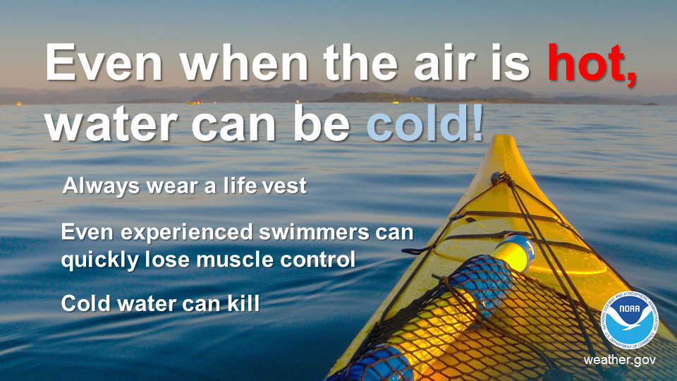
 Radar
Radar Current Weather
 Rivers & Lakes
 Satellite
 Forecast Maps
 Hour by Hour Forecast
 Tropical Weather
 Graphical Hazards
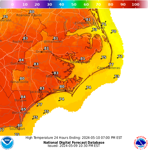 Map View
 Weather Hazard Briefing (when applicable)
 Forecaster Discussion
 Marine
 Text Products
.png) Skywarn
Skywarn Submit Storm Reports
 Coastal Flood
.png) Surf Forecast/Rip Currents
Surf Forecast/Rip Currents Follow us on X
 Follow us on Facebook
 Follow us on YouTube
 MHX RSS Feed