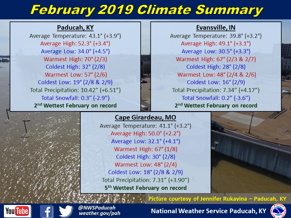
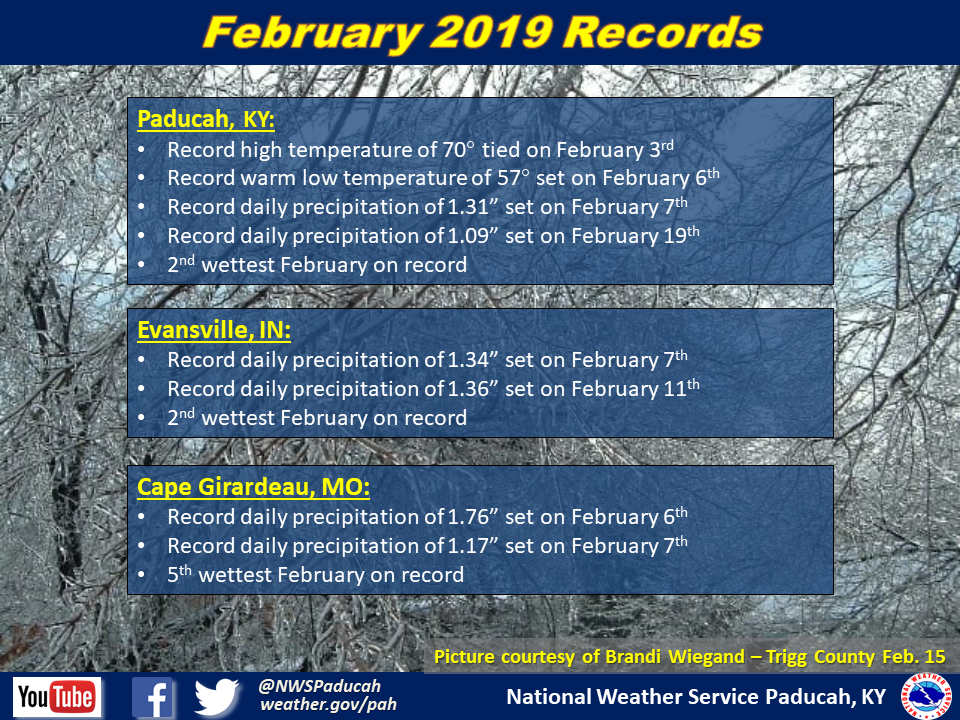
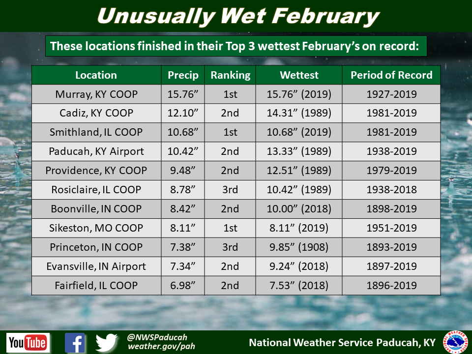
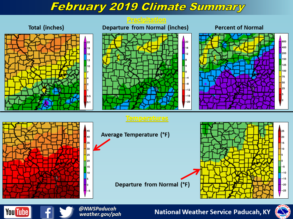
February 2019 Climate Review: The main headline for the month was the excessively wet conditions that were relentless from February 6th through 23rd. Western Kentucky saw the brunt of the heavy rainfall with totals of 9 to 15 inches common. Elsewhere 5 to 9 inches occurred across most of southeast Missouri, southern Illinois, and southwest Indiana. The only area that finished close to normal for the month was a small area around Mount Vernon, Illinois. Many locations received anywhere from 4 to 11 inches above their normal February precipitation. Many cities across the region finished in their top 3 wettest February's on record, including Paducah, KY and Evansville, IN which both finished 2nd wettest. Cape Girardeau, MO notched their 5th wettest February. Moderate to major river flooding was observed due to the repeated rounds of heavy rainfall. Snowfall was below normal for the month across most of the area, except for a corridor from Perryville, MO to Carbondale and Marion, IL that observed 3 to 5 inches of snow February 15-16. That same system brought ice accumulations in excess of a quarter of an inch across portions of western Kentucky including the Paducah area. As for temperatures, they finished above normal by 3 to 4 degrees.
The graphic below is an interpolated rainfall map using actual observations. Please note that there are likely discrepancies in between observations, since the values are estimated based on nearest reports.
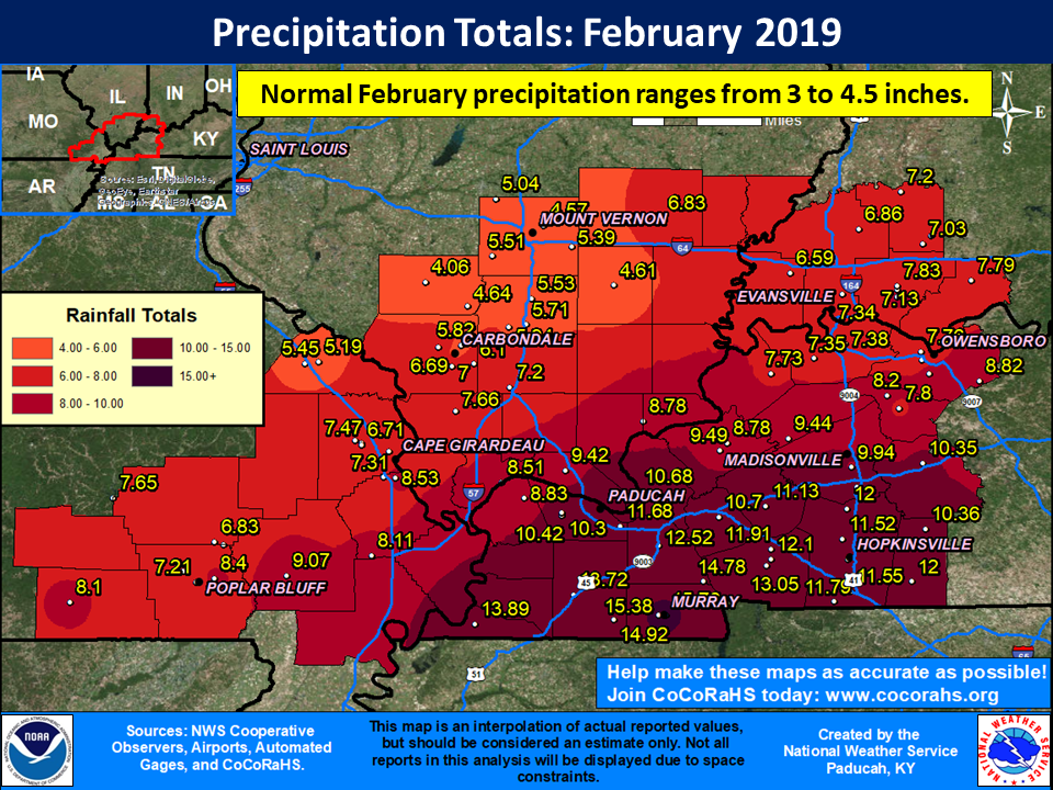
| February 2019 Review: Precipitation and Temperature Maps (Click on image to enlarge) |
 |
| Climate Maps are from the Northeast Regional Climate Center |