A couple of frontal boundaries will move east and south from the Plains to the Gulf and Atlantic coastlines. These boundaries will focus showers and thunderstorms through the weekend, with scattered severe thunderstorms from the Southern Plains and across the Gulf Coast states. Locally heavy rainfall may also occur, which may be welcome news across drought areas. Meanwhile, heat spreads westward. Read More >
Paducah, KY
Weather Forecast Office
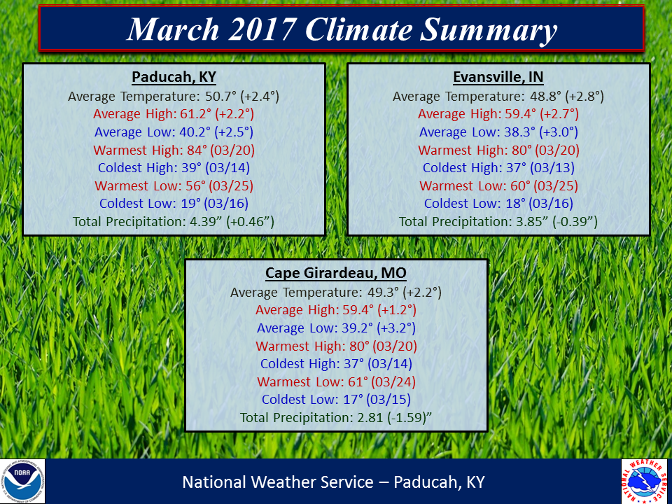
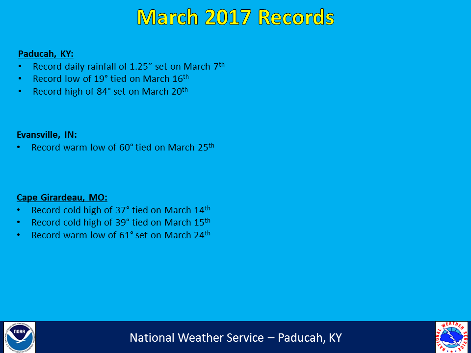
March 2017 saw above normal temperatures and generally near normal precipitation across the region. The northern half of the area, encompassing much of southern Illinois, southwest Indiana, and northwest Kentucky saw below normal precipitation for the month. Above normal precipitation was observed over the southern counties, from portions of southeast Missouri into western Kentucky. Temperatures generally ran 2 to 3 degrees above normal across the area. March became the 10th consecutive month with above normal temperatures in Paducah, Evansville, and Cape Girardeau. It was a rather active month with several days of severe weather, especially early in the month.
| March 2017 Review: Precipitation and Temperature Maps (click to enlarge) |
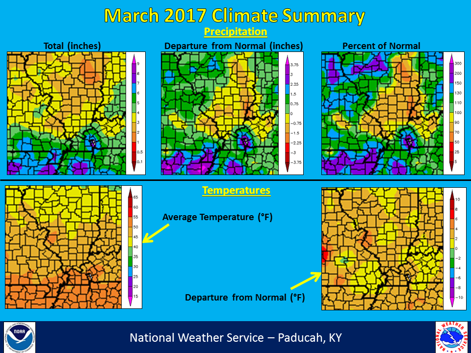 |
| Climate Maps are from the Northeast Regional Climate Center |
FORECASTS
Forecast Discussion
User Defined Area Forecast
Hourly Forecasts
Fire Weather
Activity Planner
LOCAL INFORMATION
Aviation Weather
Our Office
SKYWARN
Items of Interest
Hazardous Weather Support
Local Observations
Weather History
NWS Paducah KY Weekly Partner Briefing
US Dept of Commerce
National Oceanic and Atmospheric Administration
National Weather Service
Paducah, KY
8250 Kentucky Highway 3520
West Paducah, KY 42086-9762
270-744-6440
Comments? Questions? Please Contact Us.