Pendleton, OR
Weather Forecast Office
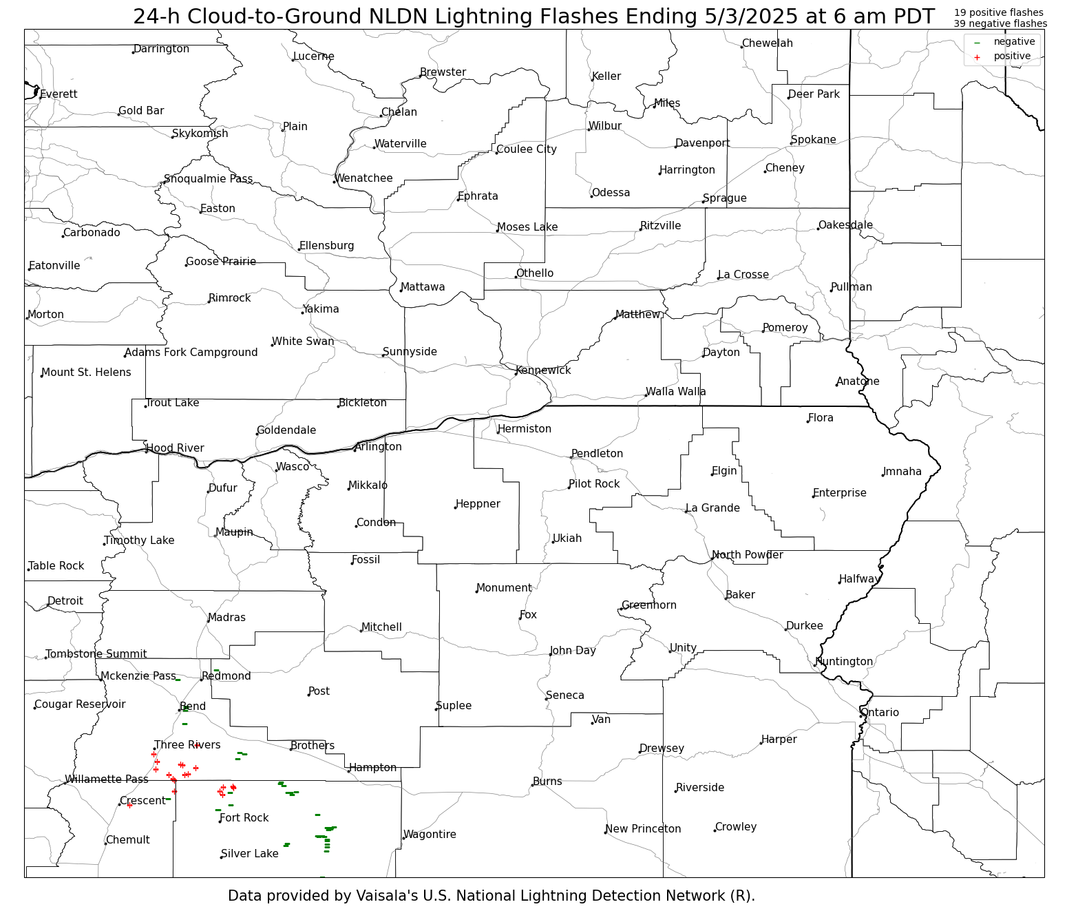
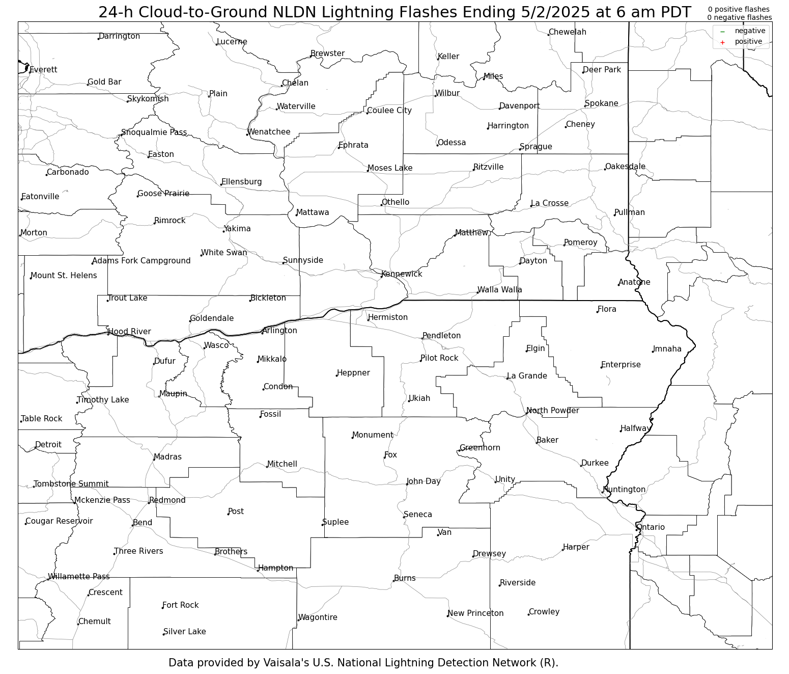
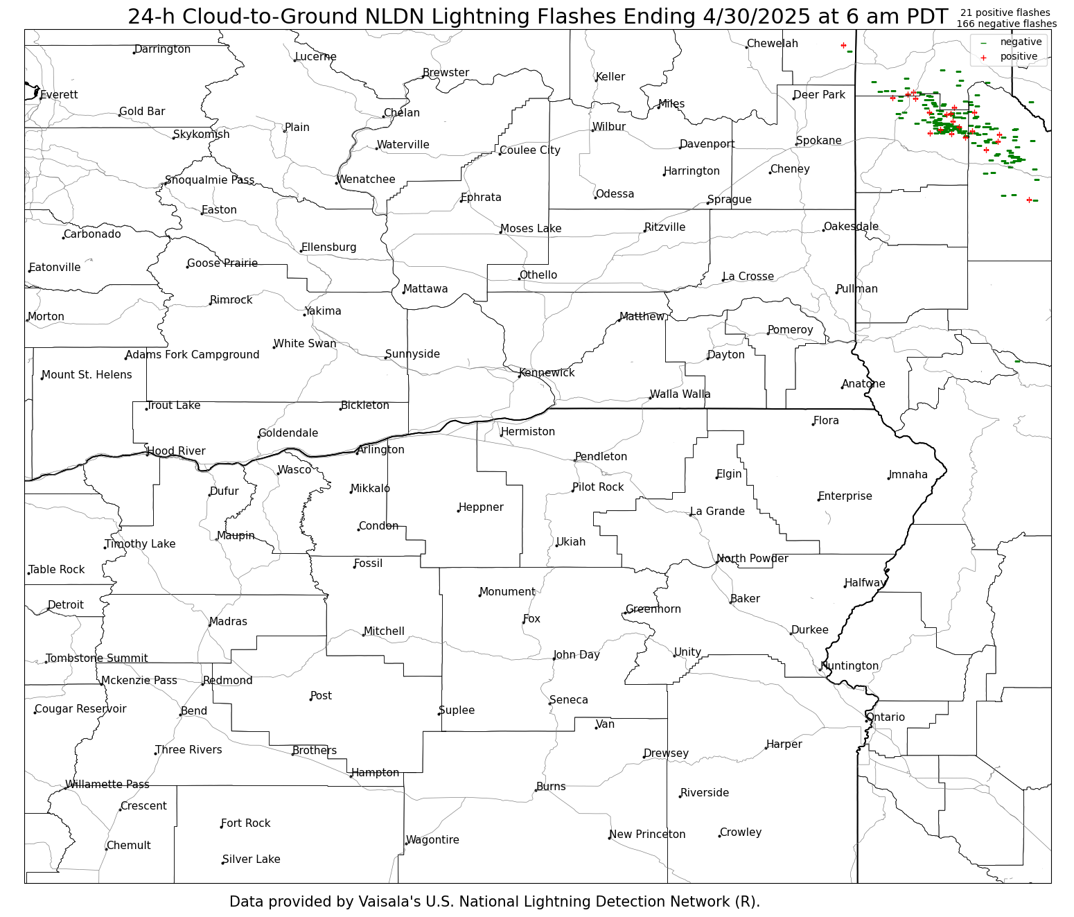
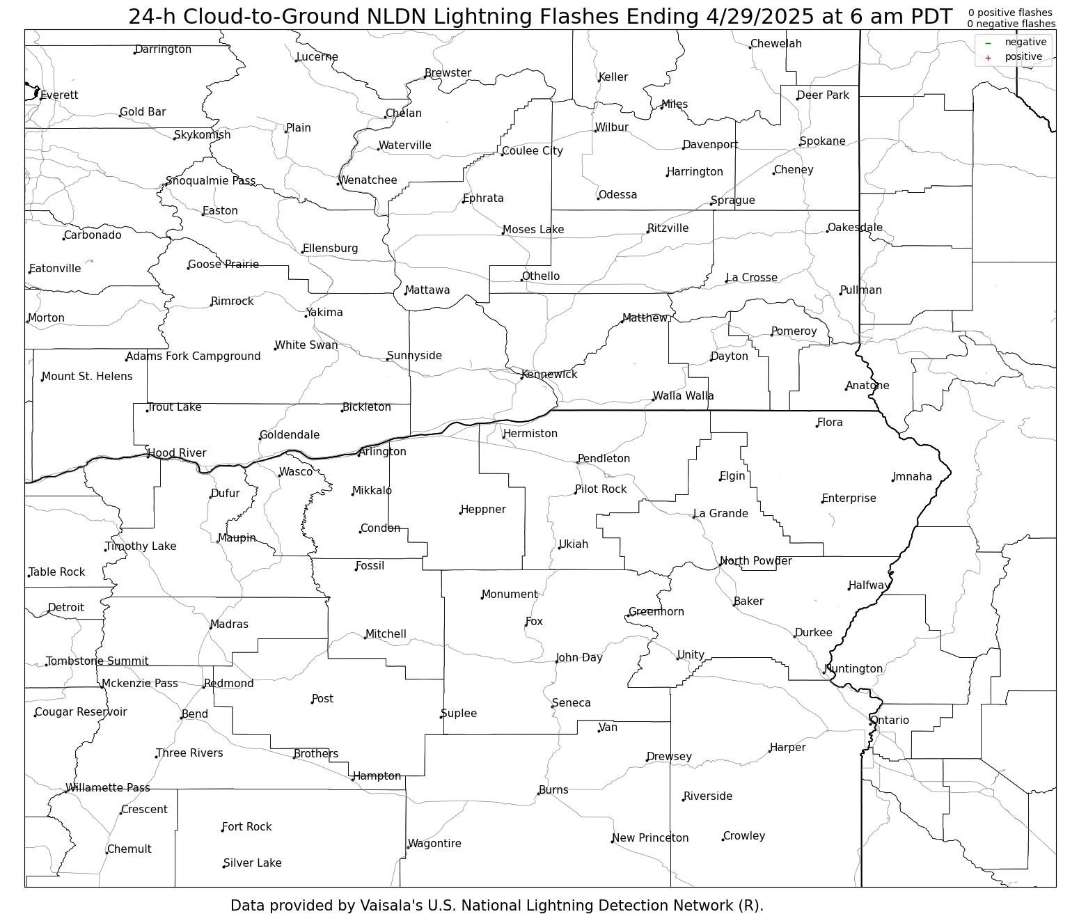
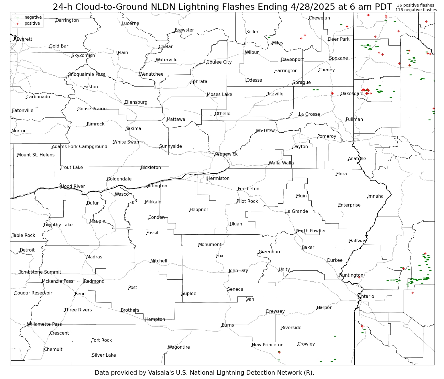
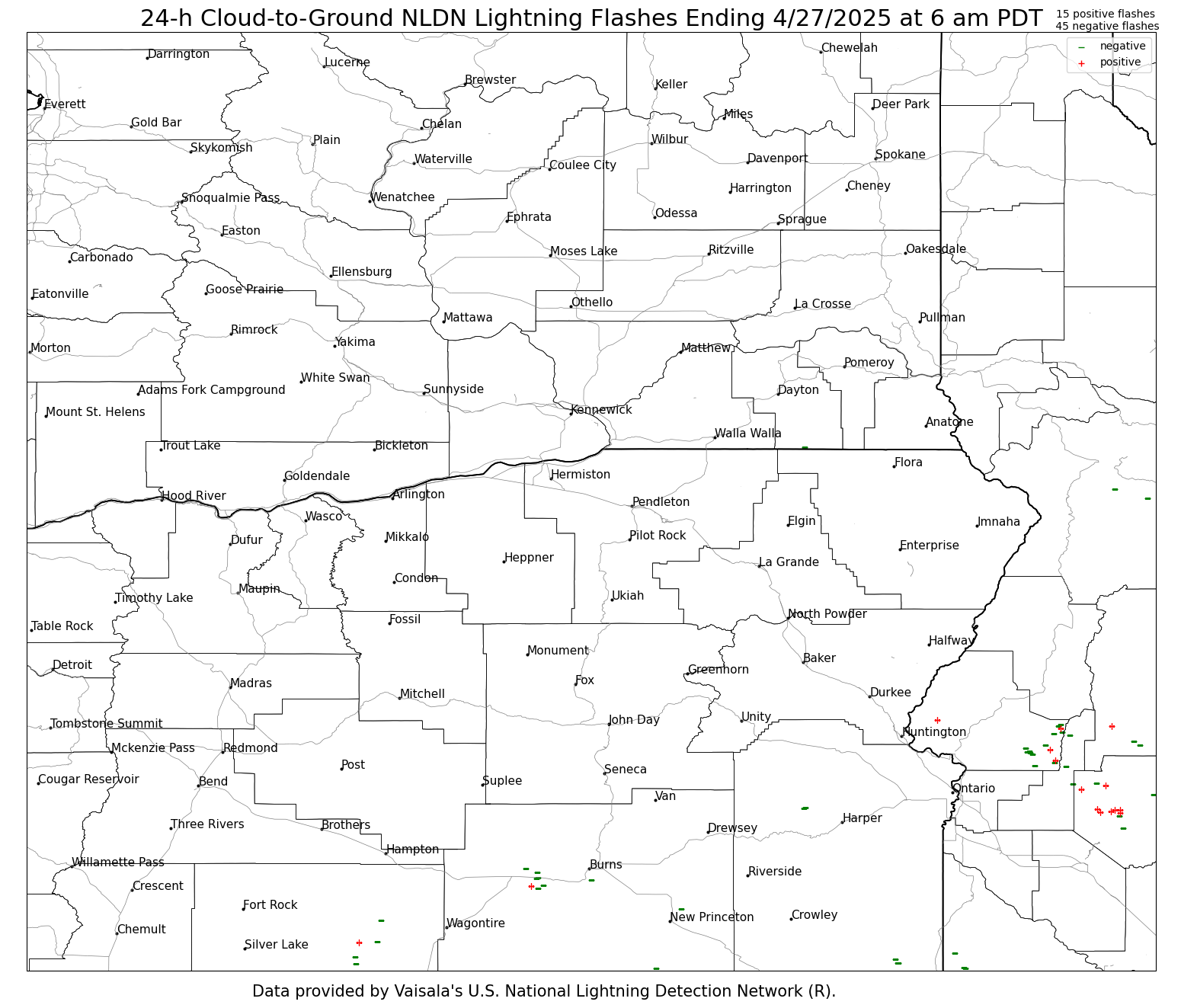
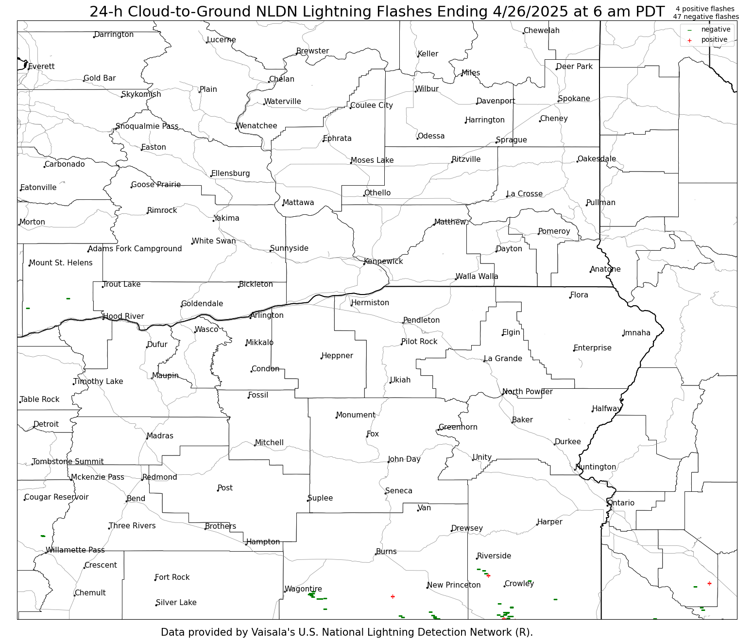
The lightning images below are updated daily around 7:30–8:30 AM and contain 24-h accumulations of lightning ending at 6 am PDT (5 am PST) each day. These are NLDN cloud-to-ground flashes. Cloud-to-ground lightning flashes are based on a surface detection network. Mouse over each day to view the 24-h cumulative lightning flash maps. Printable versions are at the bottom.
| 24-h Cumulative NLDN Cloud-to-Ground Lightning Flashes |
Yesterday | 2 Days Ago | 3 Days Ago | 4 Days Ago | 5 Days Ago | 6 Days Ago | 7 Days Ago | 8 Days Ago |
 |
||||||||
Printable: Yesterday, 2 Day Ago, 3 Days Ago, 4 Days Ago, 5 Days Ago, 6 Days Ago, 7 Days Ago, 8 Days Ago
US Dept of Commerce
National Oceanic and Atmospheric Administration
National Weather Service
Pendleton, OR
2001 NW 56th Drive
Pendleton, OR 97801
(541) 276-4493
Comments? Questions? Please Contact Us.

