Portland, OR
Weather Forecast Office
 |
Forecasts |
|
|
Observations |
|
|
Warnings & Advisories |
|
|
Forecast Guidance |
|
|
Education & Outreach |
 |
|
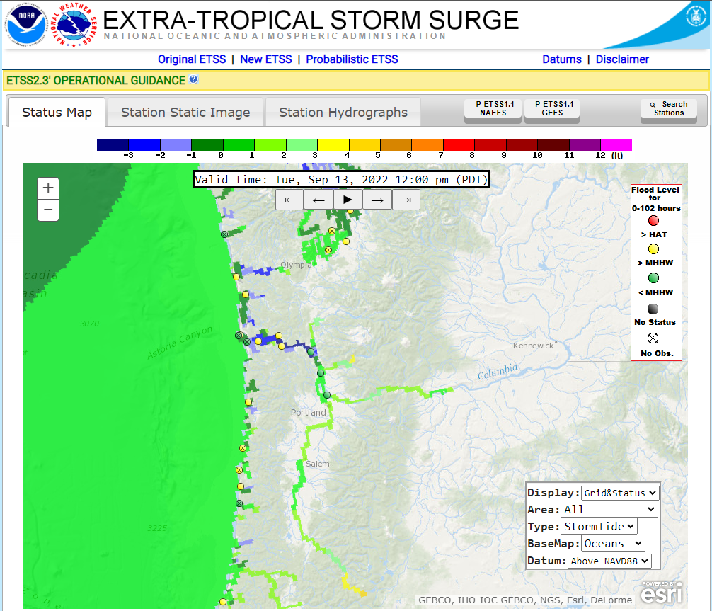
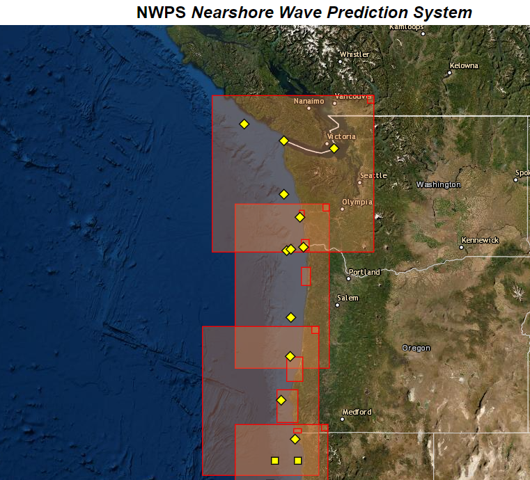
NWPS Model NOAA GFS WAVE Extratropical Storm Surge NOS High Tide Bulletin |
| Nearshore Wave Prediction System (NWPS) | Other Model Guidance |
|
Coastal Water domains Coastal Bar domains |
Wind and Wave Guidance Storm Surge, SST, and Currents |
US Dept of Commerce
National Oceanic and Atmospheric Administration
National Weather Service
Portland, OR
5241 NE 122nd Avenue
Portland, OR 97230-1089
(503) 261-9246
Comments? Questions? Please Contact Us.


.PNG)