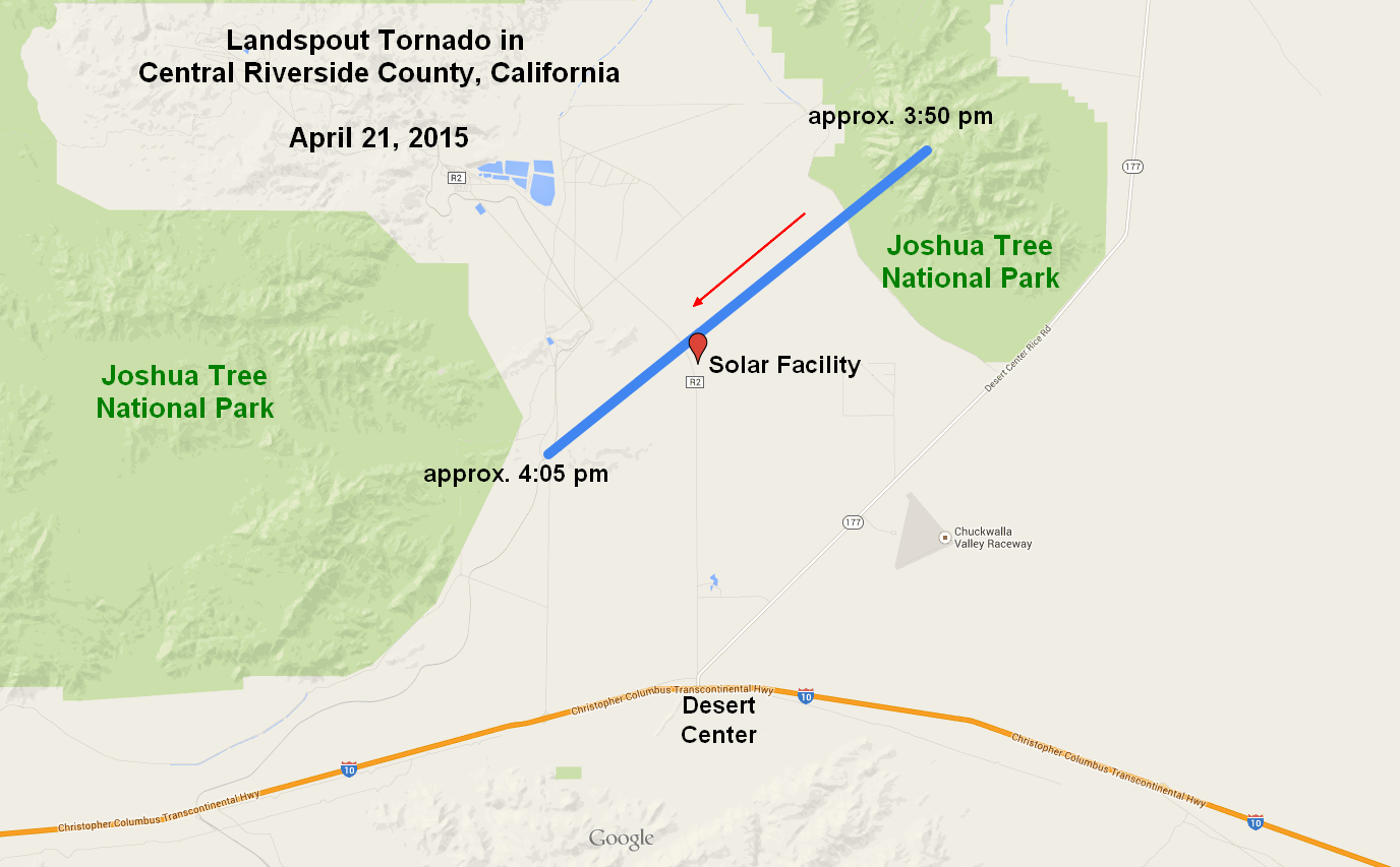
Isolated showers and thunderstorms developed over portions of southern California during the afternoon hours on 21 April 2015 as low pressure slowly moved through the L.A. basin. One storm in particular near Desert Center, CA developed rapidly around 3:30pm PDT and eventually produced a weak "landspout" tornado at approximately 3:50pm PDT. The tornado formed just east of Kaiser Rd (R2) and caused minor damage at a nearby solar facility as it moved to the southwest.
 |
|
Approximate tornado damage path, estimated from public photos, videos, and storm reports |
 |
 |
 |
|
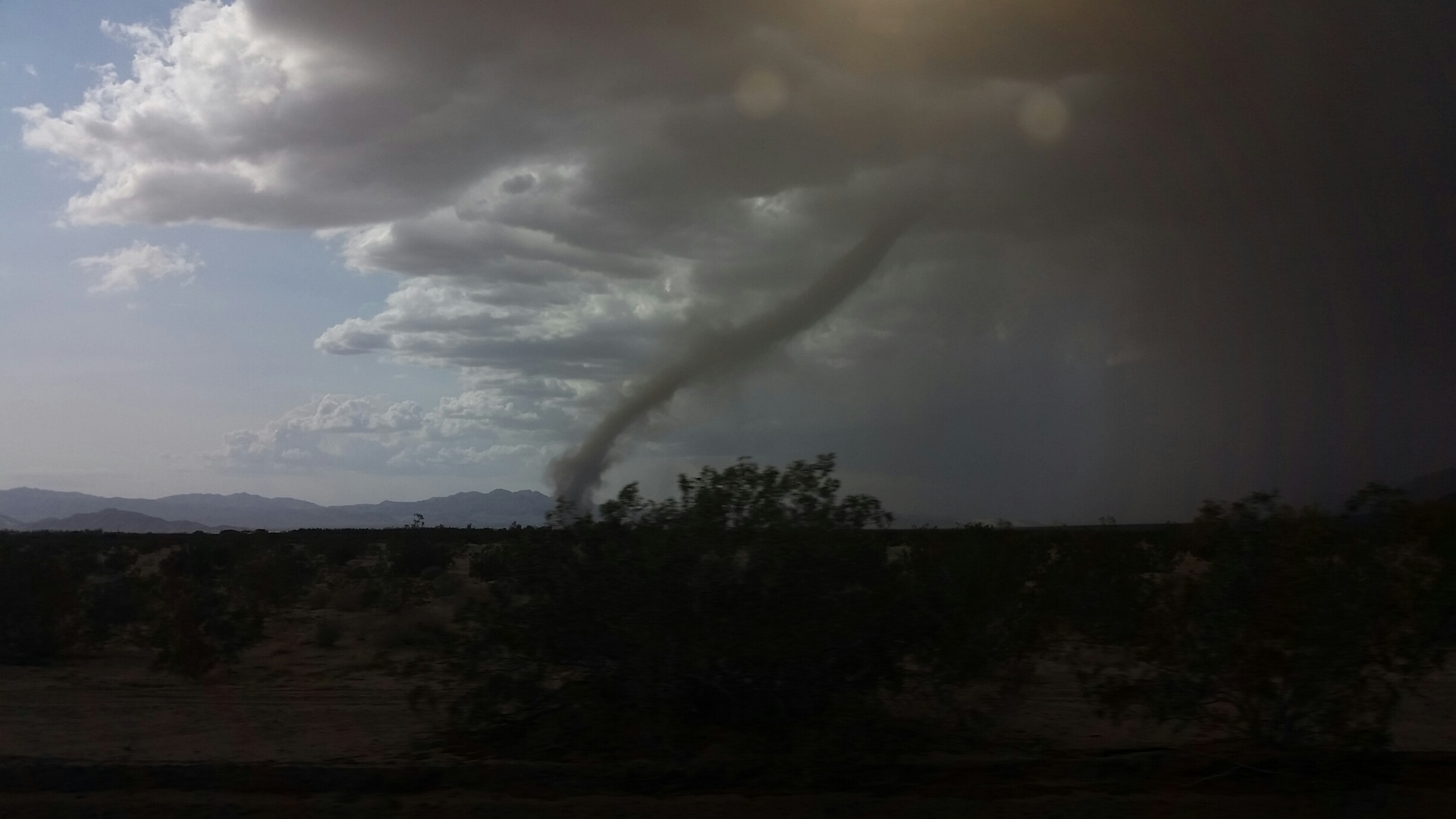
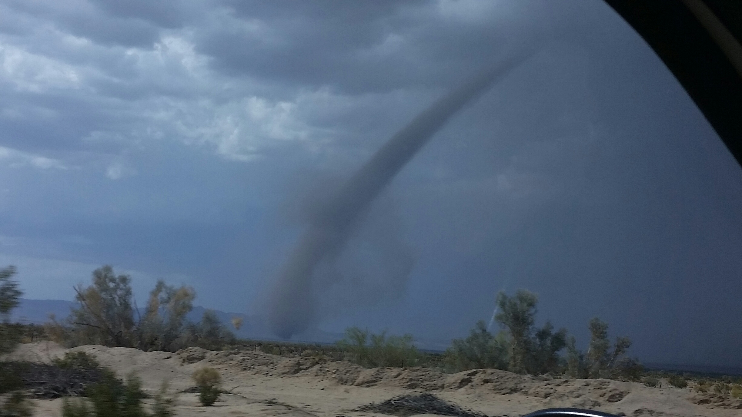
Viewer Brigitte Jerke (ABC15), as seen from Interstate 10 at the Desert Center interchange. |
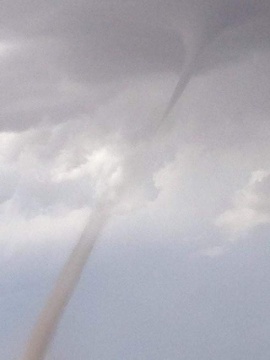
Viewer Renee Castor (KSEQ), as seen near Desert Center Solar project. |
Viewer Brigitte Jerke (ABC15), as seen from Intersate 10 at the Desert Center interchange. |
"Landspout" tornadoes can develop when strong updrafts form in an area of strong surface vorticity (shear). The surface vorticity is stretched upward into the vertical as the storm strengthens overhead, with the rotating column of air eventually reaching the cloud base. Since this rotating column of air is in contact with both the cloud base and the ground, it meets the definition of a tornado.
"Landspout" tornadoes differ from more traditional "supercell" tornadoes in a number of ways. Supercells form when the atmosphere exhibits considerable instability and considerable shear (change in wind speed and direction) and as a result, contains a storm-scale area of rotation known as a mesocyclone. Cloud bases near this mesocyclone begin to lower and form a wall cloud, at which point a rotating narrow column of air may decend and form a tornado. The storm associated with "Landspout" tornadoes do not contain a mesocyclone and do not form in areas of considerable wind shear. Also, cloud bases are often considerably higher and do not typically lower as the tornado develops. For that reason, "landspout" tornadoes are often significantly weaker and often produce limited damage.
 |
 |
 |
|
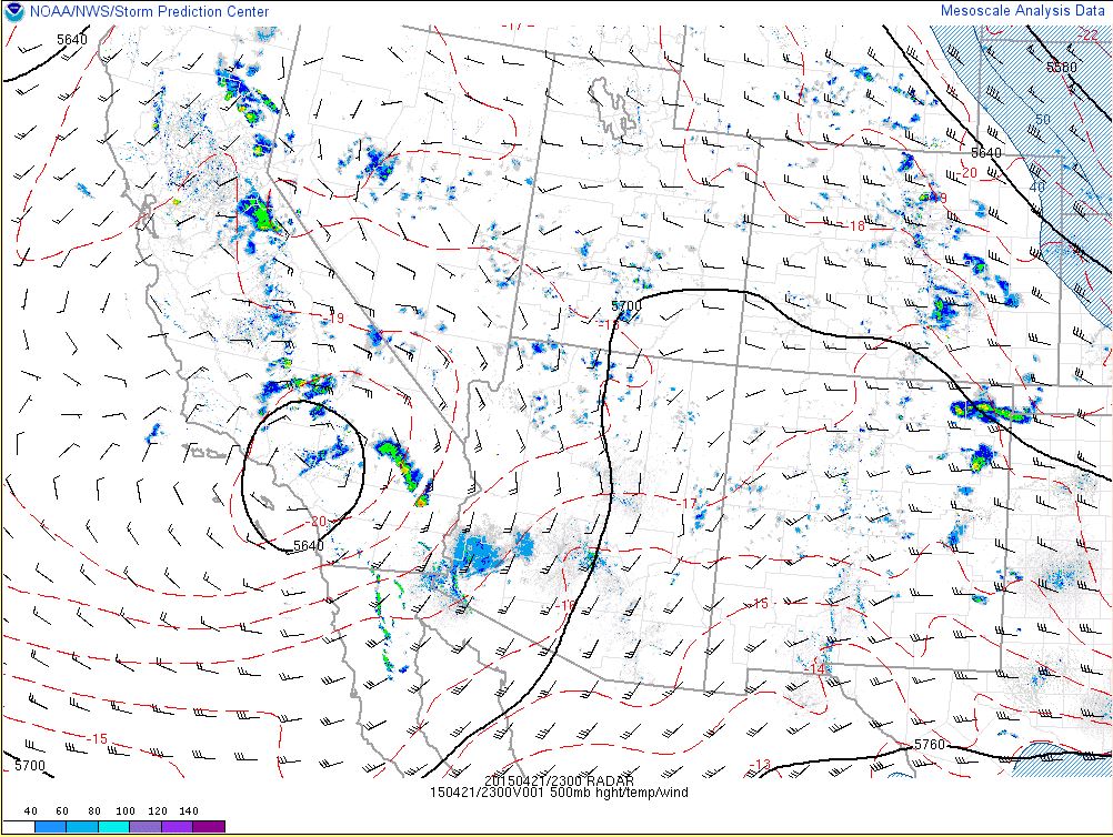
500mb heights (23Z RAP analysis) indicating a mid-level low pressure system over the L.A. basin |
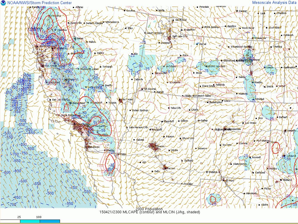
Mixed Layer CAPE (23Z RAP analysis) indicating approximately 100-250 J/Kg CAPE near Desert Center, CA |
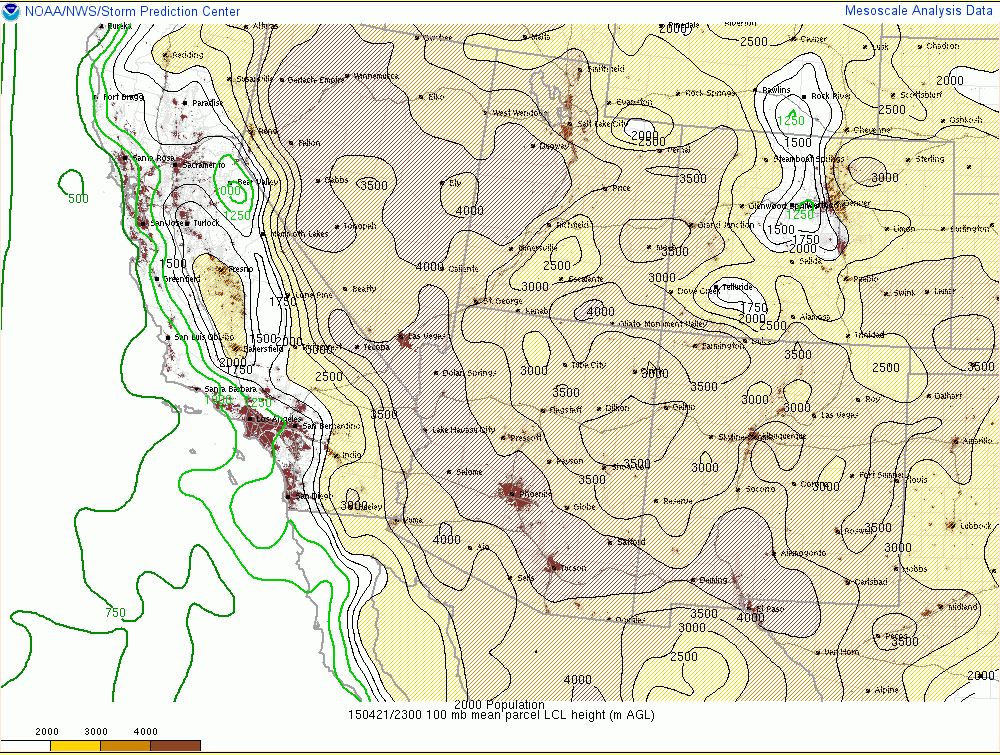
Lifting Condensation Level (LCL) heights (23Z RAP analysis) as an indicator for cloud bases across the area. |
 |
 |
 |
|
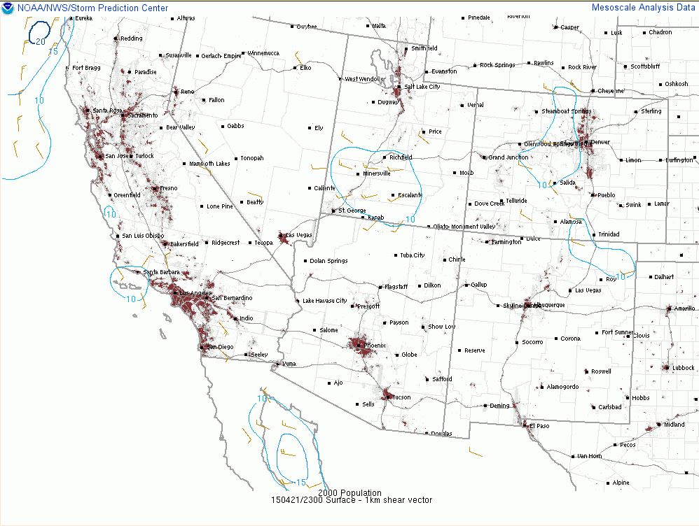
0-1km wind shear (23Z RAP analysis) indicating less than 10kts of shear around Desert Center, CA |
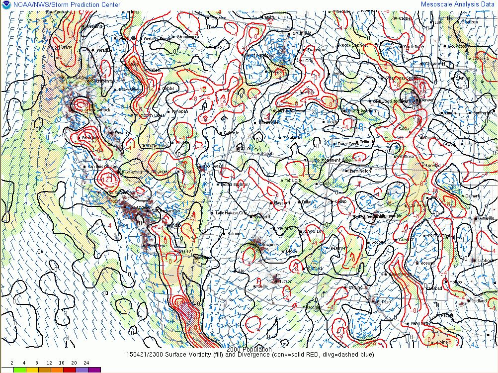
Surface Vorticity/Surface Convergence (23Z RAP analysis) indicating a vorticity maximum and area of strong surface convergence across much of southeast California |
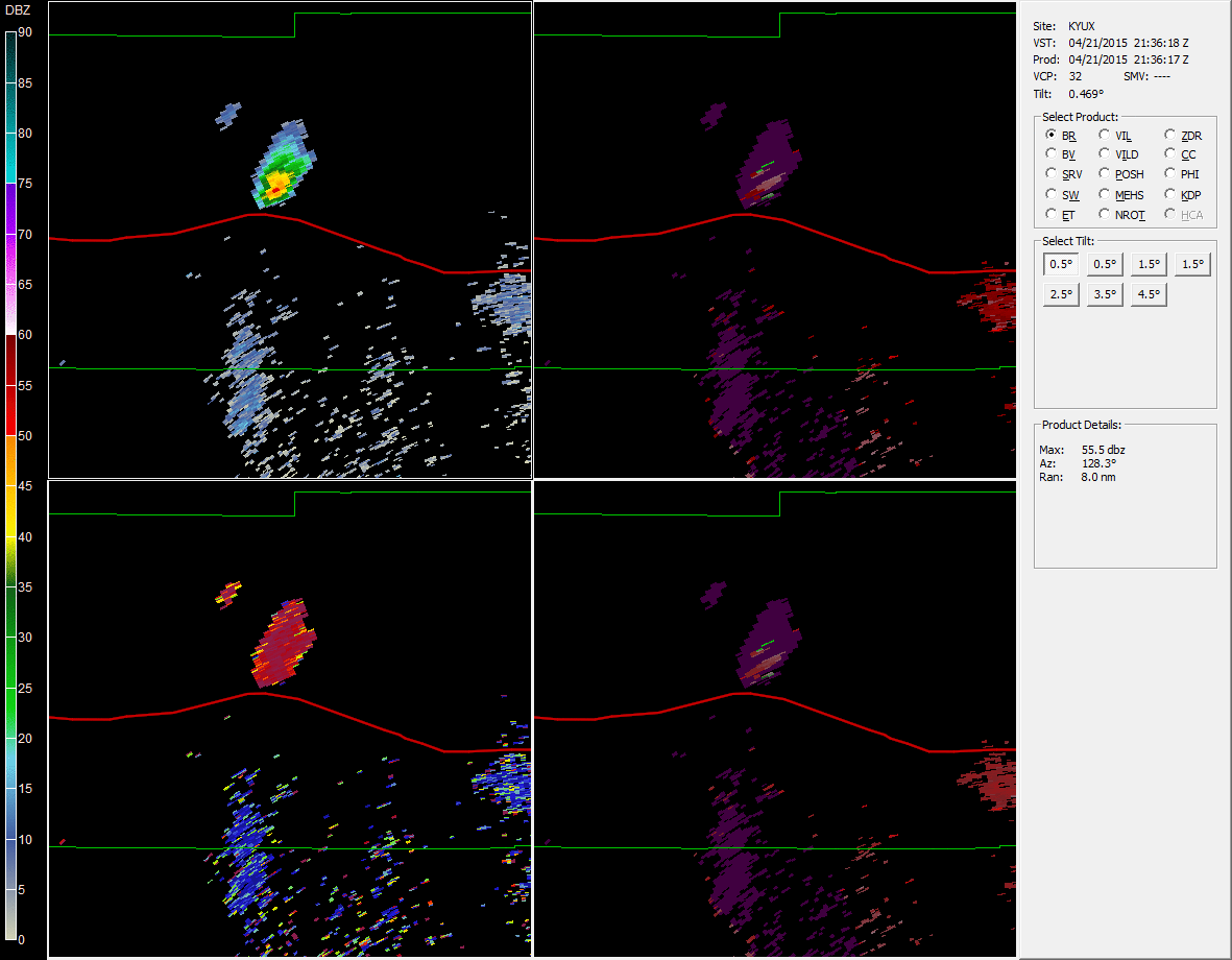
4 panel radar loop (Base Reflectivity, Base Velocity, Storm-Relative Velocity, Correlation Coefficient) showing the development and progression of the thunderstorm that produced a tornado near Desert Center, Ca. Time: 2:35pm - 4:15pm PDT |
PUBLIC INFORMATION STATEMENT NATIONAL WEATHER SERVICE PHOENIX AZ 1251 PM MST WED APR 22 2015 ...DESERT CENTER TORNADO RATED EF0... AT APPROXIMATELY 315 PM PDT ON APRIL 21 2015 AN ISOLATED THUNDERSTORM RAPIDLY DEVELOPED OVER CENTRAL RIVERSIDE COUNTY IN THE GENERAL VICINITY OF DESERT CENTER. AT APPROXIMATELY 350 PM PDT THE THUNDERSTORM DEVELOPED SOME INDICATIONS OF MARGINALLY SEVERE CHARACTERISTICS FOR ABOUT 10 MINUTES BASED ON DOPPLER RADAR IMAGERY FROM THE DISTANT RADAR SITE LOCATED IN YUMA AZ. BECAUSE OF THE DISTANCE FROM THE RADAR TO THE STORM THE RADAR WAS NOT ABLE TO VIEW THE ATMOSPHERE BELOW ABOUT 10000 FEET ABOVE GROUND LEVEL IN THE VICINITY OF THE STORM. A SIGNIFICANT WEATHER ADVISORY WAS ISSUED SHORTLY AFTERWARDS TO ADDRESS THIS STORM AND INDICATED IT WAS MOVING TOWARDS THE NORTH AT 5 MPH. WITHIN TWO HOURS AFTER THE STORM THE NATIONAL WEATHER SERVICE IN PHOENIX BEGAN TO RECEIVE PHOTOS AND VIDEOS FROM THE PUBLIC VIA SOCIAL MEDIA INDICATING A POSSIBLE TORNADO IN THE VICINITY. IN ADDITION...A PILOT REPORT WAS LATER RELAYED TO THE NWS INDICATING A PILOT SPOTTED A TORNADO IN THE VICINITY AT THAT TIME. AFTER VIEWING THESE MATERIALS AND REPORTS WE CONFIRMED THE STORM AS A TORNADO AND INITIALLY PLACED ITS LOCATION NEAR CA STATE HIGHWAY 177 JUST TO THE EAST OF JOSHUA TREE NATIONAL PARK. HOWEVER...AFTER CAREFULLY REVIEWING VIDEO IT APPEARS THAT THIS TORNADO WAS A LANDSPOUT TORNADO...MEANING IT DID NOT FORM FROM A MESOCYCLONE...AND LIKELY FORMED OVER THE EXTREME SOUTHEAST PORTION OF JOSHUA TREE NATIONAL PARK OVER THE COXCOMB MOUNTAINS AND MOVED TOWARDS THE SOUTHWEST INTO THE CHUCKWALLA VALLEY AT A SLOW SPEED...LIKELY 5 TO 10 MPH. THE NWS OFFICE SUBSEQUENTLY RECEIVED SOME INITIAL DAMAGE REPORTS FROM A SOLAR ENERGY SITE LOCATED IN THE CHUCKWALLA VALLEY 8 MILES NORTH OF INTERSTATE HIGHWAY 10. THE SITE REPORTED NUMEROUS INSTANCES OF BROKEN WINDOWS AND DESTROYED SOLAR PANELS DUE TO ROCKS BEING BLOWN INSIDE OF THE TORNADO. WE HAVE NOT BEEN ABLE TO ASCERTAIN EXACT TIMES OR THE PRECISE TRACK FOR THE LANDSPOUT TORNADO SO WE HAVE HAD TO ESTIMATE THESE BASED ON THE VERY LIMITED RADAR COVERAGE AND THE FEW VIDEOS THAT WERE MADE OF THE EVENT. IN ADDITION...BASED ON THE DAMAGE INFORMATION THAT WAS PASSED TO OUR OFFICE WE HAVE SET A PRELIMINARY STRENGTH OF EF0 TO THIS TORNADO. FOR MORE INFORMATION INCLUDING OUR ESTIMATED TRACK OF THE TORNADO...PUBLIC SUPPLIED VIDEOS AND PHOTOS...AND SUPPORTING METEOROLOGY DATA SUCH AS RADAR...PLEASE VISIT OUR WEBPAGE AT: HTTP://WWW.WRH.NOAA.GOV/PSR/PNS/2015/APRIL/DESERTCENTER.PHP A REVISED LOCAL STORM REPORT IS BEING SENT TO CORRECT THE INITIAL REPORT THAT WAS SENT YESTERDAY. $$ WATERS |

