Southeast California Flooding - July 19, 2015
The moisture surging north from the remnants of Hurricane Dolores combined with the old circulation center spinning off the southern California coast created conditions ripe for numerous thunderstorms and flooding throughout southeast California on Sunday, July 19th. The atmosphere across the Southwest United States became unusually moist and unstable as early as Saturday with severe thunderstorms impacting many communities with hail and strong winds. By Sunday, the winds through the atmosphere became extremely favorable for additional storms, and especially storms that were slow moving and capable of flash flooding.
 |
 |
|
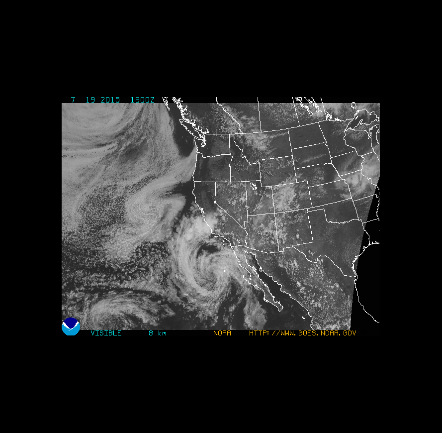
GOES-West Large Scale Visible Image (note the remnant Dolores circulation south of San Diego) (click on image for large loop) |
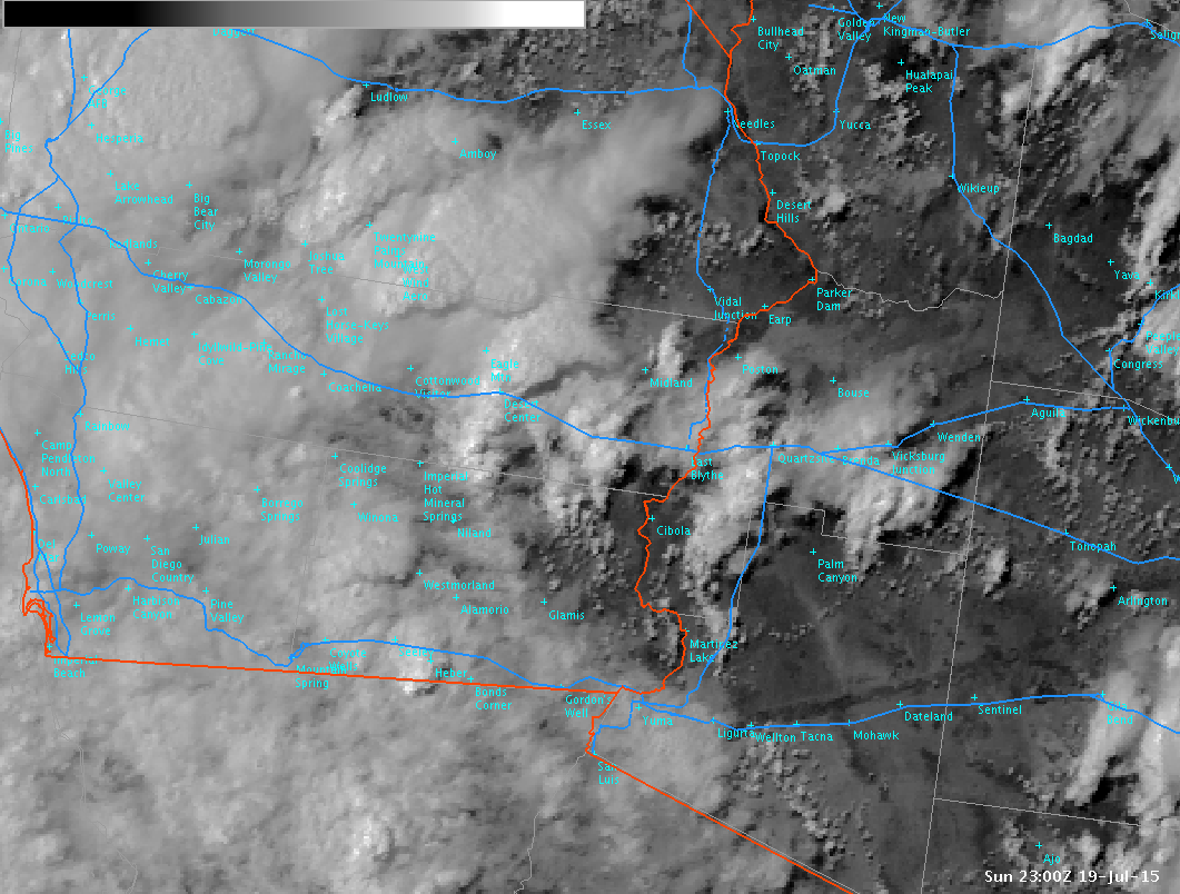
Zoomed GOES-West Image of Southeast California (storms sit right on Interstate 10) (click on image for large loop) |
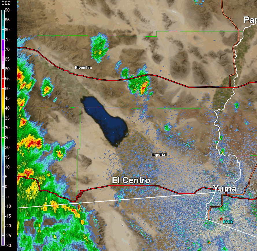
Thunderstorms developed quickly over southeast California early in the day, and persisted into the evening hours. The very moist environment allowed for these storms to become efficient rain producers. Below is a partial radar loop during the day, and notice how the storms aligned and continued to impact the same locations with prolonged heavy rainfall, especially along Interstate 10.
 |
|
Yuma (KYUX) Doppler Radar (click image for loop from 210pm through 546pm PDT)
|
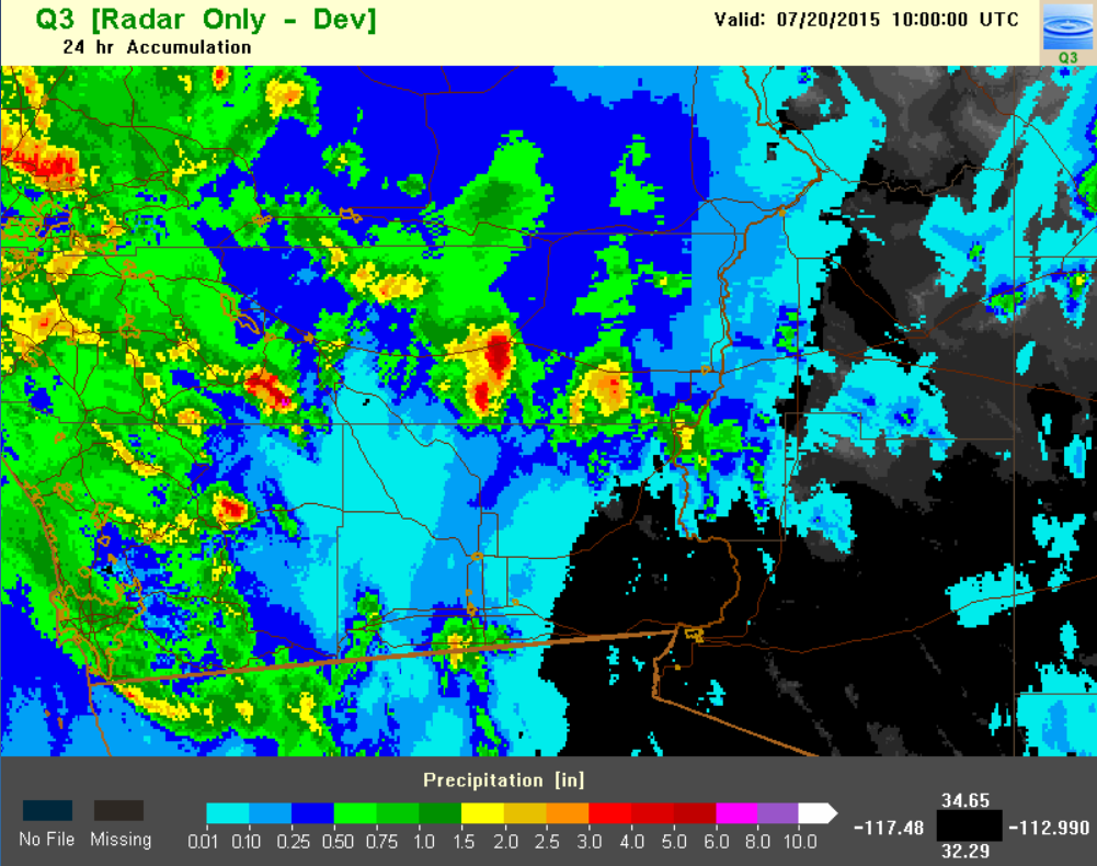
The combination of heavy rainfall rates and prolonged residence time over one location led to extensive flash flooding. The extent and magnitude of this heavy rainfall can be seen in the following map of rainfall totals derived from radar estimated data. Over 5 inches of rain fell along Interstate 10 near Desert Center.
 |
|
Radar Estimate Rainfall Data (Source NSSL Q3)
|
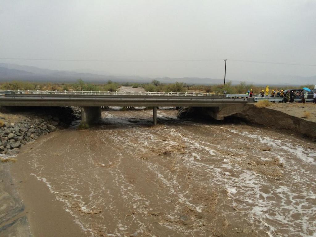
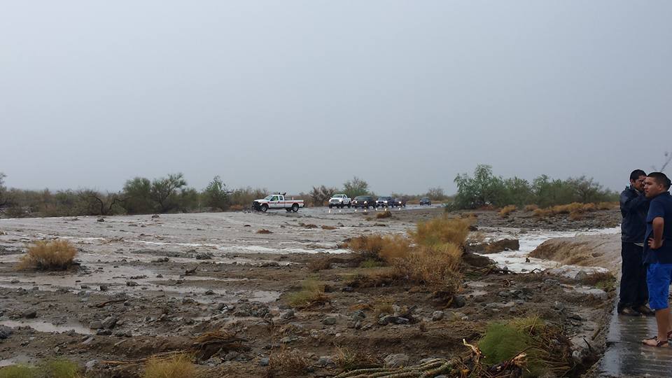
The resulting rain and flash flooding eventually flooded over Interstate 10 and completely washed out the eastbound portion of a bridge crossing Tex Wash. One motorist and his vehicle fell into the flooded wash after the bridge collapsed, but luckily his truck was secured before being washed away, and the driver rescued and transported to the hospital with injuries. Below are images captured by CalFire Riverside during the rescue operation (click on images for full sized version).
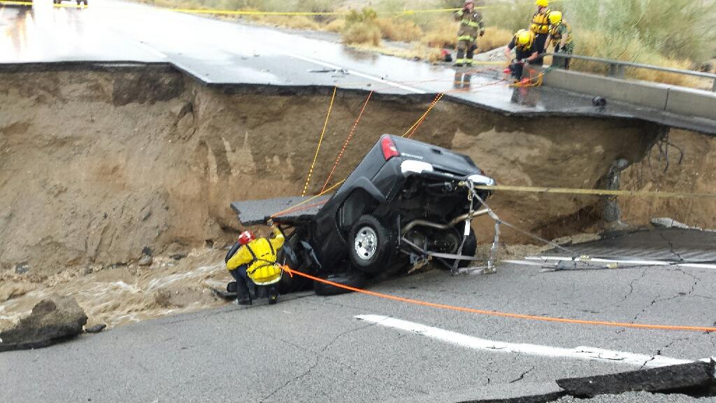 |
 |
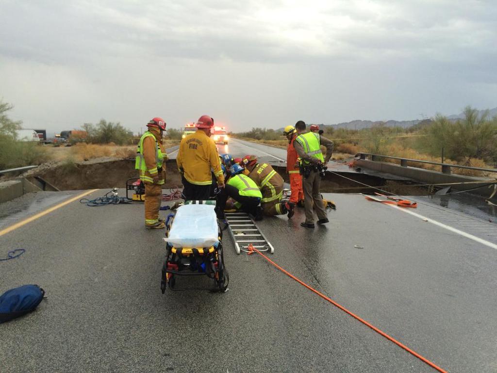 |
Below are images captured by motorist Christina Collin (click on images for full sized version).
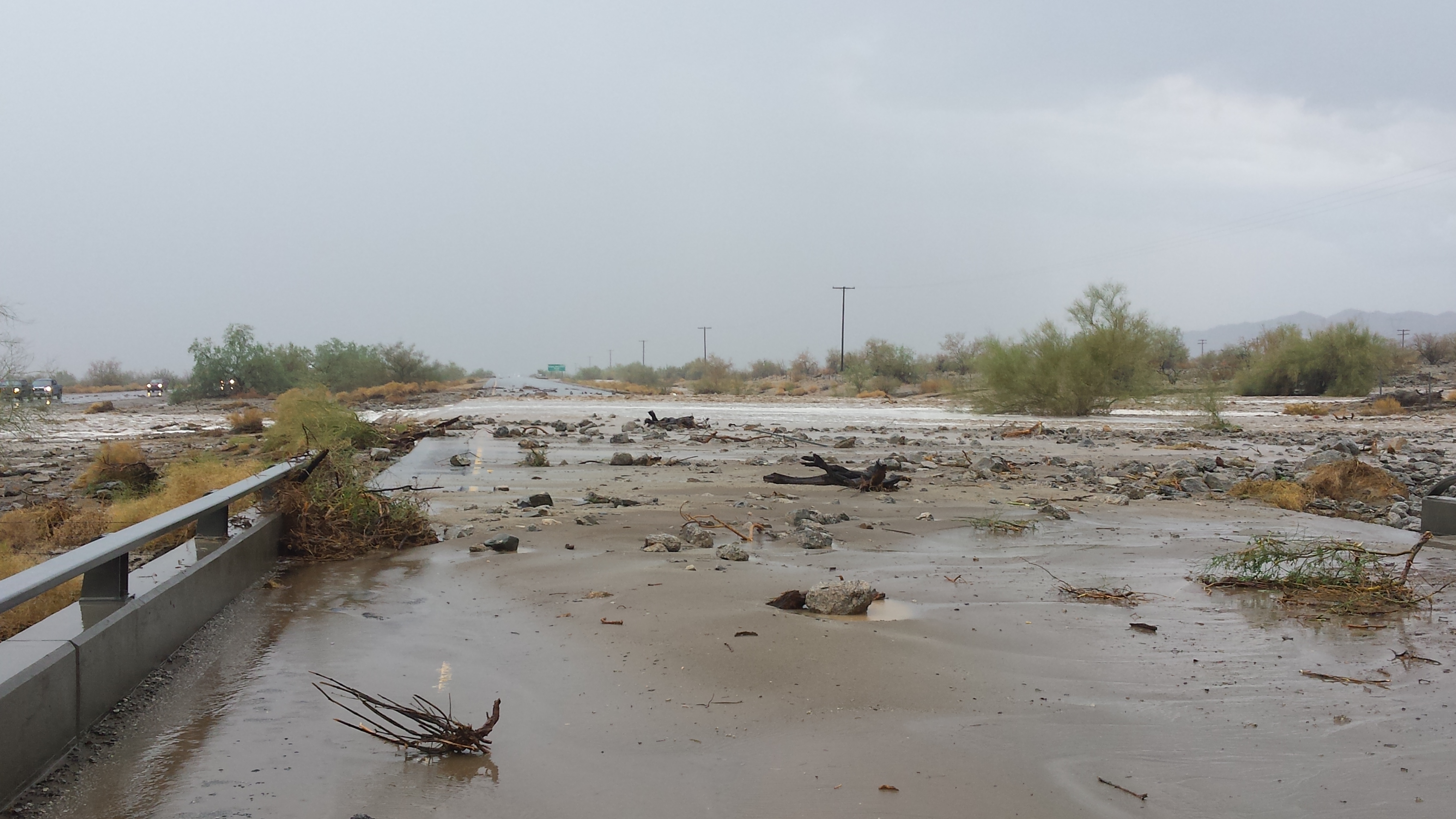 |
 |
Unfortunately, this flash flooding not only destroyed the bridge on the eastbound side of the Interstate, but also compromised the integrity of bridge on the westbound side. Therefore, the entire stretch of Interstate 10 between the Arizona border and Coachella was closed for an extended period of time. A Commuter Alert from CalTrans can be found here.

