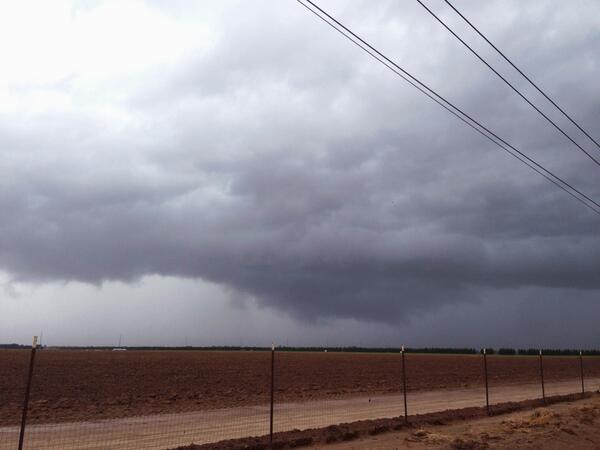
A powerful Pacific storm system gathered energy and moisture off the California and Mexican coast as the month of February came to a close. The initial river of atmospheric moisture dumped copious amounts of rain across central and southern California on Friday, February 28th. Arizona had to wait until the main core of the storm system came ashore on Saturday, March 1st before the action shifted east. The combination of strong atmospheric dynamics, a moisture laden airmass, and just enough sunshine and daytime heating to yield unstable conditions all came together over central Arizona late Saturday morning and afternoon.

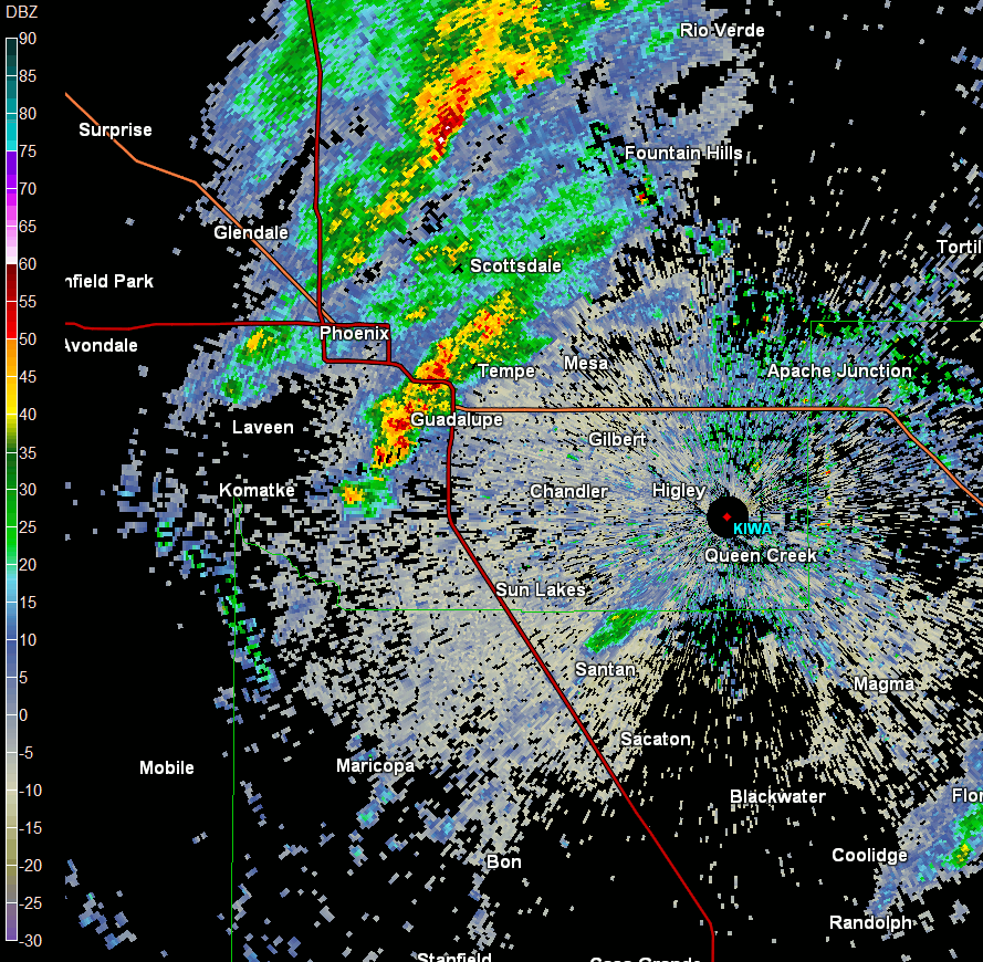
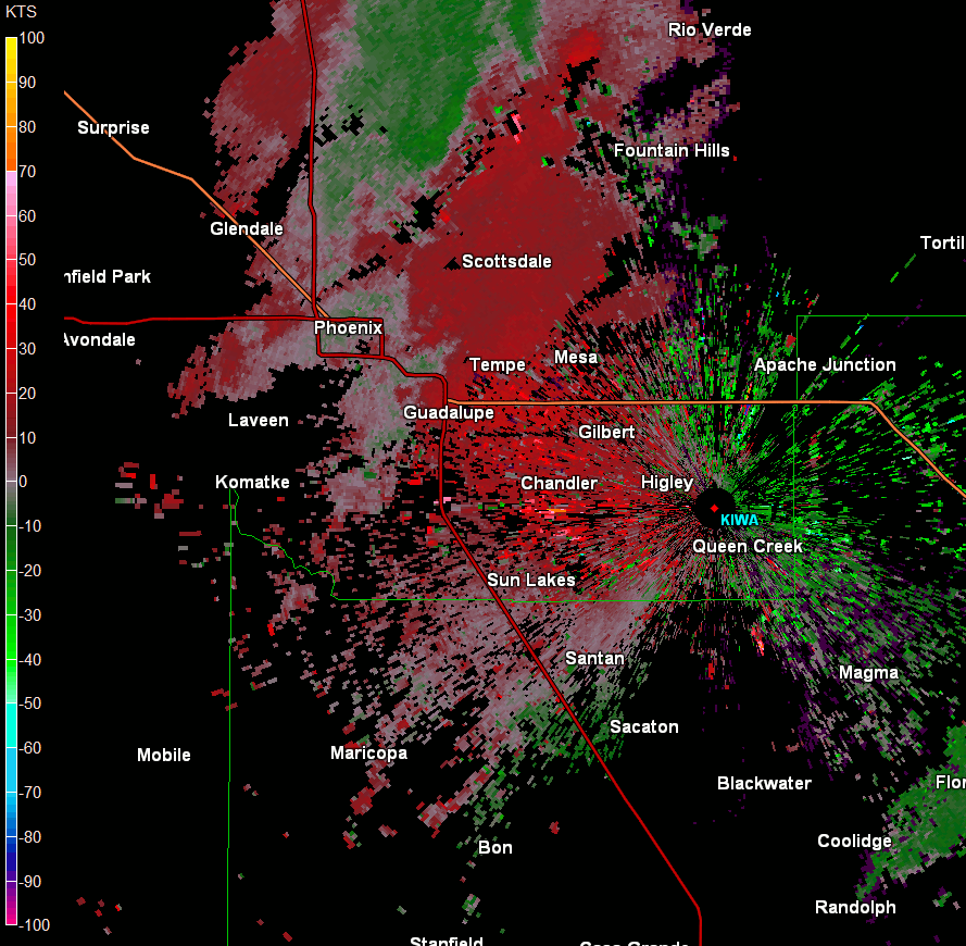
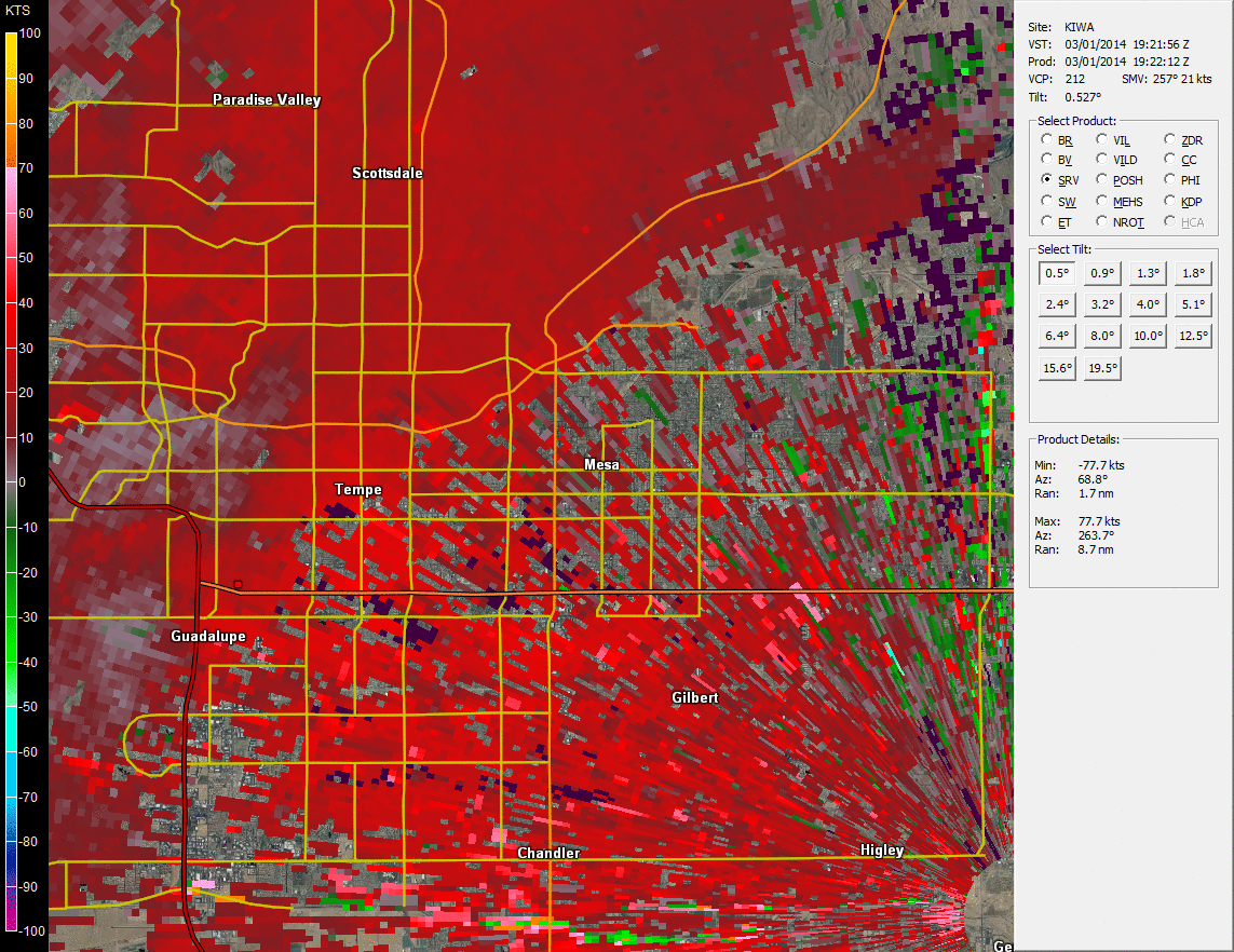
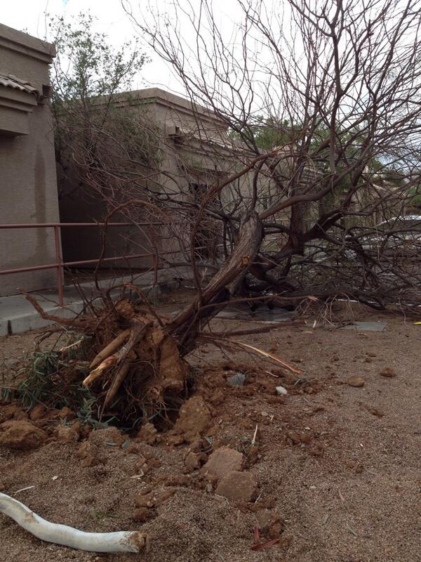
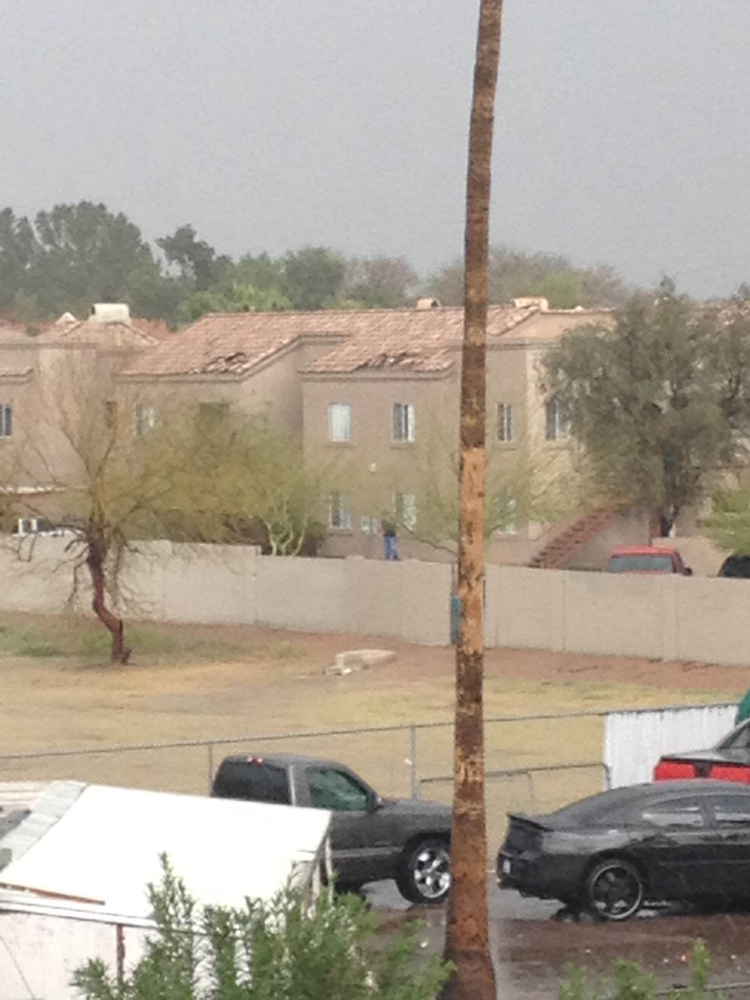
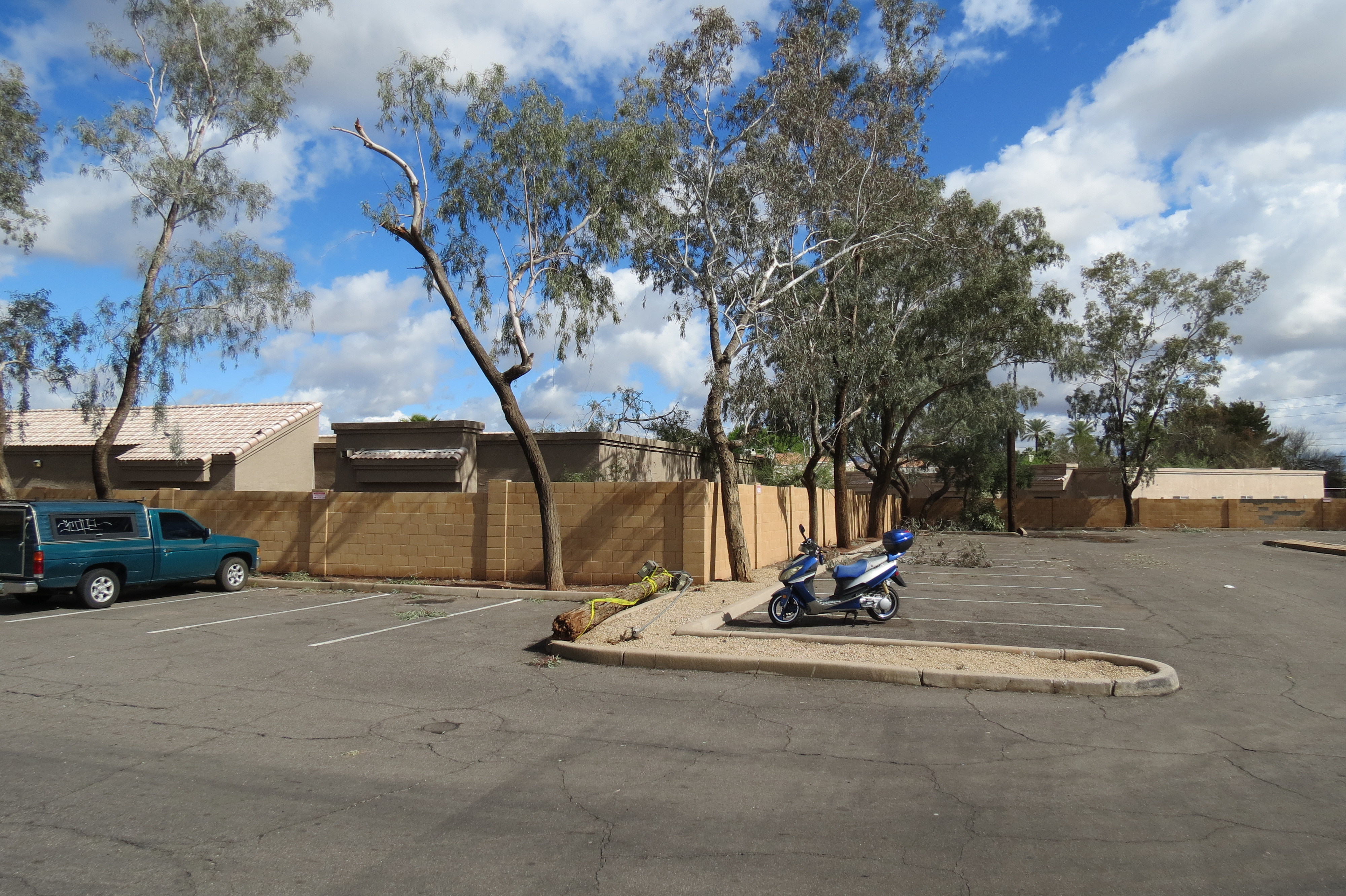
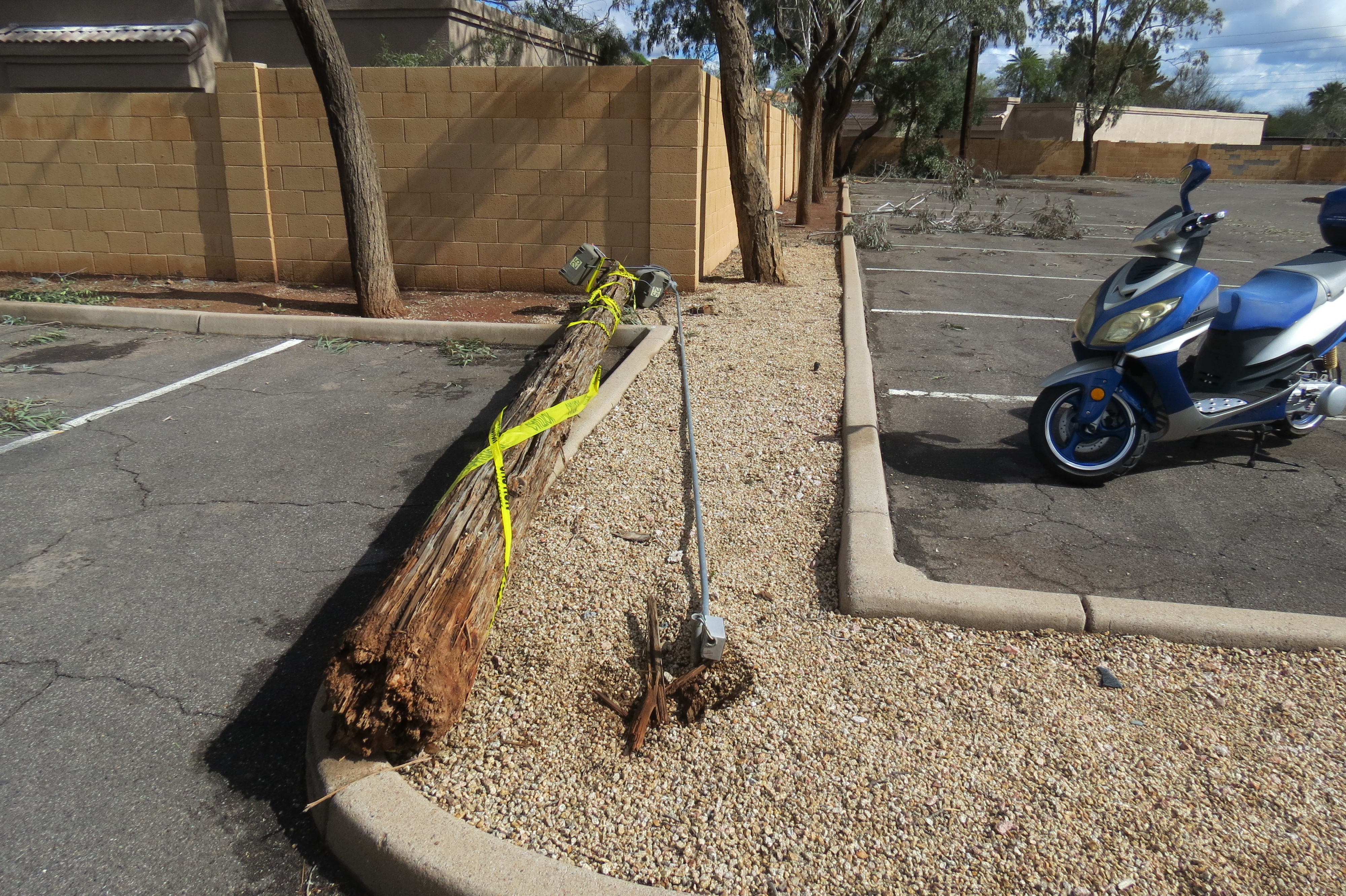
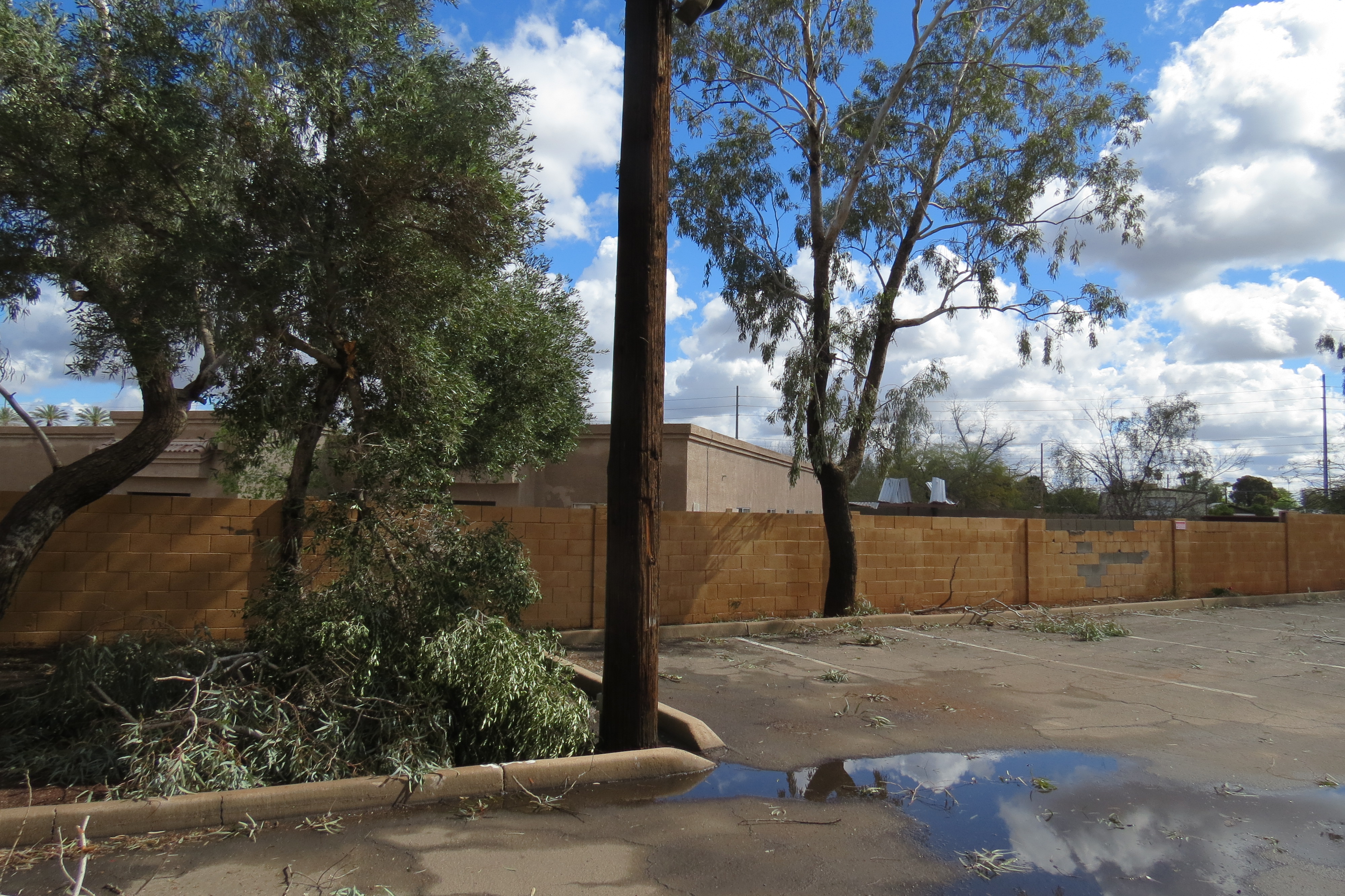
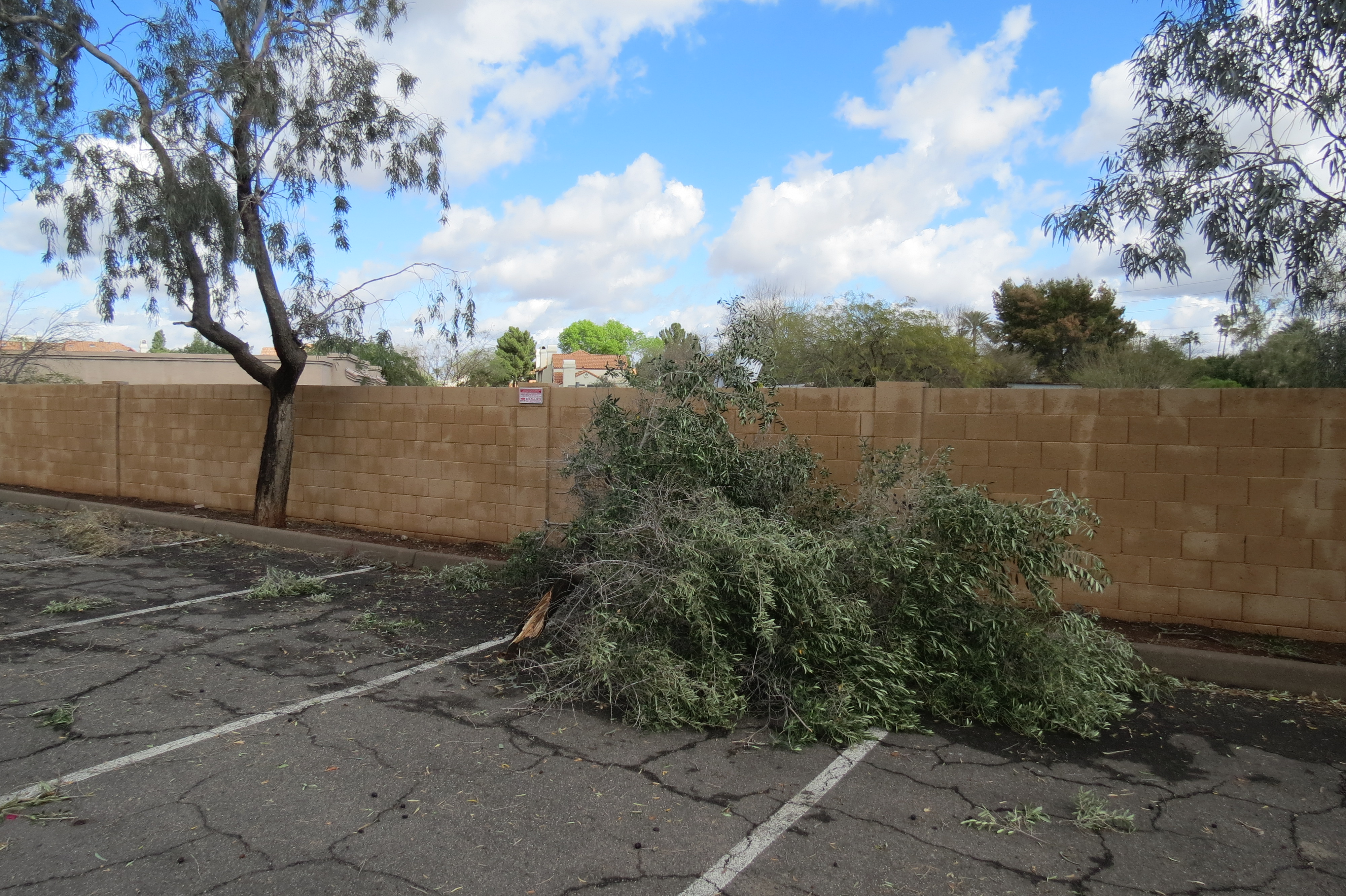
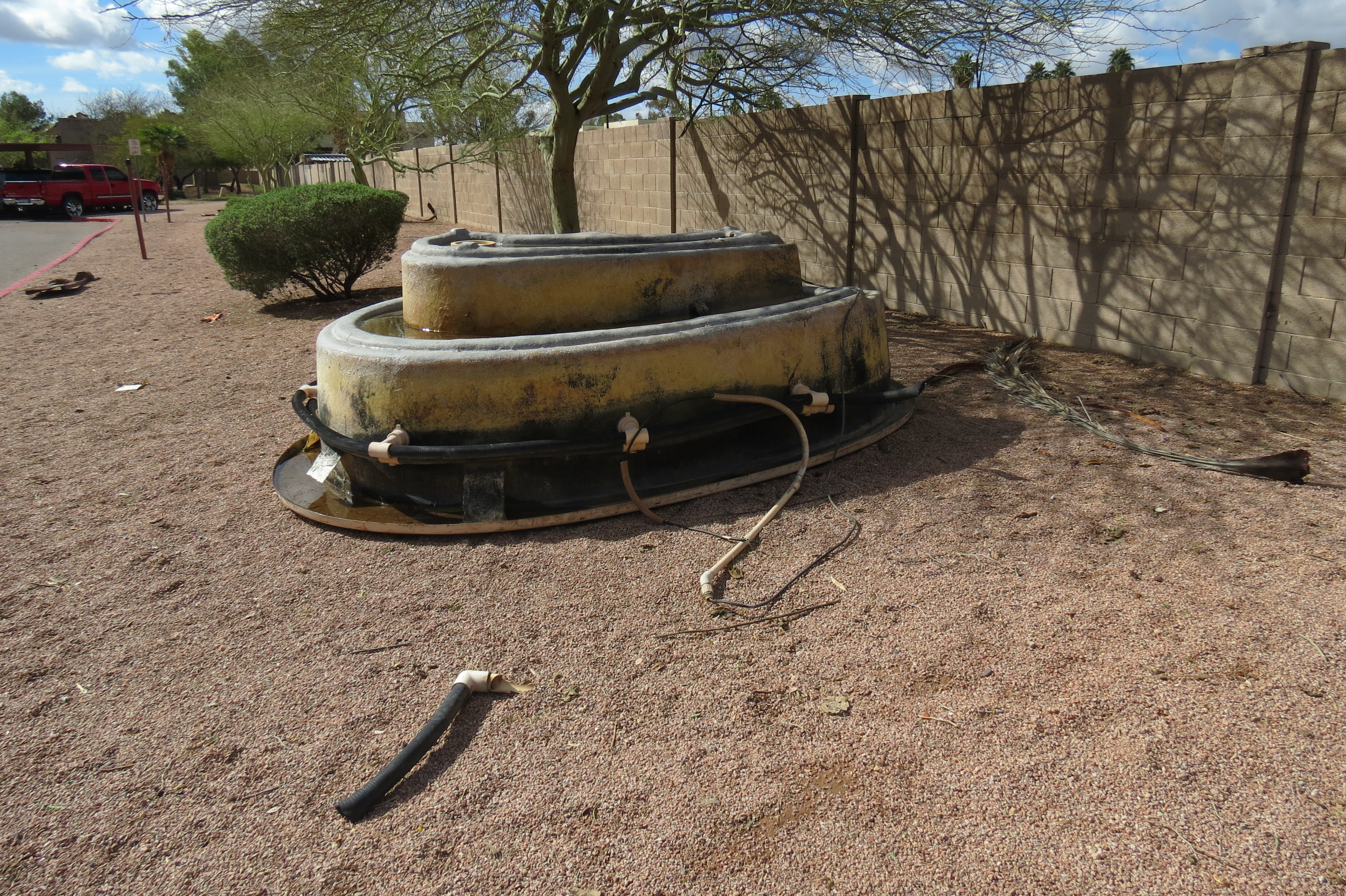
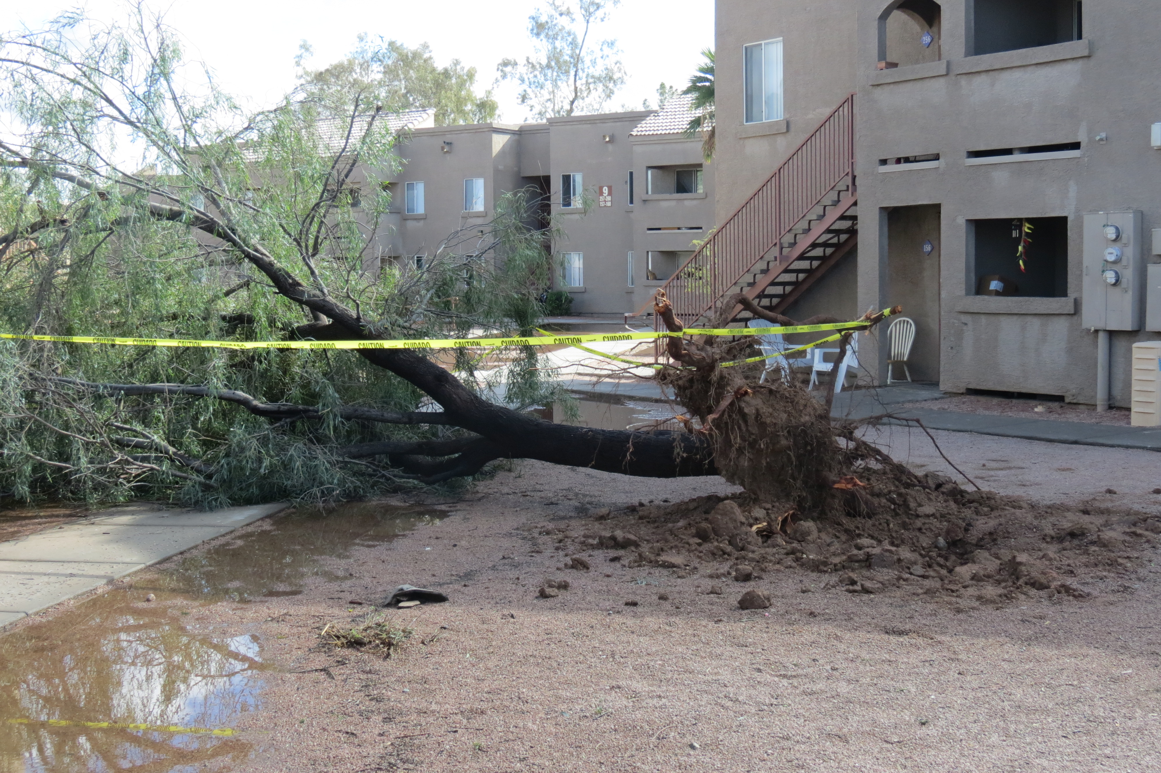
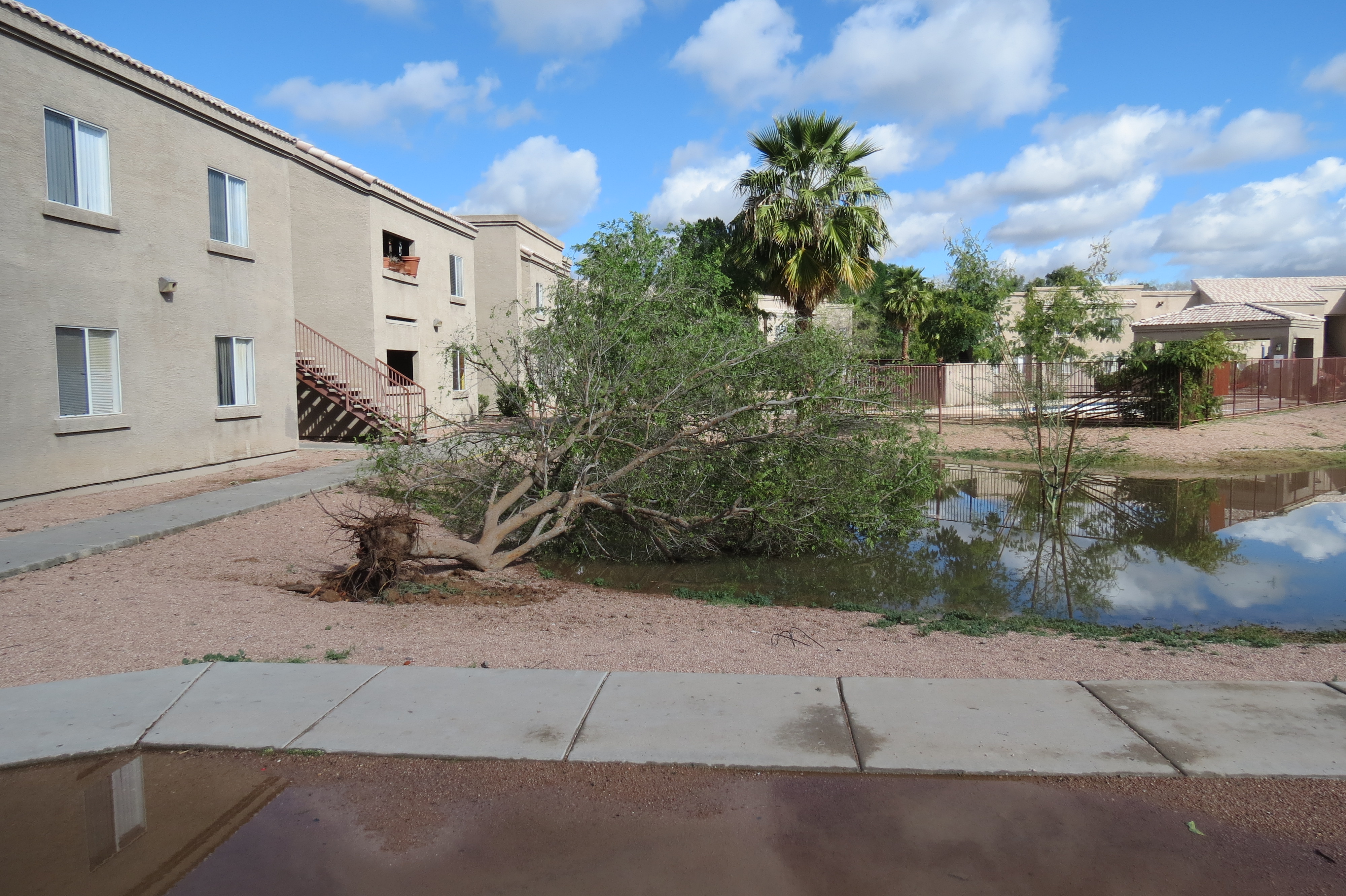
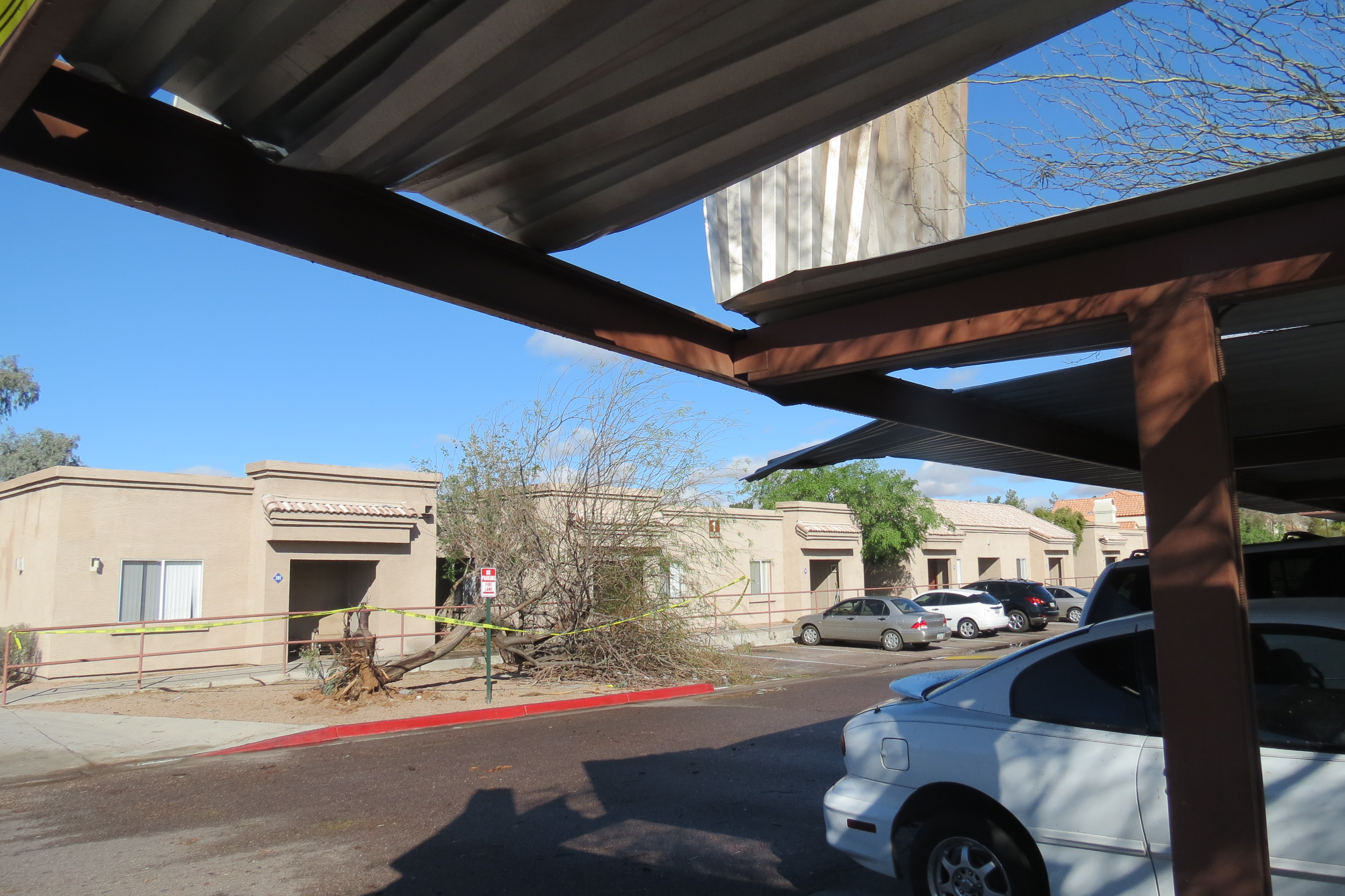
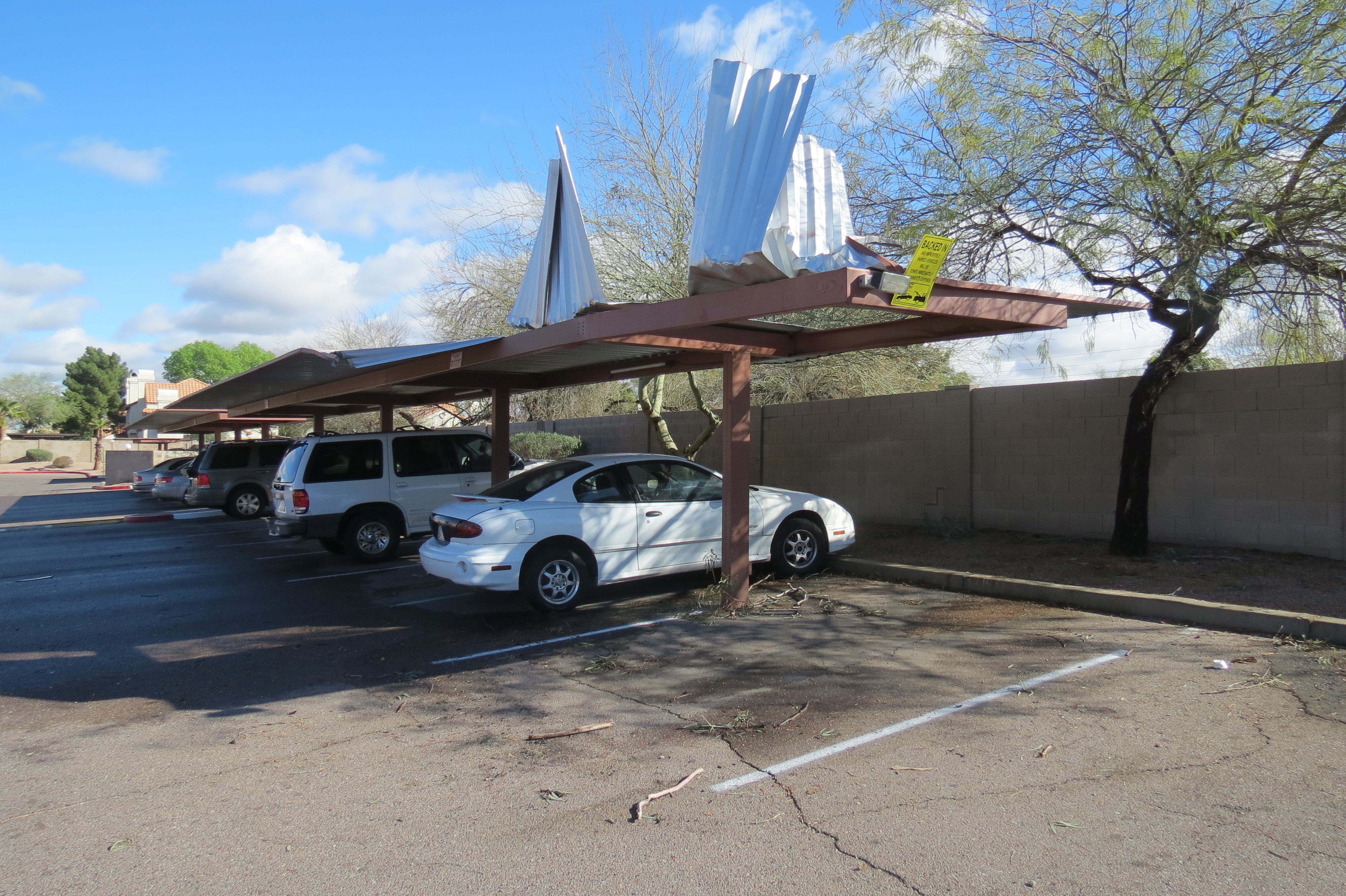
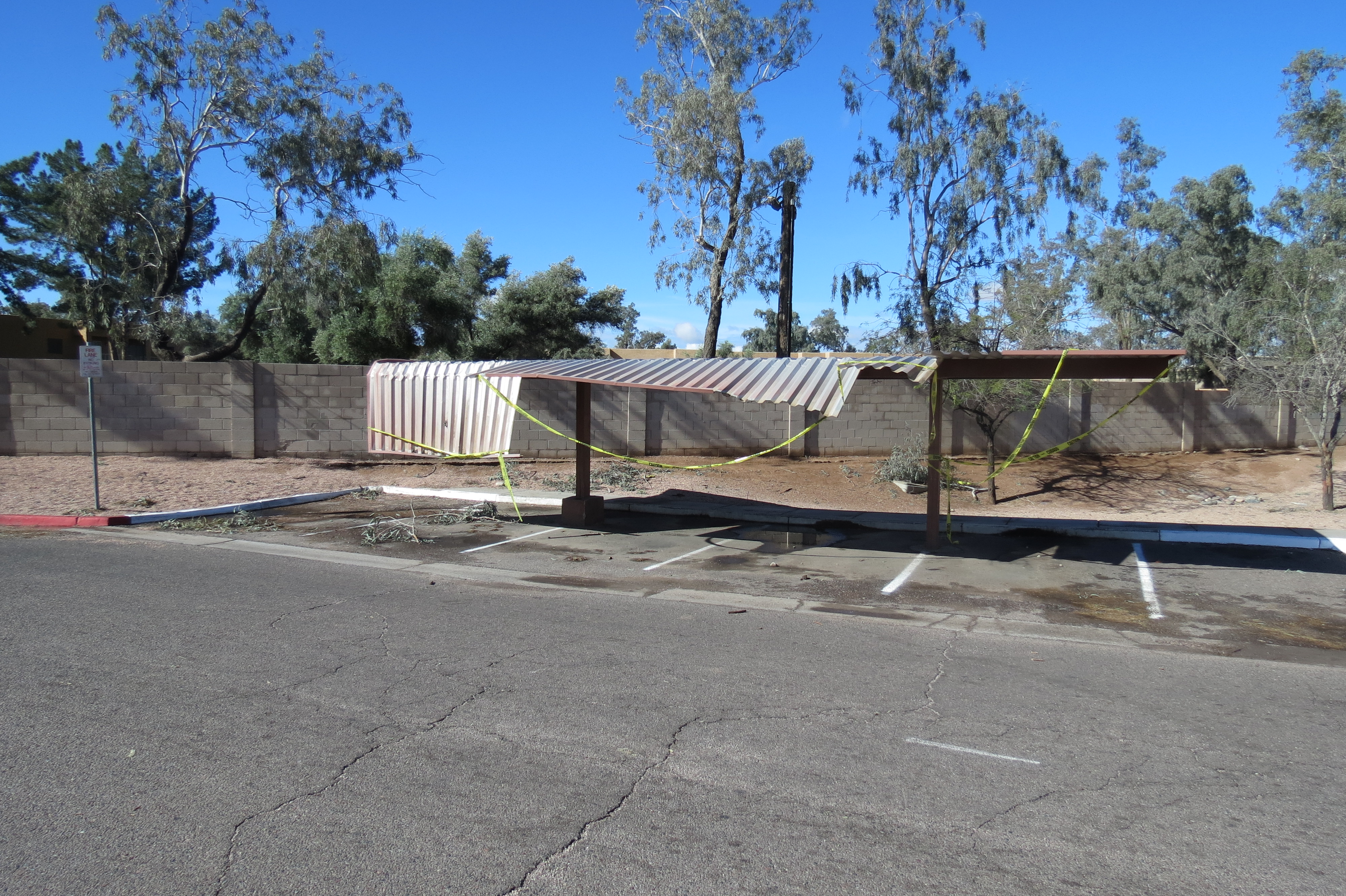
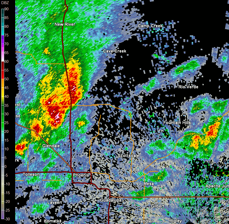
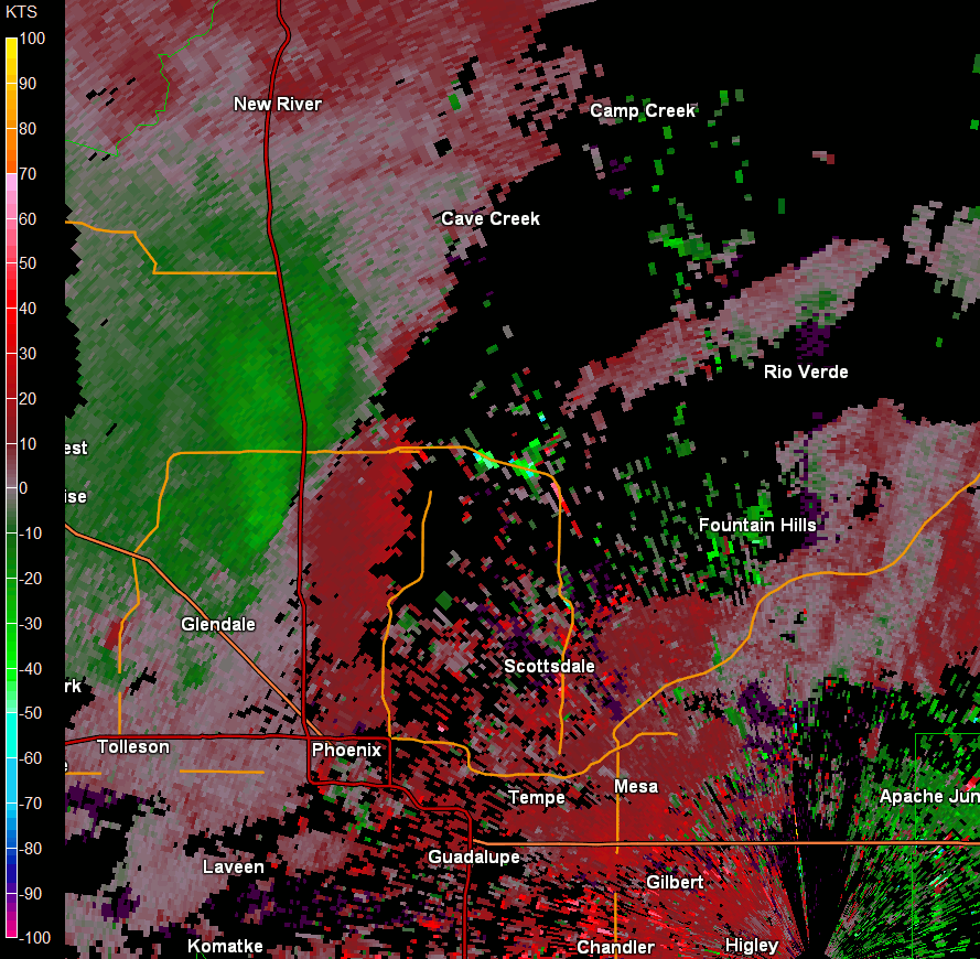
After the first batch of light rain cleared the area Saturday morning, a few breaks in the clouds allowed for the development of isolated thunderstorms. Although the atmosphere was not extremely unstable, wind shear (the measure of how winds change in speed and direction with height through the atmosphere) was much stronger than normally seen in the Desert SW, and supportive for weakly rotating storms. In fact, one of the storms that formed near South Mountain began rotating as it moved over Tempe and Mesa, and produced a weak EF-0 tornado near downtown Mesa.


The radar loops below show 1) the Reflectivity images of this storm with a brief "hook echo" type appearance near Mesa, and 2) the velocity images showing a brief period of weak rotation (green=NW winds towards the radar, Red=SE winds away from the radar) during and after the tornado touchdown.
 |
 |
 |
|
|
|
|
 |
 |
 |
 |
|
|
|
|
|
 |
 |
 |
 |
|
|
|
|
|
 |
 |
 |
 |
|
|
|
|
|
 |
 |
 |
 |
|
|
|
|
|
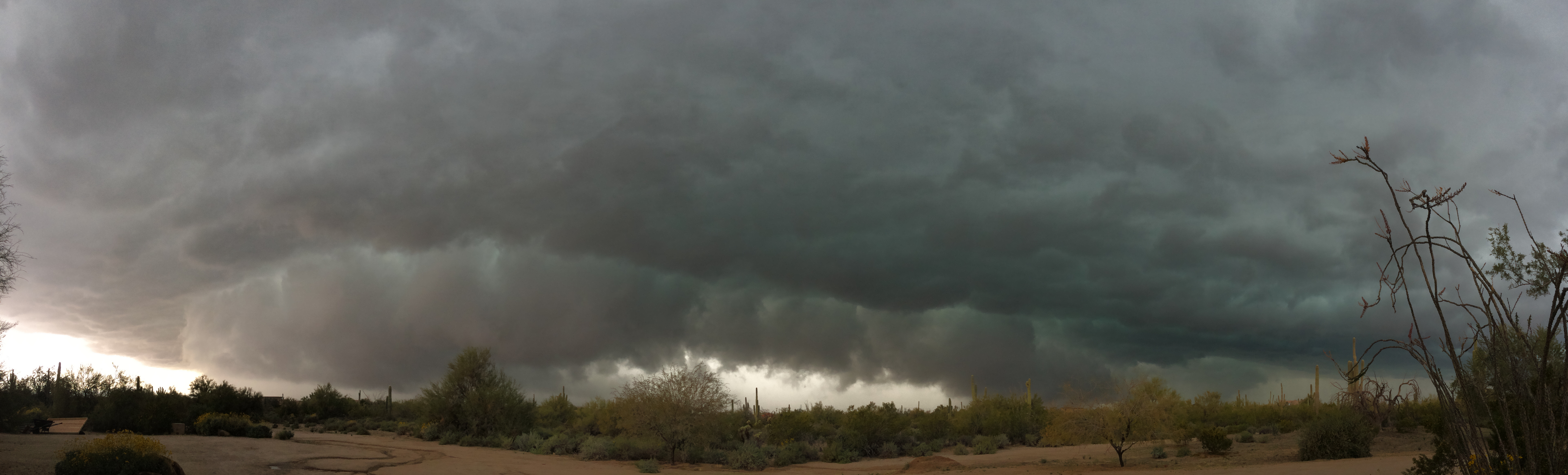
Thunderstorms continued to percolate through the afternoon, with another rotating storm moving through north Phoenix and dropping small hail and strong winds across North Scottsdale, Cave Creek, and Carefree. Below are radar loops of reflectivity and velocity showing the evolution of this storm.
 |
 |
|
|
|
 |
 |
 |
|
|
|
|
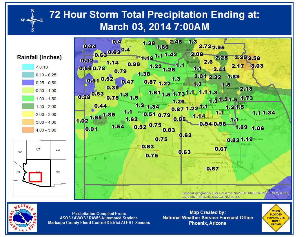
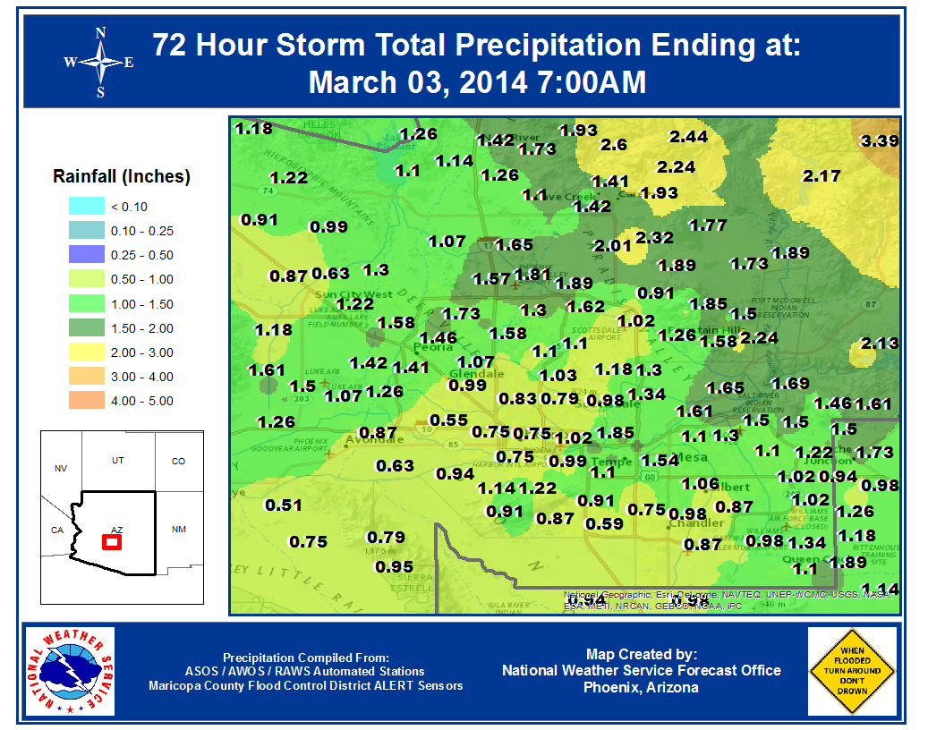
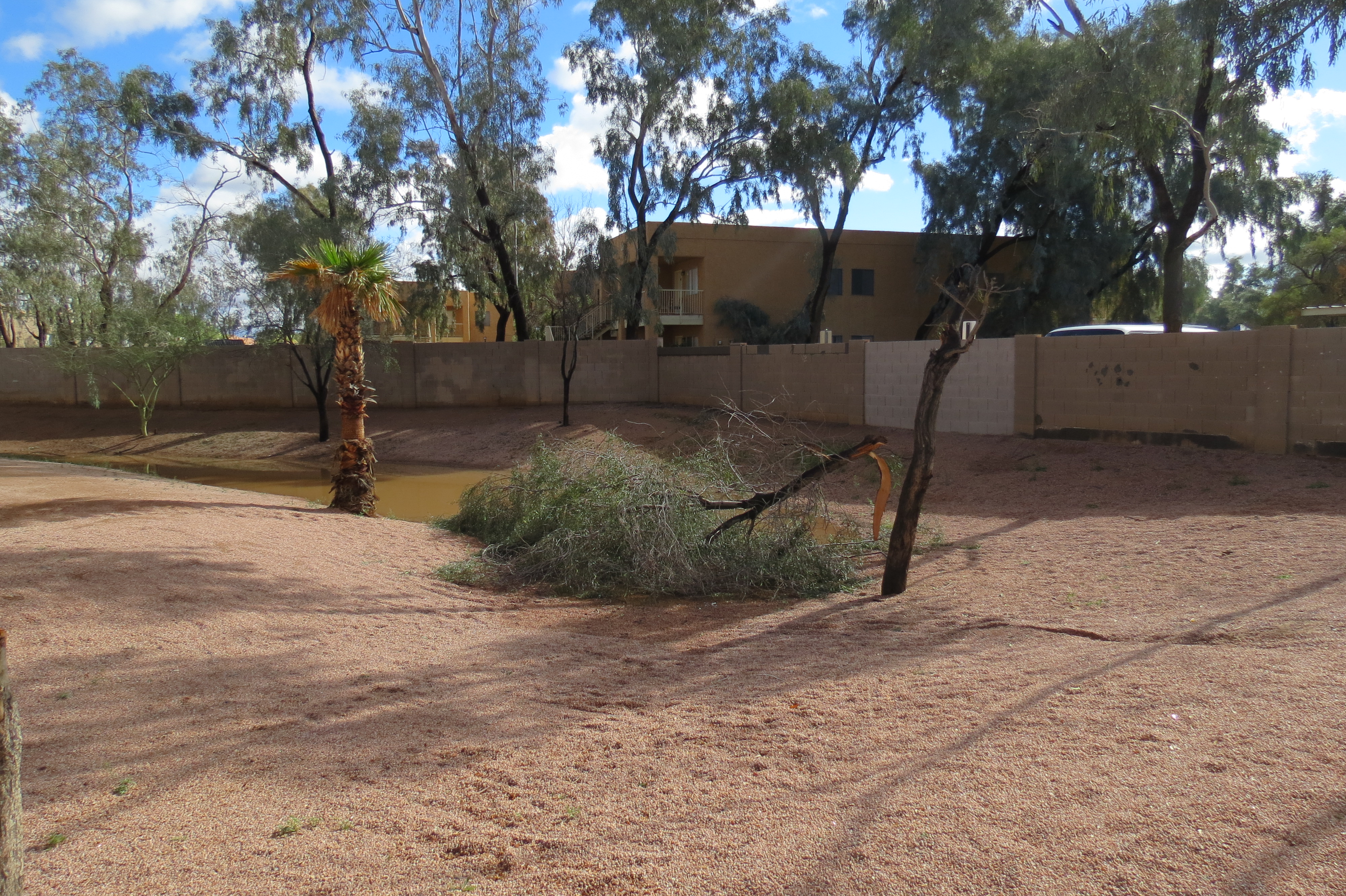
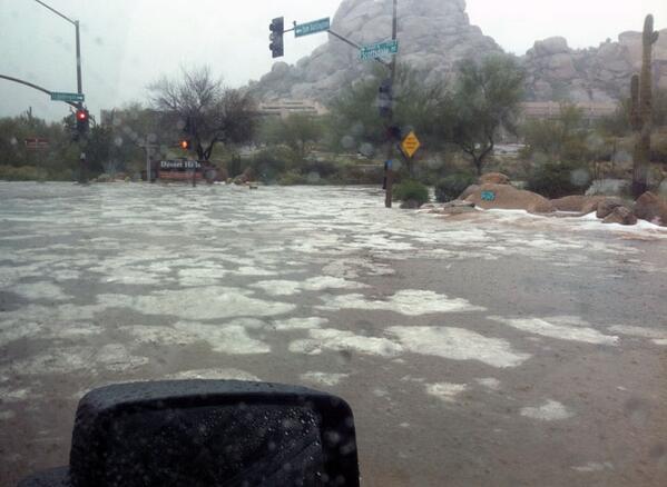
Despite these isolated severe weather events, the majority of the area only saw much welcome rainfall as the main band of moisture rotated through the state later in the afternoon and evening. After 70 days with no rain, this storm was extremely beneficial for the region. Most of the Phoenix metropolitan area saw over three quarters of an inch of rain, with the west, north, and east sides of town receiving over an inch of rain on Saturday. Below are storm total rainfall maps for Maricopa county, as well as zoomed into the city of Phoenix, along with a list of rainfall amounts from the Maricopa County Flood Control District.