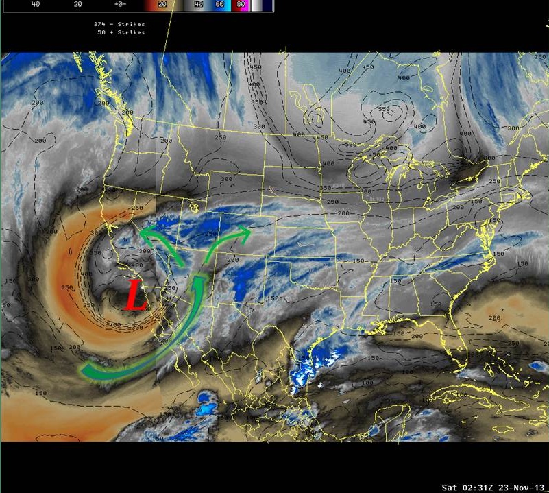
A powerful storm system intensified off the southern California coast leading up to the end of the week and weekend of the 21st through 23rd of November. As the intense low pressure system drove south, it began to pick up unseasonably moist air from the eastern Pacific and Gulf of California. Then, this storm system nearly stalled off the coast with a tremendous flux of moisture moving northward into southern California, Arizona, and most of the southwestern United States. The image below shows a water vapor image from the height of the storm system as it affected Arizona with prolonged rainfall at lower elevations, and snowfall across the higher terrain in the northern part of the state. The combination of moisture and textbook weather dynamics made this storm system one for the record books.
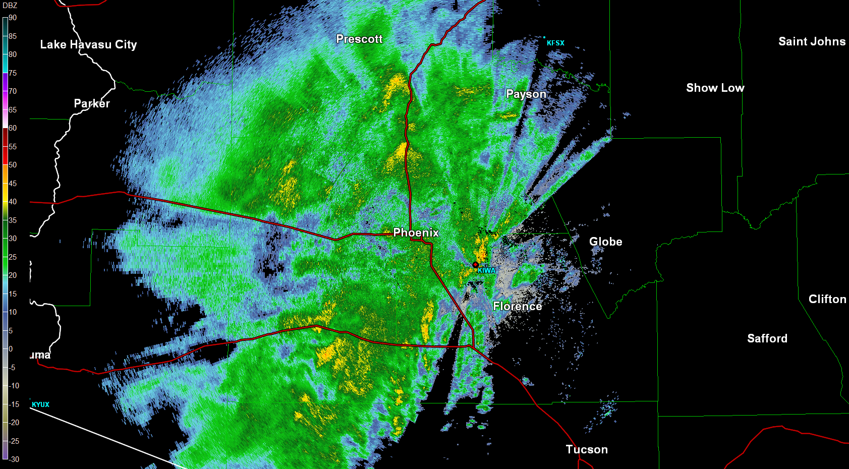
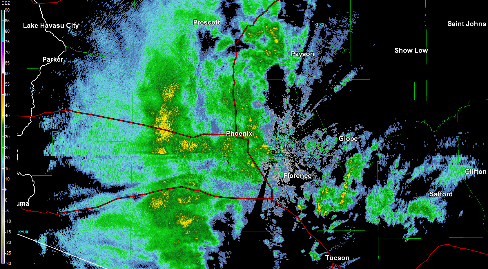
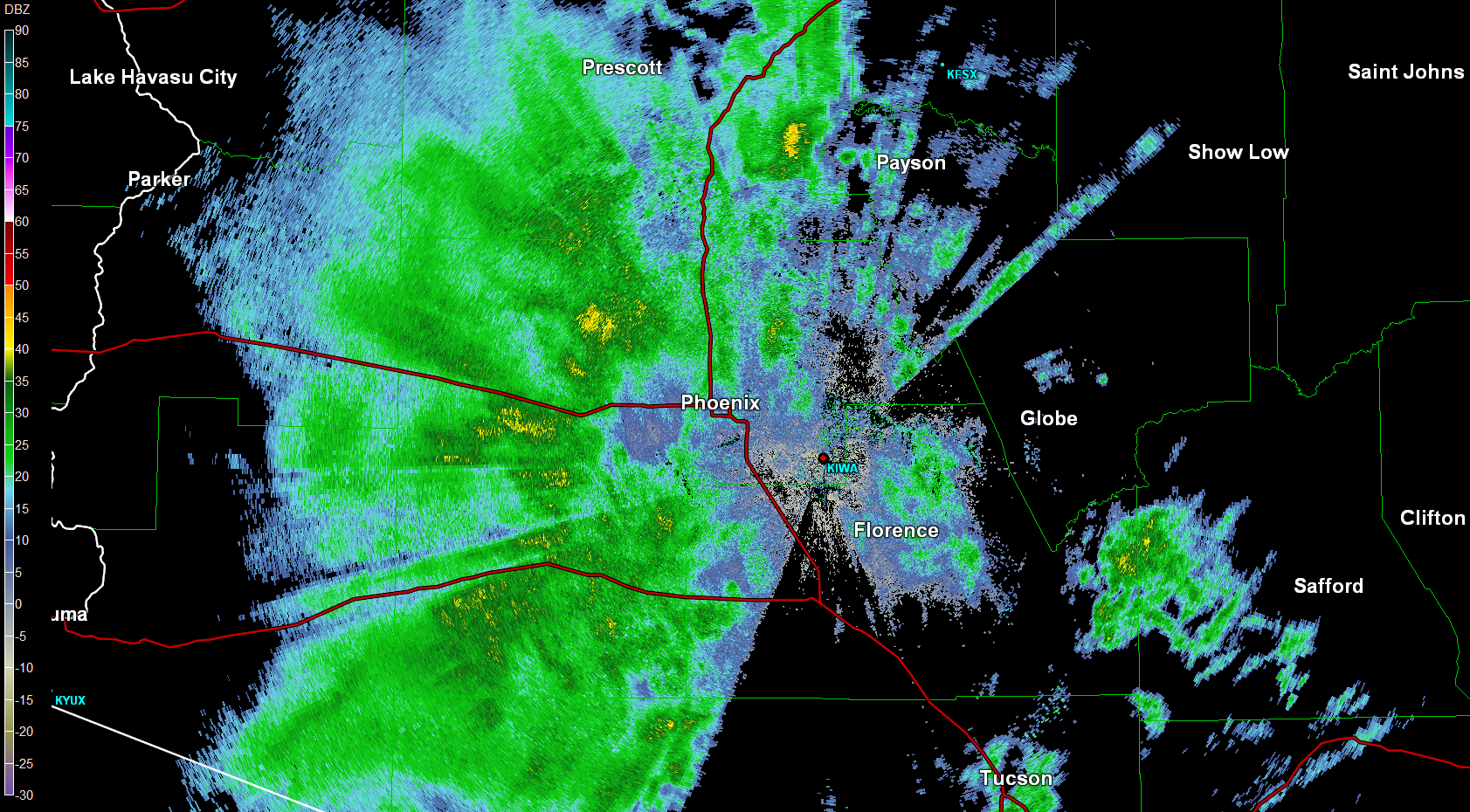
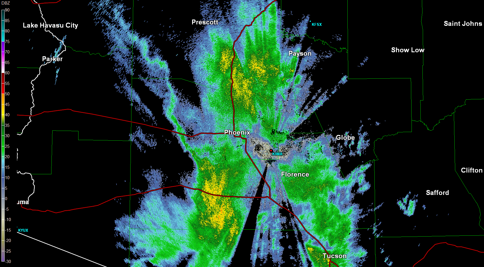
One of the more interesting parts of this storm system was not the intensity of rainfall, but rather the persistent and prolonged nature of the event which yielded accumulations of such a large magnitude. The primary plume of deep subtropical moisture and rainfall aligned across central Arizona for over an entire day, with many locations reporting hours of light to moderate rain. Below are snapshots of the radar images during the storm evolution. Note that although there are changes in the appearance of the radar images during this sequence, the position of the rain changed very little.
 |
 |
 |
 |
|
324 am Friday Nov 22nd |
649am Friday Nov 22nd |
150 pm Friday Nov 22nd |
1147 pm Fri Nov 22nd |
When all was said and done by Sunday morning, almost the entire area received between 1.50 and 3.00 inches of rain. Fortunately, this occurred over a 48 hour period, so only the typical low lying areas subject to minor flooding (i.e. the places that flood every time it rains) experienced problems with high water. On the other hand, given the persistence of rain and overall amounts, numerous outdoor activities were forced to be postponed or cancelled because of the weather. Below are graphics depicting the storm total rainfall amount across Maricopa County as of 5 pm Sunday, Nov 24th, as well as the entire state of Arizona.


A listing of storm total rainfall can be found below:
| Location |
Total |
|---|---|
| Phoenix Sky Harbor |
2.43
|
| Scottsdale Airport |
2.45
|
| Deer Valley Airport |
1.95
|
| Downtown Phoenix |
1.97
|
| Tempe |
2.48
|
| Downtown Scottsdale |
2.32
|
| Ahwatukee |
2.95
|
| Chandler |
2.60
|
| Downtown Mesa |
2.28
|
| NE Mesa |
2.64
|
| SE Mesa |
2.60
|
| Apache Junction |
2.05
|
| Queen Creek |
2.68
|
| Paradise Valley |
2.17
|
| Fountain Hills |
2.68
|
| Carefree |
2.48
|
| Sun City |
1.69
|
| Peoria |
1.65
|
| Glendale |
1.89
|
| Litchfield Park |
1.97
|
| Avondale |
2.24
|
This storm system broke daily rainfall records, and nearly monthly records in the process. The 1.60 inches of rain recorded at Phoenix Sky Harbor airport on November 22nd was a record for the day, and the 2nd most for any day ever in the month of November in Phoenix. More remarkably, this one day total was also the 22nd most ever for any day of the year in the recorded weather history for Phoenix (since 1895). Yuma also set a daily record rainfall amount on November 21st eclipsing a long standing record from 1884.
|
Rank
|
November |
Rainfall |
|---|---|---|
|
1
|
11/10/1923
|
2.24
|
|
2
|
11/22/2013
|
1.60
|
|
3
|
11/14/1993
|
1.58
|
|
4
|
11/11/1931
|
1.41
|
|
5
|
11/14/1918
|
1.40
|
As mentioned above, one of the more remarkable parts of this weather system was the extended nature of the rainfall. Over the 3-day period from the evening of November 21st through November 23rd, 2.42 inches of rain was recorded at Phoenix Sky Harbor airport. This ranks as the 2nd wettest storm for the month of November in Phoenix weather history. These 3 days alone places this year as the 7th wettest November on record. And to further emphasize how uncommon this storm system has been, Phoenix has not seen a storm with this amount of rainfall since March 5-7, 2000, or over 13 years ago.
|
Rank
|
Ending |
3-Day Rainfall |
|---|---|---|
|
1
|
11/15/1993
|
2.60
|
|
2
|
11/23/2013
|
2.42
|
|
3
|
11/11/1923
|
2.40
|
|
4
|
11/12/1931
|
2.19
|

