--
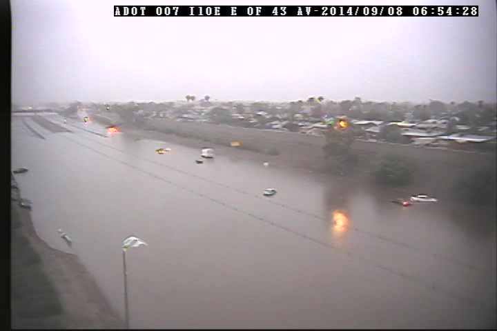
Major flooding along Interstate 10 at 43rd Ave. Image courtesy Arizona Dept of Transportation
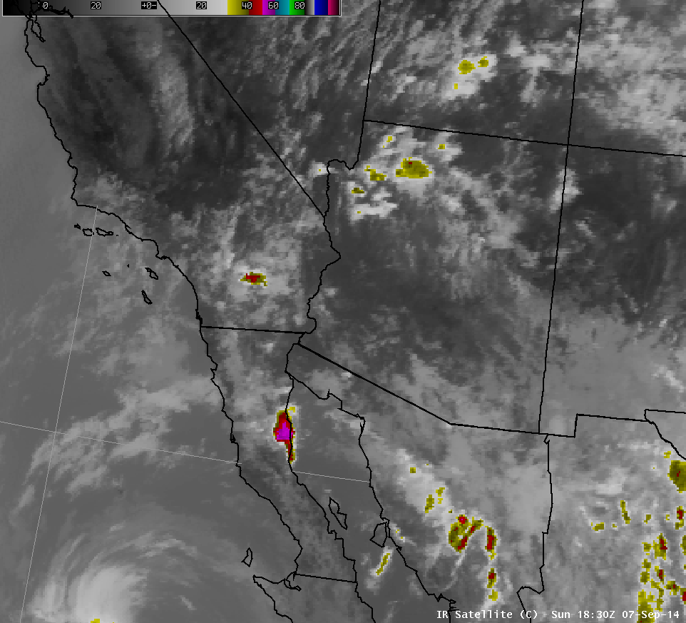
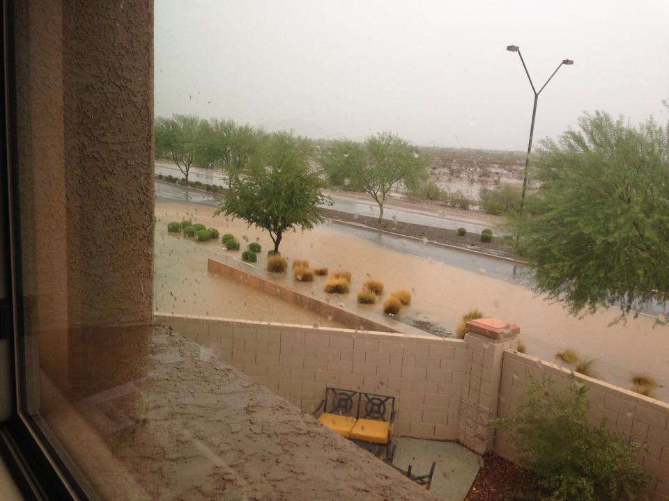
A plume of tropical moisture associated with Hurricane Norbert moved into the Desert Southwest during the early morning hours on Sunday September 7th. The increased humidity across the region led to numerous showers and thunderstorms across far northwest Arizona during the afternoon hours on Sunday, but conditions across the Phoenix metro were largely tranquil through late evening Sunday. That changed, however, around 11pm Sunday night as a complex of showers and thunderstorms developed in Pinal and Pima Counties, merged with an existing complex from La Paz County, and raced northward toward Phoenix.
Heavy rainfall began in the East Valley around 2 AM and quickly spread into central Phoenix and the West Valley around 3 am. By 3 AM, numerous underpasses along U.S. 60 were inundated and impassable and by daybreak Interstate 10 was impassable at 43rd Avenue. Showers continued periodically through approximately 8 AM before tapering off around 10 AM.
 |
 |
|
Infrared satellite image showing the decay of storms Sunday afternoon, and the evolution of the two merging clusters of storms over the Phoenix area early Monday morning. Loop is from 11 AM Sunday to 10 AM Monday. (Loop is 12MB) |
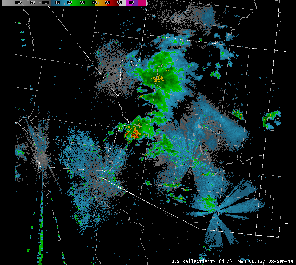
Radar loop from 11 PM Sunday to 10 AM Monday showing the merging complexes of storms over the Phoenix area. (Loop is 21MB) |
 |
 |
|
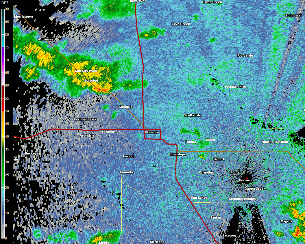
Detailed KIWA Doppler Radar loop zoomed into the Phoenix metro. (Loop is 15MB) |
Accumulation and accumulation rate graph for rainfall at Phoenix Sky Harbor |
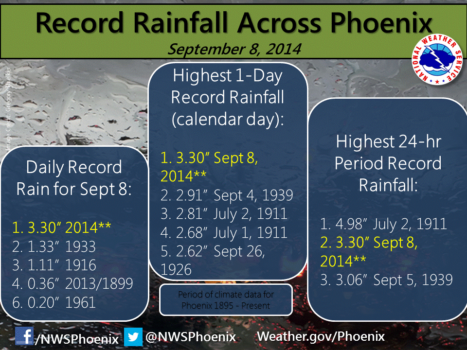
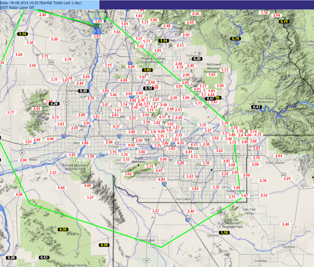
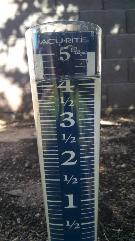
Phoenix Sky Harbor airport recorded an astonishing 3.30 inches of rain over a 7 hour period. This is the most rain ever recorded on a calendar day since records began in Phoenix in 1895! As if that wasn't impressive enough, some locations in Chandler recorded nearly 6" of rain during the same time period, and one trained spotter reported 6.09" in northwest Chandler.
 |
 |
 |
|
Sky Harbor measured 3.30" of rain on September 8 in just a matter of 7 hours. This breaks the daily rainfall record, the 1-day maximum rainfall record and ranks #2 on the 24-hr highest rainfall total list. |
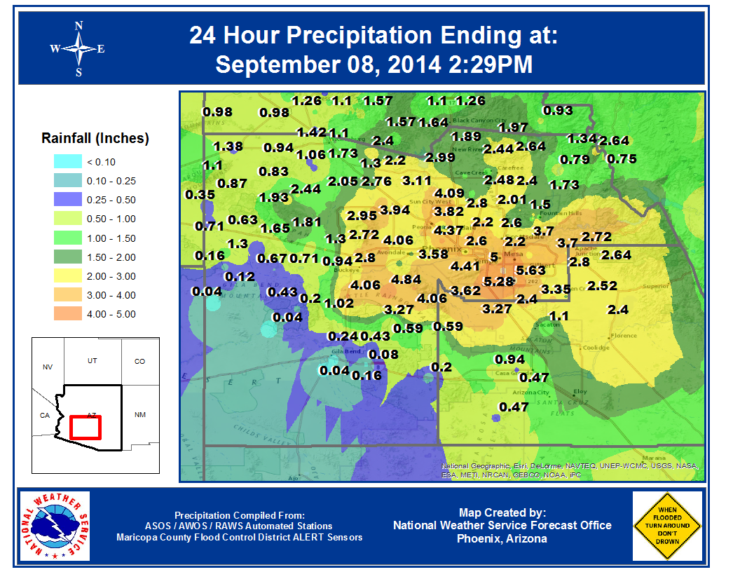
Rain gauge analysis showing rainfall totals across the metro area. |
Rain gauge totals courtesy of Flood Control District of Maricopa Co. |
 |
 |
 |
|
Chandler near Dobson & Loop 202 San Tan Freeway. Image courtesy Laura Corona via Facebook |
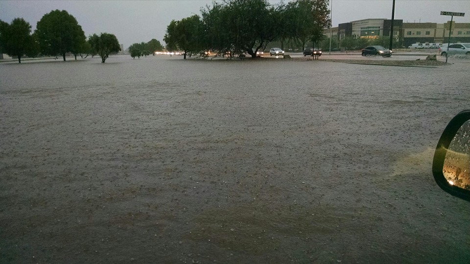
Chandler near Galveston St. Image courtesy Kara Leeper via Facebook |
Chandler near McClintock & Ray Rds. Image courtesy April Irish via Facebook |
 |
 |
 |
|
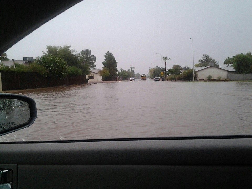
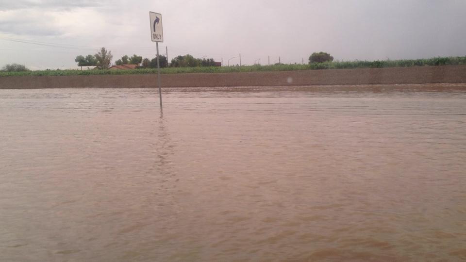
Chandler near Ocotillo & McQueen. Image courtesy Arturo Codina via Facebook |
Chandler near Warner & Arizona Ave. Image courtesy Dera Perparos via Facebook |
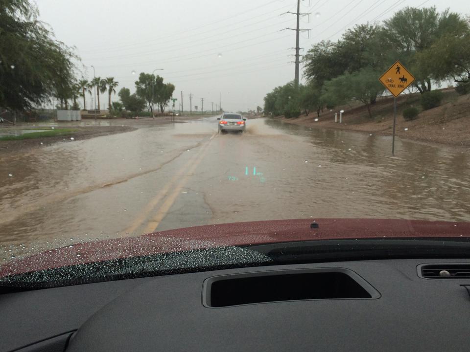
Gilbert near Val Vista & Germann. Image courtesy Sarah Koch via Facebook |
 |
 |
 |
|
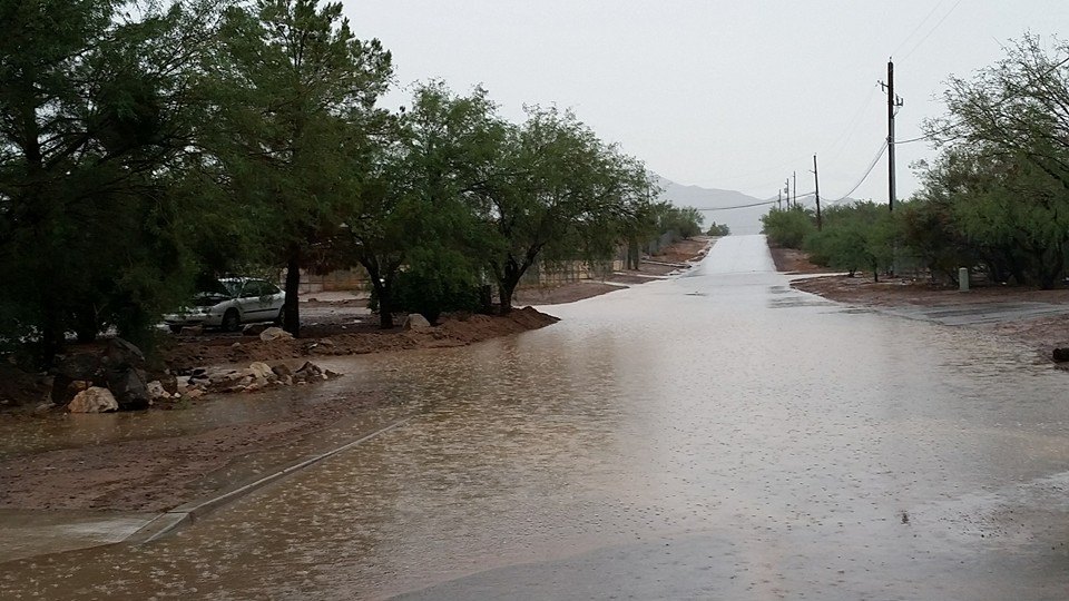
Mesa near Ellsworth & University. Image courtesy Plato Kretsedemas via Facebook |
Mesa - Sherwood Park. Image courtesy Nick Notestine via Facebook |
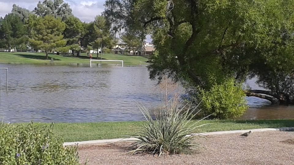
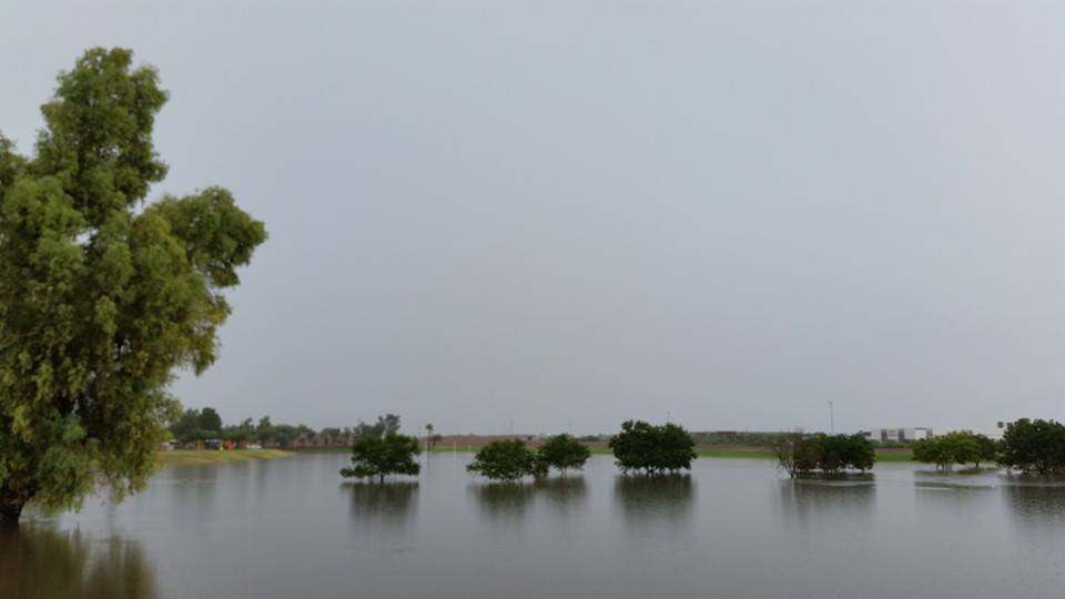
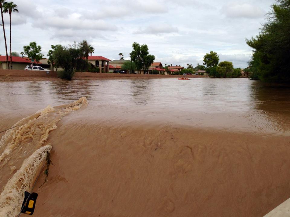
Tempe - Kiwanis Park. Image courtesy Monica Dunham via Facebook |
 |
 |
 |
|
Mesa near Baseline & Gilbert. Image courtesy Joni Keefe Birsdall via Facebook |
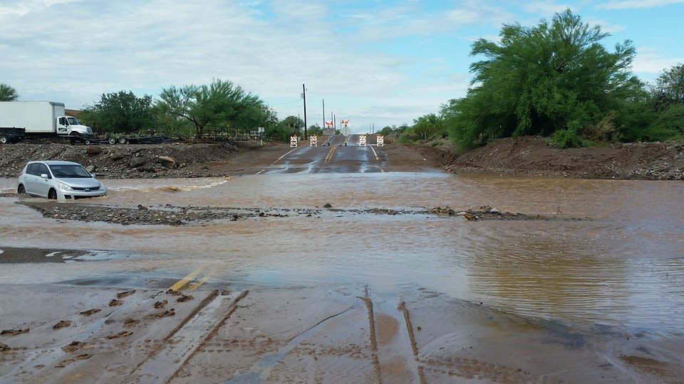
Desert Hills near Desert Hills Rd & 15th Ave. Image courtesy Ashely Kullos via Facebook |
Desert Hills near Maddock & 17th Ave. Image courtesy Ashely Kullos via Facebook |
 |
 |
 |
|
Indian Bend Wash near Hayden & Camelback. Image courtesy Lynzi Anne Meredith via Facebook |
Indian Bend Wash near Hayden & Indian School. Image courtesy Lynzi Anne Meredith via Facebook |
Surprise near 163rd Ave & Asante Blvd. Image courtesy Tracey Catanach via Facebook |

