Dangerous and extreme heat will remain across portions of the southern U.S. through the weekend. A heat wave over the Southwest U.S. will intensify this week, peaking and expanding into the Intermountain West and northern High Plains this weekend. Multiple rounds of thunderstorms will produce heavy to excessive rainfall with significant flash flooding across portions of southern New England. Read More >
Overview
|
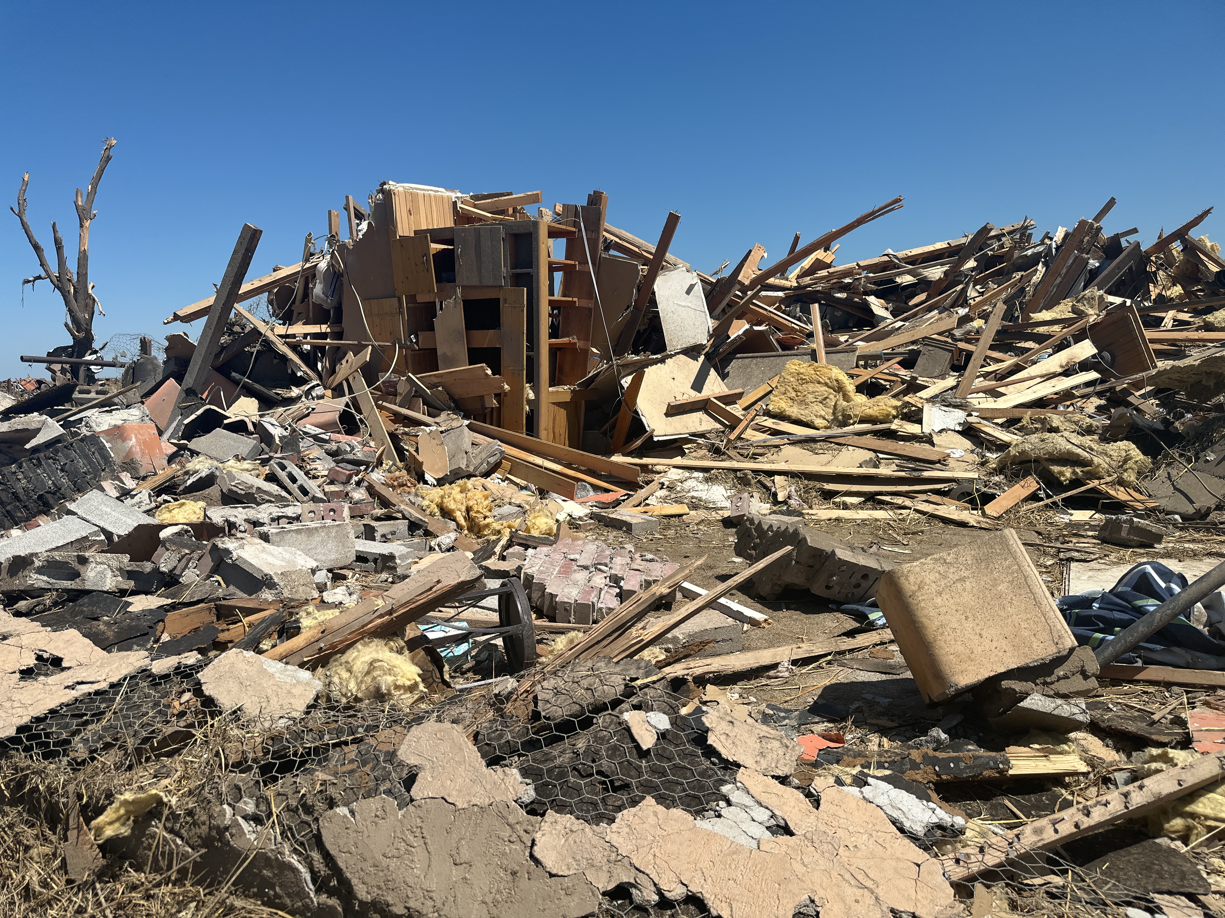
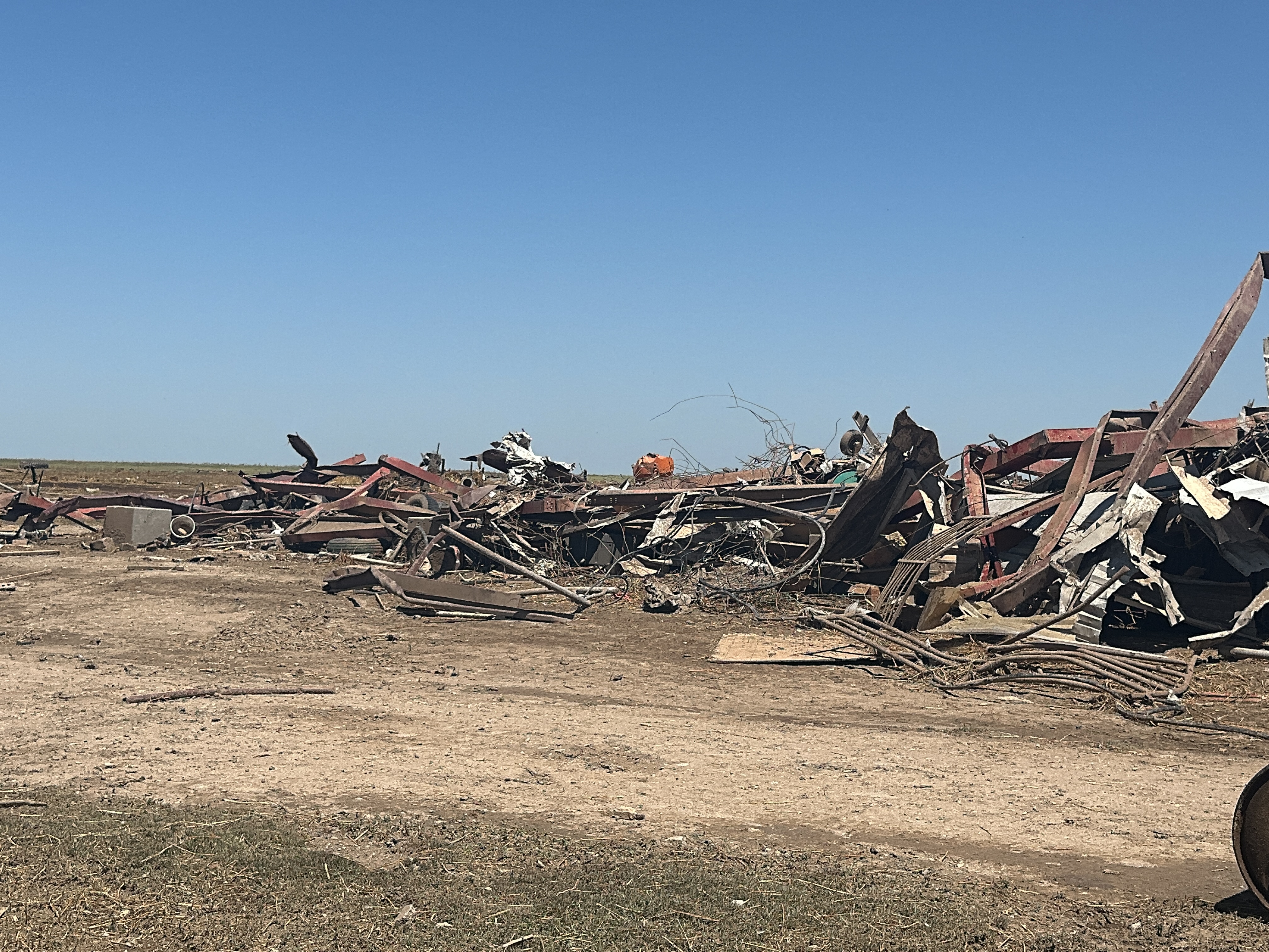
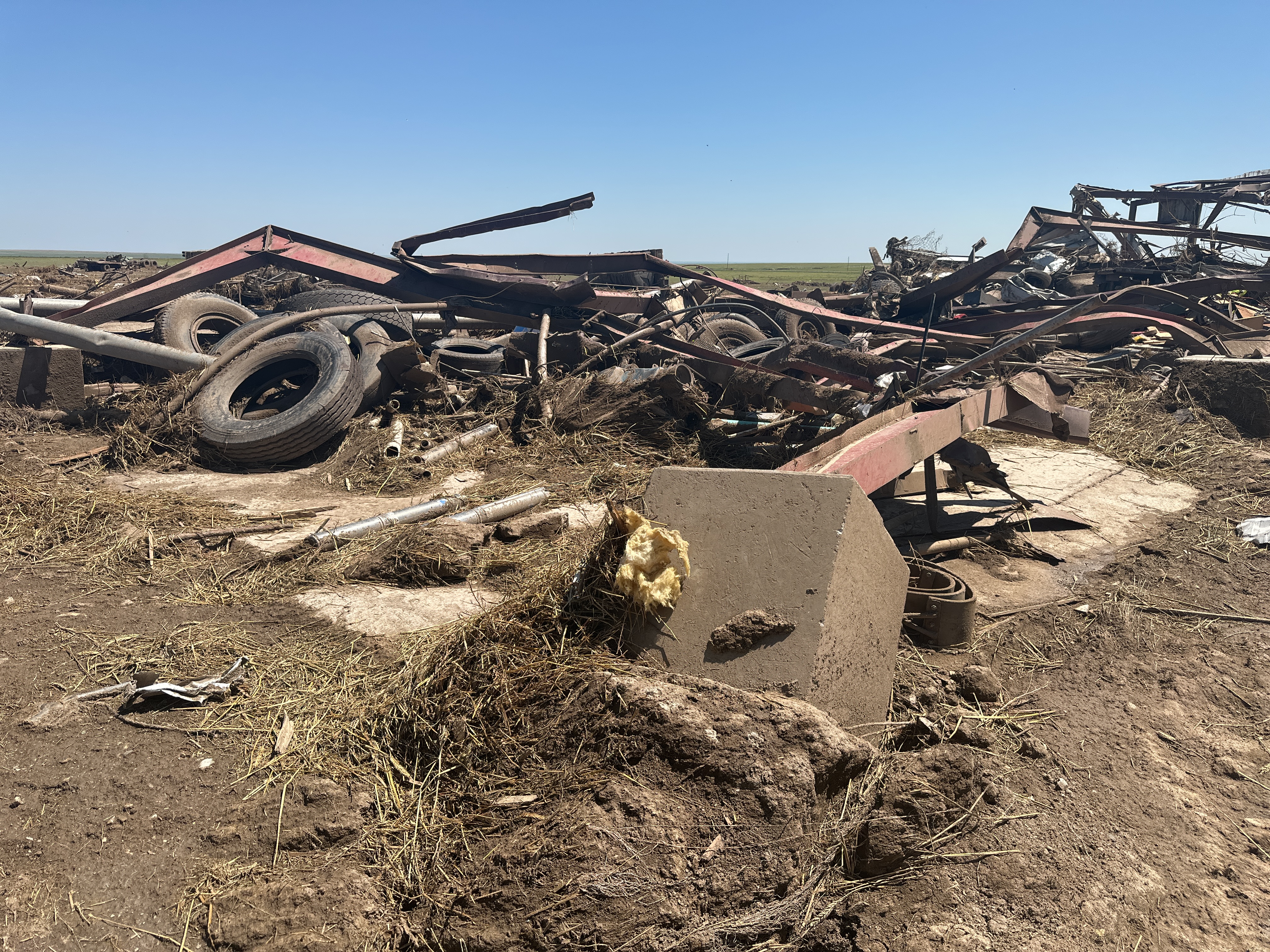
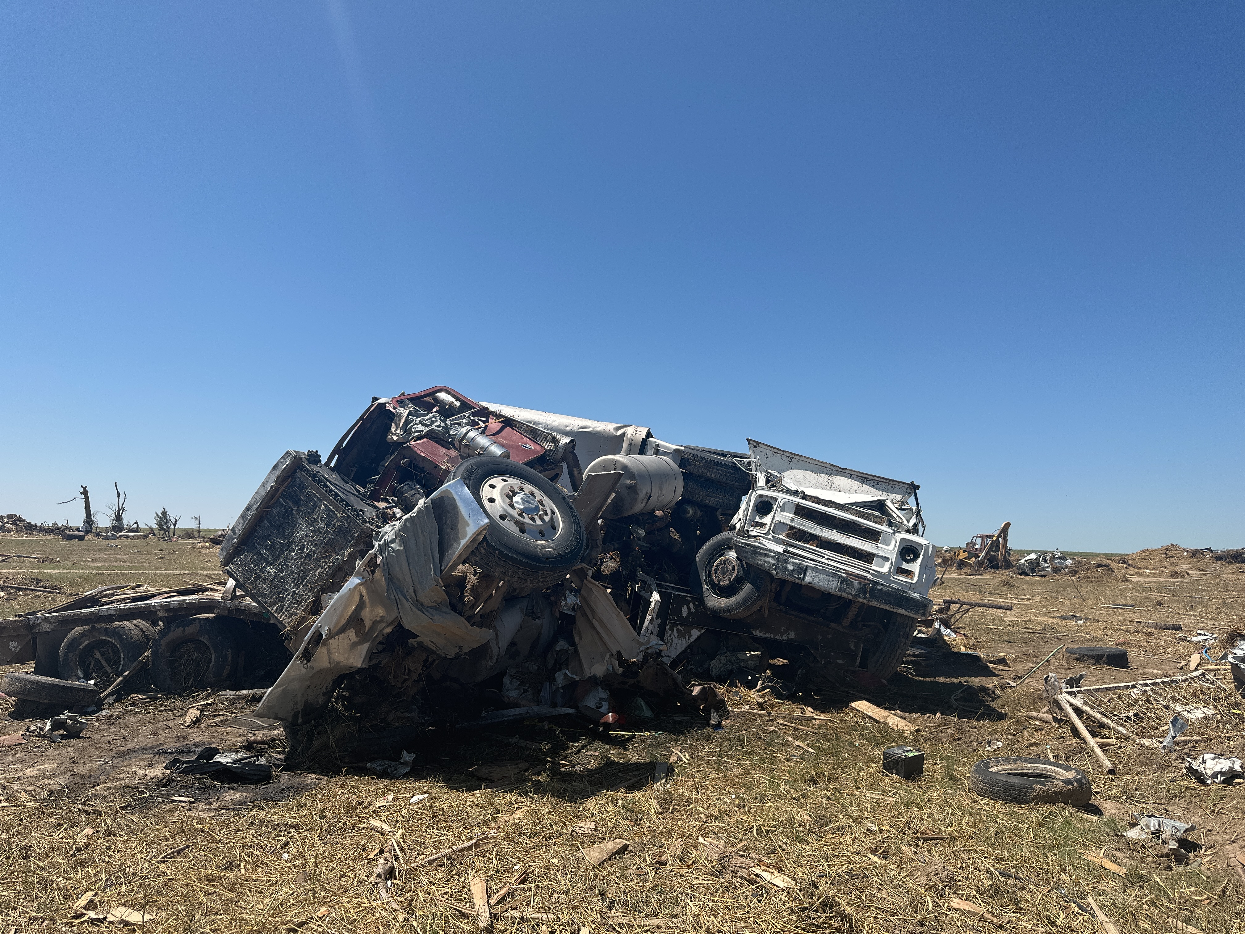
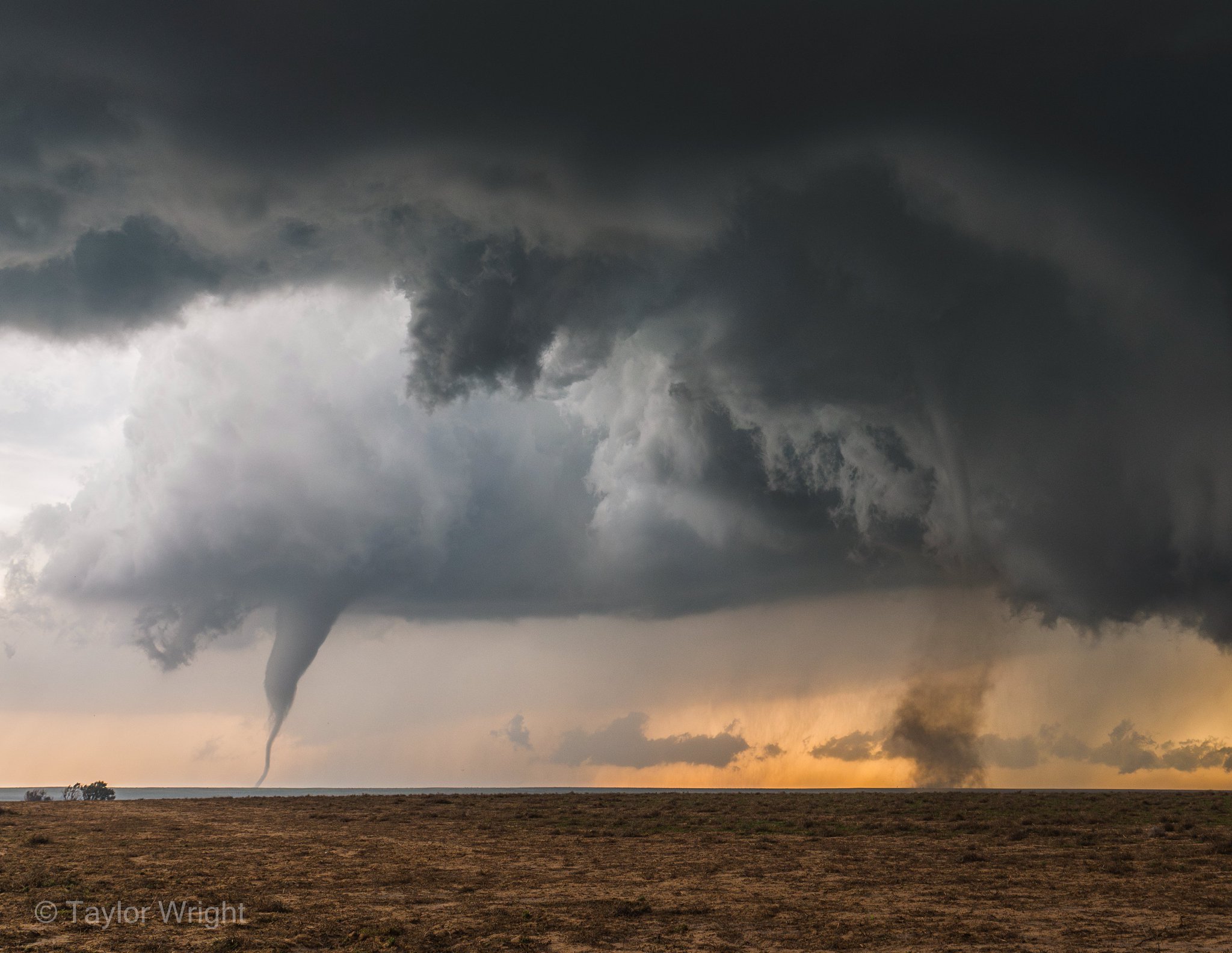
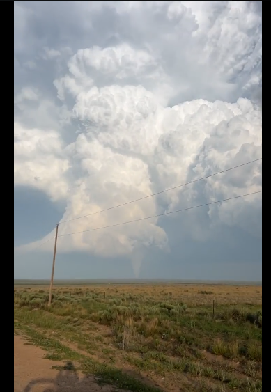
On June 23, 2023, a volatile atmosphere developed across the eastern plains of southern Colorado. Increasing southwesterly flow with an imbedded short wave would pass over the region. This allowed for a mass flux of air to the NNW, which pulled upper 60°F to near 70°F dewpoints into the area. These conditions allowed for an increase in environmental factors, such as shear and CAPE, that would become highly supportive of intense severe storms. During the afternoon, a tight dryline materialized across the eastern plains; this would become the initiation point of the Prowers County Supercell. In addition to that, robust orographic forcing was taking place across the Raton Mesa area; this would become the initiation point for the Baca County Supercell. As both storms moved east, they encountered the much more favorable air across the far eastern plains area. With the isolated nature to the storms, they quickly took advantage of the environment and became supercellular. Both storms would go on to produce large hail and photogenic, but damaging, tornadoes. |
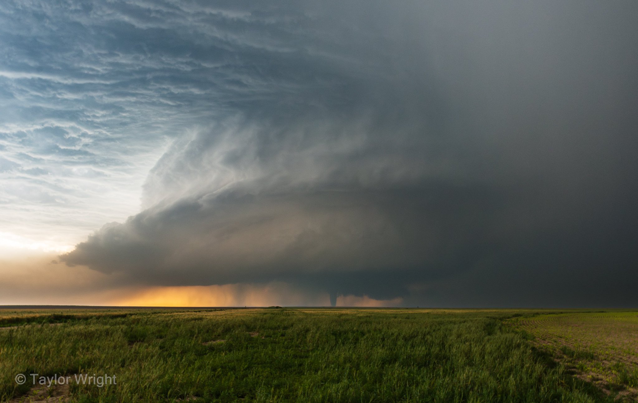 Structured supercell with tornado underneath from Prowers County. Photo By: Taylor Wright |
Tornadoes
|
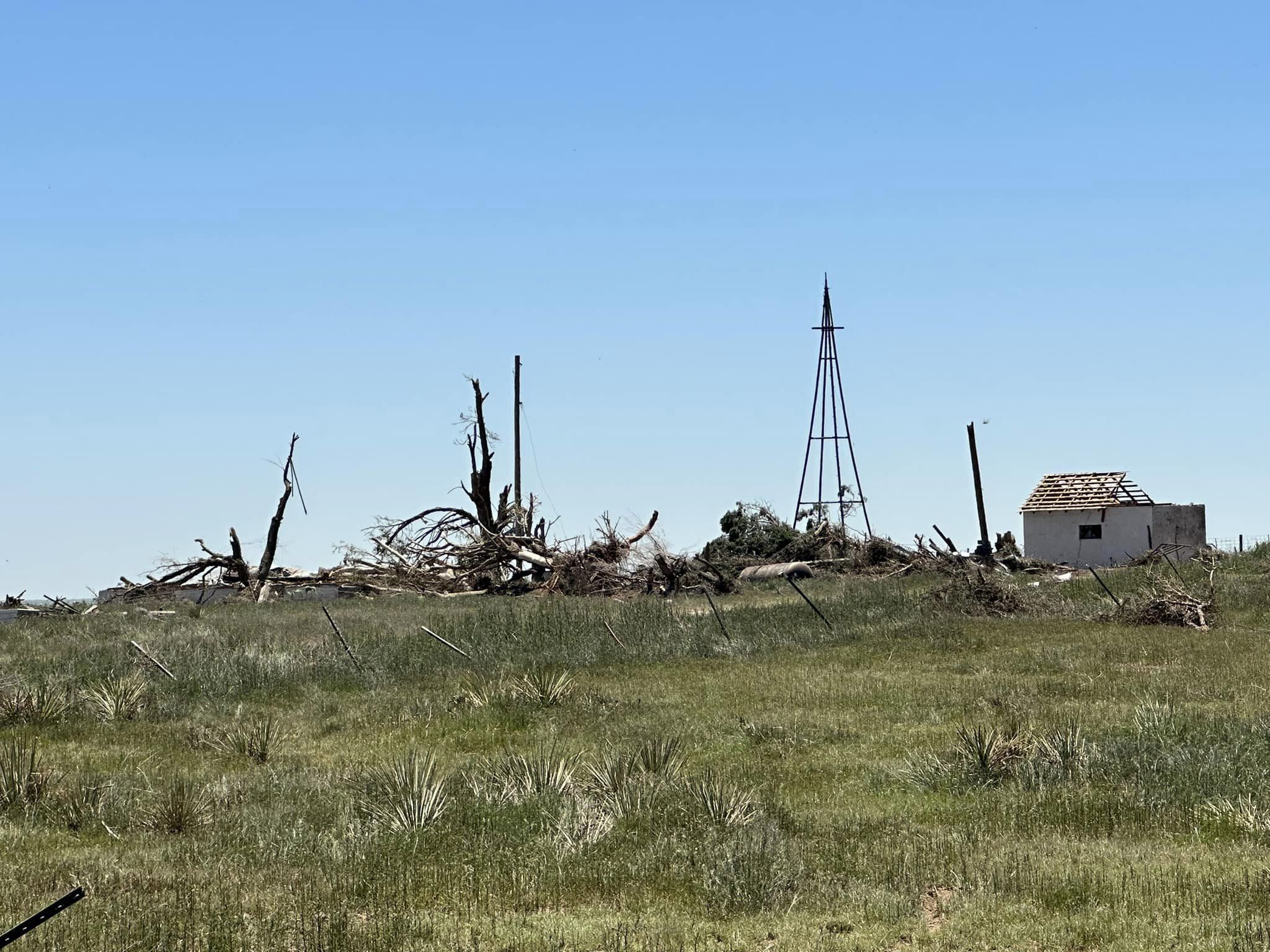
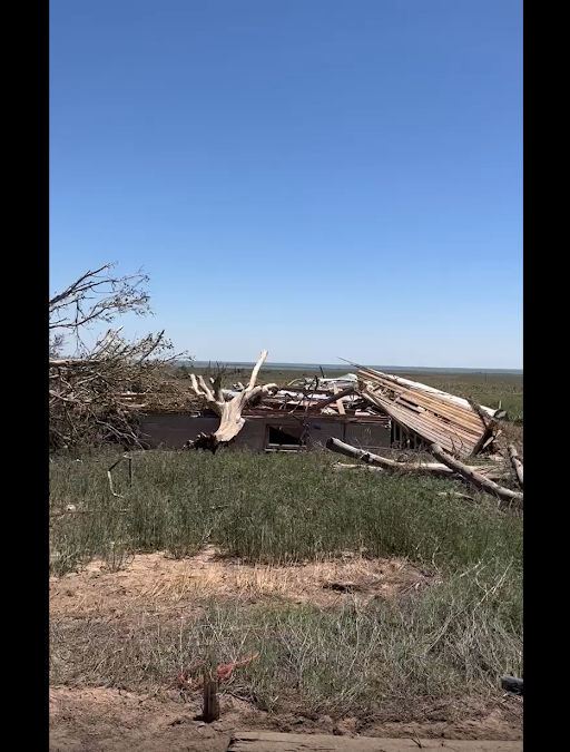
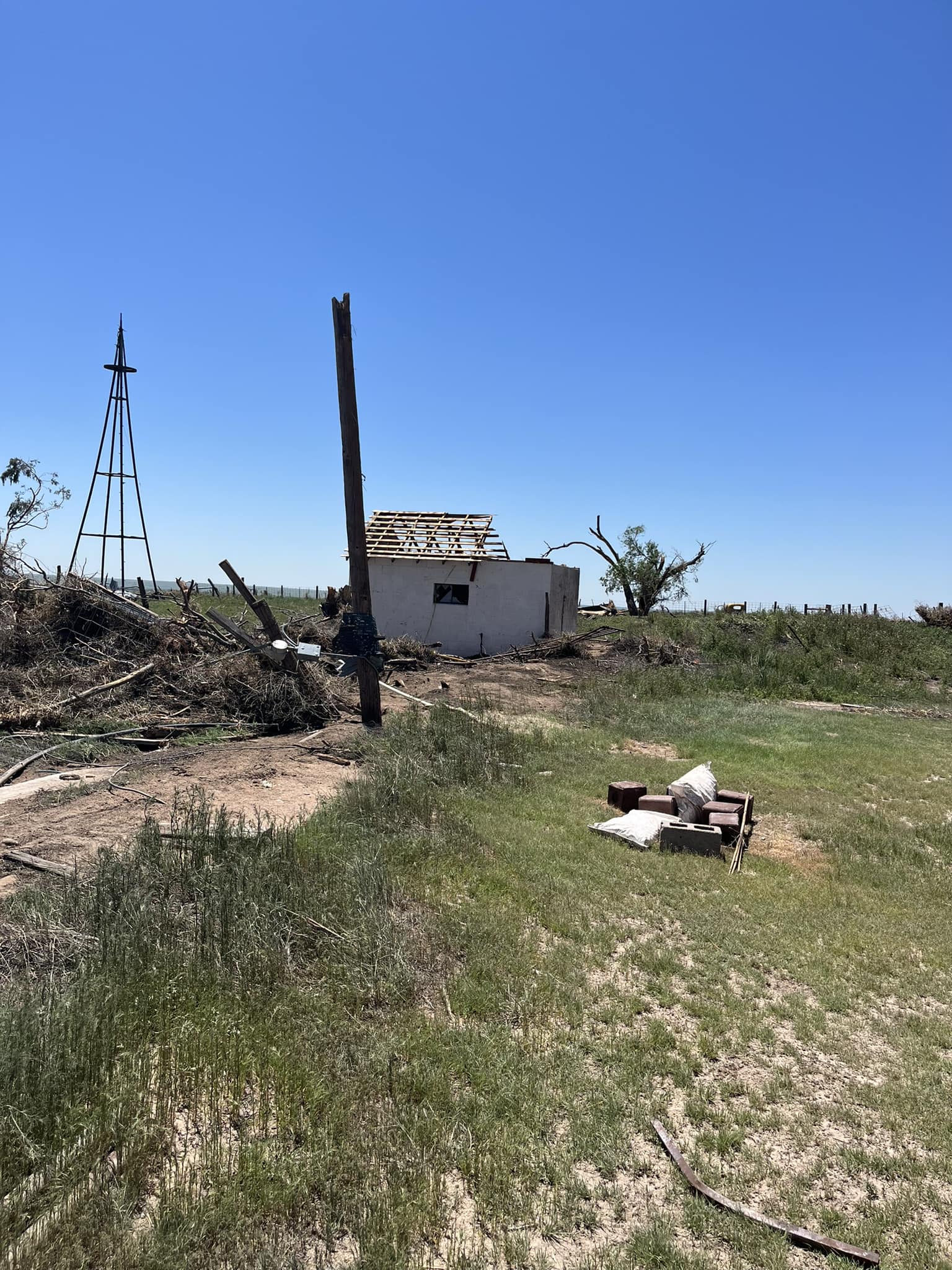
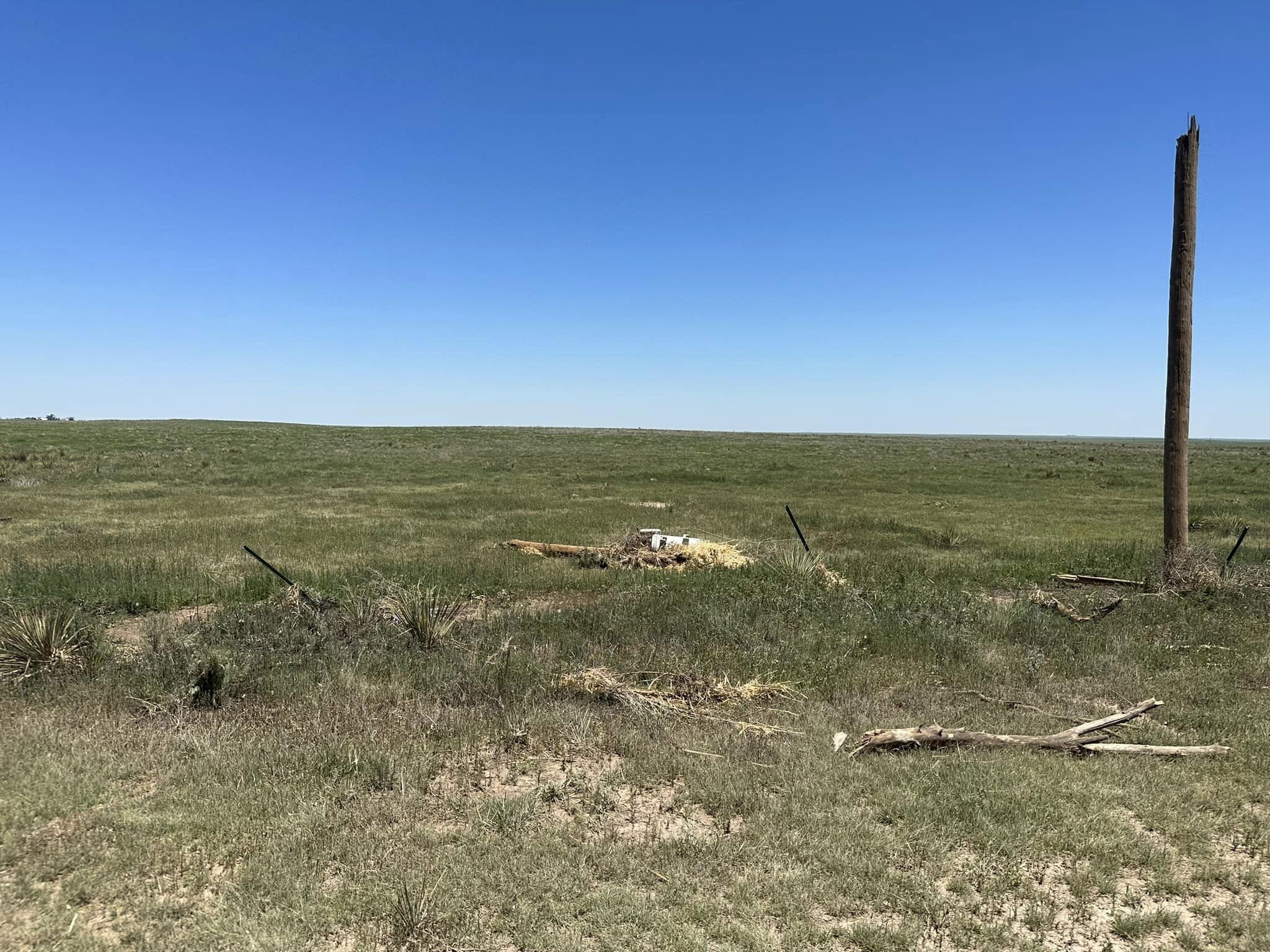
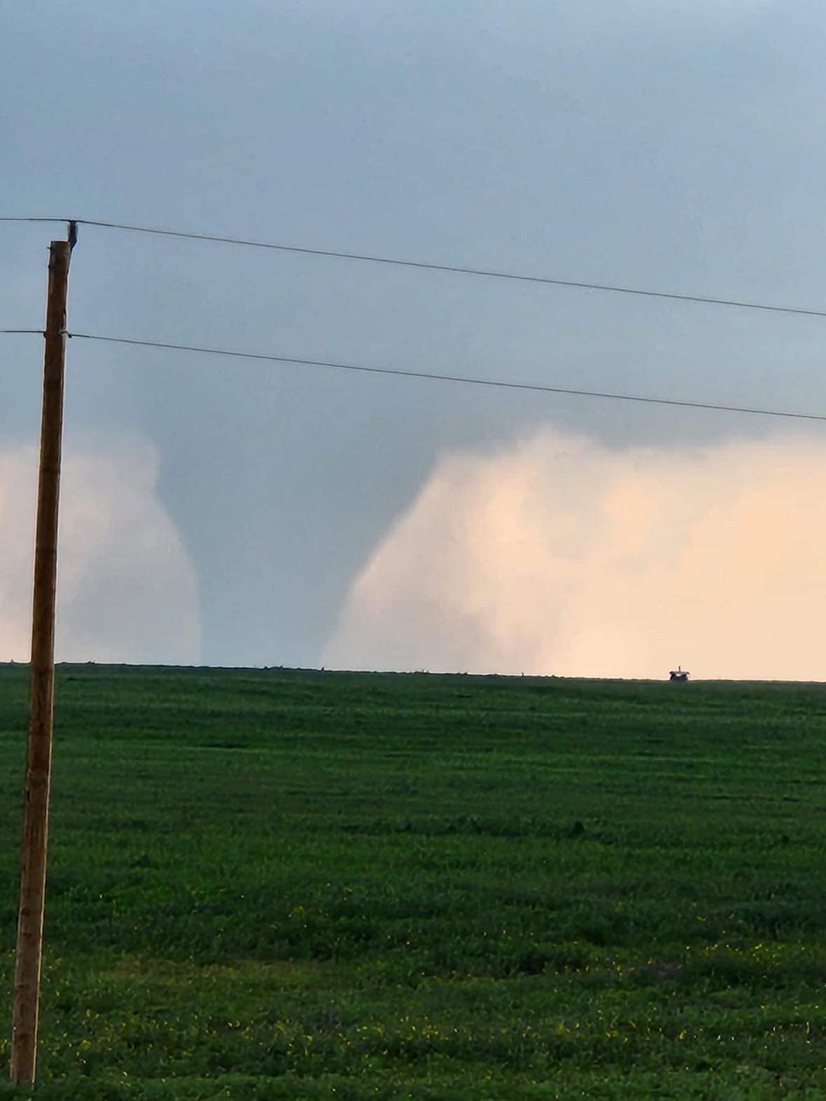
Tornado - 13 South Granada
Track Map 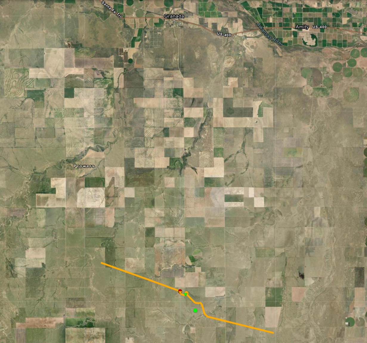 
|
||||||||||||||||
|
||||||||||||||||
|
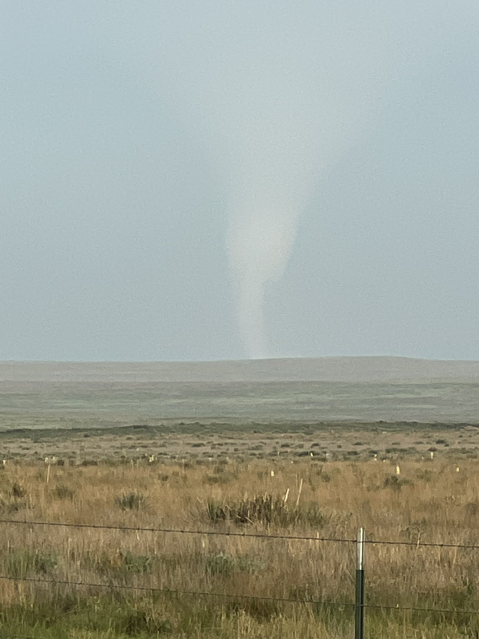
Tornado - 16 Southeast Campo
Track Map 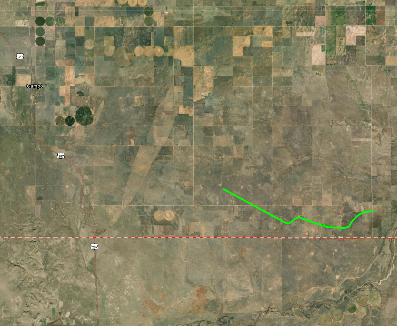
|
||||||||||||||||
|
||||||||||||||||
|
Tornado - Second Tornado With Prowers County Storm
|
||||||||||||||||
The Enhanced Fujita (EF) Scale classifies tornadoes into the following categories:
| EF0 Weak 65-85 mph |
EF1 Moderate 86-110 mph |
EF2 Significant 111-135 mph |
EF3 Severe 136-165 mph |
EF4 Extreme 166-200 mph |
EF5 Catastrophic 200+ mph |
 |
|||||
Photos & Video
Prowers County Supercell and Tornadoes
 |
 |
 |
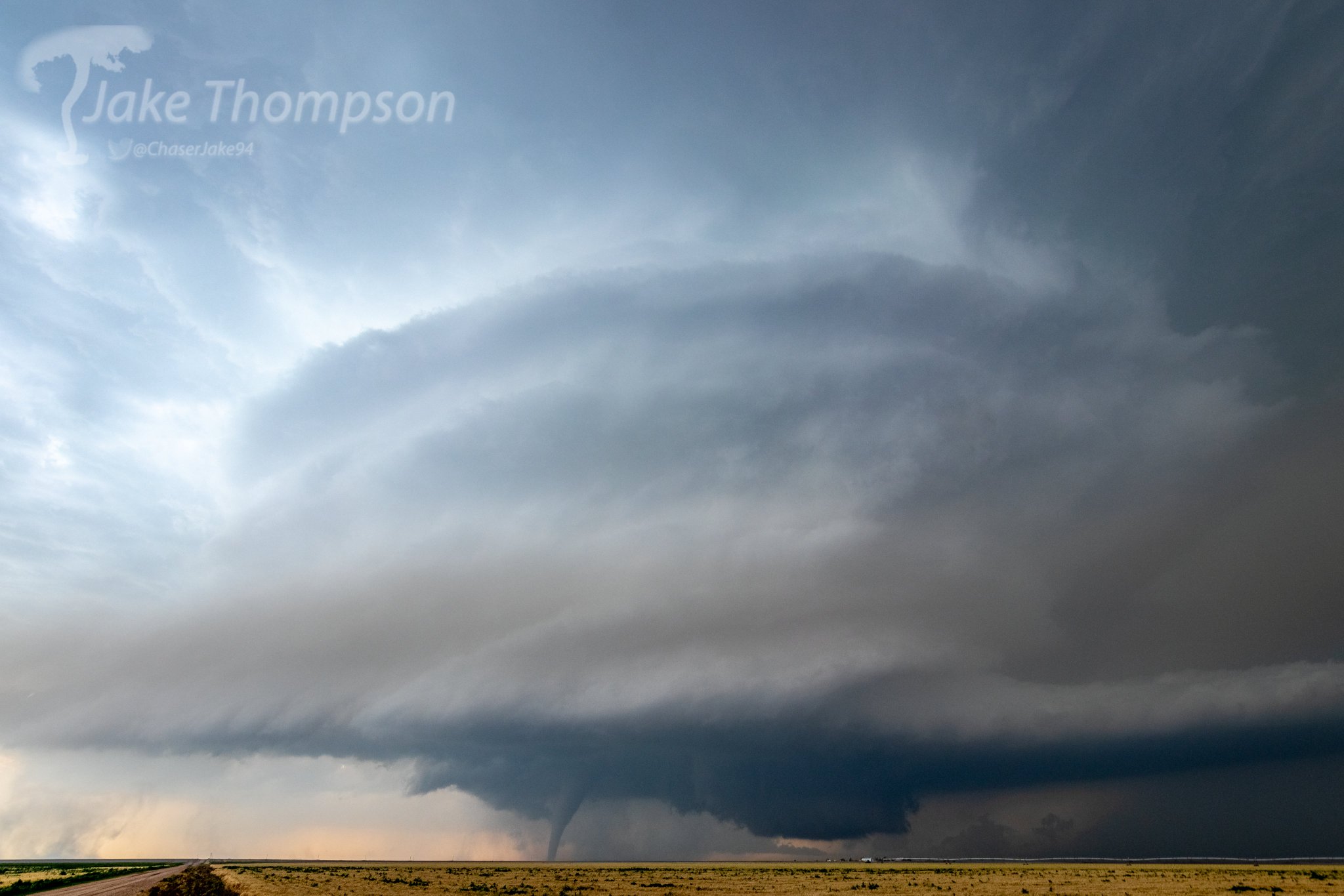 |
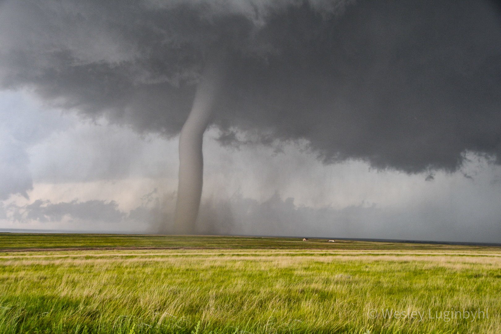
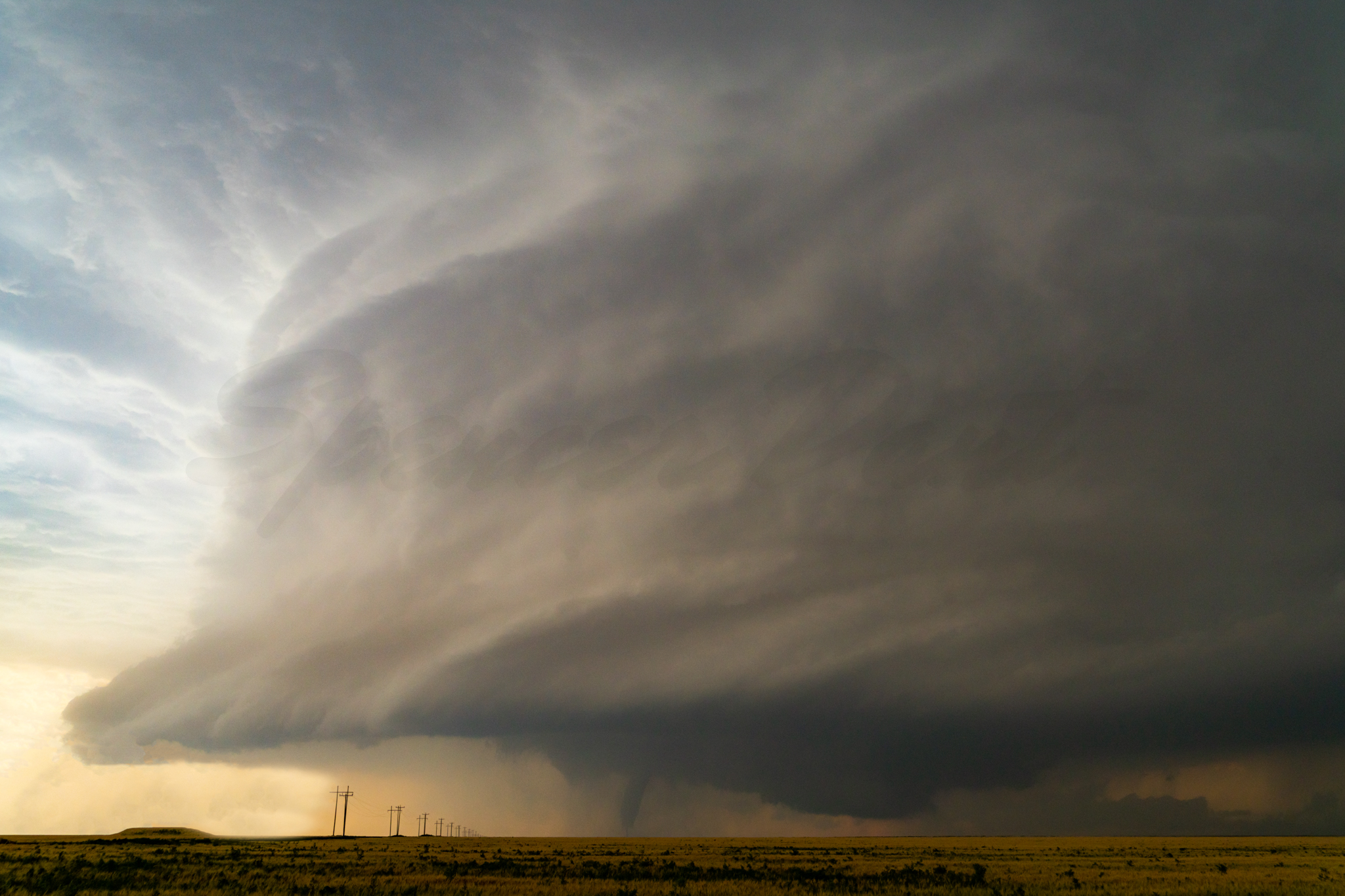
| EF-3 Tornado Over Prowers County Photo By: Wesley Luginbyhl |
Twin Tornadoes. EF-3 Tornado on the Left and EF-U Tornado on the Right Photo By: Taylor Wright |
Highly Structured Supercell with EF-3 Tornado Photo By: Spencer Dant |
Highly Structured Supercell with EF-3 Tornado Photo By: Jake Thompson |
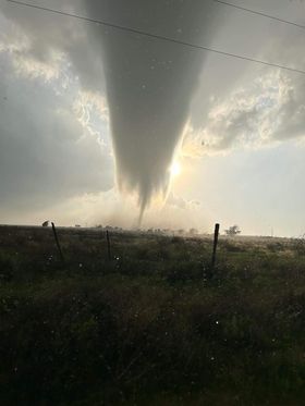
Baca County Supercell and Tornado
 |
 |
 |
 |
| EF-1 Tornado Over Baca County Photo From: Sharalee Hoffman |
EF-1 Tornado Over Baca County from Oklahoma Photo From: Sharalee Hoffman |
EF-1 Tornado Over Baca County Photo By: Ryan Schnaufer |
Backside of Supercell and EF-1 Tornado Photo By: Ryan Schnaufer |
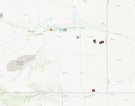
Storm Reports
Attached is a link to the PNS report and a picture of the preliminary storm reports.
Storm Report Map Below:
Environment
Synoptic Environment:
 |
 |
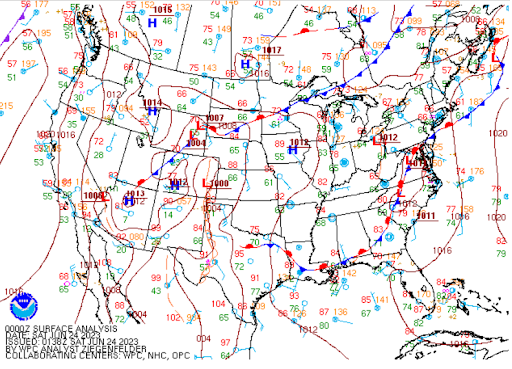 |
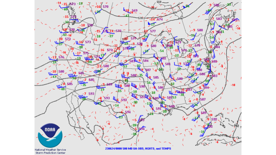
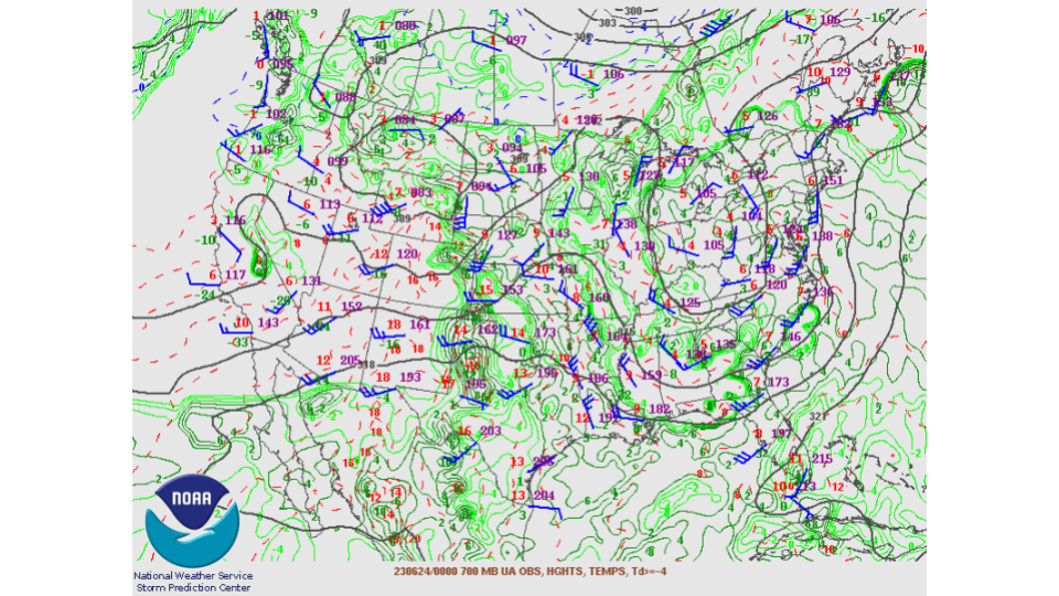
| Figure 1: 500mb at 6PM MDT June 23rd (00z June 24th) | Figure 2: 700mb at 6PM MDT June 23rd (00z June 24th) | Figure 3: Analyzed Surface Map at 6PM MDT June 23rd (00z June 24th) |
Near-Storm Environment
 |
 |
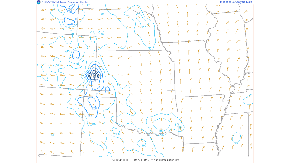 |
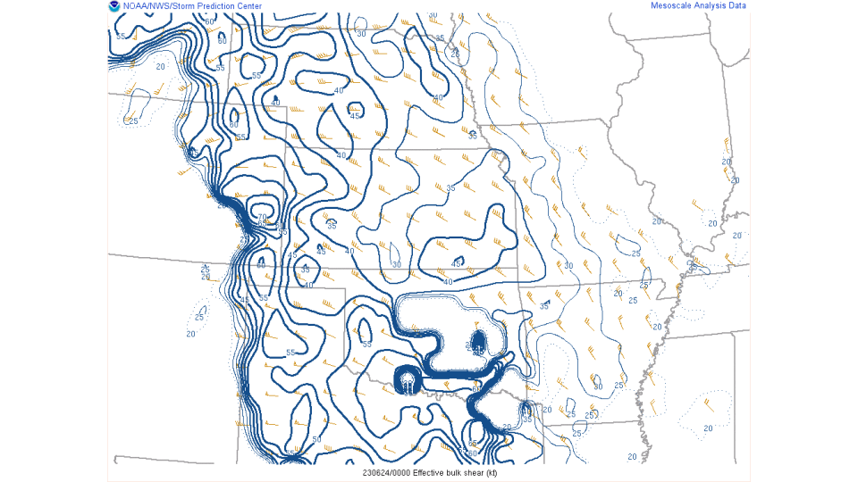
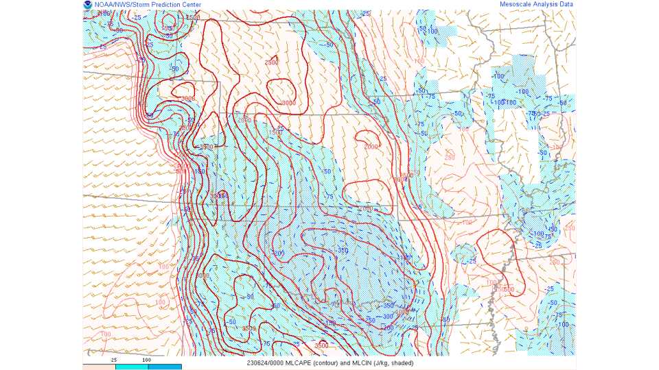
| Figure 4: Effective Shear. This parameter is similar to the 0-6 km bulk wind difference, though it accounts for storm depth (effective inflow base to EL) and is designed to identify both surface-based and "elevated" supercell environments. Supercells become more probable as the effective bulk wind difference increases in magnitude through the range of 25-40 kt and greater. Much of the eastern plains had 45-60 knots of Effective Shear | Figure 5: MLCAPE (Mixed Layer Convective Available Potential Energy) is a measure of instability in the troposphere. This value represents the mean potential energy conditions available to parcels of air located in the lowest 100-mb when lifted to the level of free convection (LFC). No parcel entrainment is considered. The CAPE and CIN calculations use the virtual temperature correction. The higher this values, the more energy for storms. MLCAPE values were 3000-3500 J/kg across the eastern plains. In addition to that, SBCAPE was 5000+ J/kg | Figure 6: 0-1km Storm Relative Helicity (SRH). SRH (Storm Relative Helicity) is a measure of the potential for cyclonic updraft rotation in right-moving supercells, and is calculated for the lowest 1-km and 3-km layers above ground level. There is no clear threshold value for SRH when forecasting supercells, since the formation of supercells appears to be related more strongly to the deeper layer vertical shear. Larger values of 0-3-km SRH (greater than 250 m2 s-2) and 0-1-km SRH (greater than 100 m2 s-2), however, do suggest an increased threat of tornadoes with supercells. For SRH, larger values are generally better, but there are no clear thresholds between non-tornadic and significant tornadic supercells. The eastern plains had values off 150-400m2/s2. |
 |
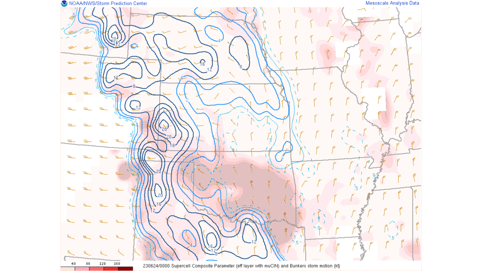 |
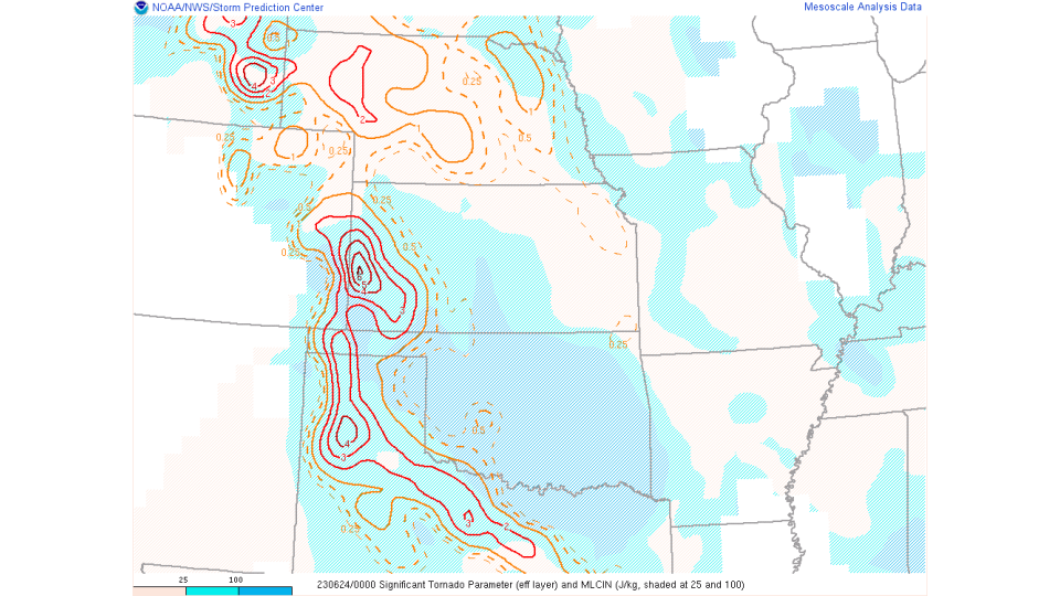
| Figure 7: Significant Tornado Parameter (STP). A multiple ingredient, composite index that includes effective bulk wind difference (EBWD), effective storm-relative helicity (ESRH), 100-mb mean parcel CAPE (mlCAPE), 100-mb mean parcel CIN (mlCIN), and 100-mb mean parcel LCL height (mlLCL). A majority of significant tornadoes (F2 or greater damage) have been associated with STP values greater than 1 within an hour of tornado occurrence, while most non-tornadic supercells have been associated with values less than 1 in a large sample of RAP analysis proximity soundings. Much of the eastern plains had values between 2-4 one June 23, 2023. | Figure 8: Supercell Composite Parameter (SCP). A multiple ingredient, composite index that includes effective storm-relative helicity (ESRH, based on Bunkers right supercell motion), most unstable parcel CAPE (muCAPE) and convective inhibition (muCIN), and effective bulk wind difference (EBWD). Each ingredient is normalized to supercell "threshold" values, and larger values of SCP denote greater "overlap" in the three supercell ingredients. Only positive values of SCP are displayed, which correspond to environments favoring right-moving (cyclonic) supercells. The SCP values across the eastern plains were 12-20. |
 |
Media use of NWS Web News Stories is encouraged! Please acknowledge the NWS as the source of any news information accessed from this site. |
|