Overview
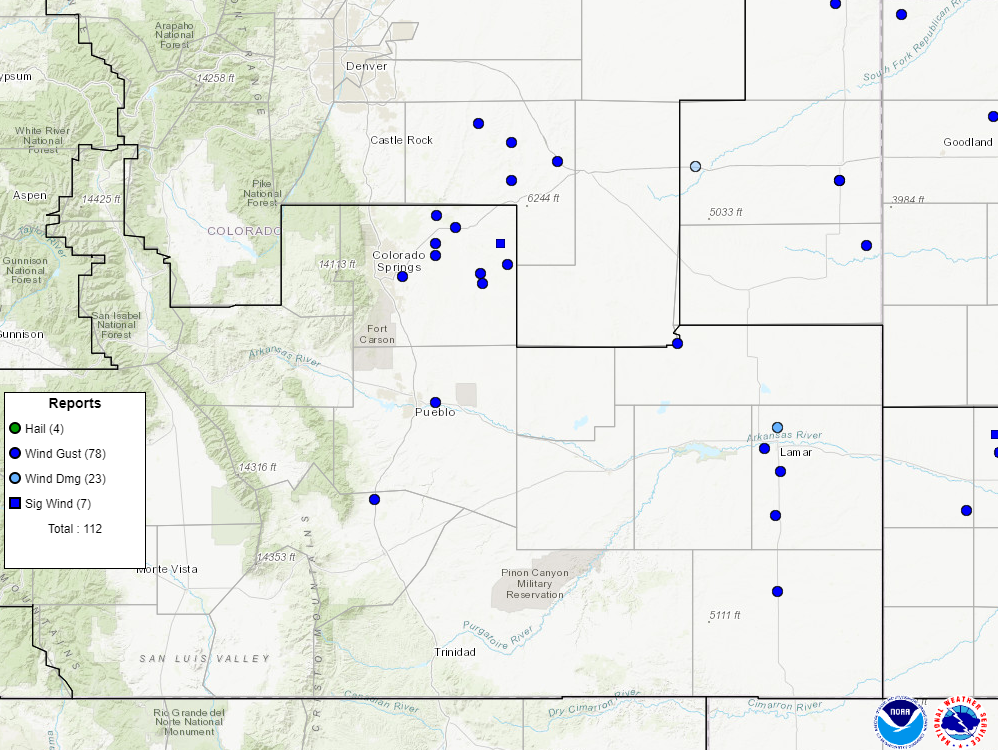
On September 17, 2024, an off-season (mid-September) severe weather event affected portions of southeastern Colorado. A negatively tilted trough was ejecting to the north-northeast throughout the day, with the southern fringes of the system pushing over south central and southeastern Colorado, bringing strong dynamic lift to the region. In addition, while this pattern allowed for greater moisture to advect into the area, CAPE (instability) remained relatively modest given hot and well above seasonal temperatures, though this did allow for steep low/mid level lapse rates and large DCAPE values, particularly along and east of the I-25 corridor. With that all said, the combination of strong dynamics with the trough, steep lapse rates, and large DCAPE values helped to compensate for the lackluster CAPE (and modest shear), and allowed for a volatile atmosphere conducive of severe thunderstorms capable of producing strong to severe winds to materialize. Initially, a broken line of sub-severe/marginally severe thunderstorms blossomed along the higher terrain around midday and tracked eastward across the mountains and valleys. As this line of storms reached the I- 25 corridor region, it quickly took advantage of the environment along and east of the interstate, and went on to produce widespread severe wind gusts across the plains, with the strongest gust from the day being a 75 mph wind gust from eastern El Paso County. In total, there were 16 storm reports this day, with 15 severe wind gusts from across the plains and 1 report of damage north of Lamar, Colorado.Photos & Video
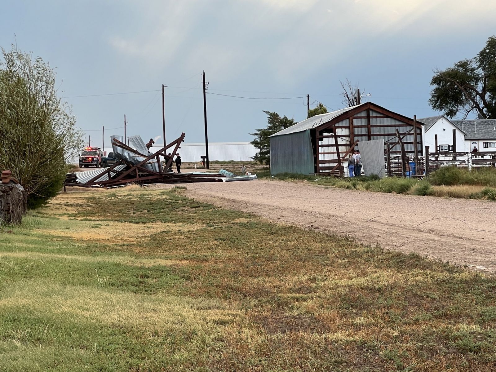
Images of Wind Damage to Outbuilding north of Lamar, Colorado
 |
 |
 |
|
| Damage to Outbuilding Photo By: James Farmer |
Damage to Outbuilding Photo By: James Farmer |
Damage to Outbuilding Photo By: James Farmer |
Radar
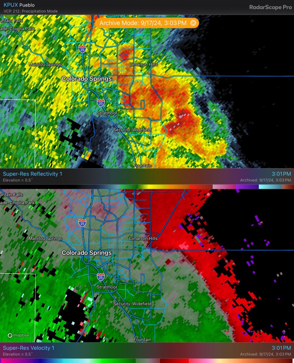
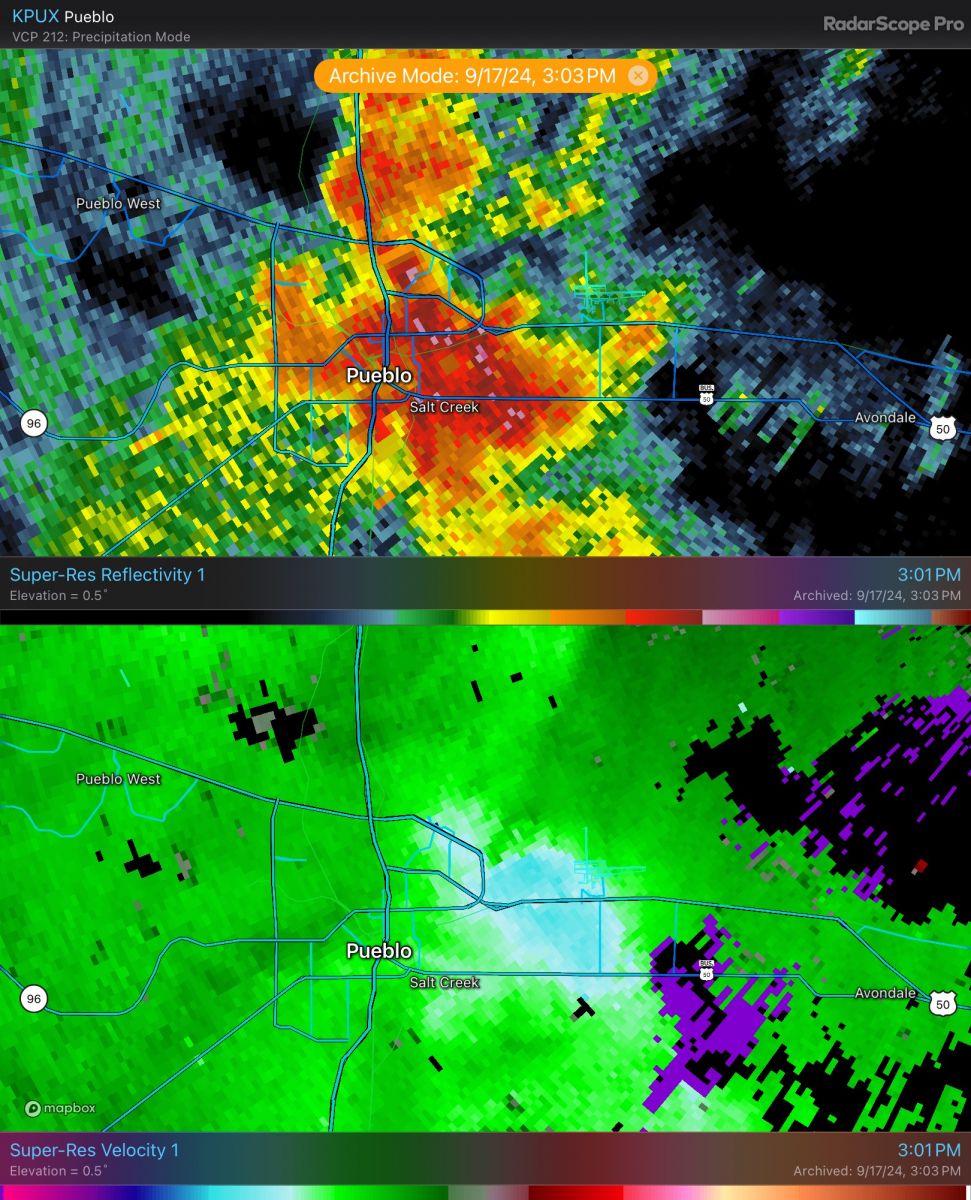
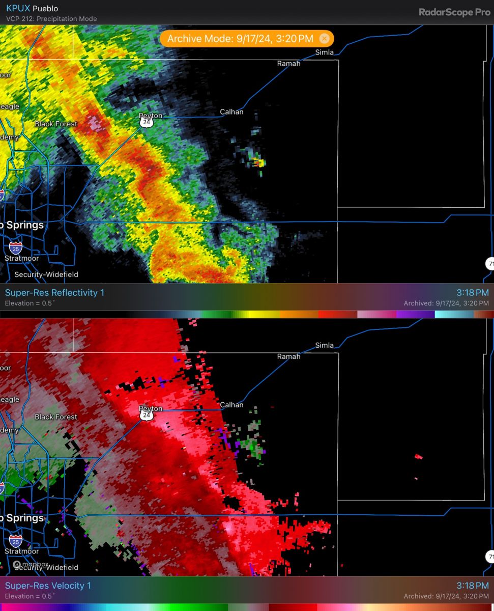
Radar Images via Radarscope of Various Times of Strongest Winds Across the Plains
 |
 |
 |
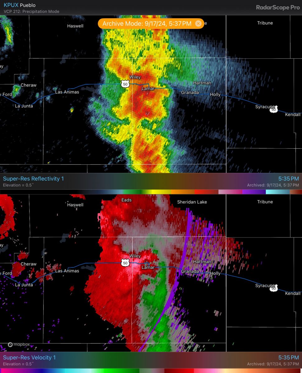 |
| Reflectivity and velocity in central El Paso County at 301 PM MDT (2101Z) | Reflectivity and velocity in central Pueblo County at 301 PM MDT (2101Z) | Reflectivity and velocity in eastern El Paso County at 318 PM MDT (2118Z) | Reflectivity and velocity across eastern plains at 535 PM MDT (2335Z) |
Storm Reports
Table Showing Storm Reports for 09/17/24
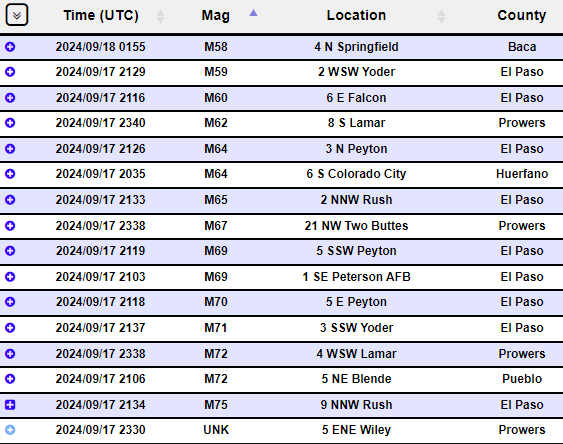
Image Showing Map of Storm Reports for 09/17/24
Environment
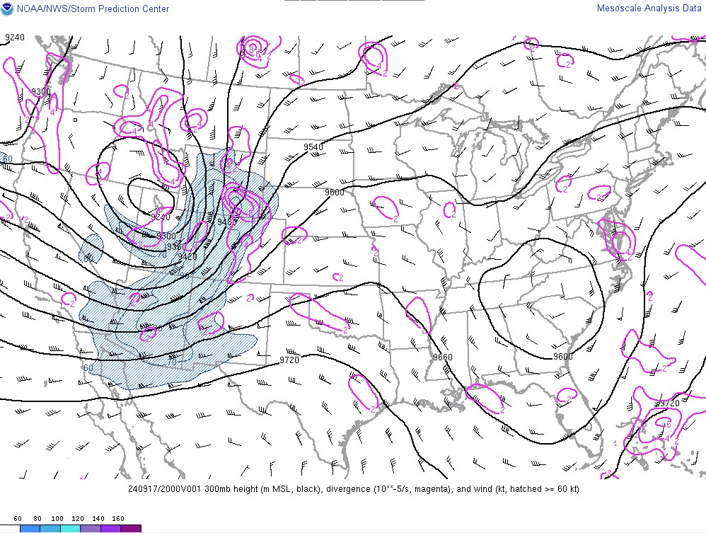
Synoptic Environment:
 |
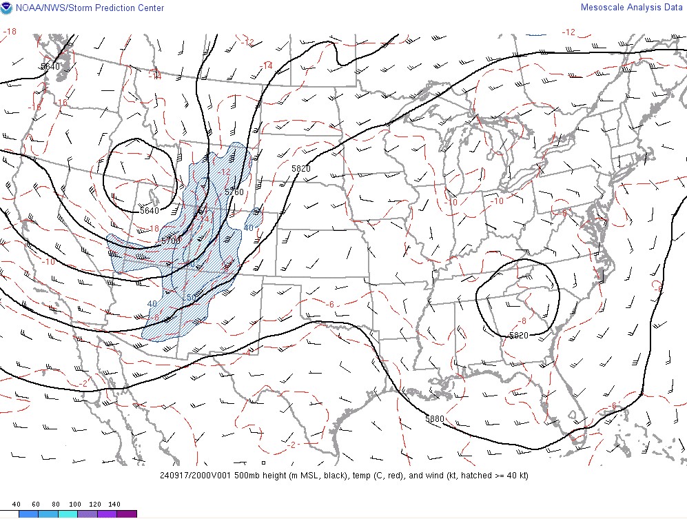 |
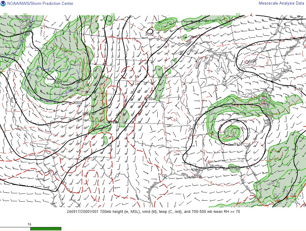 |
| Figure 1: 300mb analysis at 2PM MDT (2000z) September 17, 2024. Figure shows highly amplified negatively tilted trough in place. This supported strong dynamic lift & divergence aloft across the region. | Figure 2: 500mb analysis at 2PM MDT (2000z) September 17, 2024. Figure shows highly amplified negatively tilted trough in place. This supported strong dynamic lift across the region. | Figure 3: 700mb analysis at 2PM MDT (2000z) September 17, 2024. Shows troughiness with embedded shortwave rounding the base. Also shows area of lower/mid level moisture advecting northward. |
Near-storm Environment:
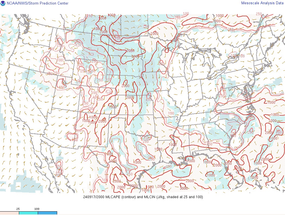 |
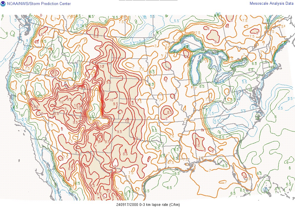 |
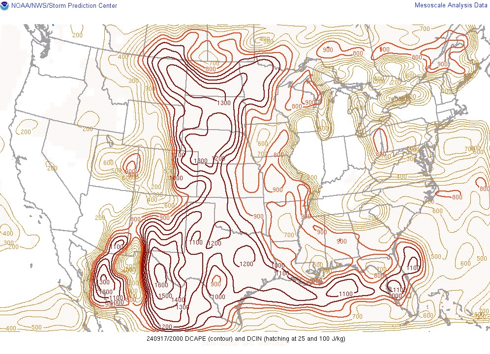 |
| Figure 4: Mixed-Layer CAPE (MLCAPE) analysis at 2PM MDT (2000z) September 17, 2024. Instability axis was situated over the far eastern plains, with only 250-500 J/kg of MLCAPE along and west of the I-25 corridor, though this lackluster instability wasn't a limiting factor in strong to severe thunderstorm development. | Figure 5: Low-level Lapse Rates analysis at 2PM MDT (2000z) September 17, 2024. Steep low-level lapse rates noted across the region. Steep lapse rates, especially in the low-levels, have been shown to support strong downdrafts. | Figure 6: Downdraft-CAPE (DCAPE) analysis at 2PM MDT (2000z) September 17, 2024. High DCAPE values across the eastern plains, with values ranging between 1,000-1,300 J/kg. Large DCAPE values further support potential for stronger downdrafts. |
 |
Media use of NWS Web News Stories is encouraged! Please acknowledge the NWS as the source of any news information accessed from this site. |
|



 Follow us on X
 Follow us on Facebook
 Follow us on YouTube
 PUB RSS Feed