#2 2012 Wildfires
Lower North Fork Fire, High Park Fire, and Waldo Canyon Fire
Lower North Fork Fire:
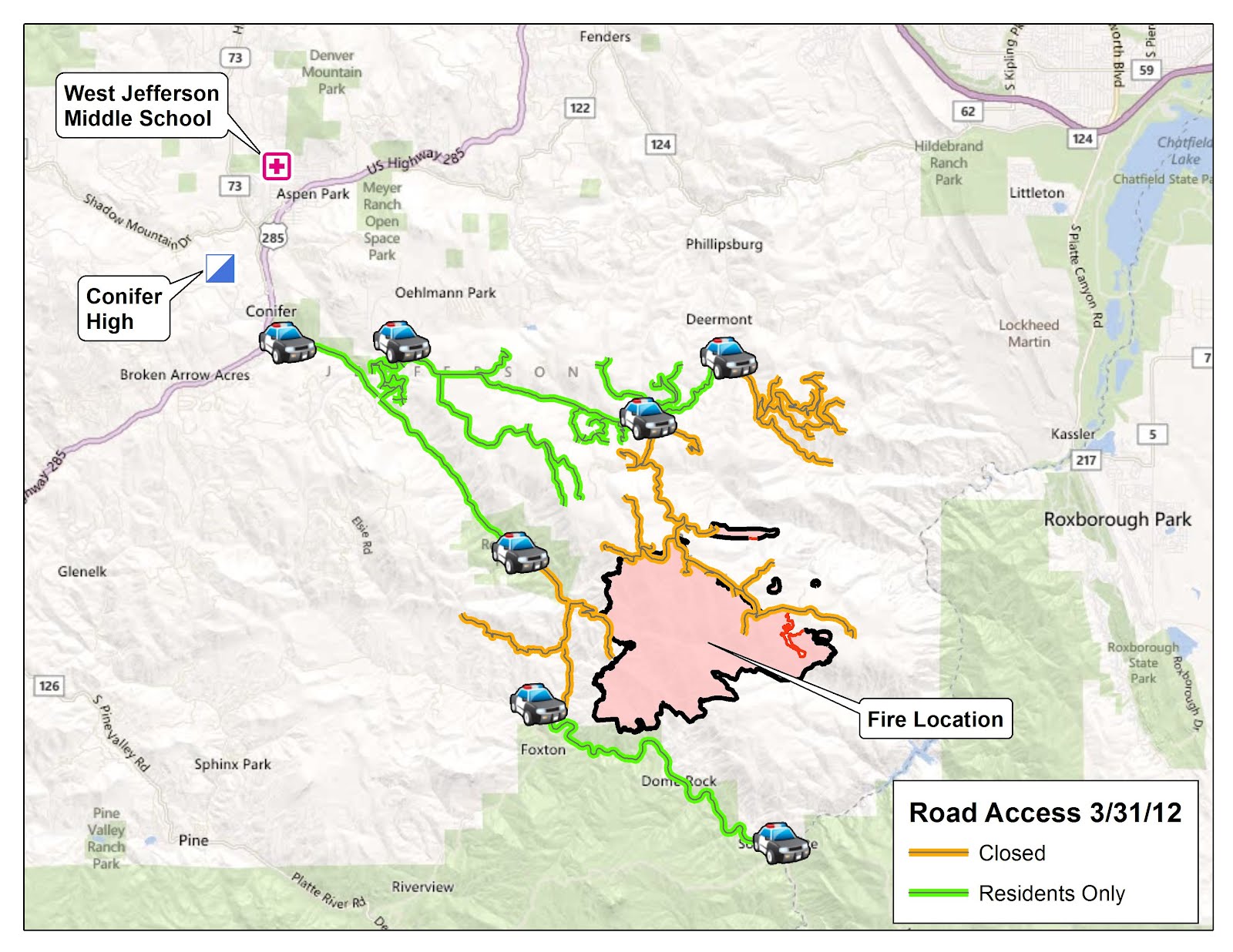
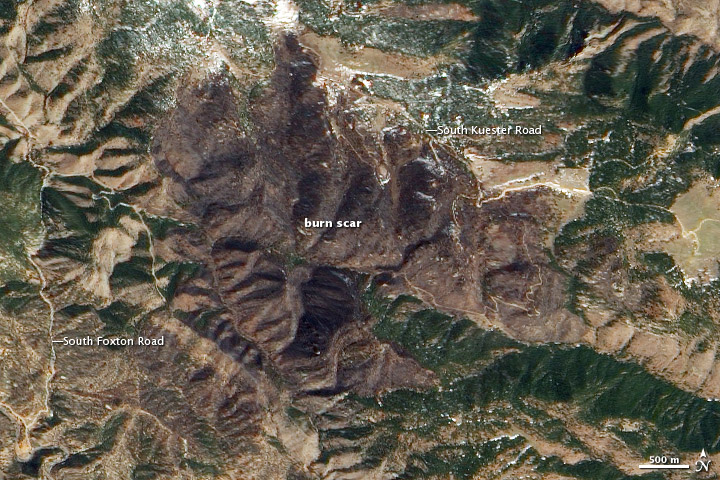
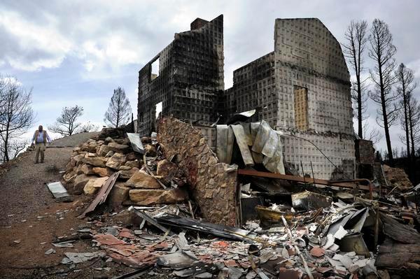
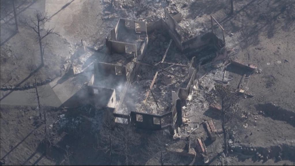
On Thursday, March 22nd, 2012, the Lower North Fork Prescribed Fire Project, located south of Conifer, Colorado, was ignited as part of a large scale restoration effort on Denver Water property. On Friday, March 23rd, the fire was put into monitor status. On March 26th, there was a three person crew monitoring the burn on a day that the NWS in Boulder issued a Red Flag Warning, meaning the forecast was for windy conditions and low relative humidity values. According to the after action report created by the State of Colorado, around 1:15 PM, winds carried embers outside the controlled burn site. According to the after action review "A fire weather watch for strong winds was issued at 2:09 PM on Saturday, March 24, 2012 and at 5:26 AM on March 25, 2012 was upgraded to a red flag warning for strong and gusty winds for Monday, March 26, 2012". On March 26th, the fire burned out of control as wind speeds up to 60 mph developed over the mountains. The fire eventually burned 4,410 acres took the lives of 3 people and destroyed 23 homes east of Foxton, Colorado. The fire was considered 100% contained on Monday, April 2nd, 2012. The after action review can be found here.
|
High Park Fire:
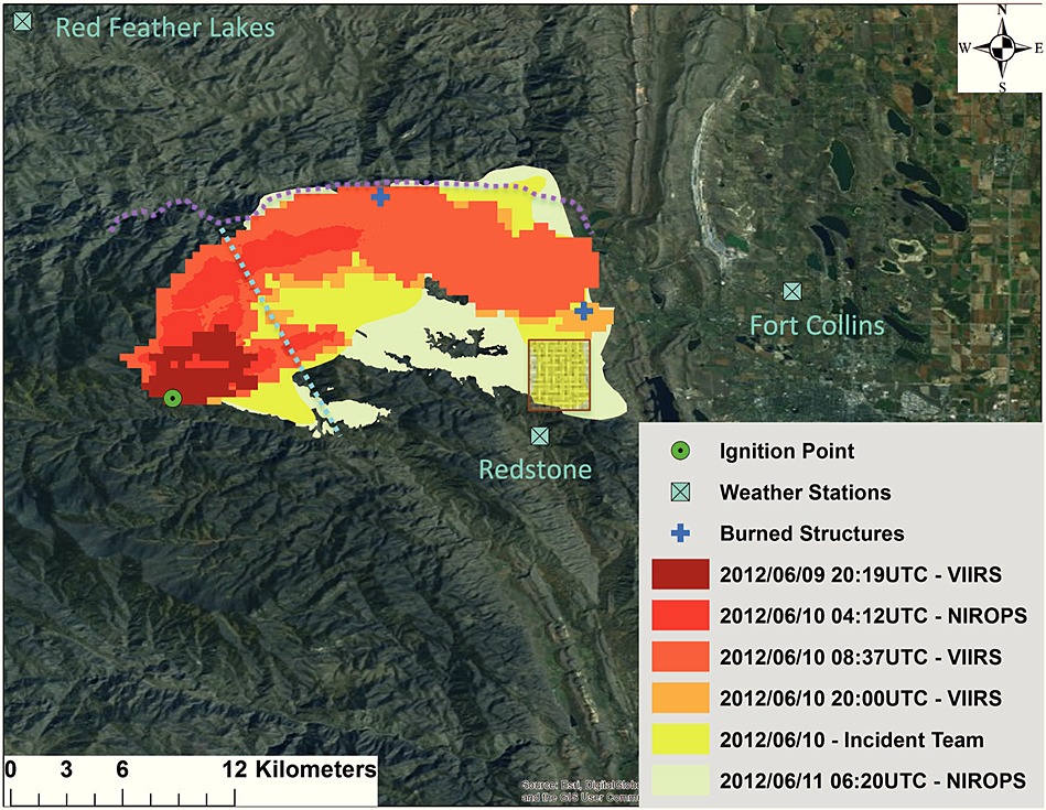
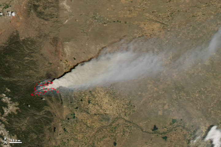
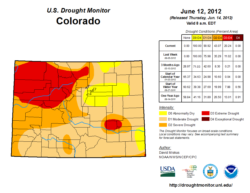
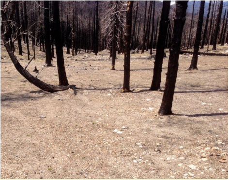
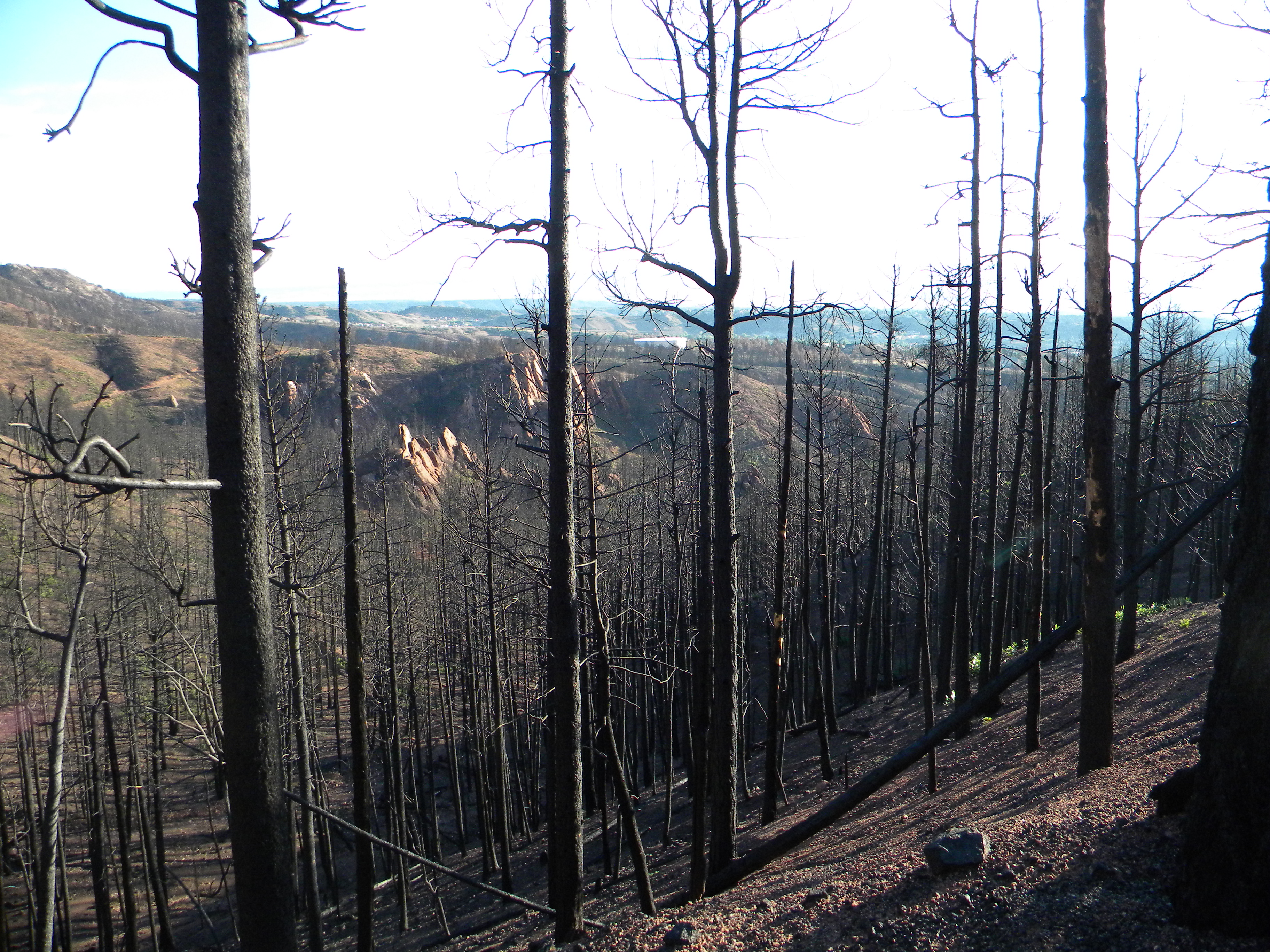
The High Park Fire, a forest fire in the mountains west of Fort Collins in Larimer County, was caused by a lightning strike and was first detected on the morning of June 9, 2012. This fire burned over 87,415 acres in the Poudre River watershed, making it the 4th largest wildfire in Colorado state history. The fire caused one fatality and destroyed 259 homes. Of the burned land, 32,302 acres burned at a low severity; 35,399 acres at a moderate severity; and 5,714 acres at a high severity. More than 14,000 acres within the perimeter were unburned. A full overview of the BAER report can be found here. A persistent pacific jet streak caused persistent gusty conditions after the fire developed, spreading the fire easterly. The previous year's winter was below average, causing the mountains to the west of Fort Collins to be in a "D2 Severe Drought" to a "D3 Extreme Drought". There was beetle-kill trees located in the fire, which caused explosive fire behavior. The fire was considered 100% contained on June 9th, 2012.
|
|
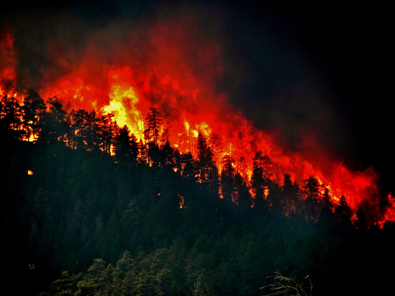
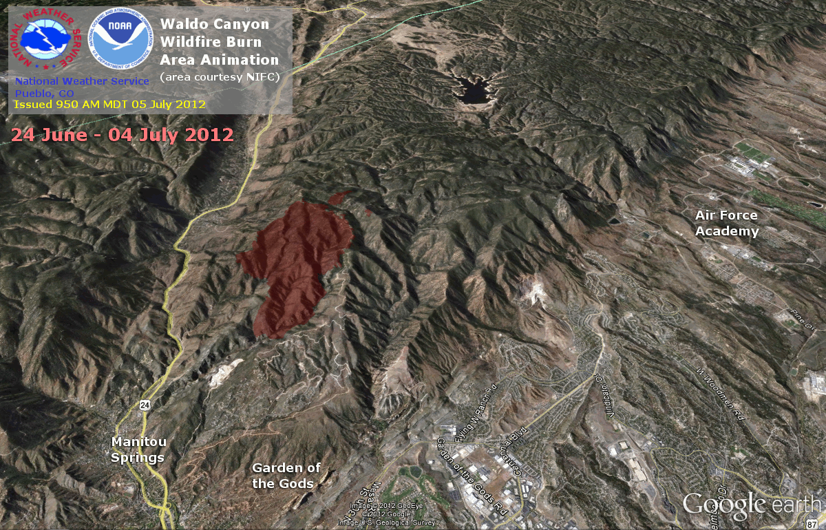
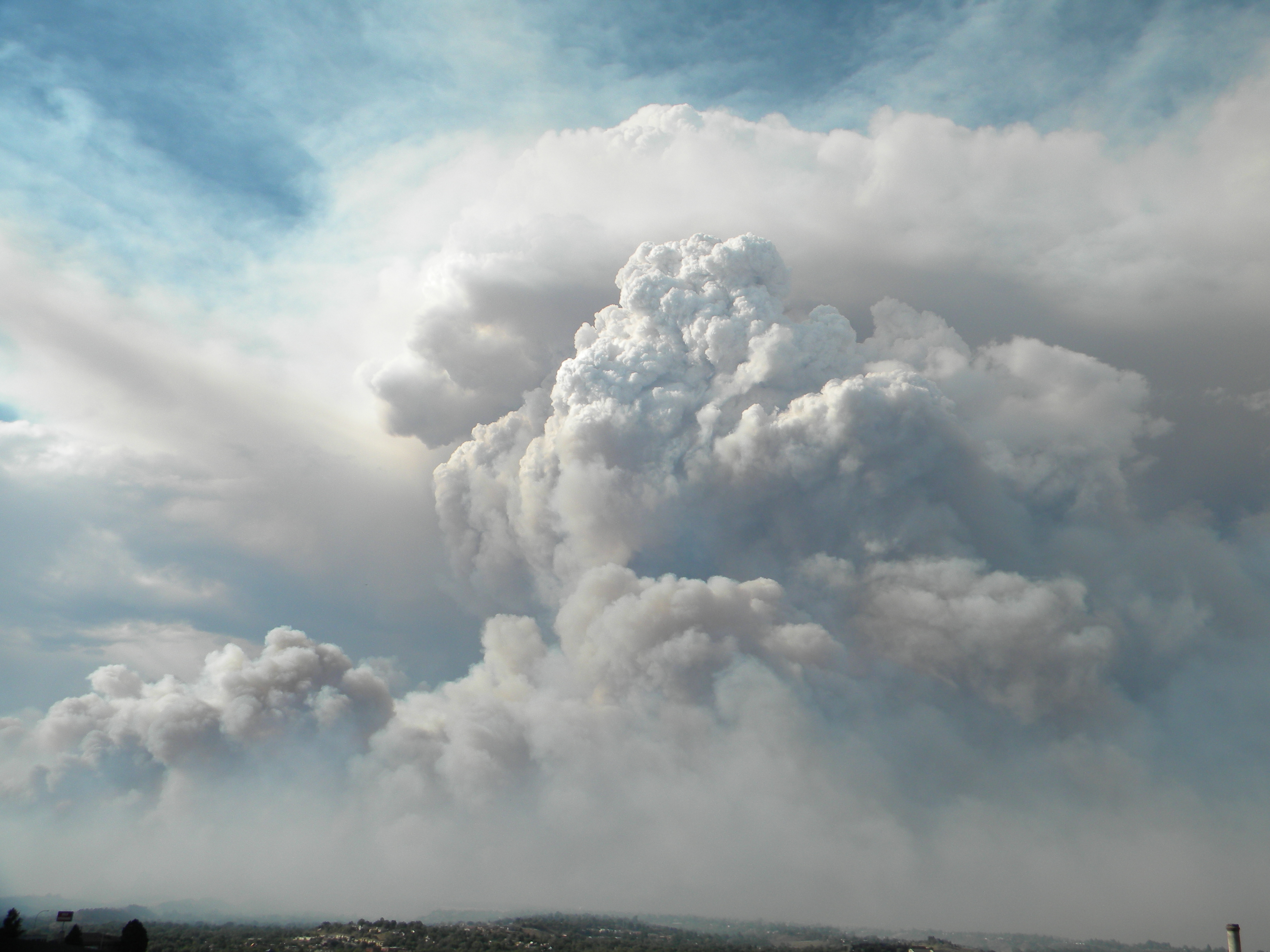
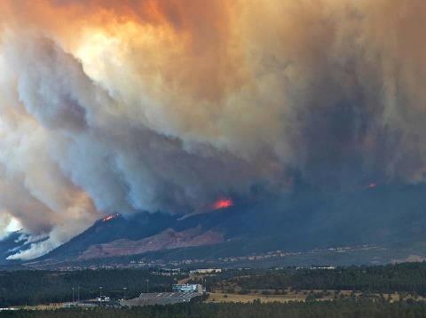
Waldo Canyon Fire:
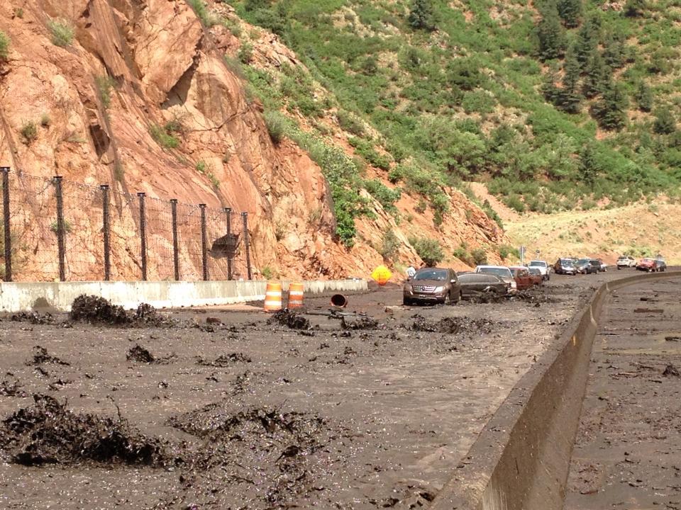
On Saturday June 23rd, 2012 a fire was reported in the Pike National Forest, just west of Colorado Springs, just north of Highway 24 in El Paso County. The fire burned for 18 days, covering 18,247 acres, taking two lives, and destroying 347 homes and damaging others. The BAER team determined the three levels of burn severity of the Waldo Canyon Fire on the soils and watersheds to be: 41% low/unburned severity (7,586 acres); 40% moderate severity (7,286 acres); and 19% high severity (3,375 acres). The Waldo Canyon Fire resulted in $453.7 million in insurance claims, which is the second most destructive fire in Colorado state history, next to the Black Forest Fire (found at #6 on the Top 12 Events). The cause of the fire was determined to be caused by a human, but the true nature of the cause is still uncertain. The fire was considered 100% contained on July 10th, 2012. The following year, a thunderstorm developed over the Waldo Canyon Fire burn scar, resulting in catastrophic flooding over Highway 24 and into the city of Manitou Springs, Colorado.
|
|