Dangerous heat will expand from the Gulf Coast into the Southern Plains and Desert Southwest through week's end. Additional extreme heat impacting the Pacific Northwest will shift to the northern Plains by the weekend. Tropical Storm Bertha is expected to continue to impact portions of the northwestern Gulf Coast from south central Louisiana to the upper Texas coast today. Read More >
#6 2013 Wildfires
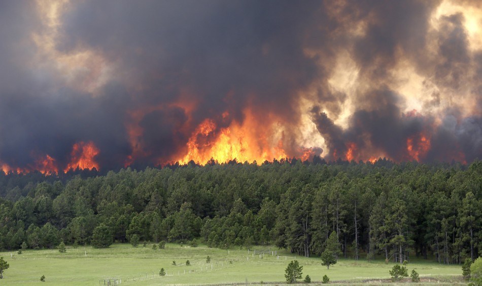
Black Forest Fire / West Fork Complex
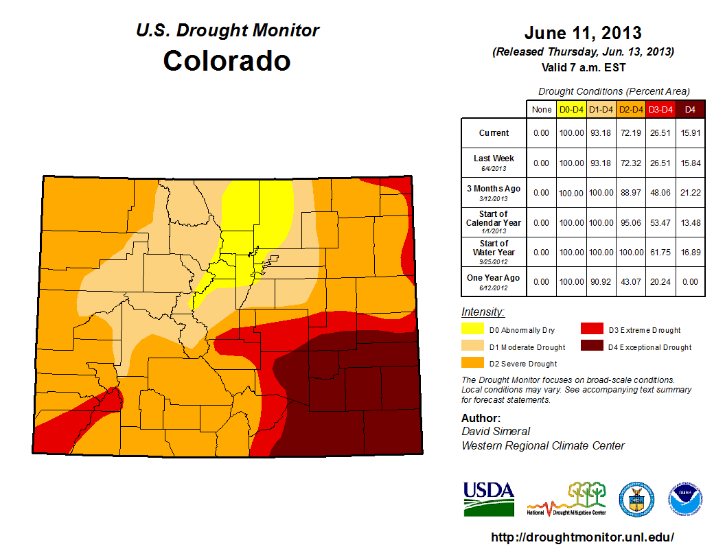
As a direct cause from #10 on the top 12 events, the 2012 Summer Heat Wave and Drought, the 2013 Wildfires includes the Black Forest Fire located in north-central El Paso County and the West Fork Complex Fire located near Wolf Creek Pass in southern Colorado.
West Fork Complex Fire:
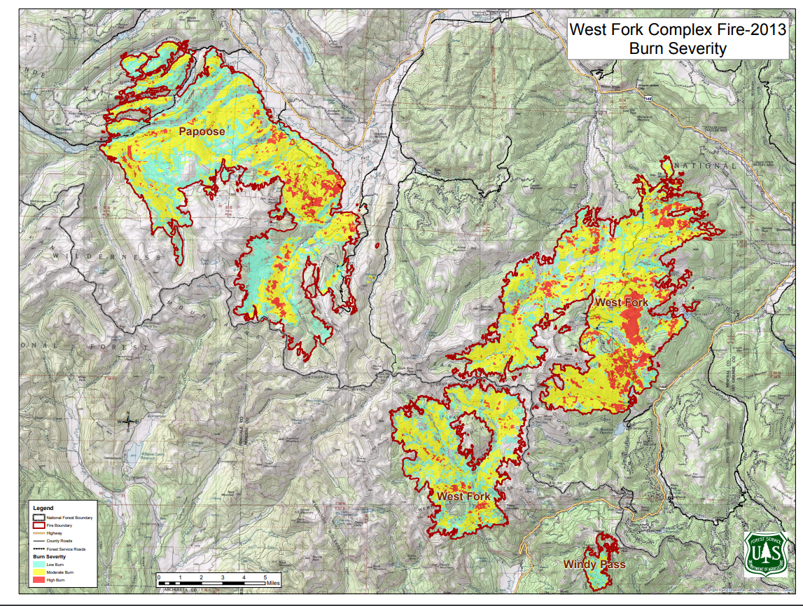
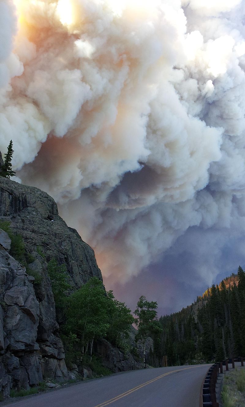
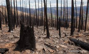
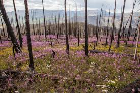
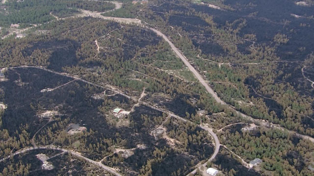
The West Fork Complex Fire consisted of three fires, the Papoose Fire (49,628 acres), the West Fork Fire (58,570 acres), and the Windy Pass Fire (1,417), burning through spruce beetle-kill trees, causing explosive nature to the fire behavior. The total acreage of all 3 fires led to this event being the 2nd largest in Colorado state history at 121,806 acres. The initial fire started on June 5th, 2013 and was considered contained on November 13th, 2013. Of all of the acres burned, 11% had "High" burn severity, 49% had "Moderate" burn severity, and 23% had "Low" burn severity. This fire burned so hot, that 21,192 acres of soil that were considered to be water-repellent ("hydrophobic") according to the BAER report. The wildfires, which were all started by lightning, burned in the San Juan and Rio Grande National Forests. The Windy Pass Fire threatened the Wolf Creek Ski Areas, but no structures were lost. The West Fork Fire threatened the town of South Fork Colorado, but was contained before any structures were lost. The Papoose Fire destroyed one small pump house, otherwise did not threaten any towns or structures. Combined, the fire impacted 103.7 miles of trails (motorized and non-motorized) and 52 miles of Forest Service System Roads. The full BAER report can be found here.
|
|
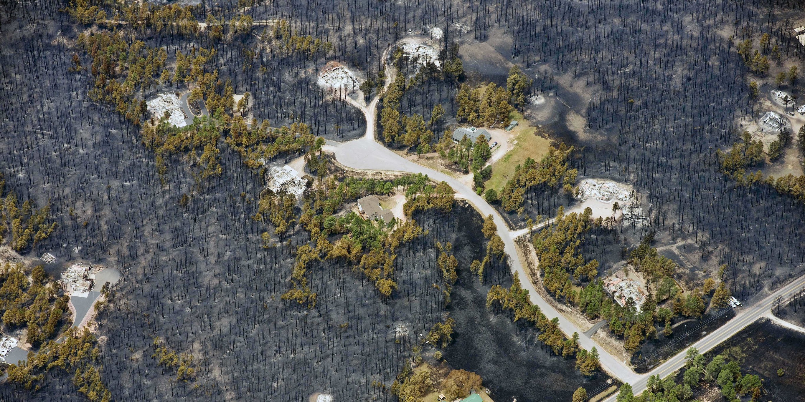
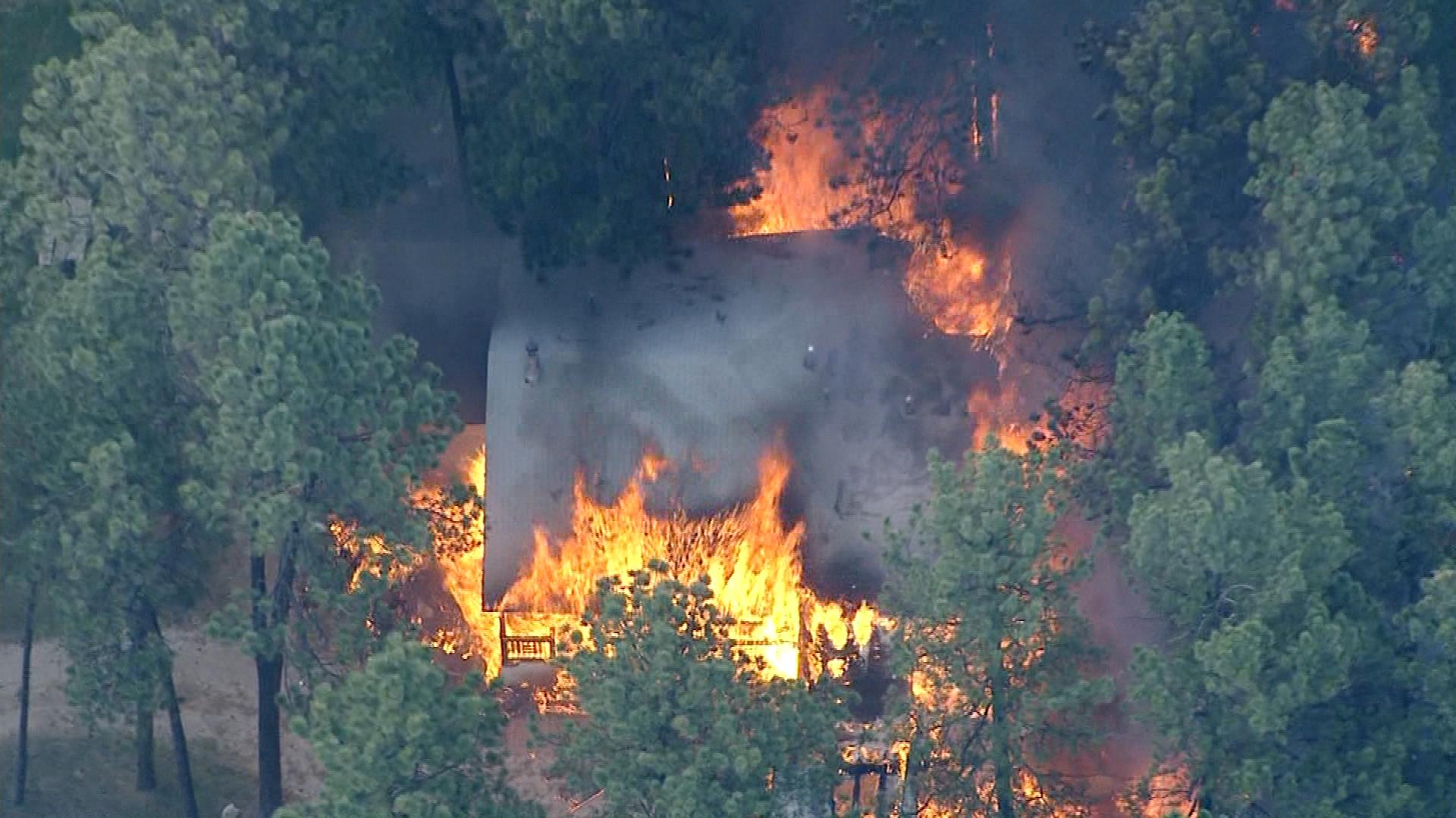
Black Forest Fire:
The Black Forest Fire began on June 11th, 2013 around 1:00 PM near Highway 83 and Shoup Road in Black Forest, Colorado, located in north-central El Paso County. The fire grew into what is considered the most destructive forest fire in Colorado history. The cause of the fire is still uncertain to this day. The fire only burned 14,280 acres but destroyed 511 homes and caused 2 fatalities. The total damage from this event was at an estimated cost of $463 million and a total of 38,000 people had to be evacuated during the fire. The fire was considered contained on June 21st, 2016.
Leading up to the fire, there were anomalously dry conditions across all of Colorado. Black Forest was on the line of a "D2 Severe Drought" and a "D3 Extreme Drought" on the day the fire started. The NWS office in Pueblo did issue a Red Flag Warning on the day of the fire, warning people to avoid activities that could start fires, forecasting or gusty winds, record high temperatures, and low relative humidity values.
|
|
Other Notable Fires in 2013:
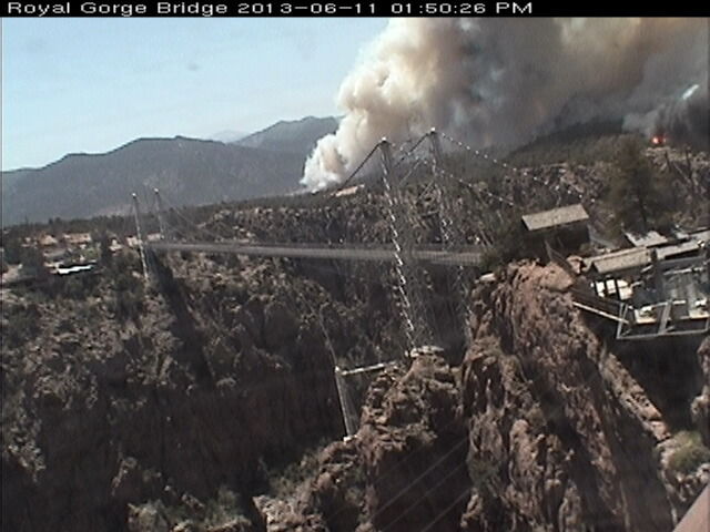
The Royal Gorge Fire:
On June 11th (the same day as the Black Forest Fire), a destructive wildfire occurred in the Royal Gorge Park and surrounding area. The wildfire scorched 3218 acres, burned 48 of the 52 buildings in the Royal Gorge Park, closing the park. The fire did burn some of the Royal Gorge Bridge, but ultimately, the bridge was saved.
|
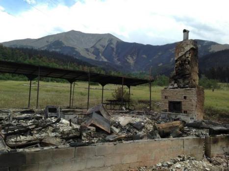
The East Peak Fire:
The lightning caused wildfire burned 13,572 acres near the base of, and up the northern slopes of East Spanish Peak in Huerfano County. Over 600 firefighters contained the blaze, and one was injured. 28 structures were destroyed, including 12 houses, 3 cabins, 12 outbuildings, and an infirmary. Many of the building were on, and near the Spanish Peaks Scout Ranch.
|