Overview
|
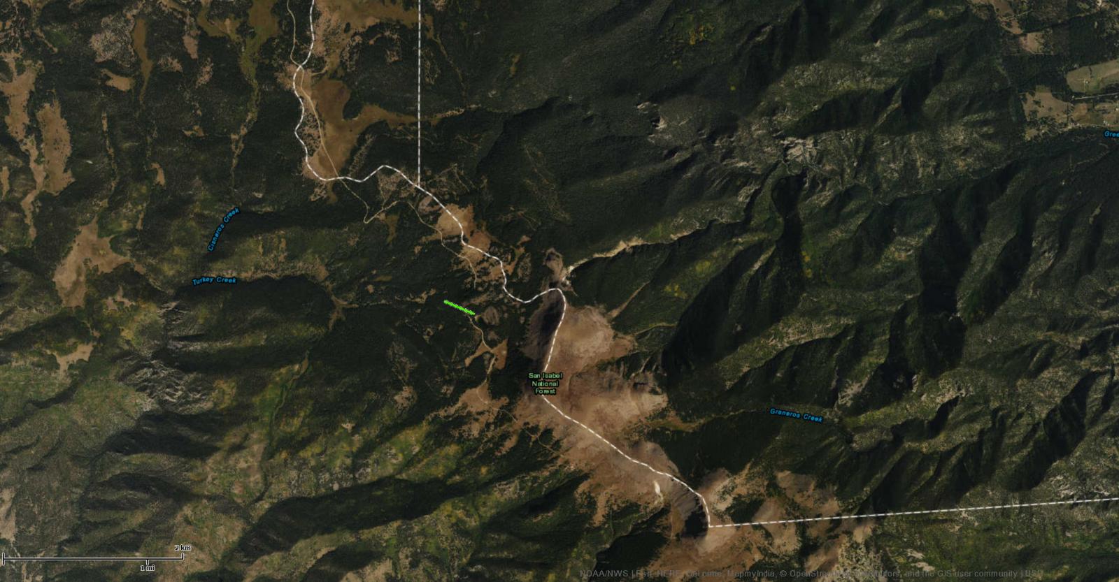
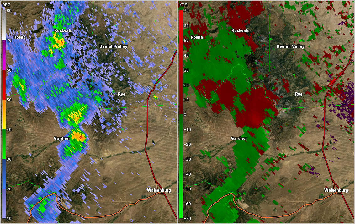
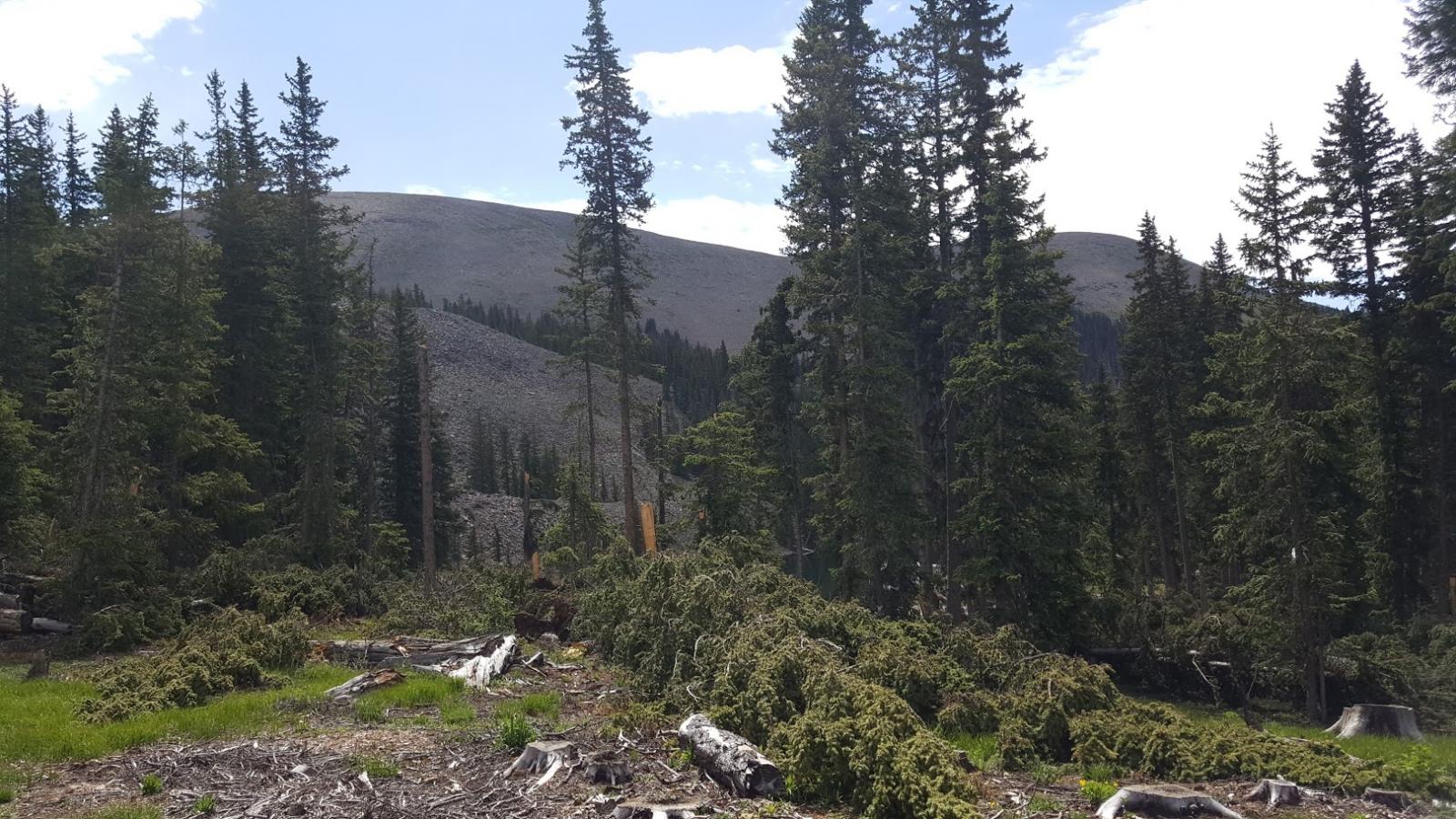
The Greenhorn Mountain tornado is a classic example of when complex interactions between weather and steep topography create unusual outcomes. An old wive's tale states that tornadoes cannot form across mountains, but of course, that is untrue. Greenhorn Mountain is the tallest mountain in the Wet Mountain Range, and has two peaks. The south peak is the highest, with an elevation of 12,352 feet. The north peak is around 12,220 feet, near the occurrence of the brief tornado. On May 8th the road up to Greenhorn Mountain was under deep snow, and no one was up there to witness the tornado. The only indication of a possible tornado was data from Pueblo's Doppler radar. NWS Pueblo issued a tornado warning at 2:20 p.m. MDT, shortly after, the radar indicated a strong velocity couplet (seen under the Radar tab). The velocity couplet indicated a rotational velocity of 95 mph. As the supercell propagated towards the north-northwest, it entered into a less favorable atmosphere to sustain it's intensity, and quickly dissipated. In late June, NWS Pueblo received a call from a US Forest Service employee, stating that once Forest Road 369 was clear of snow, he traveled up it, and near the end of the road, encountered a damage path near, and across the road. He remembered the tornado warning we issued on May 8th. The Warning Coordination Meteorologist (WCM) at NWS Pueblo took a trip up the road and observed the tree damage, determining that the short tornado path mirrored the location of the compact radar velocity couplet, and therefore,verified our tornado warning. The damage path was at an elevation of 11,300 feet and the tree damage was consistent with EF1 damage (winds around 100 mph). |
|
Radar:
 |
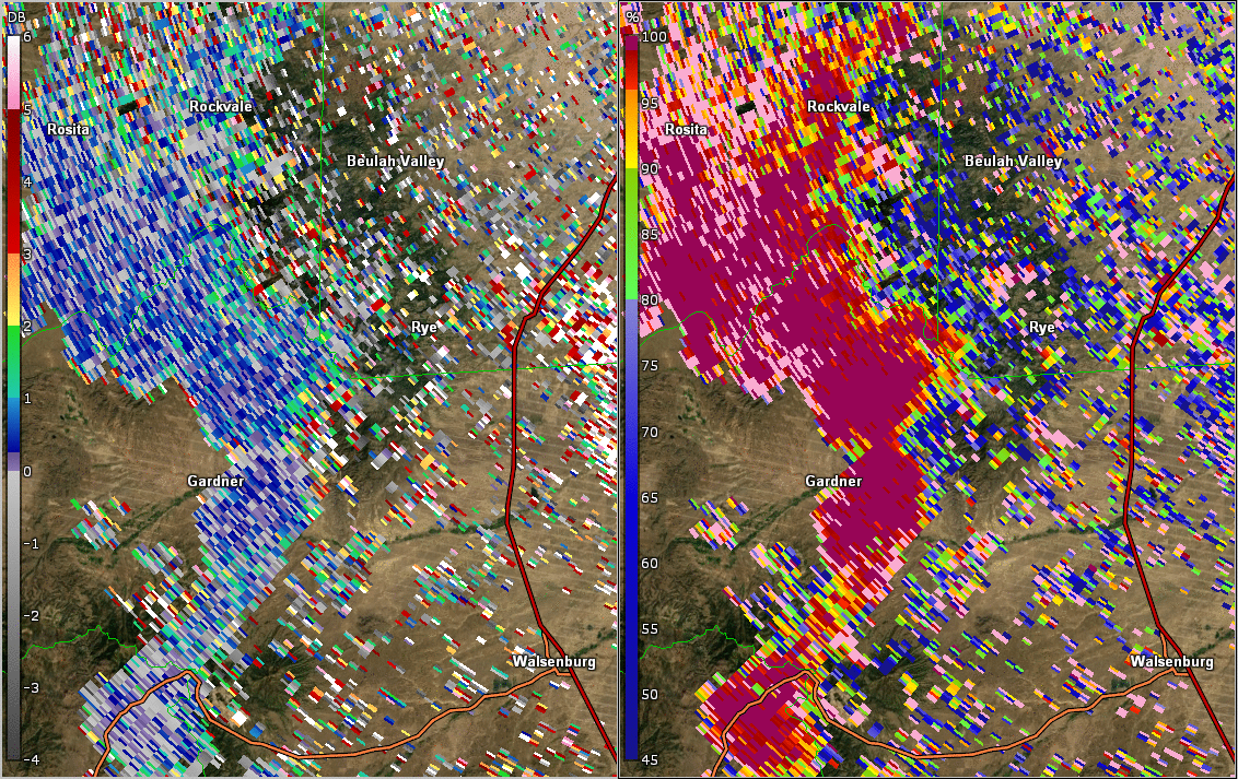 |
| Base Reflectivity and Velocity Volume Scans from Pueblo Doppler Radar | Differential Reflectivity and Correlation Coefficient Volume Scans from Pueblo Doppler Radar |
Photos:
 |
 |
 |
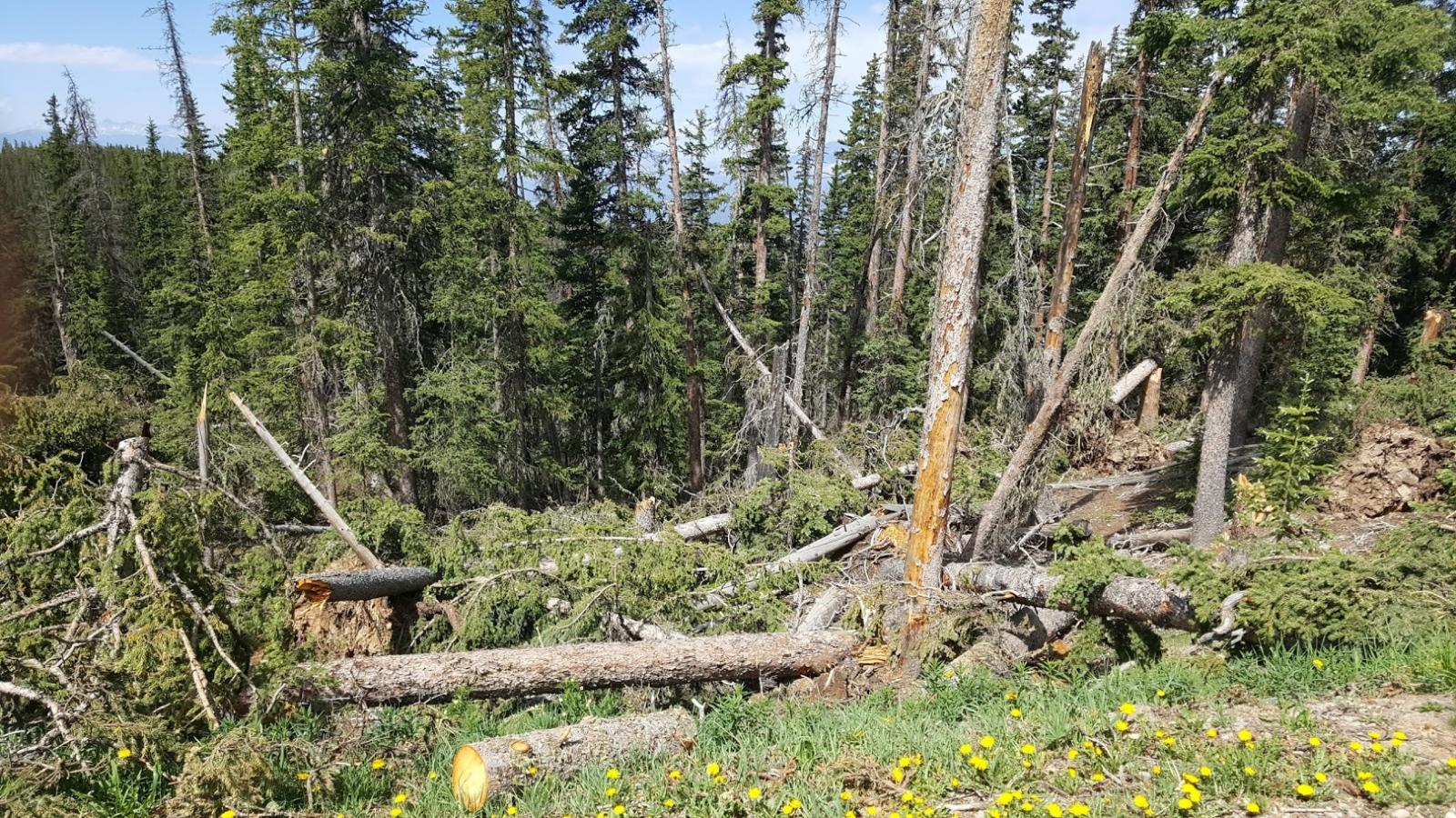 |
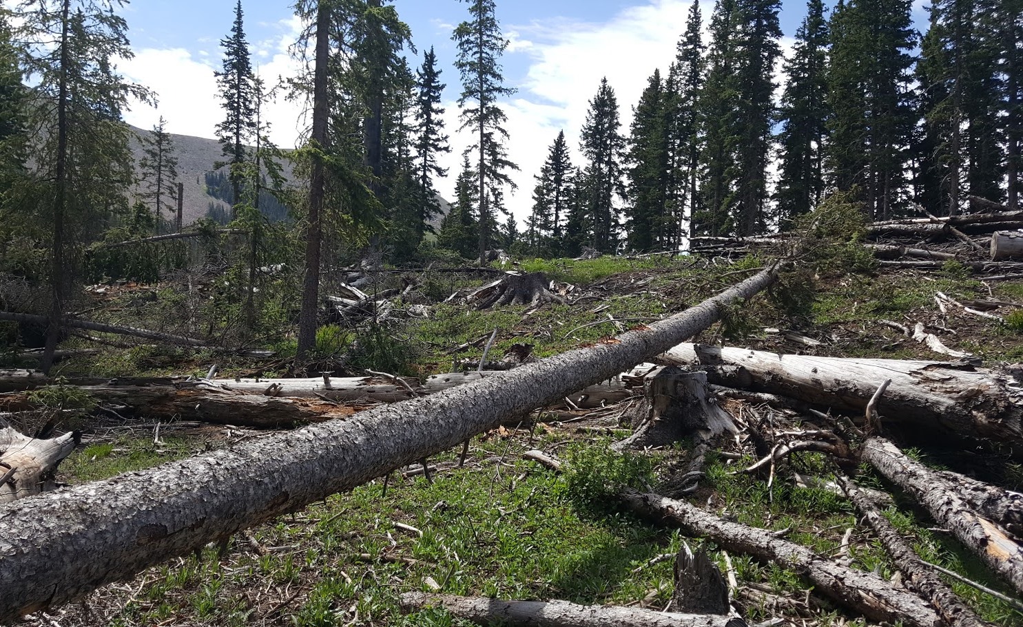
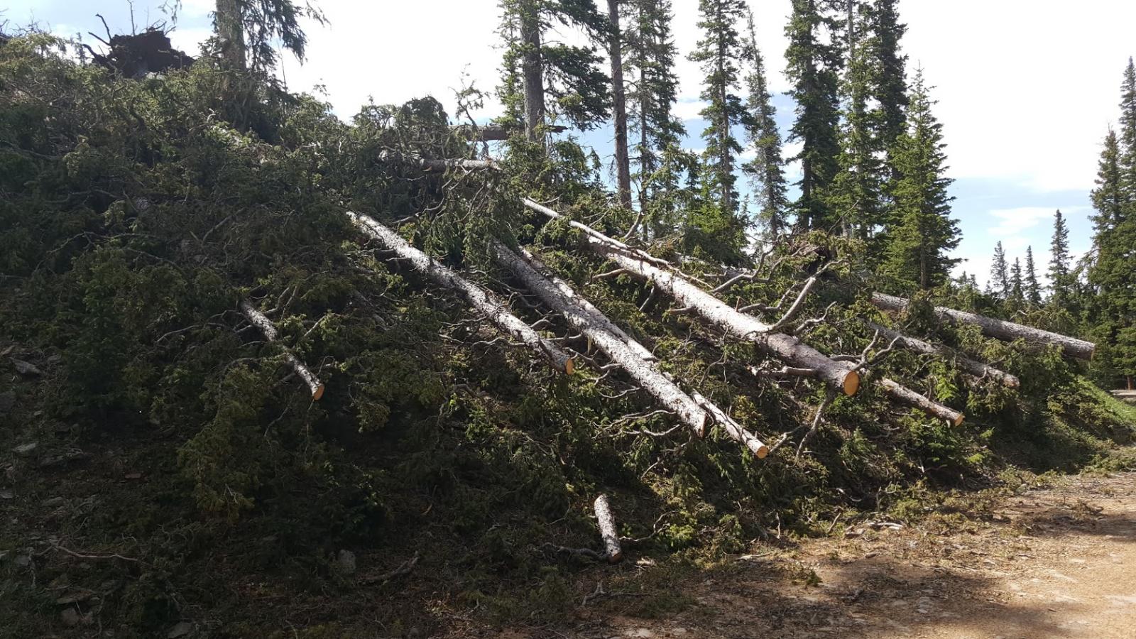
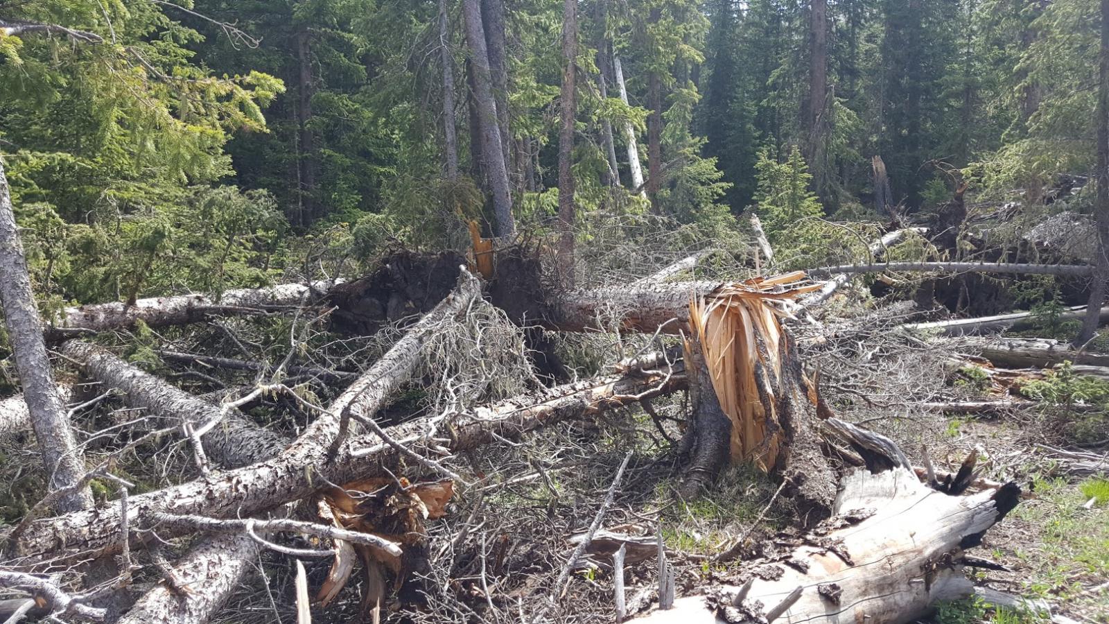
| Looking south-southeast toward the north peak of Greenhorn Mountain. Beginning of the path. | Trees snapped and Uurooted in various directions, indicating intense rotation | Uni-directional snapped trees, indicating straight-line winds, possibly the rear flank downdraft | More tree debris blown down in various directions, indications intense rotation. |
 |
 |
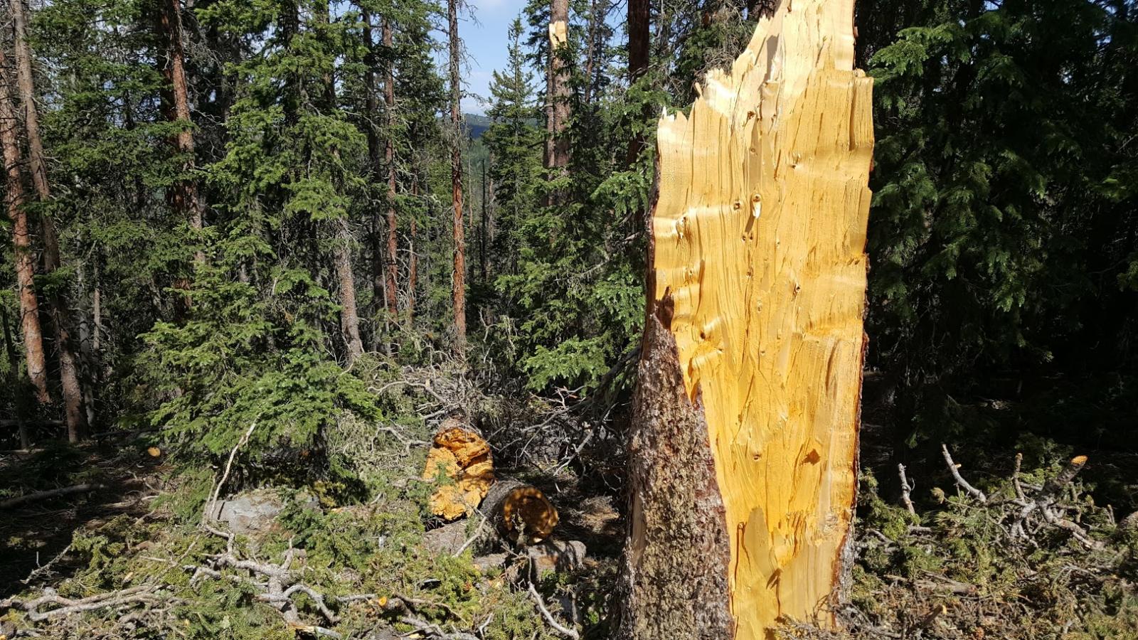 |
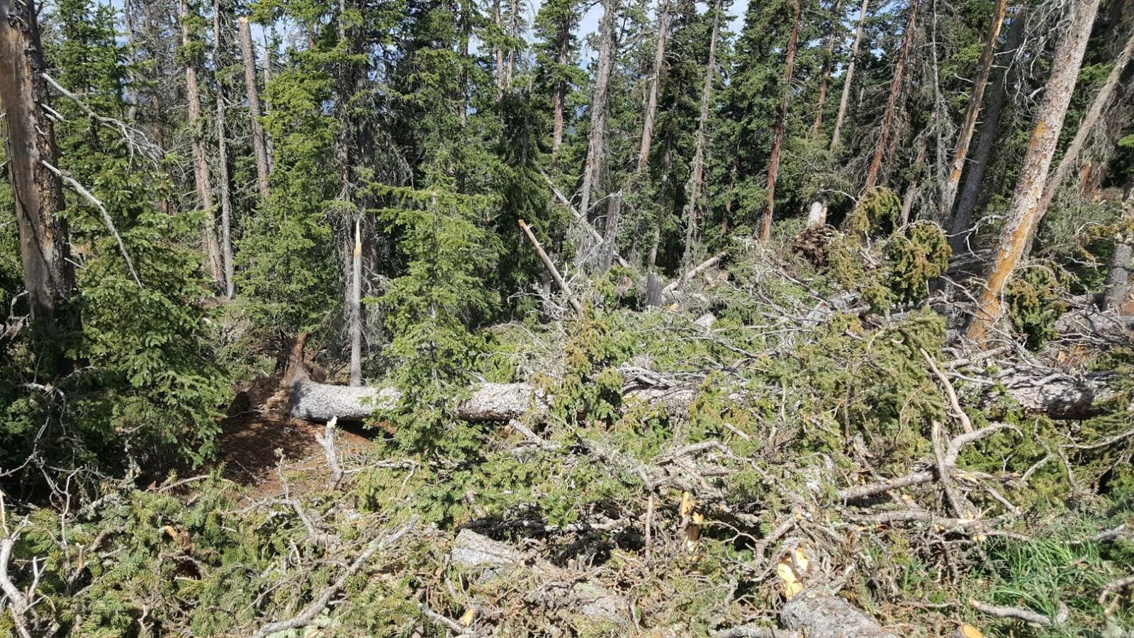
| More tree damage | Downed tree, still attached to its base | Base of the tree in the foreground, with the rest of the tree in the background |
Environment
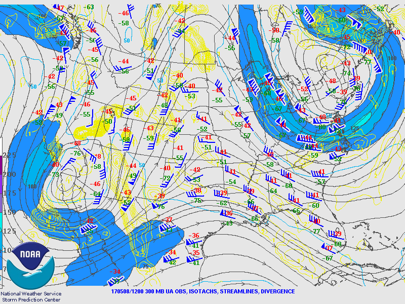
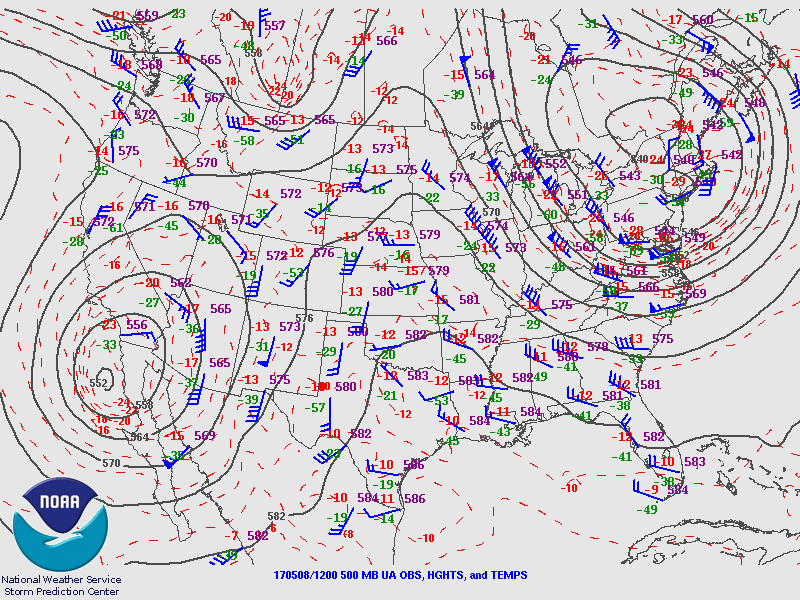
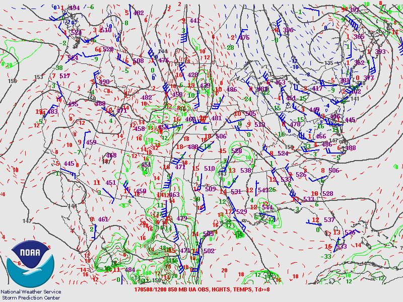
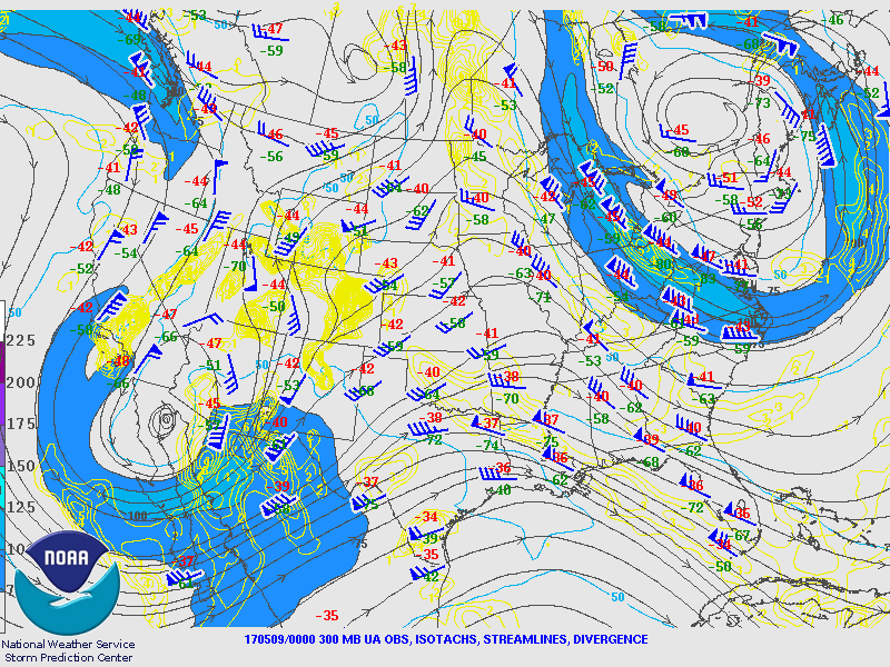
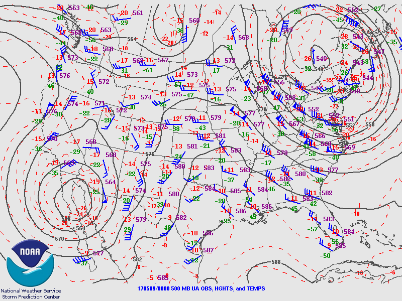
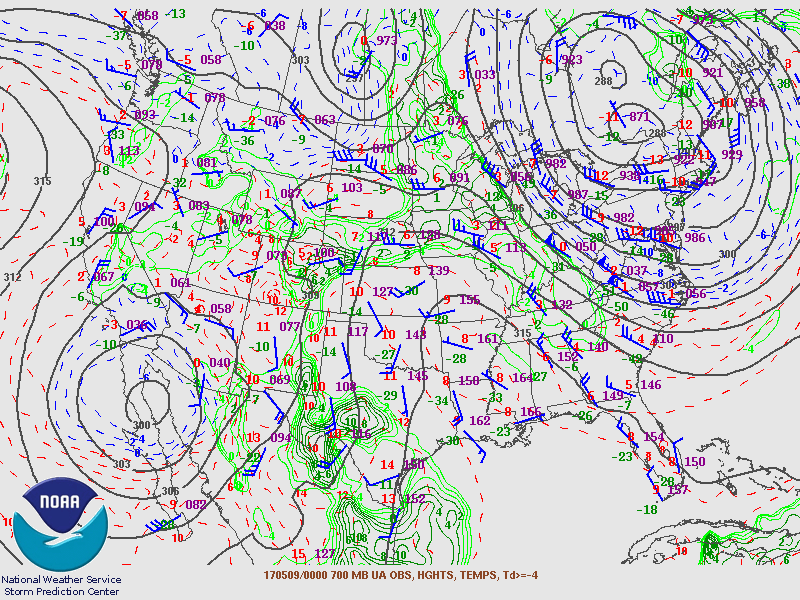
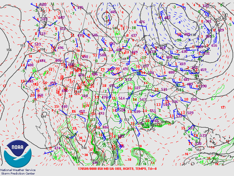
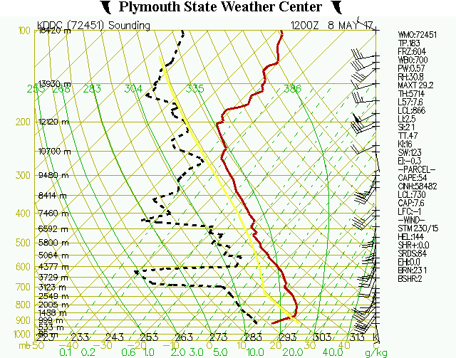
The overall synoptic pattern consisted of an upper trough in the western U.S. and a ridge to the east. The flow regime over southeastern Colorado was southerly from the surface and aloft. The surface analysis reveals that the dewpoints were in the 40s and 50s across southeast Colorado. Referring to the Skew-T diagrams, the Denver sounding at 6 AM MDT illustrated slightly favorable wind shear for supercell thunderstorms with marginal CAPE to be inferred across southern Colorado for the afternoon.
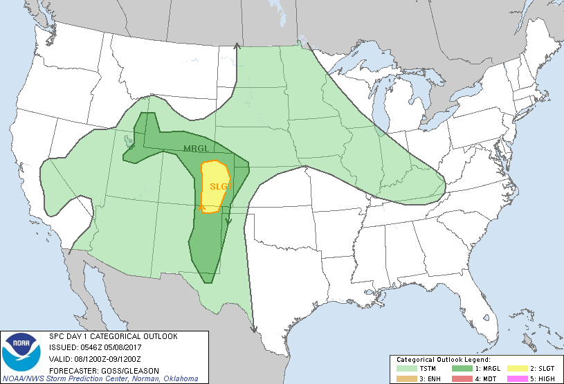 |
| SPC Day 1 Convective Outlook for May 8th, 2017 at 6:00 AM MDT |
SPC Charts:
May 8th, 2017 at 6:00AM MDT
 |
 |
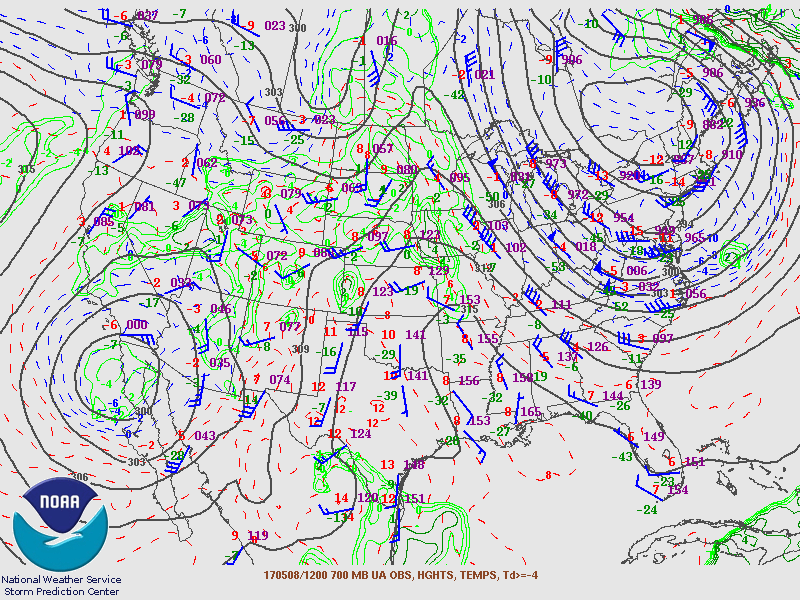 |
| 300-hPa Analysis | 500-hPa Analysis | 700-hPa Analysis |
 |
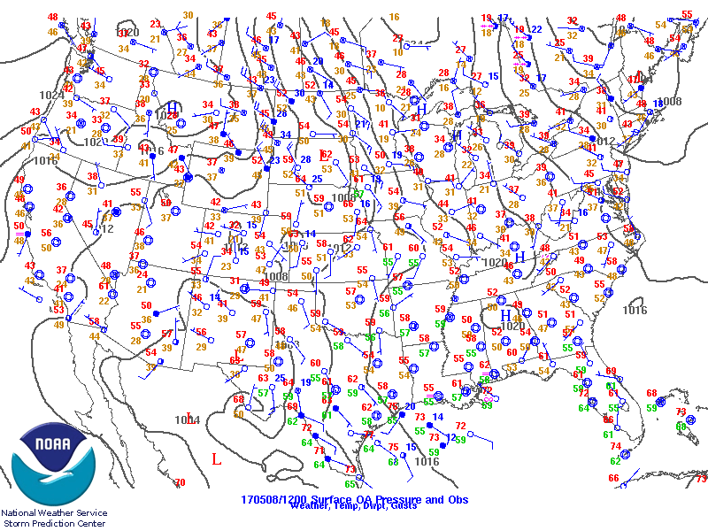 |
| 850-hPa Analysis | Surface Analysis |
May 8th, 2017 at 6:00PM MDT
 |
 |
 |
| 300-hPa Analysis | 500-hPa Analysis | 700-hPa Analysis |
 |
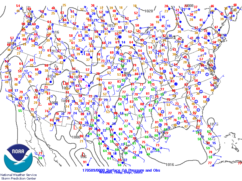 |
| 850-hPa Analysis | Surface Analysis |
Thermodynamic Sounding (Skew-T Log P Diagram):
May 8th, 2017 at 6:00AM MDT
 |
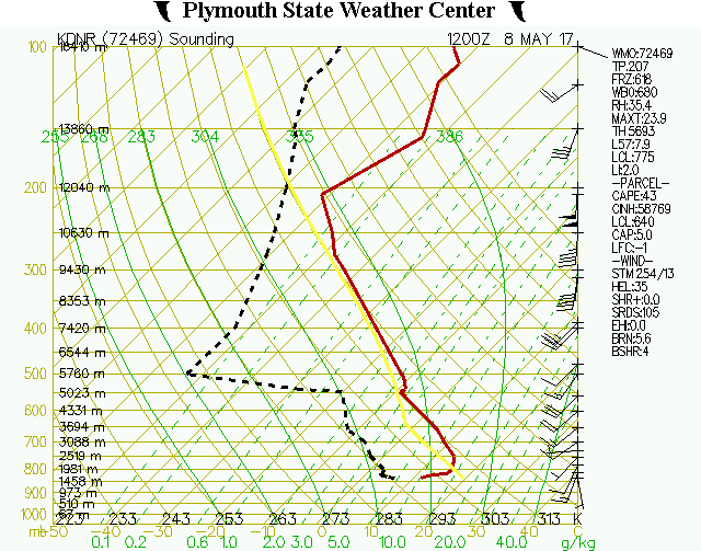 |
| Dodge City Skew-T Diagram | Denver Skew-T Diagram |
May 8th, 2017 at 6:00PM MDT
 |
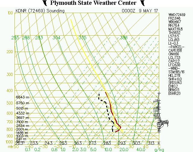 |
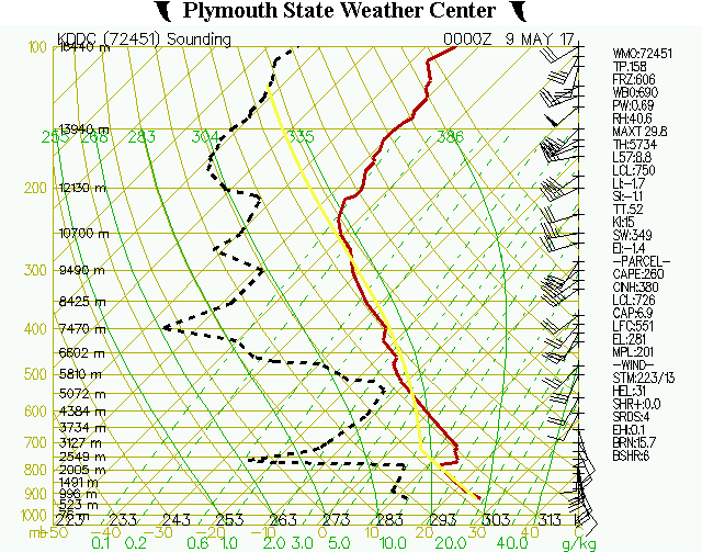
| Dodge City Skew-T Diagram | Denver Skew-T Diagram |
 |
Media use of NWS Web News Stories is encouraged! Please acknowledge the NWS as the source of any news information accessed from this site. |
|