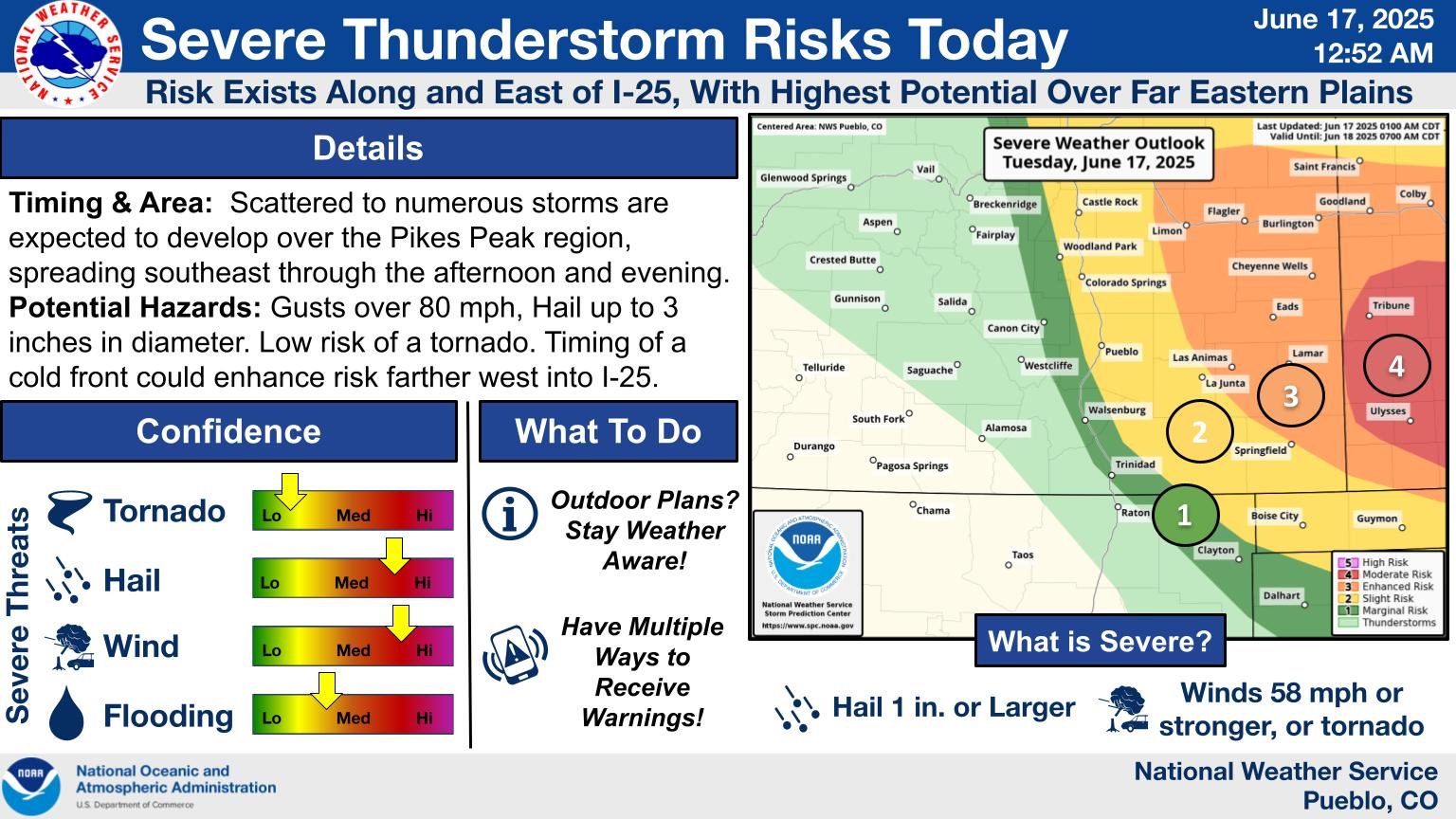
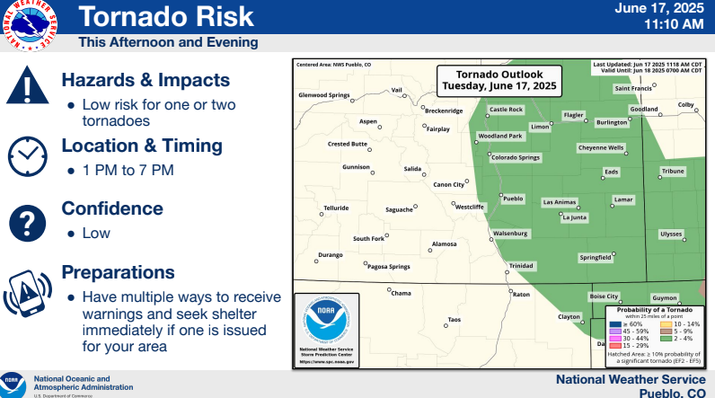
Overview
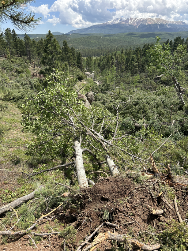
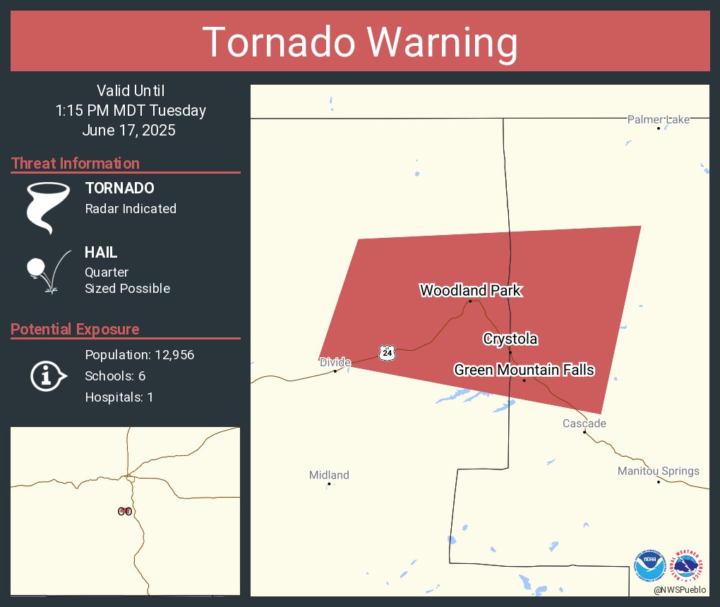
A supercell thunderstorm moved east southeast across Teller County during the early afternoon on June 17th, 2025. As it intensified, it produced a tornado just north of Divide, CO.Tornadoes:
|
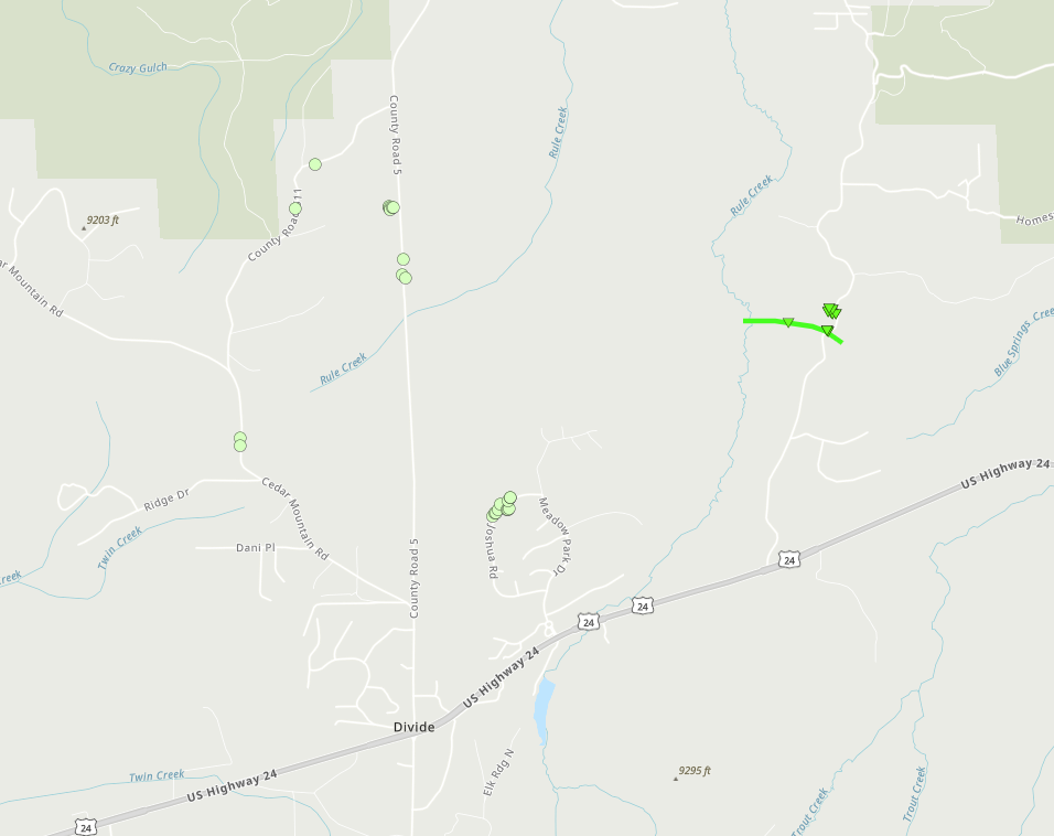
Tornado - 2 North-Northeast Divide
Track Map
|
||||||||||||||||
The Enhanced Fujita (EF) Scale classifies tornadoes into the following categories:
| EF0 Weak 65-85 mph |
EF1 Moderate 86-110 mph |
EF2 Significant 111-135 mph |
EF3 Severe 136-165 mph |
EF4 Extreme 166-200 mph |
EF5 Catastrophic 200+ mph |
 |
|||||
History of High Altitude Tornadoes in Colorado
While rare, severe thunderstorms which produce tornadoes can occur across the higher terrain of Colorado. Below is a history of high altitude tornadoes across Colorado.
|
Location |
Elevation |
Date |
Rating |
|
Mount Evans |
11,900’ |
July 28th, 2012 |
EF-0 |
|
Longs Peak |
11,400’ |
August 17th, 1984 |
N/A |
| Greenhorn Mountain | 11,300’ | May 8th, 2017 | EF-1 |
|
Pikes Peak |
9,500’ |
July 20th, 2023 |
EF-1 |
|
Wet Mountains |
? |
July 24th, 1971 |
N/A |
| Teller County (near Pikes Peak) | 9,840' | August 9th, 2024 | EF-1 |
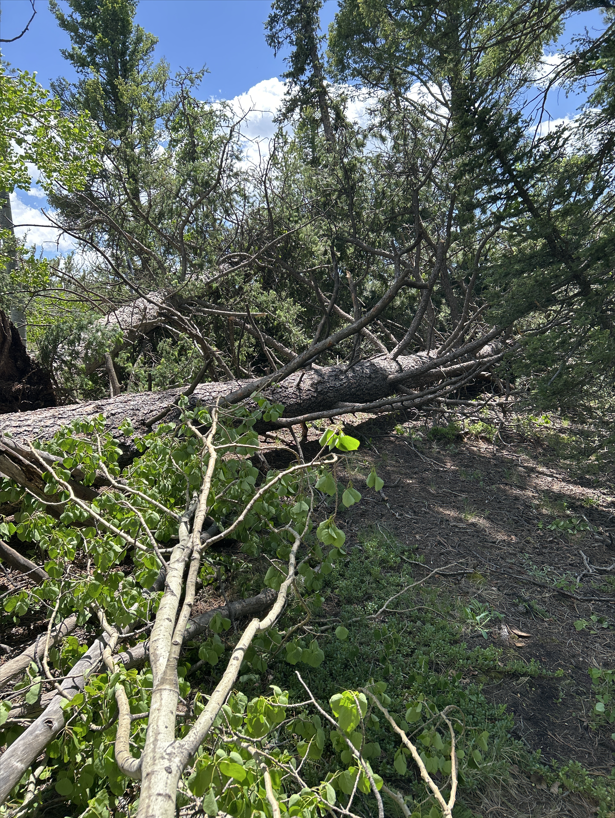
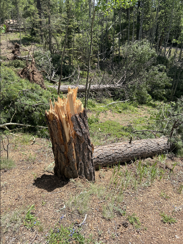
Photos & Video
 |
 |
 |
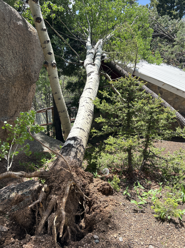 |
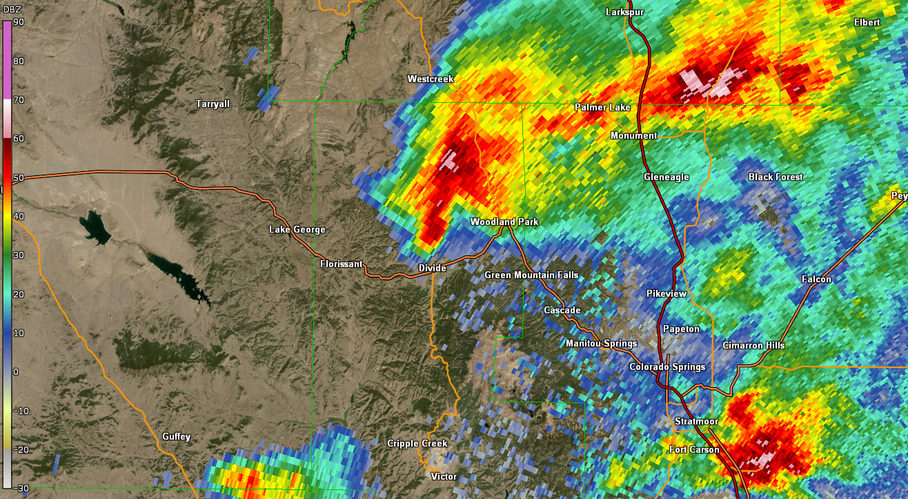
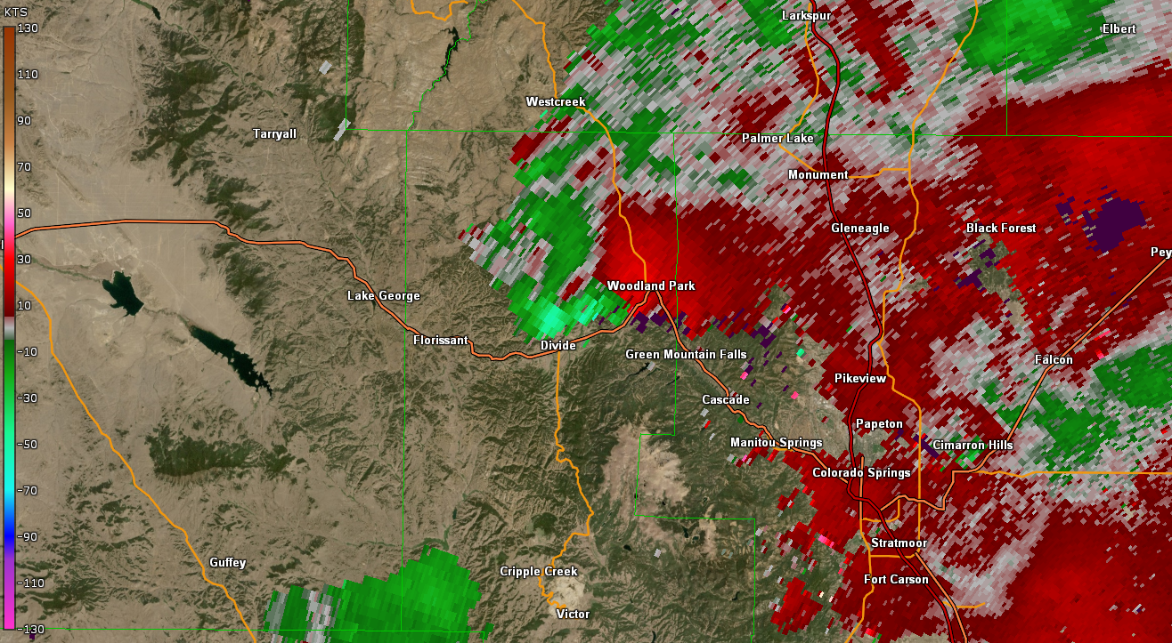
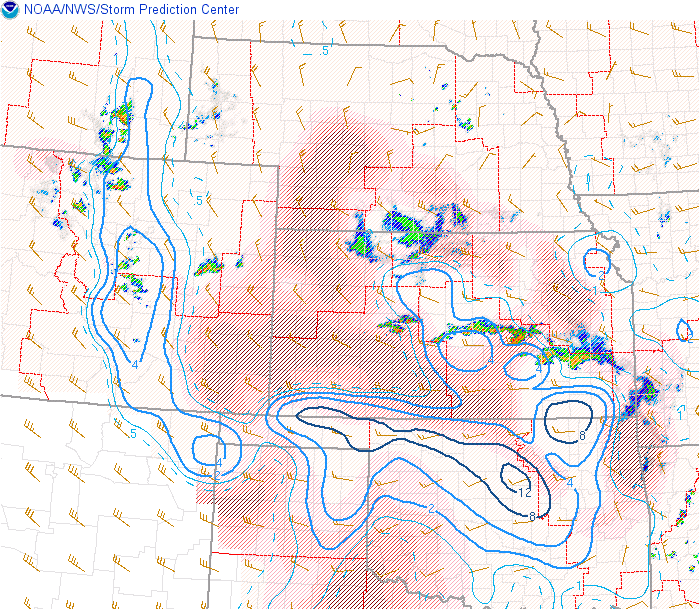
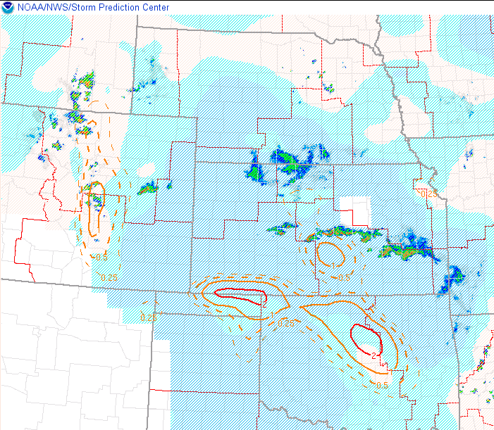
Radar
Header
 |
 |
 |
 |
| Radar Reflectivity June 17 2025 1238 PM | Radar/Velocity June 17 2025 1238 PM | Radar Reflectivity June 17 2025 1241 PM | Radar/Velocity June 17 2025 1241 PM |
Storm Reports

Preliminary Local Storm Report...Summary
National Weather Service Pueblo CO
540 PM MDT Tue Jun 17 2025

..TIME...   ...EVENT...      ...CITY LOCATION...     ...LAT.LON...
..DATE...   ....MAG....      ..COUNTY LOCATION..ST.. ...SOURCE....
            ..REMARKS..

0430 PM     Hail             7 W Hoehne              37.28N 104.51W
06/17/2025  E2.00 Inch       Las Animas         CO   Public

            Report from mPING: Hen Egg (2.00 in.).

0432 PM     Hail             5 N Trinidad            37.24N 104.50W
06/17/2025  M2.00 Inch       Las Animas         CO   Storm Chaser

            Delayed report with estimated time. Used
            radar to line it up with where the hail core
            was.

0145 PM     Hail             5 N Peterson AFB        38.90N 104.70W
06/17/2025  E1.75 Inch       El Paso            CO   Public

            Report from mPING: Golf Ball (1.75 in.).

0146 PM     Hail             5 N Peterson AFB        38.90N 104.70W
06/17/2025  E1.75 Inch       El Paso            CO   Public

            Report from mPING: Golf Ball (1.75 in.).

0128 PM     Hail             5 N Colorado Springs    38.90N 104.83W
06/17/2025  M1.50 Inch       El Paso            CO   Trained Spotter


0129 PM     Hail             7 SSW Black Forest      38.92N 104.77W
06/17/2025  M1.50 Inch       El Paso            CO   Public


0312 PM     Hail             8 SE Colorado City      37.86N 104.76W
06/17/2025  M1.50 Inch       Huerfano           CO   Trained Spotter


0128 PM     Hail             7 NE Colorado Springs   38.92N 104.78W
06/17/2025  E1.25 Inch       El Paso            CO   Public

            Report from mPING: Half Dollar (1.25 in.).

0154 PM     Hail             5 N Peterson AFB        38.90N 104.70W
06/17/2025  E1.25 Inch       El Paso            CO   Public

            Report from mPING: Half Dollar (1.25 in.).

0429 PM     Hail             8 W Hoehne              37.29N 104.52W
06/17/2025  E1.25 Inch       Las Animas         CO   Public

            Report from mPING: Half Dollar (1.25 in.).

1056 AM     Hail             3 E Colorado Springs    38.84N 104.77W
06/17/2025  E1.00 Inch       El Paso            CO   Public

            Report from mPING: Quarter (1.00 in.).

1057 AM     Hail             3 ENE Colorado Springs  38.85N 104.78W
06/17/2025  M1.00 Inch       El Paso            CO   Trained Spotter


0111 PM     Hail             8 SSE Schriever AFB     38.69N 104.46W
06/17/2025  M1.00 Inch       El Paso            CO   Public

            mPING report.

0111 PM     Hail             8 SE Schriever AFB      38.69N 104.46W
06/17/2025  E1.00 Inch       El Paso            CO   Public

            Report from mPING: Quarter (1.00 in.).

0119 PM     Hail             5 NE Manitou Springs    38.91N 104.86W
06/17/2025  M1.00 Inch       El Paso            CO   Trained Spotter


0120 PM     Hail             5 SSE Air Force Academy 38.93N 104.85W
06/17/2025  M1.00 Inch       El Paso            CO   Trained Spotter


0121 PM     Hail             5 SSE Air Force Academy 38.93N 104.83W
06/17/2025  M1.00 Inch       El Paso            CO   Trained Spotter


0123 PM     Hail             6 NE Manitou Springs    38.92N 104.83W
06/17/2025  E1.00 Inch       El Paso            CO   Public

            Report from mPING: Quarter (1.00 in.).

0125 PM     Hail             5 NE Manitou Springs    38.91N 104.85W
06/17/2025  M1.00 Inch       El Paso            CO   Trained Spotter


0126 PM     Hail             5 NE Manitou Springs    38.91N 104.84W
06/17/2025  M1.00 Inch       El Paso            CO   Public


0126 PM     Hail             5 N Colorado Springs    38.90N 104.82W
06/17/2025  E1.00 Inch       El Paso            CO   Public

            Report from mPING: Quarter (1.00 in.).

0134 PM     Hail             6 NE Colorado Springs   38.91N 104.78W
06/17/2025  E1.00 Inch       El Paso            CO   Public

            Report from mPING: Quarter (1.00 in.).

0154 PM     Hail             1 E Manitou Springs     38.85N 104.89W
06/17/2025  E1.00 Inch       El Paso            CO   Public

            Report from mPING: Quarter (1.00 in.).

0235 PM     Hail             7 E Colorado City       37.95N 104.73W
06/17/2025  M1.00 Inch       Pueblo             CO   Trained Spotter


0308 PM     Hail             8 SE Colorado City      37.86N 104.76W
06/17/2025  M1.00 Inch       Huerfano           CO   Trained Spotter
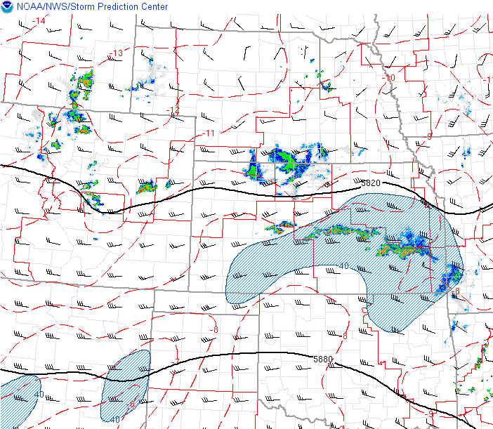
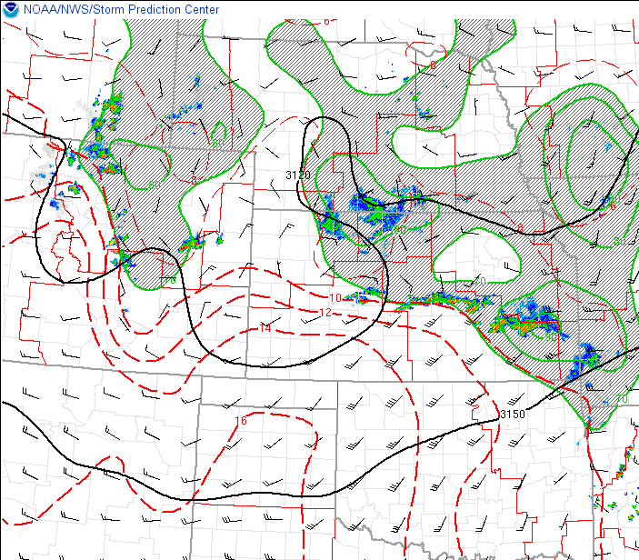
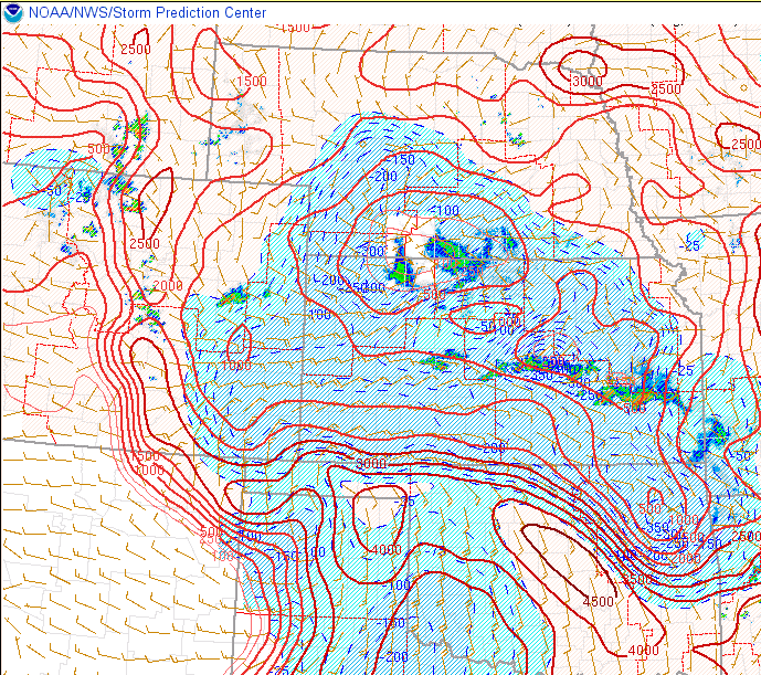
Environment
Supported by overnight outflow boundaries from the previous day's thunderstorm activity, a very moist and unstable environment was able to push well into south central and southeast Colorado on this day. This environment was even able to push into the mountains and plains interface, with the highest instability axis noted in this location. Elsewhere across southeast Colorado, early morning cloud cover kept these areas stable for much of the day. As mid level energy traversed over Colorado, low to mid level winds turned easterly right into the higher terrain and supported persistent upslope and focus into the afternoon and early evening hours. This setup also supported an abundance of shear that not only supported strong to severe thunderstorm development, but supported the development of supercell thunderstorms capable of producing tornadoes over the higher terrain, including the Rampart Range.
 |
 |
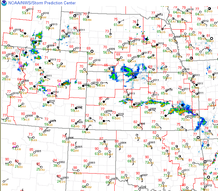 |
| Figure 1: 18Z 500mb | Figure 2: 18Z 700mb | Figure 3: 18Z Surface Observations |
 |
 |
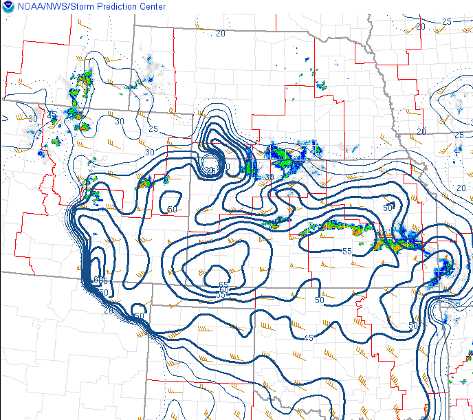 |
| Figure 4: 18Z Visible Satellite Imagery | Figure 5: 18Z Surface-Based CAPE | Figure 6: 18Z Bulk Shear |
Additional environmental data.
 |
 |
|
| Figure 7: 18Z Supercell Composite Parameter | Figure 8: 18Z Significant Tornado Parameter |
Additional Information
The Service
 |
 |
 |
 |
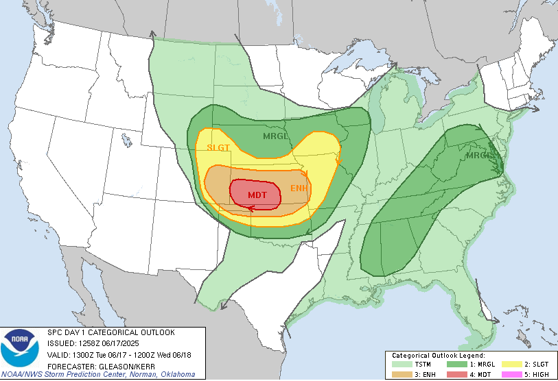
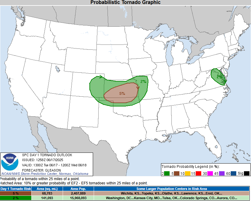
| SPC Day 1 Categorical Outlook | SPC Day 1 Tornado Outlook | Early Morning Weather Story | Local Tornado Risk Discussion |
 |
 |
 |
|
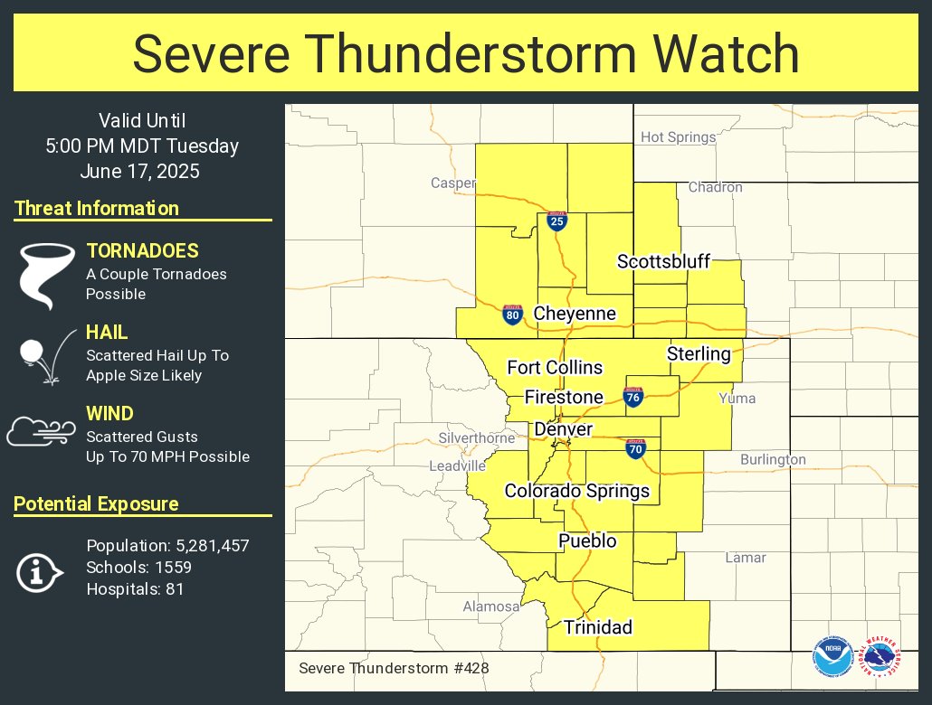
| Local Severe Threat Discussion | Severe Thunderstorm Watch | Teller County Tornado Warning |
 |
Media use of NWS Web News Stories is encouraged! Please acknowledge the NWS as the source of any news information accessed from this site. |
|