Pueblo, CO
Weather Forecast Office
Overview
|
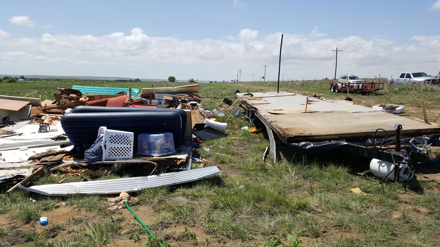
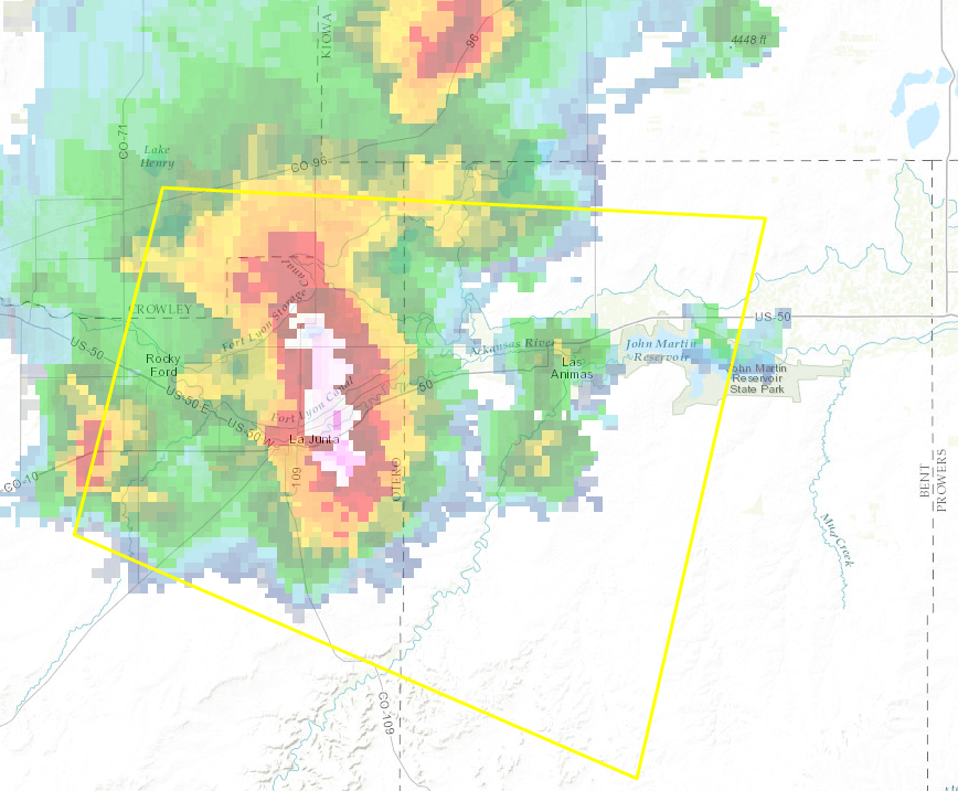
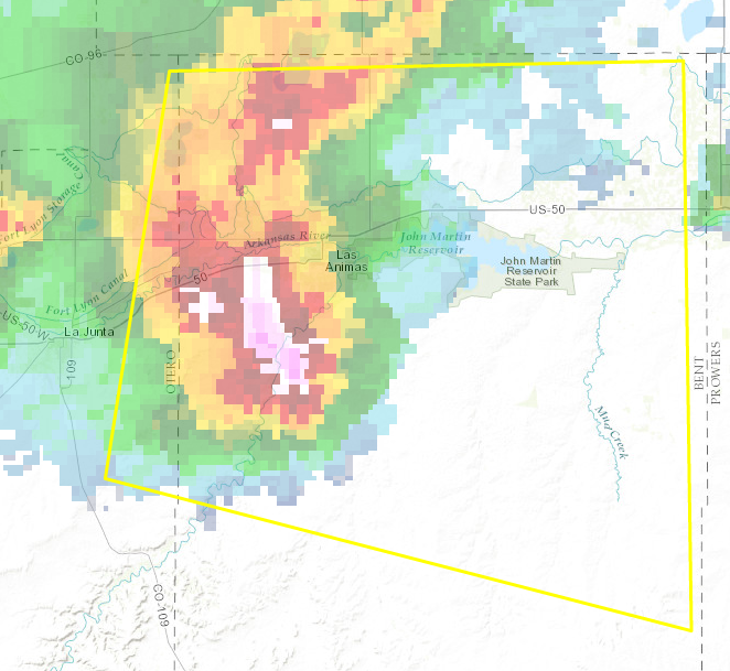
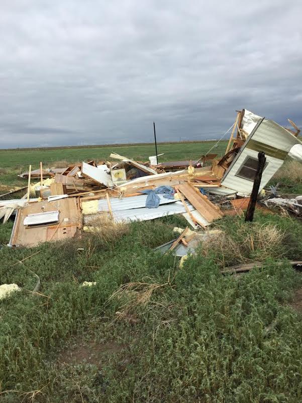
A line of severe storms moved across southeast Colorado Sunday evening, June 12th 2016. The storms produced large hail and widespread severe winds. In some areas wind gusts were in excess of 70 mph. Around 5 miles northeast of La Junta (Otero County) a trailer home, not anchored to the ground, was lofted into the air, and the occupant was killed. A damage survey was conducted by NWS Pueblo, and it was determined that 75-80 mph straight-line winds caused the destruction. A number of Severe Thunderstorm Warnings were issued for the southeast plains. The warning for northeast Otero County was issued at 8:25 p.m. MDT. The fatality at the trailer home occurred around 8:37 p.m. MDT. |
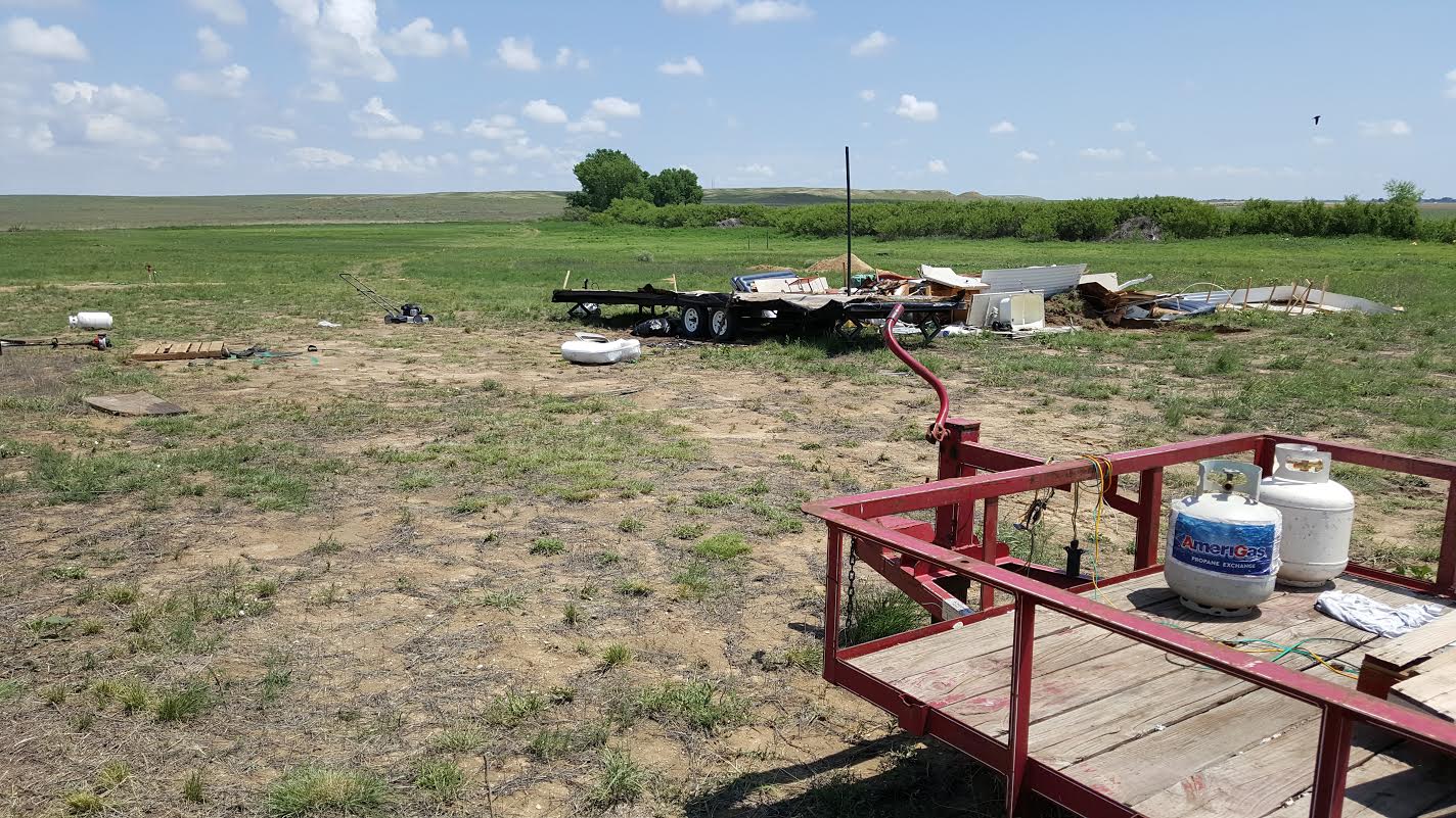 Destroyed trailer home northeast of La Junta, CO |
Wind:
A line of severe storms produced severe winds and hail in Crowley, Otero and Bent Counties.
Wind damage:
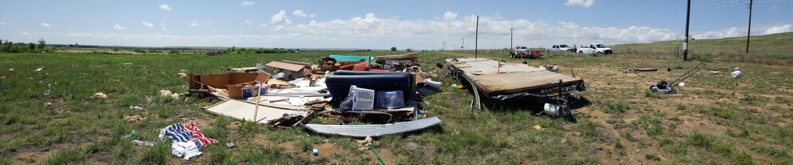
Images of the trailer home below:
 |
 |
 |
| The trailer was lofted and flipped on its side | Panoramic image: the trailer was lofted around 40 feet to the east | No damage to power poles near the trailer, or to vegetation to the east |
Radar and trailer photo:
A small, unoccupied trailer home was also destroyed around 5 1/2 miles south-southwest of Las Animas in Bent County.
 |
 |
 |
| Severe storms northeast of La Junta producing deadly microbust | Severe storms south of Las Animas which destroyed an unoccupied trailer | Destroyed trailer south of Las Animas |
 |
Media use of NWS Web News Stories is encouraged! Please acknowledge the NWS as the source of any news information accessed from this site. |
|
ACTIVE ALERTS
Warnings by State - click ATOM button
Excessive Rainfall Forecasts
River Flooding
Convective Outlooks
Hurricanes
Fire Weather Outlooks
UV Alerts
Space Weather
Winter Winter Forecasts
Enhanced Data Display(EDD)
PAST WEATHER
Climate Monitoring
Astronomical Data
Certified Weather Data
CURRENT CONDITIONS
Radar
River Levels
Observed Precipitation
Surface Weather
Upper Air
Marine and Buoy Reports
Climate Monitoring
Snow Cover
Satellite
Space Weather
Enhanced Data Display(EDD)
FORECAST
Severe Weather
Drought
Fire Weather
Front/Precipitation Maps
Graphical Foreast Maps
Rivers
Marine
Offshore and High Seas
Hurricanes
Aviation Weather
Climate Outlook
Enhanced Data Display(EDD)
WEATHER SAFETY
Owlie Skywarn - for kids
NOAA Weather Radio
StormReady
Natural Weather Hazard Statistics
Red Cross
Federal Emergency Management Agency(FEMA)
National Weather Service SafetyBrochures
US Dept of Commerce
National Oceanic and Atmospheric Administration
National Weather Service
Pueblo, CO
3 Eaton Way
Pueblo, CO 81001-4856
(719) 948-9429
Comments? Questions? Please Contact Us.

