Pueblo, CO
Weather Forecast Office
Overview
|
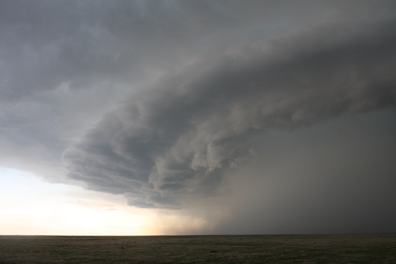
A storm developed near La Junta shortly after 6 PM. At 6:06 PM, a tornado warning was issued for this storm as it was developing northwest of La Junta near Swink. Wind speeds over 60 mph were clocked at the La Junta Airport, north of town, as the storm intensified. As it approached Cheraw, rotation was clearly evident by the hook shaped echo in the reflectivity image below. Rotation was quite strong in the velocity image (lower image), as bright green colors, signifying strong wind flow towards the radar, were immediately adjacent to the bright red colors, indicating strong winds flowing away from the radar.
Trained spotters reported a tornado touched down at 7:21PM MDT several miles northeast of Eads. Further investigation revealed minor damage from County Road W to County Road 50. An old power pole was snapped off at the base on County Road W. The tornado propagated north-northeast, twisting and overturning a center pivot irrigation system. The tornado then crossed Country Road 50, ripping tree limbs from trees. |
Radar Reflectivity Volume Scan of the Storm near La Junta, CO. |
 |
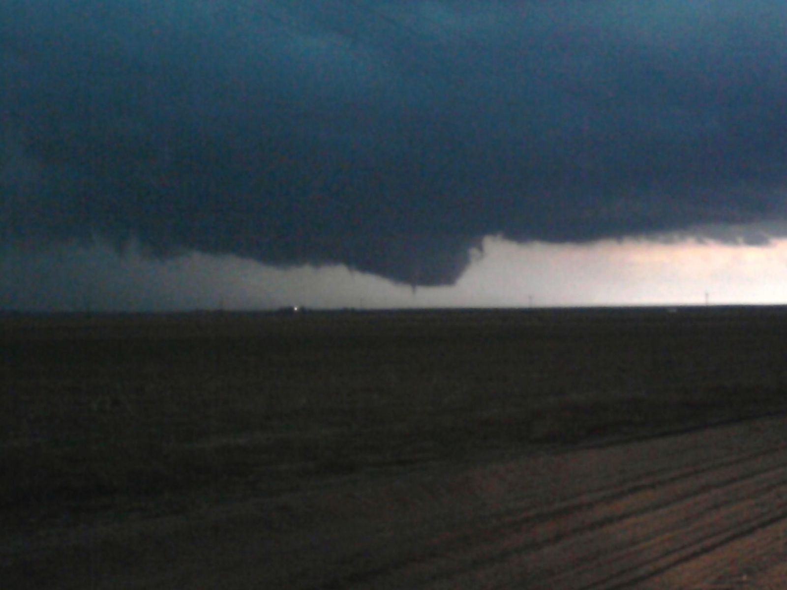 |
| HP Supercell Associated with the Tornado | Funnel Cloud That Later Spawned the Tornado |
Radar:
Header
 |
 |
| Radar Velocity Volume Scan of the Event | Radar Reflectivity Volume Scan of the Event |
 |
Media use of NWS Web News Stories is encouraged! Please acknowledge the NWS as the source of any news information accessed from this site. |
|
ACTIVE ALERTS
Warnings by State - click ATOM button
Excessive Rainfall Forecasts
River Flooding
Convective Outlooks
Hurricanes
Fire Weather Outlooks
UV Alerts
Space Weather
Winter Winter Forecasts
Enhanced Data Display(EDD)
PAST WEATHER
Climate Monitoring
Astronomical Data
Certified Weather Data
CURRENT CONDITIONS
Radar
River Levels
Observed Precipitation
Surface Weather
Upper Air
Marine and Buoy Reports
Climate Monitoring
Snow Cover
Satellite
Space Weather
Enhanced Data Display(EDD)
FORECAST
Severe Weather
Drought
Fire Weather
Front/Precipitation Maps
Graphical Foreast Maps
Rivers
Marine
Offshore and High Seas
Hurricanes
Aviation Weather
Climate Outlook
Enhanced Data Display(EDD)
WEATHER SAFETY
Owlie Skywarn - for kids
NOAA Weather Radio
StormReady
Natural Weather Hazard Statistics
Red Cross
Federal Emergency Management Agency(FEMA)
National Weather Service SafetyBrochures
US Dept of Commerce
National Oceanic and Atmospheric Administration
National Weather Service
Pueblo, CO
3 Eaton Way
Pueblo, CO 81001-4856
(719) 948-9429
Comments? Questions? Please Contact Us.

