Pueblo, CO
Weather Forecast Office
A damage survey was conducted by the Meteorologist-in-Charge of the National Weather Service in Pueblo, Colorado. The damage was consistent with high end EF0 winds of approximately 85 mph. The estimated time of occurrence was from 4:23 p.m. MDT to 4:29 p.m. MDT. The tornado path length was approximately 3/4 of a mile, and the damage path width was approximately 30 yards.

The damage was confined to one dwelling, outbuildings and a camper trailer. Photographic and video evidence demonstrate that there was only one tornado.
As was touched upon in forecast discussions and products earlier this week, conditions have been favorable for weak tornados this week. In this case, a landspout tornado resulted.
Below are some images of the damage and the tornado...

(Above) - Damage to the front of the home showing damage to the soffitt

(Above) - Damage to garage door which was east facing
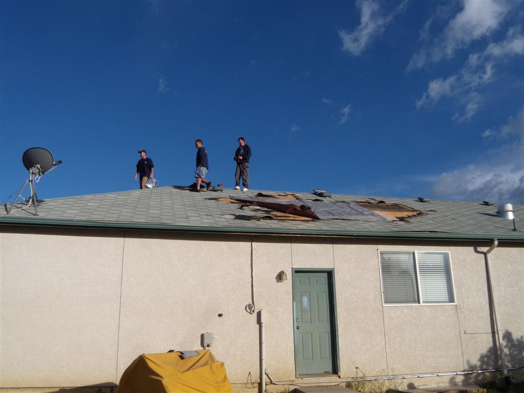
(Above) - Roof damage on the rear of the house.

(Above) - Camper trailer rolled and destroyed.
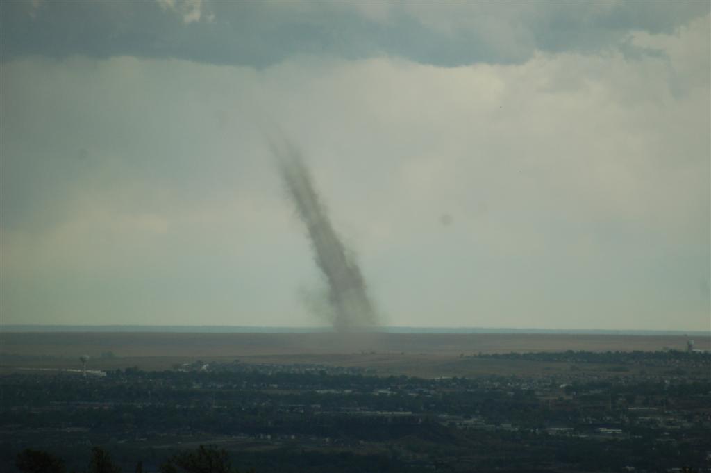
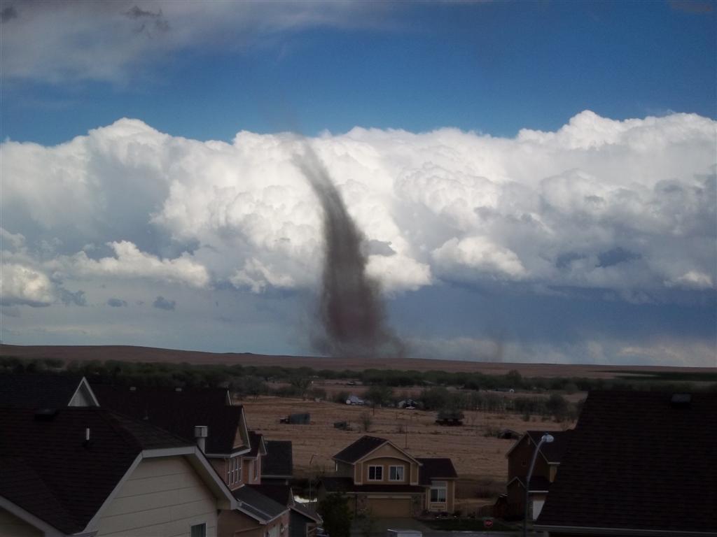
Thousands of people likely saw this landspout tornado. There are a variety of images and videos that can be found.
ACTIVE ALERTS
Warnings by State - click ATOM button
Excessive Rainfall Forecasts
River Flooding
Convective Outlooks
Hurricanes
Fire Weather Outlooks
UV Alerts
Space Weather
Winter Winter Forecasts
Enhanced Data Display(EDD)
PAST WEATHER
Climate Monitoring
Astronomical Data
Certified Weather Data
CURRENT CONDITIONS
Radar
River Levels
Observed Precipitation
Surface Weather
Upper Air
Marine and Buoy Reports
Climate Monitoring
Snow Cover
Satellite
Space Weather
Enhanced Data Display(EDD)
FORECAST
Severe Weather
Drought
Fire Weather
Front/Precipitation Maps
Graphical Foreast Maps
Rivers
Marine
Offshore and High Seas
Hurricanes
Aviation Weather
Climate Outlook
Enhanced Data Display(EDD)
WEATHER SAFETY
Owlie Skywarn - for kids
NOAA Weather Radio
StormReady
Natural Weather Hazard Statistics
Red Cross
Federal Emergency Management Agency(FEMA)
National Weather Service SafetyBrochures
US Dept of Commerce
National Oceanic and Atmospheric Administration
National Weather Service
Pueblo, CO
3 Eaton Way
Pueblo, CO 81001-4856
(719) 948-9429
Comments? Questions? Please Contact Us.

