Pueblo, CO
Weather Forecast Office
Overview
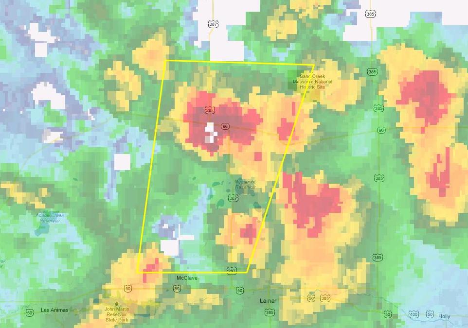
A weather disturbance in combination with moist, unstable air across far southeast Colorado produced a combination of severe hail, severe wind, and a tornado. Strong to marginally severe thunderstorms moved from the eastern mountains, through the I-25 corridor and onto the eastern plains between Noon and 3 p.m. After that, storms developed and quickly became severe across Bent, Las Animas, Kiowa, Prowers, and Baca Counties. Hail was reported to ping pong ball size around Lamar and in areas of eastern Kiowa County.
Shortly before 4 p.m., a strong thunderstorm west of Lamar collapsed, sending a downburst of severe winds through the Lamar Airport and then into Lamar. Measured wind speeds of 66 mph were clocked at the Lamar Airport.
Photos & Video:
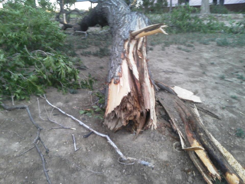
Various Damage Images
 |
 |
 |
|
Downed Tree Photo Courtesy: Staffon Warn |
Damaged Roofs (Park Swimming Pool Building) Photo Courtesy: Staffon Warn |
Gas Station Damage Photo Courtesy: Staffon Warn |
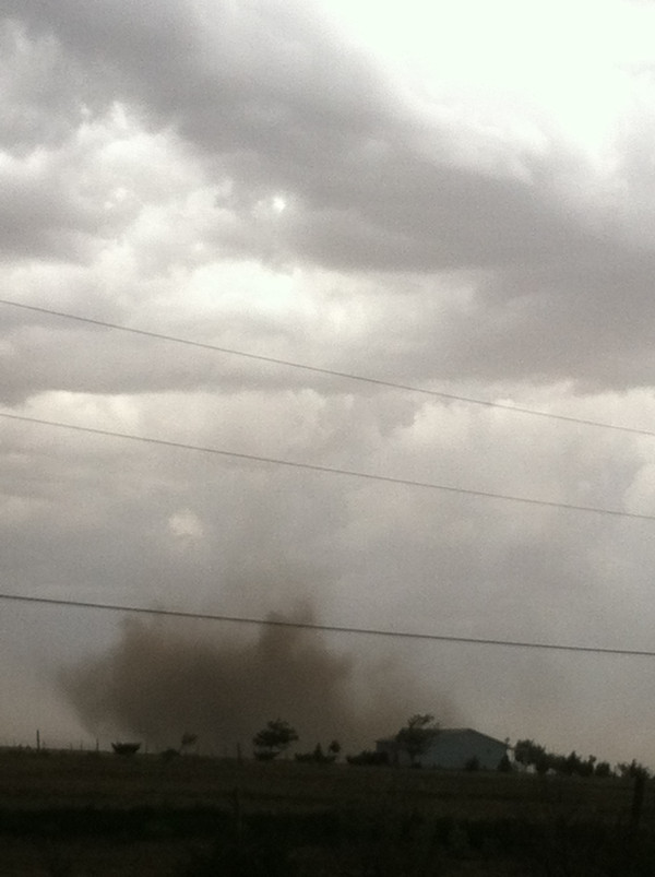
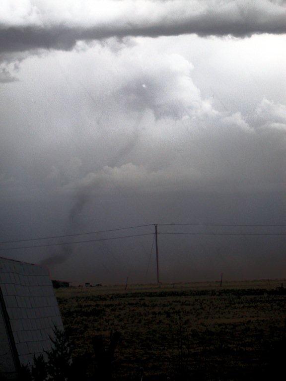
Pictures of the Landspout
 |
 |
|
Looking Southwest of Eads as the Photo Courtesy: Chris Sorensen |
Non-Mesoscylone (landspout) Tornado that Photo Courtesy: Jeanne Sorensen |
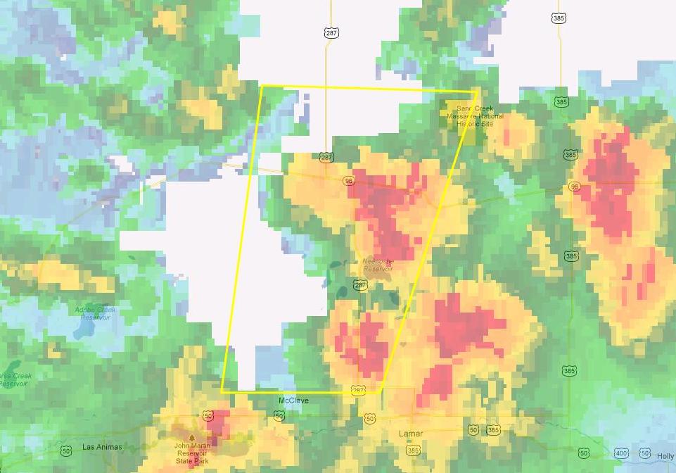
Radar:
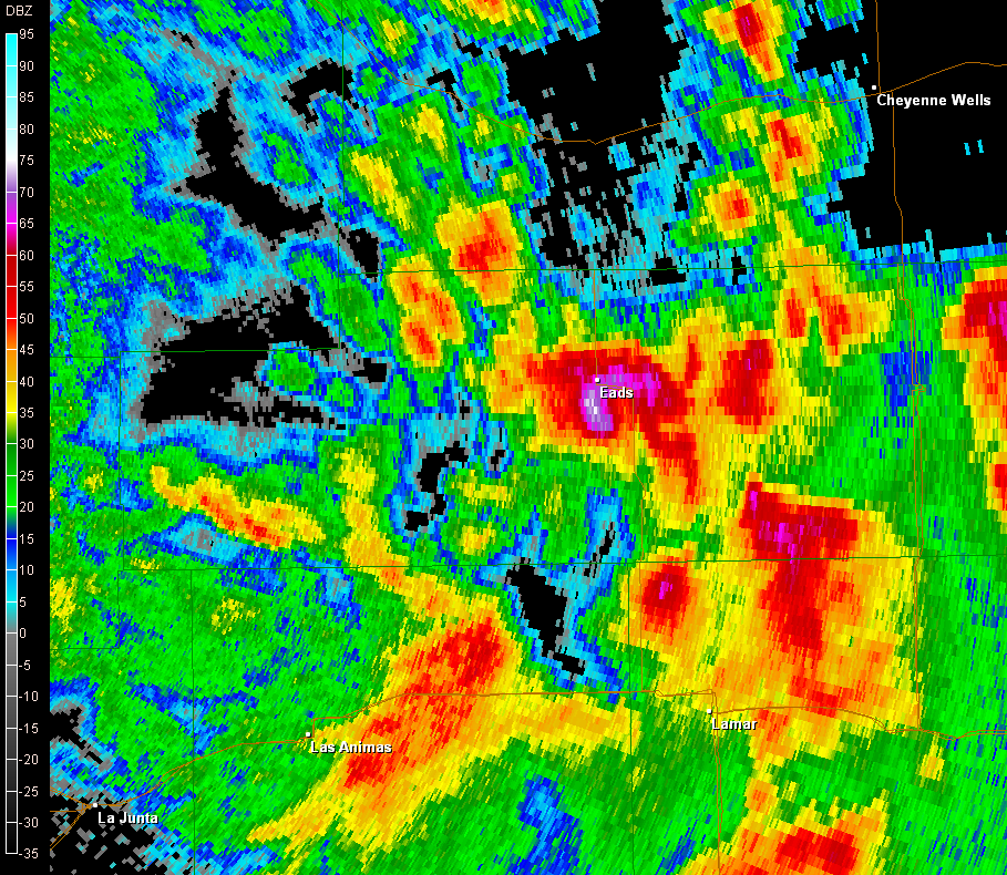
Radar Volume Scans
 |
 |
 |
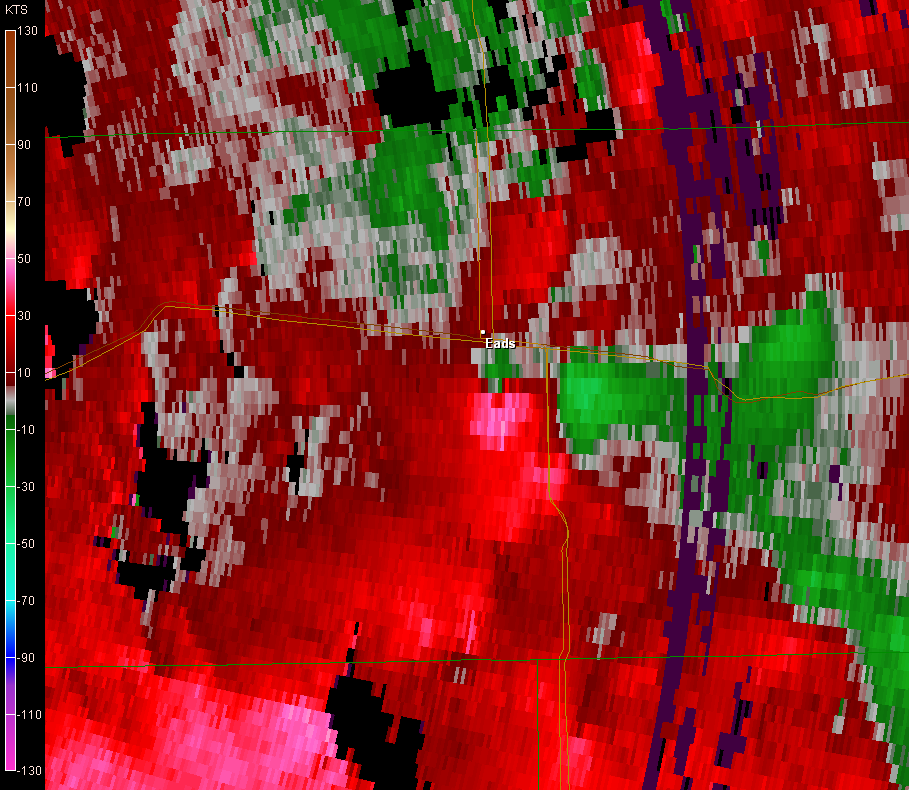 |
| At 5:00 PM MDT Radar Reflectivity Volume Scan | At 5:10 PM MDT Radar Reflectivity Volume Scan | Hook Echo Identified, Just South of Eads | Velocity Couplet via Radar Velocity Volume Scan (Green towards Radar; Red Away from Radar) |
Kiowa County officials investigated the area and found no damage, therefore the rating was an EF0 tornado.
Submitted by Tom Magnuson, Warning Coordination Meteorologist, NWS Pueblo, CO at 1 PM MDT Tuesday, June 5th, 2012.
Updated to new format by Klint Skelly, Intern Meteorologist, NWS Pueblo, CO at 10 AM MDT Wednesday May 24th, 2017.
 |
Media use of NWS Web News Stories is encouraged! Please acknowledge the NWS as the source of any news information accessed from this site. |
|
ACTIVE ALERTS
Warnings by State - click ATOM button
Excessive Rainfall Forecasts
River Flooding
Convective Outlooks
Hurricanes
Fire Weather Outlooks
UV Alerts
Space Weather
Winter Winter Forecasts
Enhanced Data Display(EDD)
PAST WEATHER
Climate Monitoring
Astronomical Data
Certified Weather Data
CURRENT CONDITIONS
Radar
River Levels
Observed Precipitation
Surface Weather
Upper Air
Marine and Buoy Reports
Climate Monitoring
Snow Cover
Satellite
Space Weather
Enhanced Data Display(EDD)
FORECAST
Severe Weather
Drought
Fire Weather
Front/Precipitation Maps
Graphical Foreast Maps
Rivers
Marine
Offshore and High Seas
Hurricanes
Aviation Weather
Climate Outlook
Enhanced Data Display(EDD)
WEATHER SAFETY
Owlie Skywarn - for kids
NOAA Weather Radio
StormReady
Natural Weather Hazard Statistics
Red Cross
Federal Emergency Management Agency(FEMA)
National Weather Service SafetyBrochures
US Dept of Commerce
National Oceanic and Atmospheric Administration
National Weather Service
Pueblo, CO
3 Eaton Way
Pueblo, CO 81001-4856
(719) 948-9429
Comments? Questions? Please Contact Us.

