
Dangerous and extreme heat will remain across portions of the central U.S. this week, persisting across the mid to lower Mississippi Valley, Gulf Coast, southern Plains and portions of Texas. A heat wave over the Southwest U.S. will peak this weekend. Heavy to excessive rainfall may produce flash flooding from the Delmarva Peninsula north into the Hudson Valley today and tonight. Read More >
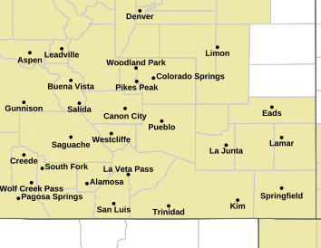
Pueblo, CO
Weather Forecast Office
A strong cold front will bring a quick blast of wintry weather late tonight through Monday morning, with a mix of fog, freezing drizzle and light snow. This may result in a light coating of ice on road surfaces, especially bridges and overpasses for the Monday morning commute. Use caution if you must travel along the I-25 corridor or adjacent plains late tonight through Monday morning.
Here are the latest winter weather highlights for southern Colorado.
| Winter Storm Warning |
|
||
| Freeze Warning |
|
||
| Winter Weather Advisory |
|
||
| Hard Freeze Watch |
|
||
| Freeze Watch |
|
||
| Hazardous Weather Outlook |
|
||
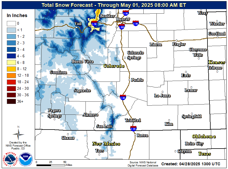
Here is the projected snowfall through the episode across southern Colorado.
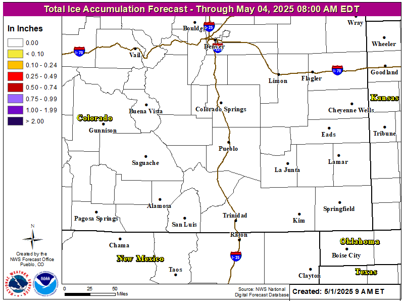
Here is the projected ice accumulation through the episode across southern Colorado.
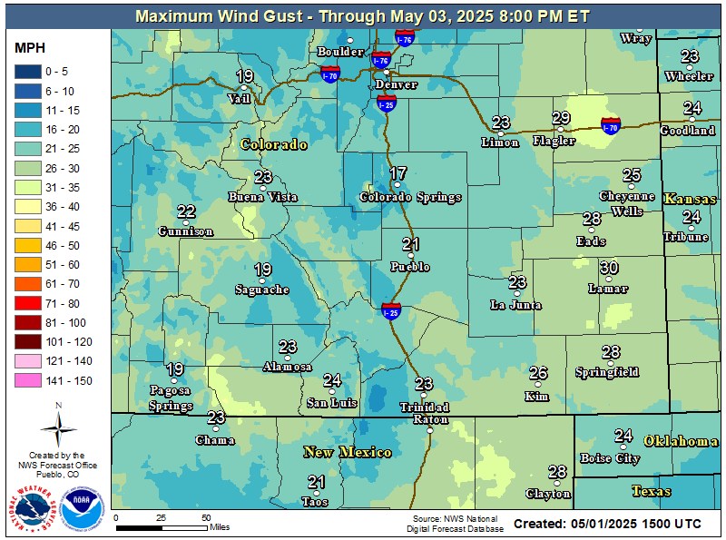
Here are the projected maximum forecast wind gusts for the episode.
Some things to keep in mind regarding the snow situation and travel across southern Colorado.


Continue to monitor the latest weather forecasts and winter highlights.
Here is a link to the Colorado Department of Transportation website...
Here is a link to our latest...
Here is NWS Pueblo's latest...
We would appreciate storm total snowfall amounts from our NWS weather spotters via the weather spotter phone number. Other citizens, as well as weather spotters can report by clicking the link below...
NOTE: Daily snowfall and liquid precipitation maps which usually appear in our News Headlines can be viewed by clicking HERE and HERE.
ACTIVE ALERTS
Warnings by State - click ATOM button
Excessive Rainfall Forecasts
River Flooding
Convective Outlooks
Hurricanes
Fire Weather Outlooks
UV Alerts
Space Weather
Winter Winter Forecasts
Enhanced Data Display(EDD)
PAST WEATHER
Climate Monitoring
Astronomical Data
Certified Weather Data
CURRENT CONDITIONS
Radar
River Levels
Observed Precipitation
Surface Weather
Upper Air
Marine and Buoy Reports
Climate Monitoring
Snow Cover
Satellite
Space Weather
Enhanced Data Display(EDD)
FORECAST
Severe Weather
Drought
Fire Weather
Front/Precipitation Maps
Graphical Foreast Maps
Rivers
Marine
Offshore and High Seas
Hurricanes
Aviation Weather
Climate Outlook
Enhanced Data Display(EDD)
WEATHER SAFETY
Owlie Skywarn - for kids
NOAA Weather Radio
StormReady
Natural Weather Hazard Statistics
Red Cross
Federal Emergency Management Agency(FEMA)
National Weather Service SafetyBrochures
US Dept of Commerce
National Oceanic and Atmospheric Administration
National Weather Service
Pueblo, CO
3 Eaton Way
Pueblo, CO 81001-4856
(719) 948-9429
Comments? Questions? Please Contact Us.

