
Widespread life-threatening flash and urban flooding will continue to pose a significant threat to life and property in south-central Texas. Catastrophic fiver flooding, with rapid rises on small streams, arroyos, and typically dry washes, is expected. Monsoonal showers persist across the Great Basin and Southwest with greatest flash flooding in southern Arizona. Read More >
| Local | Mesowest | Fire RAWS | Marine | Tides |
| Mesonet Observations (choose desired scale) | ||
 |
||
| What is the "MesoNet"? MesoNet is a nearly full collection of observations from many sources, put together in one easy map. From the map, access the last 48 hours of data for a site. |
||
| Regional Airport Observations (For coded METAR observations, click here.) |
|
| Hourly Roundups: |  |
| Local Marine Obs | Other Observations | Upper Air Data |
|
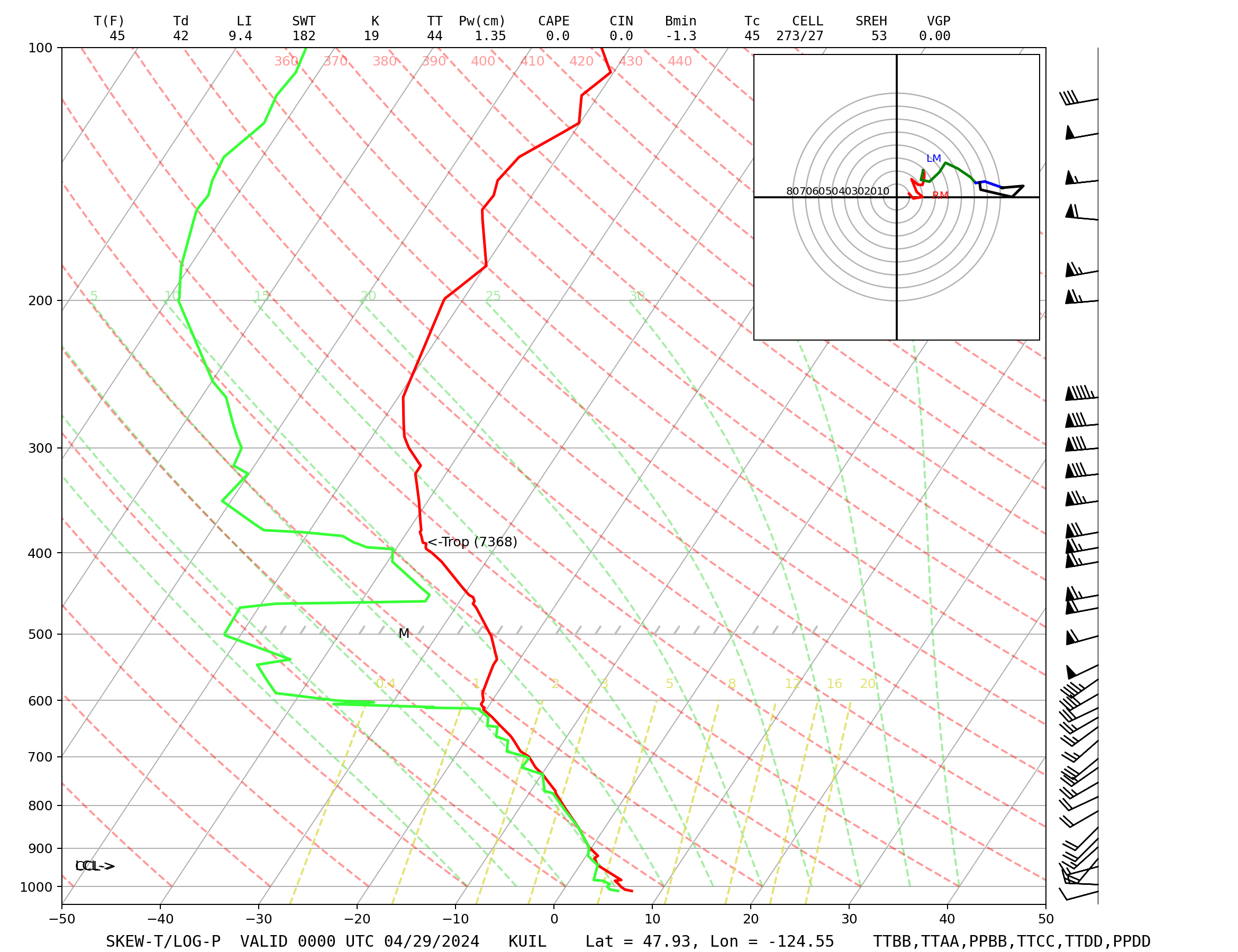
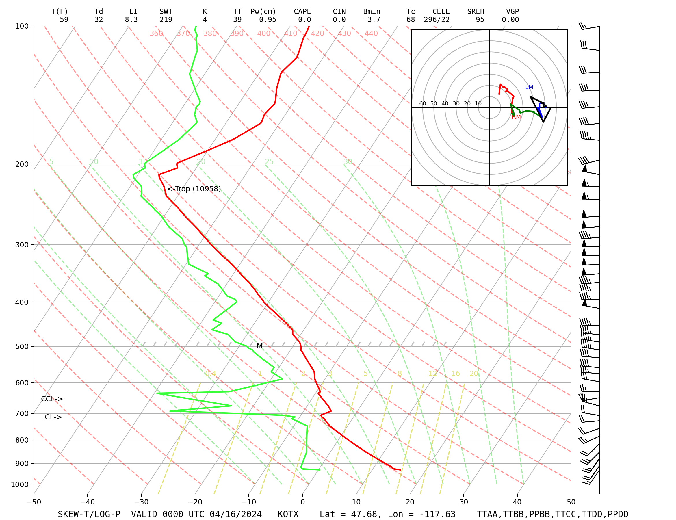
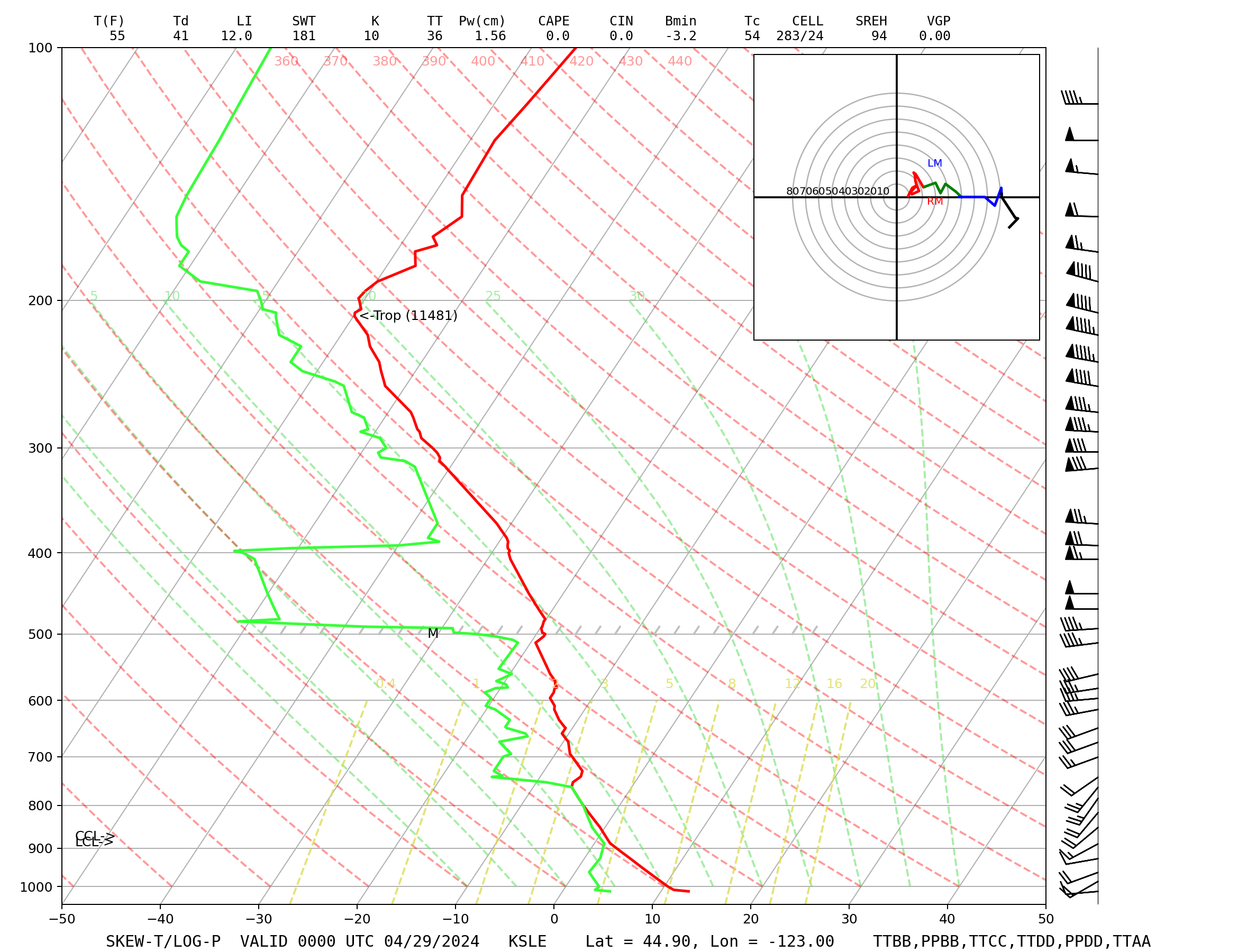
Skew-T Sounding Displays Coded Freezing Levels Mandatory Level Data Significant Level Data |

