Salt Lake City, UT
Weather Forecast Office
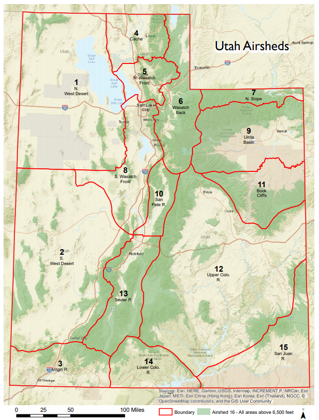
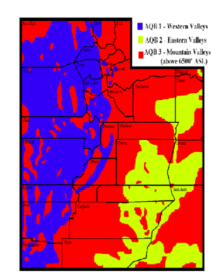
| Next 7 days | Airshed Map | Basin Map | ||||||
|---|---|---|---|---|---|---|---|---|
 |
 |
 |
 |
 |
 |
 |
 |
 |
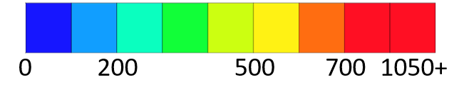
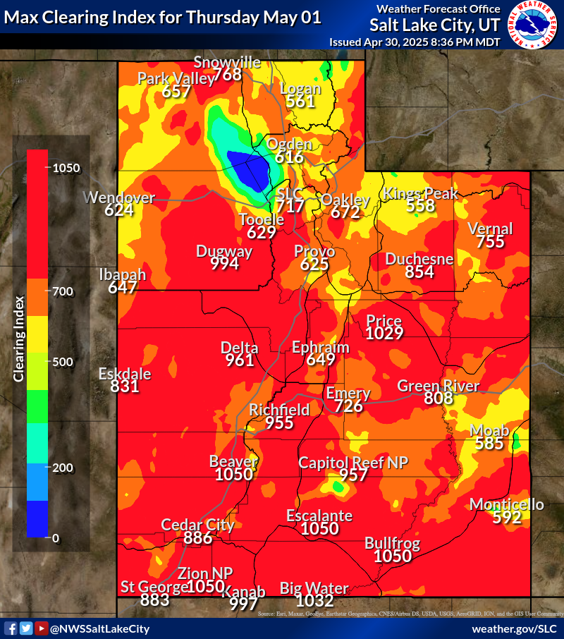
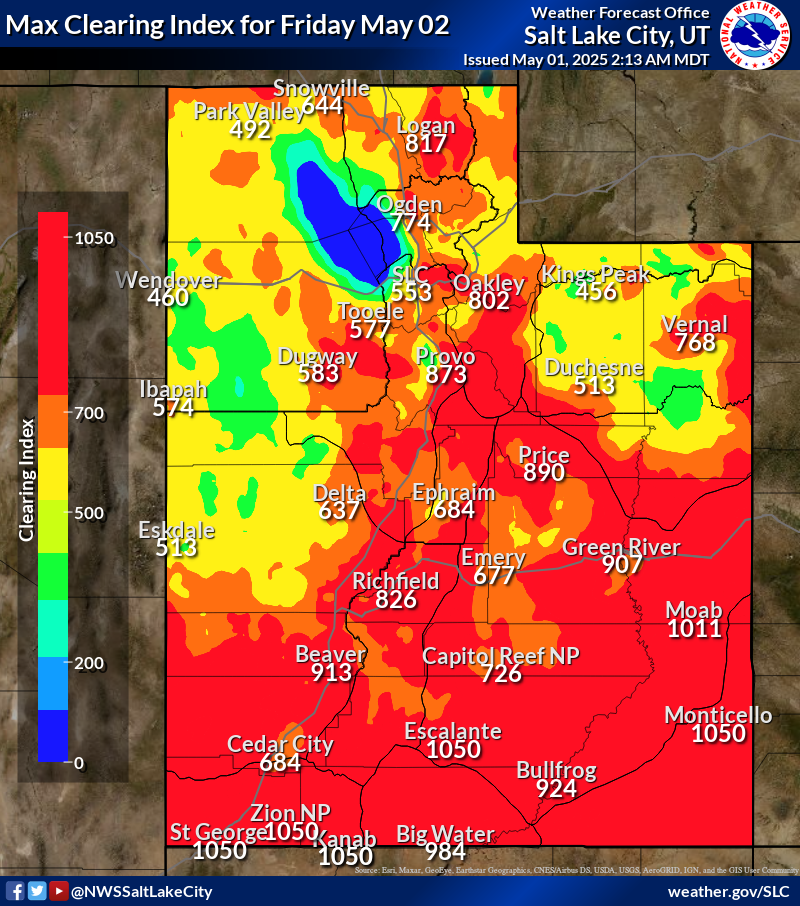
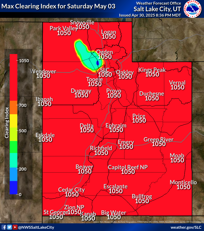
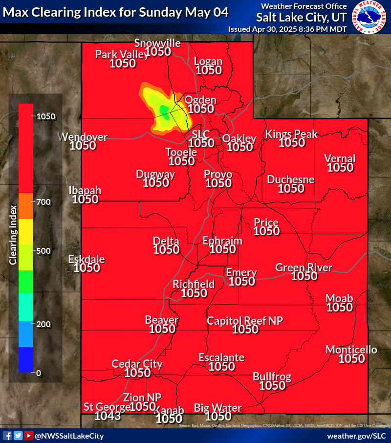
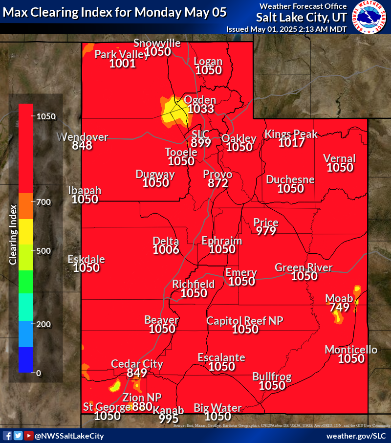
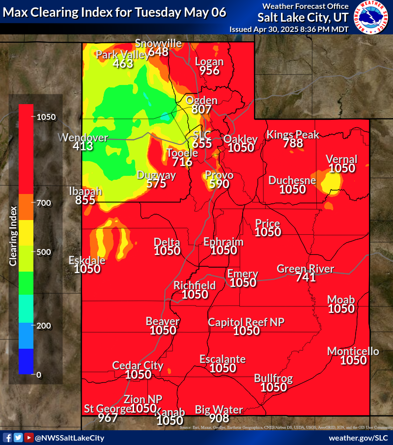
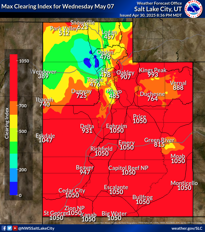
| The Clearing Index is an Air Quality/Smoke Dispersal Index used to regulate open burning and as input for other air quality decisions throughout Utah. The Clearing Index is defined as the Mixing Depth (depth of the mixed layer in 100s of feet above ground level) multiplied by the Transport Wind (average wind in the mixed layer in knots). Clearing Index values below 500 are considered poor ventilation and open burning is restricted under these conditions. Any Clearing Index values above 1000 are considered excellent ventilation and are referred to as 1000+. Data for the Clearing Index on these web pages are derived from several operational atmospheric computer models. The data will be reviewed and may be edited by NWS meteorologists before dissemination. | |
| An example calculation of the Clearing Index: | |
| Mixed Layer Depth = | 10000 feet |
| Transport Wind = | 8 knots |
| Clearing index = | (10000/100 feet) X 8 knots = 800 |
| Utah Smoke Management Program | |
US Dept of Commerce
National Oceanic and Atmospheric Administration
National Weather Service
Salt Lake City, UT
2242 W. North Temple
Salt Lake City, UT 84116
801-524-5133
Comments? Questions? Please Contact Us.

