
Extreme heat continues across the Southwest as temperatures may top 120 degrees. The heat may expand across the West and south-central U.S. into the middle of the month. Severe thunderstorms capable of severe wind gusts and large hail will be the primary hazards today across the northern Plains into the upper Midwest. Rainfall could be locally heavy across the Eastern U.S. today. Read More >
Spaceflight Meteorology Group
National Center
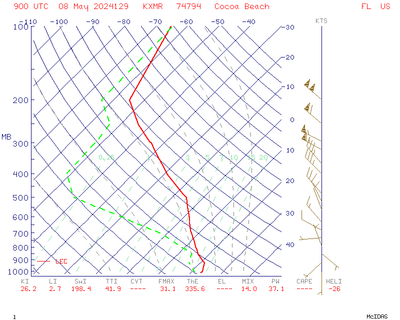
Routine early AM synoptic Skew-T Log P diagram for KXMR (Cape Canaveral, Florida) weather balloon. Mission support rawinsondes released from KXMR may be found with the link or drop down menu.
Y-axis is pressure in millibars. Wind barbs are located to the right hand side of the diagram with speed in knots. Solid red line is temperature in Celcius. Dashed green line is dew point in Celcius.
US Dept of Commerce
National Oceanic and Atmospheric Administration
National Weather Service
Spaceflight Meteorology Group
Johnson Space Center / WS8
Houston, TX 77058
Comments? Questions? Please Contact Us.

