
Flash flooding threatens areas from the Tennessee Valley to the Carolinas as storms repeat along a stalled front. Monsoonal storms may trigger flooding in the Southwest. Dangerous heat expands across the Desert Southwest, Plains, mid-Mississippi Valley and Southern Tier. Critical fire weather for interior Pacific Northwest. Cooler, drier air brings brief relief to the Great Lakes and Northeast. Read More >
 |
AREA 1 |
AREA 2 |
AREA 3 |
AREA 4 |
AREA 5 |
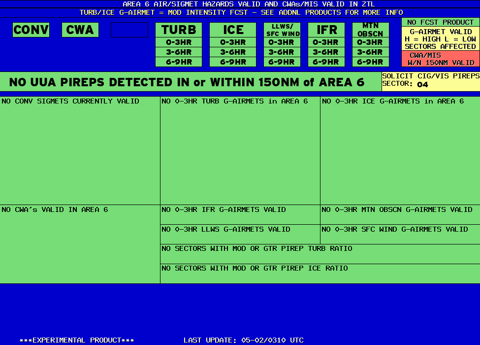
AREA 6 |
AREA 7 |
|
Lo Sectors Hi Sectors UH Sectors TRACONs Icing: Lo Sectors Hi Sectors UH Sectors TRACONs CIG/VIS: METARs By Sector TRACONs PIREPs: |
|
Plotted Pireps are updated every 5 minutes, for all flight levels and include Pireps from 2 hours previous.
Click on the PIREP icons to get more information.
The map is displaying PIREPs using the following icons:
|
|
|
|
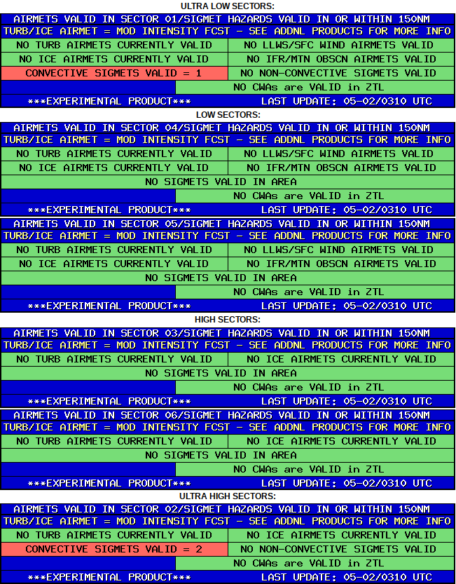
AREA 6 HAZARDS BY SECTOR |
BASED ON SIGMETS/CWAS VALID WITHIN 150NM of SECTOR and LEGACY AIRMETS VALID WITHIN SECTOR |
ULTRA LOW SECTORS: |
 |


