Flood Outlook
Current Conditions
|
|
|
|
|
Current Vis/IR Loop (click for loop)
|
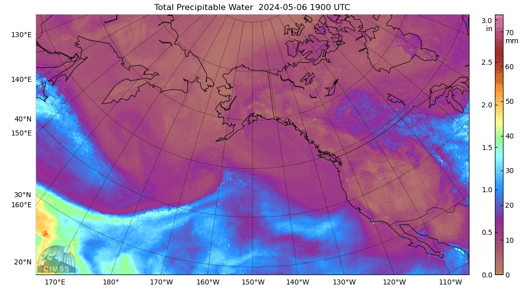
Total Precipitable Water Loop
|
|
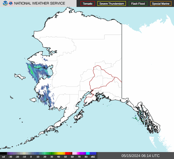
Alaska Mosaic Radar Loop
|
|
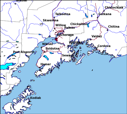
Kenai Radar Loop
|
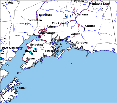
Middleton Radar Loop
|
Sitka Radar Radar Loop
|
|
Fairbanks Radar Loop
|
King Salmon Radar Loop
|
Bethel Radar Loop
|
|
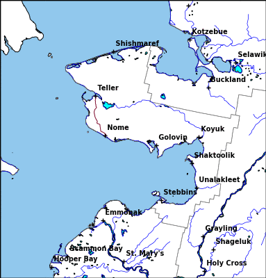
Nome Radar Loop
|
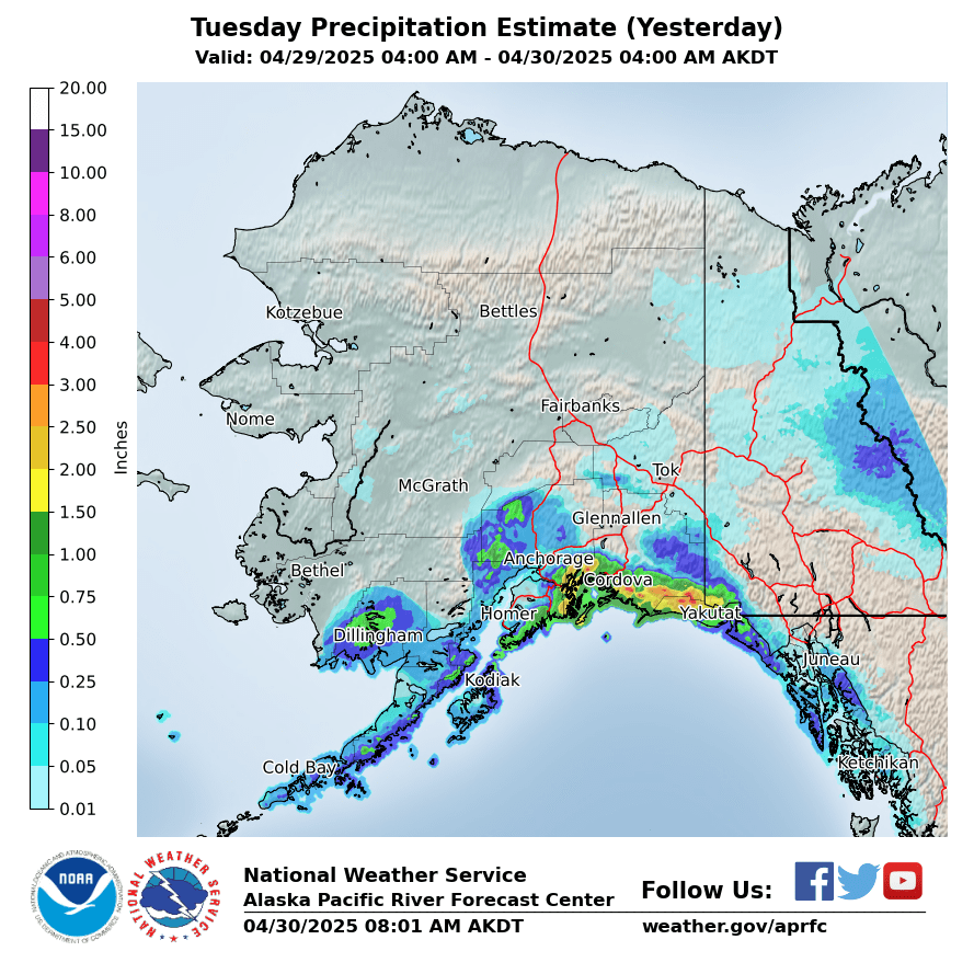
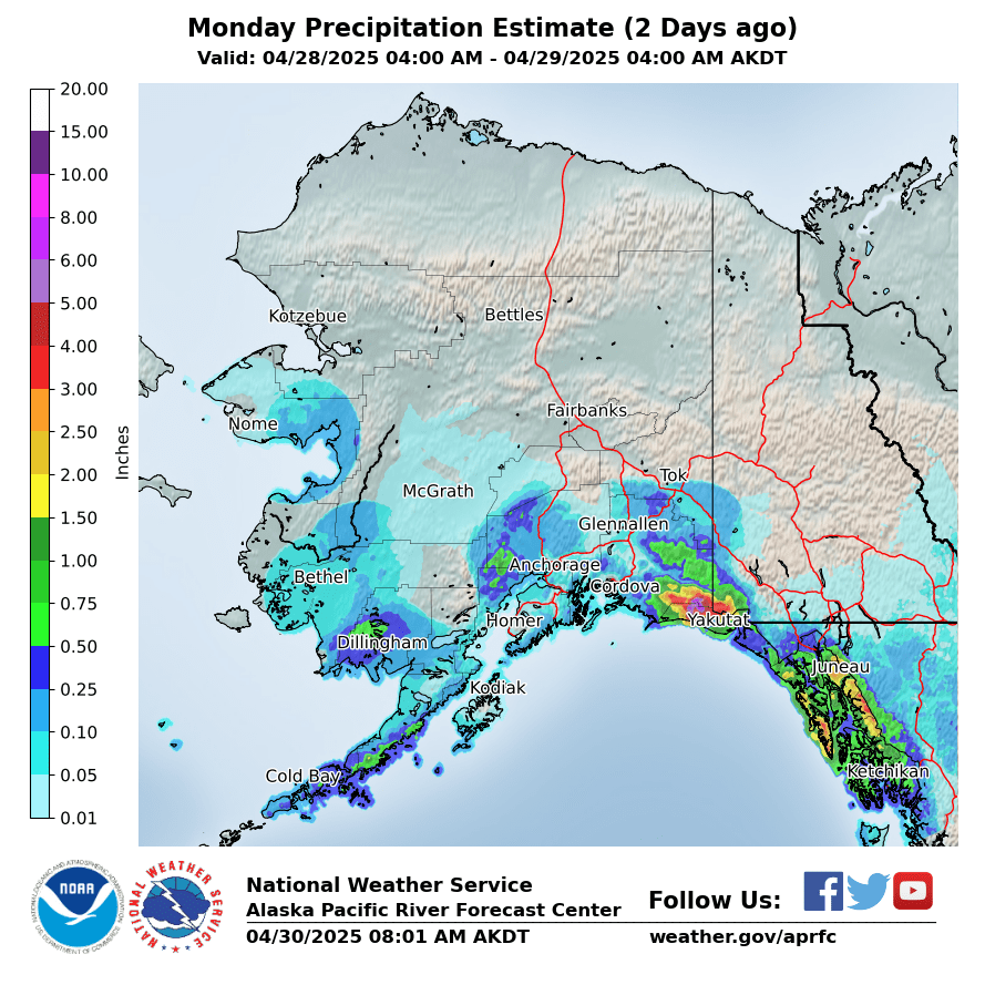
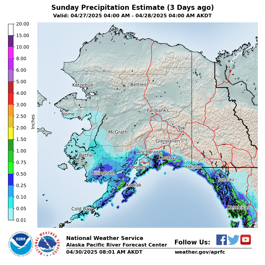
Observed Precipitation
|
Yesterday
|
2 Days Ago
|
3 Days Ago
|
|
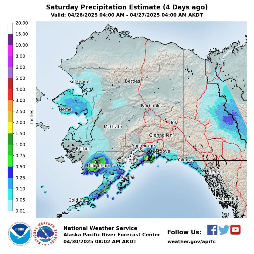
4 Days Ago
|
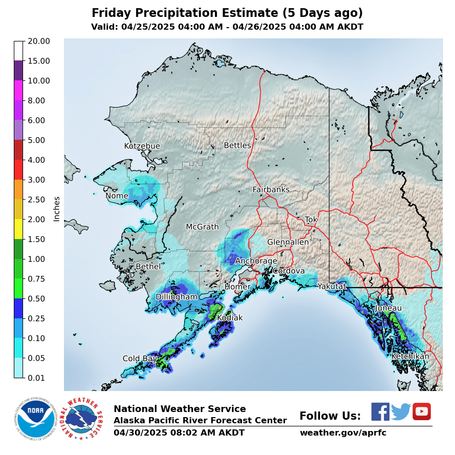
5 Days Ago
|
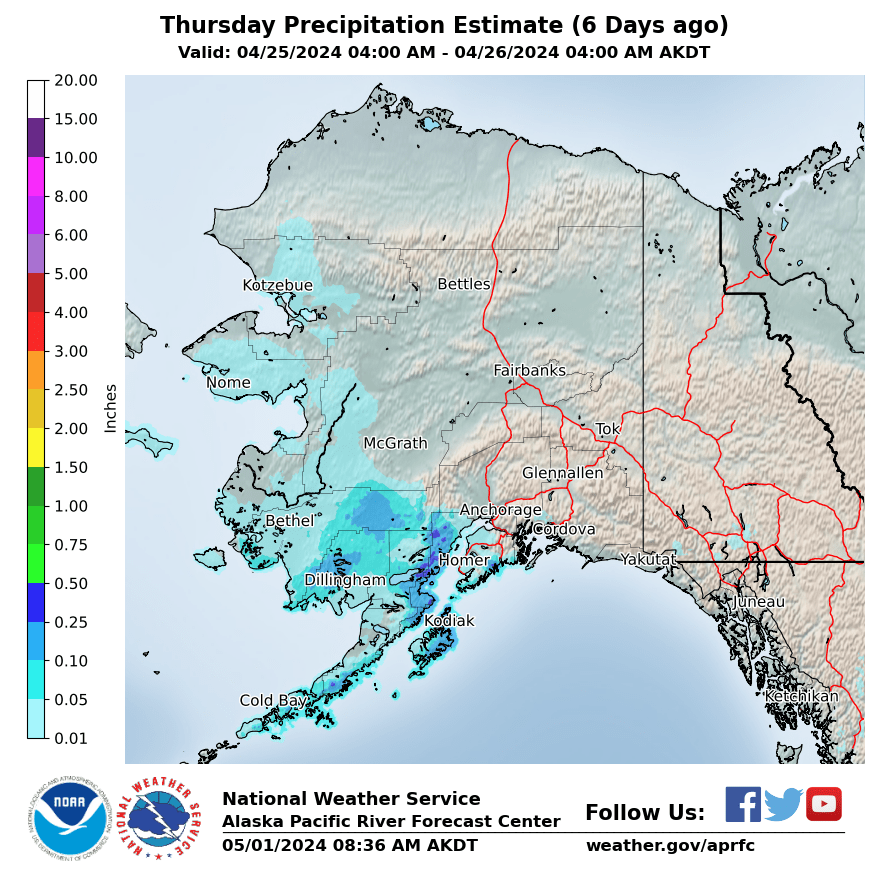
6 Days Ago
|
|
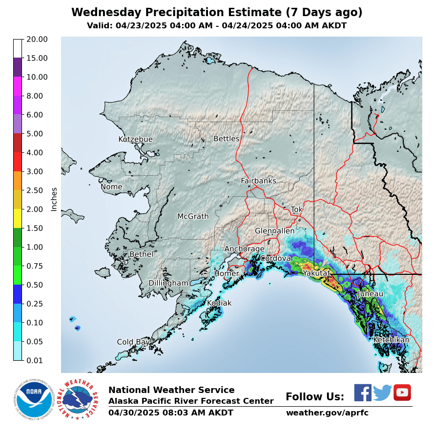
7 Days Ago
|
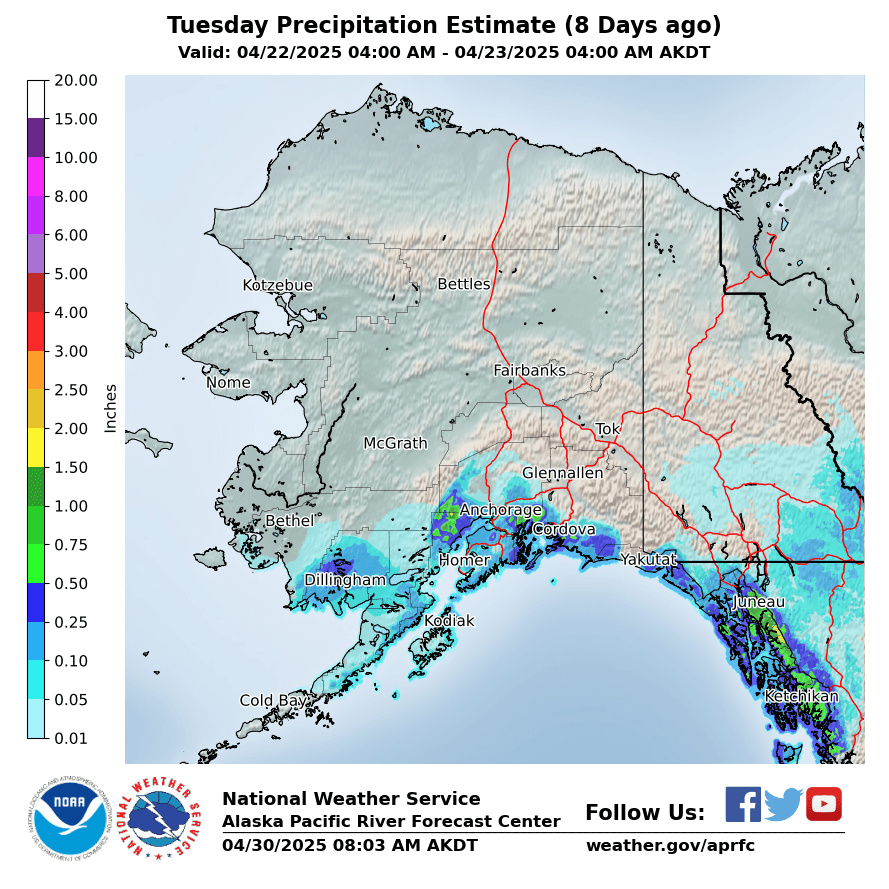
8 Days Ago
|
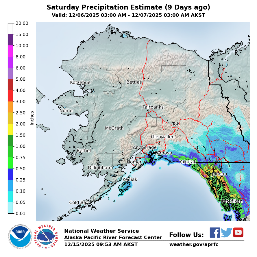
9 Days Ago
|
|
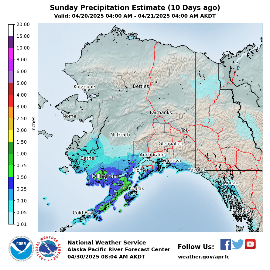
10 Days Ago
|
Forecasted Precipitation
|
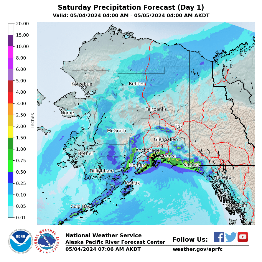
Day 1
|
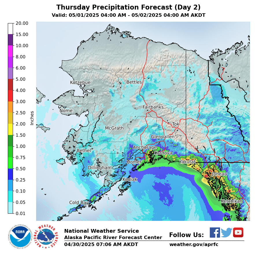
Day 2
|
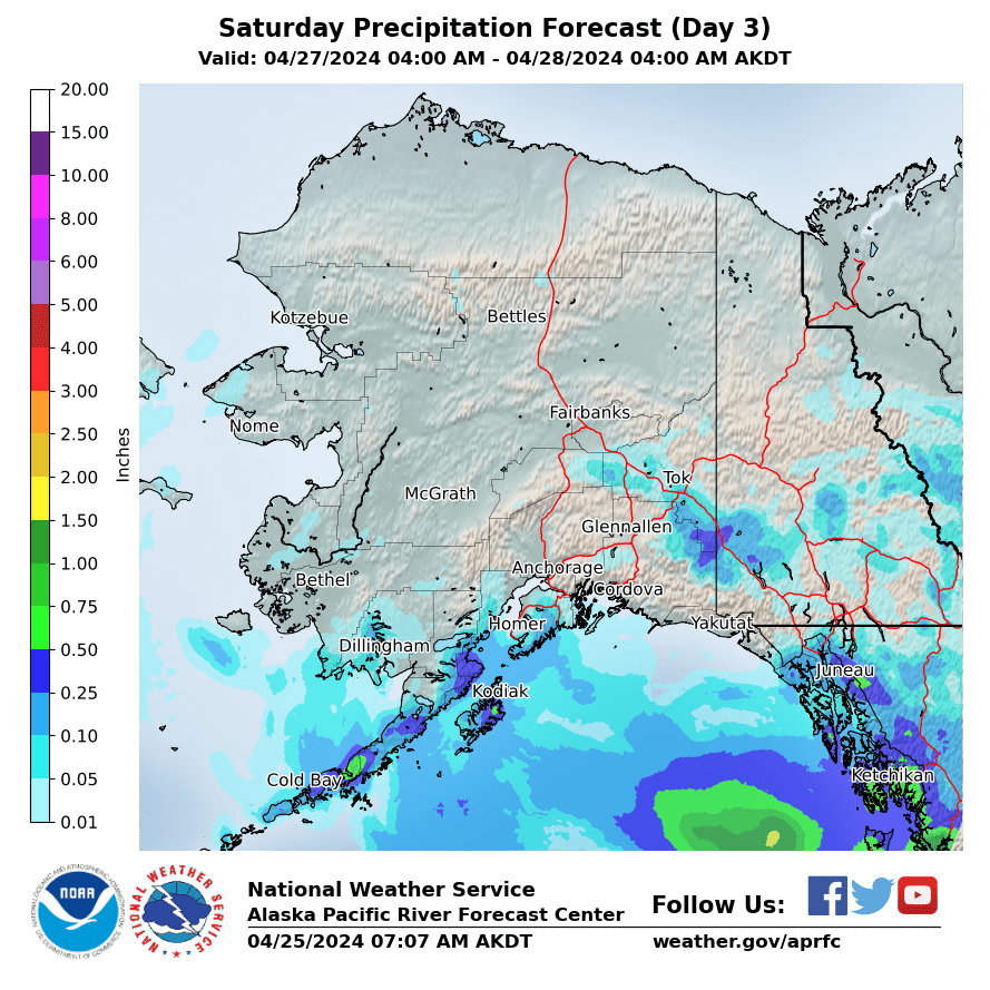
Day 3
|
|
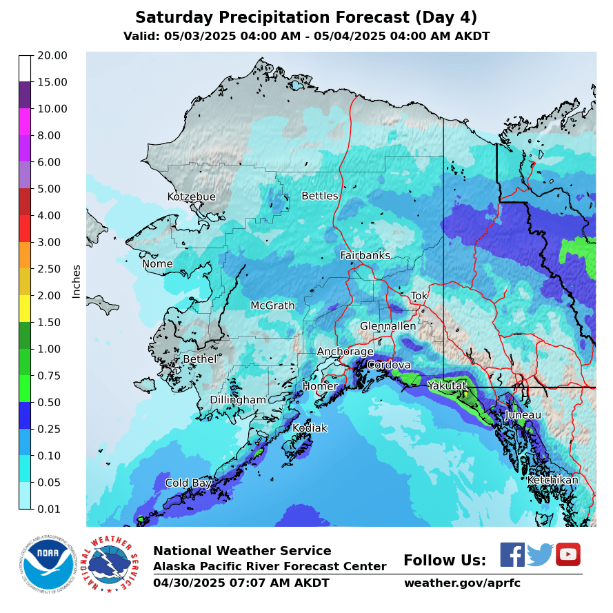
Day 4
|
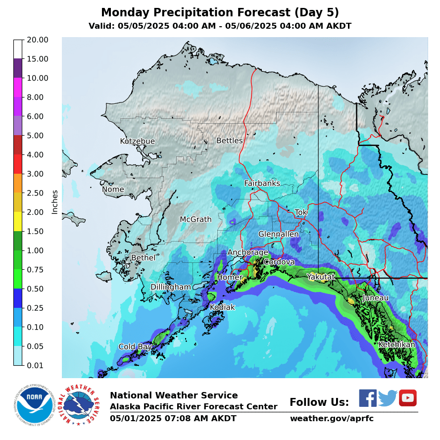
Day 5
|
Day 6
|
|
Day 7
|
Day 8
|
Day 9
|
|
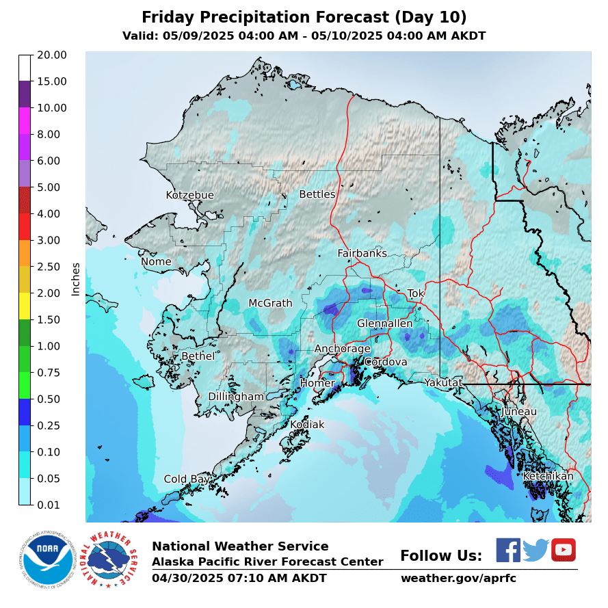
Day 10
|
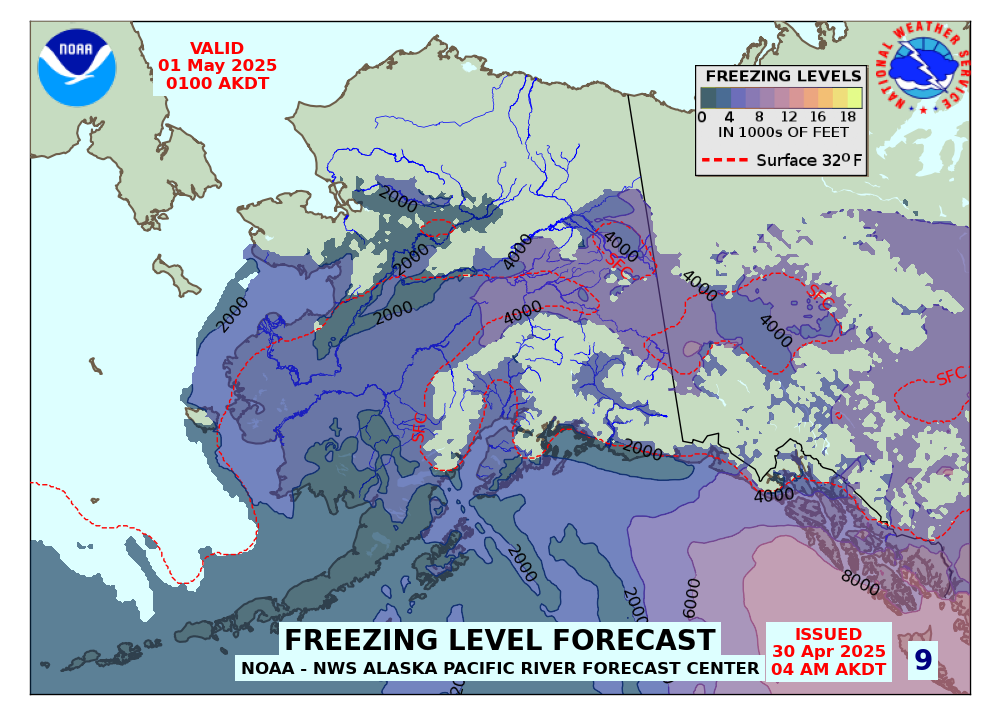
Forecasted Freezing Levels (click for Loop)
|
|
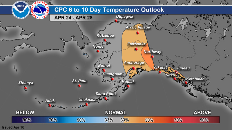
CPC 6-10 Day Outlook
|
Temperature
|
Precipitation
|
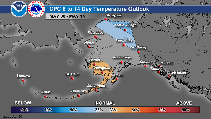
CPC 8-14 Day Outlook
|
Temperature
|
Precipitation
|
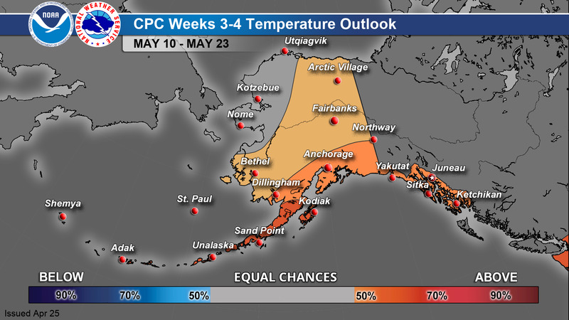
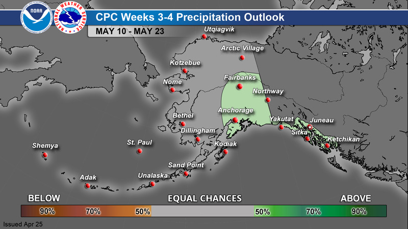
CPC Week 3-4 Outlook
|
Temperature
|
Precipitation
|
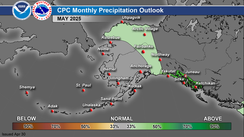
CPC 1 Month Outlook
|
Temperature
|
Precipitation
|
>
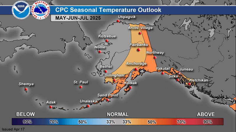
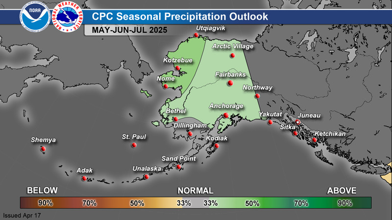
CPC 3 Month Outlook
|
Temperature
|
Precipitation
|
For additional climate outlook data, see: https://www.cpc.ncep.noaa.gov/
A Guide to Interpreting CPC Products: https://www.weather.gov/afc/GuideToInterpretCPCProducts
Alaska Drought Monitor
|
|
857
FXAK68 PAFC 111444
AFDAFC
Southcentral and Southwest Alaska Forecast Discussion
National Weather Service Anchorage AK
544 AM AKST Thu Dec 11 2025
.SHORT TERM FORECAST SOUTHCENTRAL ALASKA (Days 1 through 3)...
Key Messages:
- Gusty winds will continue through the extended forecast.
Although winds diminish tonight into Fri, winds increase again
Fri night in Valdez, Seward/Resurrection Bay, the Matanuska
Valley, and the waters around Kodiak Island with lower
confidence with how long those winds will remain elevated.
- Cold temperatures and wind chills persist until at least the end
of this week. A Cold Weather Advisory is currently in effect
through Fri afternoon for the Copper River Basin and through the
Thompson Pass area. Cold air across Southcentral has caused some
rivers to begin freezing quickly. There could be some ice
jamming of rivers as they freeze over. A hydrological outlook
has been posted.
- You can reduce your risk of hypothermia or frost bite by
protecting your skin from exposure and wearing appropriate
clothing while outdoors. Keep emergency supplies with you in
your home and while traveling whenever possible. Consider
wearing your cold weather gear while you are driving through
frigid temperatures. Know the signs of hypothermia and check on
others.
Discussion:
Stubborn high pressure remains over the Bering Sea with northerly
flow spanning across Alaska. A trough is over the Gulf with a
weak low circulating well offshore. As this trough moves out of
the area to the south and high pressure builds in, winds will
gradually decrease, becoming mostly calm this afternoon.
The relatively calm, but very cold conditions will continue
through Friday morning. However, by Friday afternoon, a strong
upper trough drops into Southcentral. The first effect of this
trough is gusty winds in Whittier and Seward, reaching over 40 mph
through Saturday. Then, gusty winds return to the Matanuska
Valley and Valdez with gusts to 50 mph expected. Higher gusts up
to 60 mph cannot be ruled out. Another round of cold air also
arrives on Saturday with this trough. Apparent temperatures have
the potential to be just as cold or perhaps even colder with this
arctic airmass. The Climate Prediction Center`s outlook for the
next couple weeks continues to favor towards colder than normal
for most of the state. Cold temperatures with the overall synoptic
pattern persisting also favors gap winds. Timing and intensity of
the cold and winds will continue to be the primary forecast
challenge across Southcentral through the next week.
Rux/JAR
&&
.SHORT TERM FORECAST SOUTHWEST ALASKA/BERING SEA/ALEUTIANS (Days
1 through 3)...
High pressure will remain situated over the southern Bering and
Eastern Aleutians through the period. Morning satellite shows
continued clear skies across Southwest Alaska and the Aleutian
Chain. Higher clouds associated with an upper trough are
overspreading the northern Bering and Pribilof Islands. Cool
morning low temperatures range from the single digits along the
Bristol Bay Coast down into the minus teens up into the Kuskokwim
Delta and Kuskokwim Valley. The coldest spot is currently Aniak
which is minus 22 degrees.
For the rest of the day mostly clear skies are forecast across
Southwest Alaska and the Eastern Aleutians. An upper trough moving
into the Seward Peninsula later today into early Friday will
bring increasing clouds into the Kuskokwim Delta along with
southwesterly winds and "warming" temperatures. A chance for light
precipitation will accompany the trough`s passage, though any
precipitation will be very light with no accumulations
anticipated. A warm nose over the YK Delta may support a brief
period of freezing rain mixing in with snow after 9pm tonight and
through the early morning hours on Friday. Temperatures will then
peak on Friday sometime around 9am with highs in the 20s and 30s
for much of Southwest Alaska.
Dry conditions return to the region through Saturday. Gusty
northerly winds will be the primary impacts through the weekend
from Southwest Alaska into the Aleutians. Winds of 15 to 25 mph
will gust from 30 to 45 mph from the Greater Bristol Bay region
down into the Alaska Peninsula.
BL
&&
.LONG TERM FORECAST (Days 4 through 7: Sunday through Wednesday)...
This weekend, an expansive area of high pressure will be centered
over the northern Bering Sea and extend across the rest of the
Bering Sea. This high pressure will aid in pulling Arctic Air
south across the state, causing a trough to dig across the
southern mainland and around a low in the Gulf of Alaska. This
will create the potential for another round of prolonged high
winds through gaps and passes, cold temperatures, and wind
chills. A shortwave low will descend from eastern Russia Monday
afternoon, but remain offshore until it crosses the Alaska
Peninsula by Tuesday morning. A complex surface low in the Gulf of
Alaska could retrograde just enough early next week to bring some
light snow to the north Gulf coast and parts of the Copper River
Basin, but forecast confidence is still low. Otherwise, dry
conditions continue region-wide, which could persist for the next
several weeks as this general pattern of cold, dry weather looks
to stick around.
&&
.AVIATION...
PANC...VFR conditions and light northerly winds will persist.
Occasional gusts up to 15 kt are possible before diminishing this
evening.
&&
$$
143
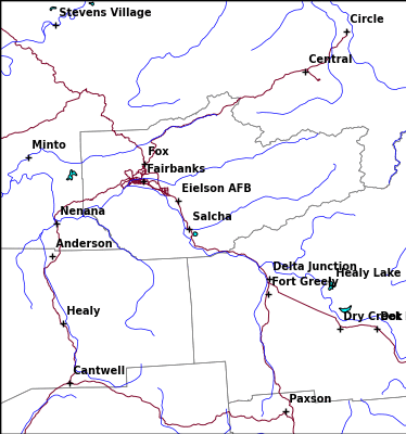
FXAK69 PAFG 111515
AFDAFG
Northern Alaska Forecast Discussion
National Weather Service Fairbanks AK
615 AM AKST Thu Dec 11 2025
.SYNOPSIS...
Cold weather continues across most of Northern Alaska, but that
will change later this morning and through the weekend as a low
moves off of Siberia. The low will shift east and move along the
Arctic coast from west to east, bringing widespread snowfall of at
least an inch with much warmer temperatures to most of Alaska
north of the AK Range. On the North Slope, winds will increase
significantly today as the low moves in, which could result in
blowing snow and reduced visibilities at times, especially where
they combine with falling snow. Early next week, while there is
uncertainty due to potential snow and cloud cover in the area,
very cold conditions over the region could drop temperatures into
the -40s or colder at times across much of Eastern Alaska, even
outside typical cold spots.
&&
.KEY WEATHER MESSAGES...
Central and Eastern Interior...
- This evening, a system will move into the area and yield snow
totals widely reaching 1 to 3 inches through the weekend, with
higher totals of over 4 inches possible from the north slopes of
the Western AK Range to the White Mountains.
- Winds will begin to increase out of the north through Windy and
Isabel Passes Friday afternoon and lasting through Saturday
morning, with blowing snow and reduced visibilities down to 1/2
mile or less possible at times.
- Cold weather will subside today across the Interior as this
system pushes out the cold air mass currently in place.
Considerably warmer temperatures are likely on Friday, with
highs widely rising into the positive single or double digits.
- Early next week, while there is uncertainty due to the chance
for light snow or cloud cover, much colder air is going to
settle back into the area, especially over the eastern half of
the Interior. Some areas, such as the Yukon Flats and Upper
Tanana Valley, could see temperatures drop enough to necessitate
Cold Weather products.
West Coast and Western Interior...
- From today through the weekend, much warmer temperatures are
expected, with increasing clouds and around 2-6 inches of snow,
with locally higher amounts farther north and inland over higher
terrain. Winds will also increase with gusts approaching 35 mph
around the Seward Peninsula and 50 mph from Kotzebue Sound and
northwest. Pockets of sleet and/or freezing rain may mix with
snow in the YK Delta/Norton Sound area as it begins to taper off
late Thursday.
- Temperatures will return to more seasonal values with initially
drier conditions going into the early part of next week.
North Slope and Brooks Range...
- Southerly winds will begin to increase through Anaktuvuk Pass
ahead of the approaching low pressure system by late this
evening. Ground blizzards and whiteout conditions are possible
through Friday with these winds. They will shift westerly after
passage of the front, which will allow them to weaken, but
snowfall will likely continue through the weekend.
- Snow is expected to move in across the region going into the
weekend as a low moves along the Arctic coast from west to east.
1 to 4 inches of snow are widely possible across the area.
Higher totals are possible in the Brooks Range and Arctic
plains, mostly east of the Dalton Highway. Portions of the
eastern Brooks Range southeast of Sagwon may receive between 6-8
inches of snow.
- Through the weekend, widespread winds of 25 to 40 mph, with
higher gusts, will shift from SW to W and could combine with
falling/fresh snow to allow for blowing snow, which could reduce
visibilities at times.
&&
.FORECAST ANALYSIS AND DISCUSSION...
A broad ridge is extending from the North Pacific across the
Bering Sea and into the Chukchi Sea, while general troughing is
extending from the high Arctic/Canadian Archipelago southwest
into Eastern Alaska. While cold air remains in place this morning
across most of Northern Alaska, a low over Siberia will shift
north into the Chukchi Sea later this morning before shifting
eastward along the Arctic Coast. As it moves east, it will
produce 1-3 inches of snow across most of Alaska north of the
Alaska Range. Higher totals will be possible in parts of
northwestern Alaska, the southern Seward Peninsula, and in the
Arctic plains and eastern Brooks Range east of the Dalton
Highway. An area extending from the western Alaska Range to the
White Mountains may also see up to 4-6 inches of snow.
As the low shifts east, winds will significantly increase across
the North Slope, with many areas seeing sustained winds up to 25
to 40 mph, with higher gusts. Parts of the eastern Arctic coast
may see sustained winds approaching 50 mph. Where these winds
combine with falling snow, they may result in blowing snow-induced
visibility restrictions, potentially reaching blizzard criteria
(especially on the eastern Arctic coast). Winter Storm Watches
have been issued on this basis for Zones 804 and 805 from Nuiqsut
east, with Winter Weather Advisories elsewhere. There will also be
westerly winds across the Interior, which may result in blowing
snow in the more elevated areas. In the Alaska Range, a Winter
Weather Advisory is in effect--after initial west winds, the winds
may turn to the north Friday afternoon resulting in a funneling
effect in the passes, strengthening the winds there.
After the low exits the area Saturday morning, most snow and winds
will fall off across the Interior, with colder conditions
reconsolidating. The primary exception is the North Slope, which
could see a series of lows moving into the area beginning Saturday
night, each of which could drop light snow in the area and
increase the winds/blowing snow again, especially on the eastern
Arctic coast. A quick burst of snow is also possible on the
Western Seward Peninsula, St. Lawrence Island, and the YK Delta
coast on Saturday with a weak surface low/shortwave aloft.
&&
.EXTENDED FORECAST DAYS 4-7...
From Monday through late next week, the ridge aloft will build
into the central to northern Bering Sea, with extensive troughing
across northwestern Canada. On the North Slope, a series of lows
is possible on the North Slope moving in from over the Arctic,
each of which may produce light snow and bring up the winds (and a
possibility of blowing snow), especially on the eastern Arctic
coast.
Elsewhere, while periods of very cold air are expected on Monday,
there is increased uncertainty on the likelihood for snowfall or
the persistence of the cold air in the area. While most models/
their ensembles support increased north winds with light snow
over Western Alaska late Monday into Tuesday, some extend the snow
as far east as the Eastern Interior, while others keep it farther
west. This has a significant effect on cloud cover and
temperatures, with the drier and clearer solutions being much more
conducive to temperatures near or below -40F. The best confidence
for such temperatures is on Monday, when temperatures at the 850
mb level across much of Eastern Alaska will range from -25 to
-30C. Thereafter through most of the rest of the third week of
December, model guidance suggests the periphery of the ridge aloft
could shift into the Interior, pushing out the cold air, although
the cold air could reconsolidate at times.
Coastal Hazard Potential Days 3 and 4...None
&&
.AFG WATCHES/WARNINGS/ADVISORIES...
AK...Winter Weather Advisory for AKZ801>803-806-807-813>824.
Winter Weather Advisory for AKZ847>850.
Winter Storm Watch for AKZ804-805.
Winter Weather Advisory for AKZ808>810.
PK...Brisk Wind Advisory for PKZ801.
Brisk Wind Advisory for PKZ802-803-808-852.
Brisk Wind Advisory for PKZ804.
Brisk Wind Advisory for PKZ805-855.
Gale Warning for PKZ806-817-854.
Gale Warning for PKZ807-856.
Gale Warning for PKZ809.
Gale Warning for PKZ810.
Gale Warning for PKZ811-857.
Gale Warning for PKZ812-858.
Gale Warning for PKZ813-859.
Gale Warning for PKZ814-860.
Gale Warning for PKZ815-861.
Gale Warning for PKZ816-851.
Heavy Freezing Spray Warning for PKZ817-854.
Brisk Wind Advisory for PKZ850.
Brisk Wind Advisory for PKZ853.
&&
$$
DS
408
FXAK67 PAJK 111537
AFDAJK
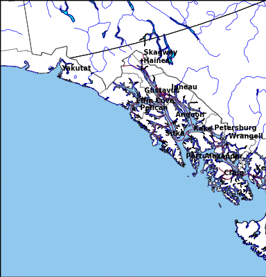
Southeast Alaska Forecast Discussion
National Weather Service Juneau AK
637 AM AKST Thu Dec 11 2025
.SYNOPSIS...
Key Messages:
- Cold temperatures continue, with many areas seeing single
digits to teens for overnight lows, with some areas in the NE
panhandle dipping to the single digits below zero. Dangerously
cold wind chills continue along White Pass.
- Clearing skies & drier conditions are in store for the rest of
the work-week.
- Continued strong outflow winds will keep the cold air in place
through the weekend for the northern panhandle. Marginally
warmer air moves into the southern panhandle this weekend with
snow becoming likely.
&&
.SHORT TERM.../Through Tonight/...Clearing skies, cold, dry, &
windy northeasterly outflow conditions, strongest over the
northern panhandle, continue with a gradual diminishing trend in
the winds starting late tonight through friday as the pressure
gradient relaxes a bit. The wind chill at White Pass has gotten
down to as low as minus 51 as of 5:30am AKDT. An Extreme Cold
Warning remains in effect for the Municipality of Skagway & the
Klondike Highway until 9am AKDT Friday. A Cold Weather Advisory
remains in effect until 9am Friday for the Haines Borough & the
Haines Highway for wind chills as low as 25 below. It has been
very lightly snowing in the Petersburg & Kake area overnight. This
will taper-off as very weak localized troughing over that area
diminishes into the morning hours.
LONG TERM.../Friday through Monday/...Only minor changes were
made to the long term forecast, mainly adjusting outflow wind
timing and beginning to narrow down timing on the potential snow
for next weekend into early next week.
Strong outflow winds continue to hold any developing showers
offshore until Saturday morning, keeping the panhandle dry with
partly cloudy skies through the rest of the week. A small surface
ridge developing on Friday is expected to make that day the most
clear and the least windy, though outflow winds will still be
elevated to around 20 kts in the strongest areas. Precipitation is
expected to return to the forecast Saturday morning as a low
jumps into the southern gulf and sends a front northward into the
panhandle. The precipitation will mainly impact the southern
panhandle over the weekend, extending north to the central and
parts of the northern panhandle through Sunday into next week.
Uncertainty still remains in how far this front will make it up
the panhandle, as persisting outflow winds will attempt to force
the front to stay more south. With colder temperatures remaining
through the long term forecast, precipitation will most likely
fall as snow for the northern panhandle. The front will bring
slightly warmer temperatures around freezing with it to the
southern panhandle, making it possible for this precipitation to
mix for parts of the weekend. Active weather looks to remain into
early next week.
The main impacts for the long term remains the temperatures and
winds. The arctic boundary sits just south of the panhandle
through the rest of the week, keeping below freezing temperatures
through much of the extended forecast. Daytime highs will struggle
to reach into the 20s for many locations in the northern and
central panhandle, and into the 30s for the southern panhandle.
Overnight lows during the week will mostly stay in the single
digits up north and in the 10s down south, slightly increasing
through the weekend as the next system moves in. Uncertainty
remains on southern panhandle temperatures through the weekend, as
models are starting to depict the arctic boundary shifting just
north of this area allowing the front to bring temperatures in the
mid to upper 30s to some of these southern locations. This makes
snow potential even more uncertain, as there may be times where
these temperatures reach above freezing enough to turn to a
rain/snow mix or even just rain for periods. This boundary looks
to shift back down south into early next week, keeping the cold
temperature trend in the extended forecast. An extreme cold
warning for Skagway, primarily along the Klondike Highway, has
been reissued through 9 AM Friday for extremely cold wind chill
temperatures as low as 55 degrees below. The cold weather advisory
for the Haines Borough has also been reissued through 9 AM Friday
for wind chills as low as 25 degrees below, primarily once the
sun sets. Strong outflow also persists through the week, with 20
to 35 kt winds and pockets of gales blowing through the inner
channels and funneling out into the coastal waters of the gulf.
The strongest winds will remain in the northern panhandle,
particularly down Lynn Canal and Stephens Passage and out of Cross
Sound, with gaps along the gulf coast serving as outlets for
strong winds to funnel through. There will be a brief decrease in
wind speeds on Friday, though Lynn Canal will still stay above 20
kts before outflow ramps up even stronger than before going into
the weekend. Strong gales are expected to spread through a
majority of the inner channels, with strongest winds remaining in
those hot spots in the northern panhandle. Freezing spray will
remain an issue in the inner channels and along the NE gulf coast
with these elevated winds, which could become heavy at times.
&&
.AVIATION.../Until 12Z Friday/...Largely VFR conditions expected
to continue across the majority of the panhandle through the TAF
period, as northerly outflow winds and diminishing precipitation
lasts throughout the day. The main areas continuing to see
precipitation are over the central panhandle between Kake and
Petersburg, with snow expected to continue into later this
morning, bringing MVFR conditions from cloud ceilings AoB 2500 ft
with VIS drops between 2 and 4 SM as snow decreases visibility at
times. This will soon push through by between 16 and 18Z when
conditions will improve to VFR. Lower CIGs to between 2000 and
3000 ft last over the southern panhandle this morning is also
expected to begin to clear up by 18Z, with Ketchikan seeing MVFR
conditions from these lowered ceilings seeing improvement by that
time as the cloud cover moves through. Skies will fully begin to
clear up by around midday across the panhandle as offshore flow
keeps the skies cleared and keeps the precipitation around a weak
low in the central Gulf offshore and away from the panhandle
today. With this continued offshore flow and outflow winds from
the northeast keeps winds in Skagway at the surface between 25 and
35 kts with gusts up to 45 kt. Juneau continues to see some cross
barrier flow from the NE winds at the ridgetop, however these
will be relatively weaker and remain between 25 and 30 kt between
1500 and 2000 ft. The majority of the TAF sites that are not
impacted by the outflow winds will see more light and variable
winds at the surface, with occasional gusts for Haines, Wrangell
and Klawock to 25 kt. Haines, much like Skagway, will see some
northerly outflow with gusts to 25 kt in the morning and sustained
NW winds reaching around 15 kt into tonight.
&&
.MARINE...
Inside Waters: Generally, the northeasterly outflow pattern
continues for the next several days, keeping up to around 40 kt
gale-force sustained winds for the northern 2/3 of the Inner
Channels with stronger winds the farther north that you go, with
Northern Lynn Canal experiencing the strongest winds. These winds
will also be accompanied by fully-developed seas up to around 15
ft, with generally the highest waves the more northward you go,
due to the long-fetch of these strong winds. Additionally, mainly
due to air temperatures being so cold, up to heavy freezing spray
is also likely for those areas.
Outside Waters: Generally, northeasterly outflow winds up to
around 35 kt gale-force are in store for the northeastern gulf
through tonight. For Friday, the pressure gradient relaxes &
winds decrease. Finally, those winds ramp-up, again, up to around
40-45 kt gales for the same area for the weekend as the pressure
gradient tightens & northerly outflow intensifies, once again.
Significant wave heights top out at around 11 ft today & top out
at around 22 ft for the weekend. Some freezing spray is possible
for the northeastern gulf.
&&
.AJK WATCHES/WARNINGS/ADVISORIES...
PUBLIC...Extreme Cold Warning until 9 AM AKST Friday for AKZ318.
Strong Wind until noon AKST today for AKZ318.
Cold Weather Advisory until 9 AM AKST Friday for AKZ319.
Strong Wind through late tonight for AKZ325.
MARINE...Heavy Freezing Spray Warning for PKZ011-012-031.
Heavy Freezing Spray Warning for PKZ013.
Heavy Freezing Spray Warning for PKZ032.
Heavy Freezing Spray Warning for PKZ053.
Gale Warning for PKZ011>013-651.
Small Craft Advisory for PKZ021-022-031>034-053-641>644-652-
661>664-671-672.
&&
$$
SHORT TERM...JLC
LONG TERM...ZTK/SF
AVIATION...Contino
MARINE...JLC
Visit us at http://www.weather.gov/Juneau