
A system tracking up from the southwest will bring widespread snow to the area late Saturday into Sunday Read More >
Fast Facts |
Storm Reports |
Photos |
Large Hail |
Meteorology & Radar |
.png) |
Text Listing of NWS Gaylord Preliminary Storm Reports
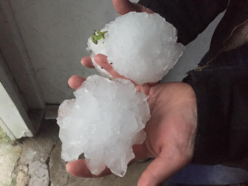 |
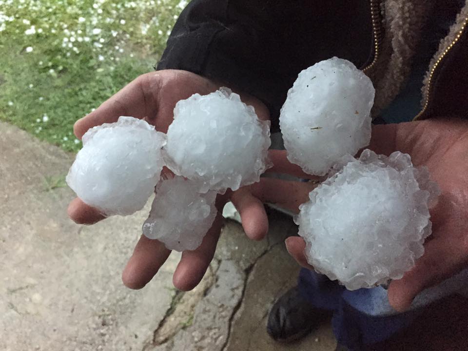
| Softball sized hail - 7 miles north of West Branch - Photo Courtesy of Shelley Evergreen |
 |
 |
| Baseball to Softball sized hail - 7 miles north of West Branch - Photo Courtesy of Shelley Evergreen |
Softball sized hail - 7 miles north of West Branch - |
.jpg) |
.jpg) |
| Large Hail - Moorestown - Courtesy of Brent Morey | Large Hail - South Higgins Lake - Courtesy Lori Ritter |
 |
.jpg) |
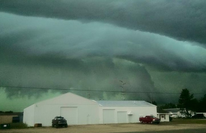
| Shelf cloud near Kalkaska - Courtesy of Jason Mroz |
Shelf cloud over Grand Traverse Bay - Courtesy of |
 |
 |
| Damage in Glen Arbor - Courtesy of Glen Arbor Artisans / Paul May | Mammatus Clouds in Onekema - Courtesy of Edward Bradford |
.png) |
| NWS Gaylord Doppler Radar Reflectivity 8:00 am - 8:00 pm |
 |
Northern Michigan experienced a complex severe weather setup, which began with a warm front lifting northward from southern Michigan toward the Straits of Mackinac and into the eastern upper penninsula. This allowed for moisture to increase across the entire lower penninsula, which was evident by mid-60 degree dew points across much of northern Lower Michigan. The following image is a depiction of deep moisture, or Precipitable Water (PWAT), analyzed by the Storm Predicition Center at 21z (5:00 pm EDT).
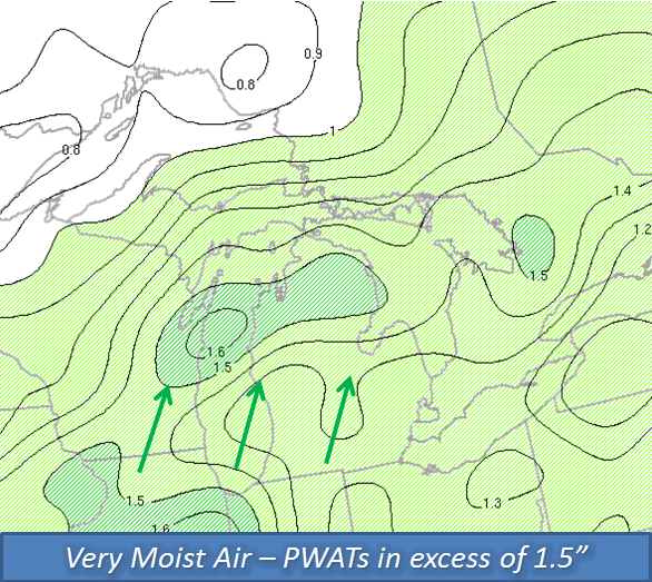 |
| SPC Mesoanalysis: Precipitable Water (in.) at 5 pm EDT |
In addition to ample moisture, the atmosphere had become extremely unstable. One frequently used variable to assess atmospheric instability is Surface Based Convective Available Potential Energy (SBCAPE). While values greater than 1000 J/kg may be sufficient to support strong-severe thunderstorms, the following image of SBCAPE analyzed by the Storm Prediction Center at 20z (4:00 pm EDT) indicates values between 2000-3500 J/Kg across portions along and south of M-32.
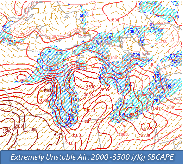 |
| SPC Mesoanalysis: Surface Based Convective Available Potential Energy (SBCAPE) (J/Kg) at 4 pm EDT |
In a typical severe weather scenario, an ingredient known as wind shear is needed to support long-lived convection. Wind shear is the change in wind speed and/or direction with height in the atmosphere. As one might suspect, August 2nd was no different. The last image, courtesy of the Storm Predicition Center, represents the amount of Effective Bulk Shear across Michigan at 21z (5:00 pm EDT). Note: Values greater than 35-40 kts are most supportive of organized severe weather.
.PNG) |
| SPC Mesoanalysis: Effective Bulk Shear (kts) at 5pm EDT |

