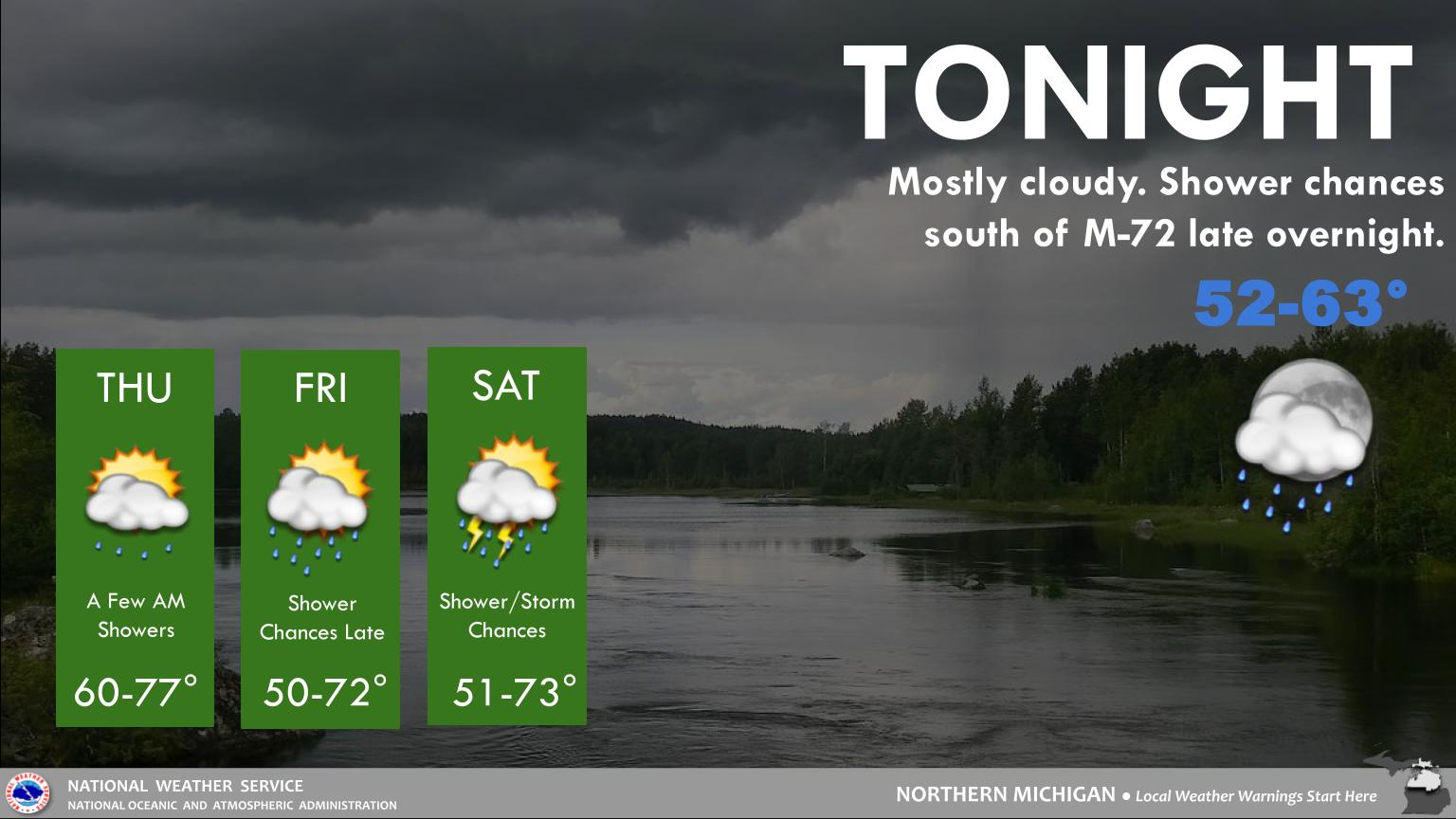
|
Latest Snowfall Forecast Information
Click image to enlarge/Click again to shrink
Snow to Liquid Ratio
Gives a representation of how wet, normal, or dry a snow will be.
Example: 11 to 1 means for every inch of liquid that falls, 11 inches of snow can be expected.
Red Shading (Wet Snow): Snow ratio of 1-11 to 1.
Green Shading (Normal Snow): Snow ratio of 11-20 to 1.
Blue Shading (Dry Snow): Snow ratio of 20+ to 1.
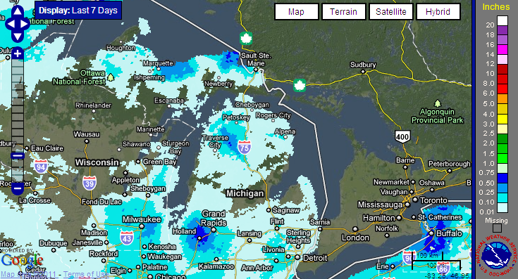
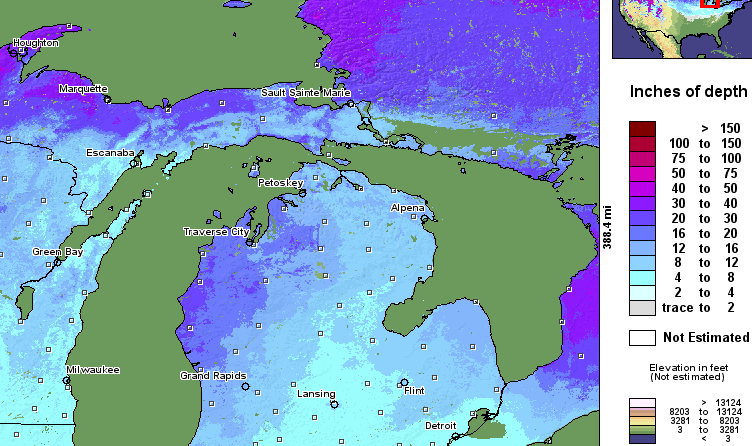
Current Snowfall/Snow Depth Information
|
Latest 24-Hr Snowfall
 |
Latest 24-Hr Liquid Precip.
 |
Latest Snow Depth
 |
|
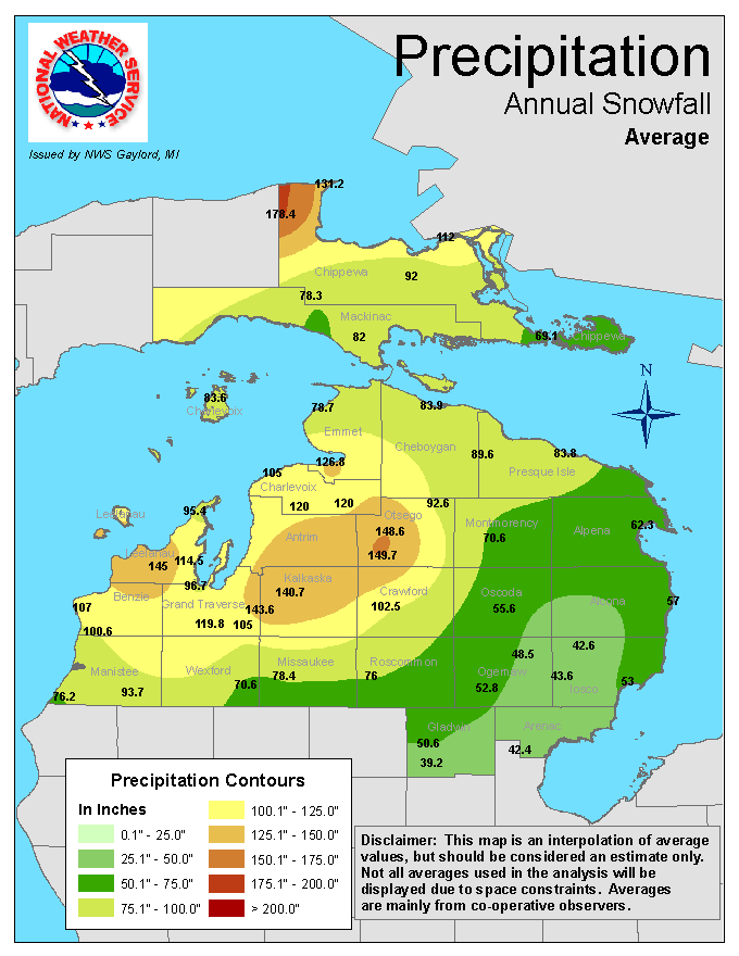
Average Annual Snowfall

|
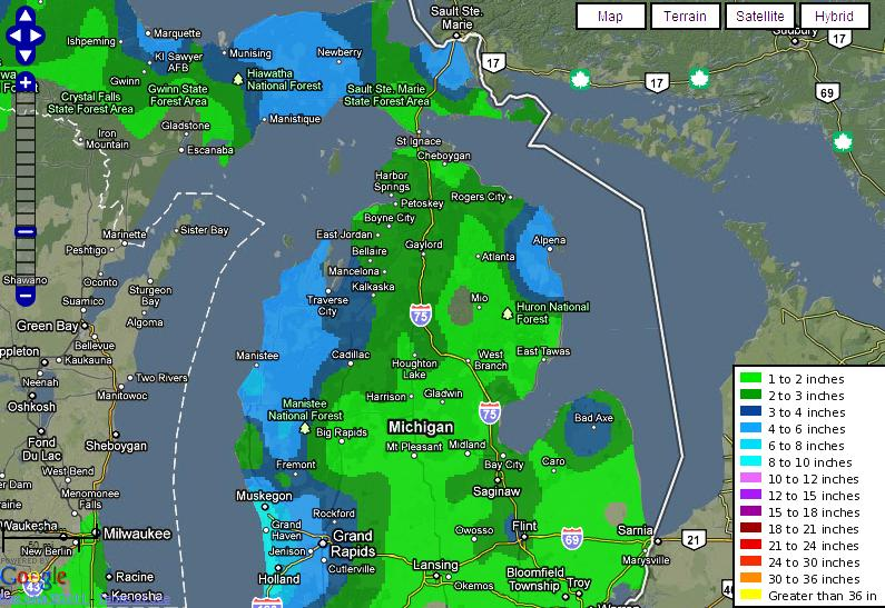
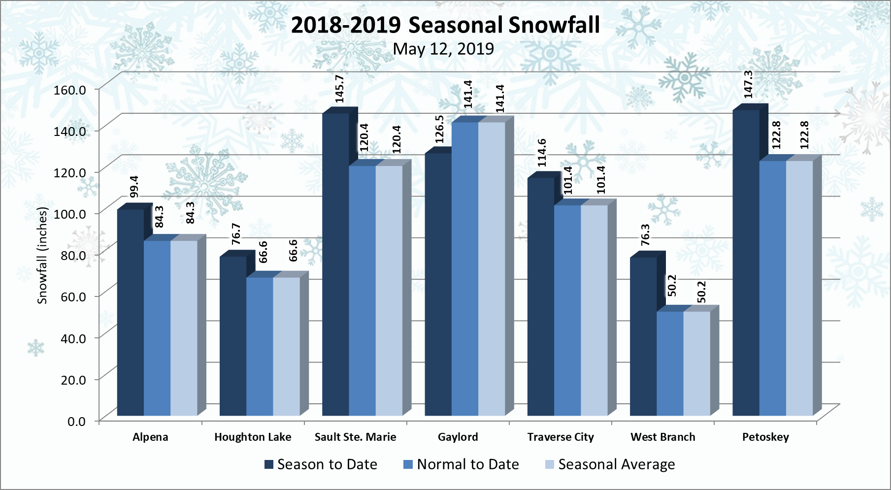
Seasonal Snowfall Total Maps
|
Seasonal Totals/Normals
|
|
Latest Snowfall Reports:
|
|
Additional Links of Interest:
|
|