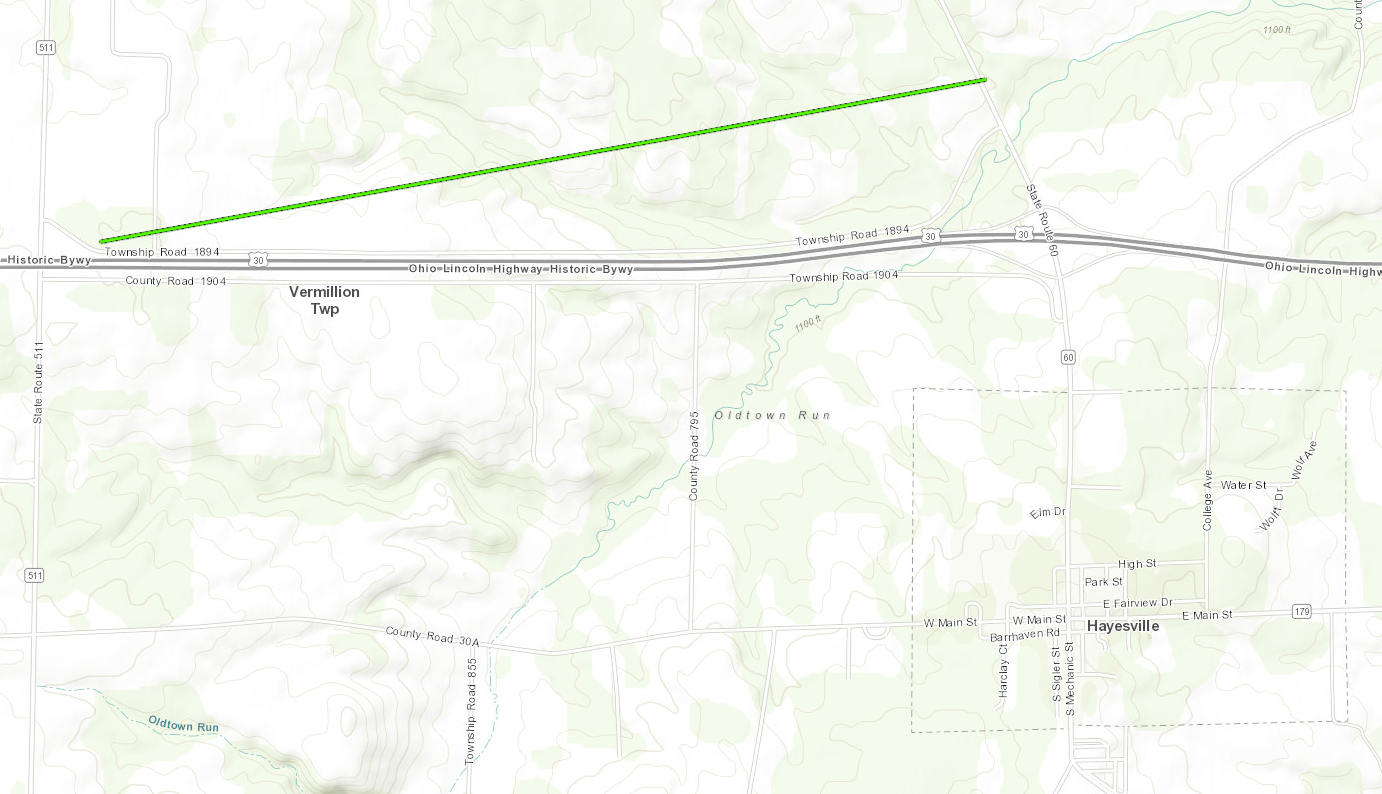
Location...1 NW Hayesville in Ashland County, Ohio
Date...November 5, 2017
Start Time...5:29 PM EST
End Time...5:33 PM EST
Maximum EF-Scale Rating...EF-1
Estimated Maximum Wind Speed...110 MPH
Maximum Path Width...100 yards
Path Length...2.04 miles
Fatalities...0
Injuries...0
* The information in this statement is preliminary and subject to
change pending final review of the event(s) and publication in
NWS Storm Data.
...Summary...
The National Weather Service in Cleveland OH has confirmed a
tornado near 1 NW Hayesville in Ashland County Ohio on November
5, 2017.
This is an update to the previously issued PNS pertaining to the
tornado near Hayesville.
The tornado touched down near the intersection of US-30 and Route
511, northwest of Hayesville. It was of EF-0 intensity in this
area where it damaged a few trees. It then continued off to the
east northeast where it intensified to an EF-1 tornado where it
produced extensive tree damage, threw a gravity wagon into the
trees, and severely injured a cow. The tornado continued off to
the east northeast where it felled multiple trees in a northwest
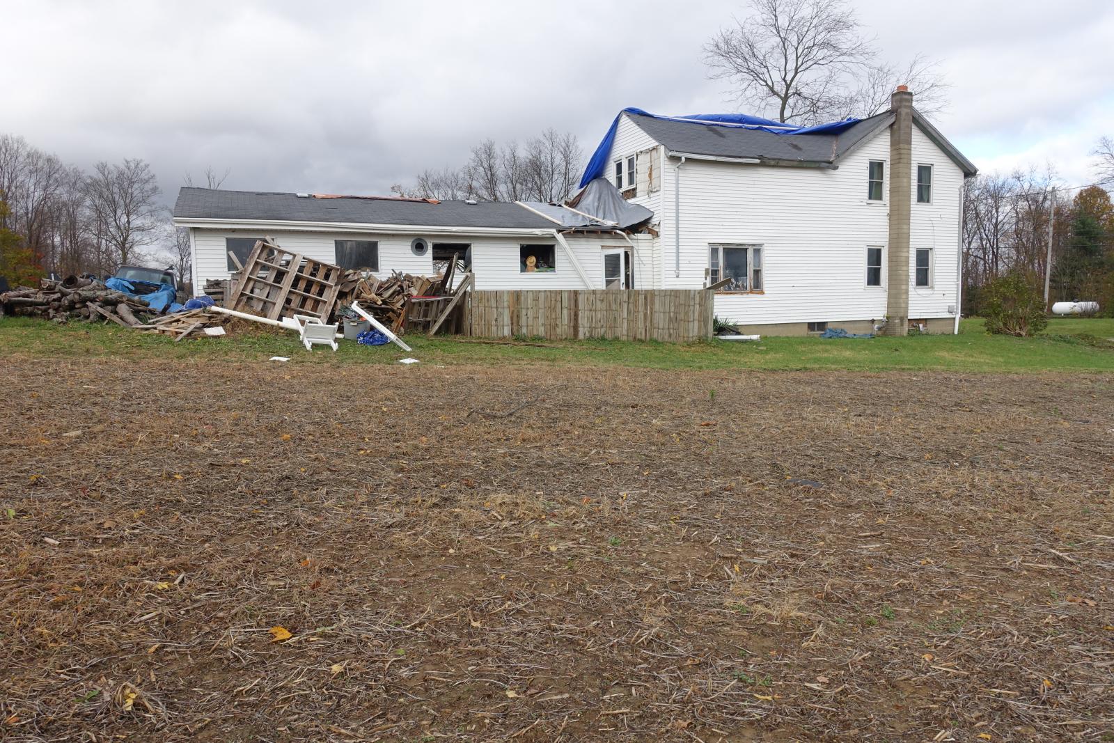
and southeast direction and struck a house along Route 61. Significant
roof and siding damage occurred to this house along with the
collapse the chimney. The tornado lifted just east of Route 61.
This information can also be found on our website at
weather.gov/cle.
For reference: the Enhanced Fujita Scale classifies tornadoes
into the following categories:
EF0...Wind speeds 65 to 85 mph
EF1...Wind speeds 86 to 110 mph
EF2...Wind speeds 111 to 135 mph
EF3...Wind speeds 136 to 165 mph
EF4...Wind speeds 166 to 200 mph
EF5...Wind speeds greater than 200 mph
$$
KO/RL