Several days prior to this rainy period, forecasts started to advertise that most of South Central Nebraska and North Central Kansas would likely receive between 1-3" of rainfall between April 16-20th. So, how did that forecast work out?
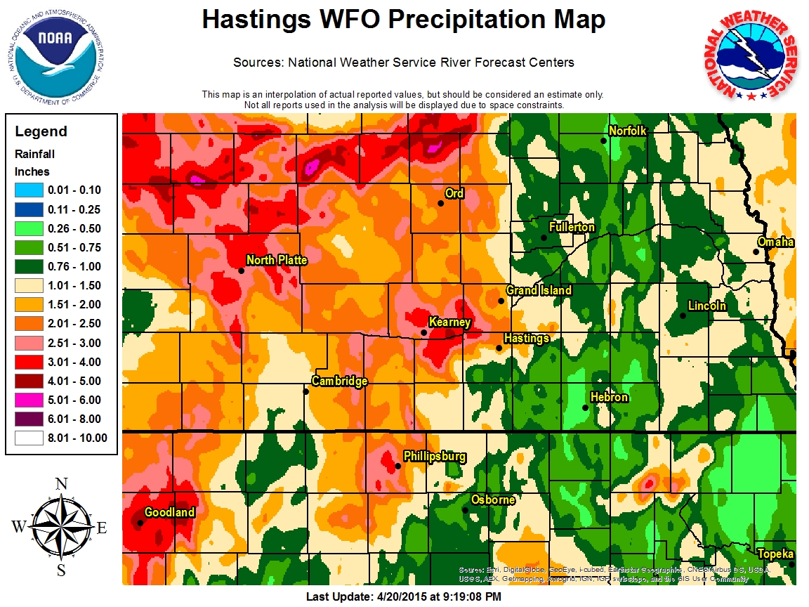
As can bee see in the list of multi-day rainfall totals below, yes, in fact much of the local 30 county NWS Hastings coverage area received between 1-3". Based on the totals below along with AHPS precipitation analysis data, the highest amounts mainly fell within counties along and especially west of the Highway 281 corridor. This was great news, as many of these counties had been the overall driest during the past several months. Although actual guage data below does not necessarily reflect it, AHPS precipitation analysis which utilizes radar rainfall estimates shows that the most concentrated zone of 2-3" rainfall totals likely fell within a triangle shaped zone between the tri-cities of Grand Island, Hastings and Kearney. On the other end of the spectrum, unfortunately there were several counties mainly east of Highway 281 that averaged less than 1" and in some cases less than 0.5". A few of these counties that really "missed out" on the higher amounts included Fillmore and Thayer in Nebraska and Osborne in Kansas.
Although the science of forecasting has gotten better over the years at predicting "general" rainfall potential across large areas, it is virtually impossible to predict in advance "exactly" how much rain will fall over the course of several days at any specific given location. This is largely due to the fact that heavier showers and thunderstorm activity happens on very small scales. As a result, it is not uncommon that locations even within 1 mile (or less) of each other can sometimes have significantly varying amounts.
AHPS precipitation analysis can be found at: https://water.weather.gov/precip
Regarding the data below, unless otherwise noted, all totals are from official NWS Cooperative Observers.
Locations That Received 2" or More:
3.15...5 WSW Wood River (NERain Observer)
2.81...Minden
2.58...Logan, KS
2.49...Canaday Steam Plant (6 SSE Lexington in Gosper County)
2.42...2 W Doniphan (NERain Observer)
2.39...10 NNE Arapahoe (NERain Observer)
2.31...Kearney Airport
2.23...Ord
2.18...Lexington Airport (automated AWOS)
2.15...Orleans (NERain Observer)
2.00...Hastings NWS Office (4 N Hastings)
Locations That Received Between 1-1.99":
1.93...Edison
1.80...8 S Elwood
1.78...Holdrege
1.77...Naponee
1.70...St. Paul
1.66...Miller
1.65...Phillipsburg, KS
1.63...Hastings Airport (automated ASOS - official Hastings total)
1.63...4WNW Plainville KS
1.58...Wilsonville
1.50...Loup City
1.49...Cambridge
1.47...Ravenna
1.37...Greeley
1.26...Superior
1.21...Grand Island Airport (automated ASOS - official Grand Island total)
1.18...Beloit, KS
1.18...Lebanon, KS
1.06...Osceola
1.05...4 N Aurora
1.04...Ionia, KS
Locations That Received Less Than 1":
0.90...6 ESE Clay Center
0.87...Bradshaw
0.86...Clay Center
0.85...Aurora Airport (automated AWOS)
0.84...Jewell, KS
0.81...Bruning
0.78...3 N York
0.76...Franklin
0.64...Burr Oak, KS
0.62...3 NE Shelby
0.56...Natoma KS
0.53...Central City
0.53...Hebron
0.48...Cawker City, KS
0.36...2 SW Alton, KS
0.34...Smith Center, KS
0.26...Geneva
 |
|
Forecast area centric 7 day total--April 13th to April 20th (ending at 7am on the 20th) (click to enlarge) |
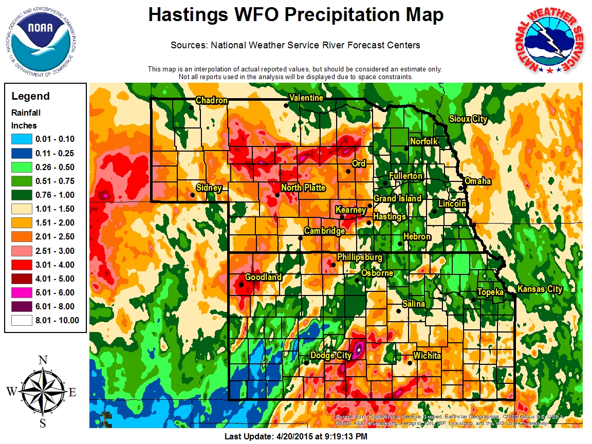 |
|
Regional 7 day total--April 13th to April 20th (ending at 7am on the 20th) (click to enlarge) |

