
A weather system in the Pacific Northwest will produce rain throughout the day, before a potent atmospheric river produces a prolonged round of heavy rainfall, widespread urban and river flooding, and high elevation snow to the region Monday through Wednesday. Showers and thunderstorms may produce isolated damaging winds, a brief tornado, and locally heavy rainfall across parts of Florida today. Read More >
Overview:
|
A powerful low pressure system gradually approached and eventually passed through the Central Plains between Friday, April 28th and Monday, May 1st, 2017. For roughly the southeastern two-thirds of the NWS Hastings coverage area (including the Tri Cities), this system was primarily a rain-maker, bringing a much-needed and widespread swath of 2.00-3.50" to most areas, along with a rare, late-season coating of light snow. HOWEVER, for primarily eight counties in the far western and northern fringes of our coverage area (especially Furnas/Gosper/Phelps/Dawson/western Buffalo/Sherman/Valley), this storm will go down in history as one of the most significant, late-season snow storms on record, as much of this area was blanketed with anywhere from 4-12" of heavy, wet snow during a 24-hour period between the morning of the 30th and the 1st. The combination of this heavy, wet snow building up on power lines and trees, along with northerly winds gusting up to around 50 MPH at times, resulted in several power outages mainly in rural areas, some of which lasted for several days. At some official NWS Cooperative Observer stations, including Cambridge and Wilsonville in Furnas County, this was the largest snow on record so late in the spring! |
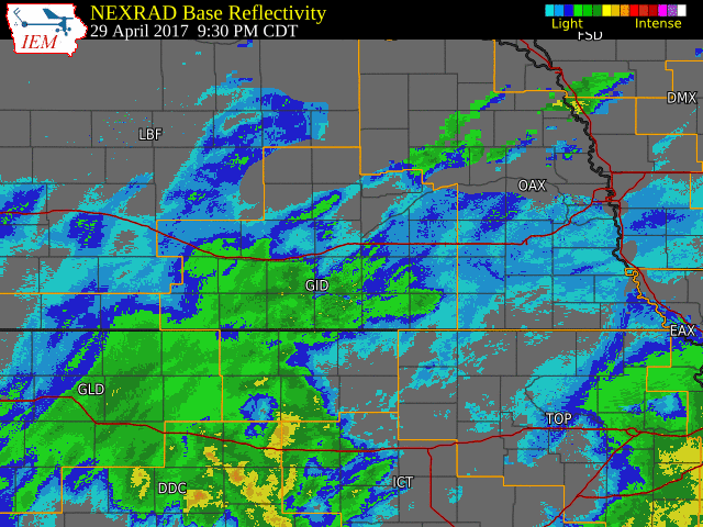 NWS Radar loop from 9:30 PM on April 29 - 8:00 AM on May 1. The NWS Hastings coverage area is outlined in orange and interstates are in red. |
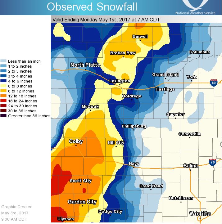
Storm Total Snow Amounts (April 30-May 1):
Snowfall details: While some northern and western areas actually received a little snow during the daytime hours on Friday the 28th, by far the "main event" occurred between the morning of the 30th and the morning of May 1st as the heart of the powerful low pressure system tracked slightly south-through-east of our local area across KS and toward IA and MO. During this time, a roughly 80-mile band of snow fell along a well-defined path from western KS, northward into north central NE (see the snow map and satellite photo below). Within the NWS Hastings coverage area, the vast majority of accumulations of 2" or higher focused west of a line from Stamford-Kearney-Spalding, with minimal-to-no snow observed east of this line. A few of the highest reported totals in western areas included 12" near Lexington and 9" at Wilsonville. While not officially a "true blizzard" in most areas, near-blizzard conditions were common at times on the 30th as frequent northerly wind gusts of 40-50 MPH combined with the heavy snow. Because temperatures hovered near-to-slightly above freezing through this entire snow event, some melting continuously occurred. This factor likely had something to do with the widely-varying official snow totals, as observers who took measurements during the height of the event likely reported overall-higher totals than those who waited until the following morning to measure (after some melting had already occurred). While by far the biggest snow amounts focused in western counties, even the lighter totals in central/eastern areas made for some noteworthy facts: for example: at Hastings, although only 0.6" officially fell on May 1st, this was still the largest May snow in 50 years (since 1967)!
(the table of storm total snow amounts below was compiled from a combination of reports from NWS Cooperative Observers and the Community Collaborative Rain, Hail & Snow Network (CoCoRaHS))
 |
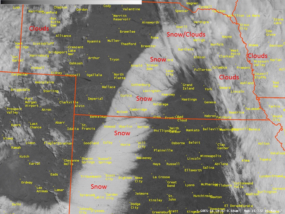 |
| This image is a "general estimate" of snow totals. PLEASE NOTE: Data may not be accurate at every location on the map. | Satellite image from Monday, May 1st, showing the roughly 80-mile wide band of heavy snow across the Central Plains. |
| Location | Total Snow (in) |
| 6 SW Lexington | 12.0 |
| 4 ESE Sumner | 10.0 |
| 10 NNE Arapahoe | 10.0 |
| 2 W Arcadia | 10.0 |
| Wilsonville | 9.0 |
| 9 NW Ord | 8.5 |
| 3 W Sumner | 8.0 |
| 6 W Elyria | 8.0 |
| Cambridge | 7.3 |
| 1 E Lexington | 6.3 |
| Miller | 6.0 |
| Ord | 6.0 |
| 6 S Wilcox | 5.0 |
| 8 S Elwood | 5.0 |
| Holdrege | 5.0 |
| Beaver City | 5.0 |
| 8 NNE Scotia | 5.0 |
| Cairo | 4.0 |
| 7 NNE Loup City | 4.0 |
| 6 NNW Oxford | 3.8 |
| Ravenna | 3.0 |
| Greeley | 2.5 |
| Kearney Airport | 1.6 |
| NWS Hastings | 0.8 |
| Grand Island | 0.3 |
4-Day Total Liquid Precipitation Amounts (April 28-May 1):
Precipitation (liquid equivalent): Cumulative, 4-day amounts from the 28th-1st totaled 2.00-3.50" across most of the NWS Hastings coverage area, with locally higher totals up to 4.73" reported at Wilsonville. Fortunately, much of this precipitation fell in separate rounds and was relatively "spread out" over these four days, which kept flooding issues to a minimum (in fact, there were no official Flood Warnings or Advisories issued by NWS Hastings during this event). For most of the area, this was actually a much-needed significant precipitation event, as parts of especially the southern half of South Central Nebraska along with North Central Kansas had been running a respectable year-to-date precipitation deficit up until this point.
(the table of 4-day precipitation totals below was compiled from a combination of reports from NWS Cooperative Observers and the Community Collaborative Rain, Hail & Snow Network (CoCoRaHS))
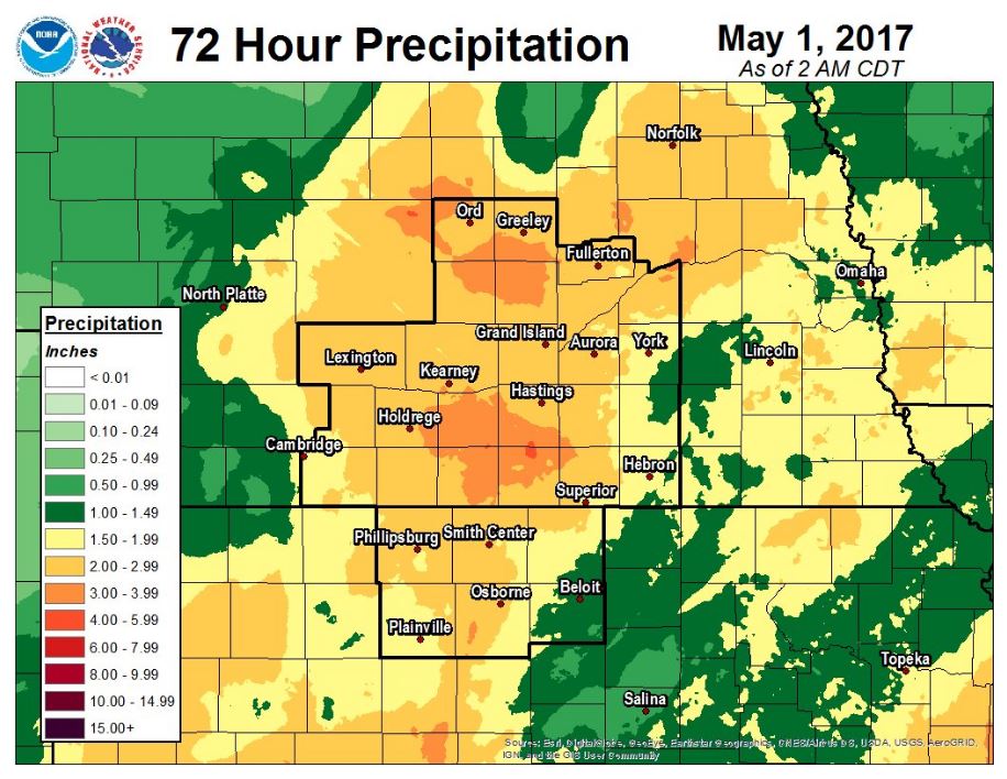 |
| This image depicts total liquid precipitation equivalent from April 28-May 1. PLEASE NOTE: Data may not be accurate at every location on the map. |
| Location | Total Liquid (in) |
| Wilsonville | 4.73 |
| Beaver City | 4.37 |
| 9 NW Ord | 4.13 |
| Edison | 3.80 |
| 4 WNW Plainville, KS | 3.68 |
| 5 SSE Deweese | 3.68 |
| 7 SSE Lawrence | 3.63 |
| 8 S Elwood | 3.59 |
| Osborne, KS | 3.58 |
| 6 NNW Oxford | 3.48 |
| Covert, KS | 3.38 |
| Osceola | 3.38 |
| Franklin | 3.33 |
| 2 W Arcadia | 3.32 |
| 5 SE Cambridge | 3.27 |
| 2 SW Naponee | 3.20 |
| 8 WNW Elba | 3.19 |
| 3 ESE Dannebrog | 3.18 |
| 4 SE Hordville | 3.15 |
| Belgrade | 3.12 |
| 4 SSE Roseland | 3.10 |
| Loup City | 3.07 |
| 6 SW Lexington | 3.05 |
| Mankato, KS | 3.04 |
| 1 SE Marquette | 3.04 |
| 7 NW Lebanon, KS | 3.02 |
| 4 E Scotia | 3.02 |
| Natoma, KS | 2.99 |
| NWS Hastings Office | 2.97 |
| Spalding | 2.97 |
| Wilcox | 2.97 |
| Nelson | 2.97 |
| 2 SW Alton, KS | 2.95 |
| 4 ENE Doniphan | 2.94 |
| Naponee | 2.94 |
| 3 NE Shelby | 2.91 |
| Clay Center | 2.88 |
| Minden | 2.82 |
| Greeley | 2.82 |
| Ord | 2.77 |
| Miller | 2.74 |
| Cambridge | 2.73 |
| Logan, KS | 2.69 |
| Phillipsburg, KS | 2.69 |
| Grand Island (airport) | 2.65 |
| Ravenna | 2.63 |
| Aurora (airport) | 2.61 |
| Burr Oak, KS | 2.55 |
| Lebanon, KS | 2.53 |
| Bradshaw | 2.53 |
| St. Paul | 2.51 |
| Hastings (airport) | 2.42 |
| Kearney (airport) | 2.41 |
Photos
 |
 |
 |
 |
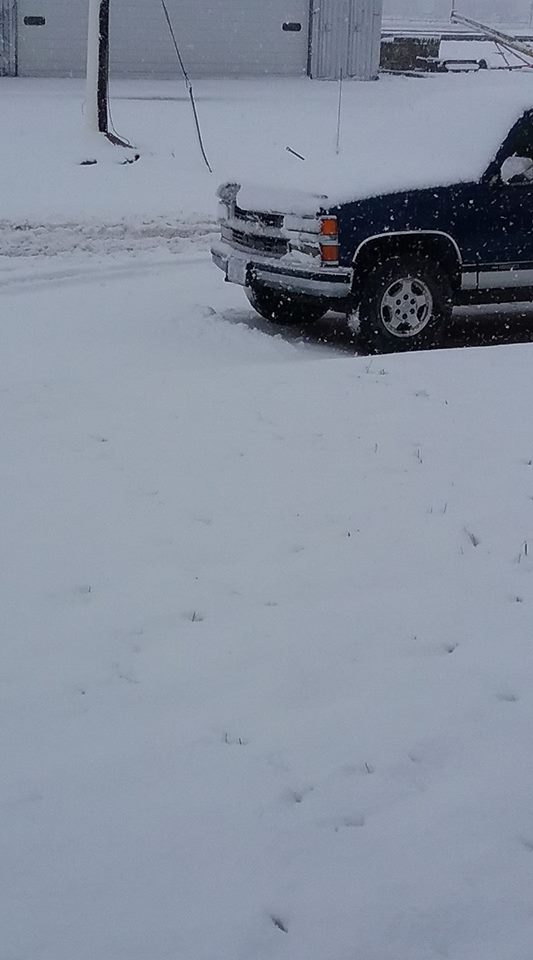
| Arcadia Photo by Angie Hain Rohan |
Near Loup City Photo by BJ Skibinski |
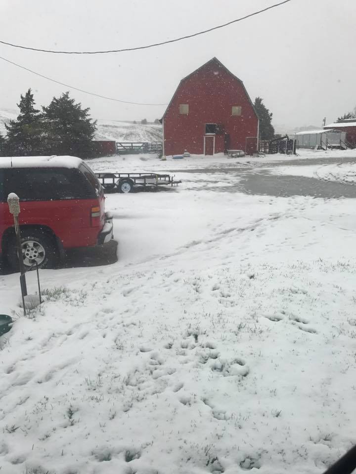
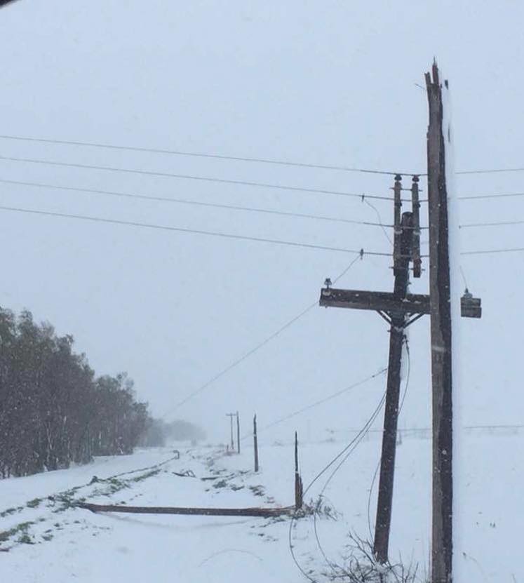
Near Bertrand Photo by Daphne Benson |
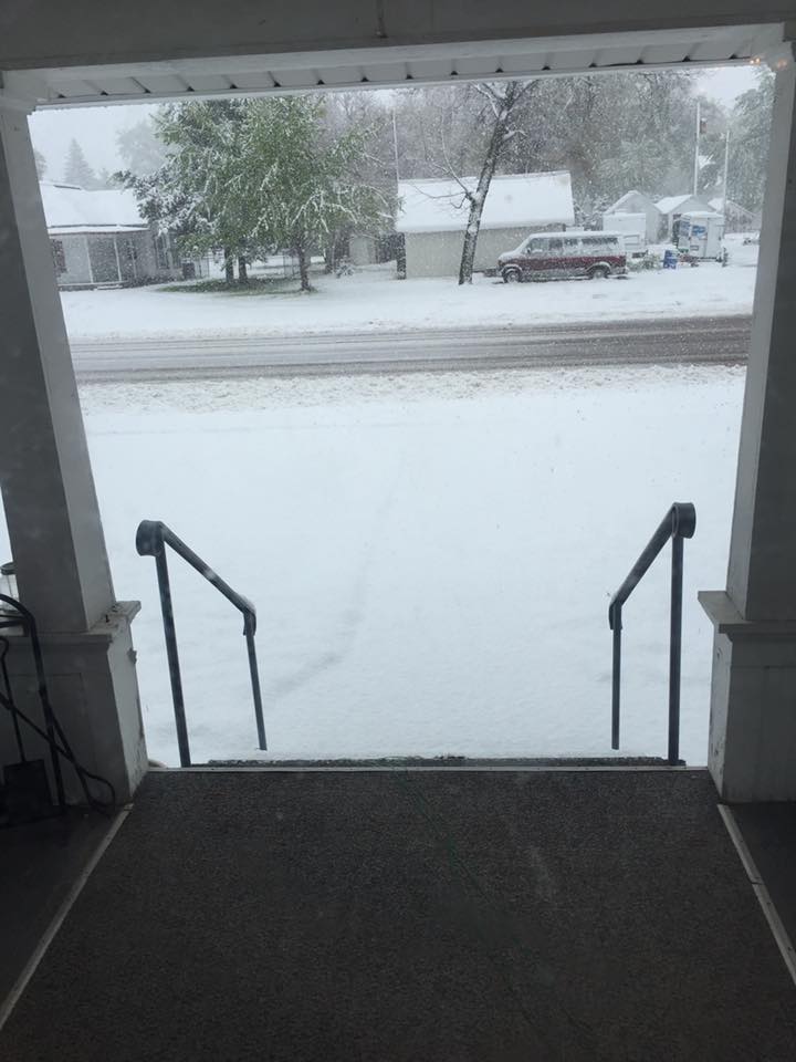
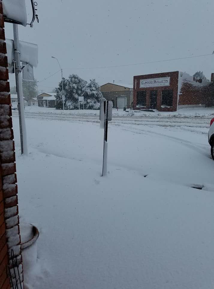
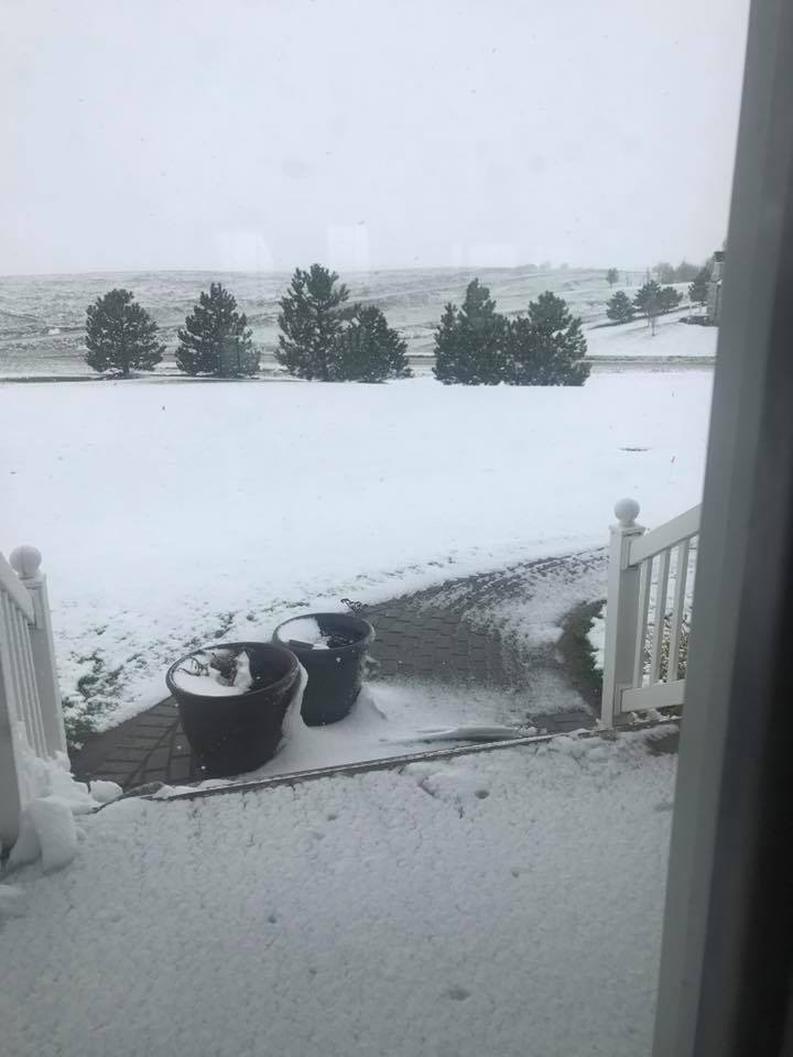
Elwood Photo by Kay Winchell Lofquist |
 |
 |
 |
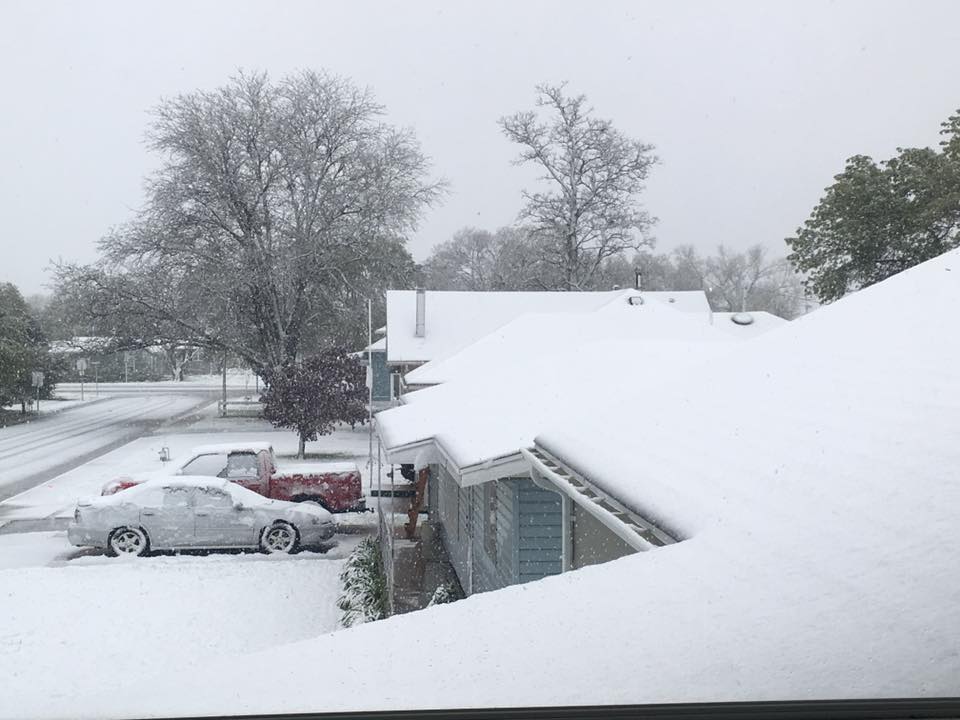
| Near Cambridge Photo by Jerry Colson |
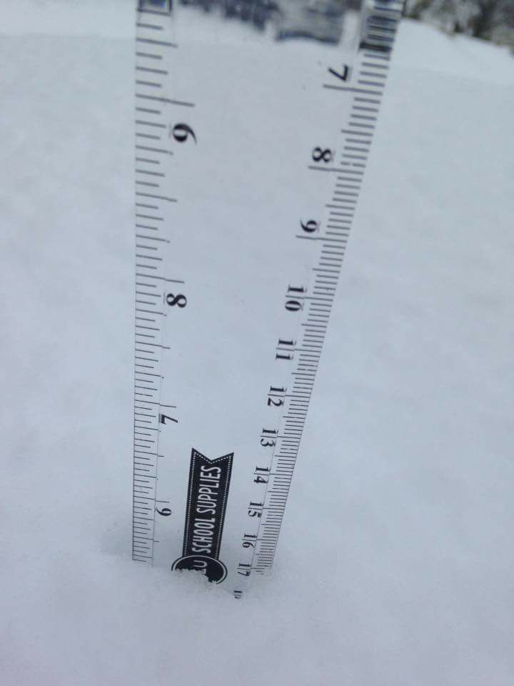
Near Elm Creek Photo by Sheri Singletary |
Near Gibbon Photo by Kailey Thyne |
 |
 |
 |
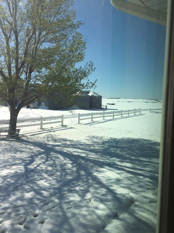
| Near Riverdale Photo by Scott Wilson |
Near Gibbon From Shana Zimmerman |
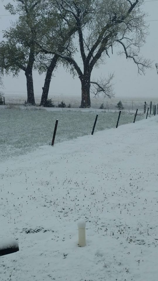
Arapahoe Photo by Stefanie Hoefs |
 |
Media use of NWS Web News Stories is encouraged! Please acknowledge the NWS as the source of any news information accessed from this site. |
|

