Severe thunderstorms are likely today across the northern Plains and into the upper Mississippi Valley. Gusty winds and dry conditions will result in widespread critical fire weather through Saturday across parts of the Four Corners region and the Great Basin. A significant and dangerous heat wave will expand from the Central U.S. into the Eastern U.S this weekend through much of next week. Read More >
Overview
|
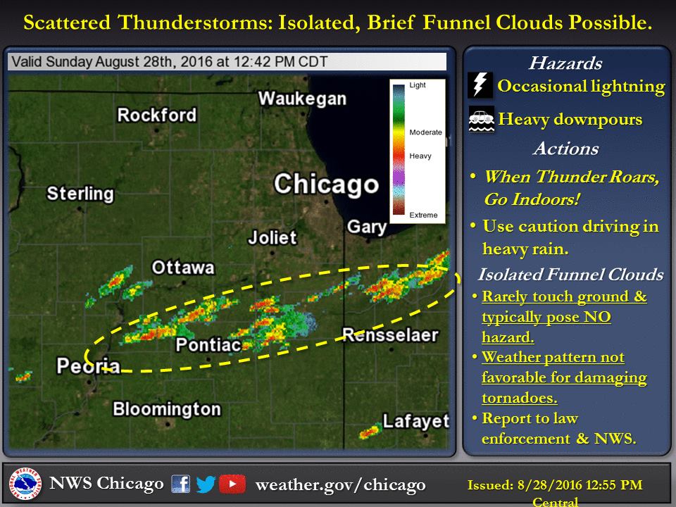
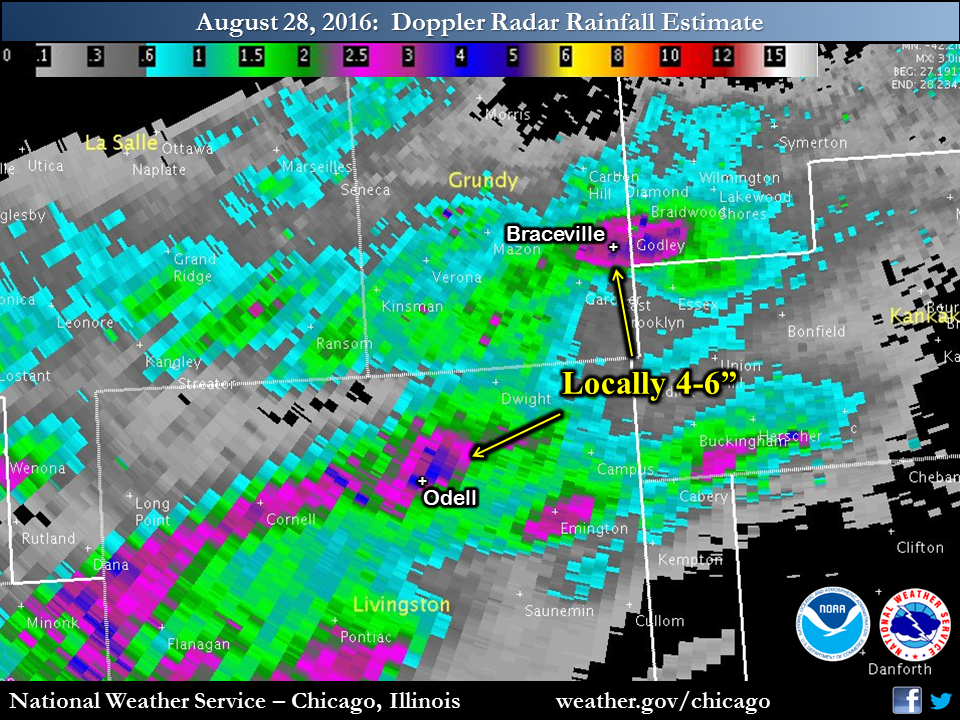
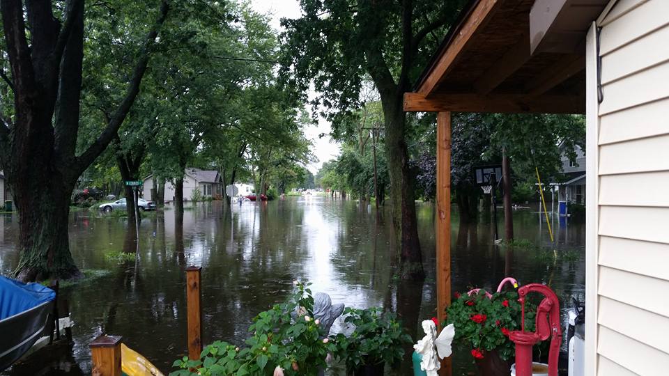
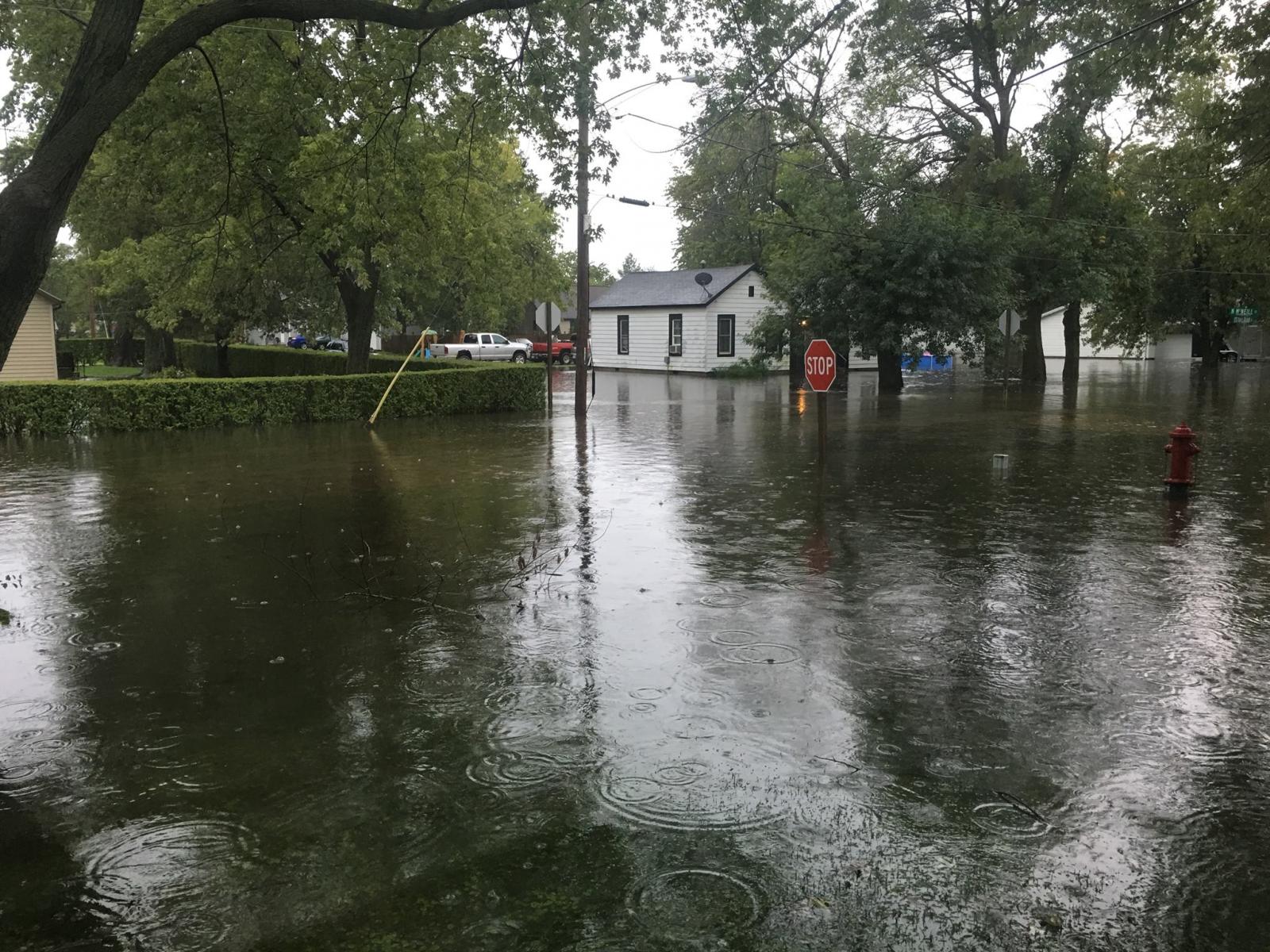
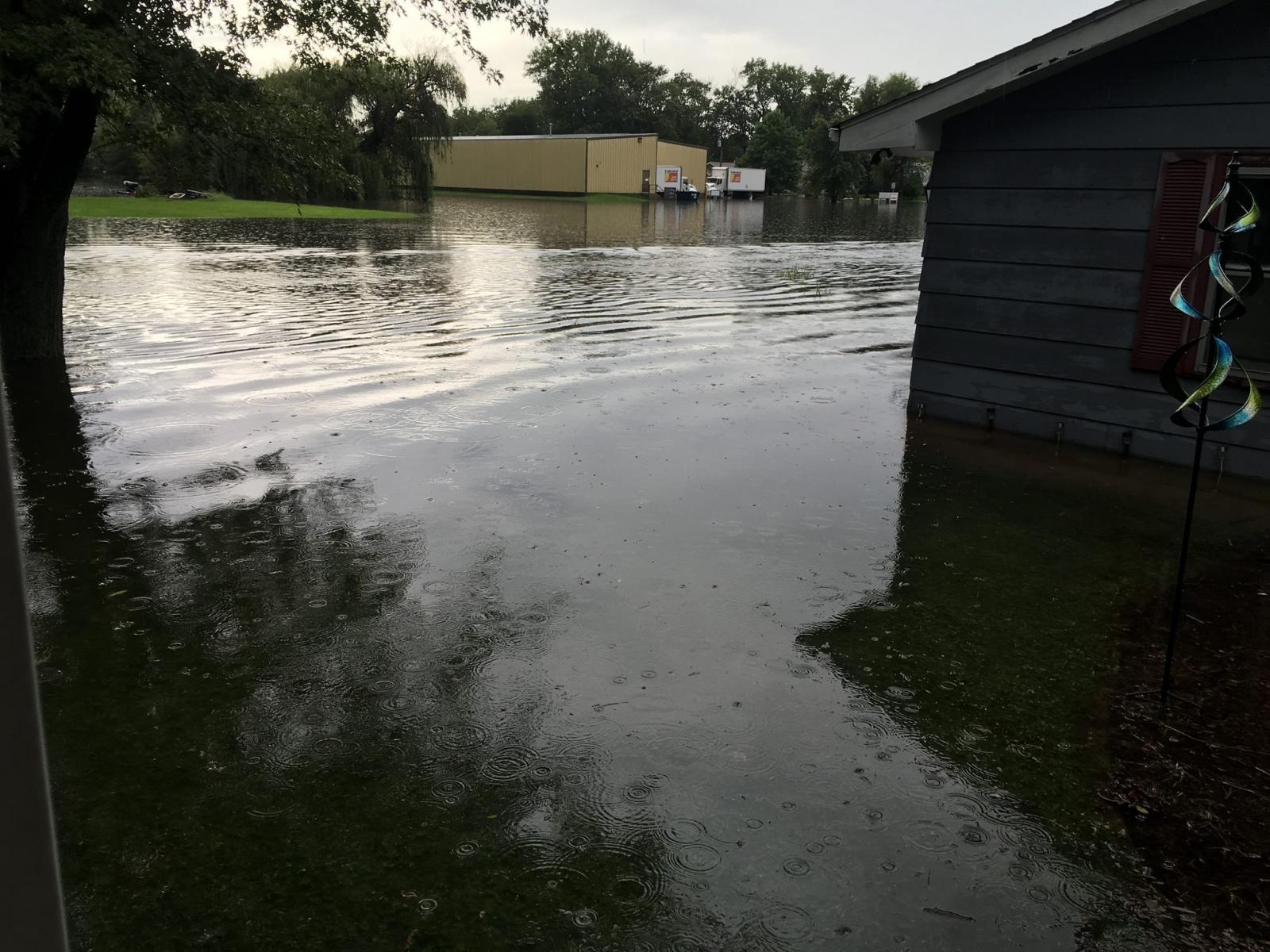
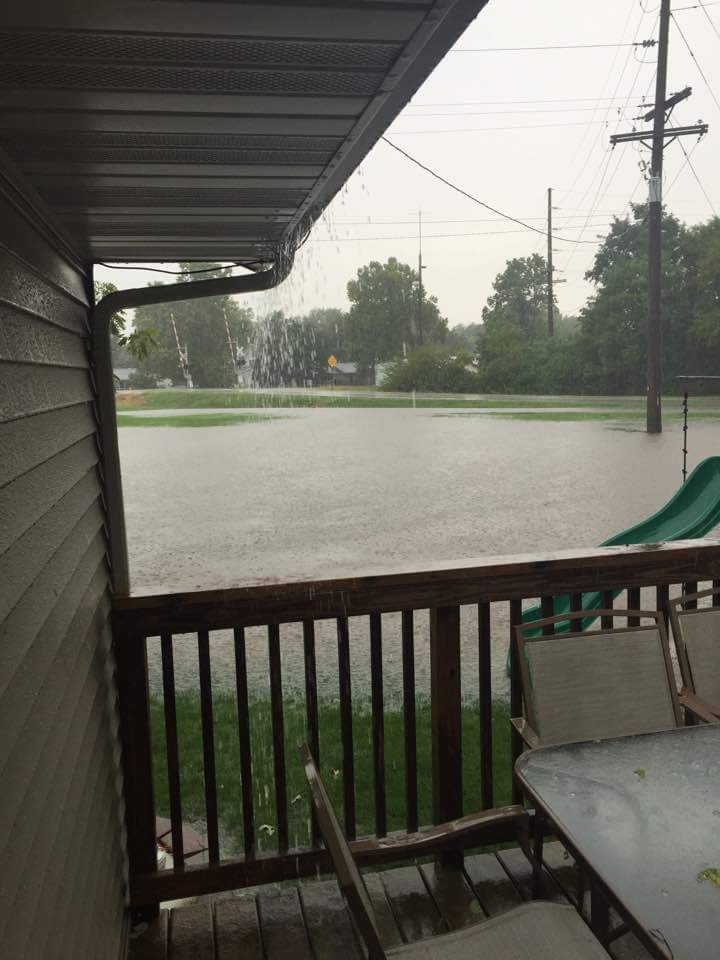
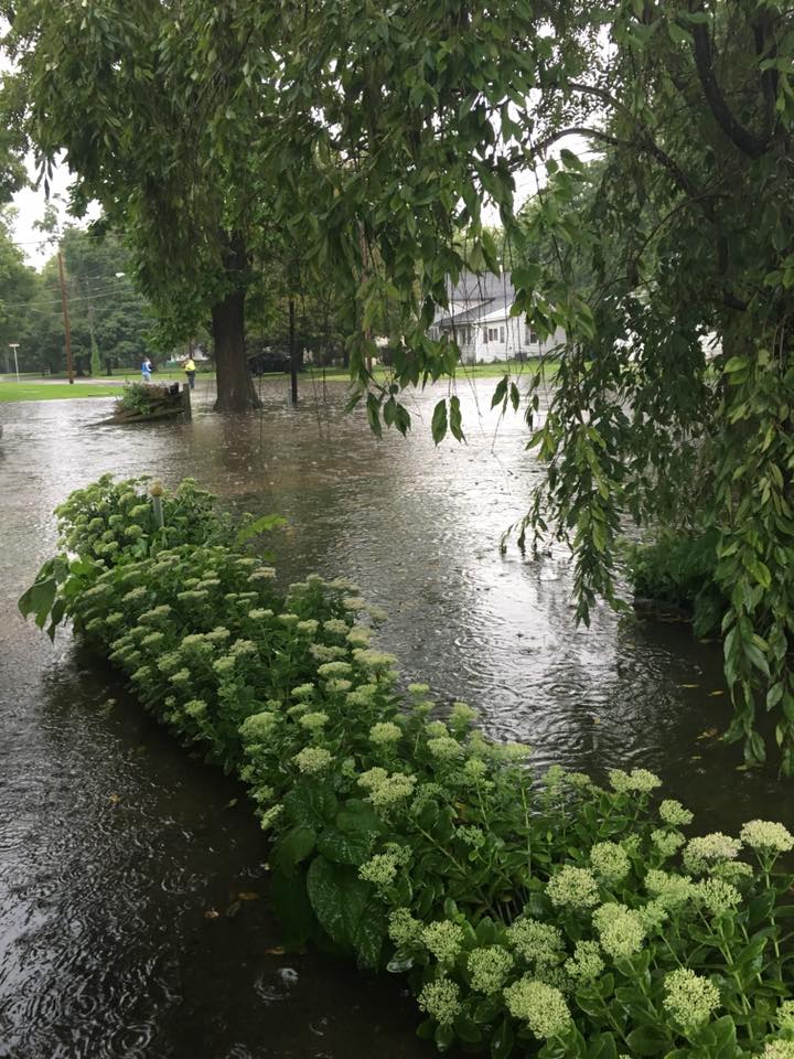
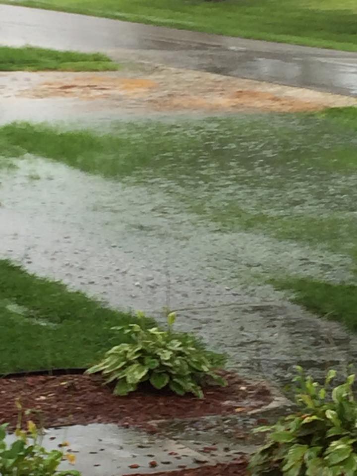
Thunderstorms developed during the late morning and early afternoon across a zone just south of I-80 in northern Illinois and northwest Indiana and persisted for several hours. An extremely moist environment set the stage for very heavy rainfall rates. In addition, storms were moving slow and training over the same areas. This brought about flash flooding due to rainfall amounts estimated at three plus inches, and possibly near six, in some locations. The hardest hit communities were Braceville and Odell in northern Illinois, and in Indiana near the town of Hebron experienced very heavy rainfall. |
 |
Flooding
Braceville
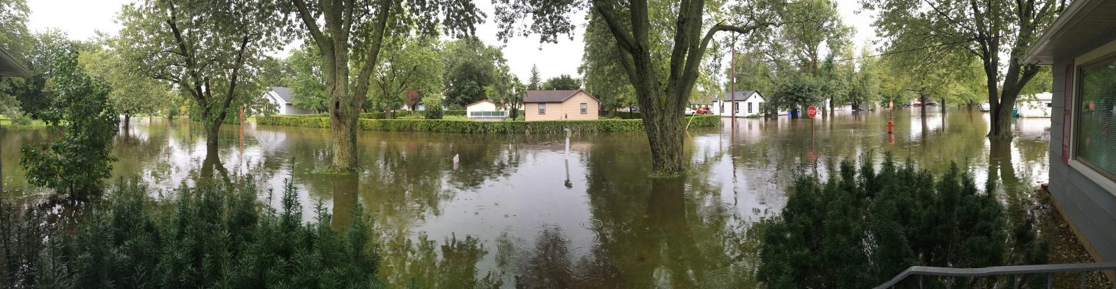 |
| Courtesy of Karen Arndt |
 |
 |
 |
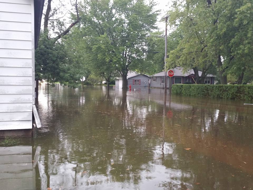 |
| Courtesy of Christina Brock | Courtesy of Karen Arndt | Courtesy of Karen Arndt | Stacy Brown |
Other Locations
 |
 |
 |
| Odell, IL: Courtesy of Heidi Legner | Odell, IL: Courtesy of Kathy Heddins | Verona, IL: Courtesy of Stacy Gans |
Radar:
 |
| NWS Chicago 0.5° Radar reflectivity loop from August 28, 11:30 a.m. - 4:30 p.m. at 5 minute intervals. |
Storm Reports
PRELIMINARY LOCAL STORM REPORT...SUMMARY
NATIONAL WEATHER SERVICE CHICAGO/ROMEOVILLE IL
757 PM CDT SUN AUG 28 2016

..TIME...   ...EVENT...      ...CITY LOCATION...     ...LAT.LON...
..DATE...   ....MAG....      ..COUNTY LOCATION..ST.. ...SOURCE....
            ..REMARKS..

0200 PM     LIGHTNING        1 NNE ODELL             41.02N 88.52W
08/28/2016                   LIVINGSTON         IL   LAW ENFORCEMENT

            CAR STUCK BY LIGHTNING ON I-55 AT MILE MARKER 210.

0200 PM     HEAVY RAIN       4 NNW DWIGHT            41.15N 88.45W
08/28/2016  M1.75 INCH       GRUNDY             IL   COCORAHS

            RAIN FELL IN PAST HOUR

0215 PM     FLOOD            LOWELL                  41.29N 87.41W
08/28/2016                   LAKE               IN   PUBLIC

            FLOODED YARDS AND MINOR FLOODING ON ROADS.

0215 PM     FLASH FLOOD      3 SE HEBRON             41.29N 87.16W
08/28/2016                   PORTER             IN   LAW ENFORCEMENT

            WATER OVER 500 WEST AND 1000 SOUTH TO THE POINT WHERE THE
            ROAD WAS CLOSED. TIME ESTIMATED PER RADAR.

0230 PM     FLASH FLOOD      ODELL                   41.00N 88.52W
08/28/2016                   LIVINGSTON         IL   PUBLIC

            SOME ROADS WITH WATER ON THEM AND MANY YARDS FLOODED.
            TIME ESTIMATED PER RADAR.

0230 PM     FLASH FLOOD      GODLEY                  41.24N 88.24W
08/28/2016                   WILL               IL   PUBLIC

            WATER AT LEAST ONE FOOT DEEP ON MULTIPLE ROADS. TIME
            ESTIMATED PER RADAR.

0250 PM     FLASH FLOOD      BRACEVILLE              41.22N 88.27W
08/28/2016                   GRUNDY             IL   PUBLIC

            AT INTERSECTION OF RAILROAD AND MCNEIL ST WATER IS 2 TO 3
            FEET DEEP.

0300 PM     FLASH FLOOD      3 N GARDNER             41.23N 88.31W
08/28/2016                   GRUNDY             IL   PUBLIC

            WATER RUNNING OVER ROADWAYS THAT TYPICALLY DO NOT FLOOD.
            ESTIMATED RAINFALL OF OVER FOUR INCHES IN OVER AN HOUR.

0302 PM     HEAVY RAIN       BRACEVILLE              41.22N 88.27W
08/28/2016  E4.50 INCH       GRUNDY             IL   PUBLIC

            RAIN FELL IN AROUND 90 MINUTES

0315 PM     FLOOD            5 SW HEBRON             41.27N 87.27W
08/28/2016                   LAKE               IN   PUBLIC

            FLOODED FIELDS.

0327 PM     FLASH FLOOD      BRACEVILLE              41.22N 88.27W
08/28/2016                   GRUNDY             IL   PUBLIC

            MANY ROADS IN TOWN FLOODED...SOME SIGNIFICANTLY.

0330 PM     FLOOD            VERONA                  41.22N 88.50W
08/28/2016                   GRUNDY             IL   PUBLIC

            FLOODED YARDS AND DITCHES.
Rain Reports
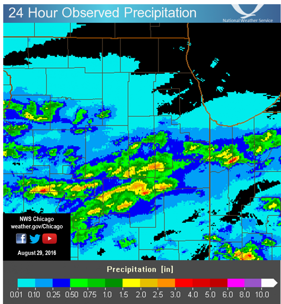 |
| 24 Hour Precipitation Ending at 7 AM August 29 |
Public Information Statement
National Weather Service Chicago IL
1005 AM CDT Mon Aug 29 2016

...Morning Rainfall Roundup...

   The following are rain amounts for the previous 24-hours
   as measured in the morning by NWS Cooperative Observers
   and CoCoRaHS observers.
   Observations are usually taken between 6 AND 8 AM.

   24-hour rainfall amounts
       for Monday(08/29/16)...


Illinois                                       Rain
  Location (County):                           fall (inches)

  Braceville (Grundy)..........................4.68
  Dwight 4NNW (Grundy).........................1.81
  Pontiac 1SE (Livingston).....................1.63
  Pontiac 1ESE (Livingston)....................1.33
  Sterling 4NE (Lee)...........................1.30
  Joliet 3WNW (Will)...........................1.22
  Dwight (Livingston)..........................1.15
  Coal City (Grundy)...........................1.01
  Pontiac (Livingston).........................0.94
  Joliet 2n (Will).............................0.87
  Wilmington 3SE (Will)........................0.79
  Dixon (Lee)..................................0.75
  Mazon 0.5ENE (Grundy)........................0.73
  Streator 1WSW (La Salle).....................0.66
  Joliet (Will)................................0.66
  Joliet 2W (Will).............................0.63
  Emington 2SSE (Livingston)...................0.53
  Dixon 2SW (Lee)..............................0.51
  Seneca 1NNE (La Salle).......................0.51
  Pontiac (Livingston).........................0.51
  Bonfield 4NNE (Kankakee).....................0.50
  Beecher 3SSE (Will)..........................0.47
  Joliet Lock/dam (Will).......................0.45
  Seneca 2SSW (La Salle).......................0.35
  Minooka (Grundy).............................0.33
  Morris (Grundy)..............................0.32
  Bonfield 4WSW (Kankakee).....................0.31
  Peotone (Will)...............................0.22
  Park Forest 1SW (Cook).......................0.18
  Morris 6ESE (Grundy).........................0.18
  Morris (Grundy)..............................0.18
  Crete 3E (Will)..............................0.17
  Channahon 2SSE (Will)........................0.17
  Bourbonnais (Kankakee).......................0.15
  Park Forest (Cook)...........................0.15
  Elwood 5NE (Will)............................0.14
  Channahon 1NNE (Will)........................0.14
  New Lenox 4SE (Will).........................0.14
  Marseilles (La Salle)........................0.14
  Manhattan 5ENE (Will)........................0.13
  Manhattan (Will).............................0.12
  Morris 2SSE (Grundy).........................0.11
  Coal City 3N (Grundy)........................0.11
  Wilmington 6NW (Will)........................0.11
  Manhattan 2SE (Will).........................0.11
  Barrington (Lake)............................0.10
  Chebanse (Kankakee)..........................0.09
  Manhattan 1ESE (Will)........................0.09
  Lockport 3ESE (Will).........................0.09
  Lockport 1SE (Will)..........................0.09
  Coal City 4NNW (Grundy)......................0.08
  Carbon Hill 3.1N (Grundy)....................0.08
  New Lenox 2SE (Will).........................0.08
  Homewood (Cook)..............................0.07
  Plainfield 5SW (Kendall).....................0.07
  Plainfield 3SE (Will)........................0.07
  New Lenox 3E (Will)..........................0.06
  Ottawa (La Salle)............................0.05
  Plainfield 1SW (Will)........................0.04
  Chatsworth (Livingston)......................0.03
  Amboy (Lee)..................................0.03
  Plainfield 2SSE (Will).......................0.03
  Romeoville (Will)............................0.03
  Paw Paw (Lee)................................0.03
  St Anne (Kankakee)...........................0.03
  Ottawa 1NW (La Salle)........................0.02
  Ottawa 2N (La Salle).........................0.02
  Mendota (La Salle)...........................0.02
  Amboy (Lee)..................................0.01
  La Salle (La Salle)..........................0.01
  Homer Glen 1ENE (Will).......................0.01
  Steward (Lee)................................0.01
  De Kalb (De Kalb)...........................TRACE
  Oak Lawn (Cook).............................TRACE
  Palos Park 1SW (Cook).......................TRACE
  Aurora 4SE (Du Page)........................TRACE
  Bolingbrook 3NE (Du Page)...................TRACE
  Ashkum 5.6E (Iroquois)......................TRACE
  Watseka 6.9WNW (Iroquois)...................TRACE
  Sugar Grove 1NE (Kane)......................TRACE
  Ashton (Lee)................................TRACE
  Highwood 1S (Lake)..........................TRACE
  Plainfield (Will)...........................TRACE
  Paxton (Ford)...............................TRACE

Indiana                                        Rain
  Location (County):                           fall (inches)

  Hebron 3SSW (Lake)...........................6.43
  St. John (Lake)..............................0.31
  Valparaiso 6WSW (Porter).....................0.27
  (kb9f)Valparaiso 4S (Porter).................0.25
  Valparaiso 1SE (Porter)......................0.21
  Valparaiso 4SW (Porter)......................0.21
  Valparaiso 6S (Porter).......................0.21
  Crown Point 2WSW (Lake)......................0.20
  Valparaiso 6SSW (Porter).....................0.20
  Valparaiso (Porter)..........................0.19
  Crown Point 1N (Lake)........................0.18
  Merrillville 2ESE (Lake).....................0.14
  Morocco (Newton).............................0.07
  Hobart 1SSW (Lake)...........................0.06
  Gary 4SSW (Lake).............................0.06
  Hobart 1NNW (Lake)...........................0.05
  (w9opr)Wheatfield 1ENE (Jasper)..............0.03
  Wheatfield 3S (Jasper).......................0.02
  De Motte 4SW (Jasper)........................0.02
  De Motte 6S (Jasper).........................0.01
  Gary 5ENE (Lake).............................0.01
  Lake Village (Newton)........................0.01
  De Motte 1NNW (Jasper)......................TRACE
  Kentland (Newton)...........................TRACE
  Porter 1S (Porter)..........................TRACE

$$
Environment
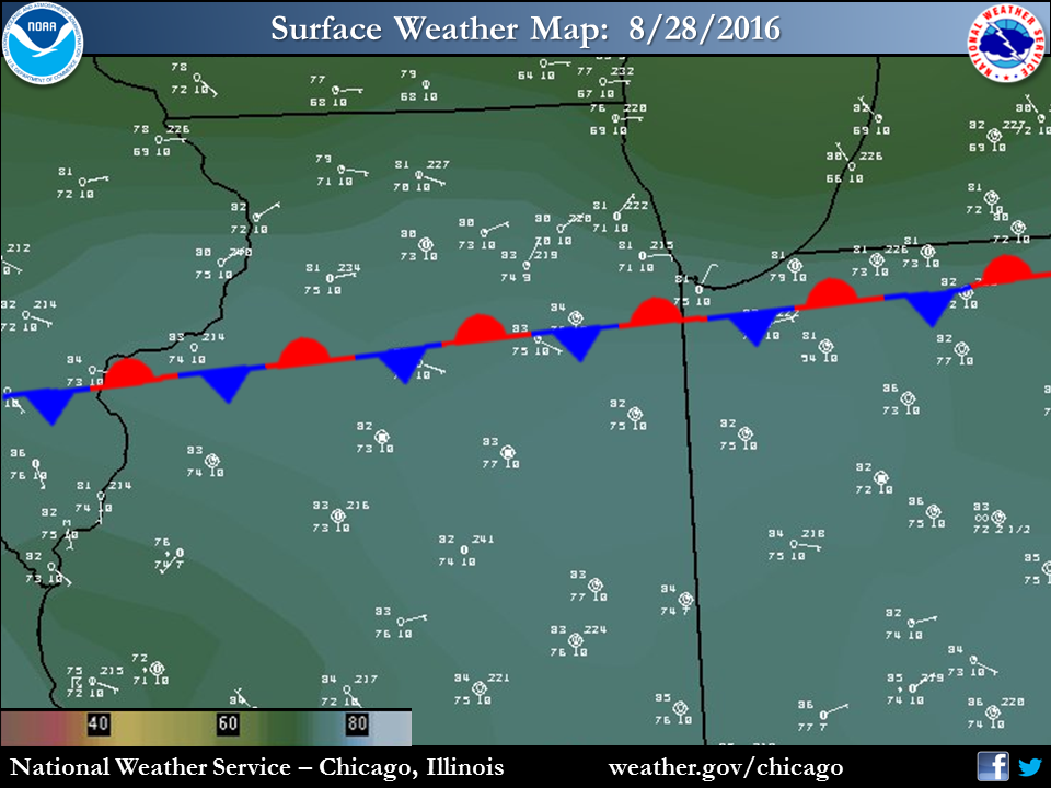 |
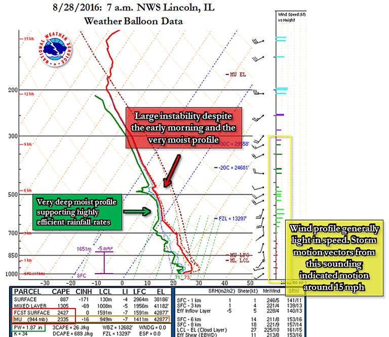 |
| 11 a.m. Surface Weather Map | Figure 2: 7 a.m. NWS Lincoln, IL Weather Balloon Data |
 |
Media use of NWS Web News Stories is encouraged! Please acknowledge the NWS as the source of any news information accessed from this site. |
|