
Dry, gusty conditions will produce elevated to critical fire weather conditions across portions of the Mid-Atlantic into the Southeast. Snow and a wintry mix is expected in the Great Lakes and portions of the Northeast, with several inches of snow possible in the higher elevations. An atmospheric river continues to bring heavy rainfall and high elevation mountain snow to the West. Read More >
237
AXUS71 KLWX 231906
DGTLWX
DCC001-MDC001-003-005-009-013-015-017-021-023-025-027-031-033-037-
043-510-VAC003-013-015-043-047-059-061-069-079-091-099-107-113-
125-137-139-153-157-165-171-177-179-187-510-540-600-630-660-683-
790-820-840-WVC003-023-027-031-037-057-065-071-301915-

Drought Information Statement
National Weather Service Baltimore MD/Washington DC
306 PM EDT Thu Oct 23 2025

For the latest Drought Information Statement from the National
Weather Service in Baltimore MD/Washington DC, see:
www.weather.gov/media/lwx/DGT/DGT_LWX_10232025.pdf

For the latest accessible, text-only Drought Information
Statement from the National Weather Service in Baltimore
MD/Washington DC, see:
www.weather.gov/media/lwx/DGT/DGT_LWX_10232025.txt

National Weather Service Baltimore MD/Washington DC Drought
Information Statement web page:
www.weather.gov/lwx/DroughtInformationStatement

$$
Current drought status for our area: (Graphics update every Thursday)

Graphics by State:


Modeled Soil Moisture Percentiles, courtesy University of Washington: (click to enlarge)

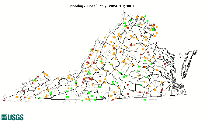
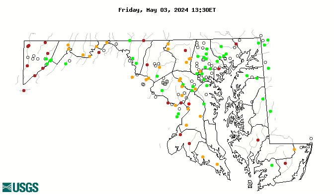
Streamflow Percentiles: (graphics update daily)
Outlook
Rainfall (or melted snowfall), in inches, for the next seven days: (graphic updates twice daily)

Seasonal Drought Outlook:


 Coastal Flood
 FAQ
FAQ